February 27: As reported in the article below from WPTV of West Palm Beach, Gov. Scott has declared a State of Emergency regarding Lake Okeechobee discharge:
Except for the possibility of floating debris, the high levels are good news (well, maybe not good for all boaters: see Philips Lange’s comments below!) for boaters transiting the Okeechobee Waterway, but bad news for fishermen in the St. Lucie River.
Lake Okeechobee discharges could last for months Monday level was 16.14 feet Jon Shainman CLICK HERE FOR THE FULL STORY
I am a boater and I don’t find high water levels good news. I barely cleared the !^#@%^&& bridge at Port Mayaca and wonder if i will have to go south to get to the Florida east coast in the spring.
The Cape Coral Cruise Club is a group of dedicated cruisers who always provide unique reports from the marinas they visit. Legacy Harbour Marina, A SALTY SOUTHEAST CRUISERS’ NET SPONSOR, is located on the Caloosahatchee River/Okeechobee Waterway, in the heart of downtown Fort Myers, Florida. Multiple dining and shopping opportunities are found within easy walking distance of this absolutely first-rate marina!
Cape Coral Cruise Club Cruises to Legacy Harbour Marina By John Queen, Commodore, Cape Coral Cruise Club
Legacy Harbour Welcome Sign
Each month, the Cape Coral Cruise Club makes a scheduled cruise to a different marina in SW Florida and stays for several days enjoying the amenities and hospitality of the marina. We do this nine times a year along with an extended cruise each spring. We take a break during the summer months of July and August, as many members return north. This January vessel compasses pointed towards Legacy Harbour Marina in downtown Fort Myers.
Moonlighter arrives at Legacy Harbour.
Club boats headed out on Tuesday, January 26th on what was actually a nice dry day, and boats headed home on Friday, January 29th, also a nice dry day. Everything in between – fergetaboutit! It was rain, rain, and more rain. Did I mention it was wet? The Club plans its monthly cruises months ahead of time and cannot of course control Mother Nature, but did she really have to rain on our parade all that week?
Seven Cape Coral Cruise Club member boats made the journey plus 2 club members live-aboard and reside at Legacy Harbour year round (they didn’t have to go far). On Tuesday night, club members gathered at the Tiki Hut for drinks and a potluck dinner. That’s when the rain began. It didn’t stop until Friday morning.
Wednesday morning, after serving up a breakfast of scrambled eggs, sausage and Bennett’s doughnuts, a tour was planned at the Edison-Ford Estates Museum and Laboratory. Seven club members made the trip only to find that Edison-Ford had closed the estate tours and grounds due to inclement weather. We toured the museum and laboratory, but it was disappointing that that the main estate was not accessible.
Wednesday night, several members brought out their best chili recipes for a chili cook-off contest. The Tiki Hut at Legacy was lined with 7 crock pots, each vying for attention. After scouting the marina to find a person who would serve as our ‘official’ chili judge, as luck would have it, Eric, the Legacy Dock Master volunteered. At the time, we didn’t realize what a true chili aficionado Eric was.
At the stroke of 6:00 PM, Eric showed up with a clipboard and judging sheet divided into 5 or 6 categories of aroma, texture, and consistency…, from which to judge. Before judging, Eric also gave an impromptu verbal lesson on the history of chili. Eric was the perfect judge! After carefully writing notes and quickly sampling each offering, Eric rose from the steam laden crocks and declared victory: Pati Queen was declared the winner followed by 2nd place to Stephanie Carrico, and 3rd place going to Bonnie Martin.
On Thursday morning, we laid out a nice breakfast of scrambled eggs, sausage, dry cereals and juices for everyone. Of course it rained the night before, and the rain continued throughout the day.
Over 40 members enjoy dinner at Pinchers Crab Shack in Ft. Myers.
Thursday evening about 45 club members converged on Pincher’s Restaurant a few blocks west of Legacy Harbour. Since several members came to Pincher’s by car, they helped shuttle boaters stay out of the rain. It’s always nice to have non boating club members join the boaters for the group dinner. Pincher’s was quite hospitable by housing all club members in a private dining area.
On Friday morning the rain finally stopped and the boaters headed out to the Caloosahatchee returning to their home slips scattered around Cape Coral. The Club certainly thanks the staff of Legacy Harbour Marina for their hospitality, as well as Pincher’s Restaurant for accommodating us on this event. We thank Mother Nature for giving us a dry trip back home on Friday.
The Cape Coral Cruise Club is open to new members who own a boat with overnight accommodations and reside in the Cape Coral / Ft. Myers area. For membership information please contact Phil Kryger at 239-541-0236. The Club website is being updated so the short video of recent Club activities and additional Club information may not be accessible. Club website, www.c-c-c-c.org
These two reports on City of Fort Myers Yacht Basin, A SALTY SOUTHEAST CRUISERS’ NET SPONSOR, come from our friends at AGLCA Forum. Fort Myers Yacht Basin lies along the southeasterly banks of the Caloosahatchee River, between the 3rd and 4th bridges from west to east.
We spent a lovely month at Fort Myers municipal marina last year about this time. They were helpful, and kind. Legacy is closer to the Publix grocery. But if you need some exercise, the Publix is a 22 minute brisk walk from the city marina. We walked up to restaurants downtown and enjoyed the many festivals that abound on the area. There were car shows, parades and the like. An added advantage was the saxophone player who serenaded us and the rest of the marina from under the highway bridge. Hope you are there when he is. Because it is close to a city street , there are early morning runners if you are docked by the street. We have also found that docking close to the city walk invites ants to join you…depending on your thoughts, you may want to spray your dock lines with a Raid like thing. But we loved it. Stayed a month. Kathy Anderson Sea Fever
Just stayed a month there, great experience. Very friendly and helpful staff, reasonable rates, and metered elec only totaled 25 bucks for the whole month. Was not on the street side so can’t comment on that. Did hear the sax player a few times, very pleasant sounds. Close to most things you might need and a free shuttle to get you around the area. Highly recommended facility. David and Barbara Doyl
Fort Myers Yacht Basin is so popular that its had a waiting list since I arrived in December. Its location is fantastic as you are 2 blocks away from a lovely downtown walking district with many cool sidewalk cafes and restaurants, a vibrant arts and music culture. It is beautifully designed and landscaped and having a pump out port right outside the boat is a new experience for us – so convenient! Best thing is the staff, so friendly and helpful. Please go somewhere else so there is room for me next time!
I had always bypassed Fort Myers in the past because it was not located at a point where I would end my cruising day, I seemed to be going by at mid-day on my way to another place to drop anchor for the night. Fortunately, bad weather ahead caused me to stop and get a spot on the transient pier in mid afternoon and we spent the night in Fort Myers while waiting for the cold front to pass by. First Street is a short walk from the marina, and “The Lodge” was a very pleasant surprise for our meal that evening. In fact, I was so impressed that after I finished moving our sailboat to its homeport, I got my wife to drive back to Fort Myers with me so that she could also enjoy the Brisket and Bar-b-que at “The Lodge”. I won’t be bypassing Fort Myers anymore. thelodgefl.com
Our thanks to SSECN Team Member, Curtis Hoff, for these navigation notes along the Okeechobee Waterway.
I just crossed the Okeechobee from Stuart to Ft. Myers the past two days and these are the items I noted during my trip.
Indiantown Railway Bridge was down as I approached with no signs of a train. Had to call on channel 9 to have it opened. Therefore don’t assume it will be ‘normally’ open unless a train is expected.
*** IMPORTANT ONE *** Regarding this recent SSECN post. The obstruction is clearly visible at MM 33.5 less than halfway between the centerline and the south edge. Looks to be 6-8″ dia wood sticking vertically up only an inch or two above the water. Stay on center or slightly north.
Also, found two similar hazards at MM34.3 and 35.2. Both are a bit further off center maybe 20% channel width from the north (Note: north, not south) edge but could be hit in a passing condition or if someone drifted off the centerline. They are a bit smaller, maybe 6″ dia but also just slightly above the water – a bird was perched on one of them when I passed.
Construction just east of Moore Haven (26°49.594’N, 081°03.890’W). Nothing to worry about right now – channel is currently very wide. Some web resources are reporting it is very narrow (20 ft) – currently at least 50 ft wide. No other construction trouble spots, but I crossed the lake and didn’t take the rim route. Ortona Lock – at least one other web resource is incorrectly stating there is a limited schedule from mid-December to mid-June That is currently incorrect – on demand according to the lock tender and he wasn’t sure if/when it would become restricted. He even checked the notices on line since he was unaware – but he did think that it could occur at some point – I believe it may be due to construction. Since the schedule could change it would be best to either check the notices online or call the lock since it could be restricted to a few openings a day at some point. But at this point don’t assume it is restricted since it wasn’t today, 1/29. Curtis
Ortona Lock is on a some what limited schedule, Depending on the day. I went across on Feb. 1, East to West, and it was by far my slowest crossing ever. They were at this time dumping huge amount of water from the lake, both east and west. I am talking about 300 million gal.s a day, both ways with aprox. 2 mph head current heading toward the lake and the 2 mph away from the lake . Ortona is waiting on some construction to start in the near future and that will slow the locking down. On Feb. 1, they actually open the Lock, both sides to ” Dump Extra Water”, and boaters had to wait about 2 hrs for this to be completed before crossing through. The lock master is only following orders and he does not know when or a what time this will occur so it is best to call ahead before going. We had called the night before and nothing was scheduled, so things can change quick. On the good side, on our way back across we make the best time ever, Its just a matter of catching the locks at the right times. Capt Dan
Our thanks to veteran cruiser David Bell for this good report from the Okeechobee Waterway. The popular Franklin Lock Boat-in Docks, which were closed for repairs in August of 2014, are open for business.
Left Stuart for Fort Myers with the lake level at 14.78′. Never saw less than 10′ of water the entire trip. We took the lake route instead of the rim route. All of the lock tenders were right on the ball. Never had a delay. But one quick note. The locks shut down at 1640. If you are not in the lock by then you will have to wait for a sunrise before you can pass. The Franklin lock docks on the NE side were empty. At $24.00 per night it is a great place to lay over and very protected. David Bell
Spent Saturday night-Halloween- at Franklin Lock docks. Lovely as always. They seem to have only replaced the pilings- no other changes to configuration. Nothing fancy but facilities were spotless. Sign still says $24 but it is $30 which becomes $15 with an inter-agency senior pass. At any of those price points it is a bargain (electric is included). 4 of the slips can be reserved online (www. recreation.gov) and 4 are first come first serve. Our group of 3 boats were the only ones there Saturday. Kim
Those of you who are frequent Lake Okeechobee Waterway cruisers are certain to have answers for Skipper Bill’s questions. Let us hear from you! USACE daily lake level reports can be found at http://w3.saj.usace.army.mil/h2o/currentLL.shtml. However, Bill’s questions refer to ARGUS soundings for Lake Okeechobee. See /?p=148612. ARGUS soundings are shown on all SSECN Chartview pages by clicking the ARGUS button at the top of the chart.
What lake level are the soundings in Lake Okeechobee corrected to, or what lake level were they observed? Since there is no `MLLW’ the lake level at observation or correction to the standard lake level is essential. Thanks, Bill
Hi Bill, For Lake Okeechobee we get the daily lake level reports from the Corps of Engineers and refer that to the 12.5 foot average as used for the NOAA charts. Then we apply that difference to the soundings for each day. Please let us know if you see anything that looks odd though, so we can investigate and make adjustments to the process if possible. Thank you, John Hersey SURVICE Engineering
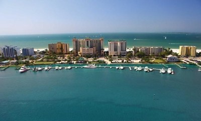
Pink Shell Beach Resort and Marina, A SALTY SOUTHEAST CRUISERS’ NET SPONSOR!, overlooks the westerly banks of the Mantanzas Pass channel, west of marker #13.
Pink Shell Beach Resort & Marina has been named to the 17 Best Resorts in Florida list by Traveluto, a rapidly growing travel blog. The resort was praised for its idyllic location, lagoon-style pool and waterfall, on-site marina, spa and tropical surroundings.
Pink Shell Beach Resort & Marina Recognized As One Of The 17 Best Resorts in Florida
FORT MYERS BEACH, Fla., July 9, 2015 Travelers heading to the Sunshine State this summer will find one more exciting reason to stay at Pink Shell Beach Resort & Marina.
One of the premier resorts on Fort Myers Beach recently made the list of 17 Best Resorts in Florida by Traveluto. A rapidly growing travel blog covering exciting destinations all over the world in addition to other travel-related topics, Traveluto searched the Sunshine State’s most popular resorts ‘“ from the Panhandle to the Florida Keys to the infamous home of Walt Disney World ‘“ to honor 17 must-visit hotel destinations in the state.
Situated on the beautiful tip of Estero Island, the full-service Fort Myers Beach hotel was praised for its lagoon-style pool and large waterfall, convenient on-site marina, spa and tropical restaurants, making it the ideal setting for spurring romance or making memories with the whole family.
In addition to the resort’s on-site amenities, the travel blog referenced its outstanding reviews on TripAdvisor, the world’s largest travel website. Pink Shell received numerous guest reviews raving about “amazing rooms with lanais,” “incredible views,” the “luxurious spa” and “friendly and accommodating staff.”
On top of making the list of 17 Best Resorts in Florida, the renowned Fort Myers Beach resort has been recognized with numerous awards including the 2014 Best of Weddings by The Knot, 2015 TripAdvisor Certificate of Excellence and Hall of Fame Award. Pink Shell also was voted the “Best Resort and Hotel of Fort Myers Beach” by Fort Myers Beach Observer and “Top 25 Best Places to Tie Up in North America” by the editors and readers of Power and Motoryacht magazine.
Starting off with a single cottage in 1953, Pink Shell has expanded across 12 lush acres and features 213 one- and two-bedroom condos, each offering sweeping ocean views from sunrise to sunset. Though it has grown, been renovated and rebranded since the original beachfront property that first sat on the sun-kissed sand, the resort celebrates the memories that were once made on Fort Myers Beach while providing all the amenities necessary for friends and families to make new ones.
About Pink Shell Beach Resort & Marina Pink Shell Beach Resort & Marina at 275 Estero Blvd. in Fort Myers Beach, FL is on 12 lush acres of sugary white sand facing the Gulf of Mexico. The full-service destination resort features 213 one- and two-bedroom condos, all offering sweeping ocean views. Additional amenities include a 41-slip marina, full-service spa, 3 heated outdoor pools, 2 restaurants, 2 ballrooms, on-site sailing school and water sports. For information, visit www.PinkShell.com or call 1-888-222-7465. Like Pink Shell Beach Resort & Marina on Facebook, follow the resort on Twitter and add it to a circle on Google Plus.
About Boykin Management Company Boykin Management Company, a leading hospitality management company with offices in Charlotte, NC and Fort Myers Beach, FL, is consistently recognized for excellence in delivering value-added lodging operations. Since 1958, BMC has been developing, managing and operating hotels, resorts, condominium hotels and conference centers. In addition to BMC’s long-standing relationships with the industry’s leading hotel brands including Marriott, Hilton, DoubleTree, Embassy Suites, Radisson, Crowne Plaza, Hampton Inn and Holiday Inn, BMC has operated numerous independent and resort hotels. BMC has managed more than 20,000 rooms in 23 states since its inception. For information, visit www.Boykin.com.
Our thanks to Skipper Susan Parker for notifying us of this change of schedule and to Officer Lieberum for clarifying this “Old Bridge” – “New Bridge” situation. Our bridge directory has been updated.
Good Morning Larry,
Even I’m a little confused, mostly due to wording. Roosevelt Bridge use to be US 1 and Dixie in this area. When they built the new high level fixed US 1 Bridge the US 1 designation was removed from the Roosevelt Bridge; however it was never removed from the CFR verbiage therefore, the description in 33 CFR 117.317 makes it sound like the old US 1 bridge, this is incorrect as this is the NW Dixie Hwy regulation below – at some point the CFR will need to be corrected to reflect the correct roadway. As the bridges in this portion of the CFR are listed from east to west you will note that the FEC R/R comes before the US 1 bridge; therefore, one can determine that this is the correct regulation for this bridge.
According to 33 CFR 117.317 (d) Roosevelt (US1) bridge, mile 7.4 at Stuart. The draw shall open on signal; except Monday through Friday, except Federal holidays, from 7 a.m. to 6 p.m. the draw need open only on the hour and half hour. However, the draw need not open between 7:30 a.m. and 9 a.m. and 4 p.m. and 5:30 p.m. except at 8:15 a.m. and 4:45 p.m. On Saturdays, Sundays, and federal holidays from 8 a.m. to 6 p.m. the draw need open only on the hour, 20 minutes after the hour, and 40 minutes after the hour. When the adjacent railway bridge is in the closed position at the time of a scheduled opening the draw need not open, but it must then open immediately upon opening of the railroad bridge to pass all accumulated vessels. Exempt vessels shall be passed at any time.
Hope this explanation helps.
Mike L
Michael Lieberum Seventh Coast Guard District Bridge Branch Bridge Management Specialist
Franklin Lock, westernmost lock on the Okeechobee Waterway, is located at Statute Mile 121 and St. Lucie Lock, the easternmost lock, lies west of Stuart, FL near Statute Mile 15. This notice was posted on AGLCA’s Forum by good friends Chuck Baier and Susan Landry.
The U.S. Army Corps of Engineers, Jacksonville District has announced restrictions for lock operations on the Okeechobee Waterway due to receding water levels on Lake Okeechobee, effective immediately.
Locking operations at the W.P. Franklin Lock & Dam near Fort Myers and the St. Lucie Lock & Dam near Stuart will be conducted every two hours from 7 a.m. to 4:30 p.m. daily. This action is the result of the water level at Lake Okeechobee falling below 12.5 feet.
`This is standard operating procedure whenever the lake falls below 12.5 feet’ said Steve Dunham, Chief of the Corps’ South Florida Operations Office. `We encourage boaters to be aware of the lake level and consider that drafts will continue to decrease if the lake drops more in coming weeks.’
Under the updated schedule, boats will be locked through at the Franklin and St. Lucie Locks at 7 a.m., 9 a.m., 11 a.m., 1 p.m., 3 p.m., and 4:30 p.m. Operations at the other three locks, Ortona, Moore Haven, and Port Mayaca, will continue on demand between 7 a.m. and 5 p.m. with final lockage beginning at 4:30 p.m.
Should the lake drop below 11.5 feet, additional reductions in service will be necessary. For more information on navigation notices concerning the Okeechobee Waterway, please visit the following website:
Pahokee Marina (3-18-15) We traveled to Pahokee via the rim canal, no problems, the lake water was up and thanks to the Cruisers Net for letting us know the canal had been cleaned. The first night was a great night, no wind. We were also warned not to leave the marina after dark. The area is a little rough. Everyone was friendly and helpful. The second night the wind picked up and clocked around from the north to north west at about 8-10 knots. That got scary in the marina. One of the regulars (liveaboards) in the marina knocked on the boat and told us we had better put on more lines and helped us to cross tie everything so we were not rubbing the dock. They also told us if the wind gets more than what we have it starts to get dangerous inside the marina. The town is within walking distance so food stuffs are within half mile walk. They also have a pool and restaurant.
Moore Haven City Dock, the first stop west of Lake Okeechobee, is located at Okeechobee Waterway Statute Mile 78, on the Moore Haven waterfront. Our thanks to Phil Herl for this advice and report.
Moore Haven City Marina (3/18/15) Great docking and electric, Lots of space on a face type dock, if you arrive early remember to tie as close as possible to the other boats, to leave as much room as possible for other boats. Also help to encourage others to do the same. Eating places and grocery store are within walking distance. Phil Herl
This AGLCA Forum report is another concerning options for a west to east crossing of Lake Okeechobee. See /?p=147224. Skippers Jenny and Kenny Beach chose the rim route despite warnings about the numerous pitfalls possible.
Today we did the rim route west to east. Thanks to all the replies which took away the unnecessary anxiety. It was beautiful, totally void of debris, and a much smoother ride than the almost straight across route had to offer. We cut the northeast corner off by heading for the canal entrance from day marker 24. We stuck to the rim route at marker 60 since the lake was very choppy at that point and the rim route provided some wind and wave protection. I think the lowest depth we saw all day was 9.8′. There is no reason to be hesitant at all about exploring this scenic area. Jeanne & Kenny Beach Daybreak
Share:
Comments from Cruisers (1)
August Trometer- March 12, 2015 - 5:15 pm
Glad you had such a good trip. We made the same trip in 2002, very scenic BUT our 3.5′ draft plowed through sand and went we got to Fort Lauderdale we were overheating as the sand had chewed up the impeller. We wished we had gone straight across, SO make sure you know the depth and leave some to spare, OR a calm day. With a 3.5′ draft I’d want 5′ minimum per the charts/Okeechobee lake level.
This AGLCA Forum report documents the Beach’s careful planning for a rim route versus direct route crossing of Lake Okeechobee. For their decision and description of their crossing, go to /?p=147301.
So the captain would like to take the rim route to cross the lake. The lock tenders say it is not recommended. The other boaters here at Roland Martin’s, who have not made the trip, say it is a bad idea. They claim that everyone they know who has done it says it is loaded with debris, tree limbs, old refrigerators, and such. The captain is not buying the horror stories but the admiral won’t go since “everyone” says it is a bad idea. Would love for some “experienced” boater feedback. Today’s water depth was 6.88′; we draw 4′. Jeanne & Kenny Beach Daybreak
Share:
Comments from Cruisers (3)
Tom Wemett- March 12, 2015 - 6:49 pm
Did the rim route last April in a 44′ Trawler with 4′ draft. Had no problems.
Richard Ross MV Chez Nous- March 12, 2015 - 4:45 pm
Don’t believe the stories you hear. We have crossed several times by both routes. The rim route shallow spot is between 4 and 4B just south of Port Mayaca lock. But you can exit the rim route around red 54, and head direct to green 5 on the lake route and avoid the shallows. This way, the rim route is actually slightly deeper than the lake route.
There are two down sides to the rim route. It is about ten miles farther, and the Torry Island swing bridge is manually operated, and the operator will not begin opening until he sees the boat waiting.
It’s been 6 or 7 years since we traveled the rim route and we heard the same stories about hurricanes pushing debris into the channel. Went anyway. Draw 3 feet and never saw less that 10 feet on the depth gage. Never saw any debris.
This AGLCA Forum report by Skipper Healy is prompted by a discussion of the Okeechobee Waterway which mentions Clewiston, Florida, which has long been a good source for checking depths in Lake Okeechobee. See /?p=147224. Peg and Jim Healy are longtime contributors to SSECN.
What’s interesting about Lake “O” is NOT the datum for the surface of the lake – which can be very misleading – but the actual depth of the water on the navigation routes. As a reservoir for Southeast Florida, lake datum is important as a measure of water reserves for the Palm Beaches. But to boats, water depth is all that matters. This really matters in the spring, as the annual “dry season” progresses toward summer. Today’s lake datum is 14.72 feet, but the Route 1 (cross-lake) water depth is only 8.66 feet and Route 2 (Rim route) is only 6.86 feet. Here’s the USACE website for nav route WATER DEPTH data: http://w3.saj.usace.army.mil/h2o/currentLL.shtml. The good news is, that status in early March should make for a comfortable season for spring crossings this year.
Also be advised, the basin at Roland Martin is VERY shallow, and the bottom is sticky mud. If the cross lake route gets to 5 feet, the basin in Clewiston will be less; maybe 4 ft. One who gets stuck in there is thoroughly stuck. Roland Martin is a bass boat marina, not a cruising boat marina. Careful consideration of water depths is advised for cruisers. There is a definite wind-driven “tide” on Lake O. Prolonged winds from the south can make the lake quite lumpy with short period seas and drive water depths on the south end of the lake a foot less than the datum would otherwise suggest. Which leads to my last point. The most “risky” part of the cross-lake route is the channel out of Clewiston leading into the Lake. That is a dredged channel that’s about 100′ wide on the south end. Most people think Florida is a big sand bar, but the bottom of lake O is limestone. Limestone is soft stone, but plenty hard enough to hurt props and rudders. It’s extremely important to stay in that channel and not get blown sideways; the channel edges are VERY unforgiving, like the “Rock Pile” in Myrtle Beach. That channel is probably 5 StM in length to G”1″. The farther out of Clewiston one gets, the farther apart the markers become. The prevailing winds on the lake will try to blow boats sideways out of the channel, SO PILOTS MUST BE ABLE TO BACKSIGHT THE MARKERS TO BE SURE THE BOAT STAYS IN THAT CHANNEL. Otherwise, there will be this very disheartening crunching sound… And, there are no Tow BoatUS/SeaTow services on the lake. Hope this is useful! Peg and Jim Healy
We would add this to Jim’s excellent observations. A few other points in looking at the COE website for navigational depths. An 8.66 depth on route 1 does not mean that the entire route is 8.66 feet. It means that 8.66 is the shallowest depth you will find if you stay in the channel along route 1. The same goes for route 2, the Rim Route. There are only two areas that you will find the shallow depths. Along route 1, that will be in the approach channel to Clewiston. Along route 2, it will be in the channel immediately after turning south out of the Port Mayaca Lock. The shallow depths can be avoided on route 2 by heading out into the lake and turning south. Then re-enter the route 2 channel at Pahokee. Depths in the Lake will be 10 to 14 feet and the rest of the route 2 depths will be 12 to 20 feet based on today’s reported depths. There is no alternative for the route 1 shallow area and the advise is simply, stay in the channel and go slow until back on the rim route. Across the Lake, depths will be 10 to 15 feet, and deeper once back on the Rim Route. Chuck Baier and Susan Landry http://www.tgboa.com/ http://trawler-beach-house.blogspot.com/ My Navigational Notices http://www.marinalife.com/navigationUpdates/index.cf
Okeechobee Waterway crossing last week on Feb 21st and 22nd. Water levels were high, 15 ft plus (above the Atlantic Ocean sea level). We were aboard a Mainship 400 with 4 foot draft. Our westbound trip from Stuart FL included anchoring up the St Lucie River Northfork, then clearing both St Lucie and Port Mayaca Locks with no issues. The lake was OK with a 2 foot chop and we spent an evening in Clewiston at Roland and Mary Ann Martins Marina. Say hi to Dockmaster Capt. Sam. He will take care of you. Just in case he is not on duty be sure to dock your boat and face your master stateroom away from the band in the TiKi Bar. Believe me, you’ll sleep better. While there, take a selfie at the Tiki Bar’s Chevy Suburban in the front yard. The rest of the trip west was fine. We had deep enough water and all the locks were working AOK. We stayed the evening on Captiva Island, a very remote quiet place, one of the last Old Florida locations you’ll visit. Then onto Cortez, FL in the fog. Chris & Alyse Caldwell
This is certainly one of the most unusual, but very legitimate, requests that I can remember posting. If you can supply Skipper Parish with a name or phone number, please reply to his email below. Port Mayaca Railway Lift Bridge with a vertical clearance of 49ft when fully open crosses the Okeechobee Waterway at Statute Mile 38, near the tiny (charted) village of Port Mayaca.
Years ago I travelled the Okeechobee Waterway and was able to get under the 49′ Port Mayaca RR bridge by hiring a marina operator to help heel my boat over so my 53′ mast would pass under the bridge. Does anyone know if this “heeling” service is still being provided by a marina along the waterway? If so, contact me directly at seabreeze384@hotmail.com. Thank you Rick Parish
Larry I received two replies today. Both sources provide the same information. One source was Kim Brown, captain of s/v Trust Me. The other source was from Indiantown Marina. Contact – Billy Owens his phone number is 561-262-5200. Best regards Rick
Glover Bight Anchorage lies on the northeasterly reaches of Glover Bight, northeast of unlighted daybeacon #9 near the western end of the Okeechobee Waterway.
Good holding in this anchorage, but stay out of the SE side as others have mentioned. In the far East corner, where the bight narrows, there is a dock and gazebo. This is a Cape Coral city park with a nice boardwalk. From the end of the boardwalk where it joins the road is 2 miles to Publix, a nice jaunt for avid walkers like us or your collapsible bicicyle. Its a very high step to get out at the dock. Enjoy the usually lame music from the Westin on the weekends! Chris
What a grand way to get into the Holiday spirit! Pink Shell Beach Resort and Marina, A SALTY SOUTHEAST CRUISERS’ NET SPONSOR!, overlooks the westerly banks of the Mantanzas Pass channel, west of marker #13.
We seldom get inquiries about specific individuals, but Skipper Schofield’s query seems genuinely sincere, especially with his kind words for Bob Wallace. If you have knowledge of Bob’s status or wish to relate your own experiences with Bob, please us hear from you.
The Fort Myers Beach Mooring Field is found east of the high-rise bridge, just north of Estero Island. The mooring field is hosted by City of Fort Myers Yacht Basin, A SALTY SOUTHEAST CRUISERS’ NET SPONSOR!
We’ve anchored in what is now the mooring field a few times but not for several years, the last time back in 2000. I wonder if anyone knows the latest on Bob Wallace who welcomed boaters to his dock to land, take on water and all he asked in return was that they sign his visitors book. I guess Bob will have passed away but I thought he had a son who might have carried on the tradition. I guess it’s a less necessary facility these days but it was wonderful back then and a hugely generous gesture by Bob. Anyone know anything? John Schofield
Fort Myers Yacht Basin lies along the southeasterly banks of the Caloosahatchee River, between the 3rd and 4th bridges from west to east. We are proud that this fine SALTY SOUTHEAST CRUISERS’ NET SPONSOR is offering their expertise and advice to Okeechobee and West Florida transients!p>
Hello to all of those transiting the beautiful Okeechobee Waterway. For current conditions on the waterway, please allow the staff at the City of Fort Myers Yacht Basin to assist you. We will be happy to provide tidal, lock schedule, weather and any other impacting information in order to help you make it through. We can be reached at 239-321-7080, yachtbasin@cityftmyers.com, llustig@cityftmyers.com and channel 16 when closer. We are open 8 to 6 and are here to serve you. Thank you, Leif Lustig, Dock Master
Notice of upcoming Okeechobee Waterway closures; Please review the tentative schedule for waterway closures to navigation which can be found on the City of Fort Myers web page at http://www.cityftmyers.com/yachtbasin, as construction continues on the I-75 bridge at mile marker 129. Thank you, Leif Lustig, Dockmaster
Notice of upcoming Okeechobee Waterway closures; Please review the tentative schedule for waterway closures to navigation which can be found on the City of Fort Myers web page at http://www.cityftmyers.com/yachtbasin , as construction continues on the I-75 bridge at mile marker 129. Thank you, Leif Lustig, Dockmaster


Comments from Cruisers (1)
I am a boater and I don’t find high water levels good news. I barely cleared the !^#@%^&& bridge at Port Mayaca and wonder if i will have to go south to get to the Florida east coast in the spring.
For the latest bridge clearances, visit – http://w3.saj.usace.army.mil/h2o/currentLL.shtml