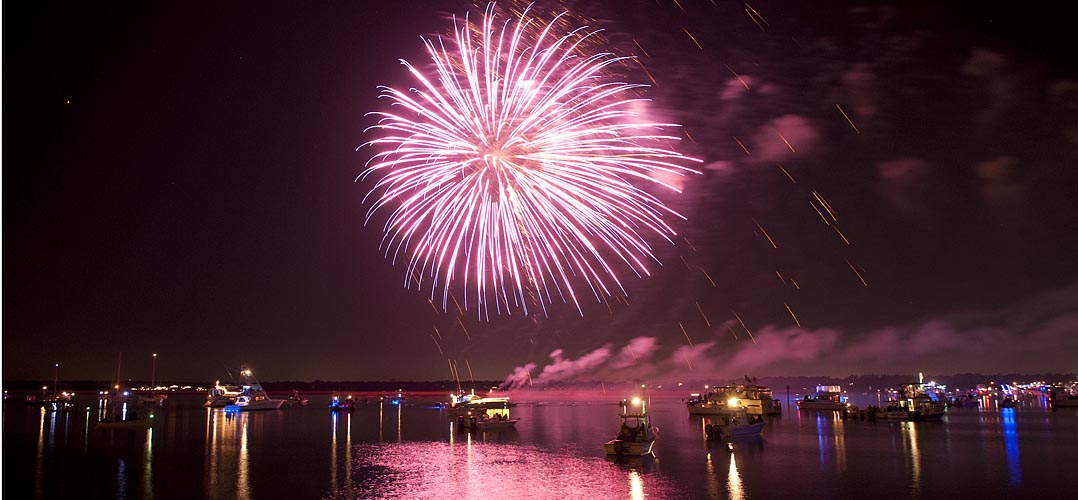
The Waterway’s path through Wrightsville Beach is a narrow congested channel, so caution must be exercised during these dark hours, especially in vicinity of spectator boats.
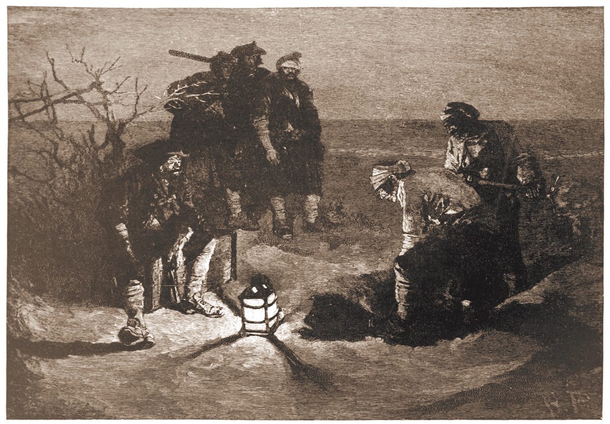
Popular literature and the public’s imagination have long perpetuated the notion that the notorious pirate buried his ill-gotten wealth, perhaps on Ocracoke Island.
“Blackbeard Buries His Treasure” illustrated by Howard Pyle for Harper’s Magazine, 1887.
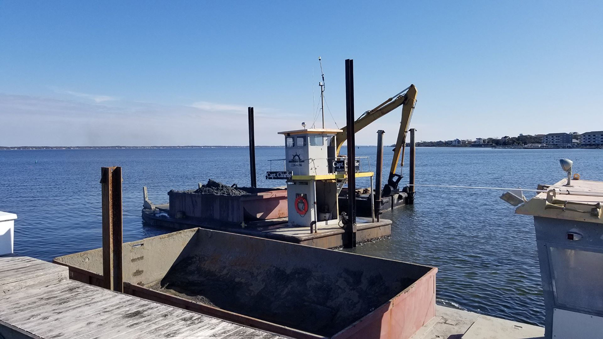
Cruisers Net reminds you that high water events, like Hurricane Nicole, typically lift lots of debris, visible and submerged, into the navigation channels, especially in the narrow portions of the ICW. A sharp watch is required. Our thanks to Winston Fowler for these photos from the Cape Fear River.
South Harbor Village Marina guards the Waterway’s northern shoreline, a short hop west of unlighted daybeacon #8, and not far from the mouth of the Cape Fear River. Our thanks to Dave Rowe aboard m/v Stinkpot for this review.
Safe Harbor South Harbor Village is really a wonderful marina. Our experience began with dock master, Ian, expertly telling us exactly what conditions we could expect at the dock, wind, state of the current–everything. He correctly even predicted a best approach for the conditions and was spot on! We rarely accept this kind of information from “off the boat,” but he shared it with such knowing authority, that we knew we were dealing with a very experienced hand, and the trust we placed in him proved not to be unfounded!
We have never been met by a larger or more competent contingent of dock hands. No one expected prematurely tossed lines, and it was clear that they understood they were dealing with an experienced crew and treated us that way. There is no doubt in my mind that, if called to do so, they could also deal with an inexperienced crew and get them on and off the dock with ease.
As soon as we were alongside, they immediately asked for another spring line, and we were again impressed that they recognized the current there, and wanted us tied without us having to readjust hastily-tied breast lines you might get anywhere else. In fact, we rarely hand out lines at all these days. The Boatswain and Captain take care of the job after some less than stellar experiences in the past, but no need for such reticence here.
The facilities are gorgeous with new looking floating docks, slip side pump-outs, and the most advanced fire suppression system we have ever seen. Two stellar restaurants onsite in this park-like setting.
The real stars are the staff. Ian and company go way above and beyond, and this well-trained, crackerjack team are endlessly impressive with their ability to anticipate a transient boater’s every need.
The entrance channel to Carolina Beach State Park marina cuts off southward from the AICW, at the western end of Snows Cut, between markers #163 and #165. Our thanks to Dave Rowe, AboardStinkpot.com, for this review and recommendation.
For the budget conscious boater, or one who loves a natural park setting, Carolina Beach State Park Marina is for you! Miles of wooded trails and one of the only spots on earth to spot a Venus Fly Trap in the wild. $30 flat fee for dockage includes power and water. This is the perfect place to hole up and relax while waiting for a favorable current on the Cape Fear River or Snow’s Cut. Choice of grocery stores and a pharmacy under a mile and a half away.
I second everything in the article. We live nearby. A great resource for local and visiting boaters. Usually has good fuel prices compared to others in the area but check first.
A longtime CRUISERS NET SPONSOR, historic Edenton always has an exciting calendar of events and places to visit! Edenton is at the mouth of the Chowan River on the northwest shore of Albemarle Sound.
Hello!
Have you heard about the newest exciting thing to come to Edenton?
The Herringbone is an exciting new restaurant that is breathing new life into an 1898 herring ice house, turning it into a remarkable destination restaurant.
Already, it is turning heads both in Edenton and beyond.
Today, I want to tell you a bit about it, including the background and why so many can’t wait for it to finally open.
The Herringbone is a tribute and celebration of all things Edenton, combining incredible history with breathtaking execution into a magnificent experience.
The Army Corps of Engineers says its five-year-old rule blocking local governments, marinas and private entities from using its dredged material disposal sites will remain.
Every season in Washington, NC, A CRUISERS NET SPONSOR, brings something new and exciting. Enjoy local festivals, area concerts, or waterfront adventure. This review is posted with permission of Stacey Guth.
North Carolina has been extremely friendly to us. They love to chat, and never seem to be in (how do I put this) a New England hurry. The dockmaster at this little city free dock changed staff overnight, and the new one was full of wonder about our lives aboard Stinkpot. As he handed me the key to the laundry room which costs a flat fee of $5 for unlimited loads, I was all smiles. “So, do you like it?” he asked.
“Here I am at the crack of dawn, chatting with a kind stranger as we get to know each other a little bit, in a beautiful place that my Captain and I are experiencing for the first time, and I woke up like a kid on Christmas with this grin because I was going to get to do laundry! All the laundry! Laundry is that exciting to me now. Yes, it’s a good life.”
Stacey Guth First Mate & Boatswain Dave Rowe Captain m/v Stinkpot
Levern Davis Parker is a descendant of George Washington Creef Sr., who developed the shad boat that was adopted in 1987 as the state boat of North Carolina.
The military has been a boon to North Carolina’s economy. It has brought in millions in government spending, thousands of jobs, and generations of families eager to live and retire where they used to serve.
This is Saturday, September 24, is National Public Lands Day, a day to show our love for the amazing natural, cultural and historic places that are protected for future generations to marvel at and enjoy.
This Public Lands Day, we are thrilled to celebrate all of these protected spaces and the natural beauty and impactful stories they preserve.
We encourage you to get out and visit your public lands – here in the Outer Banks or wherever you are – to celebrate with us! Check out our online and in-person opportunities this week to learn more about our Outer Banks national parks in particular (details below).
Did you know that biological science technicians at Cape Hatteras National Seashore carefully track, learn from and protect hundreds of sea turtle nests each summer?
One of the ways our BioTechs learn from these nests is by excavating them – digging them up to examine what’s inside – once they have hatched. In our last “Ask A BioTech” article of the season, Ben Ranelli, Seasonal Biological Science Technician on Ocracoke Island, explains the nest excavation process.
Want to see a sea turtle nest excavation in action? Tune in to our Facebook page TONIGHT at 6 p.m. (ET) when we’ll premiere a recent nest excavation on Ocracoke Island with park rangers from Cape Hatteras National Seashore.
Meet Your Volunteer: Paul Hinds
Our Outer Banks VIPs (Volunteers In Parks) are essential to the thriving of our parks.
As we celebrate Public Lands Day this month, we want to introduce you to Paul Hinds, a former volunteer at Fort Raleigh National Historic Site! If you visited Fort Raleigh this summer, you likely met Paul, whose volunteer efforts not only created a fun and engaging experience for visitors, but helped improve our park for years to come.
Calling All Educators: Plan Your OBX National Park Field Trip!
If you’re an educator at a school in Currituck, Dare, Hyde or Tyrrell Counties, we want to help you get your students to Cape Hatteras National Seashore, Fort Raleigh National Historic Site and Wright Brothers National Memorial!
Thanks to an Open OutDoors For Kids grant from the National Park Foundation, we are able to cover transportation costs for field trips for your students in kindergarten through 12th grade. To learn more about this opportunity, please email Jessica Barnes, director of Outer Banks Forever, at JessicaBarnes@OBXForever.org.
P.S.: You can also schedule remote learning field trips for your students! To learn more, email our parks at obx_interpretation@nps.gov.
Upcoming Events: Save the Dates!
Pints for Parks on Public Lands Day: Saturday, September 24
Come out and celebrate our Outer Banks national parks with our friends at Swells’a Brewing Beer Company in Kill Devil Hills on Saturday, September 24, from 5 p.m. to 9 p.m.! We hope to see you there!
Click here to learn how our friends at Swells’a are supporting our national parks through 1% For The Planet!
Bodie Island Lighthouse 150th Anniversary Celebration: Saturday, October 1
The Bodie Island Lighthouse will celebrate 150 years of illumination on October 1! You’re invited to join us, our park staff, our friends at the Outer Banks Lighthouse Society, and special guests for morning and evening events.
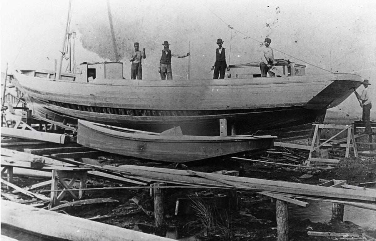
Whether building boats for business or recreation, or used as a means to freedom, boatbuilders, along with their vessels and shipyards, have impacted the maritime history of the Albemarle Sound.
Employees of Creef Boatworks in Wanchese are shown on a schooner under construction. Photo courtesy Outer Banks History Center, Manteo.
A centerpiece of the Inner Banks, Beaufort County features a state park, several smaller parks to complement its colonial heritage and is home to CRUISERS NET SPONSOR, Washington City Docks.
A longtime CRUISERS NET SPONSOR, historic Edenton always has an exciting calendar of events and places to visit! Edenton is at the mouth of the Chowan River on the northwest shore of Albemarle Sound.
Over the next month leading up to Public Lands Day on September 24, we’re reintroducing you to our Outer Banks national parks and the amazing stories and experiences they protect!
Ranger Josh shares what you can experience at Fort Raleigh National Historic Site.
When was the last time you experienced Fort Raleigh National Historic Site?
Established in 1941, Fort Raleigh National Historic Site is located on Roanoke Island overlooking the Albemarle Sound. The park is best known as the site of the first attempted English settlement in the “New World,” which is often referred to as the “Lost Colony” for its mysterious disappearance. Prior to the arrival of the English, the island was the home of the Carolina Algonquian peoples.
Fort Raleigh National Historic Site was also the site of the Freedmen’s Colony, which was established by freedom seekers and members of the Union Army during the Civil War. After the war, the colony was disbanded, but some brave individuals and families joined together to buy plots of land and establish a community on Roanoke Island. Many of their descendants still live on the island today.
Thousands of visitors come to the park each year to learn how this small island has played such an important role in America’s history.
Whether you visit the park every year or haven’t been in a while, make plans to rediscover this amazing park:
Reflect at the First Light of Freedom Monument. The First Light of Freedom monument commemorates the Roanoke Island Freedmen’s Colony that was set up during the Civil War. The colony provided a safe haven for freedom seekers to help prepare them for a new life.
Visit the reconstructed earthen fort. Archeological evidence shows an earthwork and science workshop were present on the site in the 1580s. Copper nuggets, charcoal, furnace bricks, and more were discovered just west of the earthwork, which could be the workshop site of Joachim Gans, a metal expert on the 1585 expedition.
Explore history and nature on two beautiful trails. The Freedom Trail is a 1.25 mile-trail through maritime forest that ends with views of the Croatan Sound on the western edge of the park, near the location where the Freedmen’s Colony and Civil War forts once stood. Return by the trail or use the bike path along Highway 64 for a loop back to the Visitor Center of 2.5 miles. For a shorter walk, check out the Thomas Hariot Trail, a 0.3-mile loop through the island’s maritime forest to the sandy shores of Albemarle Sound. Along the way you’ll learn about the forest habitat, the Carolina Algonquian methods for gathering food, and resources the English found valuable on Roanoke Island.
View the 1896 Monument. On November 24, 1896, the Roanoke Island Memorial Association dedicated the marker to Virginia Dare, the first English child born in the “New World.”
PS: If you use social media, follow Fort Raleigh National Historic Site on Facebook, Instagram or Twitter to stay up to date with the latest happenings!
Roanoke Island: New Clues Uncovered In Enduring Mystery
Roanoke Island’s sandy soil has many stories to tell. One of those stories is that of the “Lost Colony.”
Archaeologists with the First Colony Foundation – which is dedicated to conducting archaeological and historical research and learning about the first attempted English colonies on Roanoke Island – in partnership with the National Park Service, are working hard to understand what stories this soil holds.
Check out the schedule below for a list of ranger programs that will be offered at Fort Raleigh National Historic Site now through October 9! Limited programs are offered throughout the year; visit the park’s website before you go for the most up-to-date schedule.
The Freedmen’s Colony – The Civil War on Roanoke A beacon of hope! During the Civil War, Roanoke Island became a safe haven for freedom seekers. Discover the successes and struggles of the Freedmen’s Colony and its fate after the Civil War.
The “Lost Colony” – Walking Tour Delve into the history and mystery surrounding England’s first attempt to establish a colony in the new world. This walk follows paved sidewalks and is .25 miles in length. Meet at the plaza outside the Visitor Center. This program is wheelchair accessible.
With the help of our donors, we are currently working with our National Park Service staff and volunteers to create a new education garden beside the park’s Visitor Center!
This education garden will include three 2’ x 8’ raised garden beds that will be used to grow crops that were cultivated by the Carolina Algonquian and members of the Freedmen’s Colony. The garden will allow our park’s staff and volunteers to share why these crops were vital to the history of our community.
The goal of this new education garden is to enhance the understanding of our local history, and to help our park better tell the important stories of the people who shaped our unique community. The garden will also focus on the role women from these communities played in leading, organizing, and performing agriculture.
Consider a tax-deductible gift today to help us continue to protect and enhance this special place.
Virtual education programs are available at Fort Raleigh National Historic Site! Join a ranger from wherever you are to learn about the diverse stories that the park preserves. These programs are free and can be scheduled for schools and organized groups.
Contact Josh Nelson, Lead Park Ranger, for more information: Josh_Nelson@nps.gov.
Over the next month leading up to Public Lands Day on September 24, we’re reintroducing you to our Outer Banks national parks and the amazing stories and experiences they protect!
Ranger Beth shares what you can experience at Wright Brothers National Memorial.
When was the last time you experienced Wright Brothers National Memorial?
Wright Brothers National Memorial is located in Kill Devil Hills and was established by Congress in 1927 in celebration of Orville and Wilbur Wright, two brothers from Dayton, Ohio, who taught the world to fly. Our park is beloved by aviation enthusiasts, as well as those who love learning about the innovation, technology, and dedication it took to achieve what was once considered impossible. You can visit Wright Brothers National Memorial any time of year, or for special events like the annual First Flight Celebration on December 17, which commemorates the Wright brothers’ first successful heavier-than-air powered flight that took place in what was then called “Kitty Hawk” on December 17, 1903.
Whether you visit the park every year or haven’t been in a while, make plans to rediscover this amazing park:
Travel the first flight line – see how far Orville Wright flew during those first twelve seconds in the air!
Explore the reconstructed 1903 camp buildings to see what life was like more than 100 years ago as the brothers tested their ideas.
View or walk up to the Wright Brothers Monument. From the monument you get a 360-degree view of our beautiful island. (Note: The path to the monument is wheelchair accessible.)
See the First Flight sculpture – the iconic first flight photo come to life in bronze! Did you know that our park has an accessible, tactile model of the 1903 Wright Flyer? It’s located in the Flight Room of the Visitor Center!
Experience the recently renovated historic Visitor Center to get the full story of how the brothers made the impossible possible.
PS: If you use social media, follow Wright Brothers National Memorial on Facebook, Instagram, or Twitter to stay up to date with the latest park happenings!
Why Kitty Hawk?
Have you ever wondered why two brothers from Dayton, Ohio, would travel all the way to the Outer Banks to try and fly?
Read on to learn more about what inspired Orville and Wilbur Wright to travel to these barrier islands in their quest for powered flight.
Check out the schedule below for a list of ranger programs that will be offered at Wright Brothers National Memorial now through October 10! Limited programs are offered throughout the year; visit the park’s website before you go for the most up-to-date schedule.
Step back in history during this short walk to the actual site of the Wrights’ first powered flights. Discover why the Wrights chose Kitty Hawk for their flight experiments and what life was like in the Outer Banks; learn about the events that led to the first powered flight on that cold December day, and the lasting impact their first flight continues to have on the world today. (Note: The path to the monument is wheelchair accessible.)
Twelve seconds was all the Wright brothers needed on December 17, 1903, to show the world humans can fly. Those twelve seconds were just the start of aviation history and the Wright legacy. Explore the rest of the Wright story as you discover the impact that Wilbur and Orville had on history, the legacy they left behind, and how they are remembered in the world today.
Did you know you can help future generations learn and grow in our Outer Banks national parks?
Because of our generous donors, we were able to help our park staff at Wright Brothers National Memorial print 2,000 Junior Flight Rangers books when supply chain challenges delayed their order this summer. The Junior Flight Ranger program helps kids continue the Wright brothers’ legacy of making the impossible possible by inspiring them to soar to new heights. Over 2,000 kids have participated in the program this summer!
Consider a tax-deductible gift today to help us protect and enhance this special place.
We have Wright Brothers National Memorial-themed merchandise (including these Orville and Wilbur Wright teddy bears!) available in our online store! Your purchase ensures that future generations continue to learn and create memories in the Outer Banks through history, conservation, and the celebration of innovation.


Be the first to comment!