*** THIS DIV IS AUTOMATICALLY HIDDEN WHEN DISPLAYED – INFO FOR DEBUGGING PURPOSES *** ***MANUALLY DO: FIX TITLE, EXPIRE DATE, CATEGORIES, ENABLE SOCIAL POST *** 0: llnr: 39620 District: 05 lat/lon: 34.212836,-77.817118 Desc: New River – Cape Fear River Light 127
SAFETY/NC – NEW RIVER – CAPE FEAR RIVER/ATON/CCGD5 BNM 0334-25
1. THE FOLLOWING AID TO NAVIGATION HAS BEEN RELOCATED DUE TO SHOALING. A. NEW RIVER – CAPE FEAR RIVER LIGHT 127 (LLNR 39620) HAS BEEN RELOCATED TO APPROXIMATE POSITION: 34-12-46.184N, 077-49-01.830W. CANCEL AT//231142Z JUL 25//
BT
This email was sent to curtis.hoff@CruisersNet.net using GovDelivery Communications Cloud on behalf of: U.S. Coast Guard · U.S. Department of Homeland Security · Washington, DC 20528 · 800-439-1420
*** THIS DIV IS AUTOMATICALLY HIDDEN WHEN DISPLAYED – INFO FOR DEBUGGING PURPOSES *** ***MANUALLY DO: FIX TITLE, EXPIRE DATE, CATEGORIES, ENABLE SOCIAL POST ***
SAFETY/NC – CAPE FEAR RIVER/ATON/CCGD5 BNM 0332-25
1. THE FOLLOWING AID TO NAVIGATION HAS BEEN ESTABLISHED. A. CAPE FEAR RIVER CHANNEL LIGHTED BUOY 34 (LLNR 30692) IN APPROXIMATE POSITION 34-01-31.192N, 077-56-19.798W, FL R 2.5S, 4NM, WITH A YELLOW SQUARE ICW IDENTIFIER ON IT. CANCEL AT//231128Z JUL 25//
BT
This email was sent to curtis.hoff@CruisersNet.net using GovDelivery Communications Cloud on behalf of: U.S. Coast Guard · U.S. Department of Homeland Security · Washington, DC 20528 · 800-439-1420
*** THIS DIV IS AUTOMATICALLY HIDDEN WHEN DISPLAYED – INFO FOR DEBUGGING PURPOSES *** ***MANUALLY DO: FIX TITLE, EXPIRE DATE, CATEGORIES, ENABLE SOCIAL POST *** 0: llnr: 28529 District: 05 lat/lon: 35.918417,-75.649744 Desc: Roanoke Sound Channel Buoy 29C
ROANOKE SOUND CHANNEL BUOY 29C (LLNR 28529), AID IS REPORTED MISSING.
BT
This email was sent to curtis.hoff@CruisersNet.net using GovDelivery Communications Cloud on behalf of: U.S. Coast Guard · U.S. Department of Homeland Security · Washington, DC 20528 · 800-439-1420
*** THIS DIV IS AUTOMATICALLY HIDDEN WHEN DISPLAYED – INFO FOR DEBUGGING PURPOSES *** ***MANUALLY DO: FIX TITLE, EXPIRE DATE, CATEGORIES, ENABLE SOCIAL POST *** 0: llnr: 39750 District: 05 lat/lon: 34.063961,-77.888034 Desc: New River – Cape Fear River Daybeacon 159
SAFETY/NEW RIVER – CAPE FEAR RIVER/ATON/SEC SNC BNM 0219-25
NEW RIVER – CAPE FEAR RIVER DAYBEACON 159 (LLNR 39750) AID IS REPORTED MISSING
BT
Â
This email was sent to curtis.hoff@CruisersNet.net using GovDelivery Communications Cloud on behalf of: U.S. Coast Guard · U.S. Department of Homeland Security · Washington, DC 20528 · 800-439-1420
*** THIS DIV IS AUTOMATICALLY HIDDEN WHEN DISPLAYED – INFO FOR DEBUGGING PURPOSES *** ***MANUALLY DO: FIX TITLE, EXPIRE DATE, CATEGORIES, ENABLE SOCIAL POST *** 0: llnr: 28045 District: 05 lat/lon: 35.766478,-75.535431 Desc: Oregon Inlet Lighted Buoy 13
OREGON INLET CHANNEL LIGHTED BOUY 13 (LLNR 28045) AID IS REPORTED MISSING.
BT
This email was sent to curtis.hoff@CruisersNet.net using GovDelivery Communications Cloud on behalf of: U.S. Coast Guard · U.S. Department of Homeland Security · Washington, DC 20528 · 800-439-1420
*** THIS DIV IS AUTOMATICALLY HIDDEN WHEN DISPLAYED – INFO FOR DEBUGGING PURPOSES *** ***MANUALLY DO: FIX TITLE, EXPIRE DATE, CATEGORIES, ENABLE SOCIAL POST *** 0: llnr: 39620 District: 05 lat/lon: 34.212836,-77.817118 Desc: New River – Cape Fear River Light 127
SAFETY/NEW RIVER – CAPE FEAR RIVER/ATON/SEC SNC BNM 0217-25
THE NEW RIVER – CAPE FEAR RIVER LIGHT 127 (LLNR 39620) HAS BEEN REPORTED DESTROYED.
BT
Â
This email was sent to curtis.hoff@CruisersNet.net using GovDelivery Communications Cloud on behalf of: U.S. Coast Guard · U.S. Department of Homeland Security · Washington, DC 20528 · 800-439-1420
*** THIS DIV IS AUTOMATICALLY HIDDEN WHEN DISPLAYED – INFO FOR DEBUGGING PURPOSES *** ***MANUALLY DO: FIX TITLE, EXPIRE DATE, CATEGORIES, ENABLE SOCIAL POST *** 0: llnr: 28550 District: 05 lat/lon: 35.912226,-75.656294 Desc: Manteo Channel Lighted Buoy 6
A. MANTEO CHANNEL LIGHTED BUOY 6 (LLNR 28550) 1. AID IS REPORTED MISSING.
BT
This email was sent to curtis.hoff@CruisersNet.net using GovDelivery Communications Cloud on behalf of: U.S. Coast Guard · U.S. Department of Homeland Security · Washington, DC 20528 · 800-439-1420
*** THIS DIV IS AUTOMATICALLY HIDDEN WHEN DISPLAYED – INFO FOR DEBUGGING PURPOSES *** ***MANUALLY DO: FIX TITLE, EXPIRE DATE, CATEGORIES, ENABLE SOCIAL POST *** 0: llnr: 28550 District: 05 lat/lon: 35.912226,-75.656294 Desc: Manteo Channel Lighted Buoy 6
This email was sent to curtis.hoff@CruisersNet.net using GovDelivery Communications Cloud on behalf of: U.S. Coast Guard · U.S. Department of Homeland Security · Washington, DC 20528 · 800-439-1420
I found this article to be fascinating since I have entered many of these inlets while cruising up and down the East Coast. It is interesting to read about the rich history of many of them.
Cruisers Net publishes Loose Cannon articles with Captain Swanson’s permission in hopes that mariners with salt water in their veins will subscribe. $7 a month or $56 for the year, and you may cancel at any time.
Ocracoke Island villagers salvage lumber from the shattered hull of the schooner Nomis in the summer of 1935. Nomis was carrying 338,000 feet of lumber from Georgetown, South Carolina, to New York City.
Okay, its Fourth of July weekend, so the theme of this Loose Cannon installment is light and playful: Trivia related to various inlets along the Atlantic Coast from Virginia to the Florida border. I was digging for something in my archives, and I found historical summaries written over a decade ago but never published.
Not all inlets are mentioned, and Charleston is omitted altogether because of its historic significance defies pithy summarization. And please do not assume that just because an inlet is included it is recommended for navigation.
Enjoy.
Virginia
Rudee
What is now Rudee Inlet began as a manmade drainage culvert. In 1968, the state created the current inlet, part of a $1 million plan to attract boaters. Now regular dredging is part of a cycle of a system to replenishment sand on the beaches of Virginia Beach. You can often see East Coast Navy SEAL teams launching boats for training exercises here.
Navy SEAL stealth boat goes for a spin at Rudee Inlet, Virginia Beach.
North Carolina
Oregon
In 1873 Congress approved and appropriated funds for the building of 29 lifesaving stations, one of which was the Bodie Island Station, located on the south side of Oregon Inlet. In 1883, the station on the north side of Oregon Inlet (also known as Tommy’s Hummock) was officially named the Bodie Island Station and the “old” Bodie Island Station (south of the inlet) was renamed as the Oregon Inlet Station. These are the antecedents to the current Coast Guard Station on Bodie.
Hatteras
The first Hatteras Inlet was formed south of the current inlet, but closed around 1764. The modern Hatteras Inlet was formed on September 7, 1846 by a violent gale. This was the same storm that opened present-day Oregon Inlet to the north. This became a profitable inlet, because it gave the Inner Banks, a quicker and easier way to travel to and from the Gulf Stream. It was easier to come into this inlet from the north.
Because of the increase of commerce, Hatteras Village Post Office was established in 1858. The initial invasion of the North Carolina coast, on Hatteras Island, during the Civil War called Battle of Hatteras Inlet Batteries came from Hatteras Inlet. The two Confederate forts guarding the inlet quickly fell. The Graveyard of the Atlantic Museum is also located here. Need we say more?
Ocracoke
The residents of this area have stoutly resisted modernization and change and a visit here is very much a trip back to the way it used to be. Ocracoke is part of the area known as the Graveyard of the Atlantic, due to the many shipwrecks over the centuries—more than 600, according to some sources.
Home to whalers and Spanish privateers in the 18th century, Cape Lookout Bight is the location of the distinctively diamond patterned Cape Lookout Lighthouse. The wreck of the schooner Chrissie Wright occurred here on Lookout Shoals, where the entire crew but the cook perished in view of shore, rescuers unable to reach them until the next day due to the large breakers.
Beaufort
Pirate Edward Teach, popularly known as Blackbeard, lost his ship Queen Ann’s Revenge in 1718 after running aground at Beaufort Inlet. There is a fascinating multimedia display at the Beaufort Maritime Museum on his story, and the continuing excavation of his vessel. Blackbeard was later killed by naval forces off Ocracoke, but his head came home through Beaufort inlet, hanging on the bowsprit of the ship which captured him.
Mason
In March 2002, Mason inlet was cut through at a location about 3,500 feet northeast of what was then Mason Inlet. A week after the successful opening of the new inlet, the old Mason Inlet was closed. This engineering work, sponsored by local interests, was in response to the southward migration of Mason Inlet over the years to the point were it was threatening to undermine the Shell Island Resort and community to the south.
Masonboro
In November 1862, Union warships forced blockade running British schooner F.W. Pindar aground at the inlet, and sent a boat crew to destroy the vessel. The boat swamped and the crew was captured after successfully firing the schooner. In the same month, the Union Navy ran the British bark Sophia aground and destroyed her near the inlet as well.
Carolina Beach
Shoaling closed the original inlet in the early 1900s. It was blasted open again with explosives in 1952. In 2007, $1.2 million in federal funds were allocated for dredging Carolina Beach Inlet.
Cape Fear River
Cape Fear’s moniker comes from the fearsome Frying Pan Shoals offshore. This area marks the southern border of the Graveyard of the Atlantic. Bald Head Lighthouse, long known as “Old Baldy,” was North Carolina’s first lighthouse, dating back to 1796. Legendary 19th century singlehander Joshua Slocum came ashore in this region while returning from South America in a small vessel he built and wrote about in his book “Voyage of the Liberdade.”
Lockwood’s Folly
Lockwoods Folly Inlet was the scene of several Civil War confrontations. In an area noted as the Cape Fear Civil War Shipwreck District (shown here from a U.S. Army Corps survey chart), which crosses the inlet itself, are found the wrecks of Lisa Marie, Elizabeth, Iron Age and Bendigo. The name ‘Lockwood’s Folly’ came about when a certain Mr. Lockwood built himself a boat, which happened to have draft too great to transit the inlet. Some things haven’t changed.
Shallotte
The entire coastal area was a hotspot of activity during the Civil War. The Union gunship Penobscot, at 158 feet and 10-foot 6-inch draft, destroyed her first Confederate vessel, the schooner Sereta, which went aground and was abandoned off Shallotte Inlet in June 1862. In November, the Penobscot forced the British ship Pathfinder aground at Shallotte Inlet, then destroyed her. Penobscot was known as the “90-day gunship” for the length of time it took to build her.
A “90-day-gunship,” sister ship to the USS Penobscot.
South Carolina
Little River Inlet
Because of the marshes surrounding Little River, the area received little land traffic until roads were built in the 1920s. Along with the safety afforded by the harbor, it thus became somewhat of a haven for pirates and smugglers. Following the arrival of some ‘northerners’ after the War of 1812, the town was known as “Yankee Town,” certainly not a name fondly accepted by those born there.
Murrells Inlet
Close by Murrells Inlet lies Drunken Jack Island—and Drunken Jack. Legend has it that a pirate was accidentally marooned with nothing but a supply of rum. When the ship finally returned, all they found were empty bottles of rum, and the bones of poor Jack. The island is also another of those reputed to contain Blackbeard’s treasure.
Winyah Bay
The first Europeans to settle the banks of Winyah Bay were actually the Spanish, but after failing as farmers, they built a ship from the towering cypress and oak trees lining the swamps, and sailed off to the Spice Islands of the Caribbean, where there was a ready market for their slaves.
Stono River
Union naval forces controlled the Stono River during the Civil War, but got their comeuppance when a Confedate artillery unit set up on the banks by cover of darkness, bombarded a Union warship and forced her officers to row ashore to surrender.
North Edisto River
The North Edisto River inlet was often used as a back door for Union vessels to attack Charleston, as any vessel proceeding through the Charleston inlet was a sitting duck, unable to return fire with while inbound with Fort Moultrie forward of the alignment of her guns.
St. Helena Sound
St. Helena Island is considered the center of African American Gullah culture and is also the site of several forts which have been extensively excavated. During the Civil War, Fort Walker fell early, leading to the capture of Port Royal. The slaves were freed and measures, including land grants, were undertaken to assist them. Black history is such a powerful force in this area that those supporting the Gullah culture have been able to prevent the building of condos and gated communities on St. Helena Island.
Portrait of a Gullah community after the Civil War.
New River Entrance
Camp Lejeune is located nearby and one will often see Marines on exercises. Kids will be thrilled as they roar by in their inflatable vessels, complete with weaponry, or operating tanks on the east side of the ICW or artillery towed behind trucks. Skippers knowing that this gear constitutes targets for shooting exercises may be a little less sanguine about them.
Port Royal Sound
Most mariners are aware that the Parris Island Marine Corps base is here. What most won’t know is that Cat Island, at the anchorage at Mile 544, was at one time a nudist colony. Hilton Head Island was at one time a prominent outpost of the Gullah community. (The nudist colony closed prior to World War II in case you were wondering!)
Calibogue Sound
This entire area was fought over by the Spanish, French and British for years, and the coast was a favorite hunting ground for pirates, including Blackbeard. The area is noted for its Gullah heritage. Today, most of the coast is a major resort region, with golf on Hilton Head Island. being one of the biggest draws. The red-striped replica lighthouse at Harbortown Yacht Basin is one of the most photographed sights on the Waterway.
Georgia
Savannah River
This entire area was fought over by the Spanish, French and British for years, and the coast was a favorite hunting ground for pirates, including Blackbeard. The area is noted for its Gullah heritage. Colonial Savannah, an early “planned city” (by Gen. James Oglethorpe), is regarded as one of the most beautiful in the United States.
Wassaw Sound
Thunderbolt was supposedly named after a lighting bolt struck there, creating a spring and giving native Americans a reason to settle there.
Ossaba Sound
Archeological evidence indicates Ossabaw Island has been inhabited for 4,000 years. During the last century it was a hunting retreat and then, a privately held scholarly and artistic retreat. When the owners could no longer subsidize the cost, they sold the island to the state of Georgia, thus preserving its natural beauty for the enjoyment of future generations.
St. Catherines Sound
A Spanish fort dating from 1566 was built on St. Catherines Island, which General Sherman awarded to freed slaves after the Civil war along with Ossabaw and Sapelo islands. This state of affairs lasted for two years, after which the island was returned to its former owner, and the new residents relocated to the Georgia mainland. An 1893 hurricane covered the entire island in water. Only one person survived.
Sapelo Sound
Sapelo Island’s ownership makes for a fascinating story. Fleeing revolution at home, a syndicate of French nobles purchased it in 1790, followed by a Danish sea captain, then a planter who was the only one who ever managed to make a profit from the island’s soil. In the 20th century, an excutive of the Hudson Motorcar Company, took possession, but the Crash of ’29 forced him to sell to R.J. Reynolds of tobacco fame. In 1969, Reynold’s widow donated part of it to the state of Georgia for a wildlife refuge. Now the entire island has protected status under government ownership.
An old Coast Guard photo of the Sapelo Island lighthouse.
Doboy Sound
Cruisers using this inlet may well notice mounds of large rocks not native to the area, particularly on Commodore Island. These are ballast stones from tallships which used these waters in past centuries, tossed overboard to lighten them so they could navigate the shallower waters upstream with their cargoes.
St. Simons Sound
Originally built in 1808, St. Simons lighthouse was torn down by Confederate forces in 1862 and replaced in 1872. In 1953, the oil lamps were replaced by a Fresnel lens and the 106 foot structure can be climbed. The view is worth the effort.
St. Andrews Sound
The lighthouse on Little Cumberland Island operated from 1838 until its deactivation in 1915. The keeper’s house was destroyed by fire in 1968.
St. Mary’s Inlet
Fernandina Beach on the Florida side was founded by Union soldiers, who returned there after having occupied Amelia Island during the war; they were drawn to the area’s climate and natural beauty. That may explain why the city’s downtown resembles a 19th Century New England town.
LOOSE CANNON is a reader-supported publication. To receive new posts and support the work, consider becoming a free or paid subscriber.
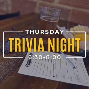
Keep your calendar clear: Every season in Washington, NC brings something new and exciting. Enjoy local festivals, area concerts, or waterfront adventure. Visit their events page at: https://visitwashingtonnc.com/events/#/
Oriental is a wonderful place with friendly people and good food. And, if you do stop here, by all means, eat at our good friends at Toucan’s Grill and stay at Oriental Marina, a SALTY SOUTHEAST CRUISERS’ NET SPONSOR!
An on-the-water retirement home or vacation home for those who love the rich cultural ports-of-call cruising waters of North Carolina, Albemarle Plantation Marina, a port on the Albemarle Loop and a CRUISERS NET SPONSOR, is located just off the AICW on the northern shores of Albemarle Sound on Yeopim River/Creek.
Exploring the Albemarle Queen: A Journey Through Time and Water
Nestled in the scenic coastal region of North Carolina, the Albemarle Queen Paddlewheel offers an enchanting escape for locals and visitors alike. As you glide along the tranquil waters of the Albemarle Sound, you’re not just enjoying a boat ride—you’re embarking on a remarkable journey steeped in history, culture, and natural beauty.
A Glimpse into History
The Albemarle Queen is more than just a boat; it’s a floating piece of history. Originally designed to evoke the classic paddlewheel boats of the 19th century, she has captured the charm and elegance of a bygone era. The vessel serves as a tribute to the rich maritime heritage that has shaped the region.
When you step aboard, you’re greeted by the breathtaking craftsmanship of the boat—its polished wood finishes, ornate columns, and intricate details call to mind a time when river travel was considered the height of luxury. The humming of the paddlewheel and the gentle ripple of water beneath the boat create an atmosphere that is both nostalgic and serene.
The Scenic Journey
As the Albemarle Queen sets sail from her dock, passengers are immediately immersed in the stunning scenery surrounding them. Towering cypress trees, lush marshlands, and the shimmering waters of the sound create a picturesque backdrop that changes with the sun’s descent. The deck offers panoramic views that invite photographers and nature lovers to capture the moment.
Cruising along the waterways, you might catch sight of local wildlife—from playful dolphins to graceful herons—as they thrive in their natural habitat. The soothing sounds of nature intermingle with the soft swell of the paddlewheel, transporting guests to a peaceful state of mind, far removed from the hustle and bustle of daily life.
The Heartbeat of the Sound
Every journey on the Albemarle Queen is infused with the stories of the region. From local legends to historical anecdotes shared by the knowledgeable crew, guests dive deeper into the intricate tapestry of the Albemarle region. The onboard guides share tales of early explorers, native tribes, and the evolution of trade routes that traversed these waters long ago.
In a time when urban life often overshadows the beauty of nature, the Albemarle Queen reminds us of the invaluable connection between people and the environment. The paddlewheel travails echo the experiences of countless souls who relied on these waters for sustenance and adventure.
Events and Entertainment
The Albemarle Queen is not just a transportation vessel; it’s a venue for unforgettable experiences. With themed cruises, dinner outings, and special events throughout the summer, there’s always something happening on board. Whether it’s a romantic dinner cruise featuring local seafood delicacies or a lively music evening with regional bands, the boat offers a diverse array of activities to suit all tastes.
Families can also enjoy special cruises designed for children, complete with engaging educational activities that bring the stories of the sound to life. From pirate-themed adventures to nature workshops, the Albemarle Queen fosters a love for the water in the hearts of younger generations.
Whether you’re a local resident looking for a unique experience or a visitor seeking to uncover the charm of North Carolina’s coast, a trip on the Albemarle Queen Paddlewheel is an experience you won’t forget. With its rich history, breathtaking scenery, and entertaining events, this floating treasure offers an escape into the heart of the Albemarle region.
As the sun sets over the horizon, casting a golden glow on the water, you’ll find yourself grateful for the memories made aboard the Albemarle Queen—an unforgettable blend of past and present, nature and culture, adventure and tranquility. So grab your hat, your friends, and be ready to set sail into a world where history comes alive and every ripple tells a story.
Book your trip on the Albemarle Queen – Learn More
Oriental is a wonderful place with friendly people and good food. And, if you do stop here, by all means, eat at our good friends at Toucan’s Grill and stay at Oriental Marina, a SALTY SOUTHEAST CRUISERS’ NET SPONSOR!
An on-the-water retirement home or vacation home for those who love the rich cultural ports-of-call cruising waters of North Carolina, Albemarle Plantation Marina, a port on the Albemarle Loop and a CRUISERS NET SPONSOR, is located just off the AICW on the northern shores of Albemarle Sound on Yeopim River/Creek.
OUr Hometown, Hertford, Featured in ‘Our State’ Magazine
In this charming story by Molly Harrison from Our State Magazine, Albemarle Plantation’s hometown of Hertford is celebrated as a hidden gem among the state’s coastal communities. The article serves as a walking guide, inviting readers to explore the rich history and natural beauty of our quaint harbor town. From its historic waterfront and lush landscapes to vibrant local eateries and charming shops, Hertford offers a unique blend of Southern hospitality and cultural heritage. Readers are encouraged to lace up their walking shoes and immerse themselves in the captivating sights and stories that make Hertford a must-visit destination. Read the full article from Our State Magazine!
PLAN YOUR DISCOVERY TOUR.
Enjoy a 3-day/2-night stay at the Inner Banks Inn in Edenton’s historic district. Live like a local and sample Albemarle Plantation’s many amenities, natural beauty and incredible water:
• Round of Golf for 2 • Boat Ride on the Albemarle Sound (subject to availability) • Golf Cart, Bikes, Kayaks/Canoes • Breakfast Each Day and Lunch or Dinner at one of our onsite restaurants • Full Access to Fitness Facility and Classes and Pool Facilities (subject to availability) • Explore Downtown Edenton by Bike and Discover the Charming Waterfront • Plus, Tour Homes, Neighborhoods, and See Our Latest Home Listings from the $400s!
book your visit now for only $249!
Explore 172 Roanoke Drive
4 Bedroom | 3 Bath | 2,500+/- Sq Ft
If you are looking for a new construction home without the build time, this is it! Bright, open living spaces abound in the Columbia. Guests are greeted with a light-filled living, dining, and kitchen area, set with glass doors that open to a lovely, screened porch and an attached deck. The vast owner’s suite is the ideal place to recharge after a day on the water or the golf course! The convenient laundry/mudroom/garage layout means your golf cart, kayak, or workout gear are easily stored and handled. Enjoy the extra flexibility of a bonus room above the garage with its own bath, too!
This Discovery Package is designed to acquaint you with Albemarle Plantation real estate opportunities. If married, both spouses must attend the property tour. Participants must live outside a 75 mile radius from the property. The $249 is paid to the hotel at time of booking. If customer does not cancel or reschedule within 14 days of arrival, the customer forfeits the $249 as a cancellation fee. Customer is responsible for any incidentals at the hotel. A valid credit card is required to reserve an Albemarle Plantation Discovery Visit. A limited number of packages are available. Subject to availability. Some blackout dates.
Oriental is a wonderful place with friendly people and good food. And, if you do stop here, by all means, eat at our good friends at Toucan’s Grill and stay at Oriental Marina, a SALTY SOUTHEAST CRUISERS’ NET SPONSOR!
A longtime CRUISERS NET SPONSOR, historic Edenton always has an exciting calendar of events and places to visit! Edenton is at the mouth of the Chowan River on the northwest shore of Albemarle Sound.
Hello,
Summer is in full swing! Kids are out of school, and people are heading off on vacations.
We hope you’ll Visit Edenton this June. Whether you’re looking for historic tours, sporting events, or musical entertainment, Edenton has it all!
So, if you are thinking about swinging through Edenton, you can book a comfortable and convenient room at one of our historic Bed and Breakfasts and experience all that Edenton has to offer this summer.
This month, I’d like to highlight three special items.
Come explore the history of Edenton on Saturday, June 7th. The Historic Edenton State Historic Site will host “Devil to Pay and No Pitch Hot,” an engaging, day-long symposium highlighting maritime, regional, and Edenton history. This unique event will feature a series of expert presentations, followed by a special guided tour of the iconic 1886 Roanoke River Lighthouse. Tickets can be purchased in advance by calling 252-632-5020.
Edenton’s beloved summer concert series is back and better than ever, offering a lively summer concert series that encapsulates Edenton’s coastal heritage and passion for good music. The Sounds of Summer Concert Series is a celebration of live music, bringing together music enthusiasts and families alike for four sensational evenings of entertainment. Each concert promises a diverse lineup of talented musicians spanning various genres, ensuring a vibrant and dynamic experience for attendees. Join us on June 14th for Mike Munson opening for Uphill.
The Edenton Steamers Baseball Season kicked off in May! Come see the Steamers play at Historic Hicks Field with home games happening all month long. Enjoy concessions, kid-friendly activities, exciting competition, and even fireworks as Edenton cheers on this beloved team! Tickets can be purchased at the gate.
We can’t wait to see you this summer in Edenton! Check out our Calendar of Events and plan to visit us this June.
Keep your calendar clear: Every season in Washington, NC brings something new and exciting. Enjoy local festivals, area concerts, or waterfront adventure.
SAFETY/NC – FRISCO AND BUXTON CHANNEL/ATON/CCGD5 BNM 0252-25
1. THE FOLLOWING AIDS TO NAVIGATION HAVE BEEN CHANGED FROM FIXED TO FLOATING AIDS. A. FRISCO APPROACH LIGHT 4 (LLNR 32295) HAS BEEN CHANGED TO FRISCO APPROACH LIGHTED BUOY 4 (LLNR 32295). B. FRISCO CHANNEL DAYBEACON 8 (LLNR 32305) HAS BEEN CHANGED TO FRISCO LIGHTED WRECK BUOY WR8 (LLNR 32305) Q R, 4NM, IN APPROXIMATE POSITION, 35-15-33.937N, 075-39-10.838W. C. BUXTON HARBOR DAYBEACON 14 (LLNR 32235) HAS BEEN CHANGED TO BUXTON HARBOR BUOY 14 (LLNR 32235). CANCEL AT//101829Z JUN 25//


Be the first to comment!