SCDNR: New Distances Required for SC Boaters on Reservoirs
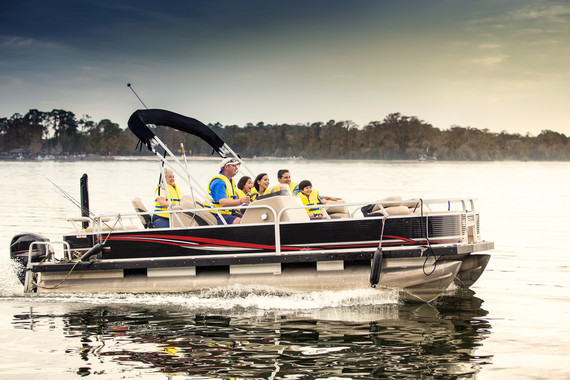
This new law went into effect March 14 and establishes increased boat-to-dock limits on most of South Carolina’s major reservoirs. The law does not apply to the Intracoastal Waterway.
|
This new law went into effect March 14 and establishes increased boat-to-dock limits on most of South Carolina’s major reservoirs. The law does not apply to the Intracoastal Waterway.
|
Charleston County Parks, A CRUISERS NET SPONSOR, announces the return of three Yappy Hours at James Island County Park. Pooches and owners are invited for an evening of live music, drinks and off-leash fun. First Yappy Hour is April 21st.
Click link for Yappy Hour: A Party in the Dog Park this Spring!

This security zone is beneath the Ravenel Bridge which is parallel to and north of the Waterway’s east/west path through Charleston Harbor. Our thanks to Officer Chad Ray for this notice.
SECURITY ZONE – COOPER RIVER BRIDGE RUN
Cooper River and Town Creek Reach, Charleston, SC
The Coast Guard is establishing a temporary security zone on certain waters of the Cooper River and Town Creek Reaches, near the Arthur Ravenel Bridge during the Cooper River Bridge Run on Saturday, April 2, 2022 from 7:30 a.m. to 11:00 a.m.
This temporary security zone prohibits persons and vessels from entering, transiting through, anchoring in, or remaining within the security zone unless authorized by the Captain of the Port Charleston or a designated representative.
In addition, Commercial Anchorage C will be utilized for the event’s planning and staging. Marine traffic is encouraged to use Commercial Anchorages A, B, and D, if needed.
This MSIB can be viewed at https://homeport.uscg.mil/port-directory/charleston. For questions or concerns regarding this MSIB, please contact on scene security assets via VHF-FM Channel 16, Sector Charleston Waterways Management Division at (843) 740-3184, or the Sector’s 24-hour Command Center at (843) 740-7050.

LCDR Chad Ray
USCG Sector Charleston
Waterways Management Div., Chief
(843) 323-7761
Coastal Carolinians are very aware of the dangers of “pluff mud” that is exposed with the tidal extremes. The small coastal creeks and waterways are so inviting to small craft explorers and while the pluff mud may look firm, but it is dangerous for humans and pets. Recently a St. Bernard fell off a pier at low tide and was saved only by giving the dog a large flat cushion to climb upon. The experience left the frightened dog exhausted.
Kayakers trapped for hours in chest-deep mud as tide rose around them, NC rescuers say – The State
The State
Charleston County Parks, A CRUISERS NET SPONSOR, is proud to announce a new yoga program beginning in April.

New Sunrise Yoga program coming to Charleston County Parks in April
Click Here To View the South Carolina Cruisers Net Marina Directory Listing For Cooper River Marina
Click Here To Open A Chart View Window, Zoomed To the Location of Cooper River Marina
Wine Down Wednesday series returns for Spring 2022. Wine, live music and food trucks at Old Towne Creek County Park. Charleston County Parks is A CRUISERS NET SPONSOR!
[WEST ASHLEY] – Charleston County Parks is excited to bring back a spring full of Wine Down Wednesdays at Old Towne Creek County Park! Take a much-needed “hump day” break and enjoy Wine Down Wednesday on March 16, March 30, April 13 and April 27 from 5:30 – 7:30 p.m.
Wine Down Wednesday is a family friendly event where guests can enjoy live music while exploring this unique county park off Old Towne Road in West Ashley. Admission fees also cover wine and a commemorative wine glass. At each event, two food trucks will also be on site with items available for purchase.
The Spring 2022 Wine Down Wednesday music and food lineup is:
Admission for Wine Down Wednesday is $20 per person in advance, and $25 the day of the event.
Guests are encouraged to bring their own chairs, tables and blankets. Dogs are welcome, but must remain on a leash at all times. If an event is canceled by Charleston County Parks, a refund will be provided. Outside alcohol is prohibited. Outside food is allowed.
Old Towne Creek County Park is located in West Ashley off Old Towne Road and is open for special events only. Wine Down Wednesday is a great opportunity for the public to be able to explore and enjoy this site. Old Towne Creek features 67 acres of beautiful open fields complemented by groves of live oak trees. The park will undergo construction later in 2022.
For more information on Wine Down Wednesday, or to register for this event, visit CharlestonCountyParks.com. This event is brought to you by your Charleston County Parks.
Owned by the Charleston County Park and Recreation Commission (CCPRC) and only open currently for special events, Old Towne Creek County Park is located at 1400 Old Towne Road, Charleston, SC 29407. The mission of CCPRC is to improve the quality of life in Charleston County by offering a diverse system of park facilities, programs and services. The large park system features over 11,000 acres of property and includes six regional parks, a skate park, three beach parks, four seasonally-lifeguarded beach areas, three dog parks, two landmark fishing piers, three waterparks, 19 boat landings, a climbing wall, a challenge course, an interpretive center, a historic plantation site, an equestrian center, cottages, a campground, a marina, as well as wedding, meeting and event facilities. The park system also offers a wide variety of recreational services – festivals, camps, classes, programs, and more. For more information on CCPRC, call 843-795-4386, or visit CharlestonCountyParks.com.
Images courtesy Charleston County Parks. High-resolution photos available upon request
Charleston County Park & Recreation Commission / 861 Riverland Drive / Charleston, SC 29412 / (843) 795-4386
|
Charleston County Parks, A CRUISERS NET SPONSOR, proudly introduces a 5K trail race series held at some of its most treasured parks for trail runners and walkers.
Charleston County Parks debuts 5K trail race seriesExplore the Lowcountry’s best trails in 2022
 Sarah Reynolds
Public Information Coordinator Charleston County Park &
| 861 Riverland Dr | , | Charleston | , | SC | 29412 |
| Primary: | 843-762-8089 |
| sreynolds@CCPRC.com | | | CharlestonCountyParks.com |
An uptick in recreational boating has led the state Department of Natural Resources to make permanent its longstanding seasonal no-wake zone for part of the Atlantic Intracoastal Waterway.
Docks line the Intracoastal Waterway between the back side of the Isle of Palms (left) and Goat Island (right) on April 20, 2017. The S.C. Department of Natural Resources has established a permanent no-wake zone for the area. File
Safety concerns lead to permanent no-wake zone between Goat Island, Isle of Palms | SC …
Post and Courier
AREA SPONSORING MARINA
Click Here To View the South Carolina Cruisers Net Marina Directory Listing For Isle of Palms Marina
Click Here To Open A Chart View Window, Zoomed To the Location of Isle of Palms Marina
The Charleston District of the U.S. Army Corps of Engineers is responsible for 15 navigation projects along the South Carolina coast, stretching from Little River Inlet near the North Carolina border to Port Royal Harbor on South Carolina’s southern coast.

USACE Charleston District survey team helps maintain South Carolina waterways – Army.mil
Army.mil
This is good advice from one of our tall-masted and deep keeled friends. Go slow and trust the markers. The southbound Waterway enters Dawho River at White Point and there is a shoal charted in the mouth of the river entrance.
Entering the Dawho River from the N Edisto River, Navionics chart was erroneous. Follow the day markers to prevent grounding.
Ann Frederick
S/V Bees Knees
You are reminded that spectator boats navigating in the darkness following the parade are at great risk. Please take your time and keep a sharp watch as you leave your anchorage.
CHARLESTON PARADE OF BOATS
Charleston Harbor, SC
On Saturday, December 11, 2021 the City of Charleston will host its annual Charleston Parade of Boats in Charleston Harbor from 4 p.m. to 8:30 p.m.
The parade will assemble in Commercial Anchorage B and begin its northern route around Commercial Anchorage A, continuing up through Bennis Reach, beyond Patriots Point to the Ravenel Bridge. The parade will then transit south down the east side of the Charleston peninsula, and will conclude at City Marina.
No persons or vessel may enter, transiting through, anchor in, or remain within the designated area unless authorized by the Captain of the Port Charleston or a designated representative.
This MSIB can be viewed at https://homeport.uscg.mil/port-directory/charleston. For questions or concerns regarding this MSIB, please contact Sector Charleston Waterways Management Division at (843) 740-3184 or the Sector’s 24-hour Command Center at (843) 740-7050.

AREA SPONSORING MARINAS
Click Here To Open A Chart View Window, Zoomed To the Location of Charleston Harbor Marina
Click Here To View the South Carolina Cruisers Net Marina Directory Listing For Cooper River Marina
Click Here To Open A Chart View Window, Zoomed To the Location of Cooper River Marina
Our thanks to Ted Ariska for posting this article in Save South Carolina’s Anchorages.

Boats are being abandoned on SC’s shores. Why? And what’s being done about them?
Island Packet
The problem is NOT owners abandoning their boats. The problem is typical government bureaucracy unable to take charge, FINE the most recent owners of these boats AND make THEM pay for removal. Just complaining about abandoned boats does not effect a solution.
A spooky South Carolina legend for Halloween!
South Carolina’s ghostly Gray Man legend offers lessons in hurricanes and shared stories
Post and Courier
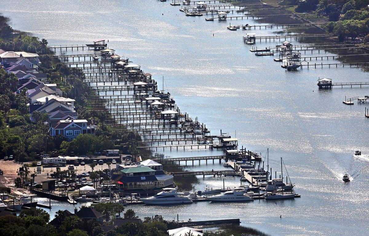
Wounded Nature-Working Veterans, a nonprofit group, organized Wednesday’s cleanup, working with the Coast Guard and DNR crews to clear five vessels from the Intracoastal Waterway. About 15 derelicts still remain in Horry County’s ICW.
Wounded Nature-Working Veterans is a group of veterans, non-veterans and active duty military personnel run by Captain Rudy Socha in the Charleston area. The non-profit volunteer organization is working to cleanup, preserve and protect our coastal environment, particularly from derelict vessels.
Hunt the owners down and force them to pay all fees required to clean up "their mess".
Perhaps allow a community group to assist and make it like a treasure hunt.
Elba Island Cut is a maintained channel on the Georgia side of Savannah River across from Fields Cut in South Carolina.
GEORGIA – SAVANNAH RIVER AND WASSAW SOUND – SAVANNAH RIVER/AICW: Dredging operations.
On or about October 5, 2021 Goodloe Marine will begin dredging operations in the Atlantic Intracoastal Waterway (AICW) at Elba Island Cut just south of the intersection of the AICW and the Savannah River in Georgia. The cutter dredge EXEL will be removing shoal material from the AICW and pumping the material thru a 20” submerged pipeline across the Savannah River to an upland spoil area on the north side of the Savannah River. Mariners are cautioned to pass dredge at an idle speed and be mindful of numerous buoys and floating pipelines in and near the navigation channel. The dredge can be contacted on channel 16 and 68 for passing instructions. Additional information can be obtained by contacting Ben Goodloe 813-355-7494. Dredging operations are expected to be complete by Nov 15, 2021. For further information, please contact the United States Coast Guard at (912) 247-0073. Chart 11512 LNM 39/21

Wounded Nature-Working Veterans is a group of veterans, non-veterans and active duty military personnel run by Captain Rudy Socha, a former Marine turned conservationist. The non-profit volunteer organization is working to cleanup, preserve and protect our coastal environment, particularly from derelict vessels.
Results from the cleanup!
Wounded Nature-Working Veterans

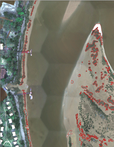 This dataset contains mapped boundaries of intertidal oyster reefs and washed shell deposits found along the SC coast. Reefs were mapped through a combination of automated and manual techniques using 4-band (blue, green, red, near-infrared) digital orthophotos with a theoretical ground resolution of 0.25 meters. These photos were taken from 2003-2006 and can be downloaded. The project area covered those sections of the SC coastal zone where oysters had historically been mapped by the SC Department of Natural Resources (SCDNR) in the 1980’s. The area spans 122 USGS quarter quadrangles (DOQQs).
Sixty of the mapped DOQQs were ground-truthed by boat to assess accuracy. The initial mapping process met the overall minimum accuracy requirements of the project (80% correct classification) and was completed through a joint effort between Photo Science Inc. and SCDNR. Since 2006, low-altitude helicopter photography (see photo below) has been used to edit and update the initial data product. In 2016, 18.5% of the mapped oysters had been updated using helicopter photography. Edits and improvements to this data product are ongoing, and this dataset will be periodically updated.
A link is included below for a table that lists initial accuracy and editing status data by DOQQ. Accuracy scores listed were calculated for the initial product and do not reflect the results of low-altitude helicopter photography editing, so these scores should be considered to be the minimum level of accuracy for the edited areas. Areas covered and analyzed by low-altitude helicopter photographs can be considered to have the highest degree of accuracy. DOQQs that have not been edited by SCDNR should be used with caution. Due to variations in image quality and visibility of oysters, some localized areas may not be as accurate as reported values. In particular, some of the oyster flats with sparse or patchy oyster coverage were difficult to map. Instructions and links are provided below for access to the data and associated metadata.

SC Intertidal Oyster Reefs Map Application
SCDNR_Oyster2015.zip (33mb) ESRI ArcGIS v10.3 File Geodatabase
| Layer Description: | Layer Names: | Layer Metadata: |
|---|---|---|
| SC Intertidal Oyster Reefs | Oyster2015Live | SCDNR_Oyster2015Live.html |
| SC Oyster Shell Deposits | Oyster2015Wash | SCDNR_Oyster2015Wash.html |
Available data set is subject to change and will be updated periodically.
Metadata about the editing status: SCDNR_Oyster2015_metadata_table.pdf
DOQQQ imagery is available at the following link, DOQQQ Imagery
|
More watercraft were involved in crashes along the Intracoastal Waterway in Myrtle Beach than anywhere else in the state last year, according to a 2020 report from the South Carolina Department of Natural Resources.
Intracoastal Waterway in Myrtle Beach leading state in boat crashes, data shows
WBTV.com/news
Safety concerns increase as more boaters enjoy the Intracoastal Waterway | WPDE
wpde.com
We made the mistake, while traveling north on the ICW, of passing through the Myrtle Beach section on a Sunday in April. It was awful. We are in a 36foot sailboat. There were many many jet skis buzzing past, swerving in and out. Power boats passing us very closely! It was the most dangerous part of our trip.
Susan Woods Bamonto don’t forget the over loaded boats and some towing people on tubes…and the day started so beautifully.
I'm not surprised the Myrtle Beach area ICW leads in boat crashes. We see all kinds of craziness whenever we travel through there and I have a photo that says it all.
The Lowcountry Maritime School of Charleston, SC was organized to promote and support their primary mission: educating youth through boatbuilding and maritime skills.

Click here for LMS August 2021 Newsletter


Be the first to comment!