Boaters have long used South Carolina’s public waterways to store or abandon their derelict vessels. If a new bill passes in the General Assembly, they may soon have to take responsibility for them.
Charleston legislators introduce bill to crack down on abandoned boats in SC waterways
Post and Courier
Our thanks to Ted Arisaka for this beautiful sunset taken from Windmill Harbour Marina, A CRUISERS NET SPONSOR!
From Windmill Harbour Marina, A CRUISERS NET SPONSOR, Hilton Head, SC
Click Here To Open A Chart View Window, Zoomed To the Location of Windmill Harbour Marina
Between the Winyah Bay Entrance south of the AICW from Georgetown, SC and the Charleston, SC harbor entrance, there is really no safe inlet and Dewees Inlet carries this emphatic warning from Claiborne: WARN ANYONE OFF FROM USING THIS INLET. THERE IS NO CHANNEL TO SPEAK OF AND TO SAY IT’S TREACHEROUS IS AN UNDERSTATEMENT. IT COULD BE DEADLY!!!
We are headed back off-shore to the south – Charleston, but would prefer Isle of Palms as it takes about two hours off the trip… if we can get in through Dewees Inlet. Charts show no marked channel to the outside but inside the water is charted deep (no channel markers), tides run 5+ feet and there are some tempting areas that may not be shoaled up. Does anyone know if this passage can be made safely with a ~6 ft. draw at HT? Thanks
Captain Ric
Click Here To Open A Chart View Window Showing the Location of Dewees Inlet
I know this is 10 years after the original post, but stay away from Dewees Inlet! Navionics had me take the outside route from McClellanville to Isle of Palms this morning because of low tide along the ICW. Well, I can tell you first hand that Dewees Inlet made me soil my shorts and need a few beers once inside. The approach consisted of many turns and following that magenta line to the "T". However, there was a northeast wind with swell coming from the northeast and the south. Everything was going fine, I was on the line and then my depth sounder started screaming low water. I draw 4'9" on my 37' Gulf Star and at 6' on the sounder with the swell, I kissed the bottom with the keel twice before finding deep water 100' to starboard (off the magenta line) on the edge of breaking waves. Halfway in I saw two large 40+' sport fishing boats turn around and say "Nope, not today". Water depth went from 30' to 6' in a matter of 100 yards and then back to 30+'. Once in calmer water, there was 40' depths the rest of the way. What a way to test the nerves of a new Captain. Next time, I'll take my chances running aground in the ICW. On a calm day, you might be able to get in or out of here, but I seriously don't suggest trying it.
Shelter Cove Harbour and Marina sits in the center of Hilton Head Island, South Carolina and the marina’s state-of-the-art facilities and comprehensive amenities are complemented by the lowcountry charm of the island.
*Due to COVID-19 protocols, Shelter Cove Harbour & Marina is taking extra precautionary measures to ensure the safety of guests and staff. Boats and equipment are being cleaned with soap and bleach at or above the CDC recommended mixing ratios. The marina Ship’s Store is regularly cleaned with disinfectants while focusing on key areas. Employees are regularly cleaning their hands with soap and hot water to keep them as well as customers safe.
Shelter Cove Harbour & Marina — Hilton Head Island, South Carolina
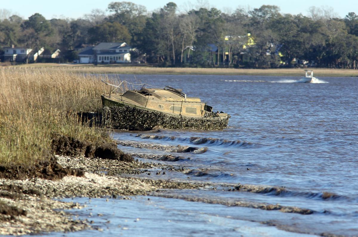
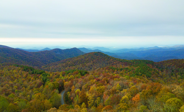
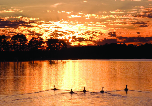
Hilton Head Island’s award-winning Shelter Cove Harbour & Marina, A CRUISERS NET SPONSOR, is the ideal place on Hilton Head for island fun, shopping and a bite to eat. Situated just off the Intracoastal Waterway — Latitude 32* 10’ 92” N Longitude 80* 43’ 56” W — in the middle of Hilton Head Island across from the renowned Palmetto Dunes Oceanfront Resort, Shelter Cove Harbour & Marina offers year-round waterfront dining, shopping and entertainment, along with water sports, activities and tours — all highlighted by Shelter Cove’s spectacular harbour and sunset views.
With 178 slip rentals, the Mediterranean-style Shelter Cove Harbour & Marina is Hilton Head Island’s largest deep-water marina. Shelter Cove’s state-of-the-art facilities and comprehensive amenities are complemented by the island’s Lowcountry charm. The skilled professional staff work hard to ensure that Shelter Cove maintains its stature as one of the East Coast’s premier boating destinations. Shelter Cove recently received the “South Carolina Clean Marina Certification.”
All kinds of water activities may be enjoyed here, from inshore and offshore fishing charters to sport crabbing, sailing and dolphin tours, sightseeing and nature excursions and more. One of the finest ports of call along the East Coast, Shelter Cove Harbour & Marina is your No. 1 Hilton Head Island destination.
When it comes to water adventure, Shelter Cove is the place to be. Rent a boat, kayak or paddleboard — or try out the popular two-person catamarans. Party-cyle with friends or fish for crabs, Shelter Cove has got it all, from nature & dolphin tours to dinner and fireworks cruises. There’s so much to do on the water at Shelter Cove. Inshore, nearshore and offshore fishing in Hilton Head Island provides some of the world’s ultimate fishing experiences.
Hilton Head is widely considered America’s favorite island, serving up 12 miles of pristine beaches and everything anyone needs for an ultimate coastal retreat. Hilton Head was voted “No. 1 Island in the Continental United States” for the fourth consecutive year in Travel + Leisure Magazine’s 2019 World’s Best Awards. In addition, readers of Condé Nast Traveler have voted Hilton Head Island 2019’s “Best Island in the United States” for the third year in a row.
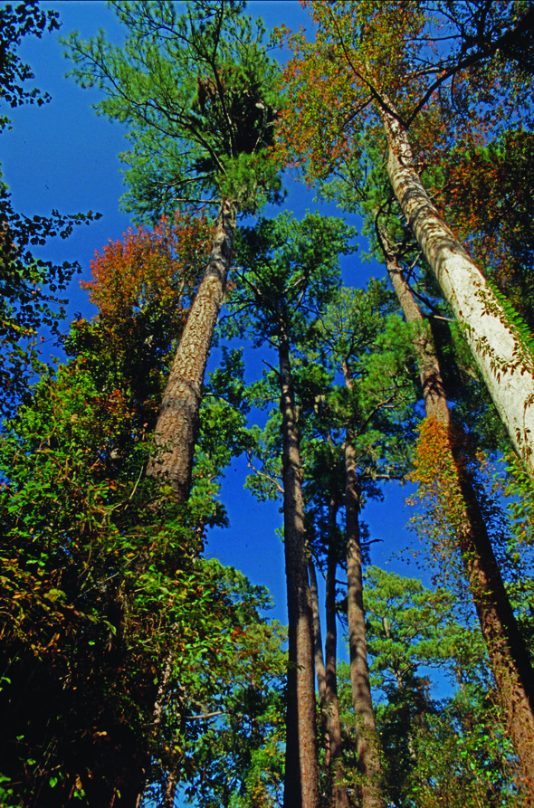
Hilton Head Island’s weather is ideal for those wanting to explore the outdoors and soak up the sunshine. The Lowcountry region features a mild, subtropical climate all year round. Enjoy easy days relaxing in the sun, sand and surf on some of the best beaches in the country. Hilton Head offers a laid-back and welcoming vibe that makes it a perfect vacation destination. There’s something marvelously different about the warm and welcoming feeling found on Hilton Head Island.
Shelter Cove Harbour & Marina is one of Hilton Head’s most popular attractions, because it hosts impressive local and world-traveled boats and yachts, has many fine restaurants and shops, and is the site of some of the island’s signature annual festivals. These events include HarbourFest, an annual summer-long celebration known for its fabulous fireworks displays on select Tuesday nights from mid-June to mid-August.
**ALL 2020 EVENTS ARE SUBJECT TO CHANGE OR CANCELLATION DUE TO COVID-19 GUIDELINES AND CROWD RESTRICTIONS DETERMINED BY THE TOWN OF HILTON HEAD ISLAND AND OUR SOUTH CAROLINA GOVERNOR. ** Visit ShelterCoveHarbourFest.com for current updates.
Centrally located on William Hilton Parkway (Route 278) East at Mile Marker 8, Shelter Cove’s mid-island location on Broad Creek also makes it a perfect launching spot for other island excursions. But with fireworks during HarbourFest all summer long, there’s no better place to have fun than Shelter Cove. For the weekend or the summer — for locals and visitors alike — there’s plenty to enjoy.
Palmetto Dunes Oceanfront Resort has been a favorite vacation destination for decades, providing one of the richest vacation experiences in the country with more award-winning activities than any other resort in the Southeast. Ranked the No. 1 family resort in the United States and Canada and one of the “Top 25 World’s Best Family Getaways” by Travel + Leisure magazine, Palmetto Dunes features activities and experiences for every member of the family. Visitors and guests can explore Shelter Cove Harbour & Marina, enjoy one of the 2,000-acre resort’s three award-winning championship golf courses, bike along the beach, or kayak the 11-mile inland lagoon system.
GOLF
Palmetto Dunes Oceanfront Resort is one of the premier golfing destinations in the Southeast. Each of the three superb layouts are distinctively different, yet challenging. The Arthur Hills Course at Palmetto Dunes, designed by famed golf course architect Arthur Hills, was built on a series of rolling dunes and was named the state’s 2009 Course of the Year. The scenic Robert Trent Jones Oceanfront Course, home to one of the most stunning oceanfront holes in the Southeast, was honored as the South Carolina Course of the Year in 2003 and is a “Certified Audubon Cooperative Sanctuary” for its commitment to providing a sanctuary for wildlife. The George Fazio Course, Hilton Head Island’s only par-70 layout, presents a challenge to any accomplished golfer: a series of long par 4’s guarded by bunkers and water hazards. Veteran golfers regard the Fazio course as Hilton Head Island’s true championship course.
TENNIS AND PICKLEBALL
Tennis lovers are able to book their ultimate tennis vacation at Palmetto Dunes Oceanfront Resort on Hilton Head Island, South Carolina, and enjoy tennis court time, lessons, clinics and more daily at the award-winning Palmetto Dunes Tennis & Pickleball Center. Palmetto Dunes offers 19 clay tennis courts, four of which are lighted for night play, and a beautifully well-stocked, 1,800-square-foot tennis pro shop — Hilton Head Island’s largest. Palmetto Dunes also offers 24 pickleball courts, all of which are lighted for night play. The Palmetto Dunes Tennis & Pickleball Center has been named the island’s top tennis resort.
OUTDOOR ADVENTURE
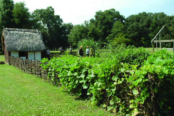
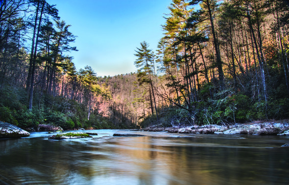
Guests may use their complimentary bike rental to explore miles of paved pathways beneath towering live oak trees and three miles of pristine beaches. Hilton Head Outfitters is available for bike rentals, canoes, kayaks, fishing and much more. Fishermen may select a fly rod or light tackle to go after large redfish, trout, bluefish, flounder and black drum. The calm waters of the 11-mile inland lagoon system that runs through Palmetto Dunes present countless opportunities for fishing, bird watching and enjoying the beauty of nature. Guided paddling trips led by trained interpretative naturalists provide an introduction to the habitat of herons, osprey, dolphins and fiddler crabs. Outfitters guides also provide kayak lessons for beginners, and more.
BIKING
Palmetto Dunes and the surrounding area of Hilton Head Island offer more than 50 miles of paved bike paths that are ideal for exploring. There is even an underpass for crossing busy Highway 278 to access Shelter Cove Harbour and Marina from the resort. Guests may rent bikes, accessories and more at Hilton Head Outfitters to explore the island and to cycle along the beach. Hilton Head Outfitters delivers bikes for free for guests staying at the resort – or anywhere on the island – making bike rentals easy and convenient.
THE PALMETTO DUNES BUGGY (seasonal)
Getting around Shelter Cove Harbour and Marina and Palmetto Dunes Resort is easy, thanks to the Palmetto Dunes Buggy. This free, on-demand service enables guests to skip the traffic and visit the beach, golf courses, Tennis & Pickleball Center, restaurants and shops at Shelter Cove Harbour from mid-April through September.
BEACH FUN
Palmetto Dunes features three miles of pristine beachfront, the ideal locale for surfing, boogie boarding, swimming, walking, lounging and collecting shells. The wide, sandy beaches that front the Atlantic Ocean were reinforced using tons of sand dredged from the resort’s 11-mile lagoon system and Shelter Cove Marina. The sand was positioned to form the resort’s characteristic dunes.
DINING
From Shelter Cove Harbour & Marina, guests can bike — or take the free Dunes Buggy shuttle from April through September — to the Dunes House, a laid-back beach bar and restaurant where guests enjoy food, drinks and fun with spectacular views of the Atlantic Ocean. Big Jim’s BBQ, Burgers and Pizza at the Robert Trent Jones clubhouse is popular for a cold drink and relaxing meal. For more upscale dining, Alexander’s Restaurant & Wine Bar is located in Palmetto Dunes, at 76 Queens Folly Road. Alexander’s is an upscale seafood restaurant and wine bar, featuring seasonally inspired cuisine, locally caught seafood and many locally-sourced ingredients. The menu pays tribute to many classic Lowcountry and Alexander’s favorites such as Baked Flounder Imperial, Shrimp and Grits, and Wiener Schnitzel.
ENTERTAINMENT
For over thirty years, Shelter Cove Harbour has hosted HarbourFest, one of Hilton Head Island’s most popular entertainment events, from Memorial Day through Labor Day. HarbourFest features fireworks on select Tuesday nights as well as street vendors, musicians, arts and crafts and more. Popular troubadour Shannon Tanner presents seasonal entertainment at Shelter Cove with his beanie hat and trademark blend of original music, popular ballads and kid favorites. Plus, many restaurants at Shelter Cove Harbour offer live music seven nights a week all summer long. HarbourFest is free and open to the public.
KIDS’ ACTIVITIES
Palmetto Dunes packs more excitement into a day than most children can handle. From three miles of beach to biking, fishing, canoeing, boating, sport crabbing, exploring, nature tours, water skiing, surfing, paddle boarding or kayaking, kids love visiting Palmetto Dunes.
#
Click Here To Open A Chart View Window Zoomed To the Location of Shelter Cove Harbour and Marina
Considered by many to be one of the best anchorages south of Charleston, Tom Point Creek cuts the western shores of North Edisto River, well south, southwest of flashing daybeacon #102. Our thanks to Jackie and Charlie for this report.
9-11-20. (Looks like we’re only ones using this great anchorage!) Anchored in Tom Point creek (and 3 nights ago also) – about mm 495.5. Came in pretty far (2nd anchor ) to escape threatened storms. Very good protection. About 5-6 times here. A favorite bad weather anchorage. Anchored in about 13-14′ at 80% hi tide. 33# claw 50′ chain 34′ boat. Anchor not move – came up almost clean. Easy in/out- keep middle channel. No place to take dog. Current normal tidal flow. Beautiful and serene!! Charlie and Jackie on Traveler
Click Here To Open A Chart View Window, Zoomed To the Location of Tom Point Creek
This wave buoy is on the SSW side of the entrance channel.
SOUTH CAROLINA – CHARLESTON ENTRANCE – CHARLESTON HARBOR: Post 45 Charleston Entrance Channel Maintenance Wave Buoy Deployment
Great Lakes Dredge & Dock Company, LLC has deployed a data buoy in the approximate work area of the Charleston Entrance Channel Dredging Projects to monitor sea conditions for the purpose of supporting safe dredging operations offshore. The wave data buoy will be anchored/tethered to the sea floor with approximately 130 feet of chain, the exact position of the buoy is dependent on local tides and currents. The wave buoy is also equipped with AIS. AIS ID is GLD-HB1. Mariners and vessels operating are advised to remain clear of the area. For further information, contact Great Lakes Dredge & Dock Company, John Huit at (630) 207-5196. Chart 11528 LNM 33/20
Shelter Cove Harbor and Marina, A CRUISERS NET SPONSOR, sits in the center of Hilton Head Island, South Carolina and the marina’s state-of-the-art facilities and comprehensive amenities are complemented by the lowcountry charm of the island. Our thanks to Loopers, Jan and Lee Rychel, for these kind words as posted on AGLCA’s Forum.
A stop at Shelter Cove Marina is a great break. If they [restaurants] are open, several very nice restaurants in the harbor. It’s a quick loaner bike ride to the beach. Jason is one of our all time favorite Harbormasters. We weathered Mathew in Shelter Cove. Jason is a true professional. Never go by without a stop.
Jan and Lee Rychel
Click Here To Open A Chart View Window Zoomed To the Location of Shelter Cove Harbour and Marina
I second that! Jason and crew and very attentive, I have been staying there for four winters and each year they get better. . I'll b e back next month!
Steamboat Creek cuts the southwestern banks of the North Edisto River, southeast of the ICW/Dawho River and this popular anchorage lies northeast of the charted position of Steamboat Landing. There have been recent local objections from boaters about these floating oyster beds and their implementation may be temporary. Many boaters consider the floating beds to be a danger to navigation and a reduction of anchoring space.
SOUTH CAROLINA – STONO AND NORTH EDISTO RIVERS – NORTH EDISTO RIVER – STEAMBOAT CREEK: Oyster Farm Project
Charleston, South Carolina. The activities include the installation of a total of 700 floating OysterGro cages in one project area. The cages will be configured in 28 trawls (or groups) of 25 cages per trawl, with each end of the trawl being anchored by an auger. From the shoreline, the trawls will be established 50’ from the MLW line and continue channelward with 25’ of spacing between parallel trawls. The perimeter of the project will extend up to approximately 205’ wide and 1,685’ in total linear length. The project area will be marked with five white “Danger Obstruction” buoys; two of the five buoys have been deployed in approximate position 32-36-39.600N, 080-16-40.800W (32°36.6600N / 080°16.6800W, 32.611000 / -80.278000) and 32-36-37.620N, 080-16-39.510W (32°36.6270N / 080°16.6585W, 32.610450 / -80.277642), which mark the southwestern end of the project area. Operations will begin on or around July 13, 2020 and conclude June 2022. For further information regarding this project, please contact USCG Sector Charleston, Waterways Management Division at (843) 323-7761. Chart 11522 LNM 28/20
Click Here To Open A Chart View Window, Zoomed To the Location of Steamboat Creek
What on earth are these people thinking? There is a high traffic boat ramp at that location, plus it is a significant year round Anchorage.
Thank you Larry for this heads up. I see reference to prior objection from boaters on these encroachments into navigable waterways – do you have any links to these? Thank you
Charleston’s city council voted Thursday night to require people wear masks in public places beginning July 1. Enforcement will be difficult in a state that values individual freedom over community welfare.
Charleston votes to require masks as county leads SC in new coronavirus cases
AREA SPONSORING MARINAS!
Click Here To Open A Chart View Window, Zoomed To the Location of Charleston City Marina
Click Here To Open A Chart View Window, Zoomed To the Location of Charleston Harbor Marina
Click Here To View the South Carolina Cruisers Net Marina Directory Listing For Cooper River Marina
Click Here To Open A Chart View Window, Zoomed To the Location of Cooper River Marina
What makes the author believe that "enforcement will be difficult"? I think most citizens of SC will think it is no big deal to wear masks if only for the benefit of their neighbors
This high water has prompted the USCG to declare a strict no-wake zone from statute miles 375-366. See Strict No-Wake Zone. Our thanks to Jim Healy for this notice.
The Coast Guard has declared a “HIGH WATER EVENT” for the Upper Waccamaw River in South Carolina. Officially, the affected zone starts an Wacca Wacha Marina and runs through Myrtle Beach, and includes the Upper Waccamaw to Conway, SC. But is fact, it will affect everyone from Georgetown through Myrtle Beach.
The ICW is above flood stage. The fixed docks at Buicksport Marina (Bucksport sausage) are under water. Because of the flooding, there isn’t much tide in this area, but there is a nasty 3-1/2 to 4 knot current on the Waccamaw that has a big effect on slower boats. We normally make 8-1/2 StM/Hr through still water; yesterday in places, 5-1/2 StM./Hr at higher engine RPM than usual. The marina folks here are saying the crest of the flooding is expected this coming Saturday (6/6/2020).
We have not traveled farther than Socastee, SC (Osprey Marina), but immediately North of Osprey is an area where houses are flooded by the high water. Some bridges (RR, not on the ICW) are locked closed. The USCG LNM is reminding boaters that they are responsible for their wakes, as water is into home is some places. And, I should make honorable mention, there is large flotsam in the water. Watch for logs. Sailboats, make sure you can clear the fixed bridges on the Waccamaw and the ICW through Myrtle Beach. There is one sailboat at Osprey that cannot make the bridges, so he’ll be stuck for a while.
Jim
Peg and Jim Healy, living aboard Sanctuary
For years and long before extreme ICW flooding, Cruisers Net has pleaded with boaters to reduce wakes as they pass through the low country of Socastee, one of those picturesque Waterway portions.
Boaters could cause more water damage to homes along the Intracoastal
ABC 15 News
HCPD, DNR investigating report of shot fired at boat
ABC 15 News
South Carolina Department of Natural Resources continues to monitor COVID-19. In accordance with directives issued by Gov. Henry McMaster, the Department of Health and Environmental Control and the Center for Disease Control and Prevention, SCDNR has canceled, postponed or closed several programs and events.
|
While operations resume at full capacity within the office, in-person transactions are not taking place at this time.
Safe Harbor City Boatyard, formerly Charleston City Boatyard, a subsidiary of Safe Harbor Marinas, A CRUISERS NET SPONSOR, is found on the northern reaches of the Wando River north of red marker #40.
Click for details on Outboard Service Available!
Click Here To Open A Chart View Window, Zoomed To the Location of Safe Harbor City Boatyard
Click Here To Open A Chart View Window, Zoomed To the Location of Safe Harbor City Marina
As you can tell from the comments of Charlie and Jackie, Church Creek is a long-time favorite anchorage. Church Creek anchorage lies 18 miles south of Charleston. Church Creek, with 13-22 ft. depths, indents the eastern flank of the AICW’s hard by marker #77.
3-27-2020- back in one of our favorite anchorages- Church Crk, about mm 486.8. We always go farther into crk than most- quieter! Anchor held first time- never dragged here before. Great Verizon, 19 over air TV, normal tidal current, no shopping or dog walking. Plenty of swing room for many large boats. Beautiful view is worth the stop. Some protection from southerly wind- more of a moderate weather anchorage. This is in top 5 of our favorites- been here well over 12 times- and will be back in future.
Charlie and Jackie on Traveler.
Click Here To Open A Chart View Window, Zoomed To the Location of Church Creek Anchorage
Dataw Island Marina, a former Cruisers Net sponsor, was completely destroyed by Hurricane Matthew, but has now rebuilt and is open for business (temporarily restricted to day-time only transients and outside dining.) The marina is located just a short distance south off the Waterway via Parrot Creek, then Morgan River, west of marker #6, along the southern banks of the Morgan River. A wonderful, intimate marina and a great stopover!
We are happy to report that the Dataw Island Marina is once again fully operational with fuel, wet slips, dry stack, a restaurant, and a full-service boatyard.
The Dataw Island Marina has rebuilt their wetslips and has a fuel once again. Gone are the days of being limited to dry stack. Hooray!!!
Laura McCarthy
Click Here For The Cruisers Net South Carolina Marina Directory Listing For Dataw Island Marina
Click Here To Open A Chart View Window, Zoomed To the Location of Dataw Island Marina
Windmill Harbour Marina, A CRUISERS NET SPONSOR, is located on Skull Creek, on the shores of Hilton Head Island. As of 5/6 transients are welcome.
|
Click Here To Open A Chart View Window, Zoomed To the Location of Windmill Harbour Marina
One of a number of Safe Harbor Marinas along the Intracoastal Waterway, Safe Harbor Charleston City Marina, A CRUISERS NET SPONSOR, is located along the Ashley River’s northeastern banks, northeast of marker #5.
Simplifying your boating experience | Introducing ePay
Click Here To Open A Chart View Window, Zoomed To the Location of Safe Harbor Charleston City Marina
Here are nine scenic locations around South Carolina you can enjoy virtually to celebrate the 50th Anniversary of Earth Day.
Happy 50th, Earth Day!While you’re practicing good social distancing, we know you miss exploring our state’s beautiful natural resources. We do, too. Here are nine scenic locations around South Carolina you can enjoy virtually to celebrate the 50th Anniversary of Earth Day. Read more about these photos on scwildlife.com.Which one will you visit first?ACE Basin Brookgreen Gardens Charles Towne Landing Chattooga River Lake Jocassee Edisto River Sassafras Mountain Congaree Swamp Sunset at Lake Murray
|
Be the first to comment!