Below, you will discover our COMPLETE listing of Western Florida cruising news/postings from fellow cruisers, arranged in chronological order, based on publication date. IF YOU WOULD LIKE TO NARROW YOUR SELECTION of WF cruising news to those messages which pertain to a specific geographic sub-region, locate the RED, vertically stacked menu, on the right side of this, and all Cruisers’ Net pages. Click on “Western Florida.” A drop down menu will appear, with a blue background, Now, click on “WF Regional Cruising News.” A sub-drop-down menu will now appear, listing 13 Western Florida geographic sub-regions. Select your waters of interest, and after clicking on your choice, a list of messages will appear, confined to the sub-region you have picked!
There is always plenty to do around Charlotte Harbor. While berthed at Fishermen’s Village Marina, A CRUISERS NET SPONSOR, you are certain to enjoy visiting Western Florida’s beautiful Charlotte Harbor/Peace River.
Fishermen’s Village APRIL Calendars of Entertainment/Events
April 2026 Sunset Beach Club CalendarApril 2026 Fisherman’s Village Calendar
There is always plenty to do around Charlotte Harbor! While berthed at Fishermen’s Village Marina, A CRUISERS NET SPONSOR, you are certain to enjoy visiting Western Florida’s beautiful Charlotte Harbor/Peace River.
There is always plenty to do around Charlotte Harbor. While berthed at Fishermen’s Village Marina, A CRUISERS NET SPONSOR, you are certain to enjoy visiting Western Florida’s beautiful Charlotte Harbor/Peace River.
Fishermen’s Village MAY Calendars of Entertainment/Events
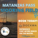
Few Floridian communities are as welcoming to the cruising community as CRUISERS NET SPONSOR, Fort Myers Beach! This is a town that knows how to treat cruisers.
Few Floridian communities are as welcoming to the cruising community as CRUISERS NET SPONSOR, Fort Myers Beach! This is a town that knows how to treat cruisers.
There is always plenty to do around Charlotte Harbor. While berthed at Fishermen’s Village Marina, A CRUISERS NET SPONSOR, you are certain to enjoy visiting Western Florida’s beautiful Charlotte Harbor/Peace River.
Fishermen’s Village APRIL Calendars of Entertainment/Events
April 2026 Sunset Beach Club CalendarApril 2026 Fisherman’s Village Calendar
There is always plenty to do around Charlotte Harbor. While berthed at Fishermen’s Village Marina, A CRUISERS NET SPONSOR, you are certain to enjoy visiting Western Florida’s beautiful Charlotte Harbor/Peace River. Please consider visiting Fishermen’s Village first annual “Earth Day at the Village” event, scheduled for Wednesday, April 22nd, 2026, 10am-4 pm.
Few Floridian communities are as welcoming to the cruising community as CRUISERS NET SPONSOR, Fort Myers Beach! This is a town that knows how to treat cruisers.
There is always plenty to do around Charlotte Harbor. While berthed at Fishermen’s Village Marina, A CRUISERS NET SPONSOR, you are certain to enjoy visiting Western Florida’s beautiful Charlotte Harbor/Peace River.
Fishermen’s Village APRIL Calendars of Entertainment/Events
April 2026 Sunset Beach Club CalendarApril 2026 Fisherman’s Village Calendar
Few Floridian communities are as welcoming to the cruising community as CRUISERS NET SPONSOR, Fort Myers Beach! This is a town that knows how to treat cruisers.
There is always plenty to do around Charlotte Harbor. While berthed at Fishermen’s Village Marina, A CRUISERS NET SPONSOR, you are certain to enjoy visiting Western Florida’s beautiful Charlotte Harbor/Peace River.
There is always plenty to do around Charlotte Harbor. While berthed at Fishermen’s Village Marina, A CRUISERS NET SPONSOR, you are certain to enjoy visiting Western Florida’s beautiful Charlotte Harbor/Peace River.
Fishermen’s Village MARCH Calendars of Entertainment/Events
There is always plenty to do around Charlotte Harbor. While berthed at Fishermen’s Village Marina, A CRUISERS NET SPONSOR, you are certain to enjoy visiting Western Florida’s beautiful Charlotte Harbor/Peace River.


Be the first to comment!