Visit Logged
  • Select Region
    • All Regions
    • VA to NC Line
    • North Carolina
    • South Carolina
    • Georgia
    • Eastern Florida
    • Western Florida
    • Florida Keys
    • Okeechobee Waterway
    • Northern Gulf
    • Bahamas
    • New York
    • Ohio
    • Pennsylvania
    • Washington
    • Puerto Rico
    • Minnesota
    • Maryland
    Order by:
    • Bahamas Chatter: Increase in VAT to 12%!

      Explorer Charts - the best charts for the Bahamas and Exumas

      Explorer Chartbooks, A CRUISERS’ NET PARTNER, has long been the standard navigational supplement for enjoyable, informative, and safe cruising through the beautiful Bahamian waters and island visits.

      Bahamas Chatter: Increase in VAT to 12%!
      Increase in VAT to 12%!

      Posted: 03 Jun 2018 02:53 PM PDT

      Effective July 1, 2018, the Bahamas VAT will increase to 12%. This increase will be devastating! If you search on-line, you can read much more about the controversy. The only concession they’ve made for the residents is that some “breadbasket” food items will be VAT free, but the list is VERY specific & VERY short. This will hurt businesses too, especially restaurants – this new VAT along with a 18% gratuity will result in 30% onto a restaurant bill – Yikes!

      We cruisers aren’t going to like this either. Also announced were a slew of various other increases including immigration fees – unknown yet if that will include Cruusing Permit fees…

      Russ

      Be the first to comment!

    • 2018 Letters from the Bahamas # 5 by Greg and Barbara Allard

      Our sincerest thanks to Greg and Barbara Allard for sharing their thoughts and beautiful photography from their Bahamas cruises. These photos and descriptions will have you aching to follow in the Allard’s wake! Hopefully there will be more letters in the weeks ahead.

      Letter # 5

      Hello everyone:
      Once again we’ve had to send two Letters in close succession, to take advantage of the good internet connection at this marina. This is likely to be the last Letter for a couple of weeks.

      Our report from Long Island continues.

      Barbara and I both grew up on Long Island, the one in New York, which is 120 miles long and has a current population of 7.8 million.

      The other Long Island, the one where we are at the moment, is in the Bahamas. It is 80 miles long, has a population of 3,500 people and there is not one traffic light on the entire island.


      Once we entered the waters towards the southern end of Long Island, we had a small milestone event: we crossed the Tropic of Cancer. This sign on Long Island shows the location of the line, and once south of it, we were officially in tropical waters.

      Jerome Hawes was born in 1876, and studied for five years at the Royal Institute of British Architecture. He then undertook studies at the Lincoln Theological College, became Father Jerome, an Anglican priest, and in 1910 designed this church on a hill above Clarence Town on Long Island. He later went to Rome, studied for three more years to become a Catholic priest, and then in 1939 designed the Catholic church on the far hill, to the right rear of the photo. Local sources say that the Catholic church was not completed until 1946. Both churches were strongly built to survive the frequent hurricanes; they still stand proudly over the town.

      Father Jerome’s Catholic church.

      While we were looking at the Anglican church, the woman on the left came up to me and allowed us to go inside. She is a member of the congregation. She was also excited to show us her new home, and gave us directions to get there. Her name is Sandra Dean, and her husband is Jeremiah.

      This is their new home, which sits on a beautiful hill overlooking the harbor and the ocean. They gave us a tour and we found it to be simply furnished and filled with beautiful breezes from the sea. This house was built to replace their prior one which was destroyed in a hurricane.

      We stopped at the Glinton School in the northern part of Long Island, to drop off some school supplies. We met the principal, Ruth Smith, on the left, and her assistant Claudette Adderley. They gave us the warmest welcome.

      No visit to a school is complete without some pictures of the children. The Bahamian educational system is excellent, the children are well disciplined, and many go on to higher education. There are 34 students enrolled at this school, and some of them are shown here and below.


      One of the teachers, Tangela Bain.

      We met Stanley Pinder, a farmer on Long Island. He gave us some of his beautiful just-picked peppers. He’s over 80 years of age, and has lived on the island his entire life, save for a few years in the U.S. as a farm worker. Long Island is one of the few Bahamian islands which has a flourishing agricultural industry. In fact, they grow enough produce to export it to other Bahamian islands.

      A Bahamian “fast food” restaurant. Regular menu items would be chicken or ribs, mac and cheese, beans and rice, all served in a square styrofoam lidded box. These places do a good lunch business.

      Alfred, who with his wife operates this small bake shop. We bought loaves of white bread, some cinnamon buns and a delicious piece of lemon cake.

      It’s likely that a combination of old age and a hurricane or two destroyed this church. The Bahamians are a religious people – even the smallest of towns have at least one or two churches.

      At the French restaurant, Chez Pierre. A fine lunch, good wine and a great companion.

      St. Mary the Virgin Anglican Church, now in ruins, reported to have been built by the Spanish in the late 17th century. Hopefully, it will someday be restored.

      We collect Bahamian baskets, first of all because we like them, but more importantly because the Bahamians who make them are skilled artisans who carry on a trade which may not last forever. Over the years we have visited Ena Majors’ shop in Clarence Town, where she showcases high quality baskets made by local people. Our friends and us bought the ones on the counter.

      Ena Majors. She is 82 years of age.

      Long Island is the home of Dean’s Blue Hole, a spectacular 660’ deep hole, reputed to be the deepest in the world. It is supposedly connected to the ocean at its bottom.
      This is the site of yearly competitions with participants from all over the world, to see who can set a record by going down the deepest while holding their breath, without SCUBA, or any other devices. Some of the contestants reach 250+ feet. The white raft in the middle has a line which the divers use to guide them. It is an extremely dangerous sport. On the rock to the left of the picture, surrounded by three cherubs, is a plaque listing the people who have died while diving here. The cause their deaths, simply stated, is blacking out from lack of oxygen.
      My task is to send Letters, not to make judgments.

      We went looking for the delicious pineapples which are grown on Long Island, but it was a bit early in the season. In Turnbull, we met Leroy Gibson while he was walking along a road, and the conversation turned from pineapples to other subjects. He liked to verbally joust, and when I eventually asked to take his picture, he said: “I never want my picture taken, but you can take it.” This is the result.

      DCIM100GOPROGOPR1279.

      Life can be difficult in the Bahamas. Fishing is one of the main ways to earn a living. This fisherman’s boat, Lady Max, dragged her anchor, and came to rest in shallow water. It will be difficult to salvage the boat, and his livelihood.

      There was one day where the sun poked out for a couple of hours, and we were rewarded with this view. Look carefully at the name of the boat.

      Hopefully this rainbow is a sign that better weather is on the way. When that happens, we can head north again, back through the Exumas.

      Warm regards-
      Greg and Barbara
      Copyright, Greg Allard

      Be the first to comment!

    • Bahamas Chatter: Official Email from US Customs about New CBP ROAM

      Explorer Charts - the best charts for the Bahamas and Exumas

      Explorer Chartbooks, A CRUISERS’ NET PARTNER, has long been the standard navigational supplement for enjoyable, informative, and safe cruising through the beautiful Bahamian waters and island visits.

      Bahamas Chatter: Official Email from US Customs about New CBP ROAM
      Official Email from US Customs about New CBP ROAM
      Posted: 31 May 2018 10:27 AM PDT

      INTRODUCING A NEW OPTION FOR REPORTING YOUR PLEASURE BOAT ARRIVAL TO CBP

      Hello SVRS member,

      It is our pleasure to announce that U.S. Customs and Border Protection (CBP) is launching the CBP Reporting Offsite Arrival – Mobile (ROAM) app, a new way for pleasure boaters to report their U.S. entry in select locations nationwide! This app provides pleasure boaters with a convenient and efficient way to report their U.S. entry from a personal device, as opposed to calling their local CBP number. Please note: Float plans are no longer required, and the Small Vessel Reporting System (SVRS) is being discontinued in the coming months. A notice will be posted to the SVRS website with a specific date and thereafter all travelers will be directed to utilize the CBP ROAM app. Your SVRS, Local Boater, or Registered Traveler numbers will remain in effect and can be utilized and saved within the app to expedite reporting.

      What is the CBP ROAM app?

      The CBP ROAM app is a free mobile application that provides a new and faster option for pleasure boaters to report their U.S. entry to CBP. Travelers can use their personal smart device (or a tablet located at partner businesses) to satisfy reporting requirements in select areas. All travelers, regardless of nationality or citizenship, are eligible to use the CBP ROAM app.

      Where can the CBP ROAM app be used?

      Currently, the CBP ROAM app can be used to report U.S. entry by pleasure boat in Florida, select locations in Minnesota, and in the Great Lakes and Saint Lawrence River area between Buffalo and Ogdensburg, NY. Additional locations are being added, and travelers should contact their local port of entry to confirm whether arrival submissions via the CBP ROAM app are accepted.

      Download CBP ROAM on your Android or Apple device! Detailed instructions on how to install and use the app on a personal device are attached for your reference. Click Here to download CBP ROAM App Instructions.pdf

      For more information on the CBP ROAM app, visit the CBP ROAM page on CBP’s website. For CBP ROAM questions or comments, please reach out to cbproam@cbp.dhs.gov.

      This program is a pilot and is still under development; please report any difficulties or comments to this email box and we will respond as quickly as possible.

      Happy boating and stay safe!

      U.S. Customs and Border Protection

      Click Here to download CBP ROAM App Instructions.pdf

      Be the first to comment!

    • Currents and Tides by Tom Hale

      Our thanks to AGLCA Forum contributor, Tom Hale, for allowing Cruisers’ Net to share his article on currents and tides with our readers.

      Subject: Currents and Tides
      The issue of tides and currents in estuaries is a bit complicated. A few years ago I researched this for an article for Chesapeake Bay Magazine. The article won an award from the Boating Writers International. What the article describes and explains, is that the time of slack current is out of phase with the timing of high and low tide. On the Chesapeake it lags by three hours. The time of maximum flood current is at the time of high tide. And max ebb is at the the time of low tide. I know it does not make sense, but read the article. I gave the article to AGLCA and it can be found in the member resources section.
      In researching this article I also looked a quite a few other estuaries: Hudson River,
      Delaware Bay, Cape Fear River, Winyah Bay, Tampa Bay and San Francisco Bay, Each estuary is different but they all follow the same pattern that slack water does not occur at the time of high or low water.
      Navigating the coastal waters, a current table is just as important as a tide table.
      Tom Hale

      CLICK HERE FOR TOM’S ARTICLE ON CURRENTS AND TIDES

      Be the first to comment!

    • Good Review of Myrtle Beach Yacht Club, AICW Statute Mile 346


      A CRUISERS NET SPONSOR, Myrtle Beach Yacht Club occupies the northerly banks of Coquina Harbor; Coquina Harbor itself cuts into the northern banks of the Waterway, opposite marker #13.

      Stayed there over a soggy Memorial Day weekend. Good price ($1/ft with Boat US discount), great facilities, helpful dock personnel (Bud and Lex), friendly locals. Tight entrance, so be careful.
      Jimbo Jr.

      Click Here To View the South Carolina Cruisers Net’s Marina Directory Listing For Myrtle Beach Yacht Club

      Click Here To Open A Chart View Window Zoomed To the Location of Myrtle Beach Yacht Club

      Be the first to comment!

    • 2018 Letters from the Bahamas # 4 by Greg and Barbara Allard

      Our sincerest thanks to Greg and Barbara Allard for sharing their thoughts and beautiful photography from their Bahamas cruises. These photos and descriptions will have you aching to follow in the Allard’s wake! Stay tuned for more letters in the weeks ahead.

      Letter # 4
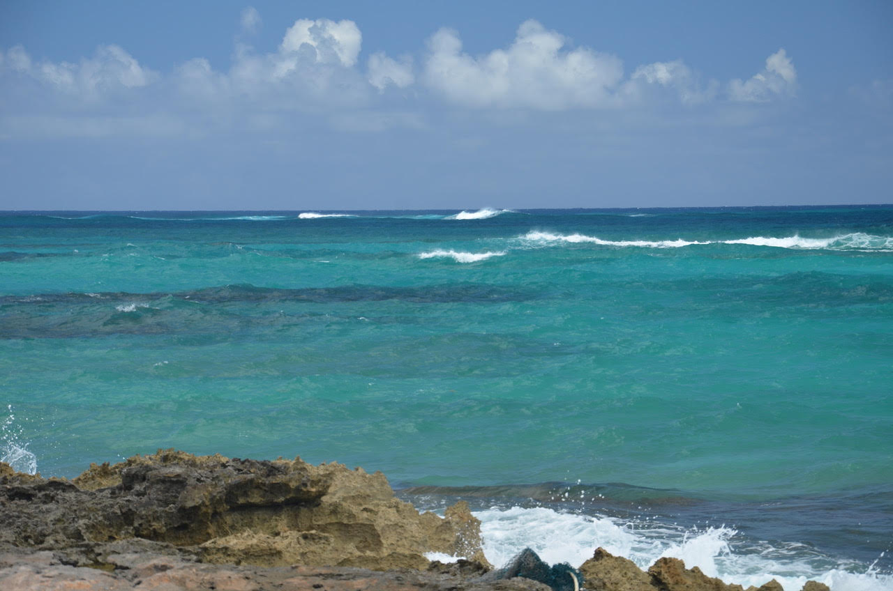
      Sometimes, in these letters, we may give the impression that cruising in the Bahamas is all about spectacular clear turquoise water, friendly and interesting local people, historic places, great food, and gentle winds. Yes, we often have those things. But not always.

      The type of cruising we do is not for everyone. Right now we are hundreds of miles off the coast of the U.S., in a foreign country. Some people enjoy their boats by “coastal cruising”, where they stay close to home port, and go out for day trips. Over the years, we have often enjoyed boating that way. Non-boaters have a vision of what we do as similar to an experience on a 1000’ long cruise ship, where they are served lobster and steak and the finest wines. Of course, the beauty of a cruise ship experience is that, to use a Bahamian word, there is no “boderation” (“botheration”) – that is, the running and maintenance of the ship, the meals and entertainment and all of the other support work is done for you by other people.

      Not on “Meander”. We are self sufficient, and we have to do it all: Barbara and I must function as navigators and pilots, ship’s engineers and mechanics, weather analysts, route planners, and still have time to do cooking, laundry, and repair any one of the dozens of onboard systems. (We carry many spare parts.)

      Our boat is not simple. We have two Detroit Diesel propulsion engines, each rated at 735 HP. They need fuel, and we track their usage carefully, since fueling locations in the remote Bahamas are limited, and the few suppliers that exist often run out – if for instance the fuel barge cannot make it to their location because of bad weather.

      On board, we can make two of the three critical things we need: water and electricity. We can’t make fuel. For electricity, we have two generators (which like the engines need to be maintained), and we have a watermaker, which takes salt water and using a high pressure pump pushes it through a membrane to remove the salt. (It makes the best drinking water you’ve ever tasted.) Good water is critical for us; many Bahamians do not even drink their own municipal water, and rely instead on bottled water.

      Provisioning (stocking the boat with food) is critical, since in the remote parts of the Bahamas there are few stores, and selection is often limited. We have three freezers aboard, and bring an assortment of frozen foods from the U.S.

      The most difficult challenge we face is the weather. When we have internet access (which is better every year in the Bahamas) we can use a number of excellent marine weather sites which help us make good decisions about whether to go or not to go, and where to go. If we don’t have internet access, we rely upon our Sirius XM Marine Weather receiver which obtains extensive weather reports for us by satellite; this means we can access that information far from land. “Meander” also has two radars aboard, which can help us see approaching storms up to 48 miles away.

      As we near hurricane season, we have to give extra attention to any reports of tropical storm activity, and make preparations if needed.


      This is one of the weather reports we received a several days ago. The yellow “X” marking a troubling weather system is exactly where we are. As you can see from the legend at the bottom, there is less than a 40% chance of a cyclone (hurricane) formation. Great. Not quite the odds we wanted. Since this report was issued, the projections are that it will not develop further, which is good news. Nevertheless, this is still a huge disturbance which has been with us for about ten days: high winds, lightening and thunder, and torrential rains, all of which are part of this system. It shows no signs of letting up.

      We were in George Town (for the Regatta) when this system first approached. George Town was not a good place to ride out this mess, so we had to go either north or south. After analyzing the projections, and meeting with Jim and Ellen on the boat traveling with us, we decided to go south to Long Island, to a place called Thompson’s Bay, which would provide protection for us from the projected week-long 30+ knot NE winds.

      We left while the weather was still good. Here, Barbara pilots us south, through the shallow waters of the banks west of Long Island.

      The trip to Long Island was uneventful; winds were still calm, and our course brought us through some spectacular waters.

      We anchored in Thompson’s; the holding was good – which means the anchor dug in and held us quite well. (That doesn’t always happen – often the bottom is rock or thick weeds, and the anchor has a hard time holding in those kinds of bottoms.)

      After a couple of days there, the weather information projected that conditions would deteriorate even further, so we pulled up our anchors and travelled about two hours along the west coast of Long Island to a little marina at Stella Maris. The plan was to seek shelter in their enclosed basin.

      This is an aerial view of the marina from their website, taken on a nice day.

      One problem with the Stella Maris marina: there are over three miles of extremely shallow water leading into the marina. At low tide there is not sufficient water to float our boats, which draw about 4’10”, and at low tide there is only 4’ of water. So we had to time our entry into the marina at full high tide.

      It’s a small run-down facility, with only a few slips for larger boats. We guess it was built in the 70’s, and has not been well maintained, probably because access to the marina over the three miles of really shallow water discourages most boats from attempting the passage. At one time it’s likely that a channel was dredged for the three miles, but the first hurricane would have filled that in, and it is just too expensive to do after every storm.

      We timed the approach correctly, and we had about 1’7” of water under our keel, just enough to squeak into the basin. As I write this, “Meander” is docked in the lower part of the basin, in the “L” just behind the tree. “Latitude” is just behind us.

      The move to this marina turned out to be a prudent one: we’ve been here over a week now, and we’ve had continued high winds, with repeated thunderstorms and driving rain. The owners and staff at this marina have been superb, and we recommend it to any cruiser.

      A view from our boat, docked inside the marina. Once in a while the sun poked through the clouds, but only for a minute or two. Each wave of thunderstorms brought heavy gusts of wind.

      It has rained so much that Jim (on “Latitude”) said:
      “Think we need a cruise meeting this AM, or why bother… all we need to do is start getting two of each of the local animals on board?”

      The advantages of weathering stormy weather while tied to a dock are significant; it provides an opportunity to go ashore and explore the island you came to visit. It also gives you the confidence of knowing that your boat will be there when you return. We’ve have friends who left their boat anchored off shore, and when they returned the anchor line had been cut through from sharp coral on the bottom of the harbor, and their 40’ boat wound up on a rocky shore.

      Our marina is part of a large resort which is on the east side of the island, and since we are guests at the marina, we have full use of the resort’s beautiful property. There, we saw first hand parts of the large storm we were evading. The waves offshore were 6-8’ in height.

      We then came upon something strange, as shown in this photo. The resort had created a salt water swimming pool carved out of the rock along the shore. Off to the left is a set of stairs leading down into the pool. The fresh ocean water comes in from the right side, and flows out the far end. They put tons of sand into the pool, to make it comfortable to walk on. The pool never has to be cleaned, vacuumed or treated with chemicals. The natural flow of the ocean provides a constant source of clean water.

      Here is the channel which was dug out of the rock to supply water to the pool. This was a clever approach to providing a good, protected place to swim on a rocky coast.

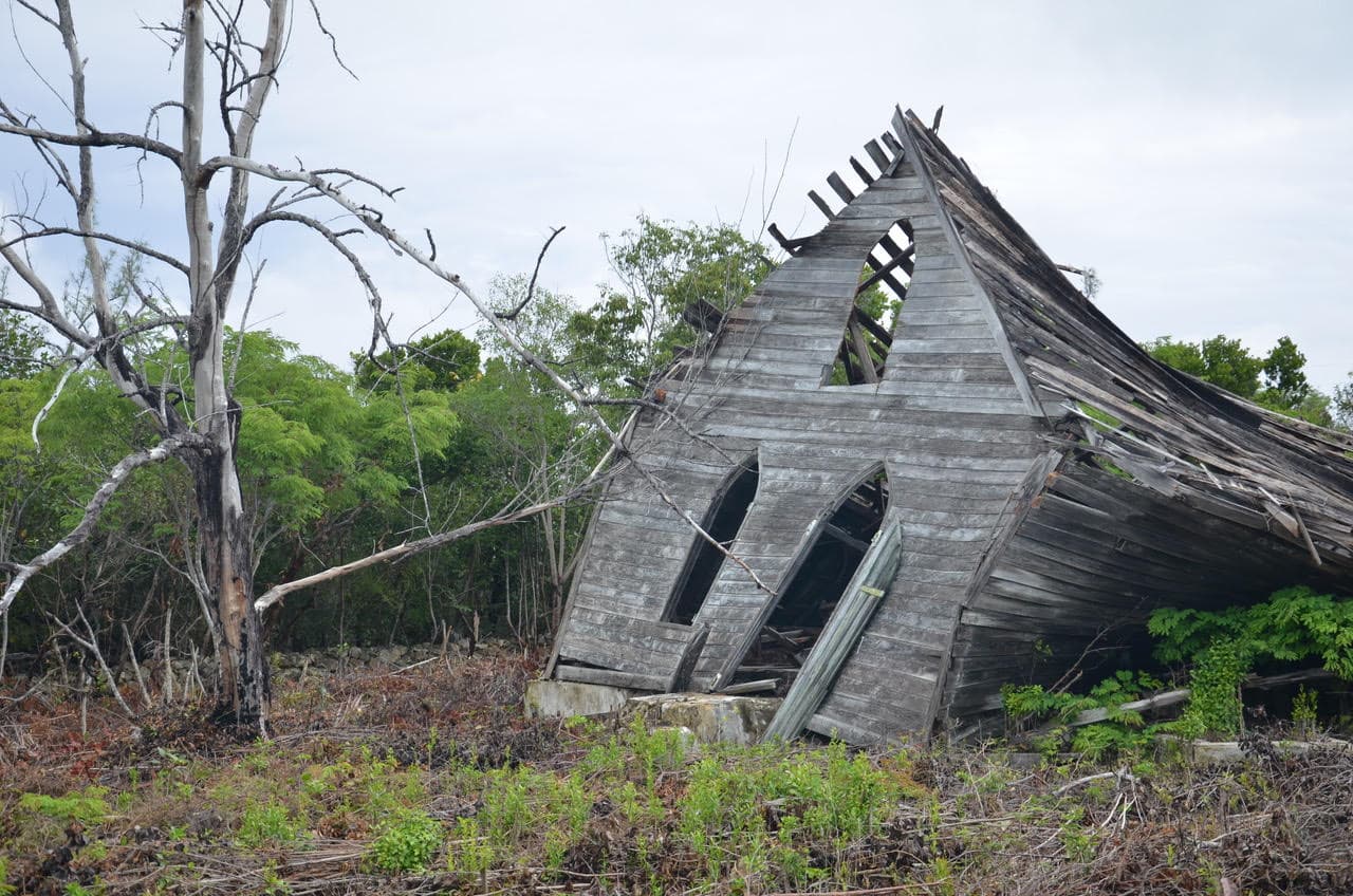
      No place to be in a boat.

      We rented a car, and at the end of a horrendously potholed half-mile mud-dirt road, we came upon a small house. This woman, Sarah Adderley, is a basket maker, upholding a fine but declining tradition.

      Sarah Adderley

      The Bahamas are home to huge land crabs. They normally hide in the woods and come out at night, but this one decided to cross the road in front of our car. If he stretched his claws out, he would be at least a foot and a half wide. Some Bahamians eat them, but they need to be purged for several days or else they taste foul.

      Over the years we have collected a number of quality Bahamian baskets, but until we met this man, we had never known a male basket maker. This basket was $18, and was an unusually good design.

      Charles Wallace of Dunmore, Long Island, The Bahamas. Proud basketmaker.

      The rains continued. We passed this church and saw a group of smart Bahamian goats, who had taken shelter under the portico. We didn’t think the pastor would be too happy when he saw the mess they made.

      We drove a mile down another muddy, soaked, potholed road, in search of – believe it or not – a French restaurant we’d heard about. There are only a dozen or so “restaurants” on this island of 3,500 people and many of those are take-out places – serving the Bahamian version of fast food. So when we heard of a fine French restaurant, we just had to find it.

      It took this French-Canadian, Pierre, fifteen years to build his restaurant which is in the middle of nowhere. He performs the exceptional cooking, waits on the tables, and washes the dishes. All alone.

      Dining on the porch at Chez Pierre restaurant, with Jim and Ellen. We had quite simply one of the best meals in a very long time. Even if it was raining!

      “I really don’t know why it is that all of us are so committed to the sea, except I think it’s because in addition to the fact that the sea changes, and the light changes, and ships change, it’s because we all came from the sea. And it is an interesting biological fact that all of us have in our veins the exact same percentage of salt in our blood that exists in the ocean, and, therefore, we have salt in our blood, in our sweat, in our tears. We are tied to the ocean. And when we go back to the sea – whether it is to sail or to watch it – we are going back from whence we came.” John F. Kennedy

      As of this writing, we are still docked at the small marina on Long Island, as the thunderstorms still roll in and the winds howl. It looks as if we may not have an opening in the weather for at least several more days. There are many worse places to be. In our next Letter we will cover more of this interesting and diverse island.

      Warmest regards
      Greg and Barbara
      Copyright, Greg Allard

      Comments from Cruisers (2)

      1. Laurie -  May 31, 2018 - 9:04 am

        How did you find Stella Maris? And did you contact them first or just take a chance? Enjoying your journey and Letters!! Keep em coming!
        L

        Reply to Laurie
        • greg allard -  June 7, 2018 - 6:08 am

          Laurie- Thank you for your kind comment.
          Stella Maris is a very small marina, with only a handful of slips, so it would be best to call them first. They have about 3 slips (alongside) for bigger boats (60+), and several smaller slips, some of which are stern-in, with no finger pier, which makes it difficult to get on and off the boat. Suggest you specify a side-tie slip, regardless of the size of your boat.
          The Explorer Chart VPR routes into the marina are accurate. However there are not markers left in the channel, other than one single PVC pipe, which survived the last hurricane.
          Stella Maris is a bare-bones marina. They do have wi-fi, and they offer a free shuttle to the main resort a few miles away. That resort has two pools, a beach bar, and a good restaurant. As was mentioned, depending on your draft, you may need to coordinate your arrival and departure with the tide.
          If you have any other questions, please let me know.
          – Greg Allard

          Reply to greg
    • NAV ALERT: LNM: Low Cable Restricting Air Space at Torry Island Bridge, Okeechobee Waterway Statute Mile 60


      This hazard was first posted on Cruisers’ Net in December of 2017, https://cruisersnet.net/168847, and, obviously, no progress is being made to raise the cable from 35ft to its charted height of 52ft.

      FLORIDA – ST. LUCIE INLET TO FORT MYERS AND LAKE OKEECHOBEE – OKEECHOBEE WATERWAY – LAKE OKEECHOBEE (ROUTE
      2): Hazard to Navigation

      The US Army Corps of Engineers Jacksonville District has identified a low hanging fiber optic cable at the Torrey Island Bridge in RT-2 of the Okeechobee Waterway. The fiber optic cable is estimated to be 35 feet above the water; high mast vessels are encouraged to use RT-1 until the cable is raised to 52 feet. Recreational and commercial boaters are to use caution when navigating through these sections of waterway. Once the cable is raised to the required 52 feet normal traffic will be restored. USACOE POC is Gary Hipkins at 863-983-8101.
      Chart 11428 LNM 21/18

      Click Here To View the Okeechobee Cruisers’ Net Bridge Directory Listing For Torry Island Bridge

      Click Here To Open A Chart View Window, Zoomed To the Location of Torry Island Bridge

      Be the first to comment!

    • Bahamas Chatter: Customs Fees/Duty On Repair Parts

      Explorer Charts - the best charts for the Bahamas and Exumas

      Explorer Chartbooks, A CRUISERS’ NET PARTNER, has long been the standard navigational supplement for enjoyable, informative, and safe cruising through the beautiful Bahamian waters and island visits.

      Bahamas Chatter: Customs Fees/Duty On Repair Parts
      Customs Fees/Duty On Repair Parts

      Posted: 24 May 2018 04:58 AM PDT
      We have a 90 day cruising permit and are exploring the Bahamas. A $500 replacement halyard will be shipped to us in the Bahamas via Watermakers Air. What do we need to do to avoid or minimize any duty charges?
      Thanks for your advice.
      Steve Johnson

      Comments from Cruisers (1)

      1. Susan -  May 25, 2018 - 4:16 pm

        Good luck with that. Let us know the outcome. 2 or 3 years ago we had a main halyard shipped to us in the Bahamas and we had to pay 45% duty on the cost AND the shipping for it! Since it is essentially not an “engine part”, it was not exempt.

        Reply to Susan
    • Warning: Submerged Stump, Albemarle-Chesapeake Canal, AICW Statute Mile 16


      Our thanks to M/V Bella and Hank Pomeranz of Carolina Yacht Care, partners with CRUISERS’ NET SPONSOR, Southport Marina, for passing along this warning. For more on the Albemarle and Chesapeake Canal (VA to NC Cut), see https://cruisersnet.net/2016.

      Hi Larry,
      Submitted on behalf of M/V Bella… “Hit submerged stump dead center of channel one Statute Mile south of Centerville swing bridge. Prop damage”.

      May be a good time to remind everyone that the Albermarle – Chesapeake Canal is rife with obstructions.
      Regards,
      Hank

      Click Here To Open A Chart View Window Zoomed To the Location of Centerville Bridge

      Be the first to comment!


    Social Media Auto Publish Powered By : XYZScripts.com