Below, you will discover our COMPLETE listing of Georgia cruising news/postings from fellow cruisers, arranged in chronological order, based on publication date. IF YOU WOULD LIKE TO NARROW YOUR SELECTION of GA cruising news to those messages which pertain to a specific geographic sub-region, locate the RED, vertically stacked menu, on the right side of this, and all Cruisers’ Net pages. Click on “Georgia.” A drop down menu will appear, with a blue background, Now, click on “GA Regional Cruising News.” A sub-drop-down menu will now appear, listing 4 Georgia geographic sub-regions. Select your waters of interest, and after clicking on your choice, a list of messages will appear, confined to the sub-region you have picked!
*** THIS DIV IS AUTOMATICALLY HIDDEN WHEN DISPLAYED – INFO FOR DEBUGGING PURPOSES *** ***MANUALLY DO: FIX TITLE, EXPIRE DATE, CATEGORIES, ENABLE SOCIAL POST *** 0: llnr: 6905 District: 07 lat/lon: 30.779188,-81.488267 Desc: Cumberland Sound Range D Front Light
1. CUMBERLAND SOUND RANGE D FRONT LIGHT (LLNR 6905) IS REPORTED MISSING DAYBOARDS. 2. ALL MARINERS ARE ADVISED TO TRANSIT THE ARA WITH CAUTION. CANCEL AT//251507Z JUL 25//
BT
This email was sent to curtis.hoff@CruisersNet.net using GovDelivery Communications Cloud on behalf of: U.S. Coast Guard · U.S. Department of Homeland Security · Washington, DC 20528 · 800-439-1420
*** THIS DIV IS AUTOMATICALLY HIDDEN WHEN DISPLAYED – INFO FOR DEBUGGING PURPOSES *** ***MANUALLY DO: FIX TITLE, EXPIRE DATE, CATEGORIES, ENABLE SOCIAL POST *** 0: llnr: 4570 District: 07 lat/lon: 31.987819,-80.767301 Desc: Tybee Range Lighted Buoy 6
UPDATE/GA – SAVANNAH RIVER AND WASSAW SOUND – TYBEE RANGE/ATON/SEC CHS BNM 0141-25 UPDATE-2
1. TYBEE RANGE LB 6 (LLNR 4570) IS OFF STATION IN POSN 31-58.99N 080-45.39W. ALL MARINERS ARE REQUESTED TO TRANSIT THE AREA WITH CAUTION. CANCEL AT//241346Z JUL 25//
BT
This email was sent to curtis.hoff@CruisersNet.net using GovDelivery Communications Cloud on behalf of: U.S. Coast Guard · U.S. Department of Homeland Security · Washington, DC 20528 · 800-439-1420
*** THIS DIV IS AUTOMATICALLY HIDDEN WHEN DISPLAYED – INFO FOR DEBUGGING PURPOSES *** ***MANUALLY DO: FIX TITLE, EXPIRE DATE, CATEGORIES, ENABLE SOCIAL POST *** 0: llnr: 6905 District: 07 lat/lon: 30.779188,-81.488267 Desc: Cumberland Sound Range D Front Light
1. CUMBERLAND SOUND RANGE D FRONT LIGHT (LLNR 6905) IS REPORTED MISSING DAYBOARDS. 2. ALL MARINERS BE ADVISED TO TRANSIT THE AREA WITH CAUTION. CANCEL AT//241149Z JUL 25//
BT
This email was sent to curtis.hoff@CruisersNet.net using GovDelivery Communications Cloud on behalf of: U.S. Coast Guard · U.S. Department of Homeland Security · Washington, DC 20528 · 800-439-1420
I found this article to be fascinating since I have entered many of these inlets while cruising up and down the East Coast. It is interesting to read about the rich history of many of them.
Cruisers Net publishes Loose Cannon articles with Captain Swanson’s permission in hopes that mariners with salt water in their veins will subscribe. $7 a month or $56 for the year, and you may cancel at any time.
Ocracoke Island villagers salvage lumber from the shattered hull of the schooner Nomis in the summer of 1935. Nomis was carrying 338,000 feet of lumber from Georgetown, South Carolina, to New York City.
Okay, its Fourth of July weekend, so the theme of this Loose Cannon installment is light and playful: Trivia related to various inlets along the Atlantic Coast from Virginia to the Florida border. I was digging for something in my archives, and I found historical summaries written over a decade ago but never published.
Not all inlets are mentioned, and Charleston is omitted altogether because of its historic significance defies pithy summarization. And please do not assume that just because an inlet is included it is recommended for navigation.
Enjoy.
Virginia
Rudee
What is now Rudee Inlet began as a manmade drainage culvert. In 1968, the state created the current inlet, part of a $1 million plan to attract boaters. Now regular dredging is part of a cycle of a system to replenishment sand on the beaches of Virginia Beach. You can often see East Coast Navy SEAL teams launching boats for training exercises here.
Navy SEAL stealth boat goes for a spin at Rudee Inlet, Virginia Beach.
North Carolina
Oregon
In 1873 Congress approved and appropriated funds for the building of 29 lifesaving stations, one of which was the Bodie Island Station, located on the south side of Oregon Inlet. In 1883, the station on the north side of Oregon Inlet (also known as Tommy’s Hummock) was officially named the Bodie Island Station and the “old” Bodie Island Station (south of the inlet) was renamed as the Oregon Inlet Station. These are the antecedents to the current Coast Guard Station on Bodie.
Hatteras
The first Hatteras Inlet was formed south of the current inlet, but closed around 1764. The modern Hatteras Inlet was formed on September 7, 1846 by a violent gale. This was the same storm that opened present-day Oregon Inlet to the north. This became a profitable inlet, because it gave the Inner Banks, a quicker and easier way to travel to and from the Gulf Stream. It was easier to come into this inlet from the north.
Because of the increase of commerce, Hatteras Village Post Office was established in 1858. The initial invasion of the North Carolina coast, on Hatteras Island, during the Civil War called Battle of Hatteras Inlet Batteries came from Hatteras Inlet. The two Confederate forts guarding the inlet quickly fell. The Graveyard of the Atlantic Museum is also located here. Need we say more?
Ocracoke
The residents of this area have stoutly resisted modernization and change and a visit here is very much a trip back to the way it used to be. Ocracoke is part of the area known as the Graveyard of the Atlantic, due to the many shipwrecks over the centuries—more than 600, according to some sources.
Home to whalers and Spanish privateers in the 18th century, Cape Lookout Bight is the location of the distinctively diamond patterned Cape Lookout Lighthouse. The wreck of the schooner Chrissie Wright occurred here on Lookout Shoals, where the entire crew but the cook perished in view of shore, rescuers unable to reach them until the next day due to the large breakers.
Beaufort
Pirate Edward Teach, popularly known as Blackbeard, lost his ship Queen Ann’s Revenge in 1718 after running aground at Beaufort Inlet. There is a fascinating multimedia display at the Beaufort Maritime Museum on his story, and the continuing excavation of his vessel. Blackbeard was later killed by naval forces off Ocracoke, but his head came home through Beaufort inlet, hanging on the bowsprit of the ship which captured him.
Mason
In March 2002, Mason inlet was cut through at a location about 3,500 feet northeast of what was then Mason Inlet. A week after the successful opening of the new inlet, the old Mason Inlet was closed. This engineering work, sponsored by local interests, was in response to the southward migration of Mason Inlet over the years to the point were it was threatening to undermine the Shell Island Resort and community to the south.
Masonboro
In November 1862, Union warships forced blockade running British schooner F.W. Pindar aground at the inlet, and sent a boat crew to destroy the vessel. The boat swamped and the crew was captured after successfully firing the schooner. In the same month, the Union Navy ran the British bark Sophia aground and destroyed her near the inlet as well.
Carolina Beach
Shoaling closed the original inlet in the early 1900s. It was blasted open again with explosives in 1952. In 2007, $1.2 million in federal funds were allocated for dredging Carolina Beach Inlet.
Cape Fear River
Cape Fear’s moniker comes from the fearsome Frying Pan Shoals offshore. This area marks the southern border of the Graveyard of the Atlantic. Bald Head Lighthouse, long known as “Old Baldy,” was North Carolina’s first lighthouse, dating back to 1796. Legendary 19th century singlehander Joshua Slocum came ashore in this region while returning from South America in a small vessel he built and wrote about in his book “Voyage of the Liberdade.”
Lockwood’s Folly
Lockwoods Folly Inlet was the scene of several Civil War confrontations. In an area noted as the Cape Fear Civil War Shipwreck District (shown here from a U.S. Army Corps survey chart), which crosses the inlet itself, are found the wrecks of Lisa Marie, Elizabeth, Iron Age and Bendigo. The name ‘Lockwood’s Folly’ came about when a certain Mr. Lockwood built himself a boat, which happened to have draft too great to transit the inlet. Some things haven’t changed.
Shallotte
The entire coastal area was a hotspot of activity during the Civil War. The Union gunship Penobscot, at 158 feet and 10-foot 6-inch draft, destroyed her first Confederate vessel, the schooner Sereta, which went aground and was abandoned off Shallotte Inlet in June 1862. In November, the Penobscot forced the British ship Pathfinder aground at Shallotte Inlet, then destroyed her. Penobscot was known as the “90-day gunship” for the length of time it took to build her.
A “90-day-gunship,” sister ship to the USS Penobscot.
South Carolina
Little River Inlet
Because of the marshes surrounding Little River, the area received little land traffic until roads were built in the 1920s. Along with the safety afforded by the harbor, it thus became somewhat of a haven for pirates and smugglers. Following the arrival of some ‘northerners’ after the War of 1812, the town was known as “Yankee Town,” certainly not a name fondly accepted by those born there.
Murrells Inlet
Close by Murrells Inlet lies Drunken Jack Island—and Drunken Jack. Legend has it that a pirate was accidentally marooned with nothing but a supply of rum. When the ship finally returned, all they found were empty bottles of rum, and the bones of poor Jack. The island is also another of those reputed to contain Blackbeard’s treasure.
Winyah Bay
The first Europeans to settle the banks of Winyah Bay were actually the Spanish, but after failing as farmers, they built a ship from the towering cypress and oak trees lining the swamps, and sailed off to the Spice Islands of the Caribbean, where there was a ready market for their slaves.
Stono River
Union naval forces controlled the Stono River during the Civil War, but got their comeuppance when a Confedate artillery unit set up on the banks by cover of darkness, bombarded a Union warship and forced her officers to row ashore to surrender.
North Edisto River
The North Edisto River inlet was often used as a back door for Union vessels to attack Charleston, as any vessel proceeding through the Charleston inlet was a sitting duck, unable to return fire with while inbound with Fort Moultrie forward of the alignment of her guns.
St. Helena Sound
St. Helena Island is considered the center of African American Gullah culture and is also the site of several forts which have been extensively excavated. During the Civil War, Fort Walker fell early, leading to the capture of Port Royal. The slaves were freed and measures, including land grants, were undertaken to assist them. Black history is such a powerful force in this area that those supporting the Gullah culture have been able to prevent the building of condos and gated communities on St. Helena Island.
Portrait of a Gullah community after the Civil War.
New River Entrance
Camp Lejeune is located nearby and one will often see Marines on exercises. Kids will be thrilled as they roar by in their inflatable vessels, complete with weaponry, or operating tanks on the east side of the ICW or artillery towed behind trucks. Skippers knowing that this gear constitutes targets for shooting exercises may be a little less sanguine about them.
Port Royal Sound
Most mariners are aware that the Parris Island Marine Corps base is here. What most won’t know is that Cat Island, at the anchorage at Mile 544, was at one time a nudist colony. Hilton Head Island was at one time a prominent outpost of the Gullah community. (The nudist colony closed prior to World War II in case you were wondering!)
Calibogue Sound
This entire area was fought over by the Spanish, French and British for years, and the coast was a favorite hunting ground for pirates, including Blackbeard. The area is noted for its Gullah heritage. Today, most of the coast is a major resort region, with golf on Hilton Head Island. being one of the biggest draws. The red-striped replica lighthouse at Harbortown Yacht Basin is one of the most photographed sights on the Waterway.
Georgia
Savannah River
This entire area was fought over by the Spanish, French and British for years, and the coast was a favorite hunting ground for pirates, including Blackbeard. The area is noted for its Gullah heritage. Colonial Savannah, an early “planned city” (by Gen. James Oglethorpe), is regarded as one of the most beautiful in the United States.
Wassaw Sound
Thunderbolt was supposedly named after a lighting bolt struck there, creating a spring and giving native Americans a reason to settle there.
Ossaba Sound
Archeological evidence indicates Ossabaw Island has been inhabited for 4,000 years. During the last century it was a hunting retreat and then, a privately held scholarly and artistic retreat. When the owners could no longer subsidize the cost, they sold the island to the state of Georgia, thus preserving its natural beauty for the enjoyment of future generations.
St. Catherines Sound
A Spanish fort dating from 1566 was built on St. Catherines Island, which General Sherman awarded to freed slaves after the Civil war along with Ossabaw and Sapelo islands. This state of affairs lasted for two years, after which the island was returned to its former owner, and the new residents relocated to the Georgia mainland. An 1893 hurricane covered the entire island in water. Only one person survived.
Sapelo Sound
Sapelo Island’s ownership makes for a fascinating story. Fleeing revolution at home, a syndicate of French nobles purchased it in 1790, followed by a Danish sea captain, then a planter who was the only one who ever managed to make a profit from the island’s soil. In the 20th century, an excutive of the Hudson Motorcar Company, took possession, but the Crash of ’29 forced him to sell to R.J. Reynolds of tobacco fame. In 1969, Reynold’s widow donated part of it to the state of Georgia for a wildlife refuge. Now the entire island has protected status under government ownership.
An old Coast Guard photo of the Sapelo Island lighthouse.
Doboy Sound
Cruisers using this inlet may well notice mounds of large rocks not native to the area, particularly on Commodore Island. These are ballast stones from tallships which used these waters in past centuries, tossed overboard to lighten them so they could navigate the shallower waters upstream with their cargoes.
St. Simons Sound
Originally built in 1808, St. Simons lighthouse was torn down by Confederate forces in 1862 and replaced in 1872. In 1953, the oil lamps were replaced by a Fresnel lens and the 106 foot structure can be climbed. The view is worth the effort.
St. Andrews Sound
The lighthouse on Little Cumberland Island operated from 1838 until its deactivation in 1915. The keeper’s house was destroyed by fire in 1968.
St. Mary’s Inlet
Fernandina Beach on the Florida side was founded by Union soldiers, who returned there after having occupied Amelia Island during the war; they were drawn to the area’s climate and natural beauty. That may explain why the city’s downtown resembles a 19th Century New England town.
LOOSE CANNON is a reader-supported publication. To receive new posts and support the work, consider becoming a free or paid subscriber.
*** THIS DIV IS AUTOMATICALLY HIDDEN WHEN DISPLAYED – INFO FOR DEBUGGING PURPOSES *** ***MANUALLY DO: FIX TITLE, EXPIRE DATE, CATEGORIES, ENABLE SOCIAL POST *** 0: llnr: 4570 District: 07 lat/lon: 31.987819,-80.767301 Desc: Tybee Range Lighted Buoy 6
UPDATE/GA – SAVANNAH RIVER AND WASSAW SOUND – TYBEE RANGE/ATON/SEC CHS BNM 0141-25 UPDATE-1
1. TYBEE RANGE LB 6 (LLNR 4570) IS RPTD EXTINGUISHED AND OFF STATION APROX 700 YDS IN GPS POSN 31-58.929N 080-45.810W. ALL MARINERS ARE REQUESTED TO TRANSIT THE AREA WITH CAUTION. CANCEL AT//170400Z JUL 25//
BT
This email was sent to curtis.hoff@CruisersNet.net using GovDelivery Communications Cloud on behalf of: U.S. Coast Guard · U.S. Department of Homeland Security · Washington, DC 20528 · 800-439-1420
*** THIS DIV IS AUTOMATICALLY HIDDEN WHEN DISPLAYED – INFO FOR DEBUGGING PURPOSES *** ***MANUALLY DO: FIX TITLE, EXPIRE DATE, CATEGORIES, ENABLE SOCIAL POST *** 0: llnr: 4570 District: 07 lat/lon: 31.987819,-80.767301 Desc: Tybee Range Lighted Buoy 6
SAFETY/GA – SAVANNAH RIVER AND WASSAW SOUND – TYBEE RANGE/ATON/SEC CHS BNM 0141-25
1. TYBEE RANGE LB 6 (LLNR 4570) IS RPTD OFF STATION APROX 700 YDS IN GPS POSN 31-58.929N 080-45.810W. ALL MARINERS ARE REQUESTED TO TRANSIT THE AREA WITH CAUTION.
CANCEL AT//160400Z JUL 25//
BT
This email was sent to curtis.hoff@CruisersNet.net using GovDelivery Communications Cloud on behalf of: U.S. Coast Guard · U.S. Department of Homeland Security · Washington, DC 20528 · 800-439-1420
*** THIS DIV IS AUTOMATICALLY HIDDEN WHEN DISPLAYED – INFO FOR DEBUGGING PURPOSES *** ***MANUALLY DO: FIX TITLE, EXPIRE DATE, CATEGORIES, ENABLE SOCIAL POST *** 0: llnr: 37090 District: 07 lat/lon: 31.259067,-81.394463 Desc: Mackay River Cutoff Light 229
UPDATE/ICW – BEAUFORT RIVER TO ST. SIMONS SOUND – MACKAY RIVER/ATON/SEC CHS BNM 0137-25 UPDATE-1
1. MACKAY RIVER CUTOFF LIGHT 229 (LLNR 37090) REPORTED MISSING. UNIT SET TRLB ON SCENE. ALL MARINERS ARE REQUESTED TO TRANSIT WITH CAUTION. CANCEL AT//151938Z JUL 25//
BT
This email was sent to curtis.hoff@CruisersNet.net using GovDelivery Communications Cloud on behalf of: U.S. Coast Guard · U.S. Department of Homeland Security · Washington, DC 20528 · 800-439-1420
*** THIS DIV IS AUTOMATICALLY HIDDEN WHEN DISPLAYED – INFO FOR DEBUGGING PURPOSES *** ***MANUALLY DO: FIX TITLE, EXPIRE DATE, CATEGORIES, ENABLE SOCIAL POST *** 0: llnr: 37380 District: 07 lat/lon: 31.000280,-81.421504 Desc: St Andrew Sound Lighted Buoy 30WW: blat (31.00139) , blon (-81.42088) , bWWid (5) , bMM (688.3) , bDOffWW (0.1) , bAbbrev (AIWW) , bWWName (Atlantic Intracoastal Waterway.gpx)
SAFETY/ICW GA – ST. ANDREW SOUND/ATON/SEC CHS BNM 0138-25
1. ST ANDREW SOUND LIGHTED BUOY 30 (LLNR 37380) IS DAMAGED. THE TOP HALF OF THE BUOY IS MISSING. THE BUOY IS UNMARKED AND UNABLE TO DISPLAY LIGHT CHARACTERISTICS. ALL MARINERS ARE REQUESTED TO TRANSIT THE AREA WITH CAUTION. CANCEL AT//131642Z JUL 25//
BT
This email was sent to curtis.hoff@CruisersNet.net using GovDelivery Communications Cloud on behalf of: U.S. Coast Guard · U.S. Department of Homeland Security · Washington, DC 20528 · 800-439-1420
Gray’s Reef National Marine Sanctuary protects Georgia’s special live-bottom wildlife habitat in the Atlantic Ocean and along the southeastern U.S. coast, an area teeming with diversity and an abundance of marine life.
Gray’s Reef National Marine Sanctuary May Recap
Gray’s Reef Hosts the 2025 MATE ROV Southeast Regional Competition
On May 10th, Gray’s Reef hosted the Southeast Regional MATE ROV Competition at the Chatham County Aquatics Center in Savannah, Georgia! The MATE ROV Southeast Regional Competition uses underwater robotics (aka remotely operated vehicles or ROVs) to inspire and challenge students to learn and creatively apply scientific, engineering, and technical skills to solving real-world problems. This year’s competition challenged students from all over the Southeast U.S. to tackle missions based on scenarios from the workplace, encouraging students to work together, network, and learn from technical professionals and each other.
The first place RANGER level team, WhaleTech from North Paulding High School, will move on to compete at the Worlds Competition in June. Competing in the 2025 regional competition, we had fourteen teams with over one hundred individuals registered as team members, coaches, or volunteers. This number was increased with family members and guests as this event is entirely open to the public. The Gray’s Reef team is looking forward to planning next year’s event! For more information about the MATE ROV Southeast Regional Competition, please contact Danielle Oxman at danielle.oxman@noaa.gov.
RANGER level competitors weighing their ROV before their pool product demonstrations. Photo by Hunter Coughlin/NOAA
2025 MATE ROV pool product demonstration in action! Photo by Hunter Coughlin/NOAA
Building Bridges Academy Join as a New Ocean Guardian School
On May 14th, Building Bridges Academy attended their first formal class as an Ocean Guardian School. Ocean Guardian Schools make commitments to protect and conserve their local watersheds, the world’s ocean, and special ocean areas, like national marine sanctuaries. The school makes this commitment by proposing and then implementing a school- or community-based conservation project.
Building Bridges Academy will be taking on composting to limit food waste in their school for their Ocean Guardian project. During their lesson, students learned about the Ocean Guardian program, Gray’s Reef, the importance of wetland habitats to a healthy ocean, and their connection to watershed areas. Students then got to put their new found knowledge to the test and build their own wetlands that would prevent pollution from draining to the ocean and protect the city from incoming storm surges! For more information about Ocean Guardian Schools, please contact Mary Quinn at mary.quinn@noaa.gov.
Education and Outreach Specialist, Mary, educating students on Ocean Guardian Schools. Photo by Danielle Oxman/NOAA
Ocean Guardian student making their wetland in a pan. Photo by Danielle Oxman/NOAA
Crew Training and Operational Readiness
On May 29, R/V Gannet transited offshore to Gray’s Reef National Marine Sanctuary for a crew training and systems review day. The team participated in docking and undocking procedures, reviewed onboard emergency systems and navigation protocols, and assisted with drills and equipment handling. They conducted two man-overboard drills while opportunistically retrieving marine debris—two helium balloons found floating offshore. They also practiced deploying and retrieving a drop marker, which helped to better calibrate GPS accuracy and improve R/V Gannet’s systems. Additionally, they evaluated an alternate return transit route through Ossabaw Sound. Although this route took longer due to the no-wake zones, it was a smoother ride and more protected—valuable information for future planning in the event of unexpected weather deterioration. For more information, please contact the Gray’s Reef Vessel Operations Coordinator voc.grnms@noaa.gov.
Lieutenant Ring preparing to drop a diving drop marker on Captain Jason’s command. Photo by Alison Soss/NOAA
Alison Soss being very excited to go offshore and showing off our crew uniform. Photo by Alison Soss/NOAA
Captain Ward at the helm transitioning back from Gray’s Reef National Marine Sanctuary. Photo by Alison Soss/NOAA
Upcoming Events with Gray’s Reef
2025 Super Sanctuary Summer: June 10th – August 15th
In honor of World Oceans Week, we’re kicking off our Super Sanctuary Summer and extending our Discovery Center hours! Starting on June 10th, we’ll be opening our doors Tuesdays – Fridays from 10:00 a.m. – 4:00 p.m. to host FREE daily activities and events. Each week will feature a new theme with talks, workshops, craft sessions, and more! The Gray’s Reef Ocean Discovery Center is located at 340 MLK Jr Blvd. Savannah, GA. For a detailed schedule of these events, check out our website below.
Ocean Depths Artistic Heights: Deep Dive Exhibit: Now – August 4th
The Gray’s Reef Ocean Discovery Center welcomes local artists to be a part of our new rotating art exhibit, Ocean Depths Artistic Heights. Check out local artist Cat Ward’s exhibit, Deep Dive, which highlights her ocean inspired acrylic and sculpture series.
Sanctuary Advisory Council Meeting: July 10th
National marine sanctuary advisory councils are community-based advisory groups that provide advice and recommendations to the superintendents of the sanctuary sites on issues like management, science, community engagement, and stewardship. Members of the advisory council represent a broad cross-section of communities, industries, and stakeholders interested in and affected by the marine sanctuary. The Gray’s Reef Sanctuary Advisory Council will be meeting on July 10th at the Ocean Discovery Center. More information about hours and agenda will be posted on our website soon!
Southeast Regional Ecosystem Assessment: July 21st – August 3rd
The Gray’s Reef team will be embarking on the NOAA Ship Nancy Foster mission in July! This multidisciplinary mission will include underwater mapping, scientific dive surveys, and public outreach. The Nancy Foster will be docked on River Street, Savannah, GA on August 3rd, and opening its doors to the public! Join us to see this incredible vessel and learn about the important research that was conducted for this mission.
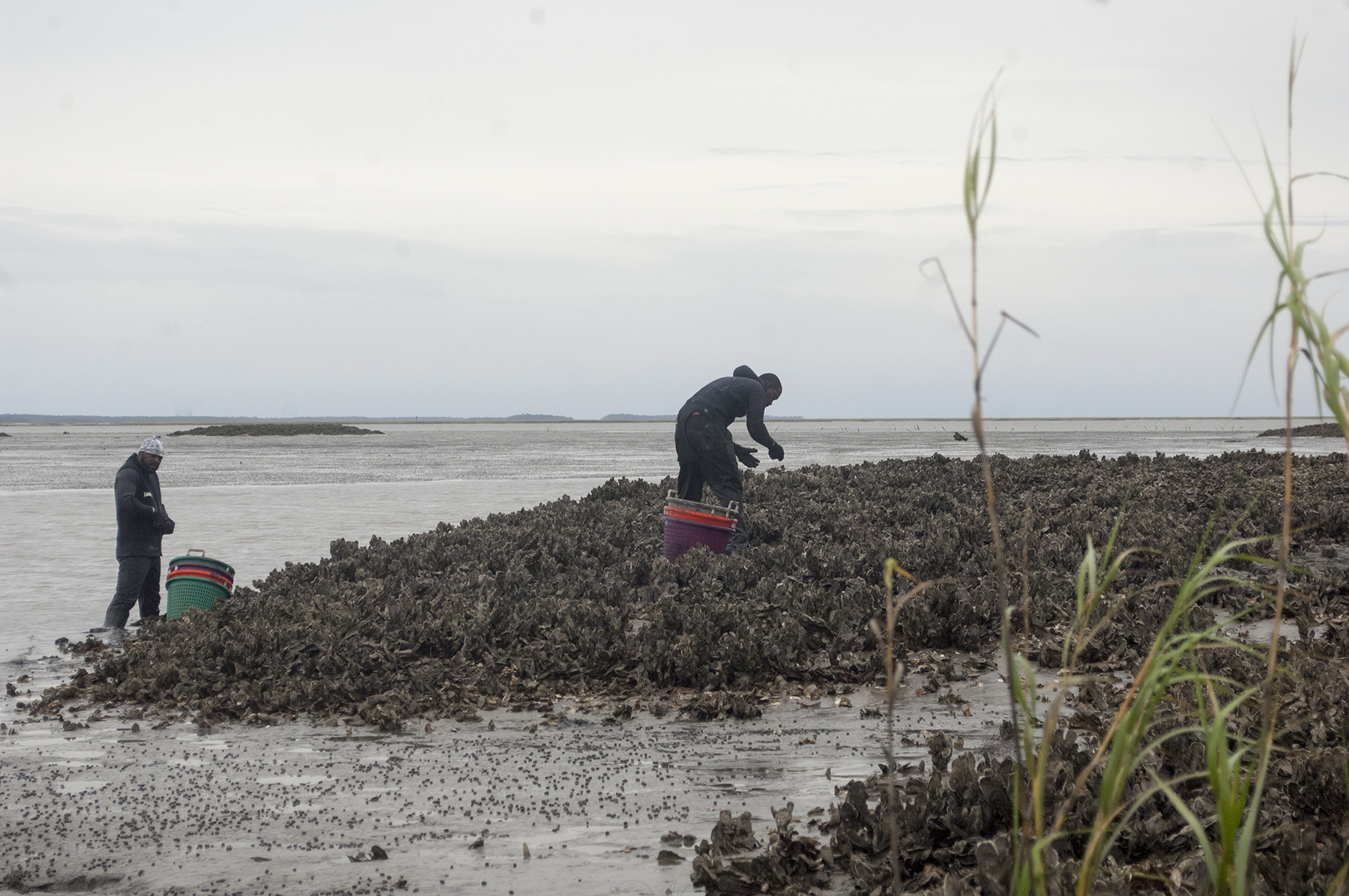
Georgia’s Coastal Waters to Close for Oyster Harvesting June 1 through September 30
Brunswick, Ga.
The Georgia Department of Natural Resources (DNR) will close the state’s salt waters to commercial and recreational oyster harvesting for human consumption effective 6 a.m. Sunday, June 1, 2025. The closure extends through midnight on Tuesday, Sept. 30, 2025, and applies to all salt waters from the Georgia-South Carolina state line to the Georgia-Florida border.
The seasonal closure is enacted annually to protect public health during the warmer months, when the risk of shellfish-related illnesses—particularly those caused by the naturally occurring bacterium Vibrio parahaemolyticus—is elevated due to rising water temperatures.
The closure follows the requirements of Georgia law (O.C.G.A. §§ 27-4-195 and 27-4-197(a)) and supports compliance with federal guidelines established by the U.S. Food and Drug Administration (FDA) and the Interstate Shellfish Sanitation Conference. These guidelines recommend implementing Vibrio control measures, including seasonal harvest closures, when average water temperatures exceed 81 degrees Fahrenheit.
An administrative order signed by DNR Commissioner Walter Rabon further cites recent scientific studies showing that the commercial quality of intertidal oyster meats declines significantly during the summer months.
This closure does not apply to subtidal mariculture oyster farms operated by certified Master Harvesters who have received explicit permission from the DNR. These operations must comply with stringent harvest, handling, and cold-chain management requirements outlined in Georgia’s recently implemented Vibrio control plan and shellfish mariculture regulations.
Oyster harvesting in Georgia will reopen at 7 a.m. on Wednesday, Oct. 1, 2025, when cooler temperatures improve both product safety and quality. For more information, contact the Coastal Resources Division at 912-264-7218.
About the Coastal Resources Division:
The mission of the Coastal Resources Division is to balance coastal development and protection of the coast’s natural assets, socio-cultural heritage and recreational resources for the benefit of present and future generations. Learn more here.
Media Contact:
Tyler Jones Public Information Officer Coastal Resources Division Georgia Department of Natural Resources tyler.jones@dnr.ga.gov 912-230-9709
DOBOY SOUND LIGHT 178 (LLNR 36795) IS REPLACED WITH TRLB ON STATION. ALL MARINERS ARE REQUESTED TO TRANSIT THE AREA WITH CAUTION. CANCEL AT//270800Z MAY 25//
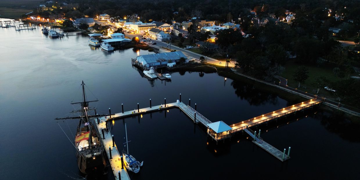
Morningstar Marina at Golden Isles, A CRUISERS NET SPONSOR, lies along the southern reaches of the Frederica River, between Lanier and St. Simons Islands, south of the charted 9 foot bridge.
St. Simons Island Overnight & Transient Dockage
Located on St. Simons Island, GA Morningstar Marina Golden Isles is right off the ICW Marker 675 with easy access to the ocean. The Frederica River provides no vertical obstructions, and we are a deep craft marina, making us a welcome stop for yachts and sailboats for overnight & transient dockage. Our Golden Isles location is home to highly trained dock masters who pair their extensive training and knowledge with superior service, delivering exceptional experiences that go beyond the norm. The overnight & transient dockage facilities for boats at Golden Isles have been designed to serve the specialized needs of today’s boaters offering 1,100 linear feet of transient dock with high-speed fuel pumps, in-slip pump out, free On Spot Wi-Fi, and 30/50/100-amp shore power service. Additional amenities include secure bathroom and shower facilities, laundry facilities, a fully stocked marina ship store, courtesy bicycles and vehicle, a swimming pool, with an onsite restaurant and coffee shop. Beyond the marina facilities, we are two miles away from St. Simons Island and the Golden Isles where you can enjoy the beaches, historic sites, golf, tennis, shopping, and amazing dining. Please submit a request by filling out the form below.
1. CUMBERLAND RIVER LIGHT 46 (LLNR 37540 [30°53.6492N / 081°30.3967W, 30.894154 / -81.506611]) IS MISSING. ALL MARINERS ARE REQUESTED TO TRANSIT THE AREA WITH CAUTION.
Brownbag will be held at the Susan Shipman Environmental Learning Center @ GADNR Coastal Regional Headquarters
One Conservation Way, Brunswick, GA 31520
Please join the GA Coastal Management Program for a Brownbag Presentation on Collecting Acoustic Data in the Coastal Ocean: New Insights from Autonomous Underwater Vehicles by Dr. Catherine Edwards and Frank McQuarrie with the Skidaway Institute of Oceanography.
Gliders are autonomous underwater vehicles, or ocean robots, that fly by changing their buoyancy and center of gravity, which makes them a relatively quiet platform for collecting acoustic data in the coastal ocean. Catherine Edwards will give an overview of her recent work in coastal Georgia using gliders for acoustic telemetry and real-time monitoring of right whales using passive acoustics, give some examples of how understanding environmental conditions can help inform interpretation of the acoustic data, and consider how to leverage these data streams to design smart systems for fisheries science and management.
Science After Party: In the science after-party, Frank McQuarrie will dig into the data from recent acoustic telemetry work at Gray’s Reef National Marine Sanctuary in more detail, and consider what processes control the effectiveness of telemetry on tidal, daily, weather, and seasonal time scales, showing data from Gray’s Reef as evidence. The second half of the after party will be a group discussion to consider the practical implications for interpretation of the data for management purposes.
Speaker Bios:
Dr. Catherine Edwards is a physical oceanographer and Associate Professor at the Skidaway Institute of Oceanography and in the Department of Marine Sciences at University of Georgia. Edwards’s research focuses on answering fundamental questions in coastal oceanography and fisheries sciences with autonomous underwater vehicles, developing novel ways to optimize their use with engineering principles and real-time data streams from models and observations. Her work has been featured in local, regional, and national press, including NPR’s All Things Considered, Science Magazine, WIRED, Forbes, and The Weather Channel.
Frank McQuarrie is a PhD candidate in the Edwards Lab at the Skidaway Institute of Oceanography focusing on acoustic telemetry efficiency. He first saw a glider at Rutgers in 2011 and they have fascinated him since, he loves deploying/piloting/retrieving them as acoustic receiver platforms around the South Atlantic Bight.
1. THE BIGHT CHANNEL LIGHT 44 (LLNR 4920 [32°6.0300N / 080°59.9465W, 32.100500 / -80.999109]) IS OFFSTATION. ALL MARINERS ARE REQUESTED TO TRANSIT THE AREA WITH CAUTION.
DNR’s CoastFest event returns to Brunswick on March 22, 2025
Dec. 11, 2024 Brunswick, Ga.
The Coastal Resources Division (CRD) is thrilled to announce the rescheduling of its annual CoastFest event, which will now take place from 10 a.m. to 4 p.m. on Saturday, March 22, 2025, at Mary Ross Waterfront Park in Brunswick.
Originally planned for October 2024, CoastFest was postponed due to the impacts of Hurricane Helene. The March event promises to deliver the same exciting blend of education, entertainment, and family-friendly activities that have made it a beloved tradition for over two decades.
“CoastFest is a celebration of our vibrant coastal environment, and we’re excited to bring it back this spring,” said Tyler Jones, CRD’s CoastFest coordinator. “We’re working hard to ensure that the rescheduled event will continue to inspire and educate visitors about the importance of Georgia’s coastal resources.”
Highlights of the day will include:
Interactive exhibits from CRD-partner environmental organizations and agencies
Live animal encounters featuring coastal wildlife
Educational activities and demonstrations about conservation and sustainability
Food vendors, activities, and cannon firings
Admission to CoastFest is free, and the event is open to the public.
With a wide variety of hands-on experiences and learning opportunities, CoastFest offers something for everyone, from young children to lifelong learners.
For more information about CoastFest, including directions, a schedule of activities, and exhibitor sign-up information, please visit DNRCoastFest.org or contact the Coastal Resources Division at 912-264-7218.
Click here to view photos from previous CoastFests.
To register to be an exhibitor at CoastFest, click here.
Note: Exhibition space at CoastFest is available for natural resources or conservation focused nonprofit organizations, government agencies, clubs, and at the discretion of DNR, some for-profit businesses. The same of items (including memberships, raffle tickets, etc.) at CoastFest is prohibited due to federal grant rules.
Media Contact:
Tyler Jones Public Information Officer Coastal Resources Division Georgia Department of Natural Resources tyler.jones@dnr.ga.gov 912-275-5118


 The Georgia Department of Natural Resources (DNR) will close the state’s salt waters to commercial and recreational oyster harvesting for human consumption effective 6 a.m. Sunday, June 1, 2025. The closure extends through midnight on Tuesday, Sept. 30, 2025, and applies to all salt waters from the Georgia-South Carolina state line to the Georgia-Florida border.


Be the first to comment!