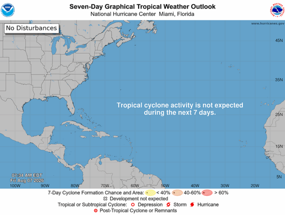
The Atlantic tropics remain tranquil with no active tropical cyclones and none expected for at least another week.
The above loop of visible satellite imagery above shows several features of interest across the North Atlantic and eastern U. S.:
Tropical waves along 58° west near the Lesser Antilles, along 44° west over the central tropical Atlantic, and along 23° west over Cabo Verde.
A massive cloud of Saharan dust covers much of the eastern and tropical North Atlantic; the dust cloud is dense near 20° north.
A cluster of thunderstorms east of Florida and over parts of The Bahamas, moving northwestward.
Strong vertical shear is evident over the Caribbean Sea; high wispy cirrus clouds are drifting eastward while the dots of lower clouds are being carried westward by the Trade Winds.
Hostile conditions remain in place over the Main Development Region; upper-level westerly winds are causing vertical shear over the Caribbean Sea and vicinity, while a dry and dusty air mass is in place over the tropical Atlantic. A few tropical waves are moving through the basin, but they have little chance to develop further.
As we expected a week ago, a disturbance is east of Florida today and is moving toward our coastline. It’s generating a haphazard collection of thunderstorms. It likely will remain disorganized as it skirts our coastline tonight and Saturday before departing to the northeast. We’ll have to watch it for surprises, but further development is very unlikely. Our coastal areas are likely to see some downpours from it over the next day or so, doing more good than harm in the face of the area’s ongoing drought.
There are signs that the Atlantic might finally perk up in 10-15 days. The Madden-Julian Oscillation will become more favorable for Atlantic activity, and we’ll be in the typical ‘prime time’ for the Atlantic that starts in mid-August and ends in mid-October. So, now is a good time to ensure that your hurricane kits are ready for any action we might see in the coming weeks. If you need advice on what to put in your hurricane kit, hurricane.sc is the place to go for prep advice.
SC Weather Highlights For the Next Week:
Thursday brought a ‘just what the doctor ordered’ soaking to much of the state Thursday, especially the Midlands and Columbia metro. As usual for these setups, Whaley Street in Columbia flooded. As usual, a driver made the mistake of driving into those waters and quickly was introduced to the concept of engine hydrolock. I’m sure that driver will be fine after dropping thousands of dollars on repairs.
Seriously, y’all, don’t drive through flood waters. The water was deep enough that the car could have been carried downstream and that driver could have drowned, or first responders could have been put at risk during a rescue. When we say, “Turn around, don’t drown,” it’s not just a cute rhyme.
We have another setup this afternoon for slow-moving downpours that can result in isolated flash flooding, especially in prone areas. So, be careful if you encounter a flooded road and reroute around flood waters. Also, we likely see a severe storm with locally damaging wind in a few places.
Downpours along our coast with the disturbance moving in from the Atlantic later tonight and Saturday can also cause isolated flash flooding. We’ll also see a scattering of afternoon thunderstorms in the Upstate Saturday, with only isolated storms elsewhere.
In general, the trend over the next few days will be toward less widespread afternoon thunderstorm activity and hotter afternoons; we’ll return to typical midsummer weather. Our temperatures have run a little below average over the last few days, but will likely be a little above average next week. Through Saturday, our highs will be in the upper 80s and lower 90s, but we’ll see lower to middle 90s for highs for a while starting Tuesday.
It’s unlikely we see any more cold fronts this far south through next week, but most of the computer models show one reaching us the following week.
Frank Strait Severe Weather Liaison S.C. State Climate Office
South Carolina Department of Natural Resources 260 D. Epting Lane West Columbia, SC, 29172








Be the first to comment!