Explorer Chartbooks, A CRUISERS NET PARTNER, has long been the standard navigational supplement for enjoyable, informative, and safe cruising through the beautiful Bahamian waters and island visits.
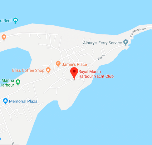
If you are headed for the Bahamas, don’t miss this invitation to link with the Royal Marsh Harbour Yacht Club, A CRUISERS NET SPONSOR!
Are you planning to cruise to the Bahamas this winter? If you answer yes, come spend the winter season in the Abacos with the Royal March Harbour Yacht Club. It’s an easy 60 mile crossing to Little Bahama Bank and then hundreds of miles of cruising amid protected islands and harbors with lots to explore.
Some of the benefits of joining Royal Marsh Harbour Yacht Club:
Affordable initiation fee and annual dues
Discounts at marinas throughout the Bahamas
Discounts at restaurants and stores, particularly in the Marsh Harbor area
There have been a number of recent legislative changes in the Bahamas that affect boaters. See Changes for Bahamas Boating and Legislative Updates. Our thanks to Greg Allard for the information on revised charges for Bahamian Cruising Permits, effective January 1, 2020.
Explorer Chartbooks, A CRUISERS NET PARTNER, has long been the standard navigational supplement for enjoyable, informative, and safe cruising through the beautiful Bahamian waters and island visits.
This timely discussion and advice re hurricane holes comes from “Bahamas Chatter” on Explorer Chartbooks’ webpage, www.explorercharts.com. Hurricane season is here, so if you have hurricane hole locations/advice to add, please do so. Explorer Chartbooks is A CRUISERS NET SPONSOR!
Nassau/New Providence Hurrican Holes Published August 26, 2015 | By Strider Hello, first time cruising the Bahamas and I have Tropical Storm Erika threatening to upgrade to a Cat 1 hurricane and move towards New Providence. The Explorer Charts are great but don’t really point out or suggest any hurricane holes to set up in to wait the storm out. I am currently anchored off of Potter’s Cay, but don’t think that is the best bet. Thank you in advance for any help!
Posted in Cruising Information, Latest, Nassau/New Providence, Questions for Fellow Cruisers 2 Responses to Nassau/New Providence Hurrican Holes monty says: August 26, 2015 at 7:08 am You might consider Palm Cay Marina, Hurricane Hole Marina, or Lyford Cay Marina.
denogail says: August 26, 2015 at 7:31 am Don’t forget Atlantis’¦yes, expensive, but you will have good peace of mind, and you can go on the giant slide, while you wait for the storm. Do not go into any marina that is exposed to the main harbor, such as Yacht Haven or Nassau Harbor Club, as the surge and wave action will destroy your boat on the dock. Get inside somewhere, and be ready to lengthen your dock likes if there is a surge in front of the storm. And, use all your dock lines, but save 2 in standby.
Those inside marinas will fill up in a hurry with local boats, so don’t wait to long, and make sure if it is a local boat, and they are next to you, that they don’t use the black polypro lobster line to tie up there boat with which they all use. That is what the two extra lines of yours are for’¦..good luck DenO
Time to give the Bahamas government a spanking. Staying in the U.S. next year. It's really better anyway. Bahamas trip expense has gotten way out of control. The Government wasteful spending has necessitated the increases.
Making it unaffordable for many. $240/ month VAT tax based on light average spend cooking on the boat and an occasional happy hour drink. My $2,000 a month for businesses will go away. Going from $300 a year to $4,000 a year for a cruising permit? Did I read that right or is it still not finalized? The economy is great there because of the boaters. Now you are going to impose even higher fees. Talk about “killing the goose that laid the golden egg….â€
Explorer Chartbooks, A CRUISERS NET PARTNER, has long been the standard navigational supplement for enjoyable, informative, and safe cruising through the beautiful Bahamian waters and island visits.
Bahamas Chatter: New Fuel and Dockage Survey 7/2/19
A new fuel and Dockage Survey has been posted on https://www.explorercharts.com/index.php?option=com_content&view=article&id=56&Itemid=53 Since the last survey eight marinas raised their dockage prices and two marinas lowered them. Most fuel prices were up as well. The prices shown in red are old and should not be trusted. We will attempt to contact the marinas with old prices and if we cannot, they will be removed from the list.
The restaurant at Nassau Harbour Club has reopened after being closed for many years. The completely renovated restaurant is now called Lattitudes.
Roosevelt Nixon at Little Farmers Cay Yacht Club has announced a new laundromat is now open.
Our sincerest thanks to Greg and Barbara Allard for sharing their thoughts and beautiful photography from their Bahamas cruises. These photos and descriptions will have you aching to follow in the Allard’s wake! For more this excellent photography, type Allard in our Homepage search window for letters from previous cruises.
“People who live on continents get into the habit of regarding the ocean as journey’s end, the full stop at the end of the trek. For people who live on islands, the sea is always the beginning. It’s the ferry to the mainland, the escape route from the boredom and narrowness of home.”
We have been traveling with our friends Jim and Ellen. Jim has been playing with a new drone and has taken some excellent pictures, including this one of our boat Meander (lower boat, dark hull) in the mooring field at Warderick Wells. Their boat, Latitude, is just above ours. We’ll show a couple more of Jim’s drone photos later.
The water looks just like what’s shown in the photo; under the boats it is about 12’ deep. The lightest colored water is just inches deep.
A rock cairn, a decorative pile of rocks which has been used for centuries. Former boy and girl scouts will remember this is a way to mark a trail. It has also been used to delineate property lines This one was erected on the beach by visitors.
A sisal tree in bloom. These trees were brought to the Bahamas in the eighteenth century, as an excellent source of strong natural fibers which were used to make ropes for ships. That industry was long ago abandoned, but there are a few scattered trees which remind us of those times.
The Bahamas are primarily made of limestone, and only a few of the islands have enough soil to grow some vegetables and fruit. The rest of the vegetation has to find a nook or cranny to set down roots in the rock or sand, sometimes not successfully. This was once a bush along the beach, but it seems to have taken a new life as a model for “The Creature from the Deep”.
The end of the school day at Black Point, a time loved by children everywhere. All Bahamian school children wear uniforms.
Black Point is an island community, one of our favorites. The island has a population of around 400, many of whom work on neighboring islands and commute there by boat.
This young man was enjoying his ice slush. He’s thinking: “Don’t even try to take this from me.” Love the hair.
Peermon Rolle runs a bakery out of her home. She makes some of the best Bahamian bread, especially her coconut bread. We can’t go to Black Point without buying several loaves.
Peermon’s granddaughter, and great granddaughter.
On the quiet main street of the Black Point settlement, you’ll find any number of residents sitting in their front yards “plaiting” – that is, weaving thin strands of palm into long strips of material usually between two and four inches wide. Those strips are then sold, by the roll, to straw makers in Nassau, who use the strips to make bags, hats or baskets. Most of the straw weavers engaged in this cottage industry are women, but this man named Boise was busy at work; his fingers were impossibly fast. We bought three rolls of plait from Boise and his wife Corrine, also a weaver.
The next day, Peermon showed Barbara and Ellen how to use the strips of plait, and the techniques for fastening them together.
Is this a boat-goat, or a goat-boat? As billy-goats go, this one was friendly, taking some shelter from the sun under this Bahamian competitive sailing vessel.
In the last Letter, we showed you a photo of a spotted eagle ray. This is a different photo of the ray, more clearly showing a remora fish under the ray’s left wing. In this case, the remora is not attached to the wing and is just swimming freely under the ray, but usually the remora attach themselves to rays, sharks and other fish, and go along for the ride.
This photo is of a large free swimming remora (also called a suckerfish), which swam under the dock at Black Point. They are regularly 8-15 inches long, and usually not more than 31”. This remora is a large one, almost three feet. Note the strange flat disc on his head which is what he uses to clamp onto the host fish. The vanes of the disc act like suction cups. It is said that the remora serves to clean the undersides of their host fish from parasites and growth. We’ve never experienced it, but we have heard that sometimes they approach divers or small boats, and attempt to attach to them; they are easily removed if pushed forward.
This seagull was lucky. It’s likely he lost his leg to a shark.
A green sea turtle, in one of the creeks at Shroud Cay.
Diving Thunderball at Staniel Cay. This rock island, with an underwater cave, is named after the James Bond Thunderball movie, where a few of the scenes were filmed. The best snorkeling is not in the cave, but outside, on the east, north and south sides, where there are some excellent coral formations with a good variety of fish, and fewer divers.
A blue Tang.
In a prior letter we showed you a hand-carved fish head from Spanish Wells. We found this driftwood board, with its fish created by nature, on a beach in the Exumas.
Barbara navigates our dinghy through the shallows.
We mentioned earlier that our friend Jim was experimenting with a new drone, and he took these next two pictures. I’m including them here, because they offer a different perspective on the beauty of the Bahamas.
This is a view of Shroud Cay with its serpentine creek which cuts right through the island, running from the Exuma Banks to the Exuma Sound. At high tide we took a dinghy through it; someone compared it to an African Queen experience.
Just south of Warderick Wells. There are no other words needed for this photo.
This derelict boat washed up on the beach in front of David Copperfield’s house on Musha Cay. Usually boats like this are difficult to get rid of, but we suspect that David will make it disappear.
A simple but engaging painting by a local Bahamian artist.
The end of the day, with the sun melting into the ocean.
This will be our last Letter from the Bahamas. Later this week, weather permitting, we will cross the Florida Straits (the Gulf Stream) back to the U.S. It has been another excellent cruise through this beautiful sea-based country, with its stunning vistas and warm, friendly people.
Hello, I enjoyed reading your articles on Cruisers Net. We are looking for another couple to cruise with, going from FL to the Bahamas in May/June 2020. We have a 48' Searay Sedan Bridge. It would be our first time there, so we'd like to go with someone who has been there before.
I've put my contact information [email] below. We live in St. Petersburg FL.
Our sincerest thanks to Greg and Barbara Allard for sharing their thoughts and beautiful photography from their Bahamas cruises. These photos and descriptions will have you aching to follow in the Allard’s wake! For more this excellent photography, type Allard in our Homepage search window for letters from previous cruises.
“We all come from the sea, but we are not all of the sea. Those of us who are, we children of the tides, must return to it again and again, until the day we don’t come back leaving only that which was touched along the way.”
—Frosty Hesson, Chasing Mavericks
Hi Friends – Some final pictures from Eleuthera, then some from the Exumas, a beautiful group of islands and cays in the central Bahamas.
The biggest challenge we face is the weather. We’ve cruised in the Bahamas for a number of years, but during the last three we found that there were more times when the wind was unrelenting, when the seas looked like this – or worse – every day for weeks on end.
As the old-salts say: the boat can take more than you can. We agree. We avoid such seas whenever possible. However, some times we leave on a calm day after we consult multiple weather sources, but the forecasts turn out to be wrong, and we have to deal with large seas for hours. Paradise is not perfect.
Marilyn and Phil operate a small organic farm on Eleuthera. We bought several of the famous Eleuthera pineapples from them. You may think you’ve had a good pineapple before tasting one from this island. Phil showed us how to propagate a pineapple by cutting off its top and planting it.
Marilyn has a killer smile.
Elliot, the owner of Tippy’s restaurant on Eleuthera. He’s also the lead singer in their Saturday night band. Yes, he is a character.
Tarpum Bay, on Eleuthera, is a poor settlement, with the look of a place struggling to survive. Yet the community found the resources to build this new waterside swing and hammock set for their children. Pride of place. Correct priorities.
Earlier in this trip we showed you a Ghost crab. This is his cousin – a Land crab. Some land crabs can spread their claws sideways and they will be two feet wide. This variety is a bit smaller, but his beautiful colors make up for any size envy. I particularly liked the face: a perpetual frown moulded into his shell. Sadly, he never gets to smile.
We visited Charles Strachan in his home. He is a basket weaver, and uses only the fronds from silver top palms for his work; he says they are the strongest and most durable. Barbara plans to use the large round mat as a wall hanging.
Our next leg brought us to the Exumas, a group of islands in the central Bahamas. The Exuma Land and Sea Park is a legally designated sanctuary where fishing, lobstering, collecting shells or removal of any natural item are not permitted. The Park is twenty two miles long and 8 miles wide, and consists of dozens – if not hundreds – of cays and islands.
When we arrived at Warderick Wells, the island where the park office is located, we were happy to see the new Metal Shark boat, built by the company where our son Chris is CEO.
I was fortunate to join the Park Administrator and go out on patrol. Captain Joseph Ierna Jr., the Administrator, was at the helm, and one of the Royal Bahamian Defense Force Marines – who are regulars on board – was at the bow. Joe commented that he liked that the Metal Shark boat gave the impression of “all business” – that it was intimidating in a way, which made his enforcement duties easier. My response to Joe: “Yes, the boat certainly has a military, aggressive look, but I do think that much of the intimidation was due to the large muscular Marine, Tamal, at the bow, with a sidearm.”
Tamal exchanges some paperwork with a sailboat which was anchored in the Park.
Yes, maybe even a bit ferocious.
Captain Joe Ierna. He’s brought fresh ideas, sound business sense and a new approach to the Park.
The Bahamas are as beautiful underwater as they are above. The visibility is incredible. We estimated here that it was over 250’. When I used to dive in the Northeast, we were happy to have 30’ of visibility. At the top of the photo you can see the underside of the surface of the water.
There is a huge variety of soft and hard coral. At the upper right is a brain coral. Lower left are sea rods. In the center is what we think is a saucer coral. On our boat we carry some excellent guides to fish, coral and reef creatures, but sometimes especially with coral, identification is difficult. So for convenience we call the dark green one in the center a vase coral.
One of the most beautiful fish in the sea – a stunning Queen Angelfish.
The colors on this Ocean Surgeonfish are more subtle than those of the Queen Angel, but this fish is just beautiful.
A purple sea fan with a large parrot fish feeding on the coral.
A spotted eagle ray, with a wingspan close to eight feet. It’s humbling to swim near something so big. Under his left wing, look for the tail of a remora fish. More about that in a future letter. The ray’s tail is so long it extends outside of the picture, to the right.
More recent brain coral, growing over some older coral.
These fish are called Sergeant Majors, because of their chevron-like markings. This photo may look like it was taken through an aquarium window, but the location is on a reef just north of Cambridge Cay. The fish closest to the camera was particularly curious. He thought we had brought food…
The fish in the Park have nothing to fear from man because they are in the sanctuary of the Park. (How do they know if they are in the Park?) In any event, they are relaxed around divers.
So…Just in case you thought the last photo was from an aquarium, our friend Ellen took this photo of me, surrounded by dozens of Sergeant Majors, as I tried to take the previous picture!
This reef, aptly enough, is called The Aquarium.
Sunset over the Land and Sea Park.
Today on a remote beach we bumped into two longtime Bahamian friends, who are involved in the marine and tourism business. We were all swimming together, and she commented that the water was almost too warm to be refreshing. We had noticed that this year the water in the Bahamas was warmer much earlier (we could swim in April) and the waters are now warmer than we have ever experienced in June. They said that this really concerns them as we have just entered the hurricane season, and that it’s too early for the water to be so warm. Hurricanes view warm water as food. They thrive on it, and it makes them grow.
As we consider how long we will remain in the Bahamas, our friends’ comments will have weight on our decision. It’s a long way home, and our boat does not go faster than a hurricane.
Explorer Chartbooks, A CRUISERS NET PARTNER, has long been the standard navigational supplement for enjoyable, informative, and safe cruising through the beautiful Bahamian waters and island visits.
I’ll soon be crossing from West Palm to the West End and eventually to the Abacos. It’s close enough, that I’m looking at the weather more closely. First thing I notice is that generally every day over the next 10 days, there is a prediction of rain or “scattered thunderstorms”. Not having been to the Bahamas before I’m wondering if this is just the standard late day 15-30 minute storms that typically roll through FL in the Summer. Or is this really a rainy time in the area.
I’d love to hear other insights or general knowledge about this so we can plan for it appropriately.
Since our stop last year here at Big Farmers Cay, four 2’x4′ red with white lettering “NO TRESPASSING” signs have been placed along the west shore of the cay.
All cruisers please be aware, Chub Cay Marina no longer allows “transients” from the anchorage to go ashore! This includes the Ship Store and the restaurants! It was in listed in this seasons explorer charts on page 62, that cruisers could buy an “Adventure” debut card for $100 and use it in the shop and restaurants. (We would of course be spending more!) Friends who were here a short time ago suggested we come here because they had so much fun at The Nauti Rooster, we were hoping to go. They no longer are providing this service as of about a week ago. Now they stop all dingy’s a the fuel dock and won’t let you go to the dingy dock. (We even had a local friend try to pick us up and take us to dinner and they still wouldn’t let us.) So now we are stuck here, low on beer, wine and some basic groceries with no access to the store.
Heads up if you need anything or want to go to the restaurant, you can’t anymore!
You can still get a slip at the marina for $4.25 a foot.
A new fuel and Dockage Survey has been posted on https://www.explorercharts.com/index.php?option=com_content&view=article&id=56&Itemid=53 Most fuel prices were up since last month and many dockage rates as well. A number of marinas could not be contacted and some were too busy to give any information. The prices shown in red are old and should not be trusted.
The date of last months survey was in error. It was posted on March 6, 2019; not 2018. We will attempt to contact the marinas with old prices and if we cannot, they will be removed from the list. Collecting the information for the survey is as frustrating as herding cats.
Update… Exuma Yacht Club has had diesel for a couple of weeks now. $4.78 a gallon. I took a few samples in a glass jar along the way, looks clean. But the pump is VERY slow. About 5GPM… fueling now… not sure if I ll have the patience to pump the 1000 gallons I wanted.
The sand bar that extends south from North Bimini Entrance Point continues to move south, encroaching on the dredged channel east of the Bimini Waypoint shown on Explorer Chart BIM 3. That problem is made worse by the lack of any effort by the Bahamas Government to move and maintain the buoys previously placed at the channel entrance. The deepest water into Bimini Sands Marina or the North Bimini Harbour is currently along a straight line from the Bimini Waypoint to the jettied entrance of the Bimini Sands Marina. The minimum SLW depth along this line is currently 2.4 meters. Just inside the jetties the depth drops to 1.5 meters for a very short distance then deepens to 3 meters at the marina basin. The straight line course between the waypoint and the jetties passes close and on the wrong side of a red buoy which was previously the second buoy on the channel entrance. The first buoy along this approach was moved by a hurricane over a year and a half ago and now rests on the Entrance Point shoal in very shallow water. This buoy should be avoided.
For vessels headed to North Bimini Harbour, a turn to the north should be made along longitude 79° 18.2′. A green buoy marking the area of this turn has been last seen on the beach near the Bimini Sands jetties. There may be several buoys marking the channel between the Entrance Point shoal and South Bimini. Depths along this part of the channel range between 2.3 and 4.5 meters.
Mariners should be alert for moved or missing aids to navigation and expect shifting sand and the possibility of future shoaling. Government maintenance of aids to navigation has been casual in the past. We have been unable to find any local contacts that can advise of changes in the existence of buoys and their accurate positions in the Bimini Channel.
We just spoke with the Dockmaster at Old Bahama Bay, West End, Grand Bahama. Here is their current status: The marina is 95% closed. That means there are 6-7 slips available in the marina. They are also making available room for 4-5 boats in the canal along a concrete dock tied to cleats. They take NO reservations. Call no sooner than 2-3 days ahead for availability.
Now that many of you are in southern waters and maybe headed for the Bahamas, don’t miss this opportunity to link with the Royal Marsh Harbour Yacht Club, A CRUISERS NET SPONSOR!
Are you planning to cruise to the Bahamas? Come spend some time in the Abacos with the Royal March Harbour Yacht Club. It’s an easy 60 mile crossing to Little Bahama Bank and then hundreds of miles of cruising amid protected islands and harbours with lots to explore.
Here are just some of the benefits of joining Royal Marsh Harbour Yacht Club.
Affordable initiation fee and annual dues
Discounts at marinas throughout the Bahamas
Discounts at restaurants and stores, particularly in the Marsh Harbour area
Friendly boating community with fun activities
The best deal in the Bahamas!
For more information and to become a member, go to www.rmhyc.com.
Cruisers Net is honored to be able to work with this five-star, customer-focused, family owned and operated organization. Watermakers Air and Staniel Cay Yacht Club have been synonymous to so many over the past years. Success is the driving element to its expanded service to the Bahamas and to its re-branding as Makers Air. Take a look at what you may do to add to your Bahamas experience. Can you say…” Wow !!” Staniel Cay Yacht Club, A CRUISERS NET SPONSOR!
There’s Something New in the Blue Skies Over the Bahamas
Watermakers Air has Re-Branded to
Makers Air
Still Providing an Unparalleled Travel Experience with A New Look
The story behind this story is filled with the passion of an enterprising gentleman, Joe Hocher, the developer of what we all know as the Staniel Cay Yacht Club, Exumas, Bahamas, and Watermakers, Inc. in Fort Lauderdale, a manufacturing company dedicated to the design, manufacture, and service of reverse osmosis desalination equipment. In the earlier years, Mr. Hocher flew around the islands in his Piper Cherokee Six, installing and servicing his desalination equipment; he affectionately became known as “Watermakers Air”.
Then, in 2002, Watermakers Air was officially launched in response to demand for reliable air service to the Out Islands of the Bahamas, operating as a Part 135-Charter for the specific purpose of flying passengers and freight.
For the past seventeen years Watermakers Air has been the preferred air service to the Bahamas from Ft. Lauderdale, FL. Growing from its initial operations servicing mostly Staniel Cay, Exumas, Makers Air is today’s premier air service to many of the Out Islands of the Bahamas.
Now you can make your island dreams come true…
Makers Air enhances your experience of travel by bringing back what it means to fly – the excitement of the great escape, togetherness with family or friends, and helping you relax as yesterday’s concerns fade into the inviting, crystal blue waters of the Bahamas.
The Makers Air “difference” runs deep. What resulted from Joe Hocher’s passion became a family-owned, strategically grown, premiere boutique airline, that believes in the value of the passenger’s experience and safety. Makers Air understands that the destination is not your only adventure – it’s also the exciting journey to get you there.
See these beautifully scattered cays from a “Makers” point of view
Sparkling blue waters dotted with small cays … So much to see, do, and enjoy.
And the flight over and back becomes so much of the total experience… and memory.
Today, Makers Air, a certificated On-Demand / Commuter Air Carrier, has taken its brand promise to the next level by creating a tailored passenger experience that is focused on customer service and connecting passengers to paradise. The company has grown to a family of 30+ employees with dedicated Scheduled Service, Charter, and Freight Departments, with a fleet of 4 Cessna Grand Caravans.
Makers Air proudly carries an Argus Gold Rating on its fleet of Cessna Grand Caravans. With various seating configurations, including an Oasis Executive Interior, they will make your travel as memorable as your destination.
Makers Air is based out of a private hangar at Ft. Lauderdale Executive Airport, convenient to all South Florida international airports. They offer a spacious, comfortable lobby with TV & WiFi, including the private, upscale Makers Club departure lounge for charter customers. You will enjoy complimentary snacks & beverages while also enjoying the lack of long security and baggage lines!
Reservations and freight offices are open 7 days a week and Makers Air is also pet-friendly!
Whether you are looking to take a vacation, fly to or from your boat, fly guests in or out, transport crew or parts or supplies, Makers Air is ready to provide you with exemplary service.
It is an honor to be able to work with such a customer-focused organization as Makers Air and the all the wonderful people of Staniel Cay Yacht Club.
Ready to kick back and start finding that one particular harbor…?
If you are in the Bahamas – Lucky You! – don’t miss the opportunity to link with the Royal Marsh Harbour Yacht Club, A CRUISERS NET SPONSOR!. Our thanks to Greg Allard for this on-site report and the very latest news from Old Bahama Bay Marina, including the fact that the marina is now fully open.
Bahamas Update on Old Bahama Bay/West End on Grand Bahama
There has been much discussion about the status of the facilities at Old Bahama Bay, especially since it is
a common place to “make land” for Bahamian bound cruisers, and also a convenient location to clear Customs and
Immigration.
I spoke with Jackie Carroll, the general manager for the Old Bahama Bay resort. We know her from our stops there over the years, and have always found her to be competent and customer friendly. She said their recent “troubles” are now over. Ms. Carroll advised that the marina is now fully open: all slips are available for occupancy with full electricity at each slip. Customs and Immigration (which never shut down) is running as usual. There is fuel available.
Two days ago, after crossing the Florida Straits (Gulf Stream) on our way from Lake Worth Inlet to Port Lucaya, we passed offshore of Old Bahama Bay; there was significant VHF traffic between cruising boats and the dockmaster of the marina, announcing arrivals and requesting slip assignments, all of which confirms that this popular and necessary destination is again available for cruisers.
Here are the contact numbers for Old Bahama Bay, if you need further information.
Now that many of you are in southern waters and maybe headed for the Bahamas, don’t miss this opportunity to link with the Royal Marsh Harbour Yacht Club, A CRUISERS NET SPONSOR!. Our thanks to Jim Lund for sharing this update on Old Bahama Bay Marina.
Explorer Chartbooks, A CRUISERS NET PARTNER, has long been the standard navigational supplement for enjoyable, informative, and safe cruising through the beautiful Bahamian waters and island visits.
Big Changes in Explorer Electronic Data Availability
February 2019 introduces some changes in the sources of data being used for electronic navigation in the Bahamas. If you have come to rely on the accuracy of the Explorer chart data, this is important information for you. If you are planning a trip to the Bahamas in the near future, you may need to make some changes right now to assure that you go with the best chart data.
One of the recent developments causing a shift is that Garmin has purchased Navionics.
Garmin has announced that its new g3 marine electronics offerings will contain only Navionics data for the Bahamas. With this February 2019 issue, Garmin will no longer make Explorer Bahamas data available to its customers. The g3 will be included in the g3 accessory cards and pre-loaded chart plotters.
The Explorer data is still available on g2 accessory cards (Garmin) and earlier pre-loaded chart plotters which may be in inventory for a few more weeks. Although the release of the new g3 material has already begun, customers desiring Explorer data still have an opportunity to upgrade their g2 cards.
If you haven’t upgraded your Garmin for awhile and don’t have the g2 data, we urge you to call Garmin or visit your marine electronics store to insure that you travel to the Bahamas with the tried and true Explorer chart data.
Other avenues for insuring Explorer-only data is to go with C-Map by Navico products and its affiliates SIMRAD, LOWRANCE, and B&G. Also, chart data through MapMedia, MaxSea, Nobeltec, Standard Horizon, RosePoint Coastal Explorer, and Furuno can be trusted to use Explorer vector and raster information. If you are using RayMarine hardware, please inquire of the company as Explorer data is available but not on all units.
There are also three new apps for phone/tablet that now include Explorer-only raster data. Check out AquaMap and iNavx. Links below:


Be the first to comment!