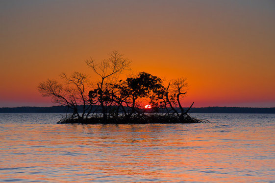
Everglades National Park’s 70th Birthday
Celebrate Everglades’ 70th birthday with 10 interesting facts about the national park.
|
Celebrate Everglades’ 70th birthday with 10 interesting facts about the national park.
|
Old Port Cove Marina, A CRUISERS’ NET SPONSOR, is located on the western shore of the northern Lake Worth channel, near unlighted daybeacon #7. Looking for that special place to eat where you dock? Sandpiper’s Cove Restaurant is another great reason to visit Old Port Marinas especially during the Holidays!
Visiting Yachtsmen: Please contact the Old Port Cove Marina Office well in advance for Dockage Reservations 561-626-1760 and to make your dinner reservations, please call Sandpiper’s Cove Restaurant 561-626-2280
LET’S CELEBRATE, OUR 5th ANNIVERSARY TOGETHER!
Sandpiper Cove Restaurant
OLD PORT COVE HOLDINGS, INC. MARINAS
Sue Morgan, Marketing and Public Relations Director
www.OPCH.com
www.SANDPIPERSCOVE.com
“Land was created to provide a place for boats to visit.” B. Atkinson <“))))><(
Click Here To Open A Chart View Window, Zoomed To the Location of Old Port Cove Marina
Our thanks to Vicki Lathom for this brief, but informative, report. Fernandina Harbor Marina, A CRUISERS’ NET SPONSOR, was damaged by Matthew, but is now offering limited service as Vicki Lathom notes below. The Marina docks and restaurant are right in the heart of the many wonderful things to do and see in this special port. For latest dockage information, call 904-310-3300.
12 mooring balls. Five slips available. Restaurant open. No fuel
Vicki Lathom
Click Here To Open A Chart View Window, Zoomed To the Location of Fernandina Harbor Marina
We just anchored at Fernandina Beach for 3 nights and had a wonderful visit. New is a Island Hopper Shuttle which picks you up at City Hall and can take you to beach, Walmart, Publix and Winn Dixie for $1.00. A great improvement for crusiers! The hours are limited to 10am to about 4 PM. Another great find was a new bicycle rental place for $15 a day with delivery to the marina. Call Steve at 904-742-4740.
Fuel is available a few miles south at Amelia Island Marina, also check with them or Tiger Point for overnight slip with power

The Florida Fish and Wildlife Conservation Commission (FWC) is announcing the opportunity to apply for Derelict Vessel Removal Grants. The application period for the Bulk Derelict Vessel Removal Grant Program will begin on January 8, 2018 at 8:00 AM (EST), and end on February 21, 2018 at 5:00 PM (EST).
Applications received after February 21, 2018, will not be eligible for consideration in round one, but may be considered for a potential subsequent round, if funding remains available. All removal applications must demonstrate proof that due process was provided for each vessel’s owner. At a minimum, this would include an opportunity for the vessel owner to challenge the derelict vessel determination, either in criminal court or in an administrative hearing. Vessel cases not demonstrating that these opportunities have been offered to the owners of the vessels will not be considered for state funding assistance. Should funding be available for a second or subsequent rounds of applications, new announcements will be made. The grant guidelines and application form may be downloaded at: http://www.MyFWC.com/DVGrant.
You may also receive the guidelines and application by contacting Phil Horning at (850) 617-9540 or email DVGrant@MyFWC.com.
Applications that meet the requirements for the Rapid Removal Grant Program may be submitted at any time after the opportunity announcement start date, but no later than November 31, 2018 at 5:00pm (EST) (based on available funding). Rapid removal cases must also meet due process requirements. Total funding allocated for derelict vessel removal for fiscal year 2017/18 is $488,550. Applications may be mailed to the Florida Fish and Wildlife Conservation Commission, Boating and Waterways Section, Derelict Vessel Grant Program Administrator, at 620 S. Meridian Street – Room 235, Tallahassee, Florida 32399-1600 or emailed to DVGrant@MyFWC.com.
For further information, please contact:
Phil Horning, Derelict Vessel Program Administrator, Florida Fish and Wildlife Conservation Commission, Division of Law Enforcement, Boating and Waterways Section, (850) 617-9540 or email Phil.Horning@MyFWC.com
A CRUISERS’ NET SPONSOR, Old Port Cove is located on the western shore of the northern Lake Worth channel, near unlighted daybeacon #7. A great place to spend your winter!
Ahoy Boaters:
Season has returned and we are thrilled to be welcoming so many of you back to the beautiful Palm Beaches! While both Old Port Cove and North Palm Beach Marinas are very full, we may have transient dockage available from time to time. Here’s the tip: Call as close to your ETA date as possible. It is very hard for us to know when a boater who has a lease on a slip will be away, that’s the reason.
With so many events and activities planned for the winter season at Sandpiper’s Cove Restaurant & Bar which is located on site at Old Port Cove Marina, we hope you will join us. In the meantime, Happy Cruising – Happy Holidays! Upcoming Events
All the best in cruising,
Sue Morgan, Marketing Director
Old Port Cove Holdings, Inc.
www.OPCH.com
www.SANDPIPERSCOVE.com
Click Here To Open A Chart View Window, Zoomed To the Location of Old Port Cove Marina
We always have a wonderful time at Sandpiper Cove Restaurant located at Old Port Cove. Our North Palm Beach Yacht Club has fun every month for our dinner meetings. Food is fantastic and the service is lovely. Thank you!
Dr. Tringali – on behalf of the entire staff , THANK YOU, for your kind words. We appreciate that you took the time to write about your experience at Sandpiper’s Cove Restaurant located at Old Port Cove Marina. Have a wonderful Holiday Season!
A CRUISERS’ NET SPONSOR, Old Port Cove is located on the western shore of the northern Lake Worth channel, near unlighted daybeacon #7. Looking for that special place to eat where you dock?
Sandpiper Cove Restaurant is another great reason to visit Old Port Marinas!
While You Were Sleeping, Our New Menu Rolled Out!
Sandpiper Cove Restaurant
CLICK HERE FOR SANDPIPER’S COVE’S NEW MENU!
OLD PORT COVE HOLDINGS, INC. MARINAS
Sue Morgan, Marketing and Public Relations Director
www.OPCH.com
www.SANDPIPERSCOVE.com
“Land was created to provide a place for boats to visit.” B. Atkinson <“))))><(
Click Here To Open A Chart View Window, Zoomed To the Location of Old Port Cove Marina

Fort Pierce City Marina, a CRUISERS’ NET SPONSOR, is located west of the Waterway, just south of the Fort Pierce high-rise bridge, and well north of unlighted daybeacon #188.

Anne Maurer
Fort Pierce City Marina
772-464-1245
amaurer@city-ftpierce.com
fortpiercecitymarina.com
Click Here To Open A Chart View Window, Zoomed To the Location of Fort Pierce City Marina
Good reports keep pouring in for CRUISERS’ NET SPONSOR, Marineland Marina which lies south – southeast of AICW marker #87, along the Waterway’s eastern shore. New Bellingham concrete floating docks and a new support building for a very attractive facility!

November 2017
New Marina Building with Restrooms and Laundry now open to support the new floating docks!
CLICK HERE FOR TEXT AND PHOTOS
Click Here To View the Eastern Florida Cruisers’ Net Marina Directory Listing For Marineland Marina
Click Here To Open A Chart View Window, Zoomed To the Location of Marineland Marina
New facilities and docks are outstanding. We really enjoyed exploring Washington Oaks,Gardens State Park, about 2 miles south of the marina.
Eric and his staff are the best!
If you are familiar with Florida law related to composting toilets, let us hear from you.
Hi, I am wondering how the pump out log requirements for some marinas in Florida (e.g. Dinner Key Marina) would apply to a composting toilet? Presently I use a Nature’s Head composting toilet, and there is only one toilet on the boat.
Thanks for your help, Kevin Boothby
We were in Dinner Key and told them we had an Air Head and there was never any question. We have been boarded by all the acronyms imaginable (USCG, FWC, Homeland Security, etc.) and they never question when we say we have an Air Head. I agree with Mike, our kids were on a boat with an Air Head in Boot Key Harbor and they had to do the once a month verification for urine, but that was it. Otherwise, FL marinas and mooring fields and officials seems to be pretty used to composting toilets.
Not quite relevant to the question but… we were stopped and boarded by the FWC for a ‘potty check’ a few years ago. They saw the Air-Head composting head and left without any issues. In Marathon where pump out is included in the fee they take our word that we have a composting head. Similar experiences elsewhere.
Follow-up… in Marathon you must get and keep a receipt showing urine has been dumped ashore in their porta-potty receptacle a minimum of once per month.
USCG Crews continue to mitigate pollution threats from vessels displaced by Hurricane Irma
The Marker R60 to which Jim refers is just west of the St. Augustine Inlet proper. Our continued thanks to Peg and Jim Healy for sharing their observations and advice. The Healys are dating themselves and showing their sense of humor with the reference to Will Robinson.
ALERT, Will Robinson! ALERT!
At St. Augustine – Experienced cruisers know that southbound approaching St. Augustine, the ICW hugs the barrier island to the east, and takes a hard STBD at floating R”60.” Well folks, EITHER R’60” has been relocated and I missed the announcement OR R”60″ is way off station. In any case, R”60″ is not where it’s always been. I don’t know if the shoal that it formerly guarded is there or not. People laugh at me for the detail of my routes. But today, I was very glad my boat knew where it was supposed to turn. R”60″ is MISSING IN ACTION.
Peg and Jim Healy aboard Sanctuary, currently at Rock Creek, Pasadena, MD
http://gilwellbear.wordpress.com
Monk 36 Hull #132
MMSI #367042570
AGLCA #3767
MTOA #3436
Click Here To Open A Chart View Window, Zoomed To the Location of St. Augustine Inlet
Passed here 11-3-17. Agree with report. Was giving instructions to a first time cruiser on how to pass through here and when we got there it was not how we described it. Red face. Sigh.
Improbability
Experienced cruisers, Jim and Peg Healy, have been generously sharing their observations and advice as they make their way south for the winter. The photos below attest to the healy’s advice to pay attention! Thank you Jim and Peg!
PAY ATTENTION TO THE WATERWAY. Here are two interesting pictures.
First, DSCN8150 shows a sunken boat IN THE CHANNEL AT FERNANDINA BEACH.
Second, DSCN8155 shows what can happen when you mistake a Range Marker for a Red lateral on a falling tide.
It was an interesting day.
Peg and Jim Healy aboard Sanctuary, currently at Rock Creek, Pasadena, MD
http://gilwellbear.wordpress.com
Monk 36 Hull #132
MMSI #367042570
AGLCA #3767
MTOA #3436
The Waterway’s channel through the bend in the Amelia River described by Jim and Peg Healy has long been a source of shoaling and channel shifting. The good news is that, as this post is being written, dredging should be underway to realign this pesky channel, see this week’s Local Notice.
Sanctuary and crew departed Brunswick, GA, southbound, at 08h40 on 11/1/2017. The weather was clear, winds light and variable, seas flat, low humidity. A great welcome to Florida in November!
Fernandina Beach, FL at the South Amelia River – We transited that area at 13h30, just a few minutes off low tide. The tide station at Fernandina Beach, Amelia River, Florida reported +0.4 ft. On the route we followed, we saw one sandpile at 7.8 ft, with the majority of the area at 8.5 ft. The control depth on the route we followed is 7.8-0.4=7.4 ft at MLLW. Not bad. Screen shot attached. Our route is in black. Our actual track is the blue highlighted line. The route recommended by Bb Sherer (Bob423) is shown in lime. Screen shot “Fernandina” shows that area, attached.
Peg and Jim Healy aboard Sanctuary, currently at Rock Creek, Pasadena, MD
http://gilwellbear.wordpress.com
Monk 36 Hull #132
MMSI #367042570
AGLCA #3767
MTOA #3436
Click Here To Open A Chart View Window, Zoomed To the Location of Amelia River

Florida manatees on the move, public stewardship on the water makes a difference.
People who remember in November to watch out for manatees as they begin migrating to warmer waters are making a difference in the species’ survival.
Florida is home to more than 6,600 manatees. With the arrival of Manatee Awareness Month, people again are slowing down and looking out for these large aquatic mammals in waterways throughout the state.
Many seasonal manatee protection zones go into effect Nov. 15. Though some signs identifying manatee zones may have been damaged by Hurricane Irma, information on manatee zone locations is also available online. If you see damaged waterway signs, report them at MyFWC.com/Boating by clicking on “Waterway Management,” “Waterway Markers” and then “Damaged/Missing Waterway Markers.”
Earlier this year, the Florida manatee was reclassified from endangered to a threatened status, under the federal Endangered Species Act, in a decision announced by the U.S. Fish and Wildlife Service. While this is a notable step, there is still work to be done to ensure continued progress toward recovery of our official state marine mammal.
“People’s efforts to help Florida manatees are working. Let’s celebrate the fact that conservation actions are making a difference and manatees are no longer endangered by thanking all the individuals and organizations that contributed to this milestone,” said Carol Knox, who leads the Florida Fish and Wildlife Conservation Commission’s (FWC) Imperiled Species Management Section.
“It’s important though to remain vigilant,” Knox said. “Let’s keep up the efforts that are helping with manatee recovery.”
How can people keep making a difference for manatees?
Watch for these large aquatic mammals as they search for warmer waters to help them survive winter’s cold, which they generally find in freshwater springs and the outflow of power plants.
Wear polarized sunglasses to spot them moving, grazing and resting in the water. Keep a lookout for the circular “footprints” they leave on the surface of the water.
Slow down when boating and follow posted manatee zones.
Observe manatees from a distance to limit disturbance.
Report injured, entangled, orphaned or dead manatees to the FWC’s Wildlife Alert Hotline: 888-404-FWCC (3922), #FWC or *FWC on your cellphone or text Tip@MyFWC.com.
Continue to support the manatee decal and license plate, and tell everyone how the decal and license plate support the FWC’s manatee conservation efforts.
Want to see a manatee? Go to MyFWC.com/Manatee and click on the link in the “Where Can I See Manatees?” box.
MIAMI — State and federal responders are scheduled to begin vessel removal operations in Miami-Dade County Thursday as part of ongoing response efforts following Hurricane Irma.
Damaged vessels being removed will be stored at two newly established locations: Watson Island Marina and the Seminole Boat Ramp.
CLICK HERE FOR THE FULL REPORT
According to their answering recording, the City Marina has re-opened after being severely damaged by Hurricane Irma and is accepting transients. The marina has no fuel at this point, but the marina is staffed 24/7, has ice and the dinghy dock is open. Call ahead, 904-825-1026 to request services or make a reservation.
Click Here To Open A Chart View Window, Zoomed To the Location of St. Augustine City Marina
A call by city officials and the local populace to further restrict the opening schedule at the Bridge of Lions has been under consideration by the USCG for most of this year. This decision not to restrict the opening schedule is good news for boaters. See Schedule Controversy from April of this year.
USCG denied city’s request to adjust Bridge of Lions openings
Click Here To View the Cruisers’ Net’s Eastern Florida Bridge Directory Listing For Bridge of Lions
Click Here To Open A Chart View Window, Zoomed To the Location of Bridge of Lions
At the intersection of the Atlantic Intracoastal Waterway and the Okeechobee Waterway, Martin County, A SALTY SOUTHEAST CRUISERS’ NET SPONSOR, is a hub of boating activity and of events of interest to boaters.

CLICK HERE FOR PHOTOS FROM MARTIN COUNTY
See /166809 for warnings to navigation in the Keys.
9/26 UPDATE: Unified Command continues assessment of vessels affected by Hurricane Irma, prioritizes displaced vessel removal
MIAMI — The Emergency Support Function 10 (ESF 10) Florida, consisting of multiple state and federal agencies, is continuing efforts to assess and remove hazards in the wake of Hurricane Irma.
Coast Guard and Florida Fish and Wildlife Conservation Commission members are conducting assessments of damaged and sunken vessels in the areas most affected by Hurricane Irma. These assessments assist in providing an overarching image to the unified command of the effects of the storm, allowing for the effective placement of assets, expediting the response process.
“The response to Irma is a collaborative effort,” said Benjamin Franco, Environmental Protection Agency Incident Commander for the response. “Every member of this team, both local, state and federal, is bringing to bear all of their expertise, experience, and the assets necessary for an expeditious conclusion to this response. Our hearts go out to those citizens impacted by Hurricane Irma and we will make every effort to ensure their needs are being addressed.”
“This command has found that all sunk and derelict vessels resulting from Hurricane Irma are a threat to the environment and our mission is to remove this threat,” said Cmdr. JoAnne Hanson, Coast Guard Incident Commander for the response. “The first priority is to remove actively polluting vessels. Second to that are the vessels that aren’t actively polluting, but where a potential for pollution exists.”
The following list represents an approximate number of vessels impacted by Hurricane Irma currently being assessed by each ESF 10 Branch Hazardous Material Assessment Team as of Sept. 25, 2017. These numbers are subject to change as more owners salvage their vessels and additional vessels are discovered in the affected areas and offshore assessments are conducted.
Miami
St. Petersburg, Florida
Jacksonville, Florida
Key West, Florida
Due to the complexity and scale of operational requirements, the Unified Command for ESF 10 Florida has established a Joint Information Center. Media members are requested to call 305-985-2867 to receive the most timely and accurate information concerning the on-going response to Hurricane Irma.
The Unified Command consists of U.S. Coast Guard Cmdr. JoAnne Hanson serving as Incident Commander, Mr. Benjamin Franco, Environmental Protection Agency Incident Commander, Florida Fish and Wildlife Conservation Commission Capt. David Schaffer as State On-Scene Coordinator and Florida Department of Environmental Protection Environmental Administrator Kent Edwards as State On-Scene Coordinator. Currently, response teams are conducting assessments of the most affected areas to include the ports and waterways from Jacksonville, Florida to Miami, Key West, and around to St. Petersburg.
The ESF 10 is the framework by which federal support is coordinated with state agencies in response to actual or potential oil spills or hazardous material releases. Partner agencies, including Florida Keys National Marine Sanctuary, are contributing expertise and experience to the assessment efforts.
https://www.dvidshub.net/
https://www.dvidshub.net/
FWC Hurricane Irma Flicker Link: https://www.flickr.com/photos/
![]()

QUESTIONS? Contact the FWC
STAY CONNECTED:![]()
![]()
![]()
![]()
![]()
![]()
![]()
SUBSCRIBER SERVICES:
Subscriber Preferences: Add/remove subscriptions, modify your password or email address. Use your email address to log in.
Localize your news: Go to Subscriber Preferences, click “Questions” and select your region(s) of interest.
Unsubscribe: Removes your email from the system.
Help: For assistance with your login or subscription service.
| This email was sent to nc-sceditor@cruisersnet.net using GovDelivery Communications Cloud on behalf of: Florida Fish & Wildlife Conservation Commission · 620 S. Meridian Street · Tallahassee, FL 32399-1600 · (850) 488-4676 |
Our thanks to Danny Munson for recommending this app, https://www.wakewatch.com/.
Don’t you wish everyone would use and respect those safety limits!
There is an app called WakeWatch that maps out all of the no wake zones in FL. It also tells what type of zone – i.e. slow speed minimum wake, no wake, speed limits, etc. with the associated time restrictions. It also has all of the bridge heights and opening schedules.


Be the first to comment!