Visit Logged
  • Select Region
    • All Regions
    • VA to NC Line
    • North Carolina
    • South Carolina
    • Georgia
    • Eastern Florida
    • Western Florida
    • Florida Keys
    • Okeechobee Waterway
    • Northern Gulf
    • Bahamas
    • New York
    • Ohio
    • Pennsylvania
    • Washington
    • Puerto Rico
    • Minnesota
    • Maryland
    Order by:
    • Healy Report: Walburg Creek to Cumberland Island, AICW Statute Miles 623 to 711


      Experienced cruisers, Jim and Peg Healy, continue to generously share their observations and advice as they make their way south for the winter. Thank you Jim and Peg! For timely remarks on Cumberland Island Anchorage, see Anchoring off Cumberland Island.

      On Tuesday, 0/20/2018, Sanctuary and crew transited from Walburg Creek anchorage to an anchorage on the Cumberland River, south of St. Andrews Sound, off the ICW at Cumberland Island. Observations follow:

      We arrived at the Little Mud River at 11h00. The tide station at Wolf Island was reporting 5.1’+ rising. North to south:

      R184 12.9′
      13.4′ low water between markers
      G184/R188 19.6′
      10.2′ low water between markers
      G189 20.7′
      R190 15.1′
      11.0′ low water between markers
      R192 13.9′
      11.0′ low water between markers
      G195 11.8′
      10.9′ low water between markers
      R194 11.1′
      G195 12.2′

      The control depth was (10.2 – 5.1) = 5.1 and MLLW. Follow the visual center of the river on the straight section and SLIGHTLY favor the outside radius of the curves. We were too close to G195, but that wasn’t the low water anyway.

      In Altamaha Sound, you must clear R208 by at least 300′; stay to the far green side for the best water.

      In Altamaha Sound, clear G211 by 200′. There is a range there that will take you too close to G211, so do not follow the range; favor red for the best water.

      We arrived at Jekyll Creek and 17h08. The tide station at Jekyll Island Marina was showing 4.9’+ falling. North to south:

      G5/R6 11.5′
      G7/R8 22.4′
      R10 15.2′
      G11 12.5′
      9.9′ low water between markers
      G13 10.0′
      9.6′ low water between markers
      R16 9.7′
      G17 5.7′
      G19 8.6′
      6.1′ low water between markers
      R20 8.0′
      7.8′ low water between markers
      R20A 8.9′
      BRIDGE 10.2′

      We were at 1/2 tide for this transit. The control depth was in the vicinity of G17 (5.7 – 4.9) = 0.8′. Wow. Could we have been is a less than ideal place? Sure. But this creek is quite narrow, so it wouldn’t have made a lot of difference. There’s very skinny in that area.

      Jekyll Creek and Hell Gate are the two places we’ve seen so far that will require help from the tide for most boats to get through.
      Jim
      Peg and Jim Healy aboard Sanctuary, currently at Charlotte Harbor, Punta Gorda, FL
      Monk 36 Hull #132
      MMSI #367042570
      AGLCA #3767
      MTOA #3436

      Click Here To View the Georgia Cruisers’ Net Anchorage Directory Listing For the Dungeness Greyfield Channel Anchorage

      Click Here To Open A Chart View Window, Zoomed To the Location of the Dungeness Greyfield Channel Anchorage

      1 Facebook Likes, 1 Facebook Reactions

      Be the first to comment!

    • Anchoring off Cumberland Island, GA AICW Statute Mile 711.5


      One of Claiborne’s favorite side trips along the southern Georgia portion of the AICW was to leave the Waterway at marker #34 and cruise up the Cumberland Island channel to anchor off the west side of Cumberland Island and east of Drum Point Island. I am not sure if this anchorage is where Perry McDonald dropped hook, but I am very sure that Perry was experiencing the true essence and joy of cruising and that you will enjoy his observations!

      We recently anchored (s/v Rasselas) with my friend Fred (s/v Rhombus) for a couple of days at Cumberland Island, GA. Cumberland is unique from most islands in that it offers abundant wildlife (horses, deer, hogs, eagles, hawks, etc.) and 18th/19th century ruins (Dungeness) not to mention a beautiful long beach one can leisurely stroll or reserve one of the Park’s bikes for several hours or miles along clearly marked bike paths.

      I arose early the second morning taking note of the sounds and sights while lazily sitting in the cockpit of the boat. I first noticed the calm still water surrounding our boats as the sun made it way above the horizon to welcome this sailor a new day. At first the water seemed motionless but upon further examination you could see the ever slow current carrying a number of barely visible particles glimmering in the water as the sun rose. I noticed a school of bait fish making their way along to the shore and then a splash as they came under attack. This only lasted a few minutes and then the water return to the stillness I had been enjoying. Soon I heard the sound of an osprey in search of food maybe for itself or possibly some hungry nesting young. It was soon joined by several other ospreys. Then one of the birds swooped down with great speed and grace and plucked a fish from the water and flew off to the tree line. By this time my morning cup of coffee was gone and the temperature was rising so I decided to dangle my feet in the cool water from the swim platform. To my amazement I was soon visited by a group of dolphins frolicking nearby but became curious about who might be anchored in the their waters. To my astonishment they came within feet of my feet as if to say good morning and welcome to our home. They would return several more times during my stay. On the shore some of the island’s famous wild horses moseyed along the shoreline feeding on the tender green grass revealed by the low tide. When you think you have heard and seen all there is–there is more. The sky above Rasselas filled with high pitch squeals of two magnificent bald eagles circling above as if performing a ballet of sorts. They flew in perfect unison scouring the waters below much like the earlier ospreys in search of meal. They soon vanished as they had appeared. Not long after the eagles disappearance the calmness and quietness of my surrounding were soon to be interrupted by the blasting horn from the arrival of the first Cumberland Island ferries depositing a small number of early arrivals to the island. Soon to be joined by the first if several sightseeing tour boats loaded with anxious tourists wanting to take that perfect picture or maybe just one of several selfies. Next to Rasselas lies Drum Point Island and it was beginning to become awash in the wakes of the passing boats as the morning passed.

      Before I realized it was time to find a shady spot to hide from the noonday blazing sun ending my account of the sounds and sights (14-15 Oct 30, 2018 of my incredible morning anchored at Cumberland Island.

      Perry is a retired LTC and sails s/v Rasselas (Hunter 36) with his wife. When not cruising and exploring the southeast coast and nearby islands they.live in St. Augustine, FL.
      Perry McDonald

      Click Here To View the Georgia Cruisers’ Net Anchorage Directory Listing For the Dungeness Greyfield Channel Anchorage

      Click Here To Open A Chart View Window, Zoomed To the Location of the Dungeness Greyfield Channel Anchorage

      Comments from Cruisers (1)

    • Praise for Jekyll Harbor Marina, AICW Statute Mile 684.5


      A CRUISERS NET SPONSOR, Jekyll Harbor Marina lies along the easterly banks of the AICW’s passage through Jekyll Creek, immediately south of the 65-foot fixed bridge. Our thanks to Perry McDonald for these good words for Jekyll Harbor Marina.

      We had the pleasure of staying here Oct 16-18 while waiting on some weather to pass. This is ONE FINE MARINA. From the dock staff to the dock master PROFESSIONAL and HELPFUL. Dockage, diesel fuel and 20lb bags of ice were reasonably priced. The restaurant serves EXCELLENT food (shrimp and grits first night and fried shrimp and flounder the second night). They have a swimming pool and Jacuzzi. Clean showers. Bikes for touring the island. Or if you prefer you can get a golf cart for 90 minutes. Flash foods and Dairy Queen are within walking distance if you are looking to get a BLIZZARD. Plus they have safe and protected walking trails all the way to the resort. I am so glad for my friend Fred recommending we stop here. Call ahead and reserve your place they fill up fast. Great marina, restaurant, and friendly staff are what we all want after a day on the water.
      Perry McDonald

      Click Here To View the Cruisers’ Net’s Georgia Marina Directory Listing For Jekyll Harbor Marina

      Click Here To Open A Chart View Window, Zoomed To the Location of Jekyll Harbor Marina

      Be the first to comment!

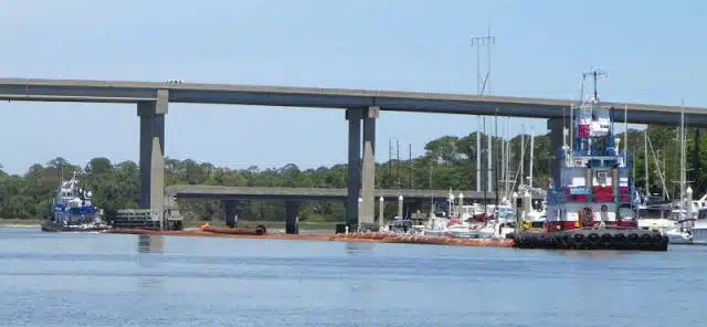
    • Problem Stretch Report: Jekyll Creek, AICW Statute Mile 683


      The channel through Jekyll Creek seems to shift with each tide and, as recommended in this report, Cruisers’ Net likewise recommends mid to high tide passage. Jekyll Creek is home to A CRUISERS’ NET SPONSOR, Jekyll Harbor Marina. Jerry and Sam’s report on this Problem Stretch is reprinted with their kind permission from AGLCA’s Forum. Thank you, Jerry and Sam!

      We went through Jekyll Creek yesterday about an hour before low tide with two days of west winds blowing what water was left out to the Atlantic. I wouldn’t suggest anyone try this section in the conditions we had, I’m just hard headed and have a 2’10” draft.
      We lost readings on both depth finders, and the Admiral stood in the cockpit and told me which prop was stirring up mud in an attempt to keep us in the deepest water as I idled the entire length from the bridge North to St. Simon sound. We never bumped bottom, but it was not a comfortable section to navigate. There was not enough room in the wet part of the creek for a Jon boat to comfortably pass either side of us.
      This is one of those sections on the AICW we will consider a mid to high tide only area on future trips.
      Jerry and Sam Williams

      Click Here To View the Cruisers’ Net’s “AICW Problem Stretches” Listing For Jekyll Creek

      Click Here To Open A Chart View Window, Zoomed To This AICW Problem Stretch

      Click Here To View the Cruisers’ Net’s Georgia Marina Directory Listing For Jekyll Harbor Marina

      Click Here To Open A Chart View Window, Zoomed To the Location of Jekyll Harbor Marina

      Be the first to comment!

    • 17th Annual Cruisers Thanksgiving Potluck, St. Marys, GA, off AICW Statue Mile 712

      The St. Marys River, which is the GA/FL state line and a popular side trip for cruisers, departs the Waterway westward just north of Fernandina, FL. See St. Marys River Cruising Info by Claiborne Young.

      17th Annual Cruisers Thanksgiving Potluck in St Marys, GA
      This is an event hosted by a group of St. Marys’ residents and the Riverview Hotel to provide a Thanksgiving stopping place for all of those boaters who are transiting south for the winter. We welcome all cruisers and boaters to St. Marys for our annual Thanksgiving week gathering and meal. We look forward to seeing old friends and meeting new ones.
      ALTHOUGH THE WATERFRONT SUFFERED DAMAGE FROM IRMA, THE DINNER WILL BE HELD. DOCK BERTHS WILL NOT BE AVAILABLE, SO PLAN TO ANCHOR AND USE THE CITY DINGHY TIE-UP FOR SHORE TRIPS. CHECK THE FACEBOOK PAGE AT “ST MARYS CRUISERS THANKSGIVING” FOR UPDATES TO THE SCHEDULE.

      Off ICW mm 712 up the St Marys River Info, Navigation & Map
      All are welcome. Events, Courtesy Rides, Fun Schedule of Events

      CLICK HERE FOR THE FULL SCHEDULE

      Thank you,
      Kathi

      Click Here To Open A Chart View Window, Zoomed To the Location of St. Marys

      Be the first to comment!

    • Healy Report: Cumberland Dividings Problem Stretch, Statute Mile 704


      Cumberland Dividings has been a Problem Stretch for several years due to constantly shifting shoals and an erroneous magenta line on many chartplotters. Experienced cruisers, Jim and Peg Healy, share their observations and advice on navigating this Problem Stretch.

      Sanctuary and crew departed Brunswick, GA, southbound, at 08h40 on 11/1/2017. The weather was clear, winds light and variable, seas flat, low humidity. A great welcome to Florida in November!

      Cumberland Dividings – SOUTHBOUND at approximately MM 703, the ICW makes a 90º turn to STBD, at R”60.” Shoaling in that area is growing eastbound. We transited at 11h30. The tide station at Crooked River, Cumberland Dividings, Georgia, reported +2.8 ft. We saw 8 ft through that area, but advise to favor Green, the OUTSIDE RADIUS OF THAT BEND IN THE RIVER for much better water depths. Screen Shot “Dividings” shows that area, attached.

      Peg and Jim Healy aboard Sanctuary, currently at Rock Creek, Pasadena, MD
      http://gilwellbear.wordpress.com
      Monk 36 Hull #132
      MMSI #367042570
      AGLCA #3767
      MTOA #3436

      Click Here To View the Cruisers’ Net’s “AICW Problem Stretches” Listing For the Cumberland Dividings

      Click Here To Open A Chart View Window, Zoomed To This AICW Problem Stretch

      Be the first to comment!

    • Healy Report: Georgia’s St. Andrew Sound, AICW Statue Mile 690


      The unpleasant passages through St. Andrew Sound experienced by many cruisers have prompted any number of alternate routes to avoid the infamous R32 at the mouth of St. Andrew Sound. See /144151. Cruisers Jim and Peg Healy suggest a route east of Horseshoe Shoal that they have used many times as weather permits.

      Sanctuary and crew departed Brunswick, GA, southbound, at 08h40 on 11/1/2017. The weather was clear, winds light and variable, seas flat, low humidity. A great welcome to Florida in November!

      St. Andrews Sound – for many years, we have followed a route along the East end of Horseshoe Shoal. The shoal does not seem to have been affected by Hurricane Irma, but is growing toward the east. We transited at 10h00 with the tide at +4.1. Along the route we take, we saw nothing less than 8 ft. That implies 4.0 ft at MLLW, but today winds were light and variable and seas were flat. On a day with lots of energy coming in off the ocean, and/or more vigorous winds, the practical depth in wave troughs would have been much less. Anyone else using this “shortcut,” heads up. Screen shot “StAndrews” shows that area, attached.

      Peg and Jim Healy aboard Sanctuary, currently at Rock Creek, Pasadena, MD
      http://gilwellbear.wordpress.com
      Monk 36 Hull #132
      MMSI #367042570
      AGLCA #3767
      MTOA #3436

      Click Here To Open A Chart View Window, Zoomed To the Location of St. Andrew Sound

      Be the first to comment!

    • Healy Report: Problem Stretch Jekyll Creek, AICW Statute Mile 683


      The channel through Jekyll Creek seems to shift with each tide and Cruisers’ Net recommends mid to high tide passage. Our thanks to experienced cruisers, Jim and Peg Healy, for their observations and advice. Jekyll Creek is home to A CRUISERS’ NET SPONSOR, Jekyll Harbor Marina.

      Sanctuary and crew departed Brunswick, GA, southbound, at 08h40 on 11/1/2017. The weather was clear, winds light and variable, seas flat, low humidity. A great welcome to Florida in November!

      Jekyll Creek – We transited Jekyll Creek southbound between 09h10 and 09h30. Tide at Jekyll Creek Tide Station was +5.1 dropping to +4.7. We saw 7.8 feet along the route, so 7.8-4.7=3.1 feet at MLLW. The most serious shallow spot is in the vicinity of G”19.” We were on a route that was too close to G”19,” and we saw 6.0 ft in the channel on our route. Although we were in the channel, we were not in the best water. I would ass/u/me all cruising boats will need some help from the tide to clear Jekyll Creek. Screen shot G”19″ shows that area, attached. Favor red at G”19.”

      Peg and Jim Healy aboard Sanctuary, currently at Rock Creek, Pasadena, MD
      http://gilwellbear.wordpress.com
      Monk 36 Hull #132
      MMSI #367042570
      AGLCA #3767
      MTOA #3436

      Click Here To View the Cruisers’ Net’s “AICW Problem Stretches” Listing For Jekyll Creek

      Click Here To Open A Chart View Window, Zoomed To This AICW Problem Stretch

      Click Here To View the Cruisers’ Net’s Georgia Marina Directory Listing For Jekyll Harbor Marina

      Click Here To Open A Chart View Window, Zoomed To the Location of Jekyll Harbor Marina

      Be the first to comment!

    • IRMA Photos from Lang’s Marina, St. Marys , GA

      Our thanks to the skipper of SV Linda Jean for these realtime photos at Lands’ Marina during Irma. See /167026 for more descriptions.


      Comments from Cruisers (1)

      1. Larry -  September 20, 2017 - 7:16 am

        Needed to be rebuilt anyway. Without loss of life this might be a blessing if the city rebuilds .

        Reply to Larry
    • Report from Lang’s Marina, St. Marys, GA

      Lang’s Marina is on the north shore of the St. Marys River in downtown St. Marys. Our thanks to the skipper of the Linda Jean for this report.

      Lang’s east docks completely gone. Any boats that remained on the docks were crushed during the hurricane. Lang’s west docks mostly destroyed with the exception of one floater remaining, Only two permanent sailboats survived by anchoring five miles up river.

      Be the first to comment!

    • Report from The Blue Goose, St. Marys, GA, St. Marys River

      The Blue Goose is a hostel and cafe in downtown St. Marys.

      Looks like we are down. All the docks downtown gone, boats were ashore and Lang’s lost some roof.
      Donna Asbell, CFO
      The Blue Goose on Osborne
      Hostel and Cafe
      126 Osborne Street
      Saint Marys, GA 31558

      Comments from Cruisers (1)

      1. SV Linda Jean -  September 13, 2017 - 10:55 pm

        Lang’s east docks completely gone. Any boats that remained on the docks were crushed during the hurricane. Lang’s west docks mostly destroyed with the exception of one floater remaining, Only two permanent sailboats survived by anchoring five miles up river.

        Reply to SV
    • Sherer Report: Survey of Problem Stretch Jekyll Creek, AICW Statute Mile 683


      The channel through Jekyll Creek seems to shift with each tide and Cruisers’ Net recommends mid to high tide passage. Fortunately, Bob and Ann Sherer, authors of 2017 ICW Cruising Guide, graciously share their 2017 survey of this Problem Stretch, complete with charts of the most treacherous segments, to assist your low tide passage through this fickle channel. Jekyll Creek is home to SALTY SOUTHEAST CRUISERS’ NET SPONSOR, Jekyll Harbor Marina.

      CLICK HERE for Charting Differences at Jekyll Island

      Click Here To View the Cruisers’ Net’s “AICW Problem Stretches” Listing For Jekyll Creek

      Click Here To Open A Chart View Window, Zoomed To This AICW Problem Stretch

      Click Here To View the Cruisers’ Net’s Georgia Marina Directory Listing For Jekyll Harbor Marina

      Click Here To Open A Chart View Window, Zoomed To the Location of Jekyll Harbor Marina

      Be the first to comment!

    • Low Tide Report from Jekyll Creek, AICW Statute Mile 684


      As confirmed by Charles Ridley, Jekyll Creek continues to require Mid to High tide for almost all vessels. Jekyll Creek is home to SALTY SOUTHEAST CRUISERS’ NET SPONSOR, Jekyll Harbor Marina, just south of the bridge.

      3-28-17 Going south in Jekyll creek at close to low tide was bad- draw 2 1/2′ and kicked mud till just south of bridge. Plenty of water at dock [Jekyll Harbor Marina].
      Charlie and Jackie on Traveler

      Click Here To Open A Chart View Window, Zoomed To the Location of Shoaling

      Click Here To View the Cruisers’ Net’s Georgia Marina Directory Listing For Jekyll Harbor Marina

      Be the first to comment!

    • Good Words for Jekyll Harbor Marina, AICW Statute Mile 684.5


      A CRUISERS NET SPONSOR, Jekyll Harbor Marina lies along the easterly banks of the AICW’s passage through Jekyll Creek, immediately south of the 65-foot fixed bridge. Our thanks to Charles Ridley for this review and for the depth report on Jekyll Creek.

      Spent 3-28-17 here. Going south in Jekyll creek at close to low tide was bad- draw 2 1/2′ and kicked mud till just south of bridge. Plenty of water at dock. Docks in good shape, decent wifi, dog friendly, restaurant on site ( many said very good but we not try it.) nice shower, rest rooms. Will plan to stay there again.
      Charlie and Jackie on Traveler

      Click Here To View the Cruisers’ Net’s Georgia Marina Directory Listing For Jekyll Harbor Marina

      Click Here To Open A Chart View Window, Zoomed To the Location of Jekyll Harbor Marina

      Be the first to comment!

    • Review of Dungeness Greyfield Anchorage, Cumberland Island, GA, AICW Statute Mile 711.5


      One of Claiborne’s favorite side trips along the southern Georgia portion of the AICW was to leave the Waterway at marker #34 and cruise up the Cumberland Island channel to anchor off the west side of Cumberland Island and east of Drum Point Island. Our thanks to Chris and Alyse Caldwell for this report.

      Cumberland Island GA anchorage allows you access to the most pristine beach you can imagine. Wander in by dinghy from the southwestern side of the island, stroll under the canopy of trees over to the incredible dunes of the Atlantic Ocean and I will bet you encounter peacocks, goats and wild horses. This national park offers overnight camping but limits the number of daily visitors. It is a must see for us every time we traverse the east coast.
      See you on the water…
      Chris and Alyse Caldwell

      Click Here To View the Georgia Cruisers’ Net Anchorage Directory Listing For the Dungeness Greyfield Channel Anchorage

      Click Here To Open A Chart View Window, Zoomed To the Location of the Dungeness Greyfield Channel Anchorage

      Be the first to comment!

    • Shoaling Reported in Cumberland Dividings, AICW Statute Mile 703


      Today’s Waterway Guide reports shoaling at Marker #60 in Cumberland Dividings, a SSECN Problem Stretch, where channel shifting at the Waterway/Brickhill River intersection is perennial. For good advice on this Problem Stretch, go to: /153352

      CLICK HERE FOR WATERWAY GUIDE’S REPORT

      Click Here To View the Cruisers’ Net’s “AICW Problem Stretches” Listing For the Cumberland Dividings

      Click Here To Open A Chart View Window, Zoomed To This AICW Problem Stretch

      Comments from Cruisers (1)

      1. Ted -  April 11, 2021 - 9:47 am

        Just went through here and there is severe shoaling on the western side of the channel.

        Reply to Ted
    • Captain Jim Healy Discusses the Waterway from Charleston to St. Augustine

      Longtime cruiser and SSECN Contributing Editor, Captain Jim Healy, shares his knowledge and experience in these observations on this portion of the Atlantic Intracoastal Waterway. Thank you Jim!

      The entire region from Charleston to St. Augustine has high tidal ranges, ranging from 5′ at St. Augustine to as much as 9′ in Savannah/Beaufort/Charleston.  Those high tidal ranges create swift tidal currents, and especially for first-times, docking is easiest in the 1/2 hour before and after slack.
      There are many areas of shallow water in the region.  The very best resource for current data on low water and caution areas is available via www.activecaptain.com.  Two other  websites that all ICW travelers should know about are www.waterwayguide.com and www.cruisersnet.net.  I’m sure you are familiar with the Waterway Guide book series.  The “Salty Southeast Cruiser’s Net” (SSECN) is  really a boating group.  It was founded by Claiborne Young.  After Claiborne’s untimely loss, the group continued in operation.  The Cruiser’s Net website specializes on the US Southeast.  There is some duplication of material between the WWG site and the SSECN site, but there is unique value to both.  Both are excellent resources for fuel prices, marinas and anchorages.  These websites would make a good sidebar for any ICW article.  Two of these websites require registration – SSECN does not – and all three are free, and all are very useful to ICW boaters.  Both WWG and SSECN also have smart phone apps that duplicate and augment website information and are very useful on small-format devices.
      There are some generalizations that apply to the region, including the stretch from Georgetown, SC all the way south to below Fernandina Beach.  In some of those areas, boats drawing more than 4′ will want to consider not traveling at low tide; especially celestial low tides.  The Army Corp of Engineers (USACE) is responsible for dredging the ICW.  USACE is funded by state congressional delegations.  In recent years, the money congress allocates to dredging has been diverted to “more pressing needs,” and so many areas of the ICW are shoaling, and in fact, the ICW resource is slowly being lost; well, allowed to die, really, by congress.  There is a not-for-profit called the Atlantic Intracoastal Waterway Association.  The Executive Director is Brad Pickel; bpickel@seahavenconsulting.com.  That would make another sidebar for any article on the ICW.  There are some local knowledge bypasses around some shoal areas.  All of the cruising sites above can provide additional detail.
      Renting a car in any of these venues greatly expands what a boating visitor can see and do.  Some, but not all, marinas have courtesy cars.  Generally they can’t be used for long periods, but they are useful for re-provisioning when needed.
      Hope this helps.
      Jim
      Peg and Jim Healy aboard Sanctuary, currently at Ft. Myers, FL

      Be the first to comment!

    • Another Good Review of Jekyll Harbor Marina and Jekyll Island, AICW Statute Mile 684.5


      A SALTY SOUTHEAST CRUISERS’ NET SPONSOR, Jekyll Harbor Marina lies along the easterly banks of the AICW’s passage through Jekyll Creek, immediately south of the 65-foot fixed bridge. Our thanks to Dick Lawson for this excellent review and for the name of a good mechanic.

      First time to Jekyll in a couple years. Marina under new management and services are good. The adjoining restaurant, DJ’s is closed, but being renovated by new owners and supposed to be open later this year. New town center on the island is beautiful with groceries, shopping and several restaurants – quite an upgrade from the past. It’s within walking distance, or the marina will let you use their golf cart for up to 90 minutes at a time. I required some engine work and they recommended Leo Ross, 912-266-1323, from Brunswick. He did a good and reasonable job and is also recommended.
      Dick Lawson

      Click Here To View the Cruisers’ Net’s Georgia Marina Directory Listing For Jekyll Harbor Marina

      Click Here To Open A Chart View Window, Zoomed To the Location of Jekyll Harbor Marina

      1 Facebook Likes, 1 Facebook Reactions

      Comments from Cruisers (2)

      1. Perry McDonald -  October 26, 2018 - 1:28 pm

        We had the pleasure of staying here Oct 16-18 while waiting on some weather to pass. This is ONE FINE MARINA. From the dock staff to the dock master PROFESSIONAL and HELPFUL. Dockage, diesel fuel and 20lb bags of ice were reasonably priced. The restaurant serves EXCELLENT food (shrimp and grits first night and fried shrimp and flounder the second night). They have a swimming pool and Jacuzzi. Clean showers. Bikes for touring the island. Or if you prefer you can get a golf cart for 90 minutes. Flash foods and Dairy Queen are within walking distance if you are looking to get a BLIZZARD. Plus they have safe and protected walking trails all the way to the resort. I am so glad for my friend Fred recommending we stop here. Call ahead and reserve your place they fill up fast. Great marina, restaurant, and friendly staff are what we all want after a day on the water.

        Reply to Perry
      2. Sonny Reeves -  July 1, 2016 - 1:26 pm

        In the 7 years we were at Jekyll Island Marina the work we hired done and observed on other people’s boats done by Leo Ross and his son was first class. As a 40 year veteran of the automotive repair business I know a good technician when I see/meet/hire one. Leo is fine Southern Gentleman of the old school where honesty and integrity are the mark of a craftsman.
        He also knows where to catch the nicest Georgia Shrimp in the area.
        Hope to get back to Jekyll one day before JIA sells it out to the rich and famous.

        Reply to Sonny
    • Detailed Report from Jekyll Creek, Jekyll Island, GA, AICW Statute Mile 684.5


      Robert Sherer is author of 2015 ICW Cruising Guide: A guide to navigating the Atlantic Intracoastal Waterway. See /?p=150181. SSECN is grateful for Captain Sherer’s willingness to share his knowledge and experience with our readers. Jekyll Creek is home to SALTY SOUTHEAST CRUISERS’ NET SPONSOR, Jekyll Harbor Marina.

      I’ve been through Jekyll Creek a dozen times and although there is a channel with 5.7 MLW depth, the problem has always been how to find it. This time through I found a good fit using ENC charts as displayed on the iPad app, Charts and Tides. I would think that any app that used NOAA ENC charts would display the same route (my laptop with ENC charts showed the route correctly).

      IMG_9157

      At Jekyll Creek just south of the bridge

      Sitting at anchor just south of the bridge on 4/22/216, we were astounded when we saw two huge tugs with several hundred feet of dredging pipe go through Jekyll at dead low tide, one tug on each end of the pipes. I followed in my dinghy. The mud stirred up was incredible. They stopped multiple times and rev’ed up the engines and plowed through. It took 20 min to round G19. In other words, they created the channel and successive runs is what keeps the channel open.
      After they passed I got in my dinghy to measured the deepest spot by G19, R20 and R20A, going side to side with a portable depth sounder and found that 80 to 100 ft off each mark was best, at least now after the two tug plow team.
      Route notes:
      – Do not hug any marks, stay off R20A, R20 and R19 by 80 to 100 ft.
      – Garmin charts are useless here but NOAA ENC charts work well.
      – The depth readings were taken the day after two tugs passed (plowed!) through.
      – A GPX file of the route is available here or go to http://tinyurl.com/hvugdss

      Route depths:
      Bridge 10.6 MLW, use as a check on general water depth, the bridge height gauge read 65 ft (it was near high tide when I passed through but all readings have been corrected to MLW)
      Heading north:
      – 1/2 way 6.7 MLW
      – R20A 8.3 MLW
      – 1/2 way 6.2 MLW
      – R20 6.6 MLW
      – By docks 9.2 MLW
      – 1/2 way 8.1 MLW
      – G19 5.7 MLW (80 ft off )
      – At shoal mark 7.6 MLW
      – G17 9.1 MLW
      – R16 7.8 MLW

      Deeper the rest of the way north.

      I don’t claim this is the best route but it worked on 4/22/2016 for 5.7 MLW.
      Robert Sherer

      Click Here To View the Cruisers’ Net’s Georgia Marina Directory Listing For Jekyll Harbor Marina

      Click Here To Open A Chart View Window, Zoomed To the Location of Jekyll Harbor Marina

      Be the first to comment!


    Social Media Auto Publish Powered By : XYZScripts.com