SCYC and Makers Air are grateful for you!
|
|
|
|
|
|
Gulfport Municipal Marina, A CRUISERS NET SPONSOR, is located in the heart of downtown Gulfport. The marina and harbor, found on the northern shores of Boca Ciega Bay, are easily accessible from the Western Florida ICW, just north of Tampa Bay.

|
|
|

Click here for Explore “Spooky Science” with NOAA Ocean Today this Halloween!


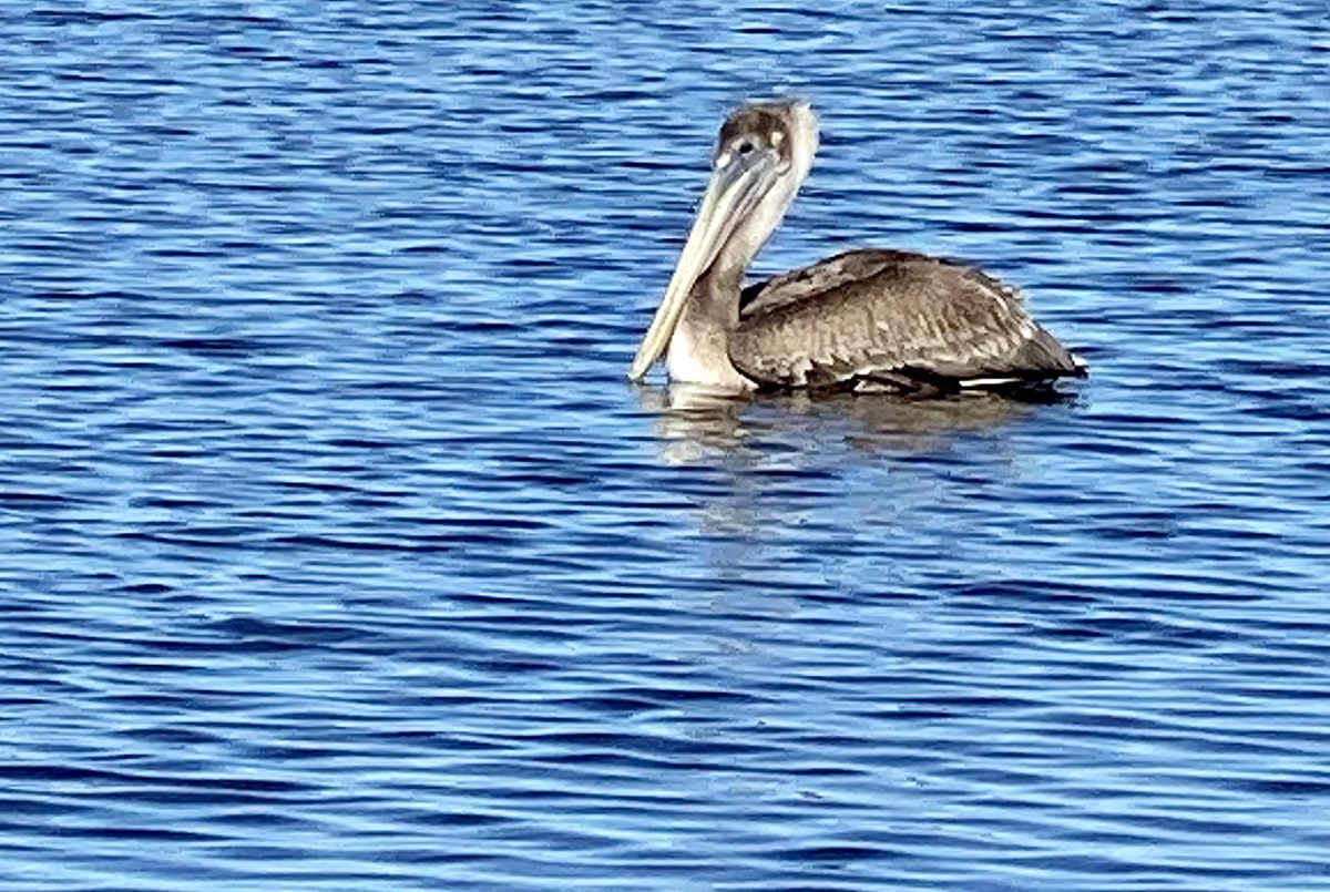
Behold the pelican, its beak can hold more than its belly can. Photo: Gordon Churchill Read more at Coastal Review, coastalreview.org.
Click here for Fishing is for the birds, and they can show you how, where
by Capt. Gordon Churchill
CoastalReview.org

Click here for This Saturday: Trick, Treat & Trail Family Fun Run and Boo Fest at Wannamaker County Park!

|

Click here for ICW Follies: Outside We Go to Manteo. Cut That Mark!
NOTE: Unless you have recent and very specific local knowledge, Cruisers Net does not recommend Oregon Inlet.
Click below for
See also Securing Lithium-Powered Equipment
The Dismal Swamp Route departs the southbound Waterway at MM 7.2 and northbound via the Pasquatank River. Our thanks to Sarah Hill for this invitation from Dismal Swamp Welcome Center, A CRUISERS NET SPONSOR!
Good Morning!
Hope all is well! Passing along some fall images from the Dismal Swamp Canal & Dismal Swamp State Park- we’re starting to see some autumn colors pop up.
Happy to report from recent boaters, very little to no duckweed- no issues. Locks & drawbridges operating on normal schedule.
We’ve put together a few “Know before you go” DSC Boating tips on our website:
https://www.dismalswampwelcomecenter.com/boating-paddling
Please feel free to share.
Many thanks to everyone cruising the historic waterway ~ we look forward to seeing you soon!
Sarah
|
| Sarah Hill, TMP Director, Dismal Swamp Canal Welcome Center Chairperson, Camden County Tourism Development Authority 2356 US Hwy 17 North, South Mills, NC 27976
|


Just pass the canal on 10/29-30 /24. 6 feet of water and wonderful stop at the visitor center. A beautiful trip in a serein environment. No rag weeds. A first for us and I am glad we did it.

From its beginning, Kanberra has used the gold standard of Tea Tree Oil in their fight against odor and other harmful daily concerns.
|
|
Morningstar Marina at Golden Isles, A CRUISERS NET SPONSOR, lies along the southern reaches of the Frederica River, between Lanier and St. Simons Islands, south of the charted 9 foot bridge.

Click Here To Open A Chart View Window Zoomed To the Location of Golden Isles Marina
| |||||||||
|
Cruisers Net publishes Loose Cannon articles with Captain Swanson’s permission in hopes mariners with salt water in their veins will subscribe.. $7 a month or $56 for the year and you may cancel at anytime.

Click link for Mean Spirited: The New Boat Show Vibe
Cruisers Net publishes Loose Cannon articles with Captain Swanson’s permission in hopes mariners with salt water in their veins will subscribe.. $7 a month or $56 for the year and you may cancel at anytime.

Click link for Q&A: Catalina 22 Seeks To Distance Herself from ‘Lieutenant Dan’
Fishermen’s Village Marina, A CRUISERS NET SPONSOR, is temporarily closed for clean up and recovery.
FOR IMMEDIATE RELEASE
Punta Gorda, FL – Fishermen’s Village Mall, Resort and Marina is currently temporarily closed as we progress through cleanup and recovery efforts following hurricane Milton.
A Reopening date will be announced and released as information becomes available.
Thank you.

| Kathy Burnam 941.639.8721
|
Click Here To View the Western Florida Cruisers Net Marina Directory Listing For Fishermen’s Village
Click Here To Open A Chart View Window Zoomed To the Location of Fishermen’s Village
If you have any interest at all in boat building, or just messing about in boats, then this article is for you. Thank you Capt. Wheeler.
 |
SPARRING WITH MOTHER NATURE ~~ latest addition! Settle back for your Sunday Morning Read. I’m so honored that you’re following along. Thank you.
Please enjoy the latest passages from STEADFAST. As of August 1st, 2024 we are undergoing extensive repair and refit and will be for several months. In boating terms we are hauled out “on the hard.” I plan to mix Sailing Stories with the challenges and intricacies of restoring a 90-year-old Sailing Yacht. I’m always open to suggestions as to content….please feel free to weigh in. Thank you. J
Boatbuilder Duncan Macfarlane has an old soul. Alive for just under four decades, he prefers music recorded prior to his birth and reveres vessels built long before that. His passion for wooden boats is so strong, in fact, that he’s made it his life’s work to bring them back to what they once were. Back to what they should be. Back to what their designers wanted them to be, and maybe, just maybe, one shade better. On his first day I said to him, “My father always told me, ‘Measure twice, cut once.’ Is that your Mantra?” He looked at me steadily and replied with just a touch of levity. “Oh no. We measure many times.”
In this photographic essay, Duncan fits the knee, (which you can see being shaped in the post MORE PRECIOUS COMMODITIES), recreates the stem, (or very front) of STEADFAST, and attaches the two together, preparing for installation. The new Purpleheart is a stark and startling contrast to the century-old materials it is replacing and supporting.


The ancient art of shipbuilding is, like many ancient arts, becoming more and more rare, as are boatbuilders themselves. It was determined a few decades ago that other materials lasted longer and were far easier to maintain. Progress? That, of course, is a matter of opinion. Regardless, what an opportunity it is to see how complex, intricate, interdependent and STEADFAST vessels such as this one really are. Thanks for following along as we complete the painstaking and joyful repair and refit of our floating home. There are many more steps to come!!
Your input is appreciated and welcome! Love wooden boats? Build them? Never seen one? People certainly fall into all these categories. Like our Boatbuilder himself, STEADFAST most certainly has an old soul, in more ways than one.
*** I will always keep the articles I have written available for free to my readers. If you see value and possess the means, it’s great encouragement to have paid subscribers. If not, simply ‘liking,’ commenting, restacking and sharing these tales helps spread the word about me and what I have chosen to do. There should be someone on your email list that would be intrigued! Sharing is caring.
Share SPARRING WITH MOTHER NATURE
Most importantly, YOU, MY READERS, ARE TREMENDOUSLY APPRECIATED!
And lastly: our weekly sunrise. These can be seen on Facebook YACHTING STEADFAST each and every morning until 2025.
You’re currently a subscriber to SPARRING WITH MOTHER NATURE.
There are options available to support my work AND there is absolutely no pressure, but if you choose to do so, THANK YOU VERY MUCH!
© 2024 Janice Anne Wheeler
548 Market Street PMB 72296, San Francisco, CA 94104
| |||||||
|
More good advice from the City of Gulfport.
| |||||||
|
| ||||||||||||||||||||||||||||||||||||||||||||||||||||||||||||||||||||||
|


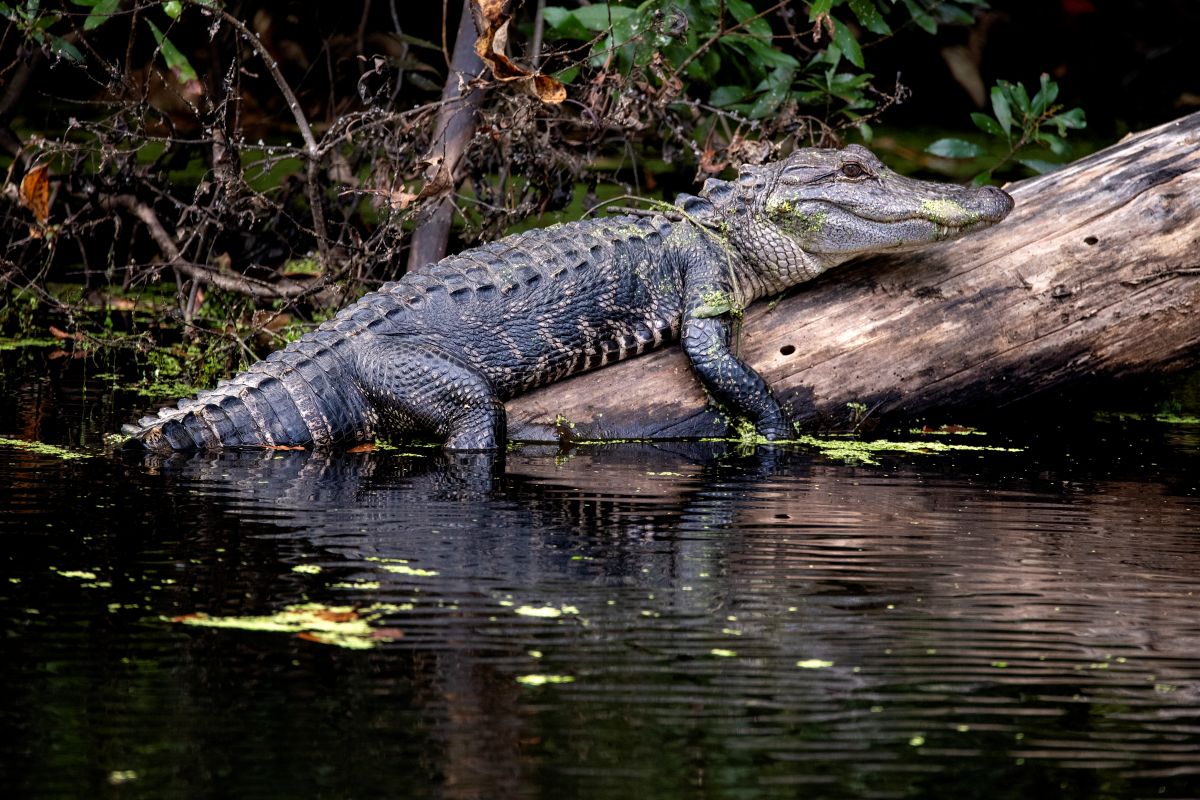
An American alligator perches on a fallen log. Photo: Courtesy, N.C. Wildlife Resources Commission
Click link for Gators’ more frequent appearances make splash along coast
CoastalReview.org
Be the first to comment!