from Norfolk to the Northern Gulf and Bahamas.
3 of 14 Open Cottages in the Keys next two weeks , Come down and Warm up, Key Lime Sailing Club, Key Largo, FL
Key Lime Sailing Club, A CRUISERS NET SPONSOR, always has very special offers for their visitors! Key Lime Sailing Club is a unique slice of KEYS ENJOYMENT…give it a try and let us hear about your experience.

 We hope that you had a wonderful holiday season and are ready to start the year off with a bang.If you’re looking to escape the cold this winter, why not come down to Key Largo and enjoy a tropical vacation? Our open cottages are the perfect place to relax and unwind, and with availability over the next couple of weeks, now is the perfect time to book your stay.Whether you want to spend your days lounging on the beach, exploring the local flora and fauna, or trying out some of the many water sports that Key Largo has to offer, we have something for everyone. Our cottages are comfortable and well-equipped, with everything you need to make the most of your vacation.So don’t let the cold weather get you down – come down to Key Largo and enjoy some sun and fun. We look forward to seeing you soon!Available Cottages and Dates
 Book at Key Lime now! Cottage rental includes unlimited use of a 22’ sailboat (for qualified sailors), kayaks, paddle boards, water toys, bicycles, snorkel and fishing gear at no extra cost.We also offer activities such as ocean side sail and snorkel charters aboard a pirate ship, bayside sunset cruise, sailing lessons, and kayak eco-tours.Visit our website www.
keylimesailingclub.com and send us a Request to Book! You can also call or text our reservation specialist at 305-451-3438 almost any time day or night!  Photo Contest Winner
 We are pleased to announce that Richard Jehu (Entry # 86) is the winner of our 2022 KLSC Photo Contest! We would like to extend our heartfelt congratulations to Richard and thank all of our guests who participated in the contest and those who voted for their favorite entries.As the winner, Richard has won a free 3-night stay at our Key Lime Sailing Club & Vacation Cottages in the beautiful Florida Keys.We are grateful to all of our guests for their participation and support, and we hope that everyone will join us again for next year’s contest. We will be announcing the contest rules in the near future, so stay tuned for more information.In the meantime, we hope that you will continue to enjoy all that Key Lime Sailing Club has to offer and make the most of your vacation experience.
 Key Lime Sailing Club and Cottages | 305-451-3438 | 99306 Overseas Highway, Key Largo Florida | www.keylimesailingclub.com
Be the first to comment!
AIWA January 2023 Newsletter
Cruisers Net is proud to be a member of the Atlantic Intracoastal Waterway Association whose lobbying work is crucial to keeping the Waterway navigable and safe. Your membership dollars directly support their vital work. Please join and encourage your boating neighbors to do likewise, regardless of their homeport.
The AIWA Launches “100 Boaters in 100 Days” Campaign AIWA Membership Drive ️ 100 Boaters in 100 Days!
With the beginning of the 118th Congress, we see the next 100 days as critical for our ability to raise awareness of the value of the Atlantic Intracoastal Waterway (AIWW) and we need your support. We are focused on reaching the new Senators and Representatives and their staff who make the day-to-day decisions to move issues forward and we need to reach them.We are launching our 100 Boaters Campaign in the next 100 days Member Drive! Please lend your support to have our ‘Voice of the Waterway’ heard in the next 100 days. To have a strong impact in Washington, DC, it is crucial for us to increase our recreational boater membership rolls.Join for $30 — less than a day’s provisions for a boat trip on the water!
Join AIWA TODAY for only $30. 


Copyright © 2023. Atlantic Intracoastal Waterway Association. All rights reserved. The AIWA is a national non-profit organization with the mission of securing funding and support for the maintenance of the Atlantic Intracoastal Waterway. We are the only organization dedicated to ensuring the future of the AIWW and proudly represent all stakeholders of the waterway.
Contact:
5A Market
Beaufort, SC 29906
(843) 379-1151 ️ atlanticintracoastal.org
Be the first to comment!
Anna Maria Island offers a taste of the simple life on Florida’s Gulf Coast
Anna Maria Island is at the mouth of the Manatee River which is home to two longtime CRUISERS NET SPONSORS, Riviera Dunes Marina and Twin Dolphins Marina.
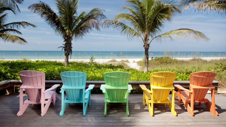
Anna Maria Island offers a taste of the simple life on Florida’s Gulf Coast
TravelWeekly.comClick Here To View the Cruisers Net Western Florida Marina Directory Listing For Riviera Dunes Marina Resort
Click Here To Open A Chart View Window, Zoomed To the Location of Riviera Dunes Marina Resort
Click Here To Open A Chart View Window, Zoomed To the Location of Twin Dolphin Marina
Comments from Cruisers (1)
-
One of our favorite islands along the west coast of FL… it is getting VERY POPULAR.
Hope it does not loose it's "old Florida" charm. Three different municipalities on the island.
-
Inlet channel maintenance made simpler: Go with the flow, Ocracoke and Hatteras, NC
The Corps of Engineers now says it has authority to follow the deepest natural water, or best water, in the Rollinson Channel Navigation Project linking Hatteras and Ocracoke islands.

The proposed corridor with high-shoaling areas to be dredged any time of year indicated in circles. Image: Corps/FONSI
Click here for Inlet channel maintenance made simpler: Go with the flow
CoastalReview.orgBe the first to comment!
Happy Holidays! from Sun Powered Yachts
Sun Powered Yachts is A CRUISERS NET SPONSOR!


Happy holidays from the team at Sun Powered Yachts, we’re certainly not in Kansas anymore! We have switched up sunny Cancun for wintery Maine to visit Katie’s family and show the girls their first ever wintery, white Christmas.
Click here for Happy Holidays!
Be the first to comment!
Merry Christmas!
Wishing you and yours a Very Merry Christmas from your Cruisers Net Team!

Be the first to comment!
1898 Oregon Inlet Life-Saving Station must go, but where?
The Old Oregon Inlet Life-Saving Station is one of the most beautiful historic buildings on the Outer Banks, situated at a dramatic coastal location that would befit a movie setting.
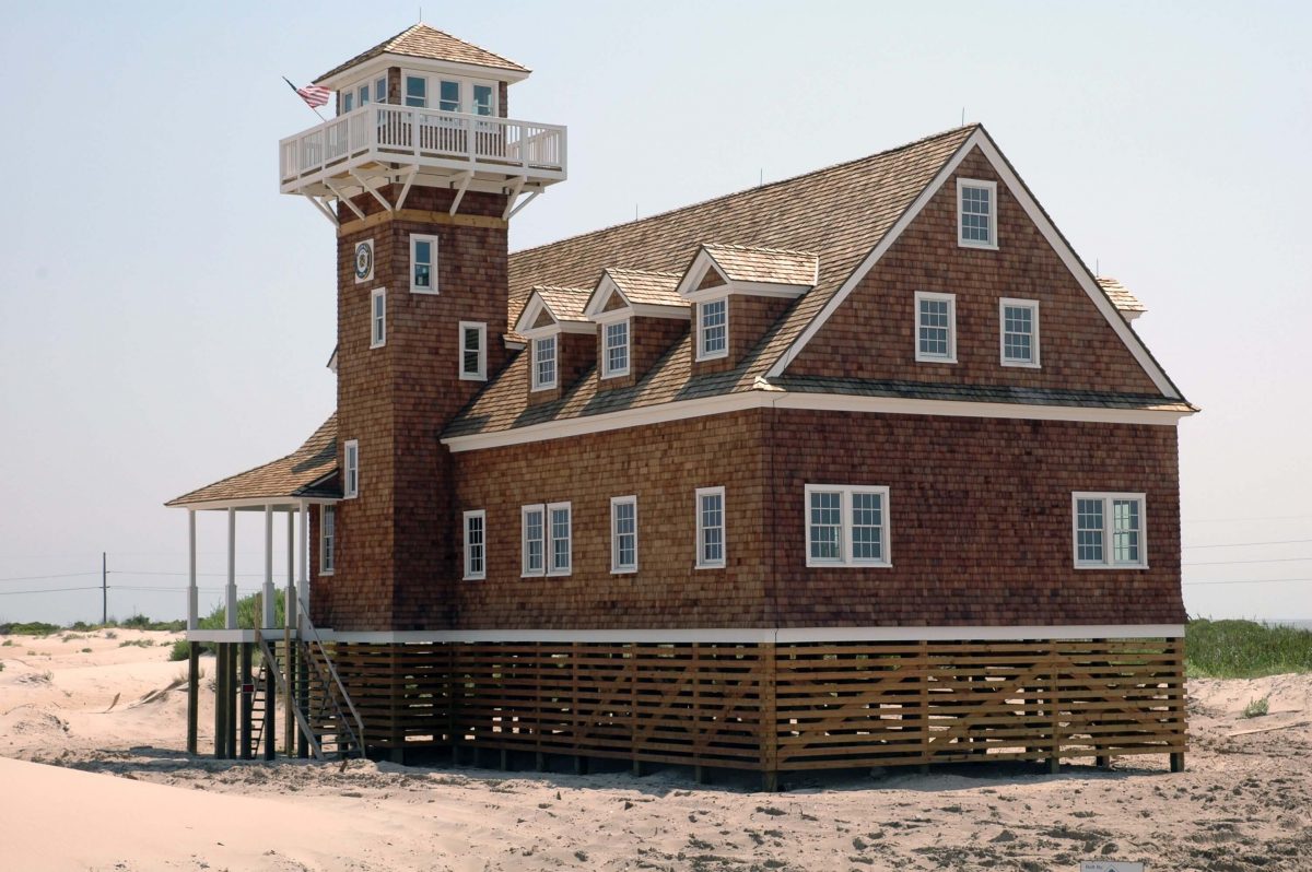
The Oregon Inlet Life-Saving Station on the southeast side of Oregon Inlet, part of the Pea island National Wildlife Refuge. Photo: Courtesy U.S. Life-Saving Service Heritage Association
Click here for 1898 Oregon Inlet Life-Saving Station must go, but where? – Catherine Kozak
CoastalReview,orgBe the first to comment!
Pamlico County a quiet destination on NC coast
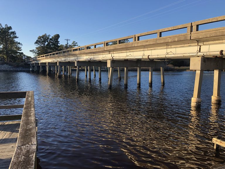
Click here for Pamlico County a quiet destination on NC coast
CoastalReview.orgBe the first to comment!
M/V Stud Muffin’s Name Is ‘Protected.’ So What?- Peter Swanson
Cruisers Net publishes Loose Cannon articles with Captain Swanson’s permission in hopes mariners with salt water in their veins will subscribe.. $5 a month or $42 for the year and you may cancel at anytime.

Click here for M/V Stud Muffin’s Name Is ‘Protected.’ So What?
Be the first to comment!
Gateway to the Gulf Newsletter, City of Gulfport, December 12, 2022, Boca Ciega Bay, FL
Gulfport Municipal Marina, A CRUISERS NET SPONSOR, is located in the heart of downtown. The marina and harbor, found on the northern shores of Boca Ciega Bay, are easily accessible from the Western Florida ICW, just north of Tampa Bay.
Click Here To Open A Chart View Window Zoomed To the Location of Gulfport Municipal Marina
Click Here To Open A Chart View Window Zoomed To the Location of Gulfport Anchorage/Mooring Field
Be the first to comment!
First right whale sighting of the year off Jekyll Island
North Atlantic right whales are in peril. Ship strikes and entanglement in fishing gear have spurred a population decline that may lead to extinction in ~20 years.

JEKYLL ISLAND, Ga. – According to the whale mapping website whalemap.org, the first right whale sighting of the year was Friday, November 30 off Jekyll Island.
The sighting was of a female right whale, no calf was seen. Another sighting was made south of Jekyll Island Tuesday, December 6.
News4Jax
Click here for First right whale sighting of the year off Jekyll Island
Whalemap.orgBe the first to comment!
[New Video] NOAA Ocean Today – Flooding on a Sunny Day? Here’s How

Click here for [New Video] NOAA Ocean Today – Flooding on a Sunny Day? Here’s How
Be the first to comment!
$75,000 Finder’s Fee – Topside Marinas
Click image below for details. Topside Marinas is A CRUISERS NET SPONSOR!
Be the first to comment!
Forget Kokomo. Key Largo is the pristine paradise where you wanna go.
The Florida Keys are home to the world’s third largest living coral reef. And Key Largo is home to Key Lime Sailing Club and Cottages, A CRUISERS NET SPONSOR!
Click for Forget Kokomo. Key Largo is the pristine paradise where you wanna go.
National Geographic/TravelBe the first to comment!
FWC now accepting applications for newly created Vessel Turn-In Program
The Florida Fish and Wildlife Conservation Commission (FWC) is now accepting applications for a recently approved and newly created Vessel Turn-In Program, a key component of Florida’s derelict vessel prevention program.
Click here for FWC now accepting applications for newly created Vessel Turn-In Program
Be the first to comment!
Wrightsville Beach Holiday Flotilla and Fireworks, Nov 26, 6:00 PM, AICW NC Statute Mile 283
The Waterway’s path through Wrightsville Beach is a narrow congested channel, so caution must be exercised during these dark hours, especially in vicinity of spectator boats.
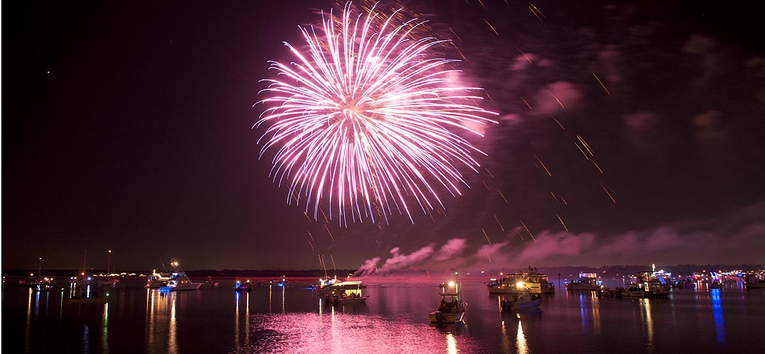
Click here for Wrightsville Beach Holiday Flotilla and Fireworks, Nov 26, 6:30-8:30 PM, AICW NC Statute Mile 283
luminanews.comBe the first to comment!
Search for Blackbeard’s treasure based on enduring myth
Popular literature and the public’s imagination have long perpetuated the notion that the notorious pirate buried his ill-gotten wealth, perhaps on Ocracoke Island.
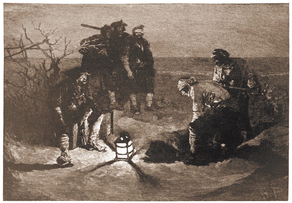
“Blackbeard Buries His Treasure” illustrated by Howard Pyle for Harper’s Magazine, 1887.
Click here for Search for Blackbeard’s treasure based on enduring myth
CoastalReview.orgBe the first to comment!
Mobile App Available from the Association of Bahamas Marinas

 IT’S BETTER IN BAHAMIAN WATERSGet The Bahamas on The GoThe Association of Bahamas Marinas announces an expansion of their digital presence by adding a new mobile app available for both IOS and Android to complement their existing website. The new offering provides users of Android and Apple devices with real time updates about all member marinas, allied service members, as well as view current information on health protocols, fishing rules and entry requirements. Payment of charter fees for commercial operators can also be completed within the app.The IOS and Android mobile apps are available for download at no charge via the Apple App Store and the Google Play Store respectively.Click below for App Downloads.News from ABM Members
 Update from Norman’s Cay Marina:While Marinas are a fixture on any island, the level of quality and efficiency at Norman’s Cay Marina is unmatched in all of The Bahamas. It currently accommodates 37 vessels with a 50’ minimum requirement and still growing to become a 63-slip marina constructed with Brazilian Ipe wood docks and surrounded by 4000 mangroves that lead to a coral stone path and lush native flora that frame the Marina. The General Store has recently opened offering a wide selection of quality provisions, freshly baked goods, homemade jams and more! Please contact the marina on channel 16 or call 1 (242) 822-0380 to make your reservation today.
 Find the perfect destination and marina:
 For more info on the ABM contact Basil SmithBe sure to to follow the ABM on our Social Media Channels:

Be the first to comment!


Be the first to comment!