Uodated Bahamas Travel Advisory – 12/24
| |||||||||||||||||||
| Copyright © 2021 The Islands Of The Bahamas 1200 South Pine Island Rd., Suite 450, Plantation, FL. 33324 | |||||||||||||||||||
| |||||||||||||||||||
| Copyright © 2021 The Islands Of The Bahamas 1200 South Pine Island Rd., Suite 450, Plantation, FL. 33324 | |||||||||||||||||||
Walburg Creek Anchorage is off the AICW and accessed from MM 619 or 623.5. Our thanks to Ted Arrisaka for sharing this photo. This editor and crew have spent many a night here.

Click Here To Open A Chart View Window, Zoomed To the Location of the Walburg Creek Anchorage
One of Georgia's gems! Sandy beach by the north entrance at low tide. Beautiful sunset over the marsh to the west. Good protection. From the wind E thru SSE. Good holding, ground tackle comes up clean.
The Florida Fish and Wildlife Conservation Commission and the U.S. Fish and Wildlife Service have announced a “supplemental feeding” plan to save malnourished manatees on the Atlantic coast.
Supplemental feeding for the malnourished manatees | Science & Technology | crimson.fit.edu
The Florida Tech Crimson
In tandem with pollution, jet skis are wreaking havoc. These can easily go over 50 mph. Neither manatees, human swimmers, nor birds have a chance against them. Jet skis are highly unsafe, noisy, pollute, and, for all the above, need to be illegal on public waterways.
This situation occurred several years ago when the Save the Manatee Club made its big push. The ideal is super, but the reality is not. Yes, they are large docile creatures that have a place in Florida. However, when steps are taken to increase their numbers above and beyond what the natural food supply will support, the situation that we have now takes place. Mess with Mother Nature, and you create a second problem. I guess it is a steep learning curve.
Cape Lookout National Seashore has been certified as a Dark Sky Place, the first in the National Park Service on the Atlantic coast to receive this certification. The popular Cape Lookout Bight anchorage is practically in the shadow of Cape Lookout Lighthouse. In rough offshore weather, cruisers with shallow draft may choose to access the anchorage via Taylor Creek and Barden Inlet which separates Shackleford Banks and Core Banks. See Dark Sky Park.
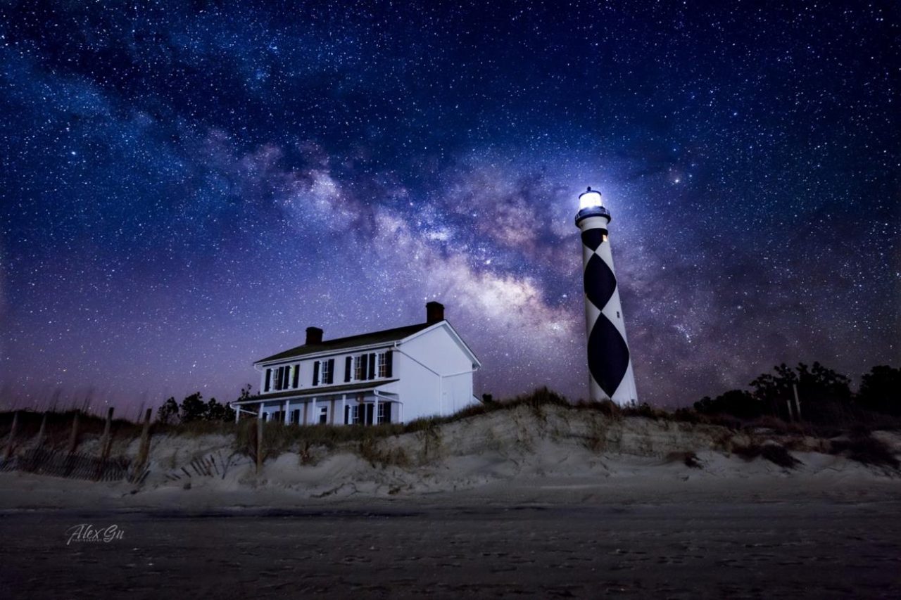
Cape Lookout Lighthouse under the night sky. Photo: Alex Gu/Crystal Coast Stargazers
Cape Lookout is now a certified International Dark Sky Park
CoastalReview.org
Click Here To Open A Chart View Window, Zoomed To the Location of Cape Lookout Bight
It makes sense, as residents have advocated for months — more than 3,000 signed a petition — to adopt strict speed limits and keep power boats from generating oversized waves big enough to swamp smaller boats, knock paddlers off boards and endanger visitors looking to enjoy a serene weekend on the water.
Editorial: Cut speed limits where boaters, swimmers share Intracoastal – Palm Beach Post
Palm Beach Post

EXUMA PARK MOORING FEES
Up to 39’11” – $30 • 40’ – 49’11” – $40
50’ – 59’11” – $50 • 60’ – 69’11” – $80
70’ – 89’11” – $120 • 90’ – 119’ – $150
120’ – over – $170
Landing Fee – $10/pp (visitors9not on mooring)
ANCHORING FEES (Daily)
under 90’ – $0.50/ft
over 90’ – $1.00/ft
Check www.bnt.bs for latest info.
Shame that the cruising fees have double , Don't mind the park fees.
Searching for clues about one of the most important forces in the planet’s climate system: a network of ocean currents known as the Atlantic Meridional Overturning Circulation (AMOC).
The Atlantic’s vital currents could collapse. Scientists are racing to understand the dangers.
MIT Technology Review

Gulfport Municipal Marina, A CRUISERS NET SPONSOR, and the City of Gulfport always have a full calendar of events for all ages. The marina and harbor, found on the northern shores of Boca Ciega Bay, are easily accessible from the Western Florida ICW, just north of Tampa Bay.
Click Here To Open A Chart View Window Zoomed To the Location of Gulfport Municipal Marina
Click Here To Open A Chart View Window Zoomed To the Location of Gulfport Anchorage/Mooring Field
David Cecelski found this group of photographs at the State Archives of North Carolina in Raleigh. They were taken in Salter Path, a fishing village on the North Carolina coast, probably in 1938 or 1939.
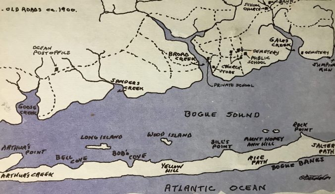
Map of the western end of Bogue Banks and Bogue Sound around 1900. From Kay Holt Robert Stephens 1984 work, “Judgment Land: The Story of Salter Path,” vol. 1.”
Our Coast’s history: The early days of Bogue Banks
CoastalReview.org
On November 30, we celebrated Giving Tuesday, a global day of giving, and the results are in: In just 24 hours you helped us raise $1,500 for our OBX national parks!
| |||||||||||||||||||||||||||||||||||||||||||||||||||||||||||||||||||||||||||||||||

Atlantic Yacht Basin, A CRUISERS NET SPONSOR, is located just south of the Great Bridge lock and bridge at Mile Marker 12 in Great Bridge, VA.
| |||||||||||||
Click Here To View the VA to NC Cruisers Net Marina Directory Listing For Atlantic Yacht Basin
Click Here To Open A Chart View Window, Zoomed To the Location of Atlantic Yacht Basin
Gulfport Municipal Marina, A CRUISERS NET SPONSOR, and the City of Gulfport always have a full calendar of events for all ages. The marina and harbor, found on the northern shores of Boca Ciega Bay, are easily accessible from the Western Florida ICW, just north of Tampa Bay.
| ||||||||||||||
Click Here To Open A Chart View Window Zoomed To the Location of Gulfport Municipal Marina
Click Here To Open A Chart View Window Zoomed To the Location of Gulfport Anchorage/Mooring Field

A longtime CRUISERS NET SPONSOR, historic Edenton always has an exciting calendar of events! Edenton is at the mouth of the Chowan River on the northwest shore of Albemarle Sound.
| ||||||||||||||||||||||||||||||||||||||||||||||||
|
Click Here To Open A Chart View Window Zoomed To the Location of Edenton Harbor City Docks
Did you know that Coast Guard units served alongside the Navy firing anti-aircraft barrages against the Japanese attackers and performing harbor and anti-submarine patrols? Open link below.
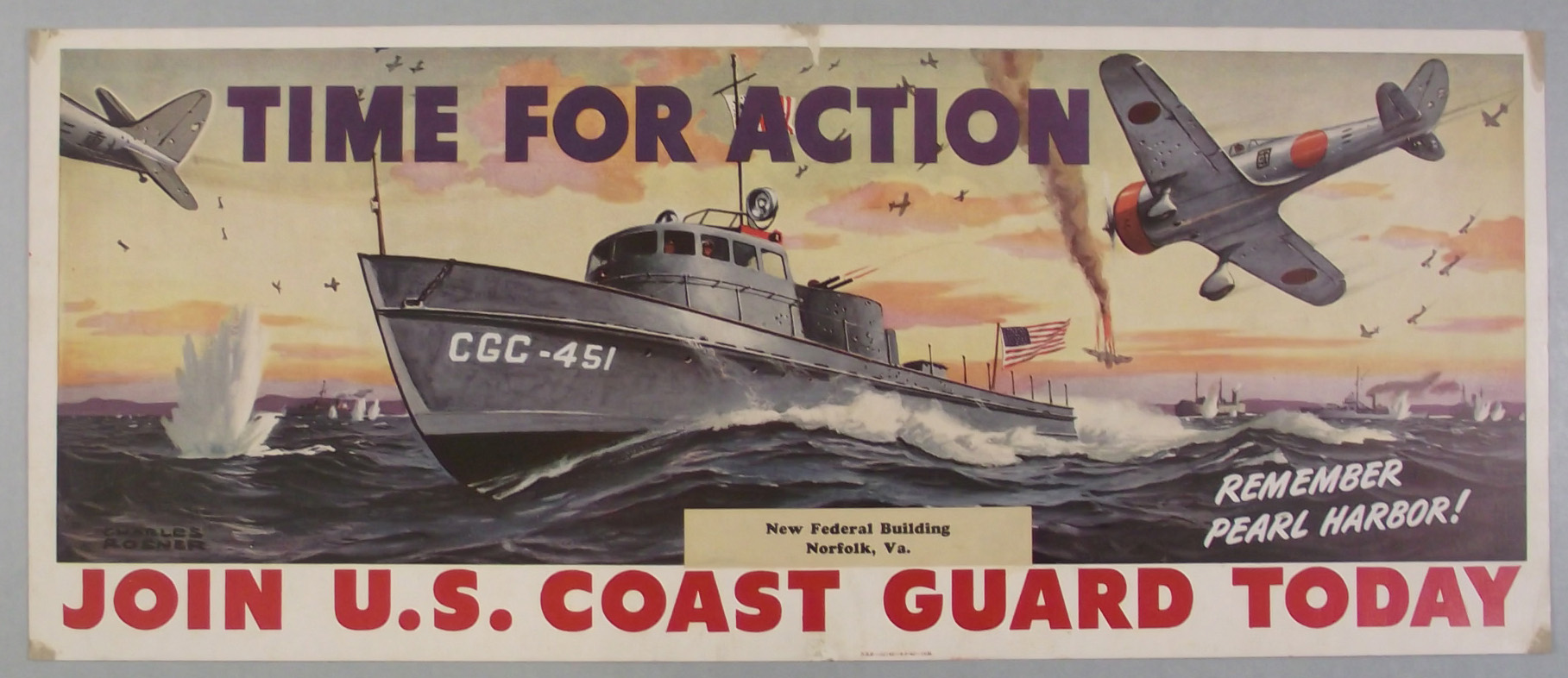
U.S. Coast Guard Commemorates the 80th Anniversary of Pearl Harbor
Maritime Executive
Gulfport Municipal Marina, A CRUISERS NET SPONSOR, and the City of Gulfport always have a full calendar of events for all ages. The marina and harbor, found on the northern shores of Boca Ciega Bay, are easily accessible from the Western Florida ICW, just north of Tampa Bay.
Click Here To Open A Chart View Window Zoomed To the Location of Gulfport Municipal Marina
Click Here To Open A Chart View Window Zoomed To the Location of Gulfport Anchorage/Mooring Field
The Florida Keys emerged from hurricane season relatively unscathed, and celebrated on Nov. 30, the last day of the storm season, by setting the red-and-black hurricane flag on fire at Truman Waterfront.

CONCH REPUBLIC BURNS THE HURRICANE FLAG IN CELEBRATION OF THE END OF HURRICANE SEASON
Keys Weekly
Plastic waste of all shapes and sizes permeates the world’s oceans. It shows up on beaches, in fish and even in Arctic sea ice.
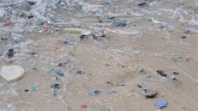
Once it reaches the ocean, plastic waste degrades into millions of small particles (CSIRO file image)
The U.S. Has a Leading Role to Play in Reducing Ocean Plastic
Maritime Executive
Research, published in the journal Nature on Thursday, found that species usually confined to coastal areas — including crabs, mussels and barnacles — have latched onto, and unexpectedly survived on, massive patches of ocean plastic.

World – There’s so much plastic floating on the ocean surface, it’s spawning new marine communities
Coastal News Today
Join a Lowcountry holiday tradition, the Charleston holiday boat parade, as this display of lighted and festive boats proceeds from the Cooper River, through the Charleston Harbor and into the Ashley River.
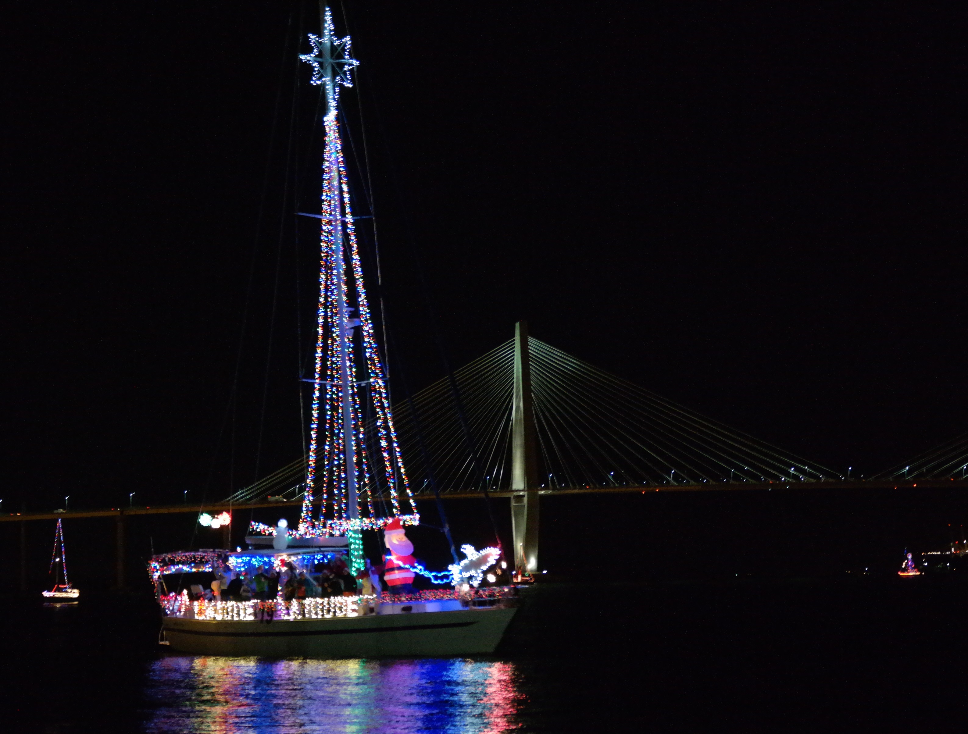
Charleston Holiday Boat Parade
visit.historic.charleston.com

Recreational fishermen in North Carolina harvest, on average, 1.1 million spotted seatrout or over 1.9 million pounds a year, second only to Florida.
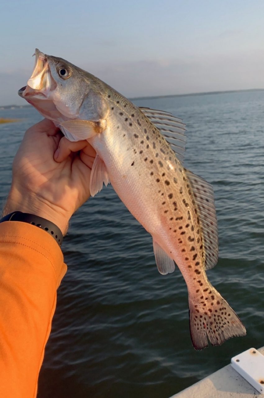
A spotted seatrout freshly caught off of the North Carolina coast. Photo: N.C. Division of Marine Fisheries
What’s on the line? Spotted seatrout, aka ‘speckled trout’
CoastalReview.org

/eblast/facebook-5e6a9236ad8e8.png)
/eblast/twitter-5e6a92508a531.png)
/eblast/instagram-5e6a9243c9493.png)
/eblast/youtube-5e6a925625a29.png)
/eblast/printest-5e6a924a0b73c.png)


Comments from Cruisers (1)
What are the requirements if arriving by boat. Consider the fact that it could take 4-5 days Jacksonville, FL to the Bahamas on the ocean or you could blow a 3 day test waiting for an appropriate weather window to leave FTL or , WPB or MIA and cross to the West End or Bimini.