Boats are Being Abandoned on SC’s Shores
Our thanks to Ted Ariska for posting this article in Save South Carolina’s Anchorages.

Boats are being abandoned on SC’s shores. Why? And what’s being done about them?
Island Packet
Our thanks to Ted Ariska for posting this article in Save South Carolina’s Anchorages.
Boats are being abandoned on SC’s shores. Why? And what’s being done about them?
Island Packet
This article begins in the heartland, but scroll down for an east coast discussion. On the east coast, marine highway projects already have a high profile. Consider the 64-Express, at the Port of Virginia’s Richmond Marine Terminal, on the James River, operating since 2008. The Port estimates that 2020 barge transport eliminated nearly 20,000 truck trips. Many people are at least generally aware that one barge can carry 1,750 tons of dry cargo, a volume requiring 16 rail cars or 70 trucks.
Inland Waterways: A Crucible of Issues
Maritime Reporter – Tom Ewing
Recent unusually high tides in the coastal Carolinas have almost certainly brought floating and submerged debris into the channel. Also, bridge heights may be reduced by as much as 4ft. See High Water. Tide boards at bridges are generally unreliable – wait for low tide and keep a sharp watch on the channel for debris.
Brightline rail service, begun in 2017, see Brightline Express, resumed service today after a 19 month halt. Brightline has been a bone of contention and debate for boaters well before the service began due the increased number of RR bridge closings over major eastern Florida waterways.
Unchecked shoaling along the water passage in Georgia costs the state and communities that dot it a small fortune in lost revenue. But the head of an Atlantic Intracoastal Waterway Association, Brad Pickle, whose members ply the waters of the ICW, says things are looking up. See November 2021 AIWA E-Newsletter. Cruisers Net is Proud to be a member of the Atlantic Intracoastal Waterway Association.

Improvements made to Atlantic Intracoastal Waterway | Local News
The Brunswick News
The entrance to Sapelo Sound has been a shoal prone area for some time. See Shoaling Reported. Our thanks to Robert J Norman for this report.
| Severe shoaling has been reported by a cruising boat while entering Sapelo Sound, Georgia, between R6 and R8 causing significant damage to rudder and rig. Robert J Norman |
In 1759, a man named William Howard purchased North Carolina’s Ocracoke Island for the sum of 105 pounds sterling. But, there is more to the story, read on.
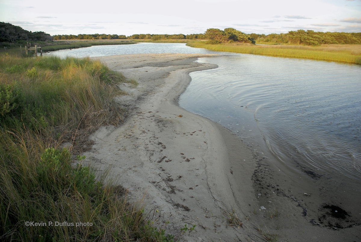
The Old Slough, Ocracoke Island. Photo: Kevin P. Duffus
Island centenarian and a pirate shared a name, maybe more
CoastalReview.org – Kevin Duffus
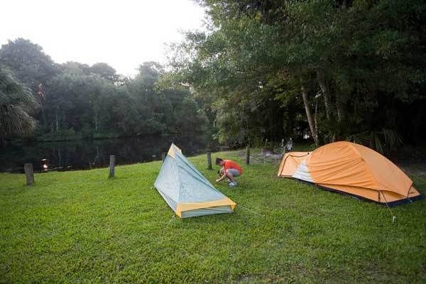
November is Manatee Awareness Month and the Florida Fish and Wildlife Conservation Commission (FWC) is reminding people on the water to slow down and look out for migrating manatees this time of year.

Manatees are in motion, it’s Manatee Awareness month
FWC
This is going to be a very difficult and complex – and hopefully science-based – discussion over the next few years. Manatee are not native to Florida; they are an invasive, if cute and cuddly, species. The "Save the Manatee" political forces in Florida have made them into a cultural icon. And, those forces have been very successful at promoting Manatee welfare. All good. Now it's time to ask, though, "perhaps, too successful?" In many areas, waterfront landowners with a vested interest in boat speed limitations on local waters found a willing partner with the Manatee welfare society forces to promote speed limiting policies.
But in places like Mosquito Lagoon and the Indian River Lagoon, and around power plants all across the state, and other places, too, a not unreasonable question to ask is, "do we have more non-native Manatee now than the area could ever support "naturally," and are they dying of starvation because the carrying capacity of their adopted habitat is over-populated?" This will not be a popular question, and I will not be popular for asking it. But the fact is, the geological makeup and natural character of these large East Coast Florida lagoons do not have much natural drainage, and their waters are not naturally self-cleansing and self-refreshing. Heavy industry (including NASA) and ENORMOUS regional population growth have undoubtedly contributed to pollutions in these waters of poor natural circulation and refreshment.
Society is going to have to do some really serious evaluation and balancing of conflicting needs as this one goes forward. And, society is going to have to make some really difficult choices, too. Ain't no pet interests gonna get outta this one without scrapes and bruises. I wonder, for example, how many septic systems drain into Mosquito Lagoon and the Indian River Lagoon in the dozens of municipal blocks that neighbor those waters? It'll take a couple of generations (of humans) to get just that detail cleaned up. And millions of $$$$. And the bureaucracy! Oh, the bureaucracy that will be created! Because this problem does NOT feel like a one-size-fits-all solution will meet the needs all across the state of Florida.
A truly confounding problem, to be sure. I hope we're up to it as a society.
We recently saw a Manatee in South Lake just off the Alligator River in NC. Manatees are everywhere we learned. Florida's efforts to protect them make it sound like they are just residents of that state. In a couple months, they will be. Florida needs to do a better job of informing boaters all the way to New England that "their" Manatees can be found anywhere. Boaters need to keep an eye out all the way down the ICW.
Charts are about to change in a big way. The paper charts we’ve used for decades are going away. So, too, are their electronic cousins, called Raster Navigational Charts. NOAA Custom Chart (NCC) is an online application that enables users to create their own customized nautical charts directly from the latest official NOAA electronic navigational chart (NOAA ENC®) data.
The accuracy of future charts depends on all of us using NOAA Custom Chart today.
PassageMaker
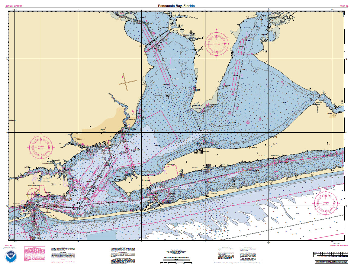
NOAA Custom Chart of Nantucket Island, Massachusetts
Greg Allard is an experienced cruiser and longtime contributor to CRUISERS NET. We are pleased to post his latest article, “Easy There, Pal,” as it appears in PASSAGEMAKER magazine. Thank you, Greg! For more articles by Greg Allard, type Allard in the search window of our Homepage.

Trawlers traveling together share the solitude of a remote anchorage at Warderick Wells in the Bahamas. Jim Pope
Four generations of Palm Coasters have enjoyed this unique annual celebration, now the largest boat parade in Central Florida. Home to CRUISERS NET SPONSOR, Palm Coast Marina, Palm Coast is located between St Augustine and Daytona Beach.

A ballet of boats: the Palm Coast Holiday Boat Parade under a full moon Dec. 18 | Palm …
Palm Coast Observer
Click Here To View the Cruisers Net Eastern Florida Marina Directory Listing For Palm Coast Marina
Click Here To Open A Chart View Window, Zoomed To the Location of Palm Coast Marina
The saga of the transport Golden Ray, with its incredible photography in which cars looked like bugs pouring out of a hive, is finally coming to a close. The Golden Ray went aground and partially capsized in Georgia’s St. Simons Sound on September 7, 2019. With numerous delays, the wreck of the capsized PCTC has taken more than two years to remove from St. Simons Sound, Georgia. See Last Section. Note: if you missed them, the earlier extraordinary photos can be accessed by typing “golden ray” in the search window of our Homepage.
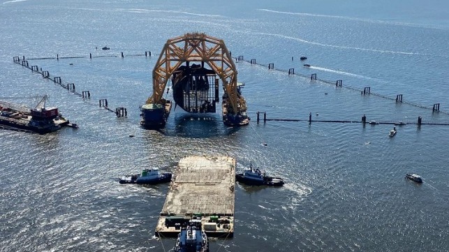
VB 10,000 carries out one of its very last lifts for the Golden Ray wreck removal, Oct. 2021 (St. Simons Sound Incident Response)
Heavy Lift Barge Departs Golden Ray Site After Yearlong Wreck Removal
Maritime Executive

Longtime CRUISERS NET SPONSOR and named “Best of Savannah” in 2021, Isle of Hope Marina lies along the northwestern shores of the Waterway in the body of a hairpin turn northwest of ICW marker 46A.

Click Here To View the Cruisers Net Georgia Marina Directory Listing For Isle of Hope Marina
Click Here To Open A Chart View Window, Zoomed To the Location of Isle of Hope Marina
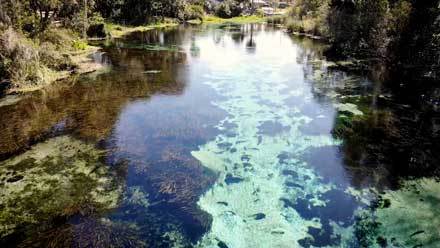
A very interesting read about the health of NC waters and the Pamlico River, home to two CRUISERS NET SPONSORS, Washington City Docks and McCotters Marina. See also Blue-Green Algae in Blounts Bay.
Paddlers’ trip highlights issues, beauty along the Pamlico
CoastalReview.org
AREA SPONSORING MARINAS
Click Here To Open A Chart View Window, Zoomed To the Location of the Washington City Docks
Click Here To View the North Carolina Cruisers Net Marina Directory Listing For McCotters Marina
Click Here To Open A Chart View Window, Zoomed To the Location of McCotters Marina
A spooky South Carolina legend for Halloween!
South Carolina’s ghostly Gray Man legend offers lessons in hurricanes and shared stories
Post and Courier
The Alliance for the Blue Economy (“All Blue”) is a local, multidisciplinary initiative to establish Wilmington and southeastern North Carolina as a national and global leader in the Blue Economy.
The Alliance for the Blue Economy
CoastalReview.org
The saga of the transport Golden Ray, which went aground and partially capsized in Georgia’s St. Simons Sound on September 7, 2019, may finally be coming to a close. With numerous delays, the wreck of the capsized PCTC has taken more than two years to remove from St. Simons Sound, Georgia. See Last Section Emerges.
Last Section of Golden Ray Removed From St. Simons Sound
Maritime Executive
As the District celebrates 60 years protecting water resources and ensuring the public’s water needs are met, it is important to plan for the state’s future water supply.
|
Cruisers Net recommends mandatory boating education classes for ALL persons in ALL states before being allowed to operate any powered vessel, especially with the COVID induced increase in boat ownership. Yesterday’s “runabouts” with 25hp outboards are today’s 17ft heavy center consoles with 200hp.
Florida boaters should take a boat education class to avoid crashes – TC Palm
TC Palm


Comments from Cruisers (1)
The problem is NOT owners abandoning their boats. The problem is typical government bureaucracy unable to take charge, FINE the most recent owners of these boats AND make THEM pay for removal. Just complaining about abandoned boats does not effect a solution.