IN THIS ISSUE– A big tree for big spaces – Watch: DNR dolphin rescue – Bird news: youth winners, Joro worries 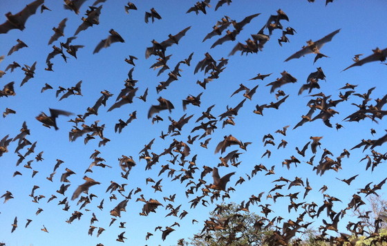
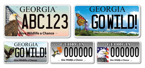
Studies rate Brazilian free-tailed bats one Earth’s fastest mammals. (Ann Froschauer/USFWS) Brazilian free-tailed bats are one of the 16 bat species native to Georgia. But make no mistake, their speed sets them apart. As does their ability to fly high and far. Also called Mexican free-tailed bats, these small bats with narrow, long wings have been clocked at a blistering 99 mph in level flight. That makes them one of the world’s fastest mammals. They also can fly as high as 10,000 feet, although often they’re only a half-mile or so up. And although they usually feed within a 50-mile radius of their day roosts, they can forage as far as 150 miles away in a night, says Katrina Morris, a program manager with DNR’s Wildlife Conservation Section. Brazilian free-tailed bats are big eaters, too. In Texas, they and other “house” bats eat an estimated 6,600 to 19,800 tons of insects a year, limiting damage to crops. So how can you help conserve these fast bats, and others? Two quick answers: - Buy an eagle or monarch butterfly license plate, or renew one of these or a hummingbird tag. Up to 80 percent of the $25 fee goes directly to wildlife.
- Donate to the Georgia Wildlife Conservation Fund at gooutdoorsgeorgia.com. No account? No problem. Just click “Licenses and Permits” to create one.
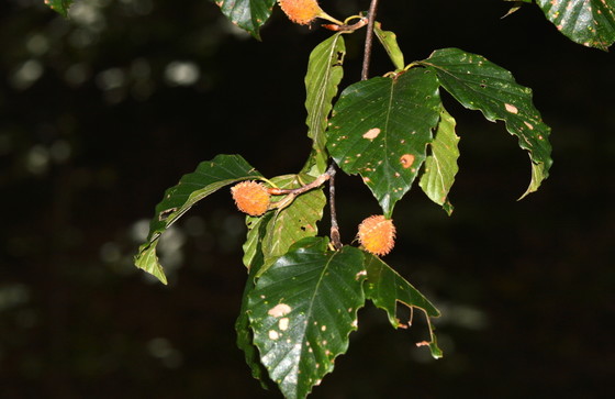
American beech on Big Lazer Creek WMA (Terry W. Johnson) By TERRY W. JOHNSONMost of the suggestions I offer about enhancing your property for wildlife are applicable to yards of almost any size. But this month, my recommendation is best for big yards – really big yards. That’s because I’m talking about the American beech. This tree is extremely valuable to wildlife, from its protein-packed beechnuts to its role as a host for some moths and butterflies and even as a source of insects that feed scores of bird species. However, the slow-growing but potentially massive American beech – which can top 125 feet tall and sport a 60-foot-wide canopy – is not suited for average-sized yards. That said, it’s a shame that beeches are hard to find these days. … Read Terry’s column exploring the beauty and value of the American beech. Terry W. Johnson is a retired DNR program manager and executive director of TERN, the Wildlife Conservation Section’s friends group. Check out past columns, his Backyard Wildlife Connection blog and his book “A Journey of Discovery: Monroe County Outdoors.” Permission is required to reprint his columns. 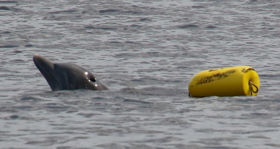
Weighed down by the crab trap, the entangled dolphin surfaces for air. (Ashley Raybould/DNR) North Atlantic right whales entangled in commercial fishing gear is a familiar headline. But DNR staff also deal with a lesser-known entanglement: bottlenose dolphins caught in crab trap buoy lines. While involving a much more common species and on a much smaller scale, these incidents can still mean life or death for the animal. Or in a case this summer, an adult dolphin and her calf. Alerted by DNR Range Safety Officer Kevin Michaud to a dolphin in trouble near Richmond Hill Aug. 4, senior wildlife biologist Clay George and crew arrived to find the buoy rope of a trap wrapped tightly around the dolphin’s tail. With the weight of the trap pulling her under, she struggled to surface and breathe. Most dolphin entanglements are straightforward. Not this one. “She had managed to roll and twist over 20 feet of rope around her tail,” George said. Complicating matters, dolphins can die suddenly from the stress of being entangled. The quicker they’re released, the better. And this dolphin had a calf close by, one too young to survive alone. The four-person team followed a basic plan. Snag the line. Control the tail. Loosen and determine where to cut the rope – fast. Slice carefully. All while hanging onto a thrashing 300-pound mass of muscle. It worked. The dolphin swam away rope-free. Her calf quickly joined her. “It’s the second case I can think of where we disentangled a mom while its calf swam around nearby,” George said. 
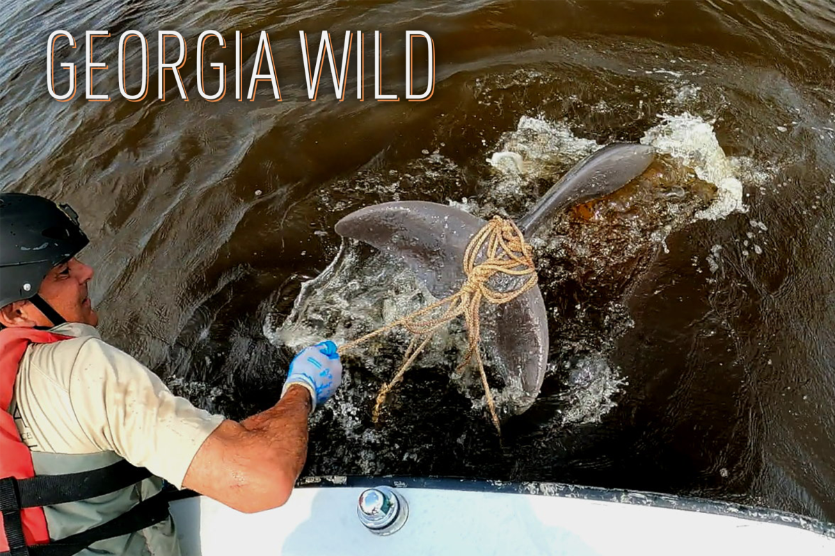
Watch as DNR’s Mark Dodd and others disentangle the mom dolphin. (Clay George/DNR) Why dolphins get entangled is not clear. Some may be trying to steal the trap bait or playing with the rope or buoy, or maybe they’re accidently caught as they swim past. While not common, entanglement also isn’t a freak occurrence. The Aug. 4 incident was the third crab-trap entanglement reported in Georgia this year and the only one that did not end in death. DNR has documented 29 confirmed and suspected entanglements since 2000. Of those, 43 percent of the dolphins died. Fortunately, this dolphin had not been entangled long. When the crabber had checked the trap that morning, she wasn’t there. WHY NOT CUT FIRSTHere’s why staff first loosen the rope and assess where to start cutting: - Loosening makes it easier and safer to slice the rope without accidently cutting the dolphin.
- The approach helps ensure all of the rope is removed so the dolphin doesn’t swim away with any, raising the risk of infection and death by constriction.
When dolphins are entangled in a crab trap buoy rope, the trap acts like an anchor. As the animal twists, rolls and pulls, the rope cinches tighter around them. WHAT YOU CAN DOIf you see an entangled, hurt or stranded dolphin, please report it immediately to DNR’s Marine Mammal Stranding Network, (800) 2-SAVE-ME (800-272-8363). Note the date, time, place and, if possible, the coordinates. | 


Be the first to comment!