Praise for Windmill Harbour Marina, Hilton Head Island, SC AICW MM 558
Our thanks to Ted Arisaka for this firsthand report during Hurricane Idalia.

Click Here To Open A Chart View Window, Zoomed To the Location of Windmill Harbour Marina


Our thanks to Ted Arisaka for this firsthand report during Hurricane Idalia.
Click Here To Open A Chart View Window, Zoomed To the Location of Windmill Harbour Marina

Our thanks to Anne Bowen of Fort Pierce City Marina, A CRUISERS NET SPONSOR, for sending us this very interesting article.

Click here for St Lucie County Artificial Reef Program
coastalanglermag.com
Click Here To Open A Chart View Window, Zoomed To the Location of Fort Pierce City Marina
|
Even with these maintenance closures, the marina will remain available to boaters, just no services at the bar, dining, and cottage rental.

The SCYC cottages, restaurant, and bar will be closed for annual maintenance from September 17th – October 1st, 2023. They will re-open on October 2nd, 2023.
South Carolina is currently one of only four US states with no boater education requirements. The new bill will add South Carolina to the majority of states that require boating safety courses for some or all boaters.
Click here for New South Carolina Boating Law Strengthens Safety Requirements
Steinberg Law Firm
As the article points out, South Carolina is one of only 4 states that did not have a similar training requirement. Whether the boater training is actually adequate or not is open for discussion. IMHO, in person classes done by the Power Squadron or USCG Auxiliary are probably pretty good – the states that only require on-line computer classes that comply with the content standard not so much.
I lived in the Midwest until the mid-90's. My state already had a law back then. And like the South Carolina law, the requirement is for everyone whose birthday is prior to a certain date. Anyone younger than about 45 from my former home has to have had the training by now, or to get it if they acquire a boat.
Since most fatal boat accidents involve excess alcohol, I suspect that you are right that younger boaters in their 20's and 30's are probably involved in a disproportionate share of accidents. Rigorous enforcement of BWI laws would probably have a larger impact on safety than training of young people, but that doesn't make the training requirement a bad idea.
BTW, the USCG publishes statistical data on boating accidents and events like boat fires every year. Look on the Coast Guard website if you want to find it.
As a follow up on my comment last month how about a breakdown on boating accidents by age responsible?
Without that data, we're just blowing smoke and can't be sure we're actually addressing the problem.
Anyone?
I would like to see some STATISTICS on boating accidents/fatalities from states that have these laws and those that don't. And do these laws make a difference? 16 years old or younger? Like driving a car, I suspect many if not most boating accidents are caused by older teenagers and those in their 20s.
Vibrio is a vicious, flesh-eating bacteria that can kill within 48 hours of exposure to warm, brackish water.

Original locations of the 709 confirmed nonfoodborne V. vulnificus infections reported to the Cholera and Other Vibrio Illness Surveillance, or COVIS, database between 2007 and 2018 within 125 miles of the coast, in blue. Graphic: “Climate warming and increasing Vibrio vulnificus infections in North America” report
Click here for Scientist urges more Vibrio awareness as risk moves north
CoastalReview.org
The South Carolina barrier island just 30 minutes from Charleston may just be the area’s best-kept secret and, of course, is home to CRUISERS NET SPONSOR, Isle of Palms Marina.
Cruisers Net was advised this morning that the “Ships Store” at Isle of Palms marina is fully open and available to all. Fully operational. Boaters are invited to visit IOP and enjoy all the amenities.
Click Here To View the South Carolina Cruisers Net Marina Directory Listing For Isle of Palms Marina
Click Here To Open A Chart View Window Zoomed To the Location of Isle of Palms Marina
There are a litany of good reasons to travel with other vessels, but due diligence is required to have realistic expectations.
Click here for Buddy Boating by Bob Arrington from Passagemaker, September, 2023

Key Lime Sailing Club, A CRUISERS NET SPONSOR, always has very special offers for their visitors! Key Lime Sailing Club is a unique slice of KEYS ENJOYMENT…give it a try and let us hear about your experience.
| |||||||||||||||||||||||||||||||||||||||

HIGHFIELD, A CRUISERS NET SPONSOR, is the leading builder of aluminum-hulled RIBs. Performance and strength are the key features of every HIGHFIELD RIB. Their advanced hull designs and Italian-influenced interior styling, keep alive the reputation of a dry-riding, seaworthy and stable craft that can handle rough conditions, as well as please the discerning eye.

Always a pleasure to find a sponsor’s product on the water, in this case, Ego Alley.

Click here for NOAA’s Ocean Today – Learn how El Niño Contributed to Record Ocean Warmth
NOAA
Cruisers Net is proud to be a member of the Atlantic Intracoastal Waterway Association whose lobbying work is crucial to keeping the Waterway navigable and safe. Your membership dollars directly support their vital work. Please join and encourage your boating neighbors to do likewise, regardless of their homeport.
|
No self-respecting Chesapeake cruiser would miss the opportunity to tie up in the narrow waterway that is Annapolis City Dock, affectionately called Ego Alley. Thanks to Winston Fowler for this shot.

Harbour Town Yacht Basin, A CRUISERS NET SPONSOR, is ready for your reservation with newly renovated docks, upgraded electrical service and onSpot WiFi, also a CRUISERS NET SPONSOR. And, as always, numerous activities at the Sea Pines Resort are offered for your enjoyment, as you will see in the Event Schedule below. Hilton Head Island is absolutely marvelous any time of year.

Click here for September 2023 Events

Click here for The sand waves of Hatteras: ‘on a mission of death’
CoastalReview.org

Our thanks to Capt. John Easley for granting permission to reprint this article originally posted on Forum at America’s Great Loop Cruisers Association.
On a fairly regular basis, people call or write to me asking about the process of hiring a captain to help move their vessel. Often, the move will involve training the new owners on the boat’s systems and effective handling. Sometimes they relate some absolute horror stories of previous captains they have hired. Stories about captains who refused to let them drive and offered little to no instruction, stories about captains that showed up late, surly, and drunk, and even one story about a captain that tied up their boat at an overnight stop and walked away without even saying goodbye.
Many of you already know me… I am a USCG-licensed 100 ton Master (captain) and a proud sponsor of the America’s Great Loop Cruisers Association (AGLCA). Here are my thoughts on finding a good crew:
You can get a feel for the potential for a good working relationship by asking a few questions and looking for a couple of traits. Sound like an interview? Well, it is. But, if you approach it like a conversation, it need not be stressful.
First, ask about the kinds of vessels on which the prospective captain acquired his or her sea time; the kinds of vessels they normally run. There are 500 ton captains out there, trying to break into the recreational vessel delivery business, and all of their sea time was acquired while working the deck of a large tugboat working the Mississippi River. What makes them think that experience translates to a 50’ motor yacht? There is at least one captain trying to break into the motor yacht delivery business and his or her sole experience is on 25’ center console fishing boats. Maybe he or she is very good. Or maybe they need some progressive experience working up to a 60’ Hatteras before trying to train someone else on how to dock one in a modest wind. Those are decisions you will need to make in order to feel comfortable with your crew selection.
There are stories of captains that quickly tell you what they’re going to do for you and that’s that. Want more? Look for the person that listens to what you want, asks questions about your previous experience, discusses your needs, and tailors their service to fit.
Perhaps you have a business or personal obligation that will keep you from making the journey to relocate your vessel to its new home port. Now you’re looking at trusting your multi-hundreds of thousands of dollars baby to a crew you likely haven’t even met. You have every right to ask for references. Also, an experienced captain will have a way to keep you informed of your boat’s location and status through the travels. He or she may also discuss parameters for handling any necessary repairs while underway.
A common question is about the costs involved in hiring a captain. We all have pretty much the same terms: A daily rate, transportation to and from the vessel, and meals. Fairly standard. The daily rate might vary a little from one captain to another but if you’re talking to one who has a rate far exceeding the others, you have every right to ask why. What does this person do that is so special it is worth the extra high fee? The other side of the coin is the one whose rate is well below the average of the others you speak with.
A service-friendly captain will also be able to handle special requests. Driving for a special event so the owner and guests can relax, helping the bride and groom escape/depart from a reception, boat naming ceremonies, spreading a loved one’s ashes at sea, or incorporating teens into the deck hand duties. We often get calls to join the boat to help with a Gulf of Mexico crossing or crossing to the Bahamas from Florida. We handle such requests like water rolling off a dolphin’s back.
Captains aren’t hard to find. Ask your broker or the dockmaster at your local marina or a fellow boater on a vessel similar to yours. Chances are you’ll have a fistful of names in short order. There are a number of licensed captains who are also AGLCA sponsors. You can find a list of us on the AGLCA website or by asking other members. We’re here for you and ready to discuss your needs. Drop us a note or give us a call. Happy boating!
John Easley
Key Lime Sailing Club, A CRUISERS NET SPONSOR, always has very special offers for their visitors! Key Lime Sailing Club is a unique slice of KEYS ENJOYMENT…give it a try and let us hear about your experience.
| |||||||||||||||||||||||||||||||||||||||||||||||||||||||||||
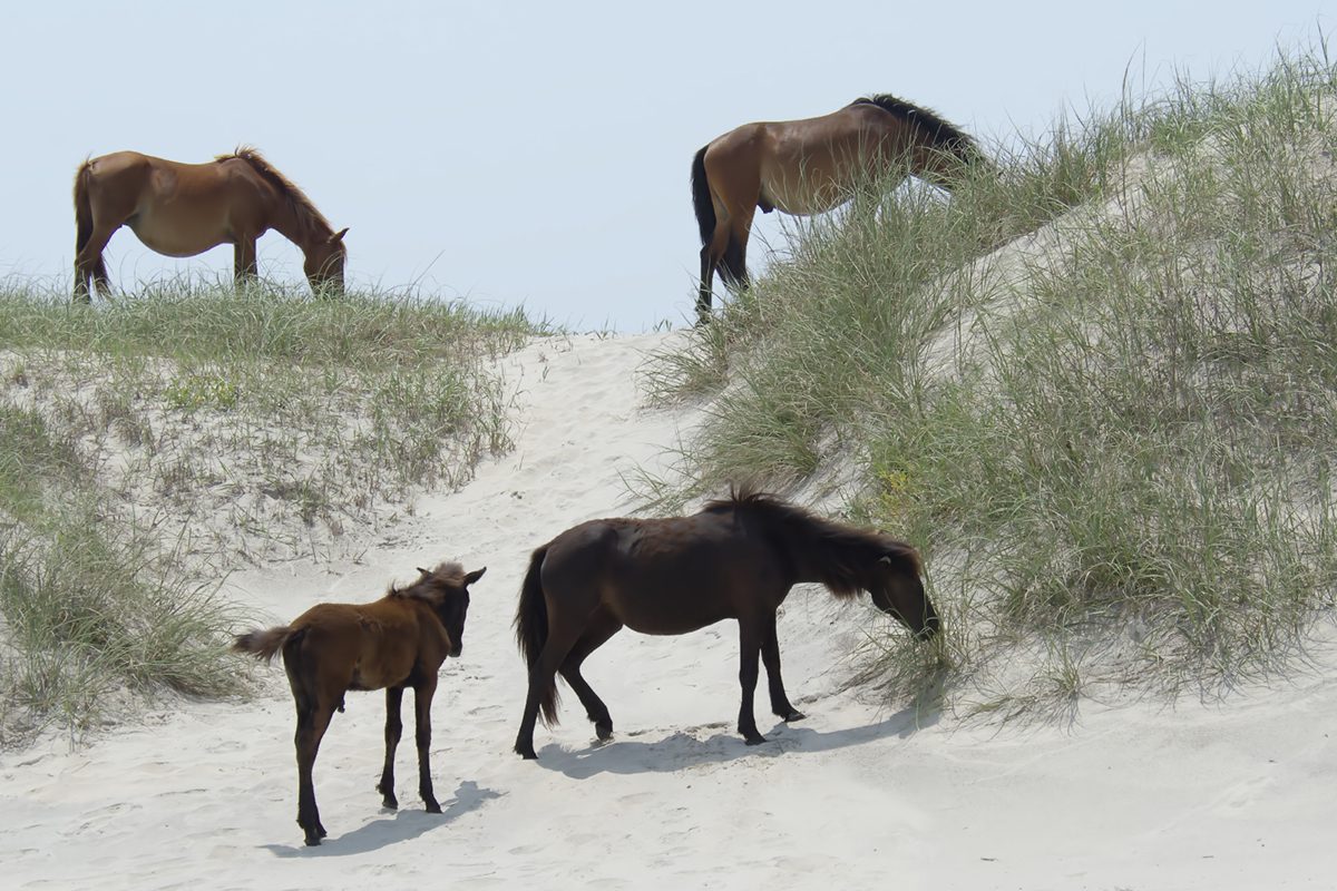
A harem at Currituck National Wildlife Refuge includes, clockwise from top left, Orlanda, Renzi; Cedar and her younger brother foal Drum. Photo: Kip Tabb
Click here for Manager says Corolla horses look ‘marshy’ for good reason
CoastalReview.org
Browns Island is the area north of Browns Inlet on the east side of the AICW.
Click here for Tourists won’t stay away from this deadly Marine Corps island
Task and Purpose


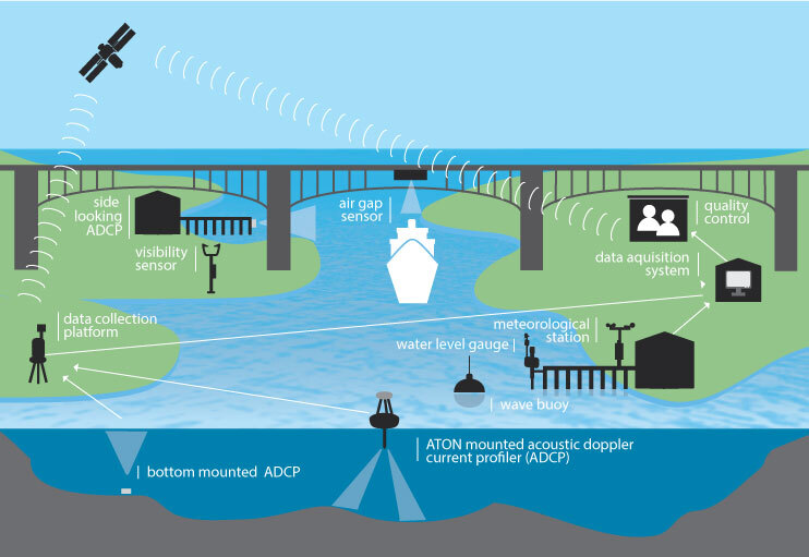
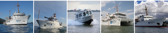
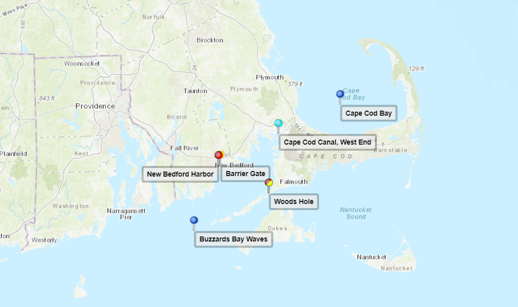
 Earlier this year, NOAA’s Office of Coast Survey released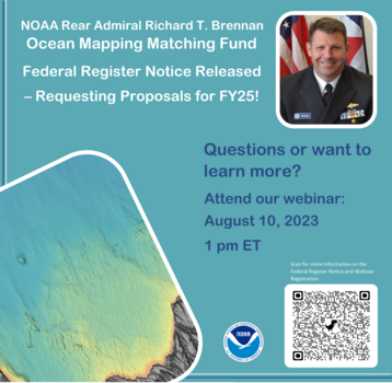



 Maybe it does get better. Stay at our base camp, Key Lime Sailing Club and Cottages while taking the class(es) and receive 25% OFF your cottage too!


 ️
️ 






Be the first to comment!