ON DECEMBER 31ST, A SAFETY ZONE WILL BE IN EFFECT FOR A FIREWORKS DISPLAY ON THE BEAUFORT RIVER ADJACENT TO THE BEAUFORT WATERFRONT. THE SAFETY ZONE INCLUDES ALL WATERS WITHIN A 150-YARD RADIUS OF THE FIREWORKS BARGE FROM 8PM TO 10PM. NO VESSELS OR PERSONS MAY ENTER, TRANSIT THROUGH, ANCHOR WITHIN, OR REMAIN WITHIN THE DESIGNATED AREA UNLESS AUTHORIZED BY ON-SCENE OFFICIAL PATROL.
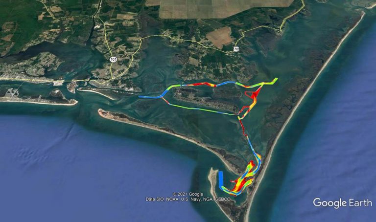
Cape Lookout Bight is a wonderful, natural harbor formed by Cape Lookout’s curve of land. This superb anchorage, one of the most popular in North Carolina, The channel between Harkers Island and Cape Lookout Lighthouse has been widened to 100 feet with depths ranging from 7 to 9 feet. This is good news for cruisers wishing to anchor in Cape Lookout Bight southeast of Beaufort.
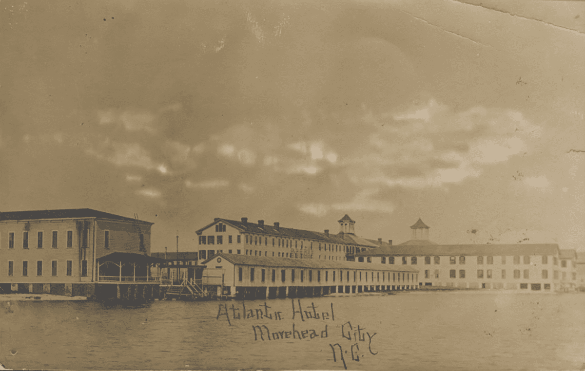
The Atlantic Hotel, a long-gone Morehead City attraction, is shown in 1909. Photo: Tabitha Marie DeVisconti Papers, East Carolina University Digital Collections
Morehead City is in the center of coastal Cataret County, NC.
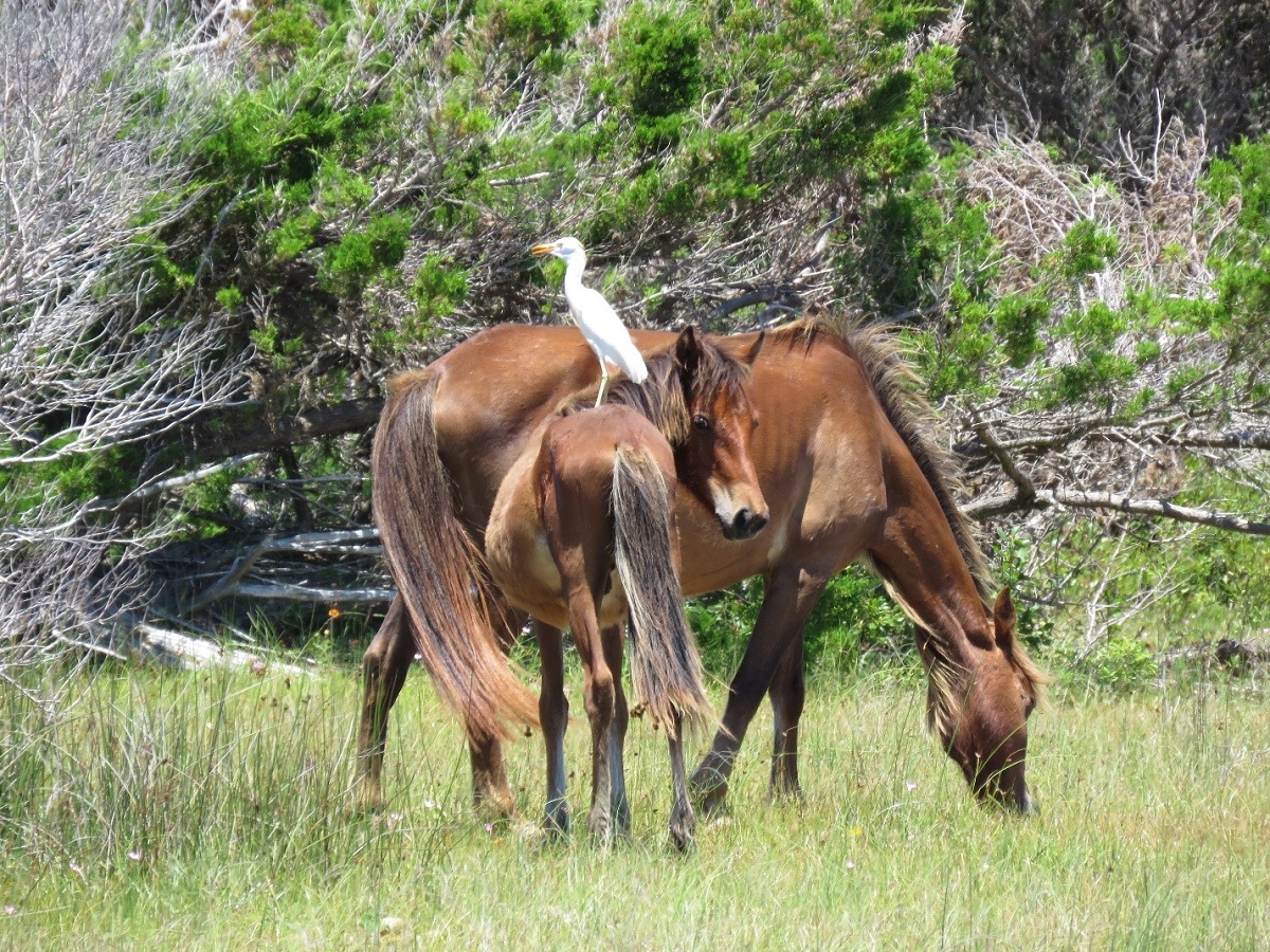
In our county history series: Colonial beginnings, Civil War battles, maritime industry, fishing, tourism and coastal living among Carteret’s numerous draws.
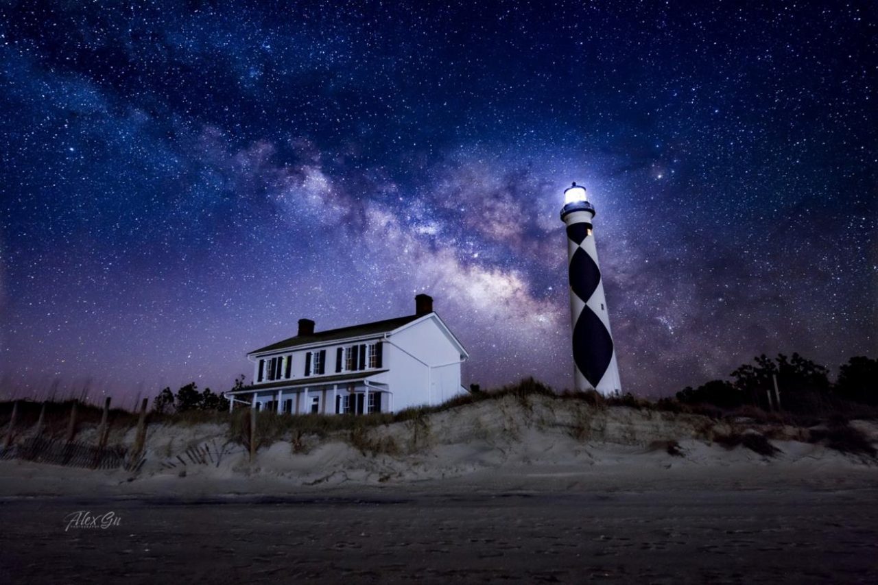
Cape Lookout National Seashore has been certified as a Dark Sky Place, the first in the National Park Service on the Atlantic coast to receive this certification. The popular Cape Lookout Bight anchorage is practically in the shadow of Cape Lookout Lighthouse. In rough offshore weather, cruisers with shallow draft may choose to access the anchorage via Taylor Creek and Barden Inlet which separates Shackleford Banks and Core Banks. See Dark Sky Park.
Cape Lookout Lighthouse under the night sky. Photo: Alex Gu/Crystal Coast Stargazers
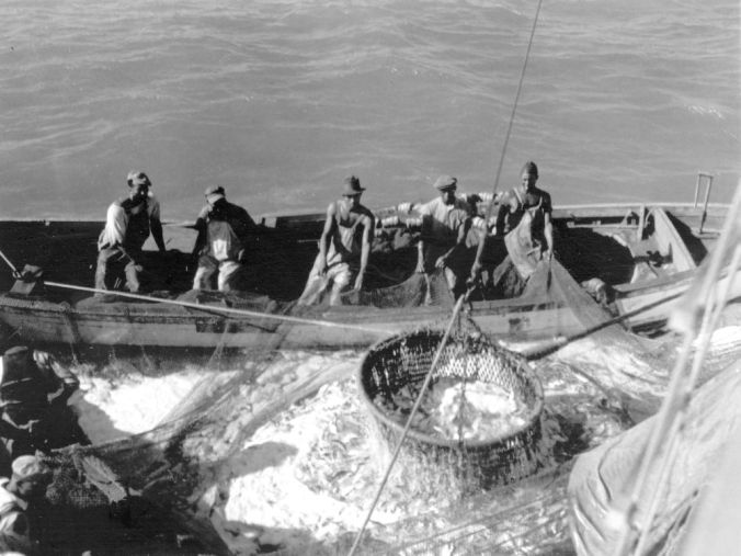
David Cecelski looks further into the work of photographer Charles A. Farrell, who documented fishing communities across the North Carolina coast in 1930s, including the menhaden industry in Beaufort and Southport.
To access the Cape Lookout Anchorage when the oceanside waters are kicking up, cruisers with shallow draft who wish to anchor in Cape Lookout Bight may choose to access the anchorage via Taylor Creek and Barden Inlet which separates Shackleford Banks and Core Banks. See Numerous ATON Changes.
Waters near Cape Lookout have become increasingly perilous because of shoaling and shifting channels, despite a two-year-old agreement between Carteret County and the National Park Service that has provided more than $5.67 million for dredging.
The Coast Guard is making more than two dozen changes to aids to navigation near Shackleford Banks and Harkers Island in Carteret County. In rough offshore weather Cruisers with shallow draft who wish to anchor in Cape Lookout Bight may choose to access the anchorage via Taylor Creek and Barden Inlet which separates Shackleford Banks and Core Banks.
The popular Cape Lookout Bight anchorage is practically in the shadow of Cape Lookout Lighthouse. In rough offshore weather, cruisers with shallow draft may choose to access the anchorage via Taylor Creek and Barden Inlet which separates Shackleford Banks and Core Banks. These shallow, sparsely marked waters require a constant eye on the depth finder.
Morehead City Yacht Basin, A CRUISERS NET SPONSOR, is located on the southern flank of the marked channel that runs west from Mile 203 of the Waterway, just north of the Morehead-Beaufort high-rise bridge.
Update for Morehead City Yacht Basin
“Morehead City Yacht Basin is open for transients and fueling. Morehead City does not show any signs of limiting boaters ability to re-provision in the city as Beaufort, NC has done. North Carolina is under an Order by the Governor to not limit any movement to essential needs like food, medical, fuel, etc. You may do so in Morehead City as long as it is essential. The restaurant next to the marina, Floyd’s, remains open to take out, as well as several other restaurants in the area. We ask that you stay on your boat except for any essential needs and that you use social distancing throughout the marina. We have a limited staff that will help you dock and fuel. We ask that you give a credit card over the phone as well as an email address for the reservation form and receipts.”
Morehead City Yacht Basin, A CRUISERS NET SPONSOR, is located on the southern flank of the marked channel that runs west from Mile 203 of the Waterway, just north of the Morehead-Beaufort high-rise bridge. Our thanks to Bru Brubaker for these king words.
We continue to stop at Morehead City Yacht Basin because of good protection, proximity of restaurants, GREAT dock hands, clean facility, good bathrooms, easy off and back on ICW, and the nice boaters who use this marina. If fueling and/or pumping out, pay attention to the floater in the basin; the depth is shallow outside it. The Ruddy Duck Restaurant has outstanding crispy duck in a serving large enough for lunch seconds the next day. Bru Brubaker
Congratulations to Morehead City Yacht Basin, A CRUISERS NET SPONSOR, for their placement in this annual competition. Morehead City Yacht Basin is located on the southern flank of the marked channel that runs west from Mile 203 of the Waterway, just north of the Morehead-Beaufort high-rise bridge.
Morehead City Yacht Basin has earned Honorable Mention as a top contender in ValvTech’s annual Best Marinas award competition. “With so many deserving marinas having excellent qualifications, picking a winner is no easy task. Congratulations to Conch Harbor,” said Marvin Griffin, President of ValvTect.
“I would like to mention the other top contenders for this award – Newport Yachting, Noank Shipyard, Haulover Marine Center, Bayport Marina, Camden on the Lake Marina, Point Oasis Marina, Morehead City Yacht Basin, Swanton Marina, Algonac Harbor, Concord Marina and Pier 1000. Congratulations to all,” he added. ValvTect judges entries based on operations, commitment to customer service and environmental stewardship.
Beaufort is a major port of call for Waterway cruisers and the harbor is home to Morehead City Yacht Basin, A CRUISERS NET SPONSOR! Happily, the marina is up and fully functional following Florence. Our thanks to S.A. Scudder for this story link.
Beaufort staff to crack down on derelict boats Posted: Saturday, September 29, 2018 11:30 pm BEAUFORT — Town officials are taking the initial steps to rid Beaufort of illegal moors and anchored boats.
Bob and Ann Sherer, authors of 2017 ICW Cruising Guide and their popular blog, http://fleetwing.blogspot.com/, generously continue to share their research of Waterway trouble spots with our readers. Having run aground in the often shoaled Russell Creek “shortcut” into Beaufort’s waterfront, this editor can vouch for the area’s confusing array of buoys. Thank you Bob and Ann!
We’ve all faced a passage where the buoy placements don’t match our charts but when it happens at an already confusing area, it’s doubly confusing – especially whens the new buoys don’t seem to make sense. The junction between the ICW and the channel to Beaufort, NC, is such and area. The Coast Guard made major revisions to the buoys in the area and the charts have not caught up with the changes. Not even Navionics which usually does a very good job shows all the buoys in their correct positions. I used the updated light list to show the correct placements compared to what’s on most charts.
First, here’s the area of interest: Here’s the NOAA ENC chart for the junction: Now for the surprise, the actual buoy placement after the Coast Guard got done:
What a difference! 28A is gone, RS has been moved northward, and 30A and 30 have been moved. Imagine the confusion in approaching this area from the north when all you have is a NOAA ENC chart which most of the chartplotter manufacturers base their own charts on. For more information on the changes and how charts from different chart providers compare see: When Charts Lie: Part I When Charts Lie: Part II
Be the first to comment!