With two recent groundings at this AICW Problem Stretch, we are upgrading these reports to a Nav Alert. Until dredging is done, slow speed and mid to high tide is recommended for this intersection. Thank you Michael and Ken for sharing these incidents and SSECN is glad neither of you sustained damage in the grounding, other than your pride!
Coming south 16Aug16 at +1′ above low. Draw 4′. At idle speed ran hard aground in mid-channel just past green buoy. C-Map charting [updated Sep15] shows channel angles sharply toward red at the green buoy — should have followed its suggestion. My mistake was to “stay mid-channel.” The bottom raised VERY quickly, almost a wall. After backing off, saw above 10′ in area on line between reds. Michael Loy
We were also headed south through this stretch on August 14. We draw 3 feet. Just past the green we also ran hard aground. We were in the channel toward the red side as recommended, but not quite on the line between the two reds. There was no warning on the depth meter before it was too late. We were able to get off eventually using bow and stern thrusters and some wakes from passing small boats. We didn’t incur damage except to our equanimity. Captain Ken Hirsch
Keeping in mind that rapid changes in shoals at inlet intersections is not unusual, RodC offers this January 2016 ACOE survey:
Latest ACOE survey for the area – clearly shows the traditional channel is ~100% shoaled to between 2 and 4ft MLLW. What channel there is (or was as of 1-16-2016) is just to the outside on the RED side of the marks. RodC
This unique establishment, A SALTY SOUTHEAST CRUISERS’ NET SPONSOR, contains everything “coastal” from clothing, to shoes, to home furnishings and accessories, to Adirondack chairs, to say nothing of the wine section and the voluminous selection of all types of gifts and personal items.
Bill Wheeler and wife Camilla now have a second store located right across the street from our new sponsor, New Bern Grand Marina and Yacht Club in historic New Bern, North Carolina. Store Owner/Manager Debbie Richart can assist you with your selection of nautical items for you or as a gift. In our book, visiting New Bern is now a double treat.
Nautical Wheelers, 202A Craven Street, New Bern, NC 28560
These thoughtful and informative reports on the Dismal Swamp Canal, home of Dismal Swamp State Park – A SALTY SOUTHEAST CRUISERS’ NET SPONSOR – come from our good friends at AGLCA. The Camden TDA/Dismal Swamp Canal Welcome Center is located on the east shore of the Canal at Statute Mile 28 and is adjacent to the Dismal Swamp State Park where there are so many fun summer programs!
We just did the DS northbound on July 27-28. It was hot, but it’s hot everywhere. The tall trees offer some shade. We passed only one boat. No competition for dock space at the visitor center. They have free ice and air conditioning. Free docks at Elizabeth City. Brown water. Some bumps. Keith and D’Anne Weitzman “Our Backyard” Carver 3607 MY
We passed through the Dismal Swamp in the other direction in early July this year. I suggest a cooler day if possible. Be ready with bug spray or a screened in helm. Take it slow. There are small logs and branches that you can sometimes see and sometimes not see that you will bump. The ones you don’t see I think are neutrally buoyant and just below the surface. Going slow will allow them to be pushed to the side without damage. They suggest 5 mph but were were a little faster especially on the north end. We did not stop in the swamp because of the flies but we stopped in Elizabeth City at the free slips to see the town and then at Lambs overnight to make the 11:00 lock time. After the swamp, we stayed in Norfolk at Waterside and then Portsmouth. See July 2016 entry in cmosboating.blogspot.com. There are pictures of the scenery which we found very pretty particularly in the morning at the south end before the first lock (and flies). Clark on Sea Moss
We went through the Dismal Swamp in late June and were mostly alone until the north lock when two other boats caught up with us. Water levels were high and the scenery was lovely. There was some construction going on at the visitor center but the facilities were open and uncrowded. Ben and Nancy Duggar September, Camano 31
I just went through the Dismal Swamp about six weeks ago and it was fine. If you leave Elizabeth City in time to catch the 0830 or 1100 openings at South Mills and run 5 to 6 knots, you will be at Deep Creek bridge in plenty of time for the 1330 or 1530 openings and then you can make Norfolk, Portsmouth or Hampton before dark. If you are wanting to go latter, you can stay at the lock wall at South Mills, the NC Welcome station, or the wall right before the bridge at Deep Creek bridge. Deep Creek is not a great stop, lots of traffic noise, but a very short walk to Food Lion for provisions and a Burger King(I think). There is also a good anchorage after the Deep Creek lock on the right just before you reach the Elizabeth River. Ken Horton
North Carolina offers several alternative routes if you have time. The “main highway” is the ICW Route, but the barrier islands and the Albemarle offer delightful alternatives. I have an article on North Carolina on my website, here: https://gilwellbear.wordpress.com/2013/06/16/north-carolina/. Under the North Carolina tab, there are several related articles on the various alternatives. Here is a link to one that discusses the Virginia Cut and the Dismal Swamp alternative: https://gilwellbear.wordpress.com/category/cruising-practica/us-east-coast/north-carolina/albemarle-to-norfolk/. Hope they are useful. Jim Monk 36 Hull #132 MMSI #367042570 AGLCA #3767 MTOA #3436
We went thru the Dismal Swamp Thursday and Friday July 28th and 29th in a 39 krogen with a 4’6″ draft. The depth was a constant 7 ft. We bumped a few logs in the water. You need to keep a constant lookout. We stayed one night at the Dismal Swamp Welcome Center. Great trip. Mack McGahee
Assuming David is talking about the AICW intersection, this is good news for this Problem Spot. However, it is definitely wise to follow the advice David gives below and SSECN has been giving for some time: follow the markers and do NOT follow the Magenta Line in this stretch of the ICW!
McCotters Marina and Repair Yard, A SALTY SOUTHEAST CRUISERS’ NET SPONSOR, is located on Broad Creek, off the Pamlico River, a few miles downstream of the Washington, NC waterfront. McCotters is one of the largest marinas in North Carolina and its repair capabilities are impressive.
McCotter’s seems to be a laid-back, easy to just relax environment. Good price, reasonable cleanliness, reasonable repair on the docks. Only problem, which is a significant concern for the younger boaters, is the Wi-Fi notoriously goes down on the weekend just when we need it most. Scott
The intersection of the ICW and Lockwoods Folly has been a Problem Stretch for years and requires almost annual dredging. Recent reports confirm shoaling and a channel shift here, /154017 and /156435. SSECN stills recommends mid to high tide for passage through Lockwoods Folly. Our thanks to John Winter for this update on this Problem Stretch.
Came through July 12 2016 at .6 feet above low tide. Shallow at 46B. At 8 feet even make sure you follow the nuns. Red nuns are against the rocks [see second link above for channel]. Stay equal distance between Nuns. John Winter
Dredging of this perennial AICW Problem Stretch was last done in the Spring of 2014. From John Winter’s report, dredging is needed again. As always, we recommend caution and mid to high tide for this intersection. Thank you John for this update. /span>
Came through July 12, 2016 at 0.5 feet above low tide and saw 3.9 feet where all the nuns are at one point. Stopped and felt around side to side and could not find any deeper water. We draw 46″ but did not feel bottom. John Winter
Coming south 16Aug16 at +1′ above low. Draw 4′. At idle speed ran hard aground in mid-channel just past green buoy. C-Map charting [updated Sep15] shows channel angles sharply toward red at the green buoy — should have followed its suggestion. My mistake was to “stay mid-channel.” The bottom raised VERY quickly, almost a wall. After backing off, saw above 10′ in area on line between reds.
July 16, 2016 Just touched at Shalotte inlet. In the middle of the marked channel with the tide up 1.7 feet. Our draft 4.5 Ft. Felt like a sand ridge. Fortunately we are a single so no harm done. Captain Jerry Taylor
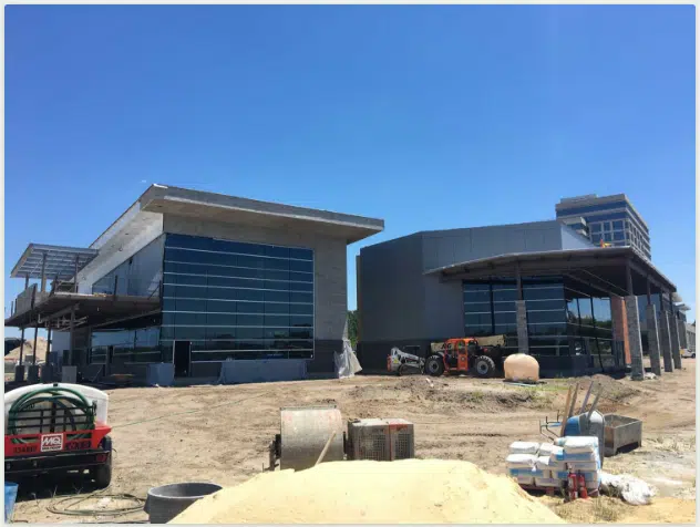
For an update on the opening-this-fall restaurant at Port City Marina, click the link below. Port City Marina, A SALTY SOUTHEAST CRUISERS’ NET SPONSOR, is located along the eastern banks of the Cape Fear River, in the heart of downtown Wilmington, NC.
A SALTY SOUTHEAST CRUISERS’ NET SPONSOR, Southport Marina is located just west of the Cape Fear River along the northern banks of the Waterway hard by flashing daybeacon #2A.
Our thanks to Contributing Editor, Captain Jim Healy, for shareing his perspective on Beaufort and Morehead City, NC, home to SALTY SOUTHEAST CRUISERS’ NET SPONSOR, Morehead City Yacht Basin, located on the southern flank of the marked channel that runs west from Mile 203 of the Waterway, just north of the Morehead-Beaufort, Newport River high-rise bridge.
Beaufort, NC: This is a seaport town near Morehead City; it’s a very pleasant, laid-back, “chillaxin'” place with a small but well done Maritime Museum, many shoppes and some nice local restaurants. For those who might enjoy a short off-shore (maybe 10 miles) cruise, depart the Beaufort Inlet and head out the the bight at the Cape Lookout National Seashore. [See Claiborne’s article on Cape Lookout.] It a large, well protected anchorage, with access to the beach for campfires and swimming. The bight itself is well protected from winds and ocean sea states, but the trip out and back can be too much for some if the wind offshore is up. Plan accordingly. Jim Healy
This wonderful expanded tour of the Albemarle Sound now includes five Salty Southeast Cruisers’ Net Sponsors. And below, SSECN Contributing Editor, Captain Jim Healy adds his thoughts on the Albemarle Loop.
Press release for the Albemarle Loop The Albemarle Loop announces the expansion of its membership by three (3) to a total of nine (9) marinas for 2016, offering free dockage and pump outs where available. Members offer two days of free dockage along with many amenities including swimming pools, golfing, tennis, restaurants and other boating necessities that make your stay at these marinas an enjoyable experience. See details of where these amenities are offered at http://albemarleloop.com/Marinas.html . The new marinas for 2016 are:
The Manteo Waterfront Marina is located in a tranquil setting less than a mile from the Roanoke Sound. It is a small, deep, and well-protected harbor, and can accommodate vessels up to 150 feet in length. Take a stroll along over a mile of boardwalks on the Manteo Waterfront. Near this site the first English colony was born on American soil. Dock your boat in the protected waters of Dough’s Creek and enjoy all the amenities this quaint island village has to offer. There are approximately 20 transient slips and 33 slips dedicated to seasonal and annual boaters. All slips feature 30 and 50 amp power, cable television, and free wireless Internet access. The air conditioned comfort station located at the marina features separate men’s and women’s bathrooms, clean showers, and coin operated washer and dryer. Boaters come to Manteo for its coastal charm and relaxed atmosphere.
Everett Marine and Cypress Cove Marina is a boating and fishing community located off the Scuppernong River about a mile west of the Columbia Docks. One of only 2 Albemarle Loop members offering both diesel and gasoline fuel, marine supplies and the only member offering repairs and a boat lift. With a friendly southern hospitality they specialize in routine marine engine service and custom installation of accessories on new or used boats. Slips feature 30 and 50 amp power, and free wireless Internet access. The air conditioned comfort station located at the marina features separate men’s and women’s bathrooms, clean showers, and coin operated washer and dryer.
The Dismal Swamp Welcome Center is a NC DOT facility providing travel and tourism to both highway and waterway traffic. With the 150’ bulkhead, numerous boats are rafted up on their transit through the canal free for one night or more depending on weather. The Dismal Swamp Visitor Center has free wireless Internet access and comfort station featuring separate men’s and women’s bathrooms and clean showers. Located adjacent to the Welcome Center, the NC State Park provides numerous opportunities for eco-tourism with an exhibit hall that allows visitors to learn the natural and cultural history of the swamp. Rangers will guide you on exciting explorations where you’ll uncover fascinating natural surroundings, and make great discoveries about the world in which we live.
The Albemarle Loop is a non-profit organization that provides the boating public with an exciting opportunity to cruise and explore the protected waters of historic Albemarle Sound. Visit the friendly communities surrounding Albemarle Sound as you share your boating experiences with other families (at a very low cost) and in high-quality marinas. Contact the Albemarle Loop at 427 Albemarle Blvd., Hertford, North Carolina, 27944 or email info@AlbemarleLoop.com or call (252) 426 – 4037 or visit http://albemarleloop.com.
Jim Healy writes:
The Albemarle sound is a shallow body of water; the “deep water” range is 12′ – 18′. These waters are home to many crab fishermen; crab pot floats are to be found virtually throughout the sound. The sound lies geographically East-West, and the prevailing winds are from the West and Southwest. Winds greater than 15 kts can raise uncomfortable beam seas for North-South crossings. Winds greater that 20 kts can produce uncomfortable chop in all directions. While not technically part of the ICW, this “loop” is centered around the ICW Routes from Norfolk/Portsmouth to the southbound ICW at the Alligator River in North Carolina. The “Albemarle Loop” is a cruising route that touches some wonderful and oft-overlooked venues. On the Crystal Coast, the towns of Manteo and Ocracoke are excellent stops. On the Western Albemarle, the towns of Edenton and Plymouth are delightful. The history of the Albemarle dates to the earliest English colonists. At Manteo, visit the Lost Colony Plantation. At Edenton, visit the revolutionary period Chowan County Courthouse, St. Paul’s Church, learn of the ladies of the Edenton Tea Party, and visit many other historical sites. Here is a link to information on the Albemarle Loop: http://albemarleloop.com. Jim Healy
Some really superb information you posted. I was searching more for Boat lift but there is only few info about this. would like to read more stuff about Lake Boat Lift… Thanks…!!
Larry… just a short note to avoid any potential confusion on Manteo’s participation. Carl Jordan, dockmaster advises that “Visitors with loop coupons will be given dockage, a free pump out and water per the Albemarle Loop guidelines on a space available basis up to 2x per year. Bathroom, Shower and laundry access and full electrical, cable and wireless access are also available at deeply disounted rates for Loopers.” Contact Carl at 252-473-3320 for further details. Thanks!
The New Bern Grand Marina lies in the heart of downtown New Bern, North Carolina, along Trent River’s northern banks between the low-level Trent River highway and railroad bridges.
James Lea’s comments are in response to a recent Local Notice re shoaling at Lockwood Folly. Cape Fear River intersects the Waterway at Mile 309. Little River Inlet lies south and east of the Waterway, right at the NC-SC state line, intersecting the Waterway at Mile 342.
This section of the ICW can be easily avoided in good weather by using Little River and Cape Fear River. Little River is well marked and frequently used by boats of all sizes. The currents in the Cape Fear River can be a challenge, particularly if the wind opposes current, but it is an all-weather entrance. In six trips up and down the ICW we have never transited this section of the ICW [Lockwood Folly], always enjoying a nice sail while listening to all the VHF chatter about passing and depths. Highly recommended. James Lea
Lockwoods Folly passing is no problem at this time! Just follow the markers as they move from time to time. If you want to be extra cautious travel through on a rising tide.
Bath Harbor Marina is located on the eastern shores of Bath Creek, north of flashing daybeacon #4. For an indepth report on Bath, see /126912 by Captains Chuck Baier and Susan Landry.
Bath Fest: Where Art Meets History! BathFest
Bath Fest 2016 is merging with the First Port Celebration to bring a combined event to Bath on May 28, 2016
Many thanks to the volunteers, vendors, and visitors who make BathFest a great success every year! For photos and additional information, visit the Bath Historic Site’s Facebook Page
Always good to hear words of praise for one of our newest SALTY SOUTHEAST CRUISERS’ NET SPONSORS! Homer Smith’s Docks and Marina are located on Town Creek in beautiful Beaufort, NC.
Went into Homer Smith last week and it is a gem and is going to be a top notch marina (actually already is). Fairly easy walk to town great folks and much easier to dock than downtown docks. Also the price is much better, facilities are much better, and the attitude and service of the owners and staff far exceeds the downtown docks. This is now the place to stay if you want to see Beaufort. He has plans for expansion and even more services down the road. Navigating from the north is a piece a cake as you do not have to go under the lift bridge (which is being replaced). Leaving to founder the bridge is same as before. North bound boats can either go under the bridge, or take the Gallants Cut (even though longer, it is easier). Extremely nice docks. John Winter
Taylor Creek runs along Beaufort’s waterfront and the “jig” David Mentions is at the creek’s east end. The Creek connects several narrow cuts through Back Sound that are often used by shallow draft vessels to reach the anchorage behind Lookout Bight.
My question is, has anyone traveled from Beaufort, NC down Taylor’s Creek toward Harkers Island recently? Is the little jig at the end of Taylor’s Creek passable to vessels drawing 3-1/2 feet, and is it reasonably accurately portrayed on the latest charts? Also, is the channel past Harkers Island and through Barden Inlet to Cape Lookout similarly passable and well charted? Thanks. David Swanson s/v Lucky Penny
Share:
Comments from Cruisers (2)
Don Mercz- October 2, 2017 - 4:08 pm
Has anyone transited the east end of Taylor Creek heading up behind Harker’s to the Cape Lookout Bight recently? I’ve done it several times before in a 16′ skiff without any problems, but it’s been a couple of years. At that time, there were nothing (that I could see) marking a “channel” at the end of the creek. I’ve got a slightly larger skiff now (18′), and will probably be passing thru about 2 hrs. after low tide – just wondering if anyone has had recent experience with that route. Thanks – Don
David, The cut on the east end of Taylors Creek has more markers than this chart is showing. At mid to full tide you can get through here, however the run to the Hook inside has much shallow water and would require local knowledge to run in a vessel drawing 3.5 feet. It would be much safer to run out Beaufort Inlet and down the front side of Shackleford Banks to the Hook of Cape Lookout. Just stay a half mile off the beach.
The Tryon Palace Museum is another good reason to visit New Bern and be hosted by the ideally located New Bern Grand Marina! One of our newest SPONSORS, New Bern Grand Marina is on the northern shore of the Trent River between the two bridges near the intersection of the Trent and Neuse Rivers.
Tryon Palace Museum
Hot day? Cool off with Pepsi’s new 1893 Original Cola or Ginger Cola made with Fair Trade Certified sugar and now on sale in the Tryon Palace Museum Store!
If you need crew to handle a sailing vessel and can use Erica on the short trip from the Cape Fear River to Elizabeth City on the Dismal Swamp Route, let us hear from you! Elizabeth City is a SALTY SOUTHEAST CRUISERS’ NET SPONSOR!
I am near Wilmington looking to crew on a sailing vessel heading north towards Elizabeth City. I will be working on a sailboat here until then. Please email me if interested! Manneaej@gmail.com Erica
Port City Marina, A SALTY SOUTHEAST CRUISERS’ NET SPONSOR and newly opened for business, is located along the eastern banks of the Cape Fear River, in the heart of downtown Wilmington, NC.
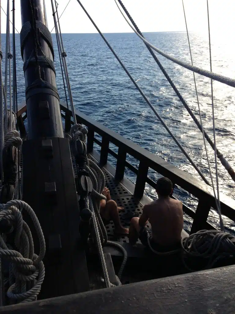
LIFE ON EL GALEON: AN ALMOST SPANISH SAILOR’S LOG
On May 10, 2016, El Galeon Andalusia maneuvered her majestic mast beneath the Cape Fear Memorial Bridge and returned to Port City Marina, what last summer’s crew called the tall ship’s “most successful port visit.”
Life at Sea
Indeed, record numbers of wannabe pirates, history buffs, and tall ship enthusiasts flocked to Pier 33 to tour the 170-foot replica of the 16th century Spanish galleon.
“We had more than 2000 visitors each of the 10 days we were there,” shared Chef David Garcia Gallardo, one of the Spanish crew. “And Port City Marina was very comfortable, with nice bathrooms!” he said, with a laugh. “This is important to sailors arriving in port!”
Incidents of rude, reckless powerboats have been reported for years now and most likely you have suffered much the same danger either in an anchorage or underway in the Waterway. Then again, you meet these same thoughtless, insane drivers on every Interstate. So…I do not have an answer other than to GRIN AND BEAR IT.
I was amazed at the amount of speedboats running thru the anchorage on plane. A constant parade on a Sunday afternoon. Many seemed to enjoy the sport of slaloming between anchored boats on half plane putting out big wakes. Then to my total amazement, a marine sheriff boat came thru, on half plane, and did nothing about the speed boats running thru here! They really don’t seem to care about basic safety and courtesy in Wrightsville beach. The cop must have been on his way to patrol the bathrooms. Ted
In many places local boaters feel they ‘own’ their waters and we transients are intruders. I anchor at Wrightsville a couple of weeks in the fall AND the spring. I spend money there at restaurants, food and hardware stores, etc. On some weekends there is standing two foot chop from wakes. As a catamaran we don’t roll but it sure is a little lumpy. I actually had a busy-body type lady tell me I should keep the free dinghy dock clear for local boaters. I had to quietly, calmly explain basic economics to her. Yes, we pay no property taxes, etc but neither do we cause wear and tear to the infrastructure or use their schools but we are paying plenty to service providers who DO pay taxes… but only as long as they stay in business. From we boaters.
This happens all the time in that area. This kind of boating does not happen just 10 miles south at the Carolina Beach boat basin. It is a no wake zone and people will remind anyone who makes a wake.


Comments from Cruisers (1)
Need to pay more attention to the Nav Markers than your “Chart Plotters”!!!!