117 Horses at Lookout: Report, Cape Lookout, east of NC AICW MM 205
Cape Lookout Bight is a popular anchorage located west of Cape Lookout National Seashore. See Cape Lookout.
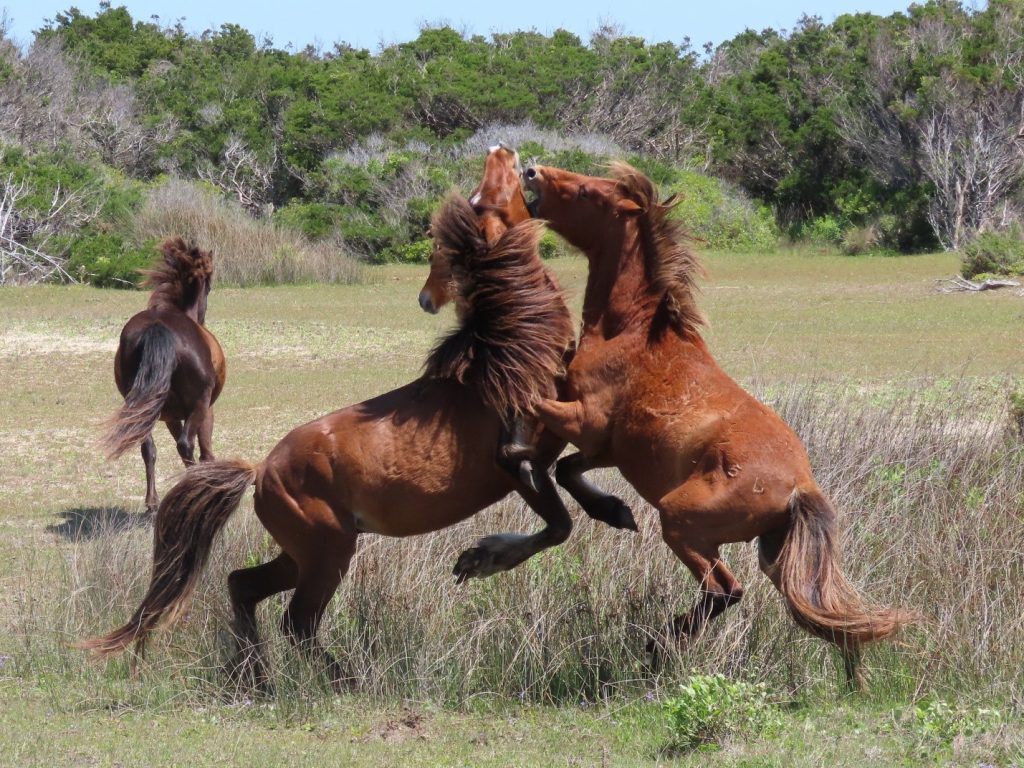
117 Horses at Lookout: Report
Coastal Review Online
Cape Lookout Bight is a popular anchorage located west of Cape Lookout National Seashore. See Cape Lookout.
117 Horses at Lookout: Report
Coastal Review Online
Ambrose Burnside’s Hatteras Expedition, which took place 159 years ago this month, was a battle fought not with Confederates but the more powerful forces of nature.
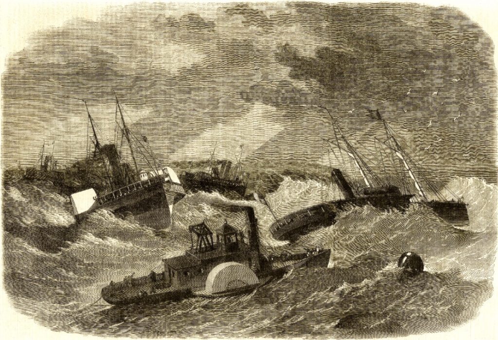
Burnside’s Armada Battles Sea at Hatteras Inlet
Coastal Review Online
Shipswrecks in the Graveyard of the Atlantic provide researchers and national seashore officials an important link to maritime history on a local, state and global level.
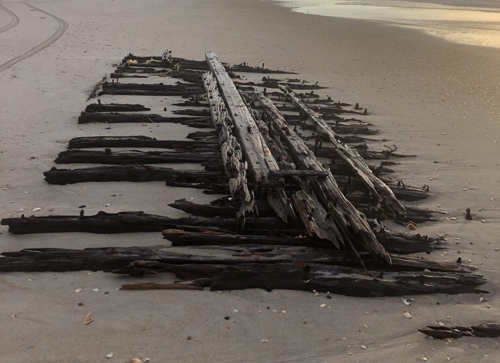
Shipwrecks Link Researchers to Bygone Era
Coastal Review Online

Designating the Great Dismal Swamp in Virginia and North Carolina a National Heritage Area is a great and timely idea. The Dismal Swamp Canal Welcome Center is located adjacent to the Dismal Swamp State Park, offering trails, exhibits and ongoing programs in Camden County, NC. Docks are provided by the Dismal Swamp Canal Welcome Center, A CRUISERS NET SPONSOR and a NC DOT Rest Area facility.

A couple takes a long walk along the main road leading into the Great Dismal Swamp on Wednesday, December 2, 2020. (Stephen M. Katz/The Virginian-Pilot)
Editorial: Designate Great Dismal Swamp a National Heritage Area
Virginia-Pilot
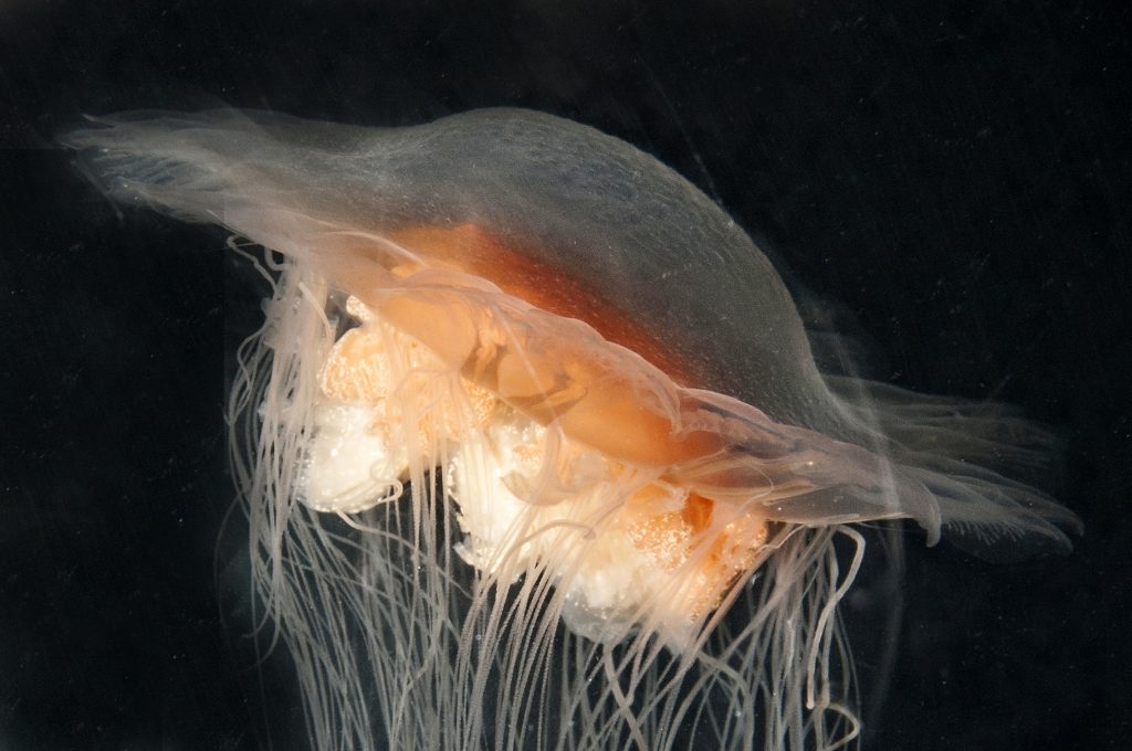
Underwater photographer Robert Michelson continues in the second of a two-part series to explore the world of sea jellies and their relatives in North Carolina waters.
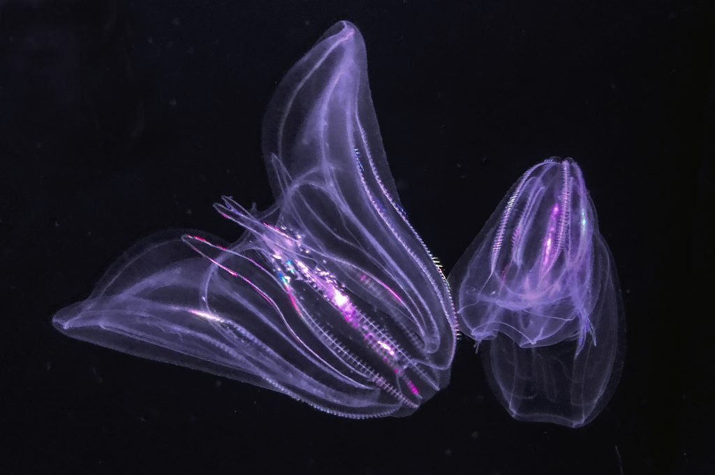
Deeper Dive into the World of NC’s Sea Jellies
Coastal Review Online
Here is definitely a case of your needing be sure to look before you leap overboard for a swim or a repair.
First in a two-part series Jellyfish are some of the coolest looking creatures that live in North Carolina’s waters. Found in all coastal areas of the state, there’s a dozen different species that can be observed at various times of year while swimming, scuba diving, snorkeling or simply walking along the beach.
Strange Beauty: Jellyfish of the NC Coast
Coastal Review Online
As the first inlet into NC waters south of the Chesapeake, Oregon Inlet is very tempting to offshore cruisers. HOWEVER, Oregon Inlet is notorious for shoaling, keeping the USCG busy relocating ATONs. Even with this dredging project, Cruisers Net still recommends attempting navigation ONLY with shoal draft and good local knowledge.
With little doubt that microplastics find their way into seafood, Todd Miller of the North Carolina Coastal Federation says we should be doing everything possible to reduce the amount of plastic released into coastal waterways.

Keep Plastics Out of Our Seafood
Coastal Review Online
Jessica Taylor, director of the Outer Banks Center for Dolphin Research and a science teacher at Manteo Middle School, is lead author on a recently published, peer-reviewed dolphin study.
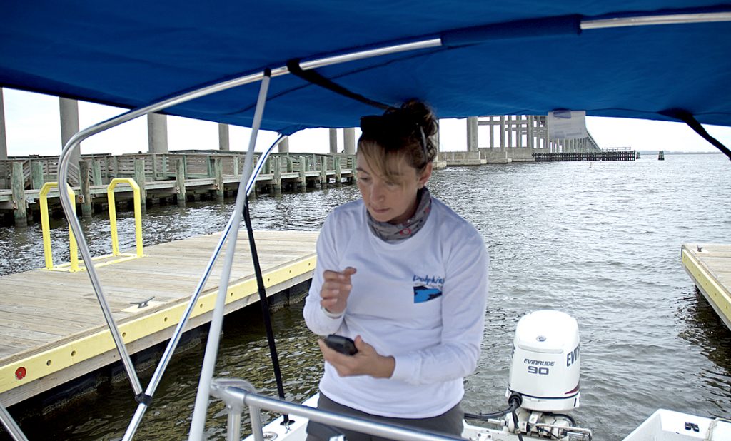
A Day With Dolphin Researcher Jessica Taylor
Coastal Review Online
Maintenance of Hatteras Inlet’s navigation channels has been a constant goal of the Dare County Waterways Commission for both economic and safety reasons.
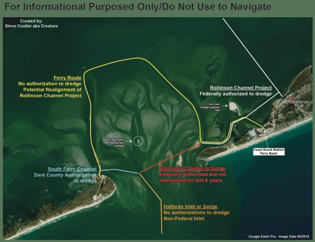
The federal authorization status of various areas in Hatteras Inlet, as compiled by Waterways Commission Chair Steve “Creature” Coulter.
Panel Eyes Future of Hatteras Inlet Navigation
Coastal Review Online
Author, researcher and contributor Kevin Duffus shares his findings that depict the the story of what he calls “America’s lighthouse” and the people connected to it. See also Restoration.
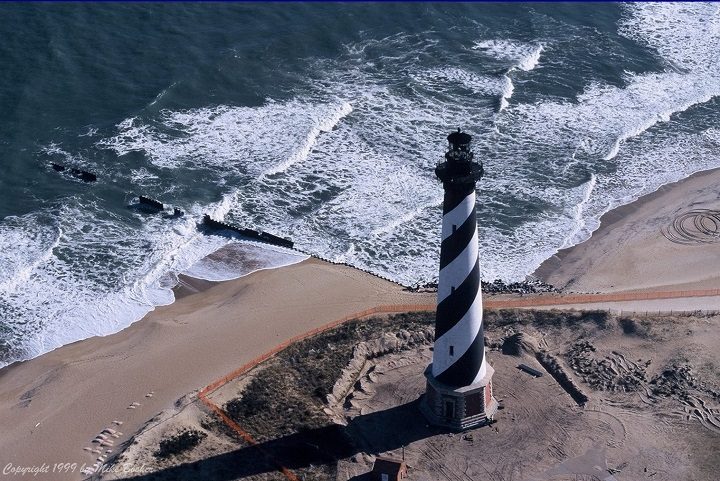
History Illuminated: Hatteras Light’s 150 Years
Coastal Review Online
Historic Photos Celebrate 150 Years of Light
Coastal Review Online
The truth about Blackbeard’s Battle at Ocracoke conflicts with popular interpretations and numerous published accounts, according to author Kevin Duffus.
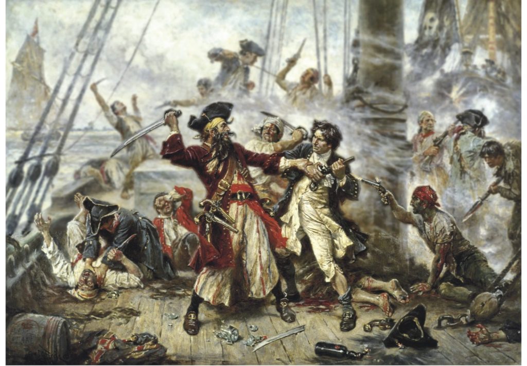
“Battle at Ocracoke,” painting by American artist Jean Leon Gerome Ferris, 1920.
Blackbeard’s Final Battle: Sorting Facts, Fiction
Coastal Review Online
Silver Lake is Ocracoke Harbor and these two entrance markers are immediately south of the maintained channel into Silver Lake’s inlet.

| 1. THE FOLLOWING AIDS TO NAVIGATION HAVE BEEN RELOCATED.
A. SILVER LAKE JUNCTION LIGHT SL (LLNR 28985 [35°6.6266N / 075°59.5121W, 35.110443 / -75.991868]) RELOCATED TO APPROX POSIT 35-06-37.633N,
B. SILVER LAKE ENTRANCE DAYBEACON 2 (LLNR 28990 [35°6.4777N / 075°59.4183W, 35.107962 / -75.990305]) RELOCATED TO APPROX POSIT 35-06-28.552N, 075-59-25.205W. |
My wife and I once spent a very pleasant three days in Elizabeth City waiting for the winds to drop allowing the long swing bridge to open. The 2.8-mile bridge across the Alligator River has closed several times in recent years to undergo repairs.
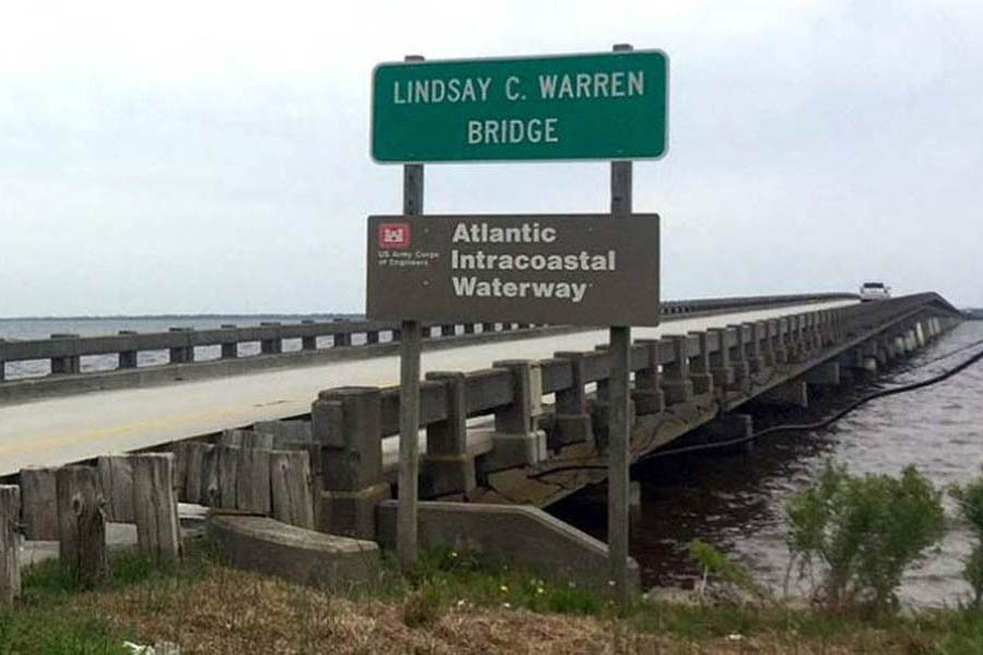
Lindsay C. Warren Bridge. Photo: Kill Devil Hills
Officials Push to Replace Alligator River Bridge
Coastal Review Online
Click Here To Open A Chart View Window, Zoomed To the Location of Alligator River Bridge
This excellent facility and CRUISERS NET SPONSOR, Southport Marina, was severely damaged by Isaias. See Hurricane Damage. As of November 6, they have resumed selling gasoline and diesel fuel.
We’re excited to announce that Southport Marina has resumed gasoline and diesel sales daily, from 8am-5pm. We are monitoring VHF ch. 16, phone 910-457-9900, and email info@southport-marina.com for any questions or needs. Although it will still be some time before we are able to accommodate overnight dockage for transiting guests, we would love to sell you the best quality marine fuel available while you’re in our town. Thank you for your patience while we continue to rebuild our facility! We’re looking forward to the opportunity to serve our customers again soon!
Hank Whitley, CMM
Marina Manager
Southport Marina
606 W. West St.
Southport, NC 28461
910-457-9900
View our live webcam at https://www.youtube.com/user/SouthportMarina
Click Here To View the North Carolina Cruisers Net Marina Directory Listing For Southport Marina
Click Here To Open A Chart View Window, Zoomed To the Location of Southport Marina
Our thanks to Phil and Karen for sharing their AGLCA Forum posting with our readers. Many of you will travel through Snows Cut at some point in your cruising lifetime. Mile long Snows Cut departs the coastal Waterway at the entrance to Carolina Beach and intersects Cape Fear River at Mile 296.
Living on the ICW, it’s amazing the number of boats we see every day heading south for the winter. 20, 30 a day perhaps, and we only see some of them. Trawlers, sailboats, large yachts and other craft, a few with looper flags but mostly snowbirds. Most loopers know Snow’s Cut, a few miles south of us, as a tricky waterway that connects the Cape Fear River with the ICW at Carolina Beach.
Though interesting, few good photos of this area exist. It’s difficult to get decent photos as you’re transiting it as you’re busy navigating a narrow, tricky channels with a 2 or 3 knot current. On a recent bike ride over the Snow’s Cut bridge, I took a few photos that might give our captains a good overview of the mile-long man-made cut.
Phil & Karen Barbalace
Helms Port
Wilmington,NC
Gold Loopers

Phil Kent and Karen Barbalace

Phil Kent and Karen Barbalace

Phil Kent and Karen Barbalace
Thanks for the great photos… Pictures are certainly worth a thousand words.
An important reminder for our North Carolina locals and for off-shore cruisers. Local knowledge is recommended for most for these inlets.
NC – HAZARDS OF NORTH CAROLINA COASTAL INLETS
Hazardous inlets. To heighten public awareness about the hazards that exist in and around the North Carolina coast, this information is provided to mariners. Shoaling conditions exist at following North Carolina coastal inlets:
Oregon Inlet
Hatteras Inlet
Ocracoke Inlet
Barden Inlet
Beaufort Inlet
Bogue Inlet
New River Inlet
Topsail Inlet
Masonboro Inlet
Carolina Beach Inlet
Lockwoods Folly Inlet
Shallotte Inlet
Shoaling conditions increase the potential for groundings. These inlets are subject to continual and sometimes rapid environmental changes. Mariners are highly encouraged to obtain the most recent U.S. Army Corps of Engineers Wilmington, North Carolina District hydrographic survey information, centerline waypoints and controlling depth at: http://www.saw.usace.army.mil/Missions/Navigation/HydrographicSurveys.aspx
Mariners should use caution when navigating in these areas and passage through the inlets is not recommended without local knowledge of the area. The aids to navigation in these inlets may not be charted and may not be marking best water due to continually shifting shoals. Consult Local Notice to Mariners, 5th Coast Guard District for the latest positions and status of aids to navigation:
https://www.navcen.uscg.gov/?pageName=lnmDistrict®ion=5
To report any aids to navigation discrepancies (missing, damaged, off station, extinguished lights), shoaling, hazards to navigation, or discrepancies on bridge lighting, please contact Sector North Carolina Command Center (910) 343-2200.

The North Carolina Estuarium in Washington, A CRUISERS NET SPONSOR, is exploring an essential element — water — with the Water/Ways traveling exhibition, a part of Smithsonian’s Museum on Main Street program.
Estuarium Dives into the Necessity of Water
Coastal Review Online
For two days and nights in October 1878, the 11th hurricane of the season thrashed the North Carolina coast and ships offshore, with dramatic ocean rescues and loss of life.

Great Gale of 1878 Brought Nights of Terror
Coastal Review Online
Until his recent untimely death, Robert Peek served as Lockmaster of Deep Creek Lock on the Dismal Swamp Canal for 24 years. See In Memorium Robert Peek. Our thanks to Donna Steward, Director of Dismal Swamp Welcome Center and longtime friend, for sharing this 2012 Facebook article on a typical day in Robert’s life.
Great Dismal Swamp – The Life of a Lockmaster
Kathy Bohanan Enzerink
It was a very nice person we enjoyed this lock and it is parts of our best lock souvenir. Rest in peace


Be the first to comment!