Gearing up for Hurricane Season – NC Coastal Federation
|


|
|
|

The Dismal Swamp Canal is open to navigation & locks are operating normally. Attaching some images from the last couple days- it has been a busy spring/summer along the waterway!
Thanks,
Sarah
|
| Sarah Hill, TMP Director, Dismal Swamp Canal Welcome CenterChairperson, Camden County Tourism Development Authority 2356 US Hwy 17 North, South Mills, NC 27976
|


Brunswick County is North Carolina’s southeast corner and in numerous ways a microcosm of the entire coastal region.

Fort Johnston. Photo: Eric Medlin
Click here for From pivotal beginnings, Brunswick County history lives on
CoastalReview.org – Eric Medlin


A longtime CRUISERS NET SPONSOR, historic Edenton always has an exciting calendar of events and places to visit! Edenton is at the mouth of the Chowan River on the northwest shore of Albemarle Sound.
See more today at VisitEdenton.com Hello! If you’re thinking of visiting Edenton this spring, the Edenton Museum Trail is a free and easy way to explore the natural beauty, history and culture of Edenton. This self-guided tour highlights some of our town’s best architecture and iconic monuments. You’ll start at our beautiful waterfront, wind your way past historic buildings, and stop by churches and gardens. Along the trail, you’ll learn what makes Edenton the “South’s Prettiest Town” and one of the best destinations in North Carolina! Find out more about the trail here. I hope to see you soon on the Edenton Museum Trail.
Thanks for reading! 101 W Water St, Edenton, North Carolina 27932 |
With a closed vertical clearance of 14ft, the 2.8-mile bridge across the Alligator River has had lengthy closures to undergo repairs several times in recent years.
Click here for Federal grant to accelerate Alligator River bridge project
CoastalReview.org
See also Officials Push to Replace Alligator River Bridge
Click Here To Open A Chart View Window Zoomed To the Location of Alligator River Bridge
As a native of this area we have enjoyed stopping and waiting as the swingspan opens and lets the boat traffic pass. I Have been able to get out of the truck walk around and " smell the roses " heck I've even seen people throw out a line while they wait. Swingspans and Drawbridges will soon be a things of the past , most people don't even remember that there was once a swing up at Coinjock . Time and Tide march on…
The Dismal Swamp Canal’s locks are open and accessed southbound at MM 7.2 south of Norfolk or northbound from Albemarle Sound and the Pasquatank River.
See UPDATE: NAV ALERT: LNM: AICW MM 12 Great Bridge Temporary Openings
The Dismal Swamp Canal is OPEN and locks are operating on their normal schedule.
Thanks,
Sarah
|
| Sarah Hill, TMP Director, Dismal Swamp Canal Welcome CenterChairperson, Camden County Tourism Development Authority2356 US Hwy 17 North, South Mills, NC 27976
|

Click Here To Open A Chart View Window Zoomed To the Location of South Mills Lock
Click Here To View the North Carolina Cruisers Net Bridge Directory Listing For South Mills Lock
Click Here To View the VA to NC Cruisers Net Marina Directory Listing For Deep Creek Lock
Click Here To Open A Chart View Window Zoomed To the Location of Deep Creek Lock
We transited the Dismal Swamp Canal northbound May 16 and 17. Saw one boat and hecwas tied up at Rest Center headed south. Canal is great place for photography. My wife was a happy camper taking lots of photos. Lockmasters at both ends were helpful and friendly. Locks easy to transition. Hardly any turbulence atvall. Rest Center on VA NC border convenient stop overnight if you need one. Well maintained. Space for three or four boats. Bathrooms and water available. I never heard road traffic at night. We have a 5’ draft. We clunked 4 or 5 times in the 22 mile canal. Probably sunken logs/branches bseveral felled trees along the way. No issue. Lots of high trees with overhanging branches. We tried to avoid them but one broke off wind vane at top of the mast. All in all, I liked no traffic, beautiful photography, easy overnight. Overhanging trees are a problem for sailboats.

Paddlers take to the water in the Great Dismal Swamp National Wildlife Refuge. Photo: USFWS
Click here for ‘Morass’ no more: Great Dismal could get new designation
by Catherine Kozak, CoastalReview.org
|
Morehead City is in the center of coastal Cataret County, NC.

In our county history series: Colonial beginnings, Civil War battles, maritime industry, fishing, tourism and coastal living among Carteret’s numerous draws.
Click here for Carteret County’s history, amenities have long lured
CoastalReview.org
Guest commentary: The Cape Fear River and its historically important and scarce resources are rapidly being lost or adversely altered forever.
Click here for Cape Fear River Ghost Trees: What stories could they speak?
CoastalReview.org
The Corps of Engineers now says it has authority to follow the deepest natural water, or best water, in the Rollinson Channel Navigation Project linking Hatteras and Ocracoke islands.

The proposed corridor with high-shoaling areas to be dredged any time of year indicated in circles. Image: Corps/FONSI
Click here for Inlet channel maintenance made simpler: Go with the flow
CoastalReview.org
The Old Oregon Inlet Life-Saving Station is one of the most beautiful historic buildings on the Outer Banks, situated at a dramatic coastal location that would befit a movie setting.
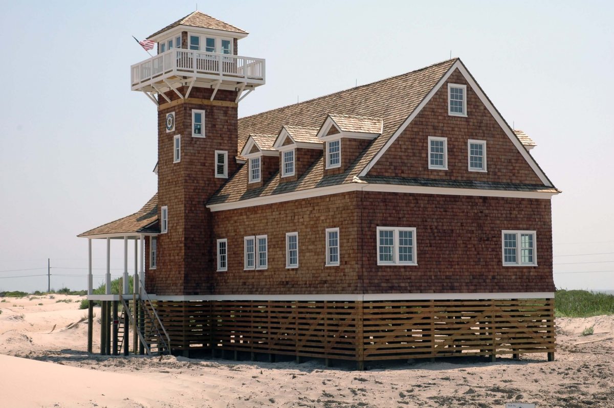
The Oregon Inlet Life-Saving Station on the southeast side of Oregon Inlet, part of the Pea island National Wildlife Refuge. Photo: Courtesy U.S. Life-Saving Service Heritage Association
Click here for 1898 Oregon Inlet Life-Saving Station must go, but where? – Catherine Kozak
CoastalReview,org
Click here for Pamlico County a quiet destination on NC coast
CoastalReview.org
The Waterway’s path through Wrightsville Beach is a narrow congested channel, so caution must be exercised during these dark hours, especially in vicinity of spectator boats.
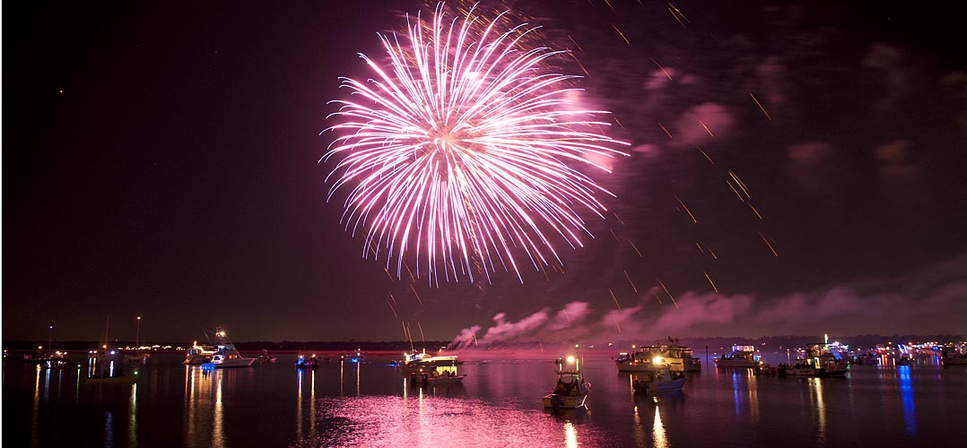
Click here for Wrightsville Beach Holiday Flotilla and Fireworks, Nov 26, 6:30-8:30 PM, AICW NC Statute Mile 283
luminanews.com
Popular literature and the public’s imagination have long perpetuated the notion that the notorious pirate buried his ill-gotten wealth, perhaps on Ocracoke Island.
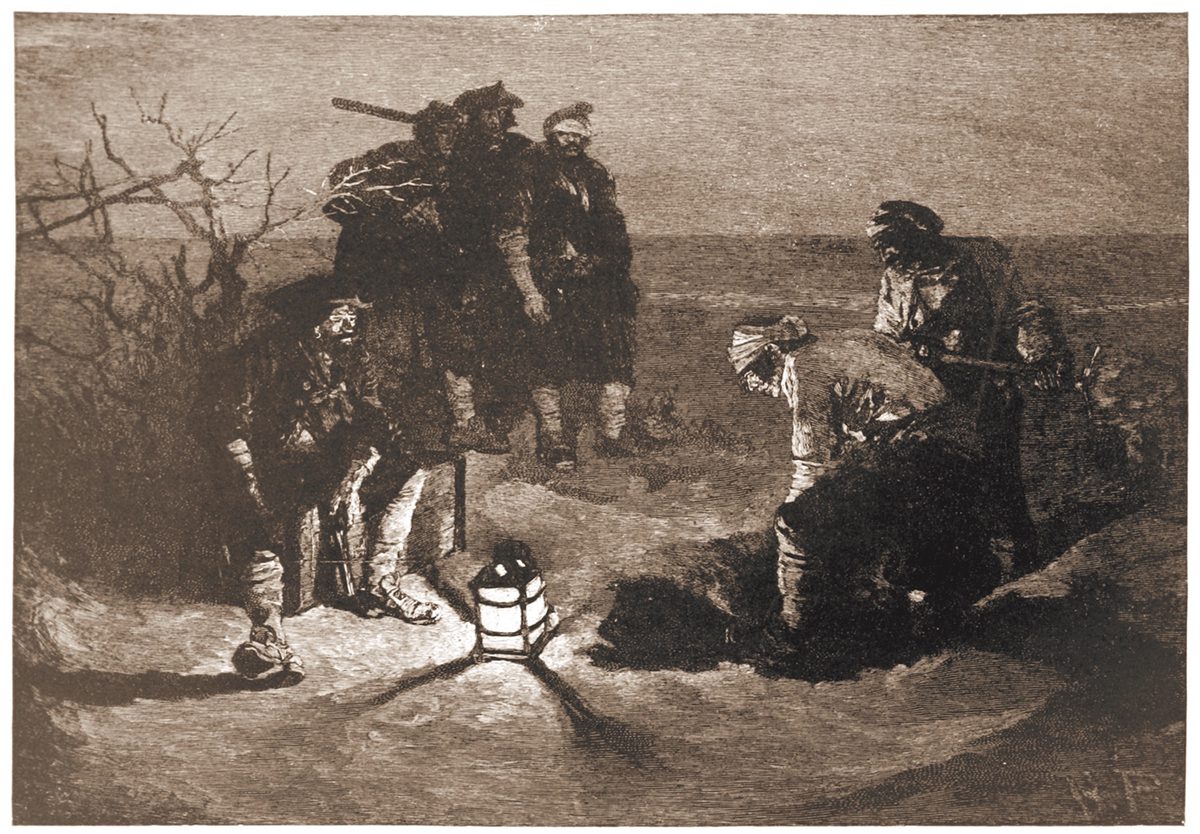
“Blackbeard Buries His Treasure” illustrated by Howard Pyle for Harper’s Magazine, 1887.
Click here for Search for Blackbeard’s treasure based on enduring myth
CoastalReview.org
Cruisers Net reminds you that high water events, like Hurricane Nicole, typically lift lots of debris, visible and submerged, into the navigation channels, especially in the narrow portions of the ICW. A sharp watch is required. Our thanks to Winston Fowler for these photos from the Cape Fear River.

Cape Fear River, Wilmington, NC

Cape Fear River, Wilmington, NC
South Harbor Village Marina guards the Waterway’s northern shoreline, a short hop west of unlighted daybeacon #8, and not far from the mouth of the Cape Fear River. Our thanks to Dave Rowe aboard m/v Stinkpot for this review.
Safe Harbor South Harbor Village is really a wonderful marina. Our experience began with dock master, Ian, expertly telling us exactly what conditions we could expect at the dock, wind, state of the current–everything. He correctly even predicted a best approach for the conditions and was spot on! We rarely accept this kind of information from “off the boat,” but he shared it with such knowing authority, that we knew we were dealing with a very experienced hand, and the trust we placed in him proved not to be unfounded!
We have never been met by a larger or more competent contingent of dock hands. No one expected prematurely tossed lines, and it was clear that they understood they were dealing with an experienced crew and treated us that way. There is no doubt in my mind that, if called to do so, they could also deal with an inexperienced crew and get them on and off the dock with ease.
As soon as we were alongside, they immediately asked for another spring line, and we were again impressed that they recognized the current there, and wanted us tied without us having to readjust hastily-tied breast lines you might get anywhere else. In fact, we rarely hand out lines at all these days. The Boatswain and Captain take care of the job after some less than stellar experiences in the past, but no need for such reticence here.
The facilities are gorgeous with new looking floating docks, slip side pump-outs, and the most advanced fire suppression system we have ever seen. Two stellar restaurants onsite in this park-like setting.
The real stars are the staff. Ian and company go way above and beyond, and this well-trained, crackerjack team are endlessly impressive with their ability to anticipate a transient boater’s every need.


Dave Rowe Captain m/v Stinkpot AboardStinkpot.com
Click Here To View the Cruisers Net North Carolina Marina Directory Listing For South Harbor
Click Here To Open A Chart View Window, Zoomed To the Location of South Harbor Village Marina
The entrance channel to Carolina Beach State Park marina cuts off southward from the AICW, at the western end of Snows Cut, between markers #163 and #165. Our thanks to Dave Rowe, AboardStinkpot.com, for this review and recommendation.
For the budget conscious boater, or one who loves a natural park setting, Carolina Beach State Park Marina is for you! Miles of wooded trails and one of the only spots on earth to spot a Venus Fly Trap in the wild. $30 flat fee for dockage includes power and water. This is the perfect place to hole up and relax while waiting for a favorable current on the Cape Fear River or Snow’s Cut. Choice of grocery stores and a pharmacy under a mile and a half away.


Click Here To View the Cruisers Net North Carolina Marina Directory Listing For Carolina Beach State Park Marina
Click Here To Open A Chart View Window, Zoomed To the Location of Carolina Beach State Park Marina
I second everything in the article. We live nearby. A great resource for local and visiting boaters. Usually has good fuel prices compared to others in the area but check first.


Be the first to comment!