{"ssecn-2018.js":"1753025597","underDevelopment-2018.js":"1757184168","utils-2018.js":"1740672719","ssecnchartview-2018.js":"1751832564","zoomTMSLayer.js":"1653505619","ssecn-2018.min.js":"1753025600","underDevelopment-2018.min.js":"1757184171","utils-2018.min.js":"1740672721","ssecnchartview-2018.min.js":"1751832567","zoomTMSLayer.min.js":"1653505619"}
Do you ALREADY RECEIVE the Cruisers' Net Weekly Newsletter? NO YES
Do you want to SIGN UP to receive our Newsletter? YES Not Now NO Visit Logged
At last Location At Current Location At Selected Location Enter A Location Enter Latitude and Longitude
Lowest Diesel Prices Anywhere Lowest Gas Prices Anywhere Virgina to North Carolina North Carolina South Carolina Georgia Eastern Florida St. Johns River Florida Keys Okeechobee Waterway Western Florida Select Region
All Regions VA to NC Line North Carolina South Carolina Georgia Eastern Florida Western Florida Florida Keys Okeechobee Waterway Northern Gulf Bahamas New York Ohio Pennsylvania Washington Puerto Rico Minnesota Maryland Tennessee NW Waters
Latest Cruising News Breaking News Current Local Notices and Nav Alerts Recent Comments Boat Broker Partners Lowest Gas Prices Anywhere Lowest Diesel Prices Anywhere Resource Articles Photos Photos Young’s Yarns Tropical Storm Outlook Local Forecasts Local Forecasts Search: Focus On Sponsors Shelter Cove Harbour and Marina Windmill Harbour Marina Gulfport, Boca Ciega Bay, Florida St. Petersburg Municipal Marina Darien, Georgia Makers Air - Destinations Made Palm Coast Marina, FL AICW Statute Mile 803 Riviera Dunes Marina Resort, on the Manatee River, off Tampa Bay Atlantic Intracoastal Waterway Association Marineland Marina, Marineland, FL, AICW Statute Mile 796 Fort Pierce City Marina Twin Dolphin Marina, off Tampa Bay Edenton, NC Legacy Harbour Marina onSpot wifi Fishermen’s Village Resort and Marina Harbour Town Yacht Basin Windmill Harbour Marina Morehead City Yacht Basin Staniel Cay Yacht Club Isle of Hope Marina VA to NC All Cruising News VA to NC Local Notices and Nav Alerts VA to NC Marinas VA to NC Fuel Prices VA to NC Bridge Schedules Stat. Mile/Lat-Lon Chart View Search Intersection of AICW and Bogue inlet Intersection of AICW and Browns inlet Trouble Spots – Intersection of AICW and Carolina Beach Inlet Trouble Spots – Intersection of AICW and Lockwoods Folly Inlet Trouble Spots – Intersection of AICW and New River Trouble Spots – Intersection of ICW and Shallotte Inlet Trouble Spots – Northern Mouth of Alligator River NC All Cruising News NC Regional Cruising News AICW, Dismal Swamp Route (Statute Mile 25 to 65) AICW, NC Virginia Cut Route (Statute Mile 34 to 65) Albemarle Sound (off the AICW) Pamlico, Crotoan and Roanoke Sounds (off the AICW) AICW, Alligator River to Pungo River (Statute Mile 65 to 145) Pamlico River (off the AICW) AICW, Goose Creek to Bay River (Statute Mile 145 to 165) Neuse River (AICW Statute Mile 165 to 185) AICW, Adams Creek to Beaufort and Morehead City (Statute Mile 185 to 207) AICW, Bogue Sound to New River (Statute Mile 207 to 247) AICW, Swan Point to Snows Cut (Statute Mile 247 to 299) Cape Fear River (AICW Statute Mile 299 to 309) AICW, Southport to Calabash (Statute Mile 309 to 343) NC AICW Problem Stretches NC Local Notices and Nav Alerts NC Anchorages All Anchorages AICW Dismal Swamp Route (Statute Mile 25 to 65) AICW NC Virginia Cut Route (Statute Mile 34 to 65) Albemarle Sound (off the AICW) Pamlico, Crotoan Roanoke Sounds AICW Alligator River to Pungo River (Statute Mile 65 to 145) Anchorages on the Pamlico River AICW Goose Creek to Bay River (Statute Mile 145 to 165) Neuse River (AICW Statute Mile 165 to 185) AICW Adams Creek to Beaufort and Morehead City (Statute Mile 185 to 207) AICW Bogue Sound to New River (Statute Mile 207 to 247) AICW Swan Point to Snows Cut (Statute Mile 247 to 299) Upper Cape Fear River (off the AICW) AICW Southport to Calabash (Statute Mile 309 to 343 NC Marinas All Marinas SSECN Sponsoring Marinas AICW Dismal Swamp Route (Statute Mile 25 to 65) AICW NC Virginia Cut Route (Statute Mile 34 to 65) Albemarle Sound (off the AICW) Pamlico, Crotoan Roanoke Sounds (off the AICW) AICW Alligator River to Pungo River (Statute Mile 65 to 145) on the Pamlico River (off the AICW) Hobucken Cut to Neuse River and New Bern (Statute Mile 145 to 185) AICW Adams Creek to Beaufort and Morehead City (Statute Mile 185 to 207) AICW Bogue Sound to New River (Statute Mile 207 to 247) AICW Swan Point to Snows Cut (Statute Mile 247 to 299) Upper Cape Fear River (off the AICW) AICW Lower Cape Fear River to Calabash (Statute Mile 299 to 309) NC LPG/CNG Availability NC Chart View North Carolina General Elizabeth City, NC Edenton, NC Columbia, NC Manteo, NC Hatteras, NC Ocracoke, NC Belhaven, NC Bath, NC Washington, NC Oriental, NC New Bern, NC Beaufort, NC Morehead City, NC Swansboro, NC Wrightsville Beach, NC Wilmington, NC Southport, NC Stat. Mile/Lat-Lon Chart View Search NC Fuel Prices NC Bridge Schedules NC Photo Albums Belhaven, NC Oriental, NC Beaufort, NC Trouble Spots – Ashepoo Coosaw Cutoff Into Coosaw River Trouble Spots – Channel South of McClellanville, SC to Awendaw Creek Trouble Spots – Fields Cut Trouble Spots – Intersection of Wright River and Northern Fields Cut Trouble Spots - Waterway Northeast of Ben Sawyer SC All Cruising News SC Regional Cruising News AICW, Calabash to Socastee Bridge (Statute Mile 343 to 371) AICW, Waccamaw River to Waccamaw Point (Statute Mile 371 to 403) Georgetown, Winyah Bay, Pee Dee River, Black River (AICW Statute Mile 403 to 410) AICW, Belle Isle to Sullivan Island (Statute Mile 410 to 464) Charleston, including the Cooper, Wando and Ashley Rivers (AICW Statute Mile 464 to 473) AICW, Stono River to North Edisto River (Statute Mile 473 to 496) AICW, Dawho River to Ashepoo-Coosaw Cutoff (Statute Mile 496 to 518) AICW, Coosaw River to Lady’s Island Bridge (Statute Mile 518 to 536) Beaufort, SC (AICW Statute Mile 537) AICW, Beaufort River to Calibogue Sound and Hilton Head Island (Statute Mile 537 to 565) AICW, Cooper River to Savannah River (Statute Mile 565 to 575.5) AICW Problem Stretches Local Notices and Nav Alerts SC Anchorages All Anchorages AICW, Calabash to Socastee Bridge (Statute Mile 343 to 371) AICW, Waccamaw River to Waccamaw Point (Statute Mile 371 to 403) Georgetown, Winyah Bay, Pee Dee River, Black River (AICW Statute Mile 403 to 410) AICW, Belle Isle to Sullivan Island (Statute Mile 410 to 464) Charleston, including the Cooper, Wando and Ashley Rivers (AICW Statute Mile 464 to 473) AICW, Stono River to North Edisto River (Statute Mile 473 to 496) ICW, Dawho River to Ashepoo-Coosaw Cutoff (AICW Statute Mile 496 to 518) AICW, Coosaw River to Lady’s Island Bridge (Statute Mile 518 to 536) Beaufort, SC (AICW Statute Mile 537) Anchorages ICW Beaufort River to Calibogue Sound and Hilton Head Island (AICW Statute Mile 565 to 575.5) AICW, Cooper River to Savannah River (Statute Mile 565 to 575.5) SC Marinas All Marinas SSECN Sponsoring Marinas AICW, Calabash to Socastee Bridge (Statute Mile 343 to 371) AICW, Waccamaw River to Waccamaw Point (Statute Mile 371 to 403) Georgetown, Winyah Bay, Pee Dee River, Black River (AICW Statute Mile 403 to 410) AICW, Belle Isle to Sullivan Island (Statute Mile 410 to 464) Charleston, including the Cooper, Wando and Ashley Rivers (AICW Statute Mile 464 to 473) AICW, Stono River to North Edisto River (Statute Mile 473 to 496) AICW, Dawho River to Ashepoo-Coosaw Cutoff (Statute Mile 496 to 518) AICW, Coosaw River to Lady’s Island Bridge (Statute Mile 518 to 536) Beaufort, SC (AICW Statute Mile 537) AICW Beaufort River to Calibogue Sound and Hilton Head Island (Statute Mile 565 to 575.5) AICW, Cooper River to Savannah River (Statute Mile 565 to 575.5) SC LPG/CNG Availability SC Chart View South Carolina General North Myrtle Beach – Myrtle Beach, SC Georgetown, SC Charleston, SC Beaufort, SC Hilton Head Island, SC Stat. Mile/Lat-Lon Chart View Search SC Fuel Prices SC Bridge Schedules Channel Through Cumberland Dividings Trouble Spots – Jekyll Creek Trouble Spots – Little Mud River GA All Cruising News GA Regional Cruising News Savannah River to Georgia (off the AICW) AICW, Elba Island Cut to Hell Gate (Statute Mile 575.5 to 602) AICW, Ogeechee River to St. Simons Sound (Statute Mile 602 to 680) AICW, Jekyll Creek to St. Marys River (Statute Mile 680 to 712) GA AICW Problem Stretches GA Local Notices and Nav Alerts GA Anchorages All Anchorages Savannah River to Savannah (off the AICW) AICW, Elba Island Cut to Hell Gate (Statute Mile 575.5 to 602 AICW, Ogeechee River to St. Simons Sound (Statute Mile 602 to 680) AICW, Jekyll Creek to St. Marys River (Statute Mile 680 to 712) GA Marinas All Marinas SSECN Sponsoring Marinas Savannah River to Savannah (off the AICW) AICW, Elba Island Cut to Hell Gate (Statute Mile 575.5 to 602) AICW, Ogeechee River to St. Simons Sound (Statute Mile 602 to 680) AICW, Jekyll Creek to St. Marys River (Statute Mile 680 to 712) GA LPG/CNG Availability GA Chart View Georgia General Savannah, GA Thunderbolt, GA Isle of Hope, GA St. Simons Island, GA Brunswick, GA St. Marys, GA Stat. Mile/Lat-Lon Chart View Search GA Fuel Prices GA Bridge Schedules Trouble Spots – AICW/Bakers Haulover Inlet Intersection Trouble Spots – Intersection of AICW and Mantanzas Inlet EF All Cruising News EF Regional Cruising News AICW, St. Marys River to Sisters Creek (Statute Mile 712 to 740) St. Johns River, including Jacksonville, Palatka and Sanford (off the AICW) AICW, Jacksonville Beach to Vilano Beach Bridge (Statute Mile 740 to 776) St. Augustine (AICW Statute Mile 776 to 780) AICW, San Sebastian River to Daytona Beach (Statute Mile 780 to 835) AICW, Port Orange to Haulover Canal (Statute Mile 835 to 870) AICW, Northern Indian River and Titusville to Melbourne (Statute Mile 870 to 918) AICW, Melbourne Beach to St. Lucie River and Stuart, Florida (Statute Mile 918 to 988) AICW, Great Pocket to Palm Beach (Statute Mile 988 to 1030) AICW, Lantana to Las Olas Boulevard Bridge (Statute Mile 1030 to 1064) Fort Lauderdale (AICW Statute Mile 1064 to 1067) AICW, Port Everglades to Miami and Government Cut Inlet (Statute Mile 1067 to 1090) EF AICW Problem Stretches EF Local Notices and Nav Alerts EF Anchorages All Eastern Florida Anchorages All St. Johns River Anchorages AICW, St. Marys River to Sisters Creek (Statute Mile 712 to 740) St. Johns River, Mayport to Jacksonville (off the AICW) St. Johns River, Ortega River tp Palatka (off the AICW) St. Johns River, Devils Elbow to Lake George (off the AICW) St. Johns River, Astor to Lake Monroe (off the AICW) AICW, Jacksonville Beach to Vilano Beach Bridge (Statute Mile 740 to 776) St. Augustine (AICW Statute Mile 446 to 780) AICW, San Sebastian River to Daytona Beach (Statute Mile 780 to 835) AICW, Port Orange to Haulover Canal (Statute Mile 835 to 870) AICW, Northern Indian River and Titusville to Melbourne (Statute Mile 870 to 918) AICW, Melbourne Beach to St. Lucie River and Stuart, Florida (Statute Mile 918 to 988) AICW, Great Pocket to Palm Beach (Statute Mile 988 to 1030) AICW, Lantana to Las Olas Boulevard Bridge (Statute Mile 1030 to 1064) Fort Lauderdale (AICW Statute Mile 1064 to 1067) AICW, Port Everglades to Miami and Government Cut Inlet (Statute Mile 1067 to 1090) EF Marinas All Eastern Florida Marinas EF SSECN Sponsoring Marinas AICW, St. Marys River to Sisters Creek (Statute Mile 712 to 740) St. Johns River, including Jacksonville, Palatka and Sanford (off the AICW) AICW, Jacksonville Beach to Vilano Beach Bridge (Statute Mile 740 to 776) St. Augustine (AICW Statute Mile 776 to 780) AICW, San Sebastian River to Daytona Beach (Statute Mile 780 to 835) AICW, Port Orange to Haulover Canal (Statute Mile 835 to 870) AICW, Northern Indian River and Titusville to Melbourne (Statute Mile 870 to 918) AICW, Melbourne Beach to St. Lucie River and Stuart, Florida (Statute Mile 918 to 988) AICW, Great Pocket to Palm Beach (Statute Mile 988 to 1030) AICW, Lantana to Las Olas Boulevard Bridge (Statute Mile 1030 to 1064) Fort Lauderdale (AICW Statute Mile 1064 to 1067) AICW, Port Everglades to Miami and Biscayne Bay (Statute Mile 1067 to 1094) EF LPG/CNG Availability EF Chart View Northeastern Florida General Southeastern Florida General Fernandina Beach, FL Jacksonville, FL St. Augustine, FL Daytona Beach, FL New Smyrna Beach, FL Titusville, FL Cocoa, FL Melbourne, FL Vero Beach, FL Fort Pierce, FL Stuart, FL West Palm Beach, FL Fort Lauderdale, FL Miami, FL Stat. Mile/Lat-Lon Chart View Search EF Fuel Prices St. Johns Fuel Prices EF Bridge Schedules St. Johns River Bridge Schedules EF Anchoring Rights FK All Cruising News FK Regional Cruising News Inside/Florida Bay Passage, Dinner Key and Coconut Grove to Jewfish Creek (Statute Mile 1090 to 1134) Inside/Florida Bay Passage, Blackwater Sound to Tavernier Creek (Statute Mile 1134 to 1153) Hawk Channel, Government Cut Inlet to Tavernier Creek Inside/Florida Bay Passage. Cross Bank to Channel Five (Statute Mile 1153 to 1170) Hawk Channel, Tavernier Key to Channel Give Inside/Florida Bay Passage, Old Dan Bank to Moser Channel (Statute Mile 1170 1195) Hawk Channel, Long Key to Moser Channel Marathon and Boot Key Harbor Routes from Marathon and Channel Five to Cape Sable and Western Florida Back Route from Marathon to Key West Hawk Channel, Sombrero Key to Stock Island Key West Routes to the Dry Tortugas FK Notice to Mariners FK Anchorages All Anchorages Inside Passage, Dinner Key and Coconut Grove to Jewfish Creek Inside Passage, Blackwater Sound to Tavernier Creek Hawk Channel, Government Cut Inlet to Tavernier Creek Inside Passage, Cross Key Bank to Channel Five Hawk Channel, Tavernier Key to Channel Five Inside Passage, Old Dan Bank to Moser Channel Hawk Channel, Long Key to Moser Channel Marathon and Boot Key Harbor Back Route from Marathon to Key West Hawk Channel, Sombrero Key to Key West Key West FK Marinas All Marinas SSECN Sponsoring Marinas Inside Passage, Dinner Key and Coconut Grove to Jewfish Creek Hawk Channel, Government Cut Inlet to Tavernier Creek Inside Passage, Key Largo to Vaca Cut Hawk Channel, Tavernier Key to Sister Creek Marathon and Boot Key Harbor Back Route from Marathon to Key West Hawk Channel, Sombrero Key to Key West Key West FK LPG/CNG Availability FK Chart View Florida Keys General Key Largo, FL Islamorada, FL Marathon, FL Key West, FL Stat. Mile/Lat-Lon Chart View Search FK Fuel Prices FK Bridge Schedules FK Anchoring Rights WF All Cruising News WF Regional Cruising News Cape Sable to Pavillion Key 10,000 Islands, Indian Key Pass and Everglades City Marco Island to Naples Gordon Pass to Fort Myers Beach Caloosahatchee River to Fort Myers (Statute Mile 150 to 135) ICW, Miserable Mile to Gasparilla Island (Statute Mile 0 to 34) Charlotte Harbor, Including Punta Gorda ICW, Placida Harbor to Venice (Statute Mile 34 to 57) ICW, Venice Pass to Anna Maria Island (Statute Mile 57 to 92) Tampa Bay (ICW Statute Mile 92 to 112) ICW, Boca Ciega Bay to Clearwater (Statute Mile 112 to 137) ICW, Dunedin to Anclote River Tarpon Springs (Statute Mile 137 to 150) Anclote Key to Dog Island and Carrabelle (Big Bend Region) WF Local Notices and Nav Alerts WF Anchorages Western Florida Anchorages Cape Sable to Pavillion Key 10,000 Islands, Indian Key Pass and Everglades City Marco Island to Naples Gordon Pass to Fort Myers Beach Caloosahatchee River to Fort Myers (Statute Mile 150 to 135) ICW, Miserable Mile to Gasparilla Island (Statute Mile 0 to 34) Charlotte Harbor, Including Punta Gorda ICW, Placida Harbor to Venice (Statute Mile 34 to 57) ICW, Venice Pass to Anna Maria Island (Statute Mile 57 to 92) Tampa Bay (ICW Statute Mile 92 to 112) ICW, Boca Ciega Bay to Clearwater (Statute Mile 112 to 137) ICW, Dunedin to Anclote River Tarpon Springs (Statute Mile 137 to 150) Anclote Key to Dog Island and Carrabelle (Big Bend Region) WF Marinas All Marinas SSECN Sponsoring Marinas Cape Sable to Pavillion Key 10,000 Islands, Indian Key Pass and Everglades City Marco Island to Naples Gordon Pass to Fort Myers Beach Caloosahatchee River to Fort Myers (Statute Mile 150 to 135) ICW, Miserable Mile to Gasparilla Island (Statute Mile 0 to 34) Charlotte Harbor, Including Punta Gorda ICW, Placida Harbor to Venice (Statute Mile 34 to 57) ICW, Venice Pass to Anna Maria Island (Statute Mile 57 to 92) Tampa Bay (ICW Statute Mile 92 to 112) ICW, Boca Ciega Bay to Clearwater (Statute Mile 112 to 137) ICW, Dunedin to Anclote River Tarpon Springs (Statute Mile 137 to 150) Anclote Key to Dog Island and Carrabelle (Big Bend Region) LPG/CNG Availability WF Chart View Southwest Florida General Northwest Florida General Everglades City, FL Marco Island, FL Naples, FL Fort Myers Beach, FL Fort Myers, FL Boca Grande, FL Punta Gorda, FL Venice, FL Sarasota, FL Palmetto – Bradenton, FL St. Petersburg, FL Clearwater, FL Stat. Mile/Lat-Lon Chart View Search WF Fuel Prices WF Bridge Schedules WF Anchoring Rights Okeechobee Cruising News Okeechobee Nav. Alerts Okeechobee Local Notices and Nav Alerts Okeechobee Marinas All Marinas SSECN Sponsoring Marinas St. Lucie River Caloosahatchee River Okeechobee Bridge Schedules Okeechobee Waterway Fuel Prices Stat. Mile/Lat-Lon Chart View Search N. Gulf All Cruising News N. Gulf Regional Cruising News ICW, Carrabelle Apalachicola (Statute Mile 375 to 350) ICW, Apalachicola to East Bay (Statute Mile 350 to 295) ICW, Panama City, Inlet and St Andrews Bay (Statute Mile 295 to 284.5) ICW, Hathaway Bridge to Pensacola Bay (Statute Mile 284.5 to 185) Pensacola Pensacola Inlet (NG ICW Statute Mile 185 to 179) ICW, Big Lagoon to Bon Secour Bay (Statute Mile 179 to 150) Mobile Bay and Mobile (NG ICW Statute Mile 150 to 127) ICW, Pas Aux Herons to the Rigolets (Statute Mile 127 to 35) Lake Pontchartrain New Orleans (NG ICW Statute Mile 35 to 0) Mississippi River to Grand Isle (NG ICW Statute Mile 0 to 15) N. Gulf Local Notices and Nav Alerts N. Gulf Marinas N. Gulf Bridge Schedules Stat. Mile/Lat-Lon Chart View Search Bahamas Marinas - Sponsors Bahamas Marinas – By Island Abaco Bimini Cat Island Eleuthera & Harbour Island Exuma Grand Bahama Island Long Island New Providence & Nassau Bahamas Cruising News
San Marco Marina Basic Marina Information: Phone: (239) 394-2797 EMail: info@sanmarcomarina.com Website: https://sanmarcomarina.com/customer-portal/ Lat/Lon: Near 25°55.304 N / 81°38.710 W Location: found west of the Marco to Naples waterway’s marker #6 Depths: 2.5 ft. Address: 604 E Palm Ave
Service Details:
Transient Dockage: Available. transient dockage on a strictly space available basis Transient Dockage Rate: $2.00 per foot,per night Type of dockage: fixed and floating concrete & wooden slips and face docks Live Aboards Allowed: no Total number of slips/berths: 26 Dockside Power Connections: 30/50 amp power hookups available Dock. Fresh Water Connections: Available. Restaurant: several within walking distance Restaurant Recommendations: The Old Marco Lodge Crab House (239) 234-1165, Stan’s Idle Hour Restaurant (239)394-3041, Little Bar (239) 394-5663 Provisioning Possibilities: Take taxi to supermarket in Marco Island 2 miles away Waste pump-out: Available. Wi-Fi Internet Access: Not Available Fuel Availability: Gas & Diesel Available Fuel Notes: ethanol free
Fuel Prices (All Taxes Included) Reporting Date: December 10, 2025 Fuel Notes: ethanol free Gasoline Price: $4.99 (All Taxes Included) Diesel Price: $4.00 (All Taxes Included) ValvTect Dealer: Yes
Windward Alligator Point Marina Basic Marina Information: Phone: (850) 349-2511 EMail: apmoffice@mywindward.com Website: www.mywindward.com Lat/Lon: Near 29°54.2620 N / 84°25.03 W Address: 1648 Alligator Dr
Service Details:
Transient Dockage: Available. Rate is calculated per foot, based on boat length over all (LOA) or length of slip, whichever is greater. LOA includes engines, swim platforms, bow pulpits, etc.Minimum lengths for billing to apply. Transient Dockage Rate: $2.50/ft/day, $20.00/ft/month, $15.00/ft/year Live Aboards Allowed: no Dockside Power Connections: 30/50 amp power hookups available Wi-Fi Internet Access: Not Available Fuel Availability: No Fuel Available
Rock Landing Marina Basic Marina Information: Phone: 850 984 5844 EMail: Joe@Rocklanding.com Website: rocklandingmarina.com Lat/Lon: Near 30°1.18002 N / 84°23.89998 W Location: located in Dickerson Bay Within walking distance of Panacea Address: 99 Rock Landing Road General Manager: Josh Horne Dockmaster: Josh Horne
Service Details:
Live Aboards Allowed: no Monthly Dockage Rate Notes: Noted Dry Storage Marina only Dockside Power Connections: No Power Available Dock. Fresh Water Connections: Available. Showers: Available. Restaurant: yes Seineyard at Rock Landing Restaurant Recommendations: Seineyard at Rock Landing Wi-Fi Internet Access: Not Available Fuel Availability: Gas & Diesel Available Ice: Available. Nautical Charts: Available. Hardware: Available. REPAIR CAPABILITIES: Hull Repair: Available. Engine Repair: Available. Electronics Repair: Available. Forklift: FISHING: Bait: Available. RENTALS: Row Boats: Available. Motor Boats: Available.
Fuel Prices (All Taxes Included) Reporting Date: May 14, 2026 Gas Notes: Ethanol Free Gasoline Diesel Price: Call marina for fuel prices
Marina Survey Information Date: 2022-01-13 00:00:00 By:
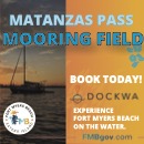
Fort Myers Beach Mooring Field (Matanzas Pass Mooring Field) Basic Marina Information:
Service Details:
Transient Moorings: Available. 70 moorings, swing room as large as 70 feet. $18.63/day, $106.60/week $322.92/month. All renters MUST register with Matanzas Pass Mooring Field Office upon arrival.FANTASTIC TIPS: For Pumpout, Dinghy Dock and Park Permits please visit https://www.fortmyersbeachfl.gov/109/Matanzas-Harbor-Mooring-Field Live Aboards Allowed: no Dockside Power Connections: No Power Available Dock. Fresh Water Connections: Available. Near dinghy dock, Spigot available. Showers: Available. 8 am - 11 pm Laundromat: Available. 8am - 11 pm Restaurant: Proximity to Times Square and walking distance from shops and restaurants. Waste pump-out: Available. Requested online at: https://www.fortmyersbeachfl.gov/FormCenter/Pump-Out-Requests-4/Pump-Out-Request-38. Please note: Pump Outs are not available on weekends or holidays. Pumpout Schedule: Monday: Odd-numbered vessels. Wednesday: Even-numbered vessels. Friday: External non-mooring field occupants. Wi-Fi Internet Access: Free WiFi Available, Available at the mooring field office Fuel Availability: No Fuel Available Ice: Available. $3 REPAIR CAPABILITIES: Engine Repair: Available. Nearby
Bradenton Exxon Marina Basic Marina Information: Phone: 941-900-1459 EMail: marinafuel2021@gmail.com Statute Mile: near GIWW Statute Mile 79 Lat/Lon: Near 27°24.955 N / 82°34.53 W Location: Boweless Creek off Sarasota Bay, GIWW Statute Mile 79 Depths: 4 to 6 feet ft. Address: 6920 14th. Street W. General Manager: Vinnie Senturk
Service Details:
Live Aboards Allowed: no Dockside Power Connections: No Power Available Provisioning Possibilities: Beer, wine and a taco shop Wi-Fi Internet Access: Not Available Fuel Availability: Gas Available Fuel Notes: non ethanol
Fuel Prices (All Taxes Included) Reporting Date: May 11, 2026 Fuel Notes: non ethanol Gasoline Price: $5.09/ 87 octane, 5.49/89 octane, 5.79 premium, 5.79non ethanol (All Taxes Included) Gas Notes: 4 grades available
Village Marina at Boca Grande
Basic Marina Information:
Service Details:
Live Aboards Allowed: no Dockside Power Connections: No Power Available Wi-Fi Internet Access: Not Available Fuel Availability: No Fuel Available
Everglades Isle Marina Basic Marina Information:
Service Details:
Live Aboards Allowed: no Monthly Dockage Rate: $18/ft./month plus electric at $75/mo (30A), $95/mo (50A) Dockside Power Connections: 20/30/50 amp power hookups available Dock. Fresh Water Connections: Available. Showers: Available. Laundromat: Available. Free Swimming Pool: Available. Restaurant: Within walking distance Provisioning Possibilities: Rent a golf cart to convenience store a mile away Waste pump-out: Available. Pump out Wi-Fi Internet Access: Available, Free Fuel Availability: Gas Available Fuel Notes: ethanol-free
Fuel Prices (All Taxes Included) Reporting Date: May 14, 2026 Fuel Notes: ethanol-free Gasoline Price: Call marina for fuel prices Gas Notes: 24-hour non-ethanol fueling station
Owl Creek Boat Works and Storage
Basic Marina Information: Phone: 239-543-2100 EMail: office@owlcreekboatworks.com Fax: 239-543-4953 Website: http://www.owlcreekboatworks.com/ Statute Mile: 125 (Okeechobee Waterway) Lat/Lon: Near 26°43.7520 N / 81°45.138 W Location: 10 miles east of downtown Ft. Myers, north off the Caloosahatchee River between markers 5 and 6 Address: 18251 Owl Creek Drive
Service Details:
Live Aboards Allowed: no Dockside Power Connections: No Power Available Wi-Fi Internet Access: Not Available Fuel Availability: No Fuel Available
C-Quarters Marina, Carrabelle, FL Basic Marina Information: Phone: (850) 697-8400 VHF: Monitored: 16 Working: 18-68 EMail: info@c-quartersmarina.com Website: http://www.c-quartersmarina.com/ Statute Mile: 376 Lat/Lon: Near 29°51.79998 N / 84°40.8 W Location: between green 13 and 15 in the Carrabelle River ICW 376Marina located in the middle of town within easy walking distance of shopping, groceries, libraries, post office etc. Depths: 7-12 ft. Address: PO Box 680 Dockmaster: Norm and Kim
Service Details:
Transient Dockage: Available. Dockage rate approx $1.00 per foot per day plus 7% tax and monthly rate of $10.00 per foot plus 7% tax Transient Dockage Rate: $1.00 Boat/US Dockage Discount: Available. Yes Other Dockage Discount: Available. America's Great Loop Members Type of dockage: fixed piers Live Aboards Allowed: no Monthly Dockage Rate: $10.00/ft per month Total number of slips/berths: 30 Dockside Power Connections: 30/50 amp power hookups available Dock. Fresh Water Connections: Available. Showers: Available. clean on site Laundromat: Available. Restaurant: yes Numerous restaurants within walking distance Restaurant Recommendations: Fisherman's Wife (850-697-4533) - across street2 Bro's (850-697-4576) - approx 1 mile away - Breakfast, lunch and dinnerFathom's (850-697-5111) approx 1/4 mile - full bar and musicCarrabelle Junction (850-697-5111) - blue plate specialMarine Street Grill (850-646-3088) Provisioning Possibilities: yes Marina has a complete ship store that includes fuel, fresh and saltwater bait, tackle, ammo, cammo and ice. Open seven days a week.ACE Hardware within walking distance. Ganders Hardware near by Waste pump-out: Available. free pump out with slip (located at dinghy dock) Wi-Fi Internet Access: Not Available Fuel Availability: Gas & Diesel Available Fuel Notes: ethanol free/89 octane > 10 cents off diesel with Marina Life Card Ice: Available. Nautical Charts: Available. Hardware: Available. FISHING: Bait: Available. Tackle: Available.
Fuel Prices (All Taxes Included) Reporting Date: May 11, 2026 Fuel Notes: ethanol free/89 octane > 10 cents off diesel with Marina Life Card Gasoline Price: $5.45 (All Taxes Included) Gas Notes: Ethanol Free Gasoline Diesel Price: $5.45 (All Taxes Included) Diesel Notes: $.10 discount with Marina Life card; $.05 off over 50 gallons for Loopers
Marina Survey Information Date: 2022-01-13 00:00:00 By:
Prosperity Point Marina
Basic Marina Information: Phone: (239) 995-2155 Website: http://www.prosperitypointemarina.com/ Statute Mile: 134.9 (Okeechobee Waterway) Lat/Lon: Near 26°39.773 N / 81°52.567 W Location: On the north shore of the Caloosahatchee River, just east of the Thomas Edison Twin Bridges Address: 1016 N Tamiami Trail
Service Details:
Type of dockage: Fixed and floating Live Aboards Allowed: yes Live Aboard Notes: Liveaboard fee: $40/month plus $50/month electric Monthly Dockage Rate: $8/foot Dockside Power Connections: No Power Available Provisioning Possibilities: "Bait Shack" Ship's Store Wi-Fi Internet Access: Not Available Fuel Availability: No Fuel Available


Be the first to review!