Cruisers Net publishes Loose Cannon articles with Captain Swanson’s permission in hopes mariners with salt water in their veins will subscribe.. $7 a month or $56 for the year and you may cancel at anytime.
It’s hard to believe but we’re at the start of another Hurricane Season, and while experts predict this to be a near-normal season for activity, as we know all too well, it only takes one storm to cause devastating damage. That’s why, as you’ll read below, our staff has been working on an important list of things everyone can do to ready themselves and their yards for storms that may head our way, which will hopefully help eliminate some of the debris that inevitably finds its way into our creeks and sounds.
– Todd Miller
Executive Director
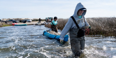
The 2023 Atlantic Hurricane Season officially began on June first, and while we hope our coast will be safe from any storms, we know how important it is to remain prepared. Hurricane Florence devastated the state in 2018, littering the coast with marine debris and causing catastrophic damage. The Coastal Federation recognized a critical gap in disaster response, the need to remove the massive amounts of debris generated by Florence, and even smaller storms. So since 2019, we’ve had crews working out on the water nonstop to help pull debris like wood from docks and piers, abandoned boats, and other large-scale debris from our coastal waters.
Now, at the beginning of another hurricane season, we’re asking you to tie it down. This simple reminder can apply to several items in and around your property. Ensure your boat is properly tied down from bow to stern if you’re unable to remove it from the water. Take any items that could get pulled out of your boat during heavy rain and wind, such as life jackets, ropes, and even bimini tops.
If you have a dock, take a moment to make sure there are no loose boards and that the dock is properly secured to the pilings, and bring in any coolers or chairs.
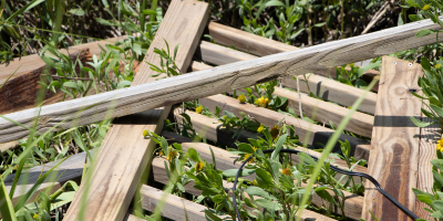
In your yard, it’s important to tie down or bring in your trash cans, secure any lawn furniture, and if you have any home improvement projects that are ongoing, be sure to tie down any lumber and bring in all tools and equipment. Our marine debris experts say it can help if you visualize what items on your property would be affected by four feet of flood water, and secure or remove those items.
Learn more about the damaging effects of marine debris and what you can do to prevent it during huricane season, here.
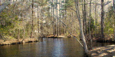
This month the Federation was awarded $1.6 million from the North Carolina Land and Water Fund Flood Risk Reduction Program to design and implement the restoration of 1,100 acres of ditched and drained timberland to wetlands within the Newport River watershed. The land which totals 1,400 acres was recently purchased by the N.C. Coastal Land Trust and will be transferred to the Federation later this year. The tract includes 1,100 acres of timberland and 300 acres of high-quality wetland habitat.
The restoration will include blocking the flow from the drainage ditches to decrease the amount of water moving to the river during a storm. The project will also restore the floodplain area along the tributary running through the center of the property to allow for floodwater storage.
Once the work is complete, it’s estimated that the property should be able to retain approximately 165 million gallons of runoff during a large storm! This will significantly reduce the volume and flow of polluted runoff entering the Newport River following each heavy rain.
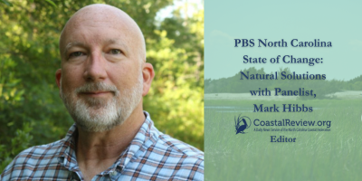
Recently Coastal Review Editor Mark Hibbs joined PBS NC’s ‘Sci-NC’ host Frank Graff along with several others for a special screening of State of Change to discuss the show’s focus on natural solutions to climate change with a specific look at carbon sequestration.
We hope you will take a moment and tune into this important discussion, here.
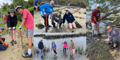
Volunteers in our central region were busy this past month, helping with several marsh grass plantings.
Recently our education staff held four different plantings at Carteret Community College, The North Carolina Aquarium at Pine Knoll Shores, Hammocks Beach State Park, and our future Center for Coastal Protection and Restoration on the banks of Bogue Sound.
Altogether nearly 100 volunteers helped us plant a combined 8,000 plugs of smooth cordgrass and Saltmeadow Hay at the four different sites.
Join us at our next volunteer event by subscribing to our events calendar, here.
This year, we are on track to accomplish one of our most ambitious goals to date for oysters: Restoring more than 20 million oysters coastwide with the addition of ten new acres of oyster reefs and launching the new Oyster Pathway in the Lower Cape Fear River. The ten acres of oyster reefs will include sanctuaries that are protected from harvest, patch reefs, and living shorelines that provide nearshore habitat. We’ll also restore the first reef in what will become the Lower Cape Fear River Oyster Pathway, a series of interconnected wetland and oyster habitats stretching more than ten miles along the lower Cape Fear River from Carolina Beach State Park to Smith Island.
Please make a special mid-year gift today to help make a huge difference for oysters in 2023!
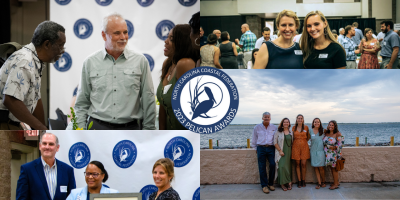
Have you grabbed your tickets yet for our annual Pelican Awards Ceremony and Taste of the Coast Celebration? This year there will be two separate events on one amazing evening!!
We hope you’ll join us first at the Pelican Awards beginning at 4:30 pm at Joslyn Hall on the Carteret Community College campus, where we’ll honor and recognize our 2023 Pelican Award Winners who are crucial in helping us further our work. This event is free but registration is required.
Later that evening, we hope you’ll join us for the festive Taste of the Coast Celebration. This event will feature a silent and live auction along with expertly paired food and drink pairings; proceeds support the Federation’s work protecting and restoring the coast. Be sure to check out our auction offerings beginning on June 30th.
Keep up with the Coast Stay up-to-date with the Coastal Review Online, North Carolina’s only nonprofit news service providing unbiased and investigative reporting on the issues that matter most to the coast. Subscribe.
As of June 23, we have 40 new members and 6 renewals!
QUESTION:
Would you pay $30 a year to use the Atlantic Intracoastal Waterway?
Whether you are cruising locally in your area from Chesapeake, Virginia to Miami or accomplishing a portion of America’s Great Loop, the ICW will be part of your experience. Meandering securely through and connecting boaters to some of early America’s most historical waterfront communities, national seashores, some of the southeast’s beautiful resort areas, is just one small part of what the ICW does for us. Docking where skippers and crew are welcomed with warm hospitality and local cultural history, is something we all enjoy.
Without a doubt the ICW is indeed a national treasure, as well as a maritime super-highway., the US Department of Transportation, which oversees the welfare of the US highway system, has designated the ICW as a Marine Highway, acknowledging the ICW’s capacity to serve a number of economic and environmental concerns. For example, energy efficiency in the movement of freight in barges that can move one ton of freight 576 miles per gallon of fuel, cleaner air through reduction of carbon emissions per ton mile, and significant economic value. In NC alone, as reported in 2006 study, businesses along the ICW generated over $257 million in annual sales, over 4000 jobs with $124 million in wages, resulting in federal taxes and fees paid $35.6 million and $21.4 million in state taxes and fees. Florida recently determined the economic impact to be right at $17 BILLION. Virginia, Georgia, and South Carolina, have somewhat similar stories to tell.
Unlike other major land highways, where tolls may be in place to help maintain them, no such fees exist to use the ICW. That’s right, no “user fees.” Why? Because the funds used to maintain it are part of a political football, the national budget.
So why did we ask the question, would you pay $30 a year to use the ICW ? In one word, POLITICS !!
We all know that congress has control of the ICW’s sustainability and very existence via its funding in the national budget. Funding to maintain its ability to serve the original as well as the minimal capacity for maritime usage. It is a full time effort to bring the ICW’s critical needs before those in congress who will determine the funds allowed for use to sustain the viability of “our ICW”.
In 1999, business along the ICW or near the ICW saw this need and organized the national non-profit Atlantic Intracoastal Waterway Association (AIWA), because they saw the rapidly declining condition of the ICW and the lack of congressional interest. Lack of interest, because in most of the USA, there is no economic impact derived from the ICW. The political concerns were with a few east coast states, Maryland, Virginia, North Carolina, South Carolina, Georgia and Florida. Yet the national benefits of increased freight movement capacity, reduced negative environmental impact, even with the impact of reducing highway congestion thru water freight movement, and reduced fuel consumption, the American Trucking Association (ATA) reports of serious driver shortages now and projected through 2030’s. Concerns which seem to be fall on deaf ears, due to lack of constituent input, no GRASS ROOTS SUPPORT concerning the ICW’s needs or its significant value.
We boaters, seasonal cruisers, using the ICW from all over this great nation, have an opportunity to voice our concerns, express the needs to properly fund the sustainability of this national treasure, the Atlantic Intracoastal Waterway. Your individual membership in the Atlantic Intracoastal Waterway Association gives its executive director and board membersa chance to show our federal legislatures the broad based membership interest and support the waterway has, plus as a member you will be receiving reports of successes as well as immediate needs that we as individuals can write to our own federal representatives with facts that need to be shared and request their support when the budget process is underway. Just maybe this will stop some of the providential thinking and gain a broader based we are all in this together attitude supporting the ICW maintenance budget needs.
ONLY $30 dollars a year and your voice and your expression of concern is made available to THE VOICE OF THE ATLANTIC INTRACOASTAL WATERWAY.
The photos below are from the recent meeting between the AIWA Board members and other supporting members of Congress.
Our team at Cruises Net and all the marine businesses who depend on your travels along the ICW say THANK YOU! and hope that many more than fifty will join in support of the AIWA’s tireless efforts on our behalf. Editor’s note: As of June 5, Director Brad Pickle reports 25 new members!
Here are a couple of links to some supporting materials and AIWA contact information if you would like more information:
PLEASE let’s all join in to keep this maritime resource and national treasure alive, well, and in tip top shape.
FIFTY by FIFTY is the GOAL
Will You Step Up and Be Counted ?
Thank You !
Share:
Comments from Cruisers (1)
Phil Barbalace- June 30, 2023 - 12:57 pm
Would I pay $30 a year to use the ICW? What a dumb concept! Who would collect this and ensure it's used for the ICW? If that were a realistic concept I would pay $100 or more a year to use the ICW. Instead, I like other thousands of boaters, spend, each of us, hundreds if not thousands of dollars a year in boating related businesses and restaurants along the ICW. And have been for many years. And we're happy to do it as the ICW is a remarkable national asset.
Orlando, Fla. (June 21, 2023) – Brightline, the only provider of modern, eco-friendly, intercity rail in America, celebrated the completion of construction to Orlando, paving the way for the launch of service between Central and South Florida this summer. To mark the completion of construction, mayors representing Brightline station cities along with Brightline Orlando construction team members gathered to celebrate with a roundtable conversation on transportation and economic impact in Florida.
Brightline’s Orlando expansion broke ground in June 2019, one year after operations began in South Florida between its Miami, Fort Lauderdale and West Palm Beach stations. Additional stations were opened in downtown Boca Raton and Aventura in 2022 as construction to Orlando continued. Brightline is the first private entity to deliver an intercity rail system since Henry Flagler built the railroad more than a century ago.
HIGHFIELD, A CRUISERS NET SPONSOR, is the leading builder of aluminum-hulled RIBs. Performance and strength are the key features of every HIGHFIELD RIB. Their advanced hull designs and Italian-influenced interior styling, keep alive the reputation of a dry-riding, seaworthy and stable craft that can handle rough conditions, as well as please the discerning eye.
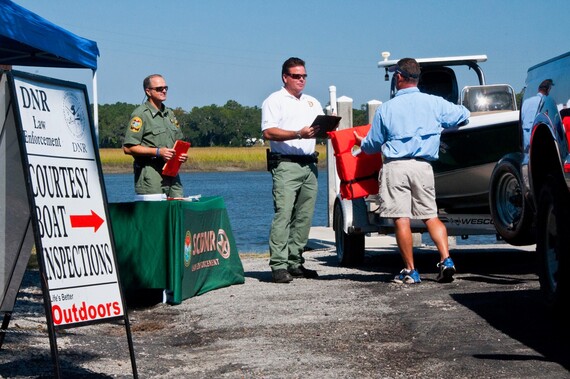
SCDNR to conduct courtesy boat inspections during July 4th holiday, weekend
SCDNR’s courtesy boat inspections during the July 4th holiday are aimed at keeping everyone safe.
In an effort to keep people and waterways safe during the July 4th holiday and preceding weekend, the S.C. Department of Natural Resources (SCDNR) Law Enforcement Division will be conducting courtesy boat inspections at public boat landings around the state.
The July 4th holiday is one of the busiest boating times of the year for South Carolina lakes and waterways, and officers want to do everything possible to keep everyone’s weekend fun and safe.
SCDNR boating safety and enforcement officers will perform quick but thorough inspections for required safety equipment and proper boat and motor registrations. Those who are not in compliance with safety regulations or registration requirements will not be ticketed during the complimentary inspections. Instead, they will be given an opportunity to correct the problem before they launch their boat. SCDNR officers will also be available to answer questions and give boaters tips on how to stay safe on the water. The boating inspections will be conducted July 1, July 2 and July 4.
To report boating violations such as reckless operation or an intoxicated boat operator, call the SCDNR toll-free, 24-hour hotline at 1-800-922-5431 or dial #DNR on your cellular phone.
For a copy of South Carolina’s boating regulations, to find out about local boating safety courses, or to obtain a free float plan form, contact the SCDNR boating safety office at 1-800-277-4301 or visit http://www.dnr.sc.gov/education/boated.html.
July 4th, weekend boat inspection locations (most inspections are from 10 a.m. to Noon):
Saturday, July 1:
Beaufort County: Lemon Island Landing, Chechessee River, 10 a.m. to Noon
The Great Dismal Swamp, whose alternate ICW route departs the southbound Waterway at MM 7.2 and northbound via the Pasquotank River in NE Albemarle Sound.Dismal Swamp Welcome Center is A CRUISERS NET SPONSOR! Our thanks to Sarah Hill for this report.
The Dismal Swamp Canal is open to navigation & locks are operating normally. Attaching some images from the last couple days- it has been a busy spring/summer along the waterway!
Thanks,
Sarah
Sarah Hill, TMP Director, Dismal Swamp Canal Welcome CenterChairperson, Camden County Tourism Development Authority
Camachee Cove Yacht Harbor, A CRUISERS NET SPONSOR, is located just off the Waterway’s western shoreline, south of unlighted daybeacon #7 and north of the Vilano Beach Bridge.
It was a historic weekend at the 2023 Old School Kingfish Shootout! Several records were broken, including boat entries at 654! First place angler William Crabtree aboard the Yellowfin 39 Offshore “Time Machine” also weighed a new tournament record 46.83-lb. kingfish! Congratulations to all the winners and thanks to all involved! #LiveDeeper
Our thanks to Makers Air and Staniel Cay Yacht Club, A CRUISERS NET SPONSOR, for posting this news.
Greetings from Makers Air!
Effective Monday June 12th, Bahamas Customs will require digital submission of their forms for residents and tourists through an app called Exempt.
Everyone traveling to The Bahamas is required to fill out a Bahamas Customs C17 Declaration Form. Whether a returning resident or a visitor on vacation, Exempt is designed for you to complete your form electronically before you land in order to save time. All passengers will use the Exempt app to submit your C17 form to Bahamas Customs.
After signing up and submitting your appropriate travel documents, you will be issued a QR code and confirmation number. Upon arrival into Customs, the Officer will review your electronic submission and process your form.
In most of our Out Island ports of entry, your Exempt confirmation code will be given to the officer on duty as your proof of submission.
Paper immigration forms are still required at this time and will be provided to you at check in.
Download the app and set up your profile today to make your Bahamas entry experience a breeze!
There is always plenty to do around Charlotte Harbor! While berthed at Fishermen’s Village Marina, A CRUISERS NET SPONSOR, you are certain to enjoy visiting Western Florida’s beautiful Charlotte Harbor/Peace River.
Fishermen’s Village July Calendars of Entertainment/Events


Be the first to comment!