CRUISERS NET
Cruisers Helping Cruisers
Comprehensive cruising resource for the Intracoastal Waterways
from Norfolk to the Northern Gulf and Bahamas.
from Norfolk to the Northern Gulf and Bahamas.
FREE to use due to the generosity of our sponsors - please patronize them
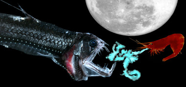
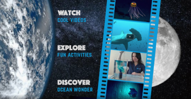
NOAA’s Ocean Today – Full Moon Bioluminescence
This full moon, learn how animals have evolved bioluminescent capabilities to breed, feed and survive.
Be the first to comment!
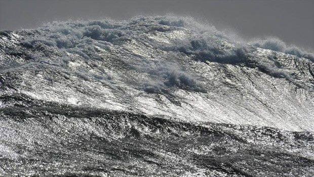
Let’s talk about the Gulf Stream
The team at the wind forecast app WINDY explain why the Gulf Stream is perhaps the most famous current in the world’s oceans.
Let’s talk about the Gulf Stream
Scuttlebutt Sailing NewsBe the first to comment!
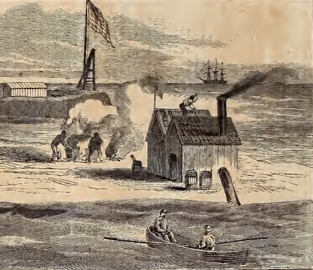
Burnside’s Miracle Happens in Hatteras Inlet by Kevin Duffus
In the last of a three-part series, author Kevin Duffus writes about the “miracle” that saved Ambrose Burnside and his crew during the January 1862 Hatteras Expedition.
Burnside’s Miracle Happens in Hatteras Inlet
Coastal Review OnlineBe the first to comment!
More on Pelican Bay Anchorages, hard by Cayo Costa Island/State Park, Western Florida ICW Statute Mile 25

But, as I’ve often said, there’s no such thing as too much information when you are on the water, so there are two more observations concerning this anchorage copied from the AGLCA forum. For more reports, enter Pelican Bay in the search window of our Homepage.1/26/2021
Highly recommend the Punta Blanca anchorage. We spent a few nights there December 20-23 2020. I have attached our route getting in on our 5.5’ draft sailboat. We entered and left at high tide, there’s one little bar we bumped over on the southwest side, otherwise stay close to the mangroves. We only saw kayakers and fishermen and a park ranger checking for campers on the island. About a mile and a half dink ride to Cayo Costa State Park dock and Cabbage Key.
cheers,
Greg Scannell, AGLCA Member
S/V Dragonfly— Attachment(s) —
89F8EB0D-489B-4306-AEEF-
DB2E39D9629E.png (738.2 KB)Alan is absolutely correct about Pelican Bay; it’s one of the premier anchorages you will find anywhere. However, “local knowledge” is important getting in there. Neither the approach to the bay, nor its entrance channel, are marked. So, ass/u/ming you are southbound on the G-ICW, turn west at a point south of G “75,” and about 200′ north of R “74.” Note that just off the shoreline, there is a Florida Speed Sign visible. Head toward that sign. Just before you reach the sign, turn SW and follow the line of the beach on Cayo Costa Island there, holding your course parallel to the beach and holding the shore close by to stbd at 50′ – 75′. Yes, a boat length or slightly more off the beach line. That “channel” carries 9′ of water, but it shoals very rapidly to the south, to 3′ or less. Many, many unwary boats go aground there. When you have passed by the beach, you will
see the Cayo Costa State Park docks at your 11 o’clock, at a distance of about 1/2 to 3/4 miles. Aim at those docks, and set a rhumb line to them until you are past the shallowest water. There are slips there, with no services, but cruising boats generally can’t use them. Only the very outermost slips carry sufficient water depth. The dock tee heads are reserved for tour boats, of which there are several that ply those waters. Plan to anchor. The bottom is sand, and the holding is excellent.
The gulf coast of Florida has diurnal tides; that is, one high and one low per day. Water depths are lowest in the morning and moderate to high in the mid-to-late afternoon. The tidal range at Pelican Bay is only about 2′. The rhumb line from the beach to the State Park docks will get down to 5-1/2′ at MLLW. By the time you get to the docks, you’ll see 6-1/2′ or more. There is a deep pool correctly charted on the current charts that carries 9′, which is the deepest water in the bay. Some older charts that are still widely circulated do not show that 9′ pool correctly. If you do not see that deep pool, you do not have the current charts of the basin. The basin is actually a “pass” between Cayo Costa Island to the west and Punta Blanco Island to the east. To the south from Pelican Bay, the water appears visually to be open; but, it is shoal, and not navigable by cruising draft boats. The only access back to the G-ICW from Pelican Bay is the one to the north of Punta Blanco Island, described above.
Armed with this “local knowledge,” you will find Pelican Bay to be a delightful, well protected anchorage with a lot to see and do.
Hope this is useful.
JimThere are two really good anchorages near Boca Grande entrance to Charlotte Harbor. The second is Pelican Bay at Cayo Costa. This is one of our favorites. Many people avoid it because of the shoal at the entrance. Just hug the beach – stay 25-50 feet off the beach and you will be in 6-9 feet of water. We draw 4.5 feet and anchor here a lot. The beach and park at Cayo Costa are great and again the park is only accessible by boat.
Marty & Jerry RichardsonPelican Bay is right in my backyard, and I have been there a number of times. The descriptions above are reasonable, although the details change often.
However, the discussion about tides is not correct. The tides in this part of the world cycle from diurnal to semidiurnal twice each month. The diurnal tides are near full moon and new moon, while the semidiurnal tides are near the first and third quarters. There is also an important annual component. The lowest tides tend to be mid-day in the winter and mid-night in the summer.
There are no simple rules that can be conveniently remembered. Even thought the average tidal range is only a couple of feet, tide tables are essential if depth is important to you.
Gene Fuller
Punta GordaThe nun has now been replaced with a post R74. We were just there 1/20/13.
Frank CushingClick Here To Open A Chart View Window, Zoomed To the Location of Pelican Bay
Comments from Cruisers (7)
-
Is there any updated info on Pelican Bay accessibility/ permission to anchor there, etc????? Last I've seen is Dec 2022.
-
We went by several days ago on saw a number of boats anchored there. Can’t go ashore but great location for nice anchorage. Looked like the boats were following the same route into Pelican Bay. Sign is still up.
-
I did dig a bit deeper and made some calls including to the Florida Park Service where I spoke to a real person. ( I had googled state parks and they gave me a list of other places still closed.) She said that the Cayo Costa is completely closed down and that included the anchorage. She was quite firm about the anchorage even when I said we would not go ashore. Has she ever even seen the place? Probably not. We are going that way anyhow in the next day or two so…….
-
I’m also looking for status of Cayo Costa. Currently anchored off Ding Darling for our second night. Mangroves look really browned out. Have not tried the dinghy yet to go inside as the entrance looks partially blocked off. Hopefully the tide is still coming up but… We are going to move to Cayo Costa probably tomorrow and will keep our fingers crossed. Came across the lake on Tuesday and very saddened to see Fort Meyers and Cape Coral and now Pine Island.
-
Jérôme – not a word – have tried for info via Boats US – nothing – seems either no one knows anything – or notinterested in answering.
Paul
-
I am looking for the same info on Pelican Bay and if boats are even cruising the ICW between Fort Myers and Venice. Have you by heard anything Paul?
-
Since the passing of Hurricane Ian can anyone tell me if the main entrance off of Marker #74 off the ICW is still navigable with a 5 foot draft???
Thank you.
Paul
-
Bahamas Chatter: Sand “bores”?

Bahamas Chatter is published by Explorer Chartbooks, A CRUISERS NET PARTNER, which has long been the standard navigational supplement for enjoyable, informative, and safe cruising through the beautiful Bahamian waters and island visits.
Bahamas Chatter: Sand “bores”?
Posted: 25 Jan 2021 04:27 AM PST
I’ve got a question that I’m hoping you might be able to help with, and the internet so far has been less-than-helpful. I notice in the Explorer charts and many other guides the use of the term “sand bore.” Explorer defines this on several charts as a “fluid, shifting, live sand bar.”
Can anyone shed some light on the origins of the term, or perhaps point me towards some reference materials? How exactly is a bore different than a “shifting sand bar,” a term often used on the same chart near the same feature? I know there are several geographic places where the term is used, but my question is mostly academic. What exactly is a sand bore?
Thanks in advance!
Matt Claiborne
s/v DulcineaBe the first to comment!
New U.S. COVID-19 Air Travel Rules
This advisory is from Tripadvisor and the US Embassy in the Bahamas.
Dear traveler,
Are you considering an international trip? If so, read on. The CDC has issued a COVID-19 order that may impact your plans for re-entering the United States.
Effective January 26, 2021 travelers arriving in the U.S. must:
1) Get tested for COVID-19 no more than 3 days before departing to the United States and show a negative test result to the airline before boarding OR 2) show documentation of recent recovery from COVID-19 to the airline before boarding.
This new order applies to all air passengers — including U.S. citizens and legal permanent residents — aged 2 years and older. It also applies regardless of the length of time spent outside of the United States.
Acceptable documentation of recovery from COVID-19 includes both a positive viral test result within 3 months of travel (or the time period specified in current CDC guidance) AND a letter from a healthcare provider or public health official stating that the passenger is cleared to end isolation.
Passengers who have tested positive for COVID-19 will need to delay their travel until they meet the criteria to end isolation; learn more here.
Need more information? Visit this FAQ page at CDC.gov.For more details, see COVID-19 Information for The Bahamas and Turks and Caicos Islands
US Embassy in the BahamasBe the first to comment!
Gulf of Mexico Marine Sanctuary Nearly Triples in Size
This week, the National Oceanic and Atmospheric Administration announced it will expand the Flower Garden Banks National Marine Sanctuary to nearly triple its current size.

Gulf of Mexico Marine Sanctuary Nearly Triples in Size
National Audubon SocietyBe the first to comment!
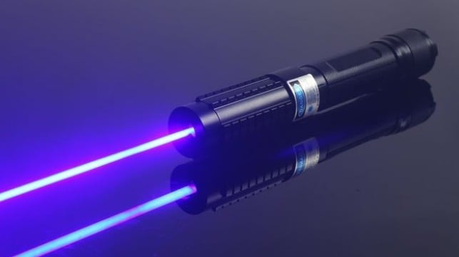
New Law Helps U.S. Coast Guard Crack Down on Laser Strikes
The National Defense Authorization Act for FY2021 includes a little-noticed provision that will improve waterway safety: it is now a felony crime to aim a laser pointer at any vessel operating on the navigable waters of the United States. See also Coast Guards Seeks Info Re Lasering Events.
New Law Helps U.S. Coast Guard Crack Down on Laser Strikes
Maritime ExecutiveComments from Cruisers (1)
-
Now, if we could only get them to "crackdown" on unsafe operators and unsafe operations….
-
I Am Going Cruising – Should I Carry a Gun? – Bill Parlatore
As a follow up to my last article about security while cruising, I want to address the question that started this conversation. People are buying boats and going cruising in a big way. And when new boaters plan to go on their first extended cruise, such as the Great Loop or other adventure, a common question is whether they should carry a gun for protection.
Click here to continue: I Am Going Cruising, Should I Carry a Gun?
Seattle YachtsBe the first to comment!


Social Media Auto Publish Powered By : XYZScripts.com
Be the first to comment!