Shared Photo: Red Cloud in Cape Fear River

Naval vessel Red Cloud
Naval vessel Red Cloud

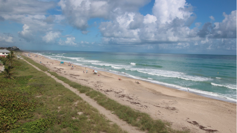
The City of Gulfport, home to Gulfport Municipal Marina, A CRUISERS NET SPONSOR, always takes steps to protect its citizens and visitors. The marina and harbor, found on the northern shores of Boca Ciega Bay, are easily accessible from the Western Florida ICW, just north of Tampa Bay.
| |||||||||||
Click Here To Open A Chart View Window Zoomed To the Location of Gulfport Municipal Marina
Click Here To Open A Chart View Window Zoomed To the Location of Gulfport Anchorage/Mooring Field
NMMA Survey Shows E15 Gasoline Warning Labels at the Pump Do a Poor Job
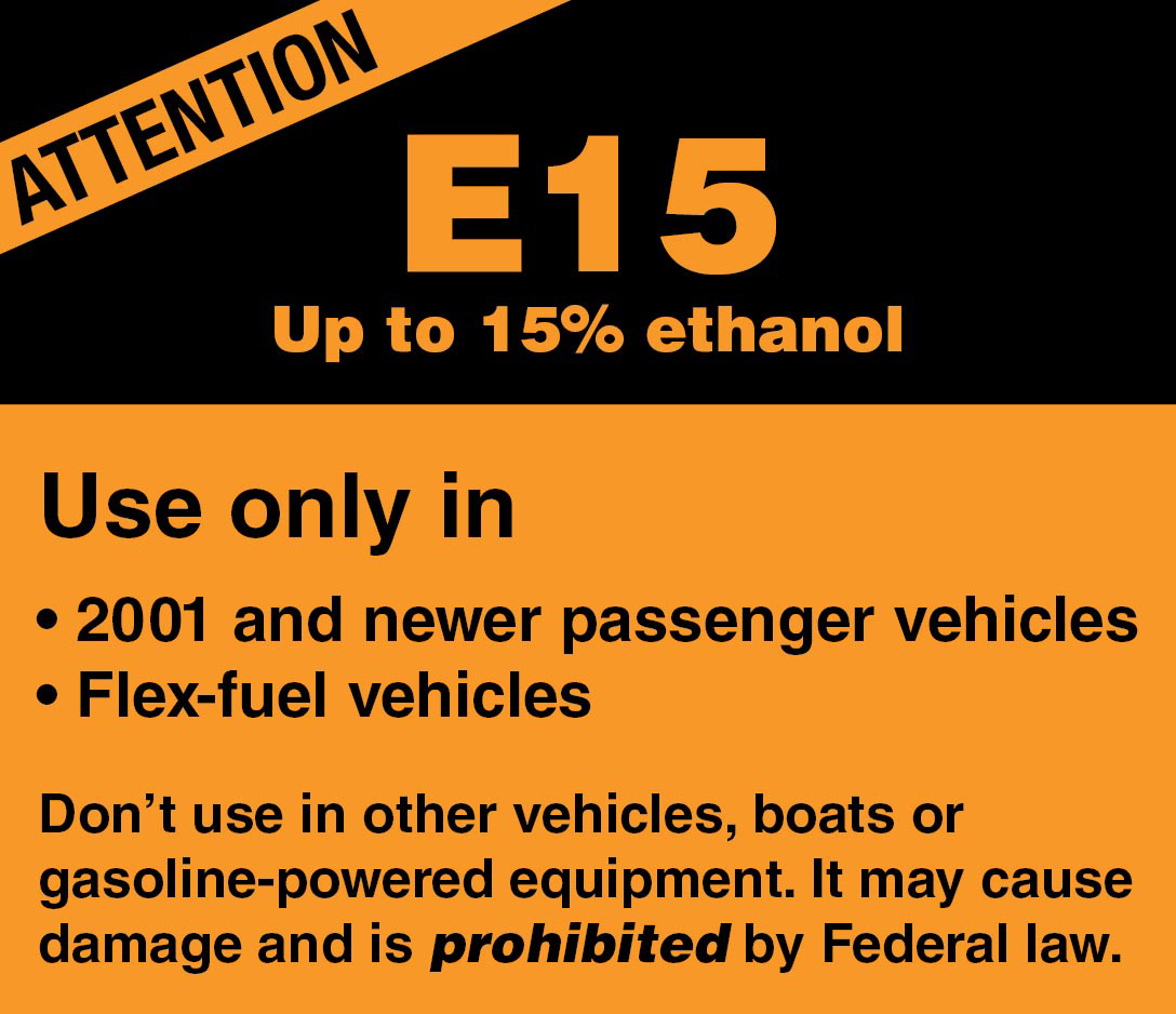
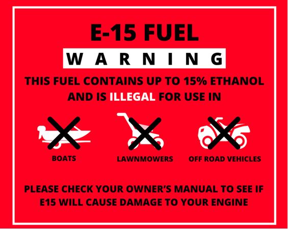
Gas Station Pump Labels Are Supposed to Warn Boaters
Against Putting the Wrong Fuel in the Tank;
Survey Reveals They Fail Miserably
Respondents favor prototype E15 warning label 4-to-1 over existing label
SPRINGFIELD, Va., Dec. 2, 2020 – With the boat in tow, you head to the gas station to fill her up. At the pump you find a fuel prohibited for use in boats, E15 gas, being sold alongside approved E10 fuel. What’s to prevent you from misfueling? A little warning label about the size of a pack of gum that’s often hard to notice, difficult to understand, and too often fails to protect consumers, said boat owners and other non-road-engine users in a recent National Marine Manufacturers Association survey on the effectiveness of current E15 warning labels.
The ethanol warning label survey is being used to help persuade EPA regulators, currently reviewing E15 labels, to offer a more effective warning. Survey takers were shown the existing orange E15 warning label and a red prototype label with pictographs. Respondents were more than four times as likely to say that the prototype label more clearly conveys the idea of a “warning” for consumers than the current label.
What made the difference? The prototype’s red color and visual reinforcement was cited as more effective than the real label. Where the label is located on the pump can also be improved: 70% of respondents noted that inconsistent placement of the E15 label on fuel dispensing pumps made it harder to locate and less effective.
“EPA has some work to do in regard to educating consumers at the pump with more effective ethanol fuel labeling that better communicates the hazards of E15 for boat engines and other small motors,” said BoatUS Manager of Government Affairs David Kennedy. E15 is prohibited by federal law for use in recreational boat engines, off-road vehicles and small engines.
In addition to supporting improvements to the ethanol content warning label type, size and location on the pump, Boat Owners Association of The United States (BoatUS) supports public education efforts, evaluating the adoption of different fuel pump nozzle sizes, ceasing misleading marketing of ethanol fuels such as “Regular 88” fuel (containing 15% ethanol), evaluating the use of physical barriers and keypad systems, and offering a dedicated pump for E0 (0% ethanol) fuel.
###
Suggested social media post: .@thenmma survey responses show that E15 fuel warning labels at the pump do a poor job of helping protect boats and other small engines from misfueling https://bit.ly/39tgYlS #BoatUSonWatch
About Boat Owners Association of The United States (BoatUS):
Celebrating more than 50 years, BoatUS is the nation’s largest organization of recreational boaters with more than 700,000 members. We are the boat owners’ voice on Capitol Hill and fight for their rights. We are The Boat Owners Auto Club and help ensure a roadside trailer breakdown doesn’t end a boating or fishing trip before it begins. When boats break down on the water, TowBoatUS brings them safely back to the launch ramp or dock, 24/7. BoatUS offers GEICO Marine Insurance policies that give boat owners affordable, specialized coverage and superior service they need. We help keep boaters safe and our waters clean with assistance from the nonprofit BoatUS Foundation for Boating Safety and Clean Water. Visit BoatUS.com.
Boating with young children presents challenges that require mariners to approach a day out on the water with the proper safety plans in place to prevent loss of life, personal injury and property damage.
| News Release | U.S. Coast Guard 7th District Southeast |
Coast Guard urges safe boating with children

MIAMI – In the United States, drowning is the most common cause of death in children ages 1 to 4. Throughout December, Coast Guard Seventh District crews are highlighting the importance of child safety and the precautions mariners must take when boating with minors.
Boating with young children presents challenges that require mariners to approach a day out on the water with the proper safety plans in place to prevent loss of life, personal injury and property damage.
The Coast Guard is advising the public of these safety tips when boating with children:
To follow our December outreach, follow @USCGSoutheast on Facebook/Twitter for more info. Media interested in an interview please call 305-202-3735.
For more breaking news follow us on Twitter and Facebook.
-USCG-
![]()
 | Questions for the Coast Guard? Contact Us |
For more Coast Guard news, visit our online newsroom here.
Privacy Policy | GovDelivery is providing this information on behalf of U.S. Department of Homeland Security, and may not use the information for any other purposes.
Find out how sustainable aquaculture practices are helping to grow healthy seafood and support a cleaner ocean.

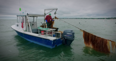
The Future of Ocean Farming – A New Video Collection (5 Parts)
The City of Gulfport, home to Gulfport Municipal Marina, A CRUISERS NET SPONSOR, always takes steps to protect its citizens and visitors. The marina and harbor, found on the northern shores of Boca Ciega Bay, are easily accessible from the Western Florida ICW, just north of Tampa Bay.
| |||||||||||
In the event of forecasted severe weather between Dec 1, 2020 and May 31, 2021, the COTP will coordinate with the Heavy Weather Advisory Group (HWAG) to evaluate port preparation and changes in port condition. While these procedures are for the SC coast, they are the same followed in all sectors.
SECTOR CHARLESTON
END OF 2020 ATLANTIC HURRICANE SEASON
The Atlantic Hurricane Season began June 1, 2020 and ran through November 30, 2020. During this timeframe, the threat of severe weather was increased and Port Condition (PORTCON) was set to PORTCON IV.
From December 1, 2020 through May 31, 2021, the threat of severe weather decreases. PORTCON V with a port status of OPEN for all ports and waterways within the Sector Charleston Captain of the Port (COTP) Zone is now in effect. These waters are identified in 33 CFR 3.35-15 and lie between the intersection of the North Carolina – South Carolina border and the northern bank of the Savannah River.
While the measures in effect are now general, this does not preclude the COTP from changing port conditions in the event of forecasted severe weather. These port conditions are as follows:
Forecasted Hours Prior to Tropical Storm Force Winds Port Condition Measures in Effect
1 DEC – 31 MAY Port Condition V General. Port status is OPEN.
1 JUN – 30 NOV Port Condition IV Hurricane seasonal alert. Industry to review heavy weather plans. Port status is OPEN.
72 hrs Port Condition WHISKEY The COTP will assess lay-up and mooring plans, meet with stakeholders, and conduct port assessments. Port status is OPEN.
48 hrs Port Condition X-RAY The COTP will finalize review of lay-up and mooring plans, hold further meetings with stakeholders, and continue port assessments. Port Status is OPEN.
24 hrs Port Condition YANKEE The COTP may restrict vessel movements, including stopping inbound vessel traffic, and cargo operations. Port status is OPEN with RESTRICTIONS.
12 hrs Port Condition ZULU The COTP may restrict all vessel movements, including stopping inbound and outbound vessel traffic, and cargo operations. Port status is CLOSED.
AFTER STORM PASSAGE Port is OPEN or OPEN with RESTRICTIONS Prior to authorizing vessel movements and cargo operations, the COTP will conduct a risk analysis based on actual weather observed and port assessments, which may include verifications of aids to navigation, channel hazards, waterfront facility damage, and vessel accountability.
In the event of forecasted severe weather, the COTP will coordinate with the Heavy Weather Advisory Group (HWAG) to evaluate port preparation and changes in port condition.
The HWAG consists of maritime transportation system professionals local to the COTP Port Zones, providing input on local operations and coordination for overall port well-being in response to severe weather events.
The COTP will announce changes to port conditions via a Marine Safety Information Bulletin (MSIB) and a Broadcast Notice to Mariners when forecasted severe weather threaten South Carolina.
Vessels, waterfront facilities, and marinas are recommended to take this opportunity of decreased threat of severe weather and evaluate heavy weather plans, anticipated vessel remain-in-port requests, avenues of evacuation, and local contact lists.
For HWAG or waterway specific questions, please contact (843) 323-7761. For facility and foreign vessel specific questions, please contact (843) 740-3186. For domestic vessel specific questions, please contact (843) 754-2076. For Coast Guard related emergencies, please contact Sector Charleston Command Center at (843) 740-7050.
This MSIB can be viewed at https://homeport.uscg.mil/port

At the intersection of the Atlantic Intracoastal Waterway and the Okeechobee Waterway, Martin County, A CRUISERS NET SPONSOR, is a hub of boating activity and of events of interest to boaters.

Click here for Celebrate Your Missed Milestones | Martin County
HAPPY THANKSGIVING EVERYONE!

Cruisers Net is so very grateful to you, our readers and our sponsors, for your support throughout 2020.
Even with the pandemic and the uncertainty of this year, we have so much for which to be thankful. Despite initial fears for the survival of marinas and the marine industry, it seems that many new boaters have turned to boating as a way of dealing with societal restrictions. Dealers report shortages of new and used boats to sell. Marinas are reporting nearly full slip capacities and slip sales. Boats have become safe havens – a way to be outside and distance oneself from the spread on COVID-19. September 2020 ranks as the second highest single-month total of new powerboats sold in more than a decade – Marina DockAge.

RESTORING BALLAST!
This shoaling appears to begin just north of Bakers Haulover Inlet. Slow speed and sharp watch are required.
FLORIDA – AICW – WEST PALM BEACH TO MIAMI – NORTHERN BISCAYNE BAY: Bakers Haulover Shoaling
Mariners are advised that significant shoaling has been identified in portions of the Intracoastal waterway within Bakers Haulover, in the vicinity of:
25-54-15.77N / 80-07-49.37W (25°54.2629N / 080°7.8229W, 25.904381 / -80.130381),
25-53-51.14N / 80-08-01.75W (25°53.8523N / 080°8.0291W, 25.897539 / -80.133819),
25-53-59.71N / 80-07-33.10W (25°53.9951N / 080°7.5517W, 25.899919 / -80.125861),
25-54-15.62N / 80-07-44.83W (25°54.2603N / 080°7.7471W, 25.904339 / -80.129119) .
The shoaling has resulted in depths being reduced below 10 feet in some areas with the most severe portions showing a depth as low as 2.9 feet.
Extreme caution should be exercised when transiting the area to avoid vessel damage and potential groundings.


Be the first to comment!