Scientists Race Against Time To Save Coral Off Florida Keys
Over the last 40 years, nearly 90% of the live corals that once covered those reefs have died off.
Scientists Race Against Time To Save Coral Off Florida Keys
Here And Now
Over the last 40 years, nearly 90% of the live corals that once covered those reefs have died off.
Scientists Race Against Time To Save Coral Off Florida Keys
Here And Now
Our thanks to Bobby Carr for sharing his photos

Jerico River in Midway, Ga. Captured during sunset on May 30, 2020
Absolutely beautiful
Oyster lovers will tell you that Carolina oysters are extra special. It is great that these oyster beds in Pamlico Sound are being regrown. The North Carolina Coastal Federation is partnering with the state Division of Marine Fisheries to add 15 acres of new oyster reef habitat in Pamlico Sound.
Pamlico Oyster Reef Habitat to Grow 15 Acres
Coastal Review Online
The beautiful Oak Island area is also home to three CRUISERS NET SPONSORS: Southport Marina, Deep Point Marina and Bald Head Island Marina – three more reasons to visit Oak Island. See Annual Oak Island Lighthouse Run for a rescheduled fall event.
15 Reasons To Visit Beautiful Oak Island, NC
TravelAwaits

Back in the mid-19th century, and continuing until 1930, a group of whalers in Australia’s Twofold Bay worked with a pod of killer whales to catch and kill baleen whales.
True and Stories/Hell on Whales
ozy.com
Considered by many to be one of the best anchorages south of Charleston, Tom Point Creek cuts the western shores of North Edisto River, well south, southwest of flashing daybeacon #102. Our thanks to Jackie and Charlie for this report.
9-11-20. (Looks like we’re only ones using this great anchorage!) Anchored in Tom Point creek (and 3 nights ago also) – about mm 495.5. Came in pretty far (2nd anchor ) to escape threatened storms. Very good protection. About 5-6 times here. A favorite bad weather anchorage. Anchored in about 13-14′ at 80% hi tide. 33# claw 50′ chain 34′ boat. Anchor not move – came up almost clean. Easy in/out- keep middle channel. No place to take dog. Current normal tidal flow. Beautiful and serene!! Charlie and Jackie on Traveler
Click Here To Open A Chart View Window, Zoomed To the Location of Tom Point Creek
|
Bath State Docks are located on the eastern shores of Bath Creek, north of flashing daybeacon #4. For an in depth report on Bath. Our thanks to Almond Drake for this update,
Due to damage from Hurricane Isaias, the State Dock at Historic Bath is closed at this time. We apologize for any inconvenience and are we are working hard to open it back up as soon as possible.
Almond Drake
Click Here To View the NC Cruisers Net Marina Directory Listing For Bath State Docks
Click Here To Open A Chart View Window Zoomed To the Location of Bath State Docks

Bahamas Chatter is produced by Explorer Chartbooks, A CRUISERS NET PARTNER, which has long been the standard navigational supplement for enjoyable, informative, and safe cruising through the beautiful Bahamian waters and island visits.
Bahamas Chatter: Report of cruise ships damaging the seabed near the Berry Islands
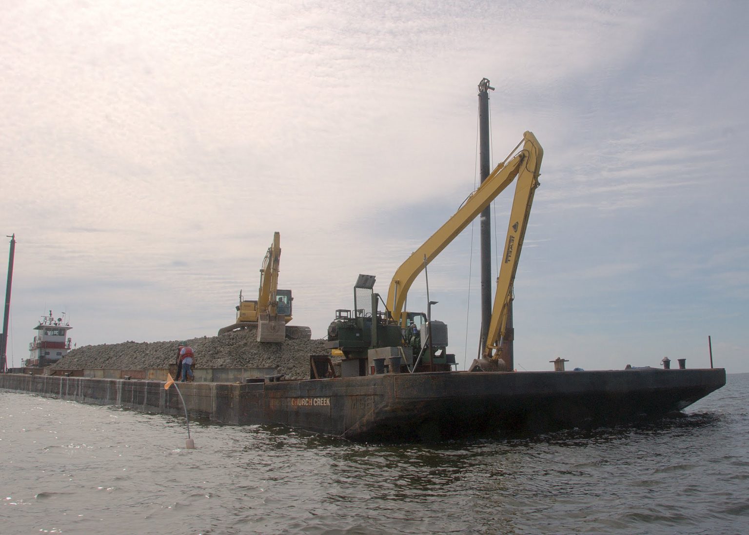
| Report of cruise ships damaging the seabed near the Berry Islands Posted: 08 Sep 2020 12:33 PM PDT The COVID-19 pandemic has forced shutdown of active cruise ships operations in the Bahamas and cruise ships have been allowed to shelter in Bahamian waters. According to a report from the director of the Bahamas National Trust, fishermen in the Berry Islands have reported significant damage to the seafloor from cruise ships’ anchors and chains dragging across the seabed. Two miles west of Little Stirrup Cay, a private cruise port (AKA Coco Cay), it’s reported there are 15-18 cruise ships anchored two to three miles apart. The fishermen have said, the anchors are sometimes dragging along the seafloor as ships fail to properly anchor or have to be repositioned. On Sunday a dive team found “significant damage” to the marine environment allegedly caused by ship anchors.“The anchors are totally destroying the fishing grounds, and dragging through the coral. The chains are dragging coral and mountains of sand, ripping up the shoals and bars, totally devastating the fishing area. It looks like someone was driving a bulldozer across the seafloor,” the report alleged. A team is urgently putting together a comprehensive assessment to determine the extent of the damage and quantify the value of the damage and the potential remediation costs. The report stressed that all vessels sheltering in Bahamian waters are “obliged to anchor, operate and navigate in a safe manner and in all respects compliant with all local laws and regulations, including safety and environmental regulations.”It added: “This extends to discharges of any kind, to the avoidance of any protected or restricted areas, and to the avoidance of damages to any sensitive commercial and environmental resources including reefs.” Divers from the Royal Bahamas Defence Force and the Department of the Environment have been ordered to carry out further anchorage site assessments between the Berry Islands and Bimini. Editors note: Most cruise ships should be able to use Dynamic Positioning to maintain a fixed position providing it is properly manned. |
National Wildlife Day, founded in 2005 by animal behaviorist and philanthropist Colleen Paige, serves to bring awareness of endangered animals, nationally as well as globally, that need to be preserved and rescued from their demise each year.

September 4 is National Wildlife Day


Be the first to comment!