Our thanks to James H Newsome for this reminder to send you comments by July 15. See Contacts for additional addresses.
There are only 9 days left to submit your public comment to GA Department of Natural Resources.
Written public comment will be received through Monday July 15, 2019. Comments should be legible, concise and limited to the proposed rule change. Following the comment period, the Board of Natural Resources will consider the proposed rule on August 27, 2019 at 9:00 AM at its Board Room located at 2 Martin Luther King Jr. Drive, SE, Suite 1252, Atlanta, Georgia.
Mail or email comments to: Kelly Hill, Coastal Resources Division, One Conservation Way, Brunswick, GA 31520. Kelly.Hill@dnr.ga.gov
Eleven excellent photos from CRUISERS NET SPONSOR, Southport Marina, located just west of the Cape Fear River along the northern banks of the Waterway hard by flashing daybeacon #2A.
There are two Ashepoo-Coosaw Cutoffs, north and south. Either can be a problem stretch between dredgings due primarily to shoaling, but this report concerns the area around marker 177 at the northern end of the southern cutoff, which has earned the Problem Stretch designation. The two cutoffs connect the Ashepoo and Coosaw Rivers and have a 5-7 ft tidal range. Our thanks to Blades Robinson for this good-news report.
NO PROBLEM – Depth Report from Ashepoo-Coosaw Cutoff AICW Problem Stretch, Statute Mile 517 We just transited over the five foot “blue shoal” depicted on the chart and the shoal is GONE! Our water depth was 27’ where the shoal was located on the chart and came up to 13’ before and after the indicated shoal. Apparently it has been dredged. Blades Robinson
North/south Hwy 17, or Ocean Hwy, passes to the east of Hertford and is crossed by a fixed vertical clearance bridge between Ferry Point and Crow Point. If you have local knowledge re the vertical clearance of this bridge or have recently navigated this area, please let us hear from you.
Just wondered if anyone has been through the Highway 17 bridge in Hertford, N.C. lately? Is there a signboard with actual clearance to water level on it? I know the posted clearance to MHW is 33 feet, and my “air draft” is 32.3′, so I would want to make sure I know the real clearance before going through. Thanks. David Swanson
Explorer Chartbooks, A CRUISERS NET PARTNER, has long been the standard navigational supplement for enjoyable, informative, and safe cruising through the beautiful Bahamian waters and island visits.
Bahamas Chatter: New Fuel and Dockage Survey 7/2/19
A new fuel and Dockage Survey has been posted on https://www.explorercharts.com/index.php?option=com_content&view=article&id=56&Itemid=53 Since the last survey eight marinas raised their dockage prices and two marinas lowered them. Most fuel prices were up as well. The prices shown in red are old and should not be trusted. We will attempt to contact the marinas with old prices and if we cannot, they will be removed from the list.
The restaurant at Nassau Harbour Club has reopened after being closed for many years. The completely renovated restaurant is now called Lattitudes.
Roosevelt Nixon at Little Farmers Cay Yacht Club has announced a new laundromat is now open.
With a fixed vertical clearance of 65ft, Hwy 278 Bridge, called Skull Creek Bridge locally, crosses the Skull Creek portion of the Waterway. Our thanks to Blades Robinson for this notice.
Both tide boards were missing. We tried to report this to the toll free number shown on the bridge and the phone line was disconnected. We ended up backing up through the bridge due to current flow and cleared with no issue. Blades Robinson
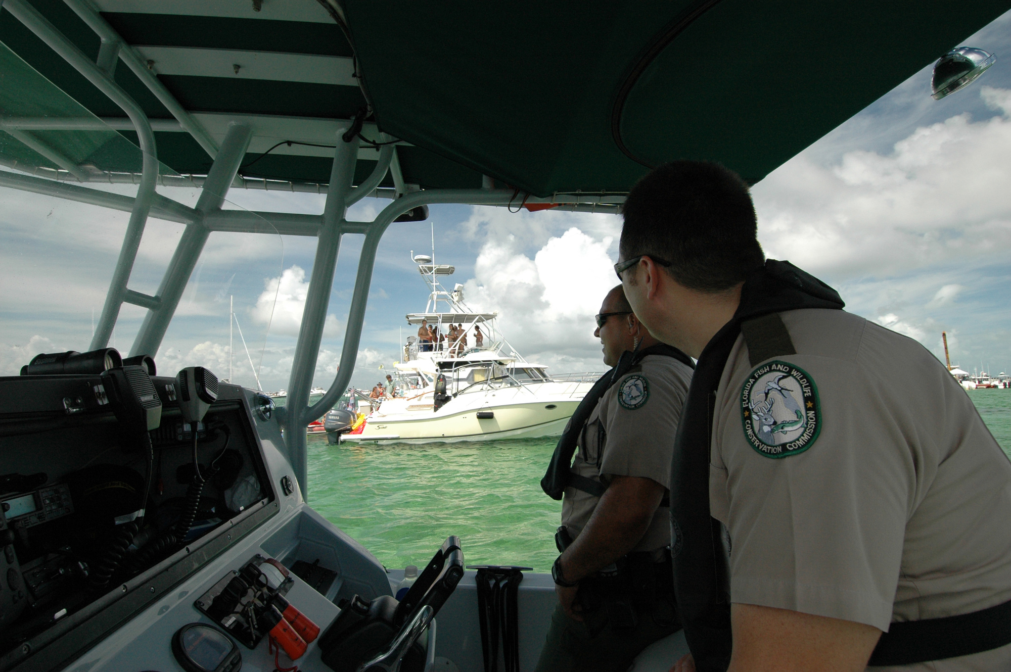
More words of wisdom from the Florida Fish and Wildlife Commission.
FWC promotes safe, sober boating this weekend for Operation Dry Water
The Florida Fish and Wildlife Conservation Commission (FWC) will be working to keep waterways safe this weekend.
During the national Operation Dry Water campaign officers will focus on removing impaired operators from the water and educating boaters about safety.
The Fourth of July holiday is one of the busiest boating holidays all over the U.S., including here in Florida. There are over 950,000 boats registered in the state and an estimated 1 million additional non-registered boats enjoying Florida’s waters.
Boaters should know that operating a vessel under the influence of alcohol or drugs is illegal and can lead to serious injuries and consequences. In Florida, it is illegal to operate a vessel with a blood alcohol content level of .08 or higher – the same as it is to operate a vehicle.
“As law enforcement, it is our job to do all we can to ensure the safety of our recreational boaters and paddlers,” said Maj. Robert Rowe, FWC’s Boating and Waterways Section Leader. “The accidents and tragedies that happen because individuals choose to drive impaired, on land or on the water, are preventable. We’re joining other agencies across the country to keep boaters safe and prevent accidents related to BUI.”
If a person decides to take alcohol on their voyage, it is important to designate an operator who isn’t drinking alcohol and will remain sober to ensure everyone gets home safely. The FWC encourages boaters to enjoy the boating season to its full extent by boating sober, wearing a life jacket and taking a boating education course.


Be the first to comment!