The W P Franklin Lock is the western most lock on the Okeechobee Waterway. Our thanks to Specialist Jeffrey Prater for this notice. The lock will be closed Wednesday, May 12, 2026 from 8 am to Noon for an Electrical System Upgrade.
EFFECTIVE: 13 May 2026 ATTN: CESAJ-OD-SN PO Box 4970 JACKSONVILLE, FL 32232-0019
POC: Kriss Zeller, Chief of Navigation (772) 380-6928
Attention all concerned boaters! W.P. Franklin Lock will be closed from 8:00 a.m. to 12:00 p.m. on May 13, 2026 for electrical system upgrades. Please plan accordingly and thank you for your patience.
For up-to-date Lock information, contact the shift operator 7:00 a.m. to 5:00 p.m. at:
St Lucie Lock & Dam 772-287-2665 or 863-662-9148
Port Mayaca Lock & Dam 561-924-2858 or 863-662-9424
Julian Keen, Jr. Lock & Dam 863-946-0414 or 863-662-9533
Ortona Lock & Dam 863-675-0616 or 863- 662-9846
W.P. Franklin Lock & Dam 863-662-9908
Canaveral Lock 321-783-5421 or 863-662-0298 (6:00 a.m. to 10:00 p.m.)
Thank you! Jeff
Jeffrey D Prater Public Affairs Specialist Corporate Communications Office U.S. Army Corps of Engineers, Jacksonville District South Florida Office 4400 PGA Blvd. Suite 501 Palm Beach Gardens, FL 33410 Cell: 561-801-5734 jeffrey.d.prater@usace.army.mil Twitter @JaxStrong Jacksonville District Facebook:
Cruisers Net publishes Loose Cannon articles with Captain Swanson’s permission in hopes that mariners with saltwater in their veins will subscribe. $7 per month or $56 for the year; you may cancel at any time.
Ted Turner, the media maverick, sports team owner, sailing champion, and philanthropist, died peacefully May 6, 2026 at his home near Tallahassee, Florida. He was 87.
As a 12-year-old at the Savannah Yacht Club, Turner dove into sailing the same way he would do everything: with pedal to the metal and damn the torpedoes, and with wholesale success. He spent as much time in the water as in his Penguin, but while observers were busy laughing, he started winning.
He took the same approach to Lightnings, then dinghies at Brown University before moving on to Y-Flyers and Flying Dutchmen on Atlanta’s Lake Allatoona. He was runner-up at the 1970 5.5 Metre Gold Cup before winning the title in 1971.
Turner moved into big boats with charters for the Southern Ocean Racing Circuit, literally learning the ropes as he went along. He learned fast, winning the SORC overall in 1966, and leading a timber-rattling après sail crew celebration that was considered “outrageous.”
Turner’s venture into the America’s Cup in the 1970s shook up what was (then) a venerable bastion of propriety. His public battles with Dennis Conner, Lowell North, and local clubs are storied. He was labeled “Captain Outrageous” by a media overjoyed to have an uninhibited rock star in their midst who spoke his mind.
Turner acquired the 12-Metre Courageous after its America’s Cup victory in 1974. Always loyal, he put together a crew of old SORC hands including tactician Gary Jobson and trimmer Robbie Doyle, and made the cover of Sports Illustrated after winning the right to defend the Cup. In 1977, Turner steered Courageous to a 4-0 sweep of Australia.
Turner won the coveted Congressional Cup that same year, and prevailed in the storm-ravaged Fastnet Race in 1979. The only man Voted Rolex Yachtsman of the Year four times, Ted Turner will probably be the last amateur skipper to win the America’s Cup.
He was inducted into the first Class of the National Sailing Hall of Fame in 2011.
The Ohio-born Atlanta businessman parlayed his father’s billboard -advertising company into television stations TNT, TBS, and CNN. He was also an owner of professional sports teams—Atlanta Braves (MLB), Atlanta Hawks (NBA), and Atlanta Thrashers (NHL).
In September 2018, Turner revealed that he was battling Lewy body dementia, an ailment that causes a progressive decline in mental abilities with physical signs and symptoms similar to Parkinson’s disease.
Turner married three times, most famously to Jane Fonda from 1991 to 2001. He is survived by his five children (Rhett Turner, Laura Turner Seydel, Jennie Turner Garlington, Teddy Turner, and Beau Turner), 14 grandchildren, and two great-grandchildren.
Gary Jobson on Sailing With Turner:
Over the years I have given nearly 3,000 lecture presentations. While the topics have varied, one subject is always included — the America’s Cup. And the most frequent question I am asked is “What is it like to sail with Ted Turner?”
I always take my time when I answer. Ted is a gifted sailor, and he recruits top sailors. Ted always says he likes when decisions are made at the lowest level. He is quite methodical when working with a tactician and navigator.
He will ask probing questions that challenge you to think hard. He appreciates people who think through all the possible options available. He will often surprise me with an alternative option that I might not have thought about. In sum, Ted does three things well on long distance races:
1. He is a superb helmsman. 2. He is very good at trimming spinnakers and will spend considerable time continuously adjusting the sail. 3. He is at his best as a leader. When Ted makes a decision, the crew buys in and executes.
I’ve attended many business meetings and a few board meetings with him over the years. His routine on the water is analogous to his work in the boardroom. He considers all the options, makes a decision, and presses ahead at full speed. He has a good way of lifting everyone’s game.
He had an extraordinary run on the water, but he had to give up sailing to focus on his media business. Ted retired from grand prix yacht racing at the young age of 41.
LOOSE CANNON covers hard news, technical issues and nautical history. Every so often he tries to be funny. Subscribe for free to support the work. If you’ve been reading for a while—and you like it—consider upgrading to paid.
About ten days ago what I thought was a Bumble Bee chose me. Seriously. It’s a forehead crinkler, I get that. But he (an assumption) did. For days, this delightful, bi-colored softly-endowed insect was constantly around my workspace, wherever I was, there he would be, checking up, checking in, an occasional collision, even, in my new relationship with one of Mother Nature’s more intriguing, essential characters. I photographed, he posed and was endowed with the nickname Kami in reference to Japanese Kamikazi warriors that took their life into their own hands, because more and more frequently he would simply bonk right into me, then bumble off. “He’s picking on someone the wrong size,” was my sailor’s comment. A little foul, no harm done. Every morning he showed up, just like we do, a gift from Mother Nature.
I was (still) engaged in the endless prep you’re tired of hearing about and I’m tired of doing, re-taping the bronze through-hulls for one of the middle coats of paint. The following morning I noted with a certain amount of astonishment and a bucketful of respect that a small, ragged hole had been torn in the center of the tape. Yes, you’re following along; it was about Bumble-Bee size, half an inch. Tree hugger at heart, I felt horrible, awful, guilty, neglectful and downright mean that I had probably taped my newest and rather loyal companion in there….also equally impressed at the solution found for such a (dire?) situation.
Exploring the many housing options, and then, the escape.
The chosen thru-hull is the drain for our shower in the aft cabin. An assortment of these exits (above) and intakes (below) waterline make our yachting systems self-sufficient, some have more powerful forces than others; the exhaust for the generator, for example, even a hearty insect would vacate that steamy, strong outflow. Now, of course, I had to wonder what’s been constructed in there, and how not to harm anyone while ensuring the functionality of said plumbing drain. We saw several bumbling about outside the next time tape was quadruple-layered over their main doorway. I learned later that they can and do bore through inches of solid wood. Ah well, I had her best interest in mind, and once again a human highly underestimates the ability of creatures surrounding us.
Kami was so much in the forefront of my mind that I mentioned my follower to former farmer, friend and fellow ‘Stacker Elizabeth Beggins (see her pollinator story here). She informed that it was a Carpenter Bee and, stingless, was trying to defend his chosen home or more likely, his mate’s chosen home—(BTW females can sting if addled), which was clearly a bronze-framed hole in my chosen home. Happy to report that after the taping incident he/she/they bumbled off and found a more suitable location with less chance of imprisonment and flash-flooding. Thank a bee, save a bee.
Pollen-encrusted Carpenter Bee on its favorite commodity.
Even with this delightful distraction from the drudgery, I finally said it out loud. The exact quote was, “Your boat is kicking my ass.”
Here’s the precursor. We’d decided that what was to be the final coat of paint was not actually good enough coverage to be the final coat, making a total of seven. It takes almost twenty hours of labor between coats. STEADFAST feels sooooo much longer, bigger, taller and wider than she was when we energetically, enthusiastically started this little repair project. “She grows on you,” is groan-worthy. To refresh memories and bring all our cool new subscribers up to date, we began in July of 2024; with an original estimate of four months.
I’m thinking you know who I was discussing the ass-kicked ailment with; he answered with a resigned, “I know.” And he does; his rear-end is certainly in a similar state, perhaps a tad worse even. We don’t need to say this out loud, but I finally did. Remember that story GOING GRAY? Still going! It would be far beyond bat-shit crazy to stop now.
At some point recently I had the realization that I’d really like to not pick up sandpaper or a paintbrush again until 2028. Our Secret Sparring Society knows how HIGHLY UNLIKELY that is, but a girl can wish! Honestly I really did enjoy refreshing and rejuvenating this floating home on a regular maintenance schedule; we all need a little rewarding reinvigoration, don’t we? But this has been way too much, there was no bargain struck for this.
My favorite quote of late? “The longer we stay here, the worse our habits become.” I’m swearing like a sailor and drinking like a fish***. That statement is not truly true, but… well, I’ll leave it to your active imaginations. More info follows on the fish part.
Have you stayed doing something, somewhere, too long? By choice or by chance? Betcha have. Do tell! My website is entitled ‘Everybody Has a Story’ AND THAT MEANS YOU DO, TOO.
Each Monday, an idea for our weekly Sparring Society Story has formed or been chosen from my brain and I gradually build these messages, an hour here and a couple hours there, often taking on a life of their own, ending up a paradox to the original idea, the best laid plans. This is one of those weeks, I think…an unintentional interlude and candle-at-both-ends ending….always searching for maximum impact, of course; we all are as we toddle through life. As I finish this, it’s almost the witching hour here on the East Coast of North America and my candle is sputtering, so until next week, I’m yours truly,
~J The accidental boat builder. Here, in my most flattering outfit.
Friend Ed wanted to learn about fiberglass; he stayed seated.
Think my work is share-worthy? Please do! Easiest way is simply to click on the little heart and the little recycle symbol, both of those send this piece to word lovers everywhere. Thanks.
*** DO FISH DRINK?! According to McGill University, yes, they do, but the rate and consequences vary based on their environment. I guess we have that in common!
I HIGHLY recommend the thoughtful and thought-provoking pieces from this writer:
Expressions from centuries past still hold merit, whether first uttered by sailor, farmer, politician or poet. This particular phrase, “The best laid schemes of mice and men oft’ go awry…and leave us nothing but grief and pain. For promised Joy.” (translated from old Scottish). I didn’t know the verbiage or its origins until a bit of laser-fast research…
Read full story
I so appreciate your support of my work. Have a wonderful week!
Fred Pickhardt’s Substack is free today. But if you enjoyed this post, you can tell Fred Pickhardt’s Substack that their writing is valuable by pledging a future subscription. You won’t be charged unless they enable payments.
The 2026 Atlantic hurricane season may offer something we haven’t seen in a while — a bit of a break.
While the official outlook from the National Oceanic and Atmospheric Administration (NOAA) isn’t due until later this May, early indicators suggest that overall activity could trend near to slightly below historical averages.
The Big Driver: El Niño
The dominant factor shaping this season is the expected development of a moderate to potentially strong El Niño in the tropical Pacific.
Why does that matter?
El Niño tends to increase upper-level winds over the Atlantic
This creates strong vertical wind shear
Wind shear disrupts developing storms, making it harder for hurricanes to form and intensify
Historical data backs this up. During strong El Niño years:
Hurricanes decrease by roughly 30–40%
Major hurricanes are often cut nearly in half
Tampa’s WFLA Meteorologist Jeff Berardellirecently highlighted this relationship, noting a significant drop in storm activity during past strong El Niño seasons.
Sea Surface Temperatures: A Mixed Signal
Ocean temperatures are another key ingredient this season:
Cooler-than-average waters have developed across the eastern and central Atlantic’s Main Development Region (MDR)
This typically suppresses storm formation
However, warmer-than-normal waters persist in:
The subtropical North Atlantic
The Gulf of Mexico
The western Caribbean
Bottom line: There’s a tug-of-war between atmospheric suppression (El Niño) and localized ocean warmth.
What the Forecasts Say
Several leading forecast groups have released early outlooks. When averaged together, they point to a slightly below-normal season:
Named Storms: ~13.6 (historical average: 14)
Hurricanes: ~6.1 (historical average: 7)
Major Hurricanes: ~2.3 (historical average: 3)
Most forecasts cluster around this range, though one outlier (University of Arizona) suggests a more active season due to expected warmer than normal ocean temperatures.
Note: If El Niño strengthens further, these numbers could trend even lower.
Landfall Risk: Lower, But Not Zero
Even in quieter seasons, it only takes one storm to make it dangerous.
32% chance of a major hurricane striking the U.S. coastline (vs. 43% historical average)
15% chance for the U.S. East Coast (including Florida)
20% chance for the Gulf Coast
35% chance for the Caribbean
Some forecasts, including AccuWeather, highlight the northern Gulf Coast and Carolinas as areas of elevated risk this year.
What the Pattern Suggests
Seasonal models based on sea surface temperatures indicate:
Below-normal activity in the Gulf and Caribbean
Near or slightly above-normal activity along the U.S. East Coast
This aligns with the current pattern of warmer subtropical Atlantic waters, which can sometimes shift storm tracks north and east.
Final Takeaway
A quieter season doesn’t mean a safe season.
Even during El Niño years, impactful hurricanes can and do occur. It only takes one landfalling storm to make a season memorable — especially for coastal communities.
Key Lime Sailing Club, A CRUISERS NET SPONSOR, always has very special offers for their visitors! Key Lime Sailing Club is a unique slice of KEYS ENJOYMENT…give it a try and let us hear about your experience.
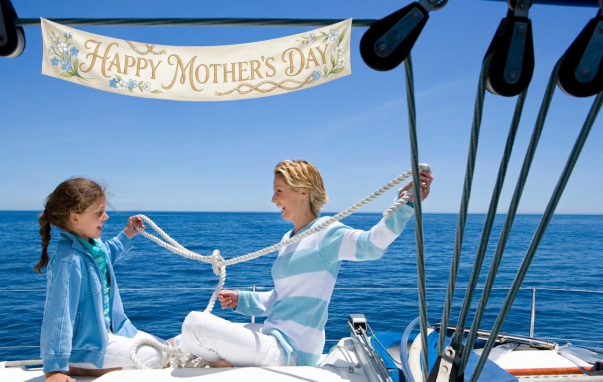
Celebrating Every Mom This Mother’s Day
Happy Mother’s Day to all the incredible moms out there! Words truly cannot express how grateful we are for everything you do, the sacrifices you make, the love you give, and the strength you show each and every day.
You deserve to be celebrated not just today, but always, and we hope this special day brings you as much joy and warmth as you bring to everyone around you.
From our little corner of paradise here in the Florida Keys, the entire Key Lime Sailing Club family wants you to know how much you are appreciated.
Whether you are on the water or at home, we hope today is filled with sunshine, laughter, and beautiful moments made just for you.
Happy Mother’s Day, with all our love from your Key Lime Sailing Club and Cottages Family.
Key Lime Sailing Club and Cottages | 305-451-3438 | 99306 Overseas Highway, Key Largo Florida | www.keylimesailingclub.com
Cruisers Net publishes Loose Cannon articles with Captain Swanson’s permission in hopes that mariners with saltwater in their veins will subscribe. $7 per month or $56 for the year; you may cancel at any time.
Agencies gather in the afterman of the Saturday evening accident. (St. Thomas Rescue photo)
Shawn Leass was run down and killed by a Customs & Border Patrol boat in the U.S. Virgin Islands, and the only reason we know the victim’s name is because of tributes to him on Facebook and at local pubs where he performed Rock & Roll favorites.
According to the St. Thomas Source news outlet, Leass had come to the USVI about 25 years ago, initially living aboard his Erickson 36 Freya. He was killed while piloting his dinghy after having left St. Thomas Carnival on its last night. The accident happened at 7:45 p.m. on Saturday.
CBP’s Office of Professional Responsibility, the U.S. Coast Guard, and the National Transportation Safety Board are investigating, according to CBP spokesman Jeffrey H. Quinones. This was the official statement:
A U.S. Customs and Border Protection (CBP) Coastal Interceptor Vessel was involved in an accident with a small dinghy near Hulover Cut, St. Thomas, U.S. Virgin Islands, during a border security patrol. The sole occupant of the dinghy was transported to a hospital but passed away.
Quinones would not go beyond that when asked about several witness reports that the 41-foot patrol boat was traveling at a high rate of speed and without lights. And why not at least announce the name of the man whose life was lost?
“That is a matter under the responsibility of the local police,” Quinones said. According to The Source, local police have notified Leass’s sister in Ohio, but have not yet publicly identified Leass as the victim, let alone say anything about the man he was.
This is a sistership to the CBP vessel that hit Leass’s dinghy: A 41-foot Coastal Interceptor Vessel.
Leass, as it happens, was well liked in the USVI cruising community and by those who enjoyed his performances at local music venues.
“Shawn was an experienced dinghy captain. Also, he was good about having lights on his dinghy. He also didn’t drink alcohol. I lost a good friend and neighbor for many years. I hope there’s a full investigation,” Jeff Birchenough wrote on Facebook.
Shannon Sharpe was another person who posted a tribute to Leass:
There are some people that you meet in life’s journey that kinda shines a light on ya. To me, Shawn was one of those guys. He was always so happy to see me. Smiles and hugs. And he would always ask me.. “Will you play with me tonight?” There was no way on earth I would ever tell him no.
For those of us that knew him, we should ALWAYS remember is dedication and passion for his music that he played. I enjoyed playing with him because of this…. When Shawn would get up on the stage, he would go to a different place. He played with a passion that we should all strive to have. Whether there was one person in front of him or many more, he always played like he was playing in front of 30,000 people. Nothing else in the world mattered.
Leass was known for his passionate covers from bands such as Led Zepelin and Steppenwolfe.
There was also anger at what some saw as an abuse of authority. As Erin Taylor wrote:
This is heartbreaking. These patrol boats need to SLOW down! This is where we live. We use Gregerie channel to get to and from our homes! They are not in pursuit of anyone. They have no business driving this fast in our local waters. It is reckless and irresponsible, especially of people wearing a badge that we should be able to trust and feel safe around. I witness them going past my house all the time, 60-70 mph for no reason at all. This life did not need to be lost. He was a sweet man that bothered nobody. I’m heartbroken and appalled at this news.
LOOSECANNON covers hard news, technical issues and nautical history. Every so often he tries to be funny. Subscribe for free to support the work. If you’ve been reading for a while—and you like it—consider upgrading to paid.
Cruisers Net publishes Loose Cannon articles with Captain Swanson’s permission in hopes that mariners with saltwater in their veins will subscribe. $7 per month or $56 for the year; you may cancel at any time.
This boat may have been anchored at Aunt Pat’s Bay within sight of the Hooker vessel on the day Lynette went missing. This photo was first published by CBS News yesterday.
Coast Guard investigators assisting Bahamian police in the case of a missing sailor’s wife want to question the owners of the boat pictured above. The sloop in question may have been anchored next to Soulmate, belonging to Brian and Lynette Hooker, on the night she went missing.
According to her husband, the 55-year-old Michigan woman disappeared during an evening dinghy ride in the Abacos. Somehow, she took the shutoff fob with her, causing the electric outboard to stop, Brian Hooker told authorities.
The dinghy took almost nine hours to drift four miles from the vicinity of Elbow Cay to Marsh Harbor despite blustery winds pushing it in that direction—a timeline that investigators may have found troubling. Agents of the Coast Guard Investigative Service, CGIS for short, are on the case under a broad mandate to investigate crimes that “happen on, over or under a navigable waterway.”
The sailing vessel they are looking for, also shown below, appears to be under 40 feet LOA, with double roller furling headsails, a flat sheer line, an arch on the stern and a sugar scoop transom. She is shown with an inflatable dinghy.
The incident happened on the night of April 4, 2026. Brian Hooker was taken into custody for questioning and later released. He has denied any wrongdoing.
LOOSE CANNON covers hard news, technical issues and nautical history. Every so often he tries to be funny. Subscribe for free to support the work. If you’ve been reading for a while—and you like it—consider upgrading to paid.
 The lock will be closed Wednesday, May 12, 2026 from 8 am to Noon for an Electrical System Upgrade.


 …
…


Be the first to comment!