Paddle for the Border ~ TOMORROW, Dismal Swamp Canal Welcome Center

The Dismal Swamp Canal Welcome Center, a Salty Southeast Cruisers Net sponsor, is a great place to visit any time.
| |||||||
The Dismal Swamp Canal Welcome Center, a Salty Southeast Cruisers Net sponsor, is a great place to visit any time.

There is always plenty to do around Charlotte Harbor. While berthed at Fishermen’s Village Marina, A CRUISERS NET SPONSOR, you are certain to enjoy visiting Western Florida’s beautiful Charlotte Harbor/Peace River.


Special Events & Community Relations
941.639.8721
Click Here To View the Western Florida Cruisers Net Marina Directory Listing For Fishermen’s Village
Click Here To Open A Chart View Window Zoomed To the Location of Fishermen’s Village

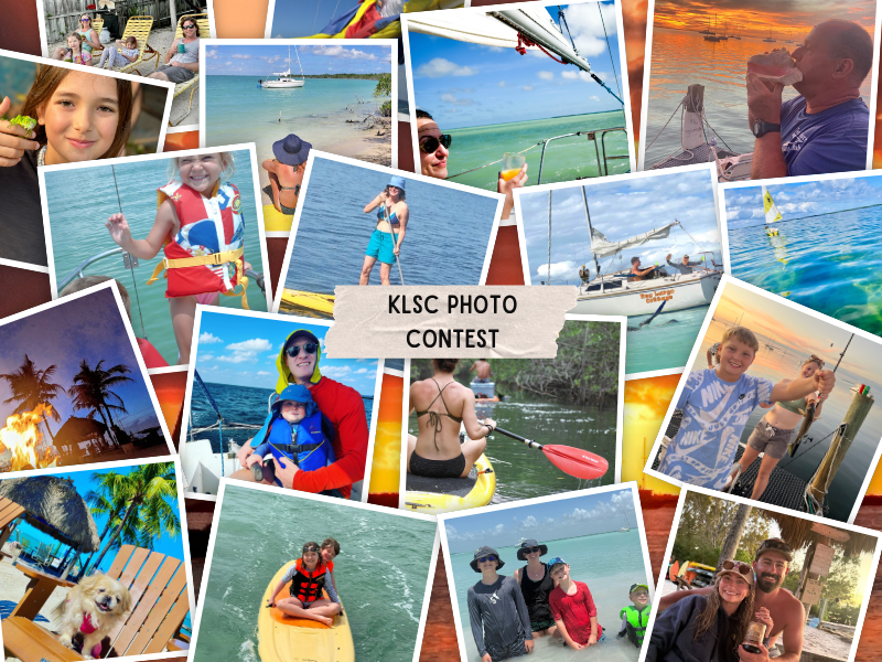
Key Lime Sailing Club, A CRUISERS NET SPONSOR, always has very special offers for their visitors! Key Lime Sailing Club is a unique slice of KEYS ENJOYMENT…give it a try and let us hear about your experience.
| |||||||||||||||||||||||||||||||||||||||||||||
|
The Blue Angels Air Show is a spectacular treat, especially viewed from the water. Please use caution, especially around anchored spectator boats. Be safe!
Good afternoon Charleston HSC,
Please find attached MSIB 07-26 regarding a safety zone for the upcoming Blue Angels Airshow. As a summary:
The U.S. Navy’s Flight Demonstration Squadron, The Blue Angels, will be conducting aerobatic maneuvers over the Charleston Harbor, SC, on Thursday, April 30th through Saturday, May 2nd, 2026.
A safety zone, encompassing a rectangular area within Charleston Harbor, will be enforced during the times referenced on the chart below. Please note that no one will be allowed to enter the safety zone without prior authorization from the Coast Guard Captain of the Port Charleston or a designated representative.
Mariners are encouraged to monitor the Broadcast Notice to Mariners on VHF Channel 16. Coast Guard Sector Charleston will announce the start and end of the safety zone enforcement each day. The Blue Angels’ schedule is dependent on weather, and any changes to the safety zone schedule will be reflected in a future MSIB.
For questions or concerns regarding this MSIB, please contact the Sector Charleston 24-hour Command Center at (833) 453-1261.
Very respectfully,
LT Nicholas Jones
WWM Division Chief
USCG Sector Charleston
Nicholas.J.Jones@uscg.mil
O: 843-740-3184
C: 843-323-7761

Screenshot

Screenshot
![]()
Welcome aboard another passage on STEADFAST…so pleased you’re here.
If you just found our engaging little community, please read SPARS & SPARRING, .….it introduces my wonders and my wanders. ~J
I spent half an hour or so with mineral spirits and a cotton rag, wiping every notable speck of dust off STEADFAST’s substantial port hull on a dew-less morning, before the sun rose and just after my first cup of sweet, strong coffee. It’s the best time of the day. I smoothed every inch of 400ish vertical square feet yesterday, taped seams and edges, calculated timing and wind because we have a gorgeous wooden boat neighbor who is sanding with equal vigor before moving on to paint. Dust is an enemy, among others, to the shiny, protective coating I’m applying. And it’s up to $60USD per quart; we’re careful with it.
The pre-dawn breeze was cool with a forecast of 87F. I’m a lizard of sorts, always have been. My finely diamond-wrinkled skin demonstrates how much I worshipped our orb, and those dismaying gems are far more noticeable, I think, when it’s at its apex. Back when it was healthy to have a tan and I had much more resilience, everyone compared contrasting lines and selected tropical destinations for that very purpose. There are few more welcoming experiences than the first rays of spring sunshine warming your back or a colorful, luminescent sunrise announcing another day. Feels so good, doesn’t it? A primal element, essential for so many things, but even sunshine burns if you get too much. Avoidance is advisable, impossible. A life inside could not be a life I chose. My mother and I stained the deck each year and did all yardwork wearing bathing suits and tube tops. Now, grudgingly, I take cover with sweaty long sleeves, floppy androgenous hats, my beloved sarongs and substantial sunblock. There used to be single-digit SPF protection out there, which we thought was enough, and now some claim 100x your ‘natural protection’. Is it more poison or a different poison or a good idea or the best solution? I have a dozen or so varieties tucked aboard, none of which I treasure or trust. The scrubbing to get zinc off my tender exposed skin also seems like too much abuse. Who knows for certain what’s best? As with many things in our lives today, the answer varies depending on how you phrase the question.I don’t want to ask an entity, any entity, who is trying to figure out what answer it thinks I expect. I want the right answer, whether I agree with it or not. Such questions used to be called ‘leading’ in the realm of growing up when my parents were trying to ascertain truth from fiction. Anthropic AI can now figure out how to wreak serious worldwide havoc, according to a NPR story today. They withdrew their latest model for the safety of humanity, because it’s too I when the whole goal was to make it I! I’m just trying to wrap my mind around what AI can do while it replaces authors and writers, publicists and artists without a backward glance, in fractions of seconds. I don’t use any such tools SPARRING WITH MOTHER NATURE, both literally and in producing this weekly observe-all, but sometimes I feel surrounded. Back here in the real world, second cup of coffee in hand on the scaffold (still) surrounding my antiquated wooden boat, I am prepped and ready to paint when an excavator arrived with two dumpsters and the contracted intention of dismantling a piece of Chesapeake Bay heritage—a neighboring classic Skipjack. In six short hours, the hand-hewn vessel was gone, the land leveled; nothing to show but, well, but what? Nothing to show, really. Sure, someone’s living was made upon her, more than one generation, perhaps, the name and hailing port were long faded. In an attempt at resurrection or stabilization, steel i-beams were inserted lengthwise and side to side in order to maintain her original shape and a scrap of dignity. When I first saw her, she was too far gone to save but the presence that most vessels from early in the twentieth century garnered respect. I’m sure it wasn’t an easy decision to take her to the nearest dump, but it was probably a practical one. STEADFAST lies along the property border between the Richardson Maritime Museum and our current home port, Yacht Maintenance Company. The Museum is a burgeoning, well-intentioned non-profit with what appears to be an assortment of visions. While I personally liked the ashes-to-ashes display, now there is a patch of dirt where the scruffy trees and mulberry had grown up around the skipjack’s keel. Ray, the gentleman with the excavator, was precise and pragmatic. “I don’t know her story,” he said, ”but somebody left her here long enough for trees to grow up through the deck….” He tilted his head at me curiously, “time for her to go.” It was a question and a statement. Wisdom and consideration, combined. “I’m not a boat guy,” he told me in a local accent, meaning he’s got no skin in the game. He might think I’m crazy to live where I live, but still has a modicum of respect for how I spend my resources. In this photo, I paint the final reconstructed bow section on our page of maritime history as another chapter is hauled efficiently away. The birds who perched there will have to change their routines, just like everyone does when lives are up-ended.
I shift gears with this turn of dust-kicking events, put the topcoat gallon away and pull the building primer back out. The label says “EZPrime” but that is not true. Fate does allow me to work on the shady side of the vessel, but it’s a back-pedal. I’m ready to get this damn project back in the water. Of course I mean damn in the most affectionate way possible; she knows how much I must love her. The starboard side of STEADFAST (right side facing the bow for my crew of loyal non-sailors…of course I didn’t know that for 95% of my life, either…) is oriented perfectly north. Around the June Solstice there is barely a shady side, but today she protects me as she always does from the unexpected power that is beaming down on my stained t-shirt as I organize my bucket of tools; you’ve seen the kit before and although contents vary, the basics are in the bottom at all times, paint scraper, utility knife, screwdriver, tape, soft putty blade, assorted sandpaper, gloves, sometimes a pair, more often not. I wear the right ones out faster so it often happens that I’m only left with lefts. The awesome gifts received from subscribers last year are still going strong.
I’m solo today, Sailor Steve is working elsewhere, to pay for the primer I’m dripping down onto the filthy felt placed beneath us nearly two years ago, and the rent for the ground beneath that cloth, among other things. When his ears aren’t here I choose the classic country station; I know every word from those times when my mom and I stained the deck, and every Saturday morning without fail. Marti belted them out like I do, out of tune but so sincerely that no one should care. Since we mentioned lizard, there’s a nine-incher aboard of late, sleek, slightly creepy, shiny black with yellow racing stripes. Yes, I know they eat bugs. I’m OK with it as long as I don’t have to sleep with him and he doesn’t want to sleep with me. ~J Share SPARRING WITH MOTHER NATURE Restacking is a great way to share my work— good folks can discover our wise comments and life lessons…. Thanks! & stay aboard! *** The title this week comes from a famous, quotable work by Veronica A. Shoffstall, originally shared by my mom, lifetimes ago. I still have the ragged copy. AFTER A WHILE After a while you learn the subtle difference Between holding a hand and chaining a soul, And you learn that love doesn’t mean leaning And company doesn’t mean security. And you begin to learn that kisses aren’t contracts And presents aren’t promises, And you begin to accept your defeats With your head up and your eyes open With the grace of a woman, not the grief of a child, And you learn to build all your roads on today Because tomorrow’s ground is too uncertain for plans And futures have a way of falling down in mid-flight. After a while you learn… That even sunshine burns if you get too much. So you plant your garden and decorate your own soul, Instead of waiting for someone to bring you flowers. And you learn that you really can endure… That you really are strong And you really do have worth… And you learn and learn… With every good-bye you learn. If you’re interested in learning more about AI, I highly recommend Ruv Draba from Down Under; he, along with Claude from Anthropic, can be found on Substack Ruv Draba Reciprocal Inquiry: from Doubt to Discovery. In case you missed it:
Check out the archives at the top of each post to select from over 100 sea stories. I so appreciate your support of my work. Have a wonderful week!
© 2026 Janice Anne Wheeler
|
Note that sea turtle season starts May 1st, and manatees are returning to South Carolina waters. Keep an eye out on the water and report any sick, injured, or dead sea turtles or manatees online or call SCDNR’s 24-hour wildlife hotline at 1-800-955-5431.
Links to report to SCDNR:
Sea Turtles: click here
Manatees: click here
|
| Stay Connected with SCDNR: |


|
| SUBSCRIBER SERVICES: Manage Subscriptions | Unsubscribe | Help |
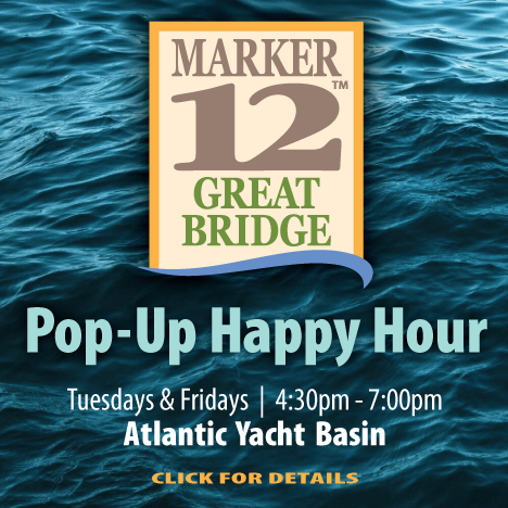
Cruisers Net is pleased to be partnering with GoChesapeake, A CRUISERS NET SPONSOR, to assist cruisers who are voyaging south or north via the Waterway through Great Bridge, VA, home to Atlantic Yacht Basin, also A CRUISERS NET SPONSOR.
|
Click Here To View the VA to NC Cruisers’ Net Marina Directory Listing For Atlantic Yacht Basin
Click Here To Open A Chart View Window, Zoomed To the Location of Atlantic Yacht Basin
The Blue Angels Air Show is a spectacular treat, especially viewed from the water. Please use caution, especially around anchored spectator boats. Be safe!
Good afternoon Charleston HSC,
Please find attached MSIB 07-26 regarding a safety zone for the upcoming Blue Angels Airshow. As a summary:
The U.S. Navy’s Flight Demonstration Squadron, The Blue Angels, will be conducting aerobatic maneuvers over the Charleston Harbor, SC, on Thursday, April 30th through Saturday, May 2nd, 2026.
A safety zone, encompassing a rectangular area within Charleston Harbor, will be enforced during the times referenced on the chart below. Please note that no one will be allowed to enter the safety zone without prior authorization from the Coast Guard Captain of the Port Charleston or a designated representative.
Mariners are encouraged to monitor the Broadcast Notice to Mariners on VHF Channel 16. Coast Guard Sector Charleston will announce the start and end of the safety zone enforcement each day. The Blue Angels’ schedule is dependent on weather, and any changes to the safety zone schedule will be reflected in a future MSIB.
For questions or concerns regarding this MSIB, please contact the Sector Charleston 24-hour Command Center at (833) 453-1261.
Very respectfully,
LT Nicholas Jones
WWM Division Chief
USCG Sector Charleston
Nicholas.J.Jones@uscg.mil
O: 843-740-3184
C: 843-323-7761

Screenshot

Screenshot


 Ironclad Anglers Fishing Rodeo at Colonial Lake (Charleston) | Saturday, May 2nd, 8:30AM – 11:30AM | SCDNR is partnering with the City of Charleston for a hero-themed Youth Saltwater Fishing Rodeo. This is a catch-and-release fishing rodeo (not a tournament) and instructors will be available to help anglers learn the basics of saltwater fishing. Children 15 years of age or younger and their parents/guardians are welcome.


Be the first to comment!