Visit Logged
  • Select Region
    • All Regions
    • VA to NC Line
    • North Carolina
    • South Carolina
    • Georgia
    • Eastern Florida
    • Western Florida
    • Florida Keys
    • Okeechobee Waterway
    • Northern Gulf
    • Bahamas
    • New York
    • Ohio
    • Pennsylvania
    • Washington
    • Puerto Rico
    • Minnesota
    • Maryland
    Order by:
    • Manatee and Sea Turtle Decals, Florida Fish and Wildlife Commission

      Stick on a decal to show support for Florida’s manatees, sea turtles

      There are more manatees and sea turtles in Florida than in any other state. More than 6,000 manatees swim in its coastal waters, rivers and freshwater springs, and thousands of sea turtles nest and hatch on its Atlantic and Gulf coast beaches.

      It’s easy to show support for these iconic Florida species by sticking on a decal.

      Every July the Florida Fish and Wildlife Conservation Commission (FWC) introduces new manatee and sea turtle decals available with a $5 donation.

      The colorful, waterproof decals are designed to look great on a vehicle’s bumper or the side of a boat. Get them when registering or re-registering a vehicle or boat at local tax collectors’ offices across the state.

      “Florida is home to more manatees and sea turtles than anywhere else in the U.S.,” said Carol Knox, who leads the FWC’s Imperiled Species Management Section. “Public support has been critical in helping us conserve these imperiled species. So please ‘stick on a decal’ and show support for our manatees and sea turtles.” 

      Decals generate funding for research, rescue and management efforts that help Florida’s manatees and sea turtles survive. For instance, when someone calls the FWC’s Wildlife Alert Hotline at 888-404-FWCC (3922) to report an injured, entangled or sick manatee or sea turtle, FWC staff responds with efforts to rescue and rehabilitate the animal.

      The decals also address important conservation issues:

      • “Look out for manatees” is the message on the new manatee decal, which shows boaters in the distance as a manatee mother and calf swim along with only her back above water.When boating or using a personal watercraft in Florida waters, it is important to look out for manatees. Mature manatees grow to 1,000 pounds or more, but can be difficult to see when they’re swimming, grazing or resting underwater. Wear polarized sunglasses, and then watch and listen carefully to detect the signs of manatees nearby. Look for circles on the water’s surface indicating their underwater movement and snouts sticking out of the water as they surface to breathe. You may also hear huffing noises when they come up for air.
      • “Helping sea turtles survive” is the message on the new sea turtle decal, which shows a green sea turtle. Green sea turtles nest on Florida’s Atlantic and Gulf coast beaches, and until recently were classified as endangered. Now after years of conservation efforts, the number of nesting green turtles has increased substantially. This species has been reclassified as threatened under the federal Endangered Species Act. That’s a major step in “green” recovery. Remember, “Hands off” is the best policy for beachgoers encountering any species of nesting or hatchling sea turtles. Watch from a distance, do not disturb them and never use a cellphone or camera to shoot flash photos.

      Learn about other ways to help conserve manatees and sea turtles at MyFWC.com/Manatee andMyFWC.com/SeaTurtle, where you also can click on “Decals” to order new or past editions of decals. Go to BuyaPlate.com to purchase a “Save the Manatee” or “Helping Sea Turtles Survive” license plate that supports those species.

      Be the first to comment!

    • Photos with Update on Dismal Swamp Canal, AICW Alternate Route


      Set in beautiful Camden Count, NC, the Dismal Swamp Canal Welcome Center provides free dockage for cruisers' on the Dismal Swamp AICW Alternate Route

      Dismal Swamp State Park is getting back into full swing as they recover from massive flooding and closure due to Hurricane Matthew. Dredging has begun and the canal is scheduled to re-open to navigation by summer’s end. The State Park is open and continuing programs as weather permits. Our thanks to Donna Stewart for this USACE update.

      One step closer to seeing boaters again! My most recent update from the USACE.

      7/19/2017
      I was able to obtain a few pictures today of the installation of the Deep Creek Lock River Gates. The gates are returning back to the water, where they belong! It was so HOT. But, notice the reflection of the sky in the shot of the newly installed gate on the left. I was told dredging still must be completed at the Feeder Ditch and Turner’s Cut, but this is one more step to getting us reopened. Many thanks to US Facilities and the Norfolk District USACE for helping me to get these shots today.
      Donna

      Crane at River Gate

      Gate installed Deep /creek

      The Deep Creek Dredging has been completed and surveyed with the assistance of the Wilmington District. The Deep Creek Lock gates are scheduled to be reinstalled on Wed., July 19th. Dredging at the Feeder Ditch and Turner’s Cut will continue until work is completed.
      We are anxious to see boats at our dock again this fall.
      Donna Stewart, Director
      Dismal Swamp Welcome Center
      2356 US Hwy 17N
      South Mills, NC 27976
      Phone – 252-771-8333
      www.DismalSwampWelcomeCenter.com

      Bird, Bike, Hike…..take in the sights!

      Click Here To View the North Carolina Cruisers’ Net Marina Directory Listing For the Camden TDA/Dismal Swamp Canal Welcome Center

      Click Here To Open A Chart View Window, Zoomed To the Location of the Dismal Swamp Canal Welcome Center

      2 Facebook Likes, 2 Facebook Reactions

      Comments from Cruisers (1)

      1. Bill Conlyn -  July 22, 2017 - 10:26 am

        Will this route be open this fall?

        Reply to Bill
    • How to Sail by Jess Miller

      Jess is responding to an earlier Cruisers Net posting of an article from Sail Magazine (see below) and now offers an article on how to sail from her blog, Jen Reviews. We are always glad to hear from other writers and researchers and always happy to share their information.

      Dear Cruisers Net,
       
      I was searching the web for information on how to sail and saw your great post 15 Electronic  Chart  Apps  Discussed
       
      I noticed you mentioned Sail Magazine in your post, and just wanted to give you a heads up that I recently wrote a blog post you might like. It’s a detailed, up-to-date 7,000 word guide on how to sail that is packed with tips and advice.  

       
      If this is something you’d be interested in, here is the link to the blog post: https://www.jenreviews.com/how-to-sail/
       
      This is completely free and if you like it, all I ask is for you to link to or share the article on your site. In return, would love to share your post with my newsletter subscribers and followers on social media. 

      Either way, keep up the great work!

      Cheers
      Jess

      Be the first to comment!

    • USCG Updated Electronic Chart Policy


      News Release
      July 18, 2017
      U.S. Coast Guard Headquarters
      Contact: Headquarters Public Affairs
      Office: (202) 372-4630
      After Hours: (202) 603-3281

      Coast Guard updates electronic chart policy

      WASHINGTON –The U.S. Coast Guard announced today an update to its navigation guidance for the use of electronic charts in lieu of paper charts and publications.

      The updated version of Navigation and Vessel Inspection Circular (NVIC) 01-16 identifies voluntary acceptable equivalencies to paper charts and publications as well as position fixing and plotting requirements under Coast Guard regulations.

      The NVIC also provides guidance and recommendations to vessel owners and operators and chart display manufacturers.

      “We took into account feedback from agency partners and industry stakeholders to adjust our electronic charts policy,” said Capt. Mary Ellen J. Durley, the chief of the Office of Navigation Systems.

      Mariners are not required to use electronic charts or electronic charting systems. The updated guidance offers a voluntary alternative means to comply with U.S. chart and publication carriage requirements.

      View the NVIC through the link above or copy and paste the following into a browser: https://www.uscg.mil/hq/cg5/nvic/pdf/2016/NVIC_01-16_electronic_charts_and_publications.pdf

      -USCG-

      Be the first to comment!

    • Good Visit to St. Petersburg Municipal Marina, Tampa Bay


      Slips are now available!! On the brand new Dock 5. For information please call (727) 893-7329 or 800 782 8350

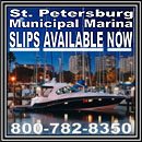
      St. Petersburg Municipal Marina, A SALTY SOUTHEAST CRUISERS’ NET SPONSOR, is a great liveaboard marina located on the western shore of Tampa Bay in downtown St. Petersburg.

      Overall a nice place to stay. Doug the master is enthusiastic and helpful. Tied up along a T/A Pier. A couple of places are roped off.
      Marina only accepts reservations via Dockwa. No phone reservations accepted.
      Bob McKane

      Click Here To View the Western Florida Cruisers’ Net Marina Directory Listing For St. Petersburg Municipal Marina

      Click Here To Open A Chart View Window, Zoomed To the Location of St. Petersburg Municipal Marina

      Be the first to comment!

    • Bahamas Chatter: “New Flights to Abacos” plus 1 more

      Explorer Charts - the best charts for the Bahamas and Exumas

      Explorer Chartbooks, A SALTY SOUTHEAST CRUISERS’ NET PARTNER, has long been the standard navigational supplement for enjoyable, informative, and safe cruising through the beautiful Bahamian waters and island visits.

      Bahamas Chatter: “New Flights to Abacos” plus 1 more 

      New Flights to Abacos

      Posted: 16 Jul 2017 10:11 AM PDT

      NEW direct service from Nassau to Treasure Cay TCB on BAHAMAS AIR
      Effective June 22 Bahamasair will reintroduce the Nassau/Treasure Cay
      service. The flight will operate as follow:

      Thurs/Sat/Sun depart Nassau at 6:30 am arrive Treasure Cay 7:40am – (note
      stop in MHH first)
      Thurs/Sat/Sun Depart Treasure Cay at 8:00am on the return to Nassau arrive
      8:35am.

      Mon/Thurs/Sun the flight will depart Nassau at 5:00pm arrive Treasure Cay at
      5:35pm –
      Mon/Thurs/Sun Depart Treasure Cay at 5:55pm arrive Nassau 7:05PM on the
      return(note stop in MHH).

      New Airlift-Fly Exclusive Bahamas

      www.flyexclusivebahamas.com

      Direct Service from Nassau to Marsh Harbor: MondayWednesday & Friday
      –morning AND evening flights available

      Direct Service Nassau to Treasure Cay starting in July

      Delta Airlines (800.455.2720):
      Direct service between Atlanta and Marsh
      Harbour (MHH) on TuesdayThursdayFridaySaturday and Sunday

      Island Wings (954.617.8804):
      Direct flights between Fort Lauderdale
      Executive Airport (EXE) and Treasure Cay on MondayThursdayFriday &
      Saturday
      Tropic Ocean Airways (888.962.7728): Treasure Cay – Monday & Friday, Marsh
      Harbour – MondayThursdayFriday & Sunday

      Silver Airways (801.0401.9100):
      Direct service between Fort Lauderdale and
      Treasure Cay

      Air Unlimited (888.962.7728):
      Direct service between Sanford(KSFP) and
      Treasure Cay (TCB) or Marsh Harbour (MHH) on FridaySaturday & Sunday

      Cat Cay Diesel price

      Posted: 16 Jul 2017 03:42 AM PDT

      I was at Cat cay last weekend and Diesel was 4.09 per gallon.

      Be the first to comment!

    • 8 New Listings at Intracoastal Yacht Sales

      Our focus is to assist boaters with the purchase or sale of their powerboats. All our yacht owners are trained and educated on the handling and systems of their new vessel as part of our service. We want to make sure your experience with us is easy by being thorough with your needs. Through aggressive internet marketing, publication ads, and our long term networks we also have the resources to get your yacht sold! Our experience allows us the understanding of the market place.

      Intracoastal Yacht Sales, a long-time SALTY SOUTHEAST CRUISERS’ NET SPONSOR, offers full service brokerage representation from three locations, Wrightsville Beach, NC, Little River, SC and Charleston, SC. You will want to see these new offerings!

      CLICK HERE FOR THESE NEW LISTINGS

      Be the first to comment!

    • Bahamas Chatter: New fuel and dockage survey

      Explorer Charts - the best charts for the Bahamas and Exumas

      Explorer Chartbooks, A SALTY SOUTHEAST CRUISERS’ NET PARTNER, has long been the standard navigational supplement for enjoyable, informative, and safe cruising through the beautiful Bahamian waters and island visits.


      Bahamas Chatter: New fuel and dockage survey

      New fuel and dockage survey
      Posted: 14 Jul 2017 12:11 PM PDT
      We just completed a survey of most of the marinas offering fuel and dockage in the Bahamas. Some we were unable to contact at the present time. More diesel and gas prices were down than up.

      Please go to our website www.explorercharts.com under Fuel and Dockage Prices to check our latest findings. We will be updating continuously as we get new information.

      Be the first to comment!

    • NOAA Nautical Chart News


      New products and activities for navigation safety…

      The latest news
      We are well into summer and Coast Survey has been busy providing commercial mariners and recreational boaters with top notch navigation products and services. Here are just a few things we have been up to.
      Rear Adm. Shepard M. Smith, director of NOAA’s Office of Coast Survey and the U.S. national representative to the International Hydrographic Organization (IHO), was elected as the chair of the newly established IHO Council.
      The council was established in November 2016 as a result of the adoption of amendments to the Convention on the International Hydrographic Organization. It is composed of 30 leading hydrographic nations from the membership of the IHO, and functions much like a corporate board of directors, overseeing performance management and the business side of the IHO.

      Read more

      Ready to hit the water this weekend? Find out if your nautical charts have been updated recently with our Weekly Chart Updates

      NOAA offers new certification program in nautical cartography  
       
      The International Board on Standards and Competence for Hydrographic Surveyors and Nautical Cartographers (IBSC) recognized and approved Coast Survey’s new certification program in cartography (CAT-B) at their 40th meeting in Willington, New Zealand. 
       
      The new program will grant certificates to up to 13 cartographers per year, through a combination of lectures, hands-on chart production experience, work details to various branches within the Coast Survey, and field trips to working hydrographic survey vessels. The first class (which is already full), will begin in fall 2017 at Coast Survey headquarters in Silver Spring, Maryland. The duration of the program is 51 weeks and comprises six courses.
      NOAA hosts first open house on nautical cartography  
       
      NOAA hosted the first open house on nautical cartography on Friday, July 7th. The event featured posters, presentations, and tours focusing on nautical cartography, highlighting the field of charting and GIS. Industry partners, international mapping groups, government agencies, and many international charting offices were in attendance. The open house welcomed a total of 200 visitors, representing 24 countries.

      This one-day event, held in the Science Center on NOAA’s Silver Spring, MD, campus, was planned in conjunction with with the 28th annual International Cartographic Conference 2017 (ICC) in Washington, D.C. where NOAA also had a presence with an exhibit booth and presentations.

      New commemorative chart marks the Battle of Midway’s 75th anniversary
      Coast Survey and the Office of National Marine Sanctuaries created a commemorative nautical chart for the Battle of Midway’s 75th anniversary. This nautical chart was first published in 1943, and the commemorative chart includes the original depth soundings surrounding the islands overlaid with historical photos from the battle. Read more

      Coast Survey hurricane prep was in full swing before hurricane season started 
       
      Official hurricane season didn’t start until June 1, but Coast Survey’s navigation managers were heavily involved throughout April and May in training exercises with the U.S. Coast Guard, ports authorities, and NOAA’s National Weather Service.
      Why is Coast Survey involved? With our expertise in underwater detection, NOAA navigation response teams and survey ships are often the first ones in the water after a hurricane, looking to make sure that no hidden debris or shoaling poses a danger to navigation. 

      .

      STAY CONNECTED:
      Like us on Facebook
      Follow us on Twitter
        
      NOAA Office of Coast Survey, 1315 East-West Highway, SSMC3 #6203, Silver Spring, MD 20906
      NOAA Office of Coast Survey, 1315 East-West Highway, SSMC3 #6203, Silver Spring, MD 20906

      Be the first to comment!


    Social Media Auto Publish Powered By : XYZScripts.com