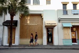
SC Governor orders Saturday evacuations of some barrier islands
McMaster orders Saturday evacuations of some barrier islands
| ||||||||||||||
|
McMaster orders Saturday evacuations of some barrier islands
| ||||||||||||||
|

Above: An aerial photograph taken and released by the Netherlands Ministry of Defence on September 6, 2017 shows the damage of Hurricane Irma in Philipsburg, on the Dutch Caribbean island of Sint Maarten. Image credit: Gerben Van Es/AFP/Getty Images.
Our thanks to friend Becky at dockwa.com for this excellent damage report and photos. Marinas’ damage status are listed by area under View Hurricane Damage Report.
|

Fort Pierce City Marina, a SALTY SOUTHEAST CRUISERS’ NET SPONSOR, is located west of the Waterway, just south of the Fort Pierce high-rise bridge, and well north of unlighted daybeacon #188.
These notes from Anne Maurer, Dockmaster
As of Thursday, 9/7, Fort Pierce City Marina is pumping fuel 22 hours a day to assist cruisers fleeing north in the path of Hurricane Irma. Gasoline is limited to 200 gals and diesel is limited to 500 gals.
We have no space for overnight dockage but will accommodate fuel bunkering.
Fort Pierce City Marina
1 Ave A; Fort Pierce, Florida
P:772-464-1245
F: 772-464-2589
www.fortpiercecitymarina.org
Click Here To Open A Chart View Window, Zoomed To the Location of Fort Pierce City Marina
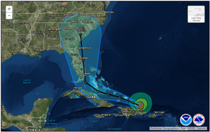
Record surge, ‘major’ storm conditions expected in South Carolina from Hurricane Irma
Surf will start to pick up Thursday, winds and rain by Saturday night. Hurricane Irma is due to make landfall in or near South Carolina late Monday or early Tuesday.
from Post and Courier, Charleston, SC
| ||||||||
|
Evacuation Shelters in Miami-Dade County from The Miami Hurricane
Awesome and frightening photo of damage in this link.
Hurricane Irma Attacks Tortola from sailingscuttlebutt.com
Surrounded by mangroves, Tortola’s Paraquita Bay in the British Virgin Islands is where charter companies hide their boats from approaching storms. But it proved to be insufficient when Hurricane Irma arrived on Wednesday, September 6, 2017.
Our thanks to Vicki Lathom and Barry Miller for this unusual shot from a radar app.
Larry:
Thought you’d be interested in a screen shot taken on a cell phone radar app that my partner, Barry Miller, just took of the eye of Irma. Look at Road Town, BVI. Right in the eye.
Will the photo work for your Irma updates?
We are planning to trek down the ICW to Florida this winter on our trawler. May be more interesting than desirable.
Vicki Lathom
Annapolis, Md.
HURRICANE IRMA VIDEO: Storm pounds Caribbean; Floridians prepare from Soundings’ Trade only Today
At the intersection of the Atlantic Intracoastal Waterway and the Okeechobee Waterway, Martin County, A SALTY SOUTHEAST CRUISERS’ NET SPONSOR, is a hub of boating activity and of events of interest to boaters.

Winston,
I received your voice message. Below is what we are sharing out, please feel free to use or edit- Nerissa
South Florida is currently in the 4-day forecast cone for Hurricane Irma. As we prepare for Hurricane Irma, please be advised that www.discovermartin will have a weather advisory scrolling across the top of the page. Additional information and numbers are listed below:
Florida Emergency Information 24-hour Hotline: 800-342-3557
Local Martin County Public Information Line: 772-287-1652
Find current updates on social media by following and using #FloridaNow
You can also text “FLPrepares” to 888777 to receive Alert Florida notifications.
Real time updates on Hurricane Irma are available at www.floridadisaster.org.
Visit Florida in partnership with Expedia have activated www.Expedia.com/Florida to provide accommodations availability information for visitors, residents and first responders.
Nerissa Okiye
Tourism & Marketing Manager
Martin County Office of Tourism & Marketing
County Administrative Center
2401 S.E. Monterey Road
Stuart, Florida 34996
Office: (772)288-5445
Cellphone: (772)631-8534


.png?t=1504727596611&width=713&height=396&name=Hurricane%20Damage%20Status%20(2).png "http://ahoy.dockwa.com/e1t/c/*W4Xmk-13T_HcBW1tfZdC8Q835Y0/*W8yMTKS6c1WrxW6ZM7yn6NhzG70/5/f18dQhb0S4HN2p44bJVX3d0F62PS_2N5122tnT0w_-N7vlSCPn_v0ZW6BzJn56CypDBW5wN11-2t6kBMW29PWWZ1K-tq0W3rYKq917qjvCVRtwzK2dkhqdW15GLN62H8WMYW15rgmQ2dj5rjW9bKr-95PWdFFW238m1f5DmwBPN4gV7YJghfY3W3gQn-95C4kbYW5CfK9f3hM0rmVNRRmV6nrMJfW5gDm2H5VWXG9N595SmS3gDQtL8r68nS4CVW2m5D815D-vB6W2nrxJT19dKtSW1Fx2YJ5WLFFFW5d4RnT8PNc-xW5c2n_d6Mry_CW4JnMpj5rfZLyW4VDkx148dZVWW4lYGp_2BbmC-V4kk8v3wXBHhW6wKXb55PQzkLW2191Bz5BgK_hW4gn3-N7Fbj9fN4PpxVYMCw4nW96mwt_3HGrmBW6yRvCh37-cDWW8zVTQp22kt_LW469yPk42MZVzW8CC5lH96N8F8W8KYYWg2nQqT9W1nlqjJ4BX2z-W50hwvm6qLn1zW1MD5cF6sL1xLW3ZY7js2f_QxDW1nYM9D8LYxtrW7mZ5th7SJZJgW5299RG12gYX5W86739k3X5__dW5mZxyh6zNPFLW8F-Pmn45VshvW2lv3s78GVJ7qW3DPkWp2mZBvHW4sD7V68MH9lgW6YShXZ8yqBxpW9h3LJD4mP4jTW4trFyz2dkd0yW95fPy57Ph3gdW95nSlg1sK-n9102")


Be the first to comment!