In response to our posting announcing the neared completion of the Carolina Bays Parkway Bridge, one of our readers hopefully asked if this means the closure of the famous (infamous?) Socastee Bridge just north of the new bridge. The answer from today’s Bridge Tender is “No!” Not only is the Socastee Bridge an historical landmark, it is a major conduit for local vehicular traffic, especially school buses. The after school hours of 2:30-4:00 are not a good time to be asking for an opening. The unduty Tender also admitted that local drivers often ignore the bridge’s red lights and drive on, further slowing a requested opening.
Will the new bridge finally close Socastee Bridge? Charles R Jones
We have friends who live on the ICW just north of the bridge. I asked them why the swing bridge remained after the high rise bridge was completed. They told me that the locals wanted the bridge kept in place and had it declared “historic” so it wouldn’t be removed.
An MH-60 Jayhawk helicopter crew from Air Station Elizabeth City, North Carolina, hoists a man from a sinking boat 140 miles from Wilmington, North Ca
Editors’ Note: Click on image to view the video.
WILMINGTON, N.C. – The Coast Guard rescued a 52-year-old man from a sinking boat 140 miles from Wilmington Saturday.
Fifth Coast Guard District watchstanders were alerted at 6:32 p.m. that the man had used his SPOT Satellite GPS Messenger to notify the International Emergency Response Center that his 32-foot Pearson sailboat Great Peace was taking on water and sinking.
An HC-130 Hercules aircraft crew and an MH-60 Jayhawk helicopter crew from Coast Guard Air Station Elizabeth City, North Carolina, launched to assist. Upon arriving on scene, the Jayhawk crew hoisted the man from the sailboat, then transported him back to Air Station Elizabeth City.
“The more prepared boaters are, the easier our job becomes when they need our assistance,” said Coast Guard Lt. Daniel Reilly, pilot of the Jayhawk helicopter crew. “Because this individual was well-prepared and utilized his satellite GPS messenger right away, we were able to get to him in time.”
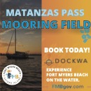
Fort Myers Beach, A SALTY SOUTHEAST CRUISERS’ NET SPONSOR, includes Matanzas Pass south of the western terminus of the Okeechobee Waterway and Matanzas Pass is home to SSECN SPONSOR, Pink Shell Resort and Marina. Comments are requested by March 15.
News Release Feb. 10, 2017 Coast Guard asks mariners help to designate anchorage area
TAMPA, Fla. — The Coast Guard is asking mariners to participate this month in a Waterway Analysis and Management System study of the mooring area adjacent to Fort Myers Beach.
This outreach is designed to gather information on the potential designation of the Matanzas Harbor Mooring Field as a Special Anchorage Area and establish a Special Local Regulation for the anchorage.
A Special Anchorage Area is a designated and charted area with federal oversight where boats may not be required to carry or exhibit anchorage lights while at anchor.
“We want to get the word out to waterway users in the area and seek their comments or concerns,” said Chief Warrant Officer Darren Pauly, the aids to navigation officer at Sector St. Petersburg. “The WAMS survey provides a great way for the public to provide their vital input.”
WAMS studies are conducted year-round on waterways all around the country and focus on managed mooring fields, anchorages, aids to navigation systems, waterborne commerce, marine casualty information, port/harbor resources, and future development projects.
Interested participants can also contact, Commander Sector St. Petersburg Attn: BOSN Darren Pauly 600 8th Ave, S.E. St. Petersburg, FL 33701 (813) 228-2191, ext. 8184. E-mail to darren.a.pauly@uscg.mil.
U.S. Coast Guard 7th District PA Detachment Tampa Bay Contact: Coast Guard PA Detachment Tampa Bay Office: (727) 535-1437 ext. 2143 After Hours: (305) 965-4672
Explorer Chartbooks, A SALTY SOUTHEAST CRUISERS’ NET PARTNER, has long been the standard navigational supplement for enjoyable, informative, and safe cruising through the beautiful Bahamian waters and island visits.
Bahamas Chatter: “Abacos Update” plus 3 more Abacos Update Report on Questionable Fuel Service Treasure Cay Valentines Spanish Wells Update Abacos Update Posted: 09 Feb 2017 12:29 PM PST Abaco Update
As we travel the Abacos, we are pleased to share with you things that have changed since our 7th edition of the Explorer Chartbook Near Bahamas. We recently updated you on Spanish Cay and Green Turtle Cay and now we can add our findings for the rest of the island group.
Sara and Monty Lewis
NAVIGATION NOTES: North Bar Channel—wreck of a stranded barge on the north tip of Linyard Cay.
Marsh Harbour— entering the harbour only the red buoy is lighted, not the green buoy. The flashing green lights shown on the chart at Outer Point Cay and Inner Point Cay are not functioning.
GREAT GUANA CAY
Guana Hideaways Marina is not operational.
TREASURE CAY
American and Delta now fly to both Marsh Harbour and Treasure Cay airports. Tropic Ocean has added flights to MHH as well.
The phone number for the Treasure Cay fuel dock is 242-365-8869.
New numbers under MEDICAL SERVICES. Integrated Medical Center 242-365-8186/8092 and Emergency 242-458-1234.
The price of the moorings is now $30/night and the anchoring fee in the basin has gone up to $20/night.
Add Bahamas Beach Club and Treasure Sands Club to RESTAURANTS.
MAN O WAR CAY
A disappointment for lovers of baked goods, Lola Sawyer no longer delivers her sweets and treats by golf cart. However, Ena’s Place Bakery (242-365-6060/475-8118) has taken over providing bread and other goodies. She comes around to the marina and the MOW Grocery and you can also call her for custom orders.
Under FERRY, add G&L, a new enterprise from Grant Albury with regular schedules to Marsh Harbour and other spots as well as a charter ferry service for special needs, such as your guests flying in to meet you on the island 242-366-6208.
The government clinic is closed. There is no set schedule for the doctor visits.
Some changes under RESTAURANTS: Islanders Seaside and Island Treats Ice Cream are closed. The good news is, in addition to the Dock n Dine at the marina, the Hibiscus has reopened and also added an ice cream shop to the side of the building.
There is a new gift and straw shop as part of the marina complex. It is called Native Jewels and it carries high quality all- Bahamian straw work, jewelry and other gifts. 242-425-0265.
HOPE TOWN
For GROCERIES, Albury’s Fish Market, Salty’s Sky Market and Sweetings are no longer in operation.
The former Hope Town Hideaways Marina is now a part of the newly expanded Hope Town Inn and Marina.
Sea Spray Resort and Marina is undergoing some improvements and expansion of the dockside restaurant and bar under its new ownership.
As with most Bahamian communities, public phones are no longer available in town.
The Sugar Shack burned and its Sun-Dried T’s is gone along with it.
MARSH HARBOUR
Customs and Immigration will come to the marina docks to clear you in.
Long’s Landing (seafood market) is closed. In its place is the Island Sports Bar.
Marsh Harbour Boatyards also has fuel
The Double R Convenience Store is across the street from the Conch Inn.
The number for the Ambulance is 242-359-6282.
FLIGHTS: Baer Air and Island Express are no longer flying in to MH or Treasure Cay.
No obvious changes in the other island communities.
Report on Questionable Fuel Service Posted: 09 Feb 2017 08:09 AM PST Thanks to the Salty Southeast cruisersnet.net for sharing the following:
J.D. French – February 7, 2017 – 9:11 pm After 31/2 weeks of mixed activities (fishing,snorkeling, cruising) very active and on the boat a lot. We traveled from Walkers down to Hopetown and back up to Walkers with several hotel and fuel splashes at same locations each direction. Returning to Ft. Pierce mid June from Walkers area with a safety margin of fuel of 8o gallons. I have been powerboat crossing since the 1980s to Bahamas . Without boring detaiils we ran out of fuel 30 miles out of Ft Pierce. Coast Guard Came to our rescue. Gotta Love those great guys ! To be honest my fuel gauge is very accurate , but my Flo-Scan is spot on. I logged all fuel gallons I paid for. After all said and done , I did not get all of the fuel I paid for. . Buyer Beware.
Spanish Wells Update Posted: 09 Feb 2017 07:54 AM PST Spanish Wells Yacht Haven has completed its major renovations and additions and is in full operation now. In addition to the 30-slip all-weather marina with its full services of dockage, fuel, water, and electricity, there is a new restaurant, pool and luxurious suites, plus laundry facilities. Dockage is $2.50/ft; suites, $250/night.
The posting with this title, ALERT!! TO ALL US COAST GUARD DOCUMENTED VESSEL OWNERS, is INCORRECT!
US Vessel Documentation (USVD) of California is a legitimate company and the posting claiming otherwise is IN ERROR!
We regret any concern this erroneous posting may have caused you.
Share:
Comments from Cruisers (1)
Steve Sipe- February 11, 2017 - 7:04 pm
The site may be legit, but the structure of the website along with the fact that they’re reported to have sent deceptive correspondence urging boaters to engage their services to renew documentation for a $75 fee that costs $26 on the LEGITIMATE USCG Documentation site- qualifies them as a scam operation, despite the fact that they actuallly provide the service they promote- albeit at an outrageously inflated rate. They’re clearly taking advantage of misunderstood or misdirected search results, given their nearly triple rate for a service that doesn’t require third party assistance. Shady, at best.
A big thank you to veteran cruiser and SSECN contributor, Greg Allard, for this excellent guide to online and printed materials related to weather.
Weather Resources for Cruisers
By Greg Allard
Cruisers- especially those looking to travel longer distances, soon learn Rule One of cruising: It’s All About the Weather.
This article discusses the weather sources we have used on the east coast of the U.S., in the Caribbean and the Bahamas, and a good bit of this information also applies to the west coast of the U.S. and Canada; some of the sources provide national or worldwide information.
Understanding cloud formation is critical to understanding pending weather. There are numerous sources which explain the many different clouds and what they portend. In this photo, taken off the west coast of the Berry Islands, these two upward moving cloud columns may develop into something nasty.
We don’t pretend that this article is exhaustive: experienced cruisers will undoubtedly have different sources or methods they rely upon, but these are the ones which have worked for us.
Remember: you are ultimately responsible for the decisions you make about the weather. By its very nature, weather forecasting is an inexact science, and the best professional forecasters and weather sites are, on occasion, just plain wrong. Wind forecasting is especially problematic: marine wind speeds are often different from what is forecast: sometimes less, and often – more. This article will outline multiple sources of weather information, but as captain of your boat, only you can use that information, and your own judgment, to make the decision to go, or not to go.
See Rule Two, at the end of this article.
This shelf cloud, coming across Highbourne Cay Marina in the Exumas, means: “Don’t leave the marina.”
If you have internet access:
Marv Market’s Weather Service: Marv provides a daily e-mail update which draws upon Buoy Weather reports (see below). He covers multiple locations throughout the Bahamas, the Caribbean and the eastern and Gulf coastal U.S. from Texas to Maine. As an example, if you are travelling from Miami to Bimini, there will be a specific report for that route. His reports include projected wave heights and their period (time between waves, in seconds), wind speed and direction, all shown in a seven day projection. The graphic reports are exceptionally easy to use.
Marv also provides extremely valuable Tropical Updates, whenever there is a potential severe weather system which might affect the U.S. east coast, the Caribbean or the Bahamas. His analysis is some of the best we have seen. He also appears to give alerts at least a couple of days before anyone else. The Tropical Updates come by e-mail; he sends them only when necessary.
If you want to be added to his daily mailing, send him an e-mail request at: marvboater1@aol.com. He asks for a voluntary donation while you use his service.
The convenience of having Marv’s comprehensive package of reports in your mail each morning cannot be overstated.
A fast moving storm, approaching from the SE, at Staniel Cay in the Exumas. The dark area which reaches down to the water (just to the right of the island) is heavy rain.
Buoy Weather: In my view, one of the singular best commercial internet weather sites. Annual fee: up to $79.95. Worldwide coverage. www.buoyweather.com.webloc
As mentioned above, one of Marv Market’s principal sources of information is an arrangement he has with Buoy Weather. You can access the Buoy Weather site for free, but that will only give you projections for two days. Membership gives you wind and wave forecasts for seven days, plus a number of multiple additional features, including the ability to select a specific location for your weather reports. It’s worth looking at the site, just to see what is offered.
Both Marv Market’s Weather Service, and Buoy Weather have additional links and significant features which make them individually valuable. We subscribe to both. We cruise about six months each year; having such valuable weather information available for a modest cost is an easy decision.
4) OCENS: A number of serious offshore cruisers use this regularly for both weather and satellite based communications. www.ocens.com.webloc
5) The NOAA National Weather Service (NWS) sites, are primary sources for coastal and offshore information. They also include hurricane data. Here are two links to get you started:
This site is operated by NOAA, and rather than give projections or estimates of wind and wave conditions, the advantage is that it reports actual conditions in almost real time, – at hundreds of locations, both buoy and coastal-based. For instance, if you access the Settlement Point (West End, Bahamas) report, you can see wind speed and direction no more than an hour ago. It’s valuable to know what the conditions actually are, rather than what they are supposed to be. (The Settlement Point site does not report on wave heights, but many of the various NDBC locations on the east and west coasts of the U.S. do.)
At times, some of the NBDC stations are “down” (not operating), or the sites are reporting only limited information.
Each station’s report includes a link to the full National Weather Service Marine reports. You can set up your own file of preferred NDBC locations to make access easier.
Another feature of the NBDC worth knowing about is the “Dial-A-Buoy” service. Information about it can be found using the link above. Using your cell phone (or sat phone) you call the NDBC and enter the number-identifier of the buoy you want. You will then hear a voice report of the current conditions at that buoy, and in many instances, you can also receive the voice report of the NWS forecast. It helps if you have identified the buoy ID numbers ahead of time on the internet, as obtaining them on the phone connection is cumbersome.
Wunderground: This is a general purpose weather site, not primarily marine, but it contains an great deal of good information, including links to the U.S. based radar sites.
This photo from NOAA shows a classic “anvil” cloud, one of the most important clouds for mariners to recognize. They are often a sign of thunderstorms.
As an example, here is the link to the Tampa, FL radar, which covers all of SE United States and includes the Florida Straits. www.wunderground.com/.webloc(Zoom the image out, to see full radar and wind coverages.)
While U.S. based radar only extends into the Bahamas as far as the center of Grand Bahama island, and the west side of Andros, U.S. radar is extremely helpful in planning a crossing of the Florida Straits (Gulf Stream).
The Wunderground radar link (above) also has sub-links to view lightening strikes and storms, as well as satellite views, which show storms and strikes outside of the U.S. radar area. (There is no weather radar in the Bahamas.)
The Wunderground site can also link you to land based forecasts which are helpful for projections of rain or thunderstorms. For instance, here is the link to the extensive Wunderground information for Great Harbour in The Berry Islands, Bahamas: www.wunderground.com/ 3.webloc
(Note on Bahamas internet access: Bahamian cruisers will find that access to the internet is very good in most places. Just as in the U.S., almost all marinas have wi-fi – at some it is free, others impose a charge. Or, if you are anchored or moored in the Bahamas near a BTC (Bahamian Telecommunications) tower – which are in-place on almost all inhabited islands – you will be able to access the internet, provided you have made plans with either your own carrier, or the Bahamian Telecommunications Company (BTC.). The BTC towers often offer coverage up to ten miles from shore. Some of the really remote Bahamian islands have no access, and the Exuma Land and Sea Park has internet only if you are sitting next to the office at the main headquarters at Warderick Wells.)
Non-Internet accessed Weather Sources:
VHF Radio Weather Channels:
With multiple internet ways to obtain weather, the National Weather Service reports on VHF Radio are often overlooked. They are free, current and as reliable as anything else. Depending upon the condition of your equipment and connections, and height of your antenna, their reports are often available a considerable distance offshore, and occasionally in some parts of the Bahamas.
For cruising everywhere along both U.S. coasts, significant portions of southern Canada (but not Alaska), the Bahamas and some portions of the Caribbean (including Cuba), we’ve found that the single best way of obtaining weather when the internet is not available is through Sirius Marine Weather (WxWorx). Just like Sirius radio, the information is provided by satellite.
This drawing, from the Sirius site, approximates the area of coverage of Sirius XM Marine weather. Sirius notes that: “Satellite signal strength at border regions may be limited.”
Sirius shows wave heights and direction, wave period, wind speed and direction, radar (again, U.S. based), lightening strikes, movement of fronts, buoy data, storm paths, tropical storm warnings, satellite views (including lightening strikes outside the reach of U.S. radar) and NWS forecasts for coastal and offshore.
A screen shot of Sirius Marine Weather (WxWorx) from our shipboard computer in April of 2015. The lower part of Florida is on the left of the screen, and some of the Bahamian islands are in the center. The bright yellow, green and (some red) areas on the left side of the screen are all rain, picked up by the U.S. based radar. There are lightening strikes shown in the red areas on the lower left. The real time version of this screen showed the storm moving directly east. Note that the U.S. based radar only goes as far as the west end of Grand Bahama island (top of the screen) and the west side of Andros, the large grey island in the middle of the screen. All of the lightening strikes from the center to the right side of the screen have been picked up by satellite, not radar, and provided by Sirius via satellite. So while there are no radar returns showing the heavy rains from the center of the screen over to the right, the strong number of lightening strikes surely means that there is bad weather there, and likely to be heavy rains and wind. The different colors of the lightening bolts indicate the amount of time since the recorded strike: white means the strike was less than 5 minutes ago, yellow is 5-10 minutes old, and orange occurred 10-15 minutes ago.
The strength of Sirius is that you have access to the weather 24-7, without needing an internet connection. It has helped us plan for multiple open-water crossings.
A negative: the wind and wave forecasts are projected only two days out. Access to the NWS forecasts does make up, to some extent, for that deficiency.
For a stand-alone Sirius marine application you need a WxWorx “black box” and a small mushroom antenna, connected to either an onboard Windows computer or laptop. The box, from WxWorx, costs $830, however you may be able to find a perfectly serviceable used one on E-Bay. We secured a used box, and found that Sirius offers free software updates for all of their older WxWorx receivers.
We’ve had two boats equipped with Sirius; on both we’ve used a stand-alone box, connected to either a Windows desktop or a laptop. The service has been excellent and the package with the most features (recommended) is the “Master Mariner” at $49.95 a month.
Some chartplotters can also receive the Sirius data, using their own proprietary black box or related equipment. We’ve seen Sirius in use on several chartplotters, and sometimes the data presented was in a different format, less detailed and a bit more difficult to access than what we receive with our stand- alone Sirius system. This is based on several observations; some cruisers may have a different experience, depending on their hardware. This statement is from the Sirius site:
“The availability and display of service features….varies by hardware provider.”
Cruisers may find that the access to Sirius WxWorx through a chartplotter will be more than adequate, and that it is more cost-effective to connect it to their existing chartplotter..
If you want to see if you can access Sirius XM weather on your chartplotter, start by consulting your owner’s manual, or contacting the manufacturer of your device. You could also call Sirius, but do not call the regular toll-free number which is used to subscribe to the service. They are nice order-takers, but know nothing about the technical side. Instead, call one of the technical people at Sirius, whose contact information is on their website.
Sirius has a good feature which allows you to suspend the service for months at a time when you are not cruising.
Once you install the system, spending less than $2.00 a day for this kind of weather access is smart choice especially if you are doing open water passages.
Ship’s Radar: Some cruisers don’t recognize the value of the vessel’s radar as a weather monitoring tool. When it is set on longer ranges, your radar will pick up fast moving rain storms, and you can plot their direction.
Other Non Internet Options: There are a number of other sophisticated – and sometimes complex – ways of collecting weather information. They include using a “short wave” radio receiver (less than $200) to receive scheduled reports; weather reports and “GRIB” files can also be downloaded from various sources through an SSB or a SAT phone. A portable “short wave” type radio receiver is a reasonable way to receive SSB forecasts, without the chore of installing and learning how to use a full featured SSB. Just be sure that the portable short wave radio you purchase has the required frequencies to access the reports you want. (See below).
Weather Services: Paid Professional Forecasting and Routing Advisors:
Offshore, SSB and Sat Phones (with a fax) can be used to obtain voice or printed forecasts from a professional weather routing provider such as Chris Parker (search “Chris Parker Weather Service”) who offers customized interpretation of weather data tailored to your specific route. (Parker’s services can also be accessed by e-mail, internet or cell phone where you have a connection.)
The use of a weather routing service may be more important if you are cruising to remote places, travelling offshore for days at a time. Parker focuses primarily on the Bahamas, the western Atlantic (including Bermuda) and the Caribbean.
Another recognized weather service is that run by Bob Jones, called Ocean Marine Navigation, Inc. (OMNI) www.oceanmarinenav.com.webloc
OMNI offers worldwide coverage, which you can access using multiple methods. Jones has provided services for the two Nordhavn cross-Atlantic Rallies and for multiple FUBAR rallies on the west coast of the U.S./Mexico. His service is well-regarded by experienced offshore and trans-ocean cruisers.
SUMMARY: Virtually all of the information and data available on any packaged weather site or service is available often for free, on the internet. The real value of dedicated sites (such as Buoy Weather, Passageweather or Marv’s Reports) is that they pull together in one place multiple sources of the information you need, and present it in an easy to digest, integrated format. Sirius does the same thing, but makes it available via satellite. Weather Routing Services go a good step further, and add professional interpretation to the data.
A Note on Learning about Bahamian and Caribbean Weather Patterns:
We would not think of cruising Bahamian waters without the most current editions of the Explorer Charts, which have separate chartbooks for Near Bahamas, Far Bahamas, and the Exumas. Not only do they have, in our experience, the most reliable and accurate charting details, but they also contain a huge amount of usable information about local anchorages, facilities, etc.
The current editions of the “Near Bahamas” and “Exumas” Explorer books include an excellent full page discussion of Bahamian weather, fronts, hurricanes, analysis of changing patterns by season, and other weather resources, written by Chris Parker and Frank Ready. All three books have a list of weather stations, frequencies and the times at which you can receive weather reports on a portable “short wave” type radio.
For Bahamian and Caribbean cruisers, another superb book is Bruce Van Sant’s: A Gentleman’s Guide to Passages South, which contains an excellent discussion of weather patterns from Florida, through the Bahamas, and into the Caribbean.
As was said above, as captain of your boat only you can use information about the weather, coupled with your own judgment, to make an intelligent decision. Which brings us to the second, simple rule of marine weather forecasting.
Rule Two: If you think the weather is questionable, and you are not sure if you should go, then don’t go.
Greg Allard has held a U.S. Coast Guard Master’s License for over 25 years. He has instructed U.S. Coast Guard and Navy crews, and the crews of foreign military partners of the U.S., in the operation of new coastal and offshore patrol boats delivered to them. He and his wife Barbara cruise aboard their 61’ Tollycraft “Meander” about six months a year. They have voyaged extensively along the U.S. east coast, the Bahamas, Caribbean, and most recently cruised aboard a friends’ boat in the Swedish archipelago on the Baltic Sea. He has no financial or other interest in any of the sites or companies mentioned.
Copyright – Greg Allard, 2016
Share:
Comments from Cruisers (1)
Scott Berg- February 13, 2017 - 2:07 pm
They may be a legitimate (licensed) company but they seem to be using the sort of deceptive marketing techniques that give the industry a bad reputation. Same with companies who write to radio station licensees and holders of internet domain registrations. They craft their unsolicited letters to appear to be official government correspondence and charge significant fees for what are simple to file forms with low or no fees paid directly to the government agency.
If you are able to participate in person with the lobbying efforts in Tallahassee, please contact Mike Bodin. Even if you are uncomfortable offering personal testimony, your presence in the group is a big help. See /162138.
ANCHORING RIGHTS VOLUNTEERS NEEDED Marine Trawler Owners Association 2/10/17 As many of you know, we have formed a coalition of boating groups to represent our “Boaters’ Rights” position with force in Tallahassee. Donations from fellow boaters (primarily AGLCA, MTOA, SSCA, and DeFever) allowed us to secure Capitol Access as our lobbyists.
At times, we must also show up in person to serve as a visual commitment to the legislative committee in Tallahassee to support our position to legislators.
Presently, we are conducting a general survey of boaters who might be able to assist.
This would entail a day commitment two or three times during the legislative session in Tallahassee to attend committee hearings.
We need Florida boating residents as well as out of state users of the AICW for in-person testimonials at the state capitol. In Tallahassee, anchoring committee hearings will commence within the near future and about a dozen boating representatives are needed. They will testify in person to committee members expressing their desire to anchor, the burden of not being able to anchor, as well as, their use of the AICW.
Anchoring committee dates have not yet been scheduled but we should prepare for this future event and coordinate our presentations.
If you can be available to participate please contact me.
Mike Bodin MTOA Public Advocate (captmike12@gmail.com)
And from AGLCA:
Unfortunately, I haven’t had a rush of volunteers sign-up for our new Advocacy and Fundraising Committees since my post Monday. Thanks to your generosity, the fundraising is not an immediate issue. But we do need some help on the advocacy committee. Bills pertaining to anchoring are expected to be introduced in the near-term by legislative committees in Florida. As they are issued, I’ll be looking to a small group of members to provide feedback on which provisions are acceptable to us, and which are not. If you are willing to provide this feedback, but are hesitant to “officially” join the advocacy committee, please email me. Kim Russo Director America’s Great Loop Cruisers’ Association krusso@greatloop.org 843.879.5030
Share:
Comments from Cruisers (6)
Bill Conlyn- February 17, 2017 - 10:03 pm
I am a retired marine mechanic and towboat captain/ owner, currently owning a 49′ trawler which I plan on cruising down to FL next year. I have spent a fair amount of time in FL on both coasts as I was in the USCG in the 60s mostly on a 82′ patrol boat. I also have pleasure cruised on the west coast too. I feel the water belongs to the people who use the water and has traditionally been free to use without abuse. This of course includes those who are fortunate enough to live on the water. If they do not like looking at boats then they should not try to ban their presence.
During last years Florida Legislative session I spend a lot of time and effort working on the Anchoring issues. I sent over 60 e-mails to State Senators and Representatives. I wasn’t counting the phone calls to their offices. I talked to the BoatUS Political People in Washington and their Lobbyist in Tallahassee. I made posts on this forum asking for help from members. I got none or very little support. I don’t understand why no one participated. As cruisers, I thought you would have time and the want to participate in this effort. I am going to work on it again this year but I am real disappointed in the members of this forum who would seem like they have the most to loose from the beginning of real anchor bans. Bill Conlyn I would be happy to work with you on this. My e-mail is tomrealest@aol.com
Tom, Your assistance is most welcome, our lobbyists is extremely active and closely following the bill as it proceeds through the various committees. We will notify you when open testimony is sought for pro anchoring legislation. Your attendance would be greatly appreciated. Best, Mike Bodin MTOA Public Advocate
Paul, Again, we appreciate your volunteering to assist us with the Florida state legislature anchoring bill. We will advise you of upcoming open committee hearing dates as they are made aware to us. Best, Mike Bodin MTOA Public Advocate
Mike Bodin- March 7, 2017 - 5:25 pm
Bill, The concern with waterside residents are not with the transient or cruising boaters but in fact with the boater that anchors for seasons or years in front of the residence. Furthermore, they do not like boats that are stored and ones that are derelict (junk). Cities may have to dip into their local taxes paid by the waterside resident for the removal of junk boats that sink. We promote safe, environmentally friendly, and courteous anchoring. Best, Mike Bodin
The Coast Guard doing more of what they do so well. Thank you Coast Guard!
News Release Feb. 7, 2017 VIDEO AVAILABLE: Coast Guard rescues 3 fishermen after vessel catches fire near St. Catherines Island, Ga. CLICK HERE FOR VIDEO AND REPORT
Explorer Chartbooks, A SALTY SOUTHEAST CRUISERS’ NET PARTNER, has long been the standard navigational supplement for enjoyable, informative, and safe cruising through the beautiful Bahamian waters and island visits.
Bahamas Chatter: Indian Cay Channel, West End GB report Indian Cay Channel, West End GB report Posted: 07 Feb 2017 05:27 AM PST A Chatter subscriber reports:
Just came thru Indian key channel 2 days ago. It’s fine–deeper than charted I thought. There is a good anchorage just around Settlement Point West End. An abandoned development in the canals is done with. Breakwater and lighted markers. 15? depth we saw. Made st lucie inlet florida from there in 12 hours in a 6 knot boat.
Share:
1 Facebook Likes, 1 Facebook Reactions
Comments from Cruisers (1)
Hominid- March 20, 2017 - 8:52 am
Are you saying it’s permitted to anchor overnight in the canal on the right after entering through the jetties?
For those of you who are or who are considering entering the current yacht market, this article from Sounding’s Trade Only Today by John Burnham of Yacht World will be of interest.
Brokerage sales increase in January Posted on February 7th, 2017 Written by John Burnham, YachtWorld.com U.S. brokers posted a moderate increase in sales volume in January and a major gain in the total price paid for the boats that were sold.
Brokerage volume rose 5 percent from the same month last year and the total value increased by 62 percent as 1,585 boats sold for $323.3 million.
According to YachtWorld member brokerages reporting in SoldBoats, their proprietary database, the dollar value was an extraordinary result — $80 million more than in any other January in the last five years.
On the other hand, although sales were above the previous two years, they were slightly less than the average number of boats sold in January during the previous five years.
Superyacht sales drove most of the increase in value. Seventeen boats 80 feet and larger changed hands during the month for a combined total of $131.6 million, compared with 11 boats in that size range last January that sold for $20.4 million.
Most of the volume gains were in the 26- to 35-foot grouping, where unit sales increased from 527 boats to 593, a 13 percent lift. Sales volumes also increased incrementally among boats under 26 feet, up 3 percent, and 46 to 55 feet, up 6 percent.
The value of the boats sold increased by double-digit percentages in all size ranges below 56 feet, especially among boats 26 to 35 feet, which gained 41 percent, from $29.5 million to $41.6 million. The lone category with lower values, 56 to 79 feet, experienced a 17 percent drop in sales volume and a 27 percent decline in total value.
Powerboat sales for the month were up strongly — 11 percent — as 1,302 boats were sold; sailboat sales declined 17 percent as 283 boats changed owners. All of the value gains in the month were in powerboat sales, although the value drop in sailboat sales was only 14 percent; there was a 4 percent increase for the month in the average sailboat price paid.
John Burnham is the managing editor of Dominion Marine Media.
A more detailed report summarizing recent U.S. brokerage sales will appear in the March issue of Soundings Trade Only.


Comments from Cruisers (2)
Then leave it in the up position
We have friends who live on the ICW just north of the bridge. I asked them why the swing bridge remained after the high rise bridge was completed. They told me that the locals wanted the bridge kept in place and had it declared “historic” so it wouldn’t be removed.