Grand Bahamas Photo by Greg Allard

Photo taken off Sandy Cay, north of West End on Grand Bahama Island.
Photo taken off Sandy Cay, north of West End on Grand Bahama Island.
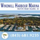
Windmill Harbour Marina, A SALTY SOUTHEAST CRUISERS’ NET SPONSOR, is located hard by the southwesterly mouth of the Waterway’s passage south down Skull Creek, on the shores of Hilton Head Island, south of marker #27.
Welcome to Windmill Harbour Marina, situated on the northwest coast of Hilton Head Island, South Carolina. We are located on the Intracoastal Waterway, just ½ mile south of the Pinckney Island Bridge at mile marker 558, 500 yards south of channel marker 27, and ½ mile north of channel marker 29 in the Calibogue Sound. The marina’s 15.5 acre harbour boasts 258 boat slips, offering many for short or long term rental or sale. Transient dockage is available including dining privileges at the Yacht Club, laundry, restrooms and showers, competitively priced fuel and a pump out station. Our remarkable harbour offers a safe, tide free haven protected by a lock system directly off the Intracoastal Waterway. The Windmill Harbour Marina lock is 75′ long by 19′ wide. Hours of operation are 0800 to 1900 by harbour master or 24 hours by yachtsmen with a keycard. We monitor channel 14 VHF and our phone number is 843-681-9235.
One of only three private locked harbours on the east coast, Windmill Harbour Marina offers an unparalleled combination of convenience and security…the safest place to keep your yacht.

Windmill Harbour initially began in 1981, the founding company chose a Southwestern style featuring an adobe look and a large windmill at the entrance. This design, however, was not embraced by the community. In response, the founders removed the windmill and the land plan changed to a mix of single-family homes, townhomes and condominiums in a more acceptable southern traditional style, similar to residences found in Charleston. As Windmill Harbour began to take shape, more and more homes were built in that style. This led to the evolution of the Charleston Lowcountry look one sees in Windmill Harbour today.
Windmill Harbour is home to a variety of different boaters. From small center console fishing boats to large offshore sport fishing boats, fertile fishing grounds are nearby. A significant fleet of Harbor 20s engages in class racing and there are numerous cruising and sailing activities including the Calibogue Cup, Harbour Town Cup and Ocean Challenge.


One of the most important assets of the community is the marina and its unique harbor. The harbor is composed of 15.5 acres and houses more than 255 boat slips and is the largest harbor on Hilton Head Island by nearly a hundred slips. The lock was constructed to create a protected harbor from the weather and the changing tides. It was only the second lock existing on the eastern seaboard at the time. The lock is operated with the gravity flow of water, electricity and hydraulics. As complicated as it may appear, it is very simple to operate.

VIDEO
As the marina and neighborhood came together the next step was to give the community a place to gather. Thus the South Carolina Yacht Club was born. The vision was that the club would be populated by the most interesting residents and visitors to Hilton Head Island, reminiscent of those early social gatherings on Hilton Head. This led to the decision which established a club that property owners could choose to join, but were not required to do so, and that would invite membership from outside of Windmill Harbour and Hilton Head as well. More detailed information on the founding of the South Carolina Yacht Club can be found on its website.

The unique history, breathtaking beauty, meticulous planning and unique harbor have made Windmill Harbour a premier marina community in the Lowcountry. Its vibrancy and growth are a testament to its founders and its residents.
Click Here To Open A Chart View Window, Zoomed To the Location of Windmill Harbor Marina

Explorer Chartbooks, A SALTY SOUTHEAST CRUISERS’ NET PARTNER, has long been the standard navigational supplement for enjoyable, informative, and safe cruising through the beautiful Bahamian waters and island visits.
Bahamas Chatter: Boat/Dinghy Thefts in the Bahamas
Boat/Dinghy Thefts in the Bahamas
Posted: 06 May 2016 08:54 AM PDT
We are getting more frequent reports of thefts from cruising yachts and from marinas. Some vessels stolen were larger outboards; many are dinghies, some large with big outboards. Reports have come from the Abacos, Nassau and George Town. Nassau thefts have occurred from a paddleboarder sneaking into marinas.
Concern is growing among cruisers and many are expressing the possibility that they will completely avoid these areas in the future.
To make your feelings known and to press for some government action on this issue, here is some contact information for Bahamas Tourism.
Bahamas Tourism George Town
Pet Hanna
phanna@bahamas.com
242-336-2430
242-357-0970
Bahamas Tourism Nassau
Minister of Tourism
Obie Wilchcombe
owilchcombe@bahamas.com
242-302-2058
242-302-1317
Let them know the seriousness of the thefts in terms of loss of tourism in the Bahamas. Perhaps it will get some action to stop and further prevent this threat to cruising yachts and other vessels in the Bahamas.

A SALTY SOUTHEAST CRUISERS’ NET SPONSOR!, Downtown Marina is located north of AICW marker #239, a short distance west of the Lady’s Island swing bridge, in the heart of downtown Beaufort.
Great stop! The marina staff is very good with the tides and the rolling current. Diesel pump was VERY slow, but price reasonable. Could not ask for a better place to shop and eat! Plenty of restaurants to choose from, and cute little shops to browse. This is our second time here, and will return!
Still Clueless
Click Here To View the South Carolina Cruisers’ Net Marina Directory Listing For Downtown Marina
Click Here To Open A Chart View Window, Zoomed To the Location of Downtown Marina of Beaufort
CLICK HERE for this story of rescue and video from WPTV West Palm Beach.
Boat capsizes off Jupiter; 2 rescued
Katie Johnson, WPTV Webteam
11:35 AM, May 5, 2016
2 hours ago
Two people were rescued after their boat capsized off the coast of Jupiter Thursday morning.
They were fishing at the time of the incident and about 5 miles from land.
They were transported to Dubois Park where paramedics met them.
They were evaluated by medical personnel and one was transported to a hospital.
BoatUS remains the premiere advocate for boaters and boating safety on all waters and SSECN is proud to present BoatUS News.
May 4, 2016
NEWS from BoatUS
Boat Owners Association of The United States
880 S. Pickett St., Alexandria, VA 22304
FOR IMMEDIATE RELEASE
Press Contact: D. Scott Croft, 703-461-2864, SCroft@BoatUS.com
“How to Use GPS” Newest Online Course From BoatUS Foundation and US Power Squadrons
Get More Out of Your GPS/Chartplotter
Which way to go? The new BoatUS Foundation “How to Use GPS” online course shows the way to get there – by getting more out of your chartplotter/GPS.
ANNAPOLIS, Md., May 4, 2016 ‘“ It’s an important piece of equipment, able to get boaters safely home, to their favored fishing hole or weekend raft up spot. But if you’ve ever wondered about all of the features and functions on your boat’s GPS or chartplotter, this is your chance to learn by taking the newest online course from the BoatUS Foundation for Boating Safety and Clean Water and the United States Power Squadrons, `How to Use GPS.’ Available for a $30 course fee at BoatUS.org/gps, the course makes learning easy as it can be taken anytime ‘“ at home, office, or the boat. Course takers may stop and return as their busy schedules permit, and the course works well with any brand of GPS or chartplotter.
CLICK HERE for the full article
St. James Plantation Marina is on the Waterway’s northerly banks, about one nautical mile west of flashing daybeacon #16.
St James Marina, mm 315.
Very friendly staff, quiet, protected marina, fuel, showers, laundry, excellent wi-fi, cafe/restaurant, “Tommy Thompsons”, and Enterprise will pick you up!
A good place to hide, especially when the weather is bad.
Bruce Franz
s/v “Hemisphere Dancer”
Dickerson 41
Click Here To Open A Chart View Window, Zoomed To the Location of St. James Plantation Marina
As Bruce Franz relates and Ms Wanda confirms, dredging at Alligator River Marina has been completed and invitations are extended to Spring Migrators! ARM lies on the western shore of the mouth of the Alligator River/AICW, just north of the swing bridge and southwest of flashing daybeacon #12. This facility provides the ONLY readily available dockage and fuel along the patch of the AICW between Coinjock, Elizabeth City and Dowry Creek/Belhaven!
Yesterday, proof positive our cruising friend’s 50 ft Gulfstar with a 6 ft draft can enter/leave Alligator Marina and visit Ms Wanda.
Bruce Franz
s/v “Hemisphere Dancer”
Dickerson 41
Click Here To Open A Chart View Window, Zoomed To the Location of Alligator River Marina
Explorer Chartbooks, A SALTY SOUTHEAST CRUISERS’ NET PARTNER, has long been the standard navigational supplement for enjoyable, informative, and safe cruising through the beautiful Bahamian waters and island visits.
Bahamas Chatter: New fuel and dockage survey for May
New fuel and dockage survey for May
Posted: 03 May 2016 12:14 PM PDT
Fuel prices were mixed in this month’s survey. Three marinas raised dockage prices and two marinas lower their rates. The rest remained the same.
Harbour View Marina in Marsh Harbour announced the installation of five new moorings available for $15 a night. Emerald Bay Marina now has an ATM on site.
As always, we appreciate the individual reports you send us to keep this survey updated. Send an email to monty@explorercharts.com for any new prices you find until the next survey.
Explorer Chartbooks, A SALTY SOUTHEAST CRUISERS’ NET PARTNER, has long been the standard navigational supplement for enjoyable, informative, and safe cruising through the beautiful Bahamian waters and island visits.
Bahamas Chatter: Many More Boat Thefts in Georgetown
Many More Boat Thefts in Georgetown
Posted: 02 May 2016 03:50 AM PDT
This weekend was the Family Island Regatta in Georgetown. Two dinghy with outboards were stolen off the back of cruising bots anchored off of Chat & Chill. A working skiff with outboard was also stolen off of the back of a Long Island boat that was in Georgetown for the Regatta.
These are not the only thefts in the past several months. Boats from cruising inflatable dinghy to much larger boats with dual large outboards are being stolen.
The police have done nothing about any of the thefts and do not seem interested in pursuing any of the cases. If you talk to many of the locals on the island they seem to know who is responsible so the police probably know also.
Those boats staying in Georgetown are resorting to hauling their boats out of the water at night and other methods. However at least 2 boats that were chained have had the chains cut in order to steal the boats & outboards


Be the first to comment!