Visit Logged
  • Select Region
    • All Regions
    • VA to NC Line
    • North Carolina
    • South Carolina
    • Georgia
    • Eastern Florida
    • Western Florida
    • Florida Keys
    • Okeechobee Waterway
    • Northern Gulf
    • Bahamas
    • New York
    • Ohio
    • Pennsylvania
    • Washington
    • Puerto Rico
    • Minnesota
    • Maryland
    Order by:
    • Another Update on Georgia’s Anchoring Restrictions

      Our thanks to Ted Ariska of Save Georgia’s Anchorages for forwarding this GNR link further defining Georgia’s anchoring restrictions. See New Boating Laws. Cruisers Net urges you to contribute to the lobbying efforts of SAGA at this AGLCA link.


      Georgia DNR has updated their website and published the “Intertidal Harvest Areas and Anchorages” KMZ files that you can download. Using these files on Google Earth on your GPS equipped smartphone can show your position relative to these no-overnight-anchoring zones. https://gadnr.org/liveaboardsc
       
      They have not published their marina and marine structures KMZ files for some reason, but we will ask them to do so.
       
      Regards, Ted 

      Be the first to comment!

    • More on Capsized Golden Ray Removal, St. Simons Sound, GA, near AICW Statute Mile 677


      The wreck of the capsized PCTC Golden Ray has taken more than a year to remove from St. Simons Sound, Georgia. This is the first clear view of the autos lost. Also see Safety Zone.


      © Savannah Corps of Engineers via Facebook The Golden Ray has been awaiting removal since September 2019, when the 656-foot-long ship caught on fire and capsized with 4200 newly built vehicles on board.


      Capsized Car-Carrying Cargo Ship Cut in Half as Salvage Continues
      CarandDriver

      Video: Stern Section of Golden Ray Removed on Barge
      Maritime Executive

      Be the first to comment!

    • Georgia Anchoring Update

      Our thanks to AGLCA Director Kimberly Russo for posting this update on AGLCA’s Forum and to Ted Arisaka for his research. See also Update on Anchoring in Georgia.


      I’m sharing some information on the Georgia Anchoring issue that was prepared by one of our Coalition members, Ted Arisaka. Ted prepared this information to help show the impacts Coalition’s efforts to preserve our cruisers’ rights in Georgia’s waters over the last few years.

      Here we analyzed the 150 unique anchorages as published in Active Captain, Waterway Guide and Cruisers’Net between 2019 Legislation HB201 and 2020 replacement bill HB833, showing the dramatic growth of what Georgia DNR considered approved shellfish harvest areas – impact grew from 19 prohibited anchorages to 50 prohibited anchorages.

      SGA Shellfish Harvest Areas 2019 / Early 2020 comparison photo album

      After offline dialogue with GA DNR, documenting the impact to 50 anchorages, they greatly reduced these areas to impact “only” 11 anchorages. These maps show the 150 anchorages in Georgia – OK in yellow, Prohibited in red. Bob423 tracks on ICW shown in magenta.

      Dec 2020 Maps of Reduced Shellfish Harvest Area Impact to 11 Anchorages

      Georgia House Bill 833 Passed Into Law 2020

      Here is an interactive map published by DNR showing the various anchoring zones for marine structures setbacks, marina setbacks and approved shellfish harvest area setbacks. (There is a legend for the colors). You can also put Lat / Long in the search field. Georgia DNR Liveaboard Anchoring Illustrative Map

      Here is our FB group that has chronicled the evolution of these regs as well as some of our communications and analyses. There are also video recordings of the initial DNR presentation to the public on their stated rationale for the need of the original HB201. Save Georgia’s Anchorages Facebook

      GA DNR Page re: Commercial Shellfish Harvest

      Cruisers’ Net Update on Steamboat Creek SC including USCG LNM Excerpt

      Georgia House Bill 501 (2019) governing Commercial Shellfish

      Best Regards,

      Ted Arisaka

      s/v Little Wing Valiant 42 #186


      If you value this kind of work done for the cruising community, please consider contributing to the Boater’s Rights Advocacy Fund. Our coalition is currently fundraising for 2021. We need your help to be able to continue working to keep anchorages open for boaters. Contribute now!

      Kim Russo

      Director

      America’s Great Loop Cruisers’ Association

      Be the first to comment!

    • More on Anchoring in Georgia’s Shellfish Harvest Areas

      Our thanks to Ted Arisaka and Robert Sherer for their efforts to clarify Georgia’s restrictive anchorage regulations.
       
      Robert Sherer, aka Bob423, asked me to overlay his long ICW tracks on a map showing the most recent Georgia anchoring restrictions as a result of the revised shellfish harvest areas.  The easiest way for me to do this was in Google Earth, from which I took screen captures.  They are in the following photo album.  They go North to South, Bob’s track shows in magenta.  The anchorages that are outside of the harvest areas are shown in yellow.  The anchorages that are inside the areas (prohibited) shown in red.
       

      Comments from Cruisers (1)

      1. James m Crothers -  December 17, 2020 - 6:58 pm

        I had no idea how to figure this out so thanks. After all there are oysters seemeverywhere in Georgia.

        Reply to James
    • A Letter Seeking Anchorage Restriction Clarification

      In pursuit of some clarification regarding Georgia’s new anchoring restrictions in commercial shellfish areas, Ted Arisaka of Save Georgia’s Anchorages wrote this letter to the USACE. Thank you for sharing Ted,


      Dear Sir / Madam: I am a recreational boater who enjoys the coastal waters of our East Coast and in particular, the coastal waters of Georgia. I have followed with interest, the evolution of Georgia’s regulations around navigation / anchoring in their estuarine waters, starting with House Bill 201 in 2019 and replacement House Bill 833 in 2020. As a result of HB833, GA DNR has updated their definitions of no-anchoring zones as published on their website: https://gcmp.maps.arcgis.com/apps/webappviewer/index.html…

      Among the various zones, one in particular, “shellfish harvest” areas (shaded in green) have expanded dramatically between 2019 and 2020. These shellfish harvest areas are portrayed as “approved” on the GA DNR website and among the multiple requirements for approval is to receive a permit from US ACE for those areas in navigable waters. If one examines the published maps, there are many areas in navigable waters as well as established channels demarcated by Aids To Navigation by USCG and charted by NOAA. This also includes portions of the Atlantic Intracoastal Waterway, which as you know is important not just for recreational boaters but also for commercial navigation. The reason for my email is to inquire as to the status of USACE approval of these shellfish harvest zones in navigable waterways.

      There is an updated page from Georgia DNR which references the need to obtain USACE approval prior to proceeding with mariculture.
      https://coastalgadnr.org/commercialshellfishharvest

      My FOIA request is to ascertain which Georgia waters have received USACE approval to date.

      Thanks and Regards,
      Ted Arisaka

      Be the first to comment!

    • Georgia Legislator Responds to Anchoring Restrictions

      Since the release of GA DNR maps displaying restricted areas of anchorage, James H. Newsome and Ted Arisaka have pursued clarification on the implementation of the broad restrictions. Cruisers Net applauds James and Ted for their efforts on behalf of boaters’ rights. Well done gentlemen!
       
      Georgia Rep Ron Stephens contacted James H. Newsome (as a representation of the boating coalition group) this afternoon and stated that he and the Commissioner have talked about our concerns with the maps showing the overbearing shellfish lease areas, and that DNR will make an internal rule change to address the problems we have pointed out. 
      DNR and Rep. Stephens will introduce legislative changes in the next session of the General Assembly to permanently correct the problem. 
      No timeline was given on how long the rule change  will take. James asked if the map could be removed while we await the revised rules. Rep. Stephens contacted the Commissioner and was told that the map must stay up for now, but there will be no enforcement of anchoring violations in these areas. We assume this to mean  other than the setbacks as defined in HB833 (150′ private docks, 300′ commercial marinas, & 500′ shellfish harvesting areas). 
      While this is welcome relief for boaters and cruisers, and we are hopeful for a quick rule change and resolution to this problem, we must also caution boaters that they should obey the directive of any local DNR Law Enforcement officer if approached while anchoring in one of these areas as defined by the map on DNR’s website. 
      We have seen instances in the past where information about recent directives has not trickled down to the local level. If necessary, read this information to the officer, but follow his/her instructions. And then please contact Ted Arisaka, Kim Russo, or James H. Newsome afterwards. We will forward your information to our contacts at Georgia DNR.

      2 Facebook Likes, 2 Facebook Reactions

      Comments from Cruisers (1)

      1. James H Newsome -  October 17, 2020 - 6:55 am

        Thanks much Larry for your support. I tried to be careful about the wording of my statement. The last thing I want to do is tell boaters that they should knowingly break the boating law pertaining to anchoring. However, based on my conversation with Rep Stephens, who was speaking with the DNR Commissioner Mark Williams, I was told that DNR has no intentions of enforcing anchoring restrictions in the newly announced commercial shellfish leased areas at this time.

        I intend to anchor as usual, avoid anchoring near private docks and marinas, and avoid anchoring near any marked recreational and commercial shellfish areas. The legal setbacks from these areas are: 150' private docks, 300' marinas, and 500' shellfish beds. If I am approached by a GA DNR law enforcement officer, I will politely comply with their directive whether I believe they are right or wrong.

        GA has very few DNR law enforcement officers working the coastal area. They do not have time, nor the inclination to harass boaters. We have been told repeatedly that enforcement is complaint driven. For example, if a marina or private landowner calls DNR and complains about a boat they believe is anchored to close to their dock, then a DNR enforcement officer will be dispatched. He/she will evaluate the situation and instruct the boater and homeowner appropriately. If there is a violation, the boater will be warned and asked to move. Take a screen shot of your GPS position for reference.

        Use common sense, be courteous, and enjoy our beautiful coastal waters. Hopefully someday GA will get the public relations effort right.

        Reply to James
    • Georgia HB 833 and Expanded Shellfish Areas – Update

      Cruisers Net has joined other concerned boating groups in requesting clarification on anchoring restrictions as defined in GA DNR’s Liveaboard Anchoring Illustrative Map. Our thanks to Ted Arisaka and James Newsome for their research and diligence in seeking fairness for all boaters, locals and transients. To see the various layers with defined restrictions, click on Layers in the center of the bottom of the map linked above.


      Commissioner Mark Williams,                                                                                          October 12, 2020

      On behalf of the group of boaters who worked with the GA DNR to create replacement HB 833 earlier this year, we seek some clarification on its implementation.  You may recall that during our conference call, we stated our concerns about the shellfish harvest areas and you directed your team to follow up with James Newsome as our representative on this matter.  This has not occurred to date and we would like to avoid another confrontational situation such as when HB201 was developed without stakeholder involvement.

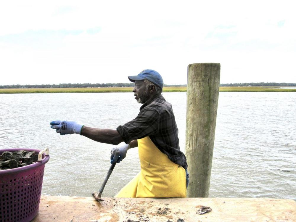
      The areas designated as shellfish harvest area buffers in the current map on the GA DNR website (Ref 1) are greatly increased vs those previously defined.  

      · Is GA DNR CRD representing the green shaded areas as currently approved shellfish growing areas?

      Terms and Conditions preceding the map state (emphasis mine) “Anchorage restriction areas means those areas within the estuarine areas of this state in any location that lies within 300 feet of a marina, 150 feet from a marine structure other than a marina, or within 500 feet of approved commercial shellfish growing areas and designated public harvest areas as determined by the department.

      · As much of the expanded shellfish growing areas include federally defined navigable waterways below the low water mark, has the US Army Corps of Engineers approved the designation USACE Nationwide Permit 48 (Ref 2 and 3) ?

      · How much of the shellfish zones will be below the intertidal zone and be set aside for the mariculture technique utilizing cages suspended in the water column by floats?

      · HB501 specifies that subtidal harvest zone leases must first be evaluated for impact against other public uses.  (Ref 4).  Has this been completed?  If so, may we examine the evaluations?  If not, what opportunity for public comment will you make available?

      ” Prior to offering a subtidal water bottoms lease, the department shall consider compatibility with other public uses of the marine and estuarine resources in proximity of the lease area that include, but are not limited to, navigation, fishing, swimming, and other forms of recreation.”

      · GA DNR has adopted the federal framework of National Shellfish Sanitation Program (NSSP), requiring shellfish waters meet the NSSP requirements before being designated as approved.  Have these assessments been completed for all indicated areas? (Ref 5)

      The boating group members seek a balance of interest among public access, waterfront property owners, and a resurgent shellfish industry.  

      Your feedback to clarify the above points would be most appreciated. 

      Coalition is comprised of:

      America’s Great Loop Cruisers Association

      CruisersNet

      DeFever Cruisers Association

      Marine Trawler Owners Association

      National Marine Manufacturers Association

      Waterway Guide

      Save Georgia’s Anchorages


      Cc:      Walter Rabon, GA DNR Deputy Commissioner,

      Doug Haymans, GA DNR Director, Coastal Resources Division

      Reference:

      1- https://gcmp.maps.arcgis.com/apps/webappviewer/index.html?id=b5a616ad152a462bad0b73cdb5eeb107

      2 – USACE Nationwide Permit 48  Commercial Shellfish Aquaculture Activities (Sections 10 and 404)

      3 – Section 10 of the Rivers and Harbors Appropriation Act of 1899 https://www.epa.gov/cwa-404/section-10-rivers-and-harbors-appropriation-act-1899

      4 – HB 501 lines 341-346 http://www.legis.ga.gov/Legislation/20192020/185110.pdf

      5 – US Food and Drug Administration – National Shellfish Sanitation Program https://www.fda.gov/media/98328/download


      October 15 update:

      SGA (Save Georgia’s Anchorages) and Georgia resident James Newsome on behalf of our boaters’ coalition followed up on his letter to GA DNR Commissioner Williams with a call to Deputy Commissioner Rabon today.
      James reports “GA DNR has acknowledged receipt of the email from the boating coalition group and is working on a response. Deputy Commissioner Rabon also agreed to host a conference call to discuss.”


      2 Facebook Likes, 2 Facebook Reactions

      Comments from Cruisers (3)

      1. James H. Newsome -  October 12, 2020 - 7:20 am

        Thanks Larry and CN for joining our efforts to address this latest challenge to anchoring issues on the GA coast.

        Reply to James
      2. James H Newsome -  October 12, 2020 - 7:18 am

        Larry, Thanks much to CN for joining our effort to address this latest challenge to anchoring issues in GA. Your support is greatly appreciated.

        Reply to James
      3. Ted Arisaka -  October 12, 2020 - 6:57 am

        Thanks to Cruisers’Net for your support and helping to raise awareness of this issue to the marine community.

        Reply to Ted
    • James H Newsome Responds to GA DNR Inquiry re Anchor Restriction Limits

      James H Newsome was one of the authors of the original protests over Georgia’s ultra restrictive HB 201, see Coalition Comments on Georgia’s HB 201, which resulted in the less restrictive HB 833. This issue now is not with the HB 833 legislation, but with the GA DNR’s implementation of those regulations. If you boat and anchor in Georgia, we invite your comments, so please let us hear from you.
       
      Once again, GA DNR rulemaking pertaining to navigation in the state’s coastal waters is causing confusion and frustration with recreational boaters and cruisers. The green colored “buffer regions around shellfish harvest and growing areas” which was recently announced on DNR’s web site appears to indicate that these entire areas are off limits to anchoring.
       
      A coalition of boating groups and cruising publications has reached out to DNR for additional information and clarification of the maps, but we have not received a reply at this time. However, information forwarded to me from an unnamed DNR representative stated that shellfish cages will not be placed within 150’ of any Federally maintain channel, and that the Army Corp of Engineers may apply more restrictive criteria when shell fishermen apply for permits at the federal level.
       
      How are boaters to interpret this information? Does this mean there are holes in DNR’s green colored areas that conflict with federal navigation law and are therefore not included in the restricted areas? 150’ from a Federally maintained channel essentially eliminates much of the ICW from inclusion in oyster bed designated areas, but 150’ from what part of the channel, the middle, the edge?
       
      At a minimum we are looking at 300’ from the center of the channel or essentially the length of a football field. With the elimination of the Magenta Line where is the center of the channel? Aids to Navigation (ATON) certainly cannot be used as indicators of the center channel. 
       
      A buffer for navigable channels, or exclusion from shellfish growing and harvesting areas, will exclude most of the marked channel in GA or at least a large part of it. So why has DNR colored these areas green when their own rule clearly excludes them for incorporation into shellfish beds? Would it not have been better to post accurate information for boaters to reference rather than confuse everyone again?
       

      Also, define “(ii)” below. Bottom leases may be granted in areas with minimum width of 200.’ Does this mean that eligible areas must be at least 200’ wide, or does it mean that areas under 200’ cannot be leased?

       “(6) Leasing of State-Owned Water Bottoms Terms, Siting, other Considerations.
      (a) The term of a state-owned water bottoms lease shall not exceed ten years and is subject to such provisions, requirements and conditions as determined by the Department. Leases may be renewed for additional terms if the lessee is in compliance with the terms of the current lease.
      (b) Subtidal water bottoms leases shall be sited in accordance with the following criteria: (i) In Approved Shellfish Growing areas as determined by the department;
      (ii) In areas with a minimum width of 200 feet at mean low water;
      (iii) In areas with a minimum depth of not less than 6 feet at mean low water; and….“
       
      Boaters in coastal waters depend on ATON and charts as roadmaps for navigating an already confusing waterway. We should not be required to reference inaccurate and non-conclusive maps on a difficult to find web site link to legally comply with GA law and rulemaking. This is a confusing and overbearing burden on boaters.
       
      Once again, it appears DNR has used the green brush rather liberally, and green does not mean “go,” it means “stop” don’t anchor. But where?
       
      Thanks,
       
      James H Newsome
      s/v CaiLeigh Anna – Coastal Cruising With Hugh & Suze 

      ICW Free Docks 

      Contributing Writer – Southwinds Magazine

      Be the first to comment!

    • GA DNR Responds to Inquiry re Oyster Cages Placement

      Ted Arisaka and Brad Pickle of Atlantic Intracoastal Waterway Association have been seeking clarification on the anchoring restrictions implied in Liveaboard Anchoring Illustrative Map. See New Georgia Shellfish Harvest Area Permit Status Inquiry and Georgia HB 833 and Expanded Shellfish Areas.

      Response from GA DNR to Brad.  The answer he received does not correlate with what is shown on the DNR website maps.

      Ted
       

      Good morning.  I heard back from my contacts at GA DNR regarding placement of oyster cages within the AIWW and here is their response-

      “Oyster cages will not be placed within 150ft of any federally-maintained channel.  The ACOE may apply more strict criteria as shellfishermen go through their process, also.”

      They also sent me the Shellfish Rule which is attached. 

      Brad


      The pertinent lines from the rules (Shellfish Rule 391-2-4-.19) are: 

      (c) Any boundary of a subtidal water bottom lease shall not be within the following:
      (i) 150 feet of a federal project, such as a federally maintained channel;

      As Ted stated, this GA DNR rule does not correlate with what is shown on the DNR website maps.

      Larry

      Be the first to comment!

    • New Georgia Shellfish Harvest Area Permit Status Inquiry

      Efforts on behalf of boaters regarding Georgia’s anchoring restrictions continue with this letter by Ted Arisaka to the USACE. See Georgia HB 833 and Expanded Shellfish Areas.

      US Army Corps of Engineers

      Savannah District
      Regulatory Division
      .

      Dear Sirs:
       
      I am a recreational boater who enjoys the coastal waters of our East Coast and in particular, the coastal waters of Georgia.  I have followed with interest, the evolution of Georgia’s regulations around navigation / anchoring in their estuarine waters, starting with House Bill 201 in 2019 and replacement House Bill 833 in 2020.
       
      As a result of HB833, GA DNR has updated their definitions of no-anchoring zones as published on their website:  
       
       
      Among the various zones, one in particular, “shellfish harvest” areas (shaded in green) have expanded dramatically between 2019 and 2020.  These shellfish harvest areas are portrayed as “approved” on the GA DNR website and among the multiple requirements for approval is to receive a permit from US ACE for those areas in navigable waters.  If one examines the published maps, there are many areas in navigable waters as well as established channels demarcated by Aids To Navigation by USCG and charted by NOAA.  This also includes portions of the Atlantic Intracoastal Waterway, which as you know is important not just for recreational boaters but also for commercial navigation.
       
      The reason for my email is to inquire as to the status of USACE approval of these shellfish harvest zones.  
       
      Thank you,
       
      Ted Arisaka

      1 Facebook Likes, 1 Facebook Reactions

      Be the first to comment!

    • Join us for Virtual CoastFest 2020! 9/30-10/2, Georgia DNR

      The Coastal Resources Division of the Georgia Department of Natural Resources invites students, teachers and the public to Virtual CoastFest 2020, being held Wednesday, Sept. 30, through Friday, Oct. 2, at www.CoastalGaDNR.org/CoastFest.


      CRD Header May 2019 -2
      CRD Latest News
      Virtual CoastFest

      Join us for Virtual CoastFest Sept 30 – Oct. 2!

      The Coastal Resources Division of the Georgia Department of Natural Resources invites students, teachers and the public to Virtual CoastFest 2020, being held Wednesday, Sept. 30, through Friday, Oct. 2, at www.CoastalGaDNR.org/CoastFest.

      While in-person CoastFest will not be held due to COVID-19, the Division will offer a series of live-streamed events highlighting its programs all three days at 9:30 a.m., 11 a.m. and 2 p.m each day. Virtual attendees will have the opportunity to interact with Division staff and ask questions about how they conserve Georgia’s coastal resources for present and future generations.

      “For 26 years, we’ve looked forward to meeting our friends and neighbors from across the region at CoastFest,” said Tyler Jones, the Division’s CoastFest coordinator. “We’ve had to get creative to work around COVID-19 this year, and we’re excited to offer a virtual way to continue that tradition and provide an opportunity to peel back the curtain and show everyone what we do at Coastal Resources Division.”

      Live-stream topics on Wednesday, Sept. 30:

      • 9:30 a.m.: “All Aboard the R/V Anna: A look at the Division’s 60-foot shrimping vessel and the fisheries management work conducted aboard.”
      • 11 a.m.: “One Fish, Two Fish, Old Fish, New Fish: Discover how biologists and citizen scientists team up to better understand coastal fish populations.”
      • 2 p.m.: “The Shoreline Comes Alive: Learn what local communities and individuals are doing to protect property and restore wetland ecosystems.”

      Thursday, Oct. 1:

      • 9:30 a.m. “Our Changing Beaches: Beaches are constantly shifting, impacted by both gentle and tumultuous processes. Find out how the processes work and how people can adapt.”
      • 11 a.m. “Safe to Swim: Educate yourself on beach water quality, and how the Division partners with other agencies to keep the public safe.”
      • 2 p.m.: “Building Homes for Fish: Dive deep with our marine biologists to learn how the Division is building artificial reefs to create essential fish habitat.”

      Friday, Oct. 2:

      • 9:30 a.m.: “Going Green for Our Future: Learn how you can capture rainwater and prevent pollution runoff in your backyard and community.”
      • 11 a.m.: “Fishing Basics 101: Grab your fishing pole and join our marine biologists as they show you how to fish along the Georgia coast, including knot tying, types of bait and techniques.”
      • 2 p.m.: “Touch Tanks Live: Tune in live as we show off some of the coolest creatures that swim in our estuarine environment, and ask our biologists questions.”

      The CoastFest Art Contest, featuring art from students across the region, will still be held as usual, and the artwork will be on display at the Marshes of Glynn Library on Gloucester Street in Brunswick from Tuesday, Oct. 6, though Tuesday, Oct. 13. Prizes and ribbons will be awarded as in the past. This year’s art contest theme is “Our Marvelous Marshes,” and students are encouraged to submit art that highlights the estuarine ecosystem that makes the Georgia coast so unique. The winner of the 2020 CoastFest Art Contest will have his or her art featured on the 2021 CoastFest T-Shirt.

      New this year, the Division is holding an essay writing contest. Students from elementary, middle and high school are encouraged to write a 400-500 word short essay from the prompt: “What makes the Georgia Coast unique and what did I learn about it at Virtual CoastFest 2020?” First, second and third place awards will be given to Georgia students in elementary, middle and high school. Schools may submit their top five essays for judging by the Division’s staff and its partners in conservation. Teacher, homeschooling parents and students can find more information, including submission guidelines and deadlines, at www.CoastalGaDNR.org/CoastFestEssay.

      Winners of both the art and essay contests will be announced Oct. 16 by press release and notification to the schools.

      CoastFest 2020 T-shirts, featuring art by Maleah Lavarias of Needwood Elementary School will be sold online. Sales will be available from a link at www.CoastalGaDNR.org/CoastFest between Monday, Sept. 21, and Friday, Oct. 9. The cost is $10 plus shipping and handling. Please allow four to six weeks for delivery. The shirt is kelly green and features a mosaic sea turtle on the back with Virtual CoastFest 2020 logo on the front breast.

      The CoastFest website will also feature short videos from previous exhibitors, allowing them to highlight their programs and missions.

      Anyone with questions about Virtual CoastFest 2020 may contact Tyler Jones at 912-262-3140 or tyler.jones@dnr.ga.gov.

      # # #


      Learn more about CRD on our YouTube Channel

      YouTube

      Support marine habitats by upgrading your license plate!

      tag


      Be the first to comment!

    • USCG Photo Report, Vessel Removed from St Marys Inlet, near GA/FL AICW Statute Mile 712


      St Marys Inlet is the US military’s channel into Kings Bay Atomic Sub Station and is extremely well maintained.

      united states coast guard

      Coast Guard removes fishing vessel from St. Mary’s inlet, GA


      JACKSONVILLE-Fla.— The Coast Guard completed pollution mitigation and removal efforts for the fishing vessel Phuong Mai in St. Mary’s Inlet Georgia, Friday.

      The vessel posed a hazard to the marine environment and was an imminent threat to obstruct passage of the navigation channel. As the Federal On-Scene Coordinator, Coast Guard Sector Jacksonville federalized the response using the Oil Spill Liability Trust Fund. Over 500 gallons of oily water was pumped from the vessel, and contractors successfully removed the vessel and debris from the water.

      The Coast Guard rescued two adults after their fishing vessel ran aground on Thursday, August  20th on the north jetty in St Mary’s Inlet, Georgia.

      Coast Guard Air Station Savannah MH-65 Dolphin helicopter crew arrived on scene and hoisted the two adults to safety with no reported injuries. The 40-foot fishing vessel encountered damage to their fiberglass hull and sank in approximately 20-feet of water.

      “The Coast Guard is responsible for safeguarding the American people, ensuring security in a complex maritime environment, and ensuring the economic prosperity of the region,” said Petty Officer First Class Justin Chartier, the Federal On-Scene Coordinator representative on the response “This was a unique response that included 6 out of 11 Coast Guard missions: Ports, Waterways, & Coastal Security, Search & Rescue, Living Marine Resources, Marine Safety, Defense Readiness, and Marine Environmental Protection. We are thankful to the multiple federal and state agencies that assisted on the response. With their help, we were able to quickly remove the vessel from the water, prevent the threat of pollution to the local area and eliminate a hazard to navigation in a port of national significance.”

      For more breaking news follow us on Twitter and Facebook.

      -USCG-


      AREA SPONSORING MARINA

      Click Here To View the Eastern Florida Cruisers Net Marina Directory Listing For Fernandina Harbor Marina  

      Click Here To Open A Chart View Window, Zoomed To the Location of Fernandina Harbor Marina

      Be the first to comment!

    • Another Update: Capsized Golden Ray, St. Simons Sound, GA, near AICW Statute Mile 677


      Royal Marsh Harbour Yacht Club

      The wreck of the capsized PCTC Golden Ray may take more than a year to remove from St. Simons Sound, Georgia, the U.S. Coast Guard told local leaders recently.
      Maritime Executive

      7/27/20 Golden Ray Salvage Delayed Due to COVID-19 Outbreak, Weather Risk
      Maritime Executive

      7/9/20 Barge Crew at Golden Ray Site Tests Positive for COVID-19
      Maritime Executive

      3/4/20 Contractors Install Protective Barrier for Golden Ray Salvage
      Maritime Executive

      2/28/20 Overturned Cargo Ship Soon To Be Sliced Up And Removed From Georgia Sound
      KPBS

      2/27/20 Competing Golden Ray Salvors Face Court
      Maritime Executive

      2/3/20 Environmental Protection Barrier to be Built Around Golden Ray
      Maritime Executive

      12/13 Lightering of Fuel from Golden Ray Complete

      11/23 Removal of Grounded PCTC Golden Ray Could Take One Year
      Maritime Executive

      Be the first to comment!

    • Georgia’s Sublime Ocean Sanctuary

      Gray’s Reef National Marine Sanctuary protects Georgia’s special live-bottom wildlife habitat in the Atlantic Ocean and along the southeastern U.S. coast, an area teeming with diversity and an abundance of marine life.


      GRAY’S REEF FOUNDATION


      The Sublime Sanctuary of the Sea

      Gray’s Reef National Marine Sanctuary near Savannah, Georgia, is indeed a “shining example of oceanic conservation and a vital research hub for marine science”, but did you know that you can explore it for yourself? Grab a copy of the July edition of Savannah Magazine to see why this southern sanctuary is also a national ocean treasure.

      (Photo credit: P. Whitfield/NOAA -scalloped hammerhead)


      Open Season in South Atlantic Waters

      Did you go fishing during the recent South Atlantic Red Snapper open season? Share your catch photos and stay current with state and federal fishing regulations on the FishRulesApp. Best practices for fishery conservation and tips for safe handling of marine species are included. Know before you go, and fish on!


      Director’s Note:
      Thank you to our friends at OCEANA for organizing #protectourcoast advocacy day with GA Congressional Representatives, and to Congressman Buddy Carter for taking time to speak with us.Gray’s Reef Foundation Director Jody Patterson, Board Chair Cathy Sakas, and Board Trustee Lane Johnson joined retired military officers and environmental advocates in requesting a reenactment of the moratorium on new oil and gas leases along the Outer Continental Shelf.The House Appropriations committee released their FY21 Interior funding bill, and it included provisions to reenact this moratorium. If it passes the House floor then it’s off to the Senate. Stay tuned and we’ll stay engaged!

      Follow us on social media
      Facebook
      Website
      Email
      Instagram
      Copyright © *|2020|* *|Gray’s Reef National Marine Sanctuary Foundation|*, All rights reserved.


      Be the first to comment!

    • LNM: Artificial Reef Deployment, St. Simons Sound, GA AICW Statute Mile 680


      This artificial reef is on the northwest shore of Jekyll Island, just east of the Waterway and north of the Waterway’s turn into Jekyll Creek. Advise staying well west of ICW lighted buoys 21 and 1.

      GEORGIA – ST. SIMONS SOUND: Inshore Artificial Reef deployment
      Georgia Department of Natural Resources (GADNR) intends to deploy 120 concrete oyster balls and 10 fish aggregating devices (FADs) at Henry Vassa Cate Reef. Oyster balls are prefabricated concrete structures that weigh 50 lbs each and FADs consist of a concrete base and PVC tines.The Henry Vassa Cate Inshore Artificial Reef site footprint (3.67 acres) is located along the northwest area of Jekyll Island, St. Simons Sound, Glynn County in the vicinity of 31-06-13.680N/81-25-30.660W (31°6.2280N / 081°25.5110W, 31.103800 / -81.425183) . Deployment dates are weather dependent and subject to change, but is anticipated to
      occur between July 9 -16, 2020. (0°16.0000N / 2020°0.0000W, 0.266667 / -2020.000000) For further information, contact GADNR Habitat Unit, Cameron Brinton at (912) 280-6926 or cameron.brinton@dnr.ga.gov. Chart 11506 LNM 27/20

      1 Facebook Likes, 1 Facebook Reactions

      Be the first to comment!

    • GADNR Anchorage Administrative Order Rescinded

      The passage of HB833 makes the GADNR Commissioner’s Anchorage Administration Order unnecessary and the Order has been rescinded effective July 1. More thanks to Save Georgia’s Anchorages.


      The Commissioner has rescinded his AO from December.


      2 Facebook Likes, 3 Facebook Reactions

      Be the first to comment!

    • GA HB833 is Signed by the Governor

      This more than year long legislative battle for boaters’ rights, see Georgia Anchoring Legislation, could not not have been won without the dedicated and persistent efforts of the members of Save Georgia’s Anchorages, like James Newsome, Wally Moran and Ted Arisaka.

      The new anchoring bill HB833 was signed by the governor on June 29 and is now law, effectively ending the draconian results of HB201. Thanks much to Cruisers Net for providing much needed support and publicity throughout the past 13 months.
      James H Newsome
      s/v CaiLeigh Anna – Coastal Cruising With Hugh & Suze
      ICW Free Docks
      Contributing Writer – Southwinds Magazine


      The anchoring nightmare is over! HB833, written to replace the draconian HB201, was overwhelmingly passed by both chambers of the GA General Assembly and signed into law by Governor Kemp. It is now law!

      http://www.legis.ga.gov/Legislation/en-US/display/20192020/HB/833

      Ted Arisaka

      9 Facebook Likes, 9 Facebook Reactions

      Comments from Cruisers (1)

      1. James H. Newsome -  July 1, 2020 - 3:43 pm

        Thanks much Cruisers Net and readers who took the time to contact GA officials. Your voices were heard and today we celebrate the signing of HB833 by the Governor. Thanks Rep Ron Stephens for championing this cause in the House of Representatives.

        Reply to James
    • Georgia Beach Week 2020 Cancelled

      Due to the importance of public safety, the annual BeachWeek events, typically scheduled for the week leading up to Independence Day, has been canceled. 


      GA Coastal 1200 header
      Latest News

      Brunswick, Ga.

      The Department of Natural Resources Coastal Resources Division (CRD) is taking precautions to keep the public safe and prevent the spread of Covid-19.  Due to the importance of public safety, the annual BeachWeek events, typically scheduled for the week leading up to Independence Day, has been canceled

      With summer in full swing, Georgia beaches throughout the coast continue to be popular destinations for visitors and residents. Therefore, CRD encourages the public to visit our website at https://coastalgadnr.org/BeachWeek2020 to learn more about the sights and sounds on Georgia’s coast.  You will also find links to our partners sites to allow you to dive a little deeper.

      Did you know that Georgia is home to 100 miles of shoreline, 380,000 acres of saltmarsh, and 14 barrier islands which buffer the mainland from the Atlantic Ocean? Five major freshwater rivers feed the Georgia coast, forming an extensive estuarine ecosystem. This network delivers vast amounts of freshwater to the coast and creates a range of habitats that support diverse wildlife. Although relatively undeveloped, the coastal Georgia landscape is changing nonetheless. New residents are drawn by the region’s natural beauty and abundance of recreational opportunities. Through a combination of wise management, stewardship, and collaboration, everything we love about coastal Georgia can be conserved for generations to come.

      For more information about Beach Week 2020 activities contact Jennifer Kline, Beach Week Coordinator at (912) 264-7218.


      20 years of Sustaining, Protecting,Enhancing, and Conserving

      video

      Support Habitat Conservation with your License Plate

      tag


      Be the first to comment!


    Social Media Auto Publish Powered By : XYZScripts.com