Visit Logged
  • Select Region
    • All Regions
    • VA to NC Line
    • North Carolina
    • South Carolina
    • Georgia
    • Eastern Florida
    • Western Florida
    • Florida Keys
    • Okeechobee Waterway
    • Northern Gulf
    • Bahamas
    • New York
    • Ohio
    • Pennsylvania
    • Washington
    • Puerto Rico
    • Minnesota
    • Maryland
    Order by:
    • A special time to remember the 1896 E.S. Newman rescue

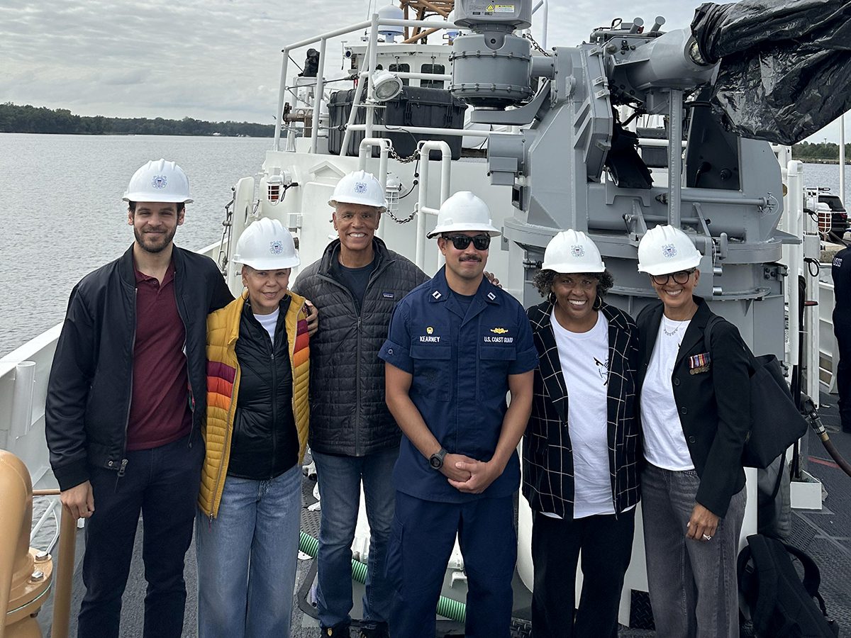
      Joan Collins, second from right, and members of her family, from left, Patrick Jefferson, Deborah Jefferson, Marshall Collins, and far right, Sharon Warner, are shown onboard the deck of the U.S. Coast Guard Cutter Richard Etheridge at the Baltimore Shipyard with Lt. Zackary Kearney, the vessel’s commander. Photo: Sharon Warner

      Click here   A special time to remember the 1896 E.S. Newman rescue by Joan Collins
      CoastalReview.org

      Be the first to comment!

    • Partial ICW Shut-Down for Savannah Bridge Demolition Could Have Been Much Worse


      See:  NAV ALERT: UPDATE: AICW MM 579.9 Closures Announced, Causton Bluff Bridge, Wilmington River, GA

      Click here for  Partial ICW Shut-Down for Savannah Bridge Demolition Could Have Been Much Worse
      Peter Swanson

      Cruisers Net publishes Loose Cannon articles with Captain Swanson’s permission in hopes mariners with salt water in their veins will subscribe.. $7 a month or $56 for the year and you may cancel at anytime.

      Click Here To View the VA to NC Cruisers Net Marina Directory Listing For Causton Bluff Bridge

      Click Here To Open A Chart View Window Zoomed To the Location of Causton Bluff Bridge


      Be the first to comment!

    • Causton Bluff Bridge – A Perspective by James Newsome


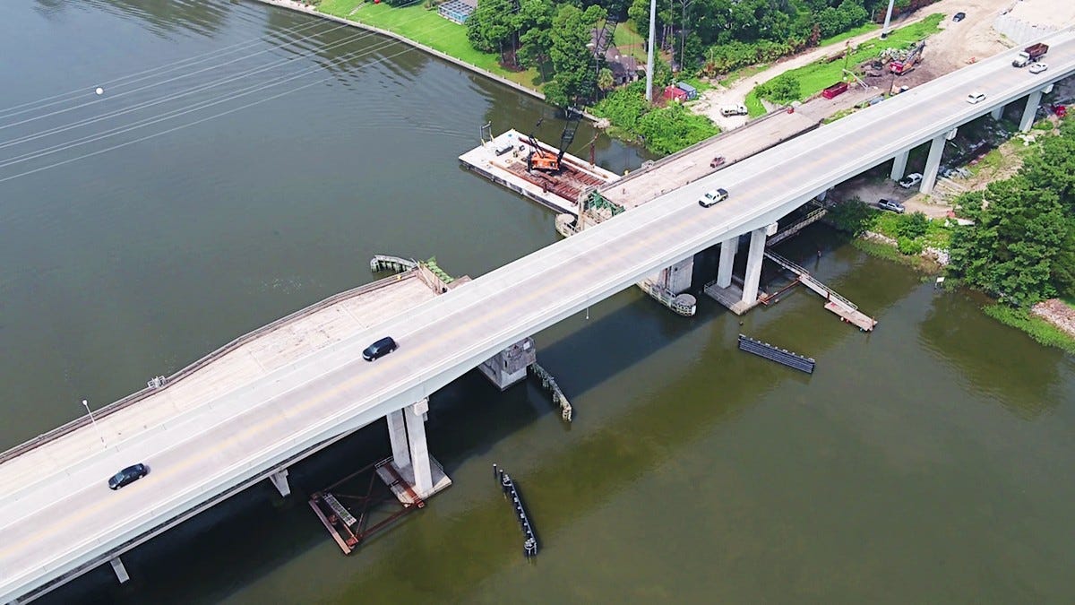
      The old Causton Bluff bascule bridge has had numerous breakdowns in the past, so its removal has been welcomed by ICW travelers. As you can see from James’ photos, the demolition work is in a very narrow space, requiring intermittent closures of the Waterway. Our thanks to James Newsome for this article reposted from Facebook See  NAV ALERT: AICW MM 579.9, Closures Postponed
       
       
      These pictures offer a bird’s eye view of the challenge facing GA DOT and their contractor. The old roadway, bridges, and foundation of Causton Bluff Draw Bridge must be removed before the 2nd high span bridge can be completed. 
       
      The contractor needs to close the ICW to stage a barge to collect debris from the demolition work, so the ICW will have to be closed. The questions are how many times a day and for how long will the waterway be opened for boat traffic to transit the area.
      James Newsome
       

      Be the first to comment!

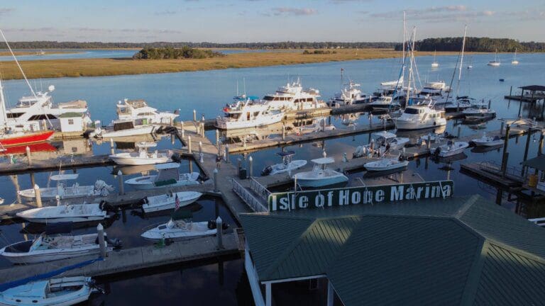
    • TPG Isle Of Hope Marina Named “2022 Best of Savannah” AICW MM 590


      Located directly on the Intracoastal Waterway, Skidaway River at Mile 590, Marker 46-A, Latitude: N 31o 58.78' , Longitude: W 081o 03.35' 2-354-8187

      CONGRATULATIONS! to Isle of Hope Marina, A CRUISERS NET SPONSOR, for being named 2022 Best Marina in Savannah by Savannah Magazine.

      2022 Best Marina in Savannah‼️
      From 1935 to 2022, we’ve always been glad to be here on Bluff Dr.
      Thank you to our customers, neighborhood, and city for voting us Best Marina in Savannah for the 3rd year in a row.


      Be the first to comment!

    • The Isle of Hope Marina Announces Sale to TPG Marinas, AICW MM 590


      SAVANNAH, Ga) After 25 years of continuous ownership, the Isle of Hope Marina has been sold to TPG Marinas, the full-service marina management affiliate of Rhode Island-based Procaccianti Companies


      Click here for  The Isle of Hope Marina Announces Sale to TPG Marinas


      Click Here To View the Cruisers Net Georgia Marina Directory Listing For Isle of Hope Marina

      Click Here To Open A Chart View Window, Zoomed To the Location of Isle of Hope Marina


      Be the first to comment!

    • Isle of Hope Marina under New Ownership, AICW MM 590


      Located directly on the Intracoastal Waterway, Skidaway River at Mile 590, Marker 46-A, Latitude: N 31o 58.78' , Longitude: W 081o 03.35' 2-354-8187

      Isle of Hope Marina, A CRUISERS NET SPONSOR, is pleased to announce their new ownership, TGI Marinas.

      Click here for more information: The Isle of Hope Marina Announces Sale to TPG Marinas

      Click Here To View the Cruisers Net Georgia Marina Directory Listing For Isle of Hope Marina

      Click Here To Open A Chart View Window, Zoomed To the Location of Isle of Hope Marina


      Comments from Cruisers (2)

      1. Paxton Watkins -  July 22, 2022 - 12:12 pm

        I agree. Chris and his staff are among the very best. Professional and very pleasant.

        Reply to Paxton
      2. Ed Grygent -  July 9, 2022 - 11:14 am

        We hope the dock and office personnel remain unchanged. They are among the best on the waterway.

        Reply to Ed
    • LNM: Tybee Island Entrance Buoy V-AIS T Replaces Lighted Buoy T, Tybee Island, GA


      Until NOAA corrects its chart issues, I cannot give you the distance offshore of this entrance buoy.

      GEORGIA – ATLANTIC OCEAN – TYBEE ISLAND TO DOBOY SOUND: Changes to Aids to Navigation

      Tybee Lighted Buoy T (LLNR 350 [31°57.8677N / 080°43.1591W, 31.964461 / -80.719318]/4530) has been discontinued and the buoy removed from the location. Tybee V-AIS T has been established as an AIS Virtual Aid with MMSI # 993672996 at assigned position 31-56-09.548N/ 080-35-03.436W (31°56.1592N / 080°35.0573W, 31.935986 / -80.584288) . Mariners are advised to exercise caution while transiting the area.

      Be the first to comment!

    • LNM: AICW MM 576 Dredging, Savannah River/AICW Intersection

      Elba Island Cut is a maintained channel on the Georgia side of Savannah River across from Fields Cut in South Carolina.


      GEORGIA – SAVANNAH RIVER AND WASSAW SOUND – SAVANNAH RIVER/AICW: Dredging operations.

      On or about October 5, 2021 Goodloe Marine will begin dredging operations in the Atlantic Intracoastal Waterway (AICW) at Elba Island Cut just south of the intersection of the AICW and the Savannah River in Georgia. The cutter dredge EXEL will be removing shoal material from the AICW and pumping the material thru a 20” submerged pipeline across the Savannah River to an upland spoil area on the north side of the Savannah River. Mariners are cautioned to pass dredge at an idle speed and be mindful of numerous buoys and floating pipelines in and near the navigation channel. The dredge can be contacted on channel 16 and 68 for passing instructions. Additional information can be obtained by contacting Ben Goodloe 813-355-7494. Dredging operations are expected to be complete by Nov 15, 2021. For further information, please contact the United States Coast Guard at (912) 247-0073. Chart 11512  LNM 39/21

      Be the first to comment!

    • Georgia’s New Anchoring Regulations Claim a Victim in Turner Creek, GA AICW Statute Mile 585.5


      Our thanks to Ted Arisaka of Save Georgia’s Anchorages for passing along this Facebook 5/28 post from Jayne Salvo Gorham. Turner Creek which intersects the Waterway south of Thunderbolt is a small low-traffic area with two small marinas allowing access to Wilmington Island and Savannah.

      Well, today we ran afoul of Georgia’s new anchoring law. We went to anchor in Turner Creek near Thunderbolt and anchored in one of the spots recommended in the cruising guides near the town and marinas. We anchored well clear of any of the marinas but apparently one of the marina operators immediately made a call to the Georgia DNR to complain and an officer came out in her car and raised us on her bull horn. We talked to her on the telephone and she told us we were definitely not allowed to Anchor within 1000 feet of any dock of any kind which pretty much eliminates all of the creek. There was one spot way up the creek under the bridge where we could be a thousand feet away from anything and it turns out it was a relatively nice place after all.

      Although the officer was very professional and polite, it is quite clear that Georgia is very hostile towards Cruisers who dare to Anchor in sight of their dock

      We were planning to go ashore and spend some money in the town, but not anymore.
      Jayne Salvo Gorham

      2 Facebook Likes, 2 Facebook Reactions

      Comments from Cruisers (6)

      1. R. Holiman -  June 4, 2020 - 10:59 am

        One idea, would be to establish anchoring reciprocity agreements from state to state, like with so many other things. That way, if you lived in a state that prohibited anchoring, you could expect the same treatment, when you went somewhere else. Because, you know a lot of the people in Georgia who support these anchoring regulations, probably like anchoring in other states. They just don't want you to do it in their state.

        Reply to R.
      2. Kent W Hassell -  May 29, 2020 - 4:20 pm

        If the poster's push pin locator is correctly placed, she was indeed in violation of the regulations. We just had our boat hauled at that marina / yard…Sail Harbor…with excellent results I might add…and her locator pin is right off the end of the Sail Harbor's docks. And the Creek is very narrow. The Aqua Map icon should be removed from that location. There is another anchoring icon a bit further up the creek toward the bridge where there is bigger water. Sorry she got flagged, but she should have been more courteous to Sail Harbor's facilities.

        Reply to Kent
        • Ted Arisaka -  June 15, 2020 - 2:00 pm

          Hi Kent:
          The marker shown on this cruisersnet post is not where they were anchored. I contacted the OP and she messaged me her GPS coordinates both before and after she was asked to move by the GA DNR. It appears they were in compliance with the 300ft setback required in "Marina Zones". My colleague, James Newsome, in our grassroots group "Save Georgia's Anchorages" contacted GA DNR and posted this positive outcome over on our facebook page.

          [James H. Newsome] "As a follow up on this incident, I forwarded 2 charts to DNR along with a brief summary opinion of why we thought the DNR officer and marina owner were wrong.
          "Assuming the boater's accounting of the incident is correct, and it certainly appears credible, we believe she was inaccurately advised by the DNR officer to abandon her anchored position. Additionally, the officer stated that the boater could not anchor within 1000' of any dock. This is not correct. The marina zone allows boaters to dock closer than 1000' but not within 300' of a marina."
          Pictures of the chart by Ted Arisaka will be included in replies to this comment.
          I discussed this situation with the Deputy Commissioner for GA DNR yesterday and he agrees with our assessment of the incident. He also commented that the officer has been contacted and the Commissoiner's AO, which established the setbacks, has been reviewed with her in an effort to prevent a future occurrence. He also said that the marina owner was contacted and informed that the boater was legally anchored and should not have been made to move.
          Deputy Commission Rabon and I agreed that while a mistake was made it was encouraging that all parties involved were cordial and acted in a responsible manner. I acknowledged that our boating organizations are working to educate cruisers and advise them of the current situation with the anchoring laws in GA.
          As a further update, we are hopeful that GA's HB833, legislation to replace HB201, will pass the Senate in the final phase of the General Assembly which will reconvene mid-June. DNR and our coalition of boating groups strongly support this legislation."

          Reply to Ted
      3. Jim Shipp -  May 29, 2020 - 4:01 pm

        AICW Statute Mile 858.5 is not in Georgia:

        Georgia’s New Anchoring Regulations Claim a Victim in Turner Creek, GA AICW Statute Mile 858.5

        Editor: Jim is correct, it should read 585.5. My bad!

        Reply to Jim
      4. Richard Gano -  May 29, 2020 - 2:39 pm

        We took the opportunity in April 2020 to just skip the entire state of GA when coming south by going outside to Jacksonville from the last passable inlet in SC.

        Reply to Richard
      5. Ted Arisaka -  May 29, 2020 - 10:32 am

        What is unfortunate is that the DNR Officer apparently only cited the 1000ft setback from structures requirement and seemingly not aware of the 300ft-1000ft "marina zones" that allow anchoring and take precedence. Our group Save Georgia's Anchorages intends to provide some feedback to the DNR on this matter. Thanks Cruisers'Net for broadcasting this story.

        Reply to Ted
    • Good News Report from Hell Gate, GA AICW Problem Stretch Statute Mile 602


      Our thanks to Bill King for confirming the success of last year’s dredging of this Problem Stretch, which, for the time being at least, seems not such a Problem Stretch.

      BTW…on the north-bound transit, came through Hell Gate (GA) last week at dead low tide. I know it was dredged but I did not expect to see 9’-plus all the way through following the USACE survey route.
      Bill King
      Stuart, Florida

      Click Here To View the Cruisers’ Net’s AICW Problem Stretches Listing For Hell Gate

      Click Here To Open A Chart View Window, Zoomed To This AICW Problem Stretch

      Comments from Cruisers (1)

      1. Nelms F Graham -  January 10, 2021 - 6:05 am

        Went thru the Gate on 1/9/21 at low tide. Lowest observed depth was 7.6 ft.

        Reply to Nelms
    • Registration Open for Atlantic Intracoastal Waterway Annual Meeting, Nov 21-22, Savannah, GA


      Registration is now open for the Atlantic Intracoastal Waterway Association’s (AIWA) 20th Anniversary Annual Meeting in Savannah, Georgia. For more detail , see Registration.

      Click here for Registration Open for the Atlantic Intracoastal Waterway Association’s Annual Meeting
      International Dredging Review

      Be the first to comment!

    • Healy Report: Walburg Creek to Cumberland Island, AICW Statute Miles 623 to 711


      Experienced cruisers, Jim and Peg Healy, continue to generously share their observations and advice as they make their way south for the winter. Thank you Jim and Peg! For timely remarks on Cumberland Island Anchorage, see Anchoring off Cumberland Island.

      On Tuesday, 0/20/2018, Sanctuary and crew transited from Walburg Creek anchorage to an anchorage on the Cumberland River, south of St. Andrews Sound, off the ICW at Cumberland Island. Observations follow:

      We arrived at the Little Mud River at 11h00. The tide station at Wolf Island was reporting 5.1’+ rising. North to south:

      R184 12.9′
      13.4′ low water between markers
      G184/R188 19.6′
      10.2′ low water between markers
      G189 20.7′
      R190 15.1′
      11.0′ low water between markers
      R192 13.9′
      11.0′ low water between markers
      G195 11.8′
      10.9′ low water between markers
      R194 11.1′
      G195 12.2′

      The control depth was (10.2 – 5.1) = 5.1 and MLLW. Follow the visual center of the river on the straight section and SLIGHTLY favor the outside radius of the curves. We were too close to G195, but that wasn’t the low water anyway.

      In Altamaha Sound, you must clear R208 by at least 300′; stay to the far green side for the best water.

      In Altamaha Sound, clear G211 by 200′. There is a range there that will take you too close to G211, so do not follow the range; favor red for the best water.

      We arrived at Jekyll Creek and 17h08. The tide station at Jekyll Island Marina was showing 4.9’+ falling. North to south:

      G5/R6 11.5′
      G7/R8 22.4′
      R10 15.2′
      G11 12.5′
      9.9′ low water between markers
      G13 10.0′
      9.6′ low water between markers
      R16 9.7′
      G17 5.7′
      G19 8.6′
      6.1′ low water between markers
      R20 8.0′
      7.8′ low water between markers
      R20A 8.9′
      BRIDGE 10.2′

      We were at 1/2 tide for this transit. The control depth was in the vicinity of G17 (5.7 – 4.9) = 0.8′. Wow. Could we have been is a less than ideal place? Sure. But this creek is quite narrow, so it wouldn’t have made a lot of difference. There’s very skinny in that area.

      Jekyll Creek and Hell Gate are the two places we’ve seen so far that will require help from the tide for most boats to get through.
      Jim
      Peg and Jim Healy aboard Sanctuary, currently at Charlotte Harbor, Punta Gorda, FL
      Monk 36 Hull #132
      MMSI #367042570
      AGLCA #3767
      MTOA #3436

      Click Here To View the Georgia Cruisers’ Net Anchorage Directory Listing For the Dungeness Greyfield Channel Anchorage

      Click Here To Open A Chart View Window, Zoomed To the Location of the Dungeness Greyfield Channel Anchorage

      1 Facebook Likes, 1 Facebook Reactions

      Be the first to comment!

    • Healy Report: Port Royal, SC to Walburg Creek, GA, AICW Statute Miles 539 to 619N or 623.5S


      Walburg Creek shapes the east side of Walburg Island and the Waterway lies on the west side. Good depths and great beach combing. My young daughters always declared the beach spooky because of the skeletal trees and dense forest to the east! While the creek has both a northern and southern entrance from the AICW, we prefer the northern passage, though there is still an unmarked shoal northwest of Middle Ground in St. Catherine’s Sound which must be bypassed. Experienced cruisers, Jim and Peg Healy, continue to generously share their observations and advice as they make their way south for the winter. Thank you Jim and Peg!

      On Monday, 10/29/2018, Sanctuary and crew travelled from Port Royal, SC to Walburg Creek, GA. Following, some observations:

      We arrived at Ramshorn’s Cut at 10h15 with the tide station at Daufuskie Island (Daufuskie Landing) showing 5.8+ rising. We saw 11.0 ft, so (11.0 – 5.8) = 5.2′ at MLLW. The channel between G39 and R40 has narrowed further. We took the visual center.

      We arrived at the un-named connector between the New River and the Wright River at 10h38 with the tide station at Daufuskie Island (Hargray Pier) showing 6.2+ rising. We saw 12.2 ft, so (12.2 – 6.2) = 6.0′ at MLLW. Follow the visual center. Honor, but stay away from, the lateral markers on pilings.

      We arrive at Field’s Cut at 11h06 with the tide station at Field’s Cut showing 7.6+ rising. Southbound, take the visual center between G47 and R48, and line up on Field’s Cut. HONOR R48A, which appears off-station to the East. We saw 11.2 ft passing about 25 ft off R48A, so (11.2 – 7.6) = 3.6′ at MLLW. This was a surprise! We followed the visual center of Field’s Cut, favoring the outside radius of the turns. That 3.6′ area was the control depth of the cut. Cross-currents are significant at the Savannah River. Be alert for river traffic and cross currents.

      There was a large, working crane barge at the Causton Bluff bridge. It appears “they” are replacing that bridge with a high rise. Another surprise.

      We arrived at Hell Gate (MM600) at 14h18, with the Egg Islands Tide Station reporting +7.0 falling. Depths we saw:
      G87 13.5′
      G89 10.4′
      9.8 low water between markers
      R90 10.9
      G91 10.4

      So (9.8 – 7.0) = 2.8′ MLLW. Also note, as you enter this cut from the Vernon River, there is a STRONG cross current that will try to sweep you sideways. Boats will need some power and some aggressive steering to stay on the best route. We crabbed into the lee of the current at about a 20° angle. There is a prominent visual distraction just to the west of the marked channel. There is a piling left over from some previous danger mark standing prominently, while the red and green floaters that mark the channel are low to the water and hard to see. Do not confuse that piling as a valid channel marker. Follow and honor the cans and nuns in the water

      Net: the overall condition of the A-ICW continues to deteriorate. Most cruising boats will need some tide help to get through this section. Plan accordingly.

      Jim
      Peg and Jim Healy aboard Sanctuary, currently at Charlotte Harbor, Punta Gorda, FL
      Monk 36 Hull #132
      MMSI #367042570
      AGLCA #3767
      MTOA #3436

      Click Here To View the South Carolina Cruisers’ Net Marina Directory Listing For Port Royal Landing Marina

      Click Here To Open A Chart View Window, Zoomed To the Location of Port Royal Landing Marina

      Click Here To View the Georgia Anchorage Cruisers’ Net Anchorage Directory Listing For the Walburg Creek Anchorage

      Click Here To Open A Chart View Window, Zoomed To the Location of the Walburg Creek Anchorage

      Comments from Cruisers (1)

      1. Richard Ross -  November 9, 2018 - 7:24 pm

        Passed thru Fields Cut on Nov 9, 2018, and found a minimum of 8 feet MLW at north end of Fields Cut. But there are two possible "gotchas". R48A appears to be off station, but it is not. For best water pass half way between R48A and the eastern shore. Also, be aware that once you turn to enter Fields Cut, (if southbound) you will be subject to strong cross currents.

        Reply to Richard
    • Sherer Report: Hell Gate, Problem Stretch, AICW Statute Mile 602


      Our thanks to author/cruiser, Bob Sherer, for this report on the notorious Hell Gate Problem Stretch where the Waterway follows the narrow, man-made canal between the Vernon and Ogeechee Rivers. As posted on Bob423.

      Robert Sherer to ICW Cruising Guide by Bob423
      October 27 at 10:21 PM ·
      Hell Gate report (10/27/2018) There is no deep path. You need tide. Strong west wind lowered the water level some, perhaps 0.3 ft or more. The 3.5 ft MLW spot was very brief, just a flash on the depth sounder. The 4.2 to 5.6 MLW areas were persistent.

      Click Here To View the Cruisers’ Net’s AICW Problem Stretches Listing For Hell Gate

      Click Here To Open A Chart View Window, Zoomed To This AICW Problem Stretch

      1 Facebook Likes, 1 Facebook Reactions

      Be the first to comment!

    • Report from Hell Gate, Problem Stretch, AICW Statute Mile 602


      Our thanks to Lori Rackliffe for this report on the notorious Hell Gate Problem Stretch where the Waterway follows the narrow, man-made canal between the Vernon and Ogeechee Rivers. As posted on Bob423.

      Hell Gate- MM601. Georgia
      We transited at 9:30 Tuesday Oct 23,2018. With 6.7’ of tide assist. High at 7:43,8.2’ above datum.
      Using Navionics Sonar Chart we stayed centered, no hugging or favoring.
      The least depth recorded was 10.9’ just before G91. Directly off G91 we saw 12.6’. Off R90-13.2’
      Lori Rackliffe

      Click Here To Open A Chart View Window, Zoomed To This AICW Problem Stretch

      4 Facebook Likes, 4 Facebook Reactions

      Be the first to comment!

    • Healy Report: Hell Gate Problem Stretch, AICW Statute Mile 602


      The Waterway follows the narrow, man-made canal known as Hell Gate between the Vernon and Ogeechee Rivers. These waters have been an AICW Problem Stretch for years. See /165309 for a June ’17 report. Due to constantly shifting channel, Cruisers’ Net continues to recommend mid to high tide for this passage. Our thanks for this report from experienced cruiser, Jim Healy.

      Sanctuary and crew transited Hell Gate (A-ICW, Georgia, MM 600) 10/28/2017, southbound, at 11h00, +3.4 ft on the tide (Ayetides app, Egg Islands Station). Passing G”89″ at a distance of about 30 feet, we saw 5.5 feet of water.
      Passing R”90″ at a distance of about 15 feet, we saw about 5 feet of water. Not good. The control depth of Hell Gate at MLLW is 5.0 – 3.4 = 1.6 feet. We may have been slightly too close to R”90,” but in any case, no more than about 2 feet of water at low tide, less for celestial lows.

      Jim

      Peg and Jim Healy aboard Sanctuary, currently at Rock Creek, Pasadena, MD
      http://gilwellbear.wordpress.com
      Monk 36 Hull #132
      MMSI #367042570
      AGLCA #3767
      MTOA #3436

      Click Here To View the Cruisers’ Net’s “AICW Problem Stretches” Listing For Hell Gate

      Click Here To Open A Chart View Window, Zoomed To This AICW Problem Stretch

      Comments from Cruisers (1)

      1. Tom Hale -  October 29, 2017 - 10:26 am

        Hi Jim,
        Thank you for the update on Hell Gate. The shoaling at G89 has been the worst place on HellGate for at least the past 4 years.
        I learned the hard way to stay away from G9. I now have two waypoints which have given me better water.
        Southbound I stay more or less mid channel to a waypoint 31 51.721 N, and 081 05.008 W. This places you about 300 feet northwest of G 89 before I turn to the south. I then stay about 150 feet west of G 89 to 31 35.677 N and 081 05.017 W. These points are based on 7 tracks through here over the past 3 years. There is no doubt that this is very shallow, but it does pay to stay north of G89 before you turn, and then stay well west of it as you head down the southern section.
        Cheers,
        Tom
        Southport NC
        Southbound on the ICW

        Reply to Tom

    Social Media Auto Publish Powered By : XYZScripts.com