Causeway Cove Marina is east of the Indian River channel immediately south of the 65ft fixed bridge connecting Causeway Island with downtown Fort Pierce.
Explorer Chartbooks, A CRUISERS’ NET PARTNER, has long been the standard navigational supplement for enjoyable, informative, and safe cruising through the beautiful Bahamian waters and island visits. Bahamas Chatter: “Exhibit of Bahamian Art” plus 2 more Exhibit of Bahamian Art Posted: 19 Dec 2017 02:48 PM PST If you are in the Stuart, FL area from now until February 25, 2018, you won’t want to miss a fabulous exhibit of the work of several Bahamian artists. The exhibit is at the Elliott Antique Automobile Museum at Stuart Beach. A variety of artists, some of whom were born in the 1800s, will bring joy to your eyes and heart. While you are there, you can also see numerous vintage vehicles as well as wooden speedboats, motorcycles, and lots of other antique artifacts. Enjoy!
Development on Great and Little Stirrup Cay Posted: 19 Dec 2017 02:39 PM PST At the top of the Berry Island chain construction continues to turn Great and Little Stirrup Cays into a tourist fantasy land. A tower is under construction near the cruise ship beach on Great Stirrup Cay and the report of a pier to be built is on Little Stirrup Cay along with a large water park. Little Stirrup Cay (Co Co Cay) is owned by Royal Caribbean Cruises Ltd and Great Stirrup Cay is owned by Norwegian Cruise Lines. Vessels in the area should use caution and expect cruise ships approaching and departing this area.
Fort Pierce City Marina, a CRUISERS’ NET SPONSOR, is located west of the Waterway, just south of the Fort Pierce high-rise bridge, and well north of unlighted daybeacon #188.
Anne Maurer Fort Pierce City Marina 772-464-1245 amaurer@city-ftpierce.com fortpiercecitymarina.com
At the intersection of the Atlantic Intracoastal Waterway and the Okeechobee Waterway, Martin County, A SALTY SOUTHEAST CRUISERS’ NET SPONSOR, is a hub of boating activity and of events of interest to boaters.
At the intersection of the Atlantic Intracoastal Waterway and the Okeechobee Waterway, Martin County, A SALTY SOUTHEAST CRUISERS’ NET SPONSOR, is a hub of boating activity and of events of interest to boaters.
Overall we did well, most power has been restored. TV & internet service still spotty. Fuel has been an issue, most facilities are coming back online. Boaters should be cautious of debris in the water both in & off shore, floating & partially submerged. Most boats did well with damage occurring mostly to a few vessels moored at exposed docks. American Custom Yachts reported yesterday that they hauled over 300 vessels and sustained NO damage
We did much better than many other areas of the state and have real concerns for the keys and west coast.
I hope this helps and will fill you in on any new details.
Fort Pierce City Marina, a SALTY SOUTHEAST CRUISERS’ NET SPONSOR, is located west of the Waterway, just south of the Fort Pierce high-rise bridge, and well north of unlighted daybeacon #188.
Hello all, Hope everyone faired well during our massive storm. The Marina fared really well. All boats stayed in their slips and the docks rose and fell with the waves. We are still without power unfortunately. The substation that reacts with the Marina is still out. As soon as they get the substation up and running we should hopefully get the docks and building up and running. I will continue to keep you posted as FPUA keeps us posted.
AS OF RIGHT NOW THE POWER IS UP!!!! WE ARE REQUESTING THAT YOU GIVE US SOME TIME TO CHECK ALL METERS AND TRANSFORMERS BEFORE PLUGGING IN YOUR BOAT. WE ARE TRYING TO MAKE EVERY EFFORT TO FINALIZE EVERYTHING.
WE WOULD APPRECIATE IT IF THE GENERAL PUBLIC WOULD STAY AWAY FROM THE MARINA UNTIL TOMORROW.[Wednesday 9/13]
TIKI BAR AND COBB’S LANDING WILL ALSO OPEN UP FOR NORMAL SERVICE BEGINNING WEDNESDAY 9/13/2017.
THANK YOU FOR ALL YOUR SUPPORT AND UNDERSTANDING.
I AM ACTUALLY LOOKING FORWARD TO GOING BACK TO WORK TOMORROW.
IF ANYONE HAS ANY QUESTIONS PLEASE FEEL FREE TO CONTACT ME VIA E-MAIL. THERE IS NO ONE IN THE OFFICE TO TAKE ANY CALLS.
Please post that we will be open for dockage and fuel beginning 6:30 tomorrow morning. [Wednesday 9/13] Anne Maurer Fort Pierce City Marina 772-464-1245 amaurer@city-ftpierce.com fortpiercecitymarina.com
Fort Pierce City Marina, a SALTY SOUTHEAST CRUISERS’ NET SPONSOR, is located west of the Waterway, just south of the Fort Pierce high-rise bridge, and well north of unlighted daybeacon #188.
These notes from Anne Maurer, Dockmaster
As of Thursday, 9/7, Fort Pierce City Marina is pumping fuel 22 hours a day to assist cruisers fleeing north in the path of Hurricane Irma. Gasoline is limited to 200 gals and diesel is limited to 500 gals.
We have no space for overnight dockage but will accommodate fuel bunkering.
Fort Pierce City Marina 1 Ave A; Fort Pierce, Florida P:772-464-1245 F: 772-464-2589 www.fortpiercecitymarina.org
At the intersection of the Atlantic Intracoastal Waterway and the Okeechobee Waterway, Martin County, A SALTY SOUTHEAST CRUISERS’ NET SPONSOR, is a hub of boating activity and of events of interest to boaters.
Winston,
I received your voice message. Below is what we are sharing out, please feel free to use or edit- Nerissa
South Florida is currently in the 4-day forecast cone for Hurricane Irma. As we prepare for Hurricane Irma, please be advised that www.discovermartin will have a weather advisory scrolling across the top of the page. Additional information and numbers are listed below:
Florida Emergency Information 24-hour Hotline: 800-342-3557
Local Martin County Public Information Line: 772-287-1652
Find current updates on social media by following and using #FloridaNow
You can also text “FLPrepares” to 888777 to receive Alert Florida notifications.
Visit Florida in partnership with Expedia have activated www.Expedia.com/Florida to provide accommodations availability information for visitors, residents and first responders.
At the intersection of the Atlantic Intracoastal Waterway and the Okeechobee Waterway, Martin County, A SALTY SOUTHEAST CRUISERS’ NET SPONSOR, is a hub of boating activity and of events of interest to boaters.
Fish Where the Fish Are… in Martin County, Florida
Martin County, Florida, is popular with fish. Lots of fish. More than 800 different species within a ten-mile radius of the St. Lucie Inlet, to be exact, according to Dr. Grant Gilmore, a renowned marine scientist.
On the Atlantic coast, Martin County is just 85 miles north of Fort Lauderdale, in the overlap of two climate zones. This environment, along with a healthy reef system and the warm Gulf Stream current, bring lots of fish to these waters.
Which makes for excellent fishing here, regardless of what type of angler you are and what type of fish you like to catch.
Stuart, the county seat, has been called “Sailfish Capital of the World” since the 1950s, and with good reason. A 1949 Palm Beach Times article tells the tale of a fishing captain who ran out of bait and had to turn back after boating 19 ‘sails in a single outing. Sailfish are the fastest marine predators, and in winter months, it’s not uncommon to hook multiple sailfish at one time.
One recent angler tells the story of reeling in a mahi when a marlin came up and ate it. An hour and a half later, the fisherman landed the marlin on a line meant for a mahi. Other salt-water species that lead to mighty fish tales include Wahoo, pompano, grouper, snapper, cobia, sea bass and kingfish.
Martin County is renowned for its fresh-water fishing, too. The county stretches from the Atlantic Ocean on the east to the fresh waters of Lake Okeechobee on the west, with a rich system of rivers and canals in between. It’s possible to fish from Stuart all the way to Fort Myers and the Gulf of Mexico via the Okeechobee Waterway. Snook, tarpon, bass, redfish and seatrout are just a few of the fish that are plentiful and fun to catch inshore.
They call this area Florida’s Treasure Coast. Fishing enthusiasts who visit know why. It’s enough to make you say Wahoo!
Our thanks to Captain Chris for this notice of dredging and shoaling near Fort Pierce City Marina, A SALTY SOUTHEAST CRUISERS’ NET SPONSOR!. The entrance channel runs to the west, just south of the Fort Pierce high-rise bridge, and well north of unlighted daybeacon #188.
South of temporary buoy 188A. Sand bar off FP City Marina Discharge pipeline goes north to ship channel then out to sea and onto beach south of jetties. Captain Chris Caldwell
This water hazard warning comes to you from John Ellor via AGLCA’s Forum. Thank you John. Loggerhead Club Marina lies west and a bit south of the AICW’s marker #122 in Vero Beach, FL.
We entered the channel to the marina. We had to slow down for a rowing crew that cut in front of us. We were pushed to the south edge of the channel by a strong current and NW wind. All of a sudden we hit something and were unable to move. It was the submerged concrete daymark # 11. We had to be towed to Ft. Pierce having sustained a bent prop. Evidently the marker has been down for some time . There is nothing to mark this hazard, nor did anyone warn us of its existence. The maximum depth of the channel is 6′ with solid rock under the layer of silt. The daymarks have been tipped over twice in the last year because there is no way to anchor the posts on the underlying rock. We will NEVER stay here again. Marina took no responsibility whatsoever. John Ellor
Interesting no one suggests reporting to the Coast Guard so that they can publish in a Notice to Mariners and also take appropriate action. Private nav aids must have a permit to be erected. The permit is issued by the Coast Guard. The permit states that the nav aid must be maintained by the permit holder. The enforcer is the CG. Ted Stehle, AGLCA Forum
The Daymarks to Loggerhead Marina in Vero are listed on the Chart as Private Aids. The Coast Guard does not maintain private aids. It does make note of their presence, location and condition and the Coast Guard should be notified if the Daymark is damaged or destroyed to note the hazard in the notice to mariners. Someone in Vero is responsible for maintaining these private aids. The Coast Guard probably has a record of who is responsible for maintaining these so they can be notified if they receive a report of a damaged or missing private daymark.
The Marker Mr. Ellor refers to is sitting outside the channel. His boat came to lie on top of the marker after not following instructions to stay center channel. I understand he had to avoid some rowers that entered the channel yet did not maintain control of his vessel to stay within the channel. Any one wishing a clear photo of his vessel out of the channel only need ask. we have hundred of vessels in and out of our facility every year without any problem.
Given the currents in the St. Lucie River, should a sudden stop be necessary, as described by Capt. Ellor, current can easily force a vessel out of the channel, And, in this instance, onto an unmarked hazard, the base of a private AtoN installed by the marina. The simple step of buoying the hazard shows anyone, particularly those unfamiliar with the area, the location of a hazard. Blaming Capt. Ellor for failing to see an unmarked submerged hazard, created by the marina, is hardly practicing good customer relations.
Vero Beach Municipal Marina, A SALTY SOUTHEAST CRUISERS’ NET SPONSOR!, lies on the eastern shores of Bethel Creek, moving northeast and north from the Vero Beach/Merrill Barber high-rise bridge and northeast of flashing daybeacon #139. Our thanks to David and Jacquelyn for sharing this report from their blog The Voyage of Elske on America’s Great Loop.
At the intersection of the Atlantic Intracoastal Waterway and the Okeechobee Waterway, Martin County, A SALTY SOUTHEAST CRUISERS’ NET SPONSOR, is a hub of boating activity and of events of interest to boaters.
At the intersection of the Atlantic Intracoastal Waterway and the Okeechobee Waterway, Martin County, A SALTY SOUTHEAST CRUISERS’ NET SPONSOR, is a hub of boating activity and of events of interest to boaters.
St. Lucie Lock, the easternmost Okeechobee lock, lies west of Stuart, FL near Okeechobee Waterway Statute Mile 15.
St. Lucie Lock
U.S. Army Corps will suspend water flows to the St. Lucie Estuary beginning Friday WPTV Webteam 11:50 AM, Nov 3, 2016
The U.S. Army Corps of Engineers announced Thursday it will suspend water flowing from Lake Okeechobee to the St. Lucie Estuary and reduce flows to Caloosahatchee Estuary.
The Corps cited falling water levels in the lake as the reason.
It said no water from the lake will be released through the St. Lucie Lock near Stuart. This is the first time since late January that discharges have been suspended from the St. Lucie Lock after a wetter than usual dry season last winter.
However, the Corps says runoff from rain that accumulates in the St. Lucie basin will be allowed to pass through the spillway.
“Drier weather has taken hold and the lake continues to recede,” Candida Bronson, Acting Operations Division Chief for the Jacksonville District, said in a news release. “Barring an unexpected heavy-rain event, we expect the recession to continue. We can safely suspend releases to the St. Lucie and will continue reducing flows to the Caloosahatchee from 2,800 cfs to 650 cfs over the coming week.”
The water level at the lake stands at 15.40 feet which the Corps says is down .21 feet over the past week.
The changes announced by the U.S. Army Corps of Engineers will begin Friday.
If you haven’t visited Fort Pierce City Marina since their renovations and expansion, you are in for a treat – it is one super marina! The entrance channel leading to Fort Pierce City Marina, a SALTY SOUTHEAST CRUISERS’ NET SPONSOR!, runs to the west, just south of the Fort Pierce high-rise bridge, and well north of unlighted daybeacon #188.
JUST IN TIME FOR FOOTBALL SUNDAY!!!!!!!
The new meeting room for tenants has opened!!!! The new location is upstairs above where the old one was, and the old marina office. You now can look out from the balcony and oversee the events going on at the Marina, play cards, meet with your fellow boaters, make new friends, have a pot luck, the events are endless!!!
ALSO…
They will be replacing the coils in the transformers on the floating docks on Tuesday November 1. Each dock will be worked on individually. The power on the dock will be off for 3 to 4 hours. We don’t know which dock they will start on so please be patient and I apologize for any inconvenience.
NEW VETERANS PARK
Take a stroll down the street from the Marina and see the newly remodeled Veterans Park. While you are there go inside and see what classes are available in the Riverwalk Center. This is going to be a great Season!!!
This release of water has to be attributed to rains from Hermine. Increased water releases from Lake Okeechobee earlier this year resulted in massive fish kills downstream of the release.
Corps of Engineers increasing Lake Okeechobee discharges by Scott Sutton The U.S. Army Corps of Engineers announced Thursday plans to increase the amount of water flowing from Lake Okeechobee over the next week….
CLICK HERE for the full report from WPTV, West Palm Beach
One of the four areas tested, Leighton Park, is in the South Fork of the St. Lucie River at Mile 9.5 of the Okeechobee Waterway just south of the Palm City Bridge. Central Marine is on the north side of the the Okeechobee/St.Lucie River, east of the New Roosevelt Bridge and Loggerhead Club and Marina. This report comes from WPTV.com of West Palm Beach, FL.
Report shows extreme toxicity in four bodies of water in Martin County WPTV Webteam 12:00 PM, Jul 15, 2016
Water samples taken in Martin County show extreme toxicity in four bodies of water. The analysis, done by chemists at the SUNY-College of Environmental Science and Forestry in New York, found that water samples from Leighton Park, Sandsprit Park, Deck and Central contained levels of microcystins that were “extremely high, well above the levels allowed for recreational contact.”
Microcystins are toxins produced by cyanobacteria, also known as blue-green algae. Those results are not surprising to Mary Radabaugh who manages Central Marine. That’s one of the locations where tests showed extreme toxicity.
The state of emergency was put into action June 29th and has now been extended. See /158039. This report comes from WPTV, West Palm Beach.
Martin County extends local state of emergency a 3rd week due to toxic algae WPTV Webteam 3:31 PM, Jul 12, 2016 7:35 PM, Jul 12, 2016 Martin County said it is extending a local state of emergency for a third week due to toxic algae. The decision allows the government to streamline efforts to finance projects that could remedy the algae situation.
The decision came on the same day that Gov. Rick Scott sent a letter to Florida’s congressional delegation.
Martin County government declares local state of emergency WPTV Webteam 2:21 PM, Jun 29, 2016 5 mins ago
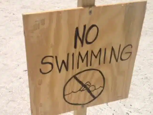
On a day when two Martin County beaches remain off limits to swimmers Martin County government officials have declared a local state of emergency due to toxic blue green algae in area waterways. It’s in effect for the next 7 day period. The declaration states that the algae pose a danger to health, life, property and the economic well-being of Martin County residents. It allows the government to waive procedures and formalities to ensure the health and safety of the community. Stuart & Bathtub beaches remain closed for swimming.


Be the first to comment!