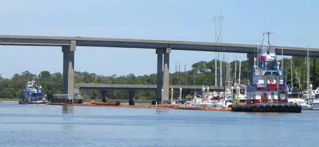
Visit Logged
  • Select Region
    • All Regions
    • VA to NC Line
    • North Carolina
    • South Carolina
    • Georgia
    • Eastern Florida
    • Western Florida
    • Florida Keys
    • Okeechobee Waterway
    • Northern Gulf
    • Bahamas
    • New York
    • Ohio
    • Pennsylvania
    • Washington
    • Puerto Rico
    • Minnesota
    • Maryland
    • Tennessee
    Order by:
    • Detailed Report from Jekyll Creek, Jekyll Island, GA, AICW Statute Mile 684.5


      Robert Sherer is author of 2015 ICW Cruising Guide: A guide to navigating the Atlantic Intracoastal Waterway. See /?p=150181. SSECN is grateful for Captain Sherer’s willingness to share his knowledge and experience with our readers. Jekyll Creek is home to SALTY SOUTHEAST CRUISERS’ NET SPONSOR, Jekyll Harbor Marina.

      I’ve been through Jekyll Creek a dozen times and although there is a channel with 5.7 MLW depth, the problem has always been how to find it. This time through I found a good fit using ENC charts as displayed on the iPad app, Charts and Tides. I would think that any app that used NOAA ENC charts would display the same route (my laptop with ENC charts showed the route correctly).

      IMG_9157

      At Jekyll Creek just south of the bridge

      Sitting at anchor just south of the bridge on 4/22/216, we were astounded when we saw two huge tugs with several hundred feet of dredging pipe go through Jekyll at dead low tide, one tug on each end of the pipes. I followed in my dinghy. The mud stirred up was incredible. They stopped multiple times and rev’ed up the engines and plowed through. It took 20 min to round G19. In other words, they created the channel and successive runs is what keeps the channel open.
      After they passed I got in my dinghy to measured the deepest spot by G19, R20 and R20A, going side to side with a portable depth sounder and found that 80 to 100 ft off each mark was best, at least now after the two tug plow team.
      Route notes:
      – Do not hug any marks, stay off R20A, R20 and R19 by 80 to 100 ft.
      – Garmin charts are useless here but NOAA ENC charts work well.
      – The depth readings were taken the day after two tugs passed (plowed!) through.
      – A GPX file of the route is available here or go to http://tinyurl.com/hvugdss

      Route depths:
      Bridge 10.6 MLW, use as a check on general water depth, the bridge height gauge read 65 ft (it was near high tide when I passed through but all readings have been corrected to MLW)
      Heading north:
      – 1/2 way 6.7 MLW
      – R20A 8.3 MLW
      – 1/2 way 6.2 MLW
      – R20 6.6 MLW
      – By docks 9.2 MLW
      – 1/2 way 8.1 MLW
      – G19 5.7 MLW (80 ft off )
      – At shoal mark 7.6 MLW
      – G17 9.1 MLW
      – R16 7.8 MLW

      Deeper the rest of the way north.

      I don’t claim this is the best route but it worked on 4/22/2016 for 5.7 MLW.
      Robert Sherer

      Click Here To View the Cruisers’ Net’s Georgia Marina Directory Listing For Jekyll Harbor Marina

      Click Here To Open A Chart View Window, Zoomed To the Location of Jekyll Harbor Marina

      Be the first to comment!

    • Unhappy with Brunswick Landing Marina, off AICW Statute Mile 680


      Brunswick Landing Marina, a very popular facility with long term resident cruisers as well as transient cruisers, sits off the direct path of the Waterway, flanking the eastern banks of Academy Creek off Brunswick River, near the heart of downtown Brunswick, Georgia.

      I have been a loyal customer of this marina for 15 years. I’ve seen it grow due to the efforts of the marina staff and the camaraderie developed among other cruisers and have always given it high marks for being among the best marina in the area. Unfortunately that has all changed under new management. Exorbitant charges are being billed as “environmental fees” i.e wifi, pump out, live aboard fees and marina security. These are to me the cost of doing business in an environment where boaters need and expect these services, but to add an additional fee to higher dockage rates has made Brunswick Landing intolerable. The boat yard in requiring outside vendors to add 20% to their normal charges to compensate the marina is ludicrous. It is clear the management is only looking out for themselves and has no understanding as to “who brought them to the table.” You may want to look into this and steer boaters to distant shores….it is NOT a place you would want to recommend.
      Robert Wilson

      Click Here To View the Georgia Cruisers’ Net Marina Directory Listing For Brunswick Landing Marina

      Click Here To Open A Chart View Window, Zoomed To the Location of Brunswick Landing Marina

      Comments from Cruisers (2)

      1. Doug Jarrett -  May 15, 2016 - 7:53 am

        We didn’t notice any extra fees, in fact, we got a 10% discount on fuel and slip for MTOA.
        Maybe slightly less organized than before, but nothing significant.

        Reply to Doug
      2. Michael Torras -  May 13, 2016 - 2:48 pm

        Mr. Wilson,

        I’m sorry to hear that you feel that way. As you are aware, we recently increased our monthly rate by $0.50/foot, up to $12.50/foot. This is after not raising our rates for the proceeding couple of years. We have made substantial infrastructure upgrades since our last increase. Our two local competing marinas charge $12.50/ft and $14.00/ft., respectively.

        We had intended to raise our rates to $13.00/foot. However, after much deliberation, we decided that instead of the extra $0.50/foot, we would make it a flat $24/month fee. We did this on the basis that we thought it would be nice for our customers to see where the extra $0.50/foot was going toward. We came up with the $24/month figure by taking our average size boat (48ft) and multiplying it by $0.50. This gave us an even $24 figure.

        If you look up the definition of “environment” you will find it to be defined as “the surroundings or conditions in which a person, animal, or plant lives or operates.” Surely all of the things you mentioned fall into this category?

        Again, I am terribly sorry that you are unhappy with our new rate structure. We wish you all the best.

        Michael Torras

        Reply to Michael
    • More Good Words for Brunswick Landing Marina, off AICW Statute Mile 680


      Brunswick Landing Marina, a very popular facility with long term resident cruisers as well as transient cruisers, sits off the direct path of the Waterway, flanking the eastern banks of Academy Creek off Brunswick River, near the heart of downtown Brunswick, Georgia.

      The marina is the best in the area, and while the facilities are some of the best on the ICW, the staff – Sherri and Cindy – are the most welcoming and “make you feel at home” people on earth. The marina is well represented by these two young ladies as anyone that has visited will attest to. Without them, it would just be another struggling marina.
      Jimmy Crack Corn

      Click Here To View the Georgia Cruisers’ Net Marina Directory Listing For Brunswick Landing Marina

      Click Here To Open A Chart View Window, Zoomed To the Location of Brunswick Landing Marina

      Be the first to comment!

    • Catamaran Skipper Seeks Boat Yard near Brunswick, GA

      Skipper Ted is looking for a DIY boat yard for his catamaran. Let us know if you have recommendations.

      Would like to know how to find out or post a message to find best marina in the New Brunswick GA area that can accommodate 24′ beam Cat for haul out and allows DIY bottom painting. Any help?? Thank you in advance. Ted

      Be the first to comment!

    • Advice on Hell Gate Problem Stretch, Statute Mile 602


      We are always hearing of extreme shallows at Hell Gate and recent conflicting reports still indicate problems at low tide. See /153633 and /153843. This report comes from one of our friends in AGLCA. SSECN still recommends MID TO HIGH TIDE as a requirement for navigating through Hell Gate.

      Hell Gate GA
      As a general rule, this section is best attempted with a rising tide. I guided 5 sailboats through there last November 21, 2015 during the Sail 2015 Rally Down the ICW.. We entered Hell Gate at exactly dead low and proceeded slowly. Of the 6 of us all drawing between 4.5 and 6 feet only the 6 footer ran aground. We draw 4.5 feet and several of the other boats with us were 5.5 feet. We were fine at dead low. In my experience, it is best to stay off G 89 about 75-100 feet.
      Reversing that route for north bound, stay center channel as you proceed into Hell Gate and then be on the west side of the as you approach G89, After the G89 continue north for about 300 feet before you actually take the turn towards the east. G89 does not exactly mark the actual bend in the channel After bend continue to stay west but then shift to the center of the channel as you approach the Vernon river.
      The most recent crowd sourced charts show 4-5 feet in the channel at low water. Given that the tidal range here is 9 feet, If you approach Hell Gate an hour or two after low you will have plenty of water in the channel. If you would like to have a copy of my tracks, please PM me.
      Cheers,
      Tom

      Click Here To View the Cruisers’ Net’s “AICW Problem Stretches” Listing For Hell Gate

      Click Here To Open A Chart View Window, Zoomed To This AICW Problem Stretch

      Comments from Cruisers (2)

      1. Nelms Graham -  September 25, 2016 - 5:14 am

        Transited Hells Gate on 09/24/16 three hours after low tide, “bumped” in channel approx. 75ft. from marker “89”, in vessel drawing 2-‘6.

        Reply to Nelms
      2. James Newsome -  August 31, 2016 - 11:47 am

        I negotiated Hell’s Gate on Sunday 08/28/16 traveling northbound exactly two hours before low tide. High tide was approximately 7.3′ for this day. Therefore, we calculated that we had 1.25′ per hour x 2 = 2.5′ of water over low tide. The least water we saw was 8′ which means the net low was around 5.5′. We steered pretty much down the middle following the magenta line, not favoring any marker.

        I draw 5’8″ to 6′ loaded which means I could have made this passage through Hell’s Gate an hour before low tide and barely had water under the keel. At low tide I could not have made it through.

        Based on the draft of your vessel, Hell’s Gate is only a concern within an hour or two of low tide, and if you only draw 4.5′ you can travel through here any time of the day, unless there is a negative tide perhaps. Just take it slow and easy on the south side of Hell’s Gate. There is some squirrelly current on the southern entrance to Hell’s Gate, but it’s nothing to be too concerned about.

        Reply to James
    • Good Words for Isle of Hope Marina, Savannah, GA, AICW Statute Mile 590


      Isle of Hope Marina – A SALTY SOUTHEAST CRUISERS’ NET SPONSOR! – lies along the northwestern shores of the Waterway in the body of a hairpin turn northwest of Waterway marker #46A. And in case you missed their FOCUS ON, see /150925.

      Have been at ISLE of hope now for about 2 1/2 years the staff is and has been great. The showers are always kept clean (you can always come in behind some one who leaves it messed up but the staff jump on it and make sure it’s cleaned. Restraints are close and downtown is full of things to do. Thanks and will probably keep coming back as we start our island hopping.
      Nick on the Cavalier

      Click Here To View the Cruisers’ Net’s Georgia Marina Directory Listing For Isle of Hope Marina

      Click Here To Open A Chart View Window, Zoomed To the Location of Isle of Hope Marina

      Be the first to comment!

    • Course Suggestion for St. Andrew Sound, AICW Statute Mile 690


      Bypassing Marker #32 in St. Andrew Sound to avoid open ocean waters has been the topic of much discussion in the past, see /130975 and /130801. Rick offers a straight forward course that does not require extra miles of travel. Mid to high tide would be essential for this route. If you try this course, let us hear from you.

      Cruising News
      We are local to this area and find that if we run along a line between the larger water tank on Jekyll with the lighthouse on Little Cumberland we have no problems with depth. We only draw 4.5′ but I don’t recall ever seeing single digit depths along this line. I’m not recalling any number below 12′. In timing out passage through Jekyll Creek we try to pass here at half tide which would be +3 above normal MLLW.
      Rick

      Click Here To Open A Chart View Window, Zoomed To the Location of St. Andrew Sound

      Comments from Cruisers (2)

      1. John F Pholeric, Jr -  March 19, 2016 - 7:13 am

        We have cut the R-32 buoy for several years. Our draft is 4 feet and I don’t recall seeing less than 4 feet even at low tide.

        Reply to John
      2. Peter Colket -  March 18, 2016 - 5:07 pm

        I have followed the suggested “shortcut” countless times in the last 10 years. Draw 4 feet, usually find 12 foot depths.

        Reply to Peter
    • Georgia Coastal and Marine Planner Now Available Online

      Here is an opportunity for boaters to learn more about the plans that our state government agencies are considering for our coastal waters. Even without the training session, the website can be very useful.

      OLYMPUS DIGITAL CAMERA

      OLYMPUS DIGITAL CAMERA

      Training for the Georgia Coastal and Marine Planner February 17, 2016

      As use of our ocean’s resources increase so do potential conflicts between user groups. The Georgia Department of Natural Resources, Coastal Resources Division (CRD) facilitates state management of coastal and ocean resources through improved planning and coordination.
      unnamed (36)

      CRD is partnering with the Georgia Tech Center for Geographic Information Systems and Strategic Energy Institute to launch a new planning tool called the Georgia Coastal and Marine Planner (GCAMP), which provides key information to coastal and ocean use stakeholders. GCAMP is a web-based map viewer that provides Georgia-specific data and information for planning and decision making. The resource assessment and planning tool provides easy access to geospatial information without the requirement of expensive or complicated software. GCAMP was designed to provide biological, physical, and human-use information in the offshore environment to planners, managers, decision makers, and the public.

      “GCAMP establishes a transparent and open process for fostering better understanding among stakeholders about what is happening in Georgia’s coastal and ocean environment. It provides factual information about the location of natural resources and the location of human uses. This will help coastal and ocean resource managers avoid conflicts when modifying existing human uses and planning future activities,” said Jill Andrews, program manager at CRD.

      Training on GCAMP will be held from 12:00 pm to 1:00 pm February 17, 2016 at the Susan Shipman Environmental Learning Center located at the DNR Coastal Regional Headquarters, One Conservation Way, Brunswick. The public is invited to attend. There are also tutorials on the viewer’s website Geospatial.gatech.edu/GCAMP

      For more information on GCAMP please contact Sonny Emmert or Jill Andrews at 912-264-7218

      unnamed (38)
      Questions? Contact Us

      Comments from Cruisers (1)

      1. Haskell Royer -  February 19, 2016 - 2:23 pm

        When will GA decide to become cruiser/boater friendly and keep their portion of the ICW reasonably maintained? Most boaters that have capable boats and crews opt to go offshore to avoid the state. Many others going off shore are at high risk. Even SC has finally decided to increase maintenance.

        Reply to Haskell
    • Compliments for Sunbury Crab Company Restaurant and Marina, Medway River off AICW Statute Mile 620


      AGLCA member Benjamin Peeler has these good words for Sunbury Crab Company in Brunswick, GA. Sunbury Crab Company Marina lies off the Waterway along the western shores of the Medway River, on the charted Sunbury Channel, north of Dickinson Creek.

      Had 2 great stays at Sunbury Crab Co. on our last trip down ICW to this summer. Highly recommend.

      Click Here To View the Cruisers’ Net’s Georgia Marina Directory Listing For Sunbury Crab Company

      Click Here To Open A Chart View Window, Zoomed To the Location of Sunbury Crab Company

      Be the first to comment!

    • Good Words for Fort McAllister Marina, Ogeechee River, near AICW Statute Mile 603.5


      Loopers Michael and Marian War give many reasons to take a delightful cruise up the Ogeechee River to this excellent marina. The marina is located on the southern bend of a hairpin curve in the Ogeechee River.

      Fort McAllister Marina on the Ogeechee River. Turn to port at R98 and CALL them – 912-727-2632. Follow their directions precisely as you will cross from one side of the river to the other as you approach. The marina has added buoys to mark the route from the north side of the river across to the dock. Best to dock at slack tide as the current runs about 5-6 knots. The marina has alongside floating docks, gas and diesel fuel, and Fish Tales Restaurant for dinner. Two showers and a washer/dryer just across the street, and if you’re interested in history, it’s just under a mile to Fort McAllister State Park, where Sherman ended his march to the sea.
      Michael and Marian War

      Click Here To View the Georgia Cruisers’ Net Marina Directory Listing For Fort McAllister Marina

      Click Here To Open A Chart View Window, Zoomed To the Location of Fort McAllister Marina

      Comments from Cruisers (1)

      1. Bob McLeran -  January 22, 2016 - 3:28 pm

        We went there by boat in 2009 for a couple of days and again in 2011 and visited the area several times by car since then. It’s a great marina and close to some interesting history, as the poster said. It is worth the 7 mile trip upstream from the ICW. Make sure you put your pointy-end upstream when you tie up!

        Going upstream, follow close to the starboard/north/LDB bank until you get the marina in site. Water is plenty deep very close to the bank.

        Reply to Bob
    • Compliments for Hidden Harbor Yacht Club, AICW Statute Mile 670.5


      Hidden Harbor Yacht Club is a transient friendly facility, located on Troupe Creek. This body of water intersects the AICW, immediately north of St. Simons Sound, near markers #237 and #238. These good words are from Loopers Michael and Marina War.

      Hidden Harbor Yacht Club north of St. Simons Island. Meeting Bobbie, the manager, is worth the trip. In a previous life, she was a stand-up comedian in Los Angeles, and she knows boats and the Georgia waters. It’s a small marina, part of a condo complex, and easy to find on Troupe Creek. http://hiddenharboryachtclub.net/ Bobbie will call the owner of a nearby restaurant to fetch you and return you to the marina. Patty’s (not sure of the name) is run by a retired law enforcement officer and caters to the nearby Glenco Federal Law Enforcement training center. Best pecan pie we’ve ever had.
      Michael and Marian War

      Click Here To View the Georgia Cruisers’ Net Marina Directory Listing For Hidden Harbor Yacht Club

      Click Here To Open A Chart View Window, Zoomed To the Location of Hidden Harbor Yacht Club

      Be the first to comment!

    • Good Review of Jekyll Harbor Marina and Jekyll Island, AICW Statute Mile 684.5


      A SALTY SOUTHEAST CRUISERS’ NET SPONSOR, Jekyll Harbor Marina lies along the easterly banks of the AICW’s passage through Jekyll Creek, immediately south of the 65-foot fixed bridge.

      If it were not for the exposure to the weather, I would have given this marina five stars. You are tied up to a face dock and wind out of the south can make things exciting. There can also be a wake problem when one of the jerks who can not understand the “no wake” sign come past.
      Aside from the above the place is wonderful. It is right on the ICW, has fuel, a pumpout ($15.00) and the rate is reasonable. The staff is on the ball and will be happy to help you with any questions. There is a restaurant at the marina but for serious dining you want to head for the Jekyll Island Club. In fact, if you have the time a tour of the historic district is a must. You can find out how the rich and famous lived back around 1900.
      They have made quite a few changes over the last few years. There is now a high end market available next to the convention center. It is well stocked and also has a few restaurants inside. Be forewarned, nothing on Jekyll Island is cheap.
      Public transportation is very limited, so bring your bikes or be prepared to rent a car from Enterprise, in Brunswick, they will pick you up at the marina. If you rent a car, everything that you will ever need is in Brunswick.
      If you like to ride bikes, the Island has over 20 miles of trails. The locals will stop for you where the trail crosses the road. Most tourists, not so. They will flatten you ass in a heartbeat.
      We arrived in early December and ended up staying for the entire month. We will be back in the spring.
      Dave Boxmeyer

      Click Here To View the Cruisers’ Net’s Georgia Marina Directory Listing For Jekyll Harbor Marina

      Click Here To Open A Chart View Window, Zoomed To the Location of Jekyll Harbor Marina

      Comments from Cruisers (2)

      1. James Newsome -  January 8, 2016 - 5:04 pm

        First, I loved Dave’s comment about tourists and bikers. That cracked me up!

        Back to Jekyll Island (JI). I am so glad that more and more cruisers are discovering all that JI has to offer. It is a biker’s paradise with lots of roads and trails and very little vehicle traffic. Groceries are available on JI in the new shopping area, which is a short bike ride from the marina.

        If you are looking for beach access, then you are in for a treat with the newly built Great Dunes Park. This beach is near the Convention Center and new shopping area and have excellent facilities. Here’s a map link.

        https://www.google.com/maps/d/viewer?mid=zDiAQ7gKynoI.kW7odN2cr2ao&hl=en_US

        Also, as mentioned by Dave, a visit to the Historic District is a must. Photos just don’t do this place justice. My wife and I spend part of our honeymoon on JI 43 years ago, and we visit there several times a year and it never gets old.

        http://www.jekyllisland.com/project/historic-sites/

        If you are a cruiser looking for a nice layover then JI is just the place. I don’t think you’ll be disappointed. From the Turtle Center, to Drfttwood Beach, to Glory Beach, Latitude 31 and Driftwood Bistro restaurants there are treasures to be discovered on Jekyll Island, GA’s “Nearest Far Away Place.”

        Reply to James
      2. Sonny Reeves -  January 8, 2016 - 1:44 pm

        We were there for 5+ years. The bike trails are awesome! The restaurant is closed (had a kitchen the size of a closet) Better eats at other places on island.
        The comment about the bikes and tourist are spot on. Georgia law DOES Not require a motorist to stop for a person on a bicycle in the crosswalk.

        Reply to Sonny
    • Plus and Minus for Brunswick Landing Marina, off AICW Statute Mile 680


      Brunswick Landing Marina, a very popular facility with long term resident cruisers as well as transient cruisers, sits off the direct path of the Waterway, flanking the eastern banks of Academy Creek off Brunswick River, near the heart of downtown Brunswick, Georgia.

      Great Marina. Stopped specially to fill LPG tank because it advertised refill on site. That is not the case, have to do 1-1/2 mile walk to refill tank. Bit disappointed with the refill situation but overall good experience with my stay.
      Tracie

      Click Here To View the Georgia Cruisers’ Net Marina Directory Listing For Brunswick Landing Marina

      Click Here To Open A Chart View Window, Zoomed To the Location of Brunswick Landing Marina

      Be the first to comment!

    • High Praise for Jekyll Harbor Marina, AICW Statute Mile 684.5


      It is always nice to get good reviews and especially nice when it is on one of our SPONSORS! Jekyll Harbor Marina is one of my favorite stops – even Jimmy Buffett stops here! Jekyll Harbor Marina lies along the easterly banks of the AICW’s passage through Jekyll Creek, immediately south of the 65-foot fixed bridge.

      Once safely through the shoals before the bridge, Jekyll Island Marina justifiably remains a favourite friendly stopover for boats of all shapes and sizes. Not only impeccable facilities but now they offer a courtesy golf cart enabling you to visit the brand new Beach Village stores and ogle at the huge mansions once owned by JP Morgan, Rockefeller and other “robber barons” of bygone years. Wonderful golf courses and even croquet amidst impeccable and super clean landscaping wherever you go. An onsite restaurant offers great local sea food dishes. Other amenities include a laundry, free WiFi, fish cleaning station, clean showers and fuel at competitive prices – I was able even to have Pisces pressure washed at very reasonable cost. Both staff and fellow boaters will do everything possible to make your stay pleasant and safe. During “snowbird” season, you might like to make a reservation either via VHF 16 or telephone (912) 635 3137. Undoubtedly a Five Star rating…….
      Cap’n Parky

      Click Here To View the Cruisers’ Net’s Georgia Marina Directory Listing For Jekyll Harbor Marina

      Click Here To Open A Chart View Window, Zoomed To the Location of Jekyll Harbor Marina

      Be the first to comment!

    • Praise for Brunswick Landing Marina, off AICW Statute Mile 680


      Brunswick Landing Marina, a very popular facility with long term resident cruisers as well as transient cruisers sits well off the direct path of the Waterway, flanking the eastern banks of Academy Creek off Brunswick River, near the heart of downtown Brunswick, Georgia.

      OK it’s around 5 miles off the ICW on the East River, but the extra mileage is well worth it. This is a first class marina at reasonably low cost. Immaculate floating slips, spotless restrooms and showers, free laundry, free to use BBQ and free beer. Diesel and Gas at competitive price. Nearby within walking distance are several restaurants including Thai, Chinese, Breakfast and goat curry. It’s a bike ride to an Autostore and a 5 mile taxi to the likes of Walmart, Publix and one of my favourites – Sonny BBQ. The marina accepts transients and liveaboards at competitive rates. You’re also likely to meet several of those intrepid Captains with tall masts who sail the world’s oceans. Contact the world’s friendliest Dockmaster on VHF 16 or Tel (912) 262 9264 AFTER you pass through 105 ft high cable bridge.. Five Star rating in my book.
      Cap’n Parky

      Click Here To View the Georgia Cruisers’ Net Marina Directory Listing For Brunswick Landing Marina

      Click Here To Open A Chart View Window, Zoomed To the Location of Brunswick Landing Marina

      Be the first to comment!

    • A Good Visit to Two Way Fish Camp, off the AICW Statute Mile 663


      Two Way Fish Camp is on the South Altamaha River, off the Waterway departing west between markers #218 and #218A. Old South charm and one of this editor’s favorite spots – well worth the trip!

      Around Mile Marker 660 turn into the South Altamaha River to get a mile or so to the marina – watch the markers carefully on a “Red Right Return” basis. This super friendly marina is certainly much more than a fish camp – in fact the name reminds you that you can freshwater fish north of the marina, or saltwater fish south of the marina. Two way fishing. Floating slips are in good shape, an excellent ma and pa type restaurant on site and a haul out crane with repair yard able to fix most anything wrong. To be honest the restrooms and showers could do with a spot of modernization but the systems themselves worked well. Quite a few liveaboards here anxious to help a fellow boater get to the nearest grocery and other stores. Also a chance to make friends with Coastguard trainees who one day may come to your rescue – who knows? A Four Star rating in my book – five if they spruce up the restrooms.
      Cap’n Parky

      Click Here To View the Georgia Cruisers’ Net Marina Directory Listing For Two Way Fish Camp

      Click Here To Open A Chart View Window, Zoomed To the Location of Two Way Fish Camp

      Be the first to comment!

    • Another Report from Hell Gate, AICW Problem Stretch, Statute Mile 602


      We began hearing of extreme shallows at Hell Gate last year, see /?p=145174 and /?p=146335. Mike and Cathy wisely made this passage near high tide and had no problem. SSECN still recommends MID TO HIGH TIDE as a requirement for navigating through Hell Gate.

      Just passed Hell Gate 1 hour before high tide- minimum observed depth 10 feet. Had approx 6 ft of tide
      Mike & Cathy
      S/V Second Flight

      Click Here To View the Cruisers’ Net’s “AICW Problem Stretches” Listing For Hell Gate

      Click Here To Open A Chart View Window, Zoomed To This AICW Problem Stretch

      Be the first to comment!

    • More Good Words for Thunderbolt Marine, Savannah, GA, AICW Statutue Mile 583


      Praise from Still Clueless parallels the many positive comments by other cruisers, as well as my personal experience there. Thunderbolt Marine flanks the Waterway’s southwestern shores just northwest of the small, charted square cove, south of AICW marker #35.

      We cannot say enough about this marina! Easy in, easy out. FREE laundry! Awesome restaurant (Tuby’s) is just a short walk away. Immaculate shower/bathrooms. A true bargain! Will be back next summer, and every fall here out!
      Still Clueless

      Click Here To View the Georgia Cruisers’ Net Marina Directory Listing For Thunderbolt Marine

      Click Here To Open A Chart View Window, Zoomed To the Location of Thunderbolt Marine

      Comments from Cruisers (1)

      1. Doug Jacoby -  November 17, 2015 - 12:32 pm

        Completely agree… been there many times over the last few migrations… always consistently good !

        Reply to Doug
    • Praise for Delegal Creek Marina, AICW Statute Mile 601


      According to a spokesperson at the marina, the MLW in the entrance to Delegal Creek is 3 ft with a tidal range of 8-9 ft and, as Cap’n Parky confirms, mid to high tide would be the best time to enter Delegal Creek. Once in the creek, there is plenty of depth, however the entrance channel is an issue if you draw more than 3 ft. The entrance channel begins northeast of waterway flashing daybeacon #86. just north of Hell Gate.

      Recently had the opportunity to visit Delegal Creek Marina at Mile Marker 601 a few miles south of Isla of Hope. This is the best and friendliest marina I have stayed at for a while. Certainly it’s probably a good idea to enter the creek a couple of hours before or after low tide – which gives you an easy channel around 8ft or more. The marina offers a lower transient rate than average while at the same time giving first class facilities well sheltered from inclement weather. Super clean restrooms and showers, laundry, floating slips, clubhouse, and above all a courtesy golf cart giving you a delightful run through the woods of Skidaway Island to the Publix grocery store, Bar & Grill restaurant and other stores at the Village. If you have a motorised dinghy – great fun also visiting nearby tropical island beaches. I give it a Five Star rating. Call Dockmaster Billy in advance for a reservation at (912) 224 3885.
      Cap’n Parky

      Click Here To View the Cruisers’ Net’s Georgia Marina Directory Listing For Delegal Creek Marina

      Click Here To Open A Chart View Window, Zoomed To the Location of Delegal Creek

      Comments from Cruisers (1)

      1. Michael Dindore -  November 11, 2015 - 10:20 am

        This is an oasis, hidden from almost any perspective. Once you slip in it’s a place you want to stay. Mike was the Dock master and he greeted me with open arms and they are the nicest people you will ever meet. I docked talked to Mike a second and grabbed the golf cart and went to the Village to eat. No fuss no worries just enjoy the many vistas that are around every corner. The facilities are excellently maintained and the dock is clean and free of “things”. No live a boards makes a difference to the transients that frequent here. I am on my way to Houston TX and will be comparing all to follow to this Village. And for the faint at heart they will drive out, drag you off a spoil area, and when you get in treat you like a Captain. Don’t ask how I know.
        Michael Dindore

        Reply to Michael

    Social Media Auto Publish Powered By : XYZScripts.com