For a change, there is a little weather excitement to outline today. A cold front now over the Mississippi and Ohio Valleys is moving our way, bringing rain and thunderstorms, mainly to the Upstate. The front will usher in colder air starting Sunday into Monday.
An area of rain and thunderstorms will reach the Upstate this afternoon, primarily affecting the I-85 Corridor and points to the northwest. The rain could become heavy enough to cause isolated flooding in the far northwest, despite the ongoing drought in the area.
The risk for isolated flooding continues through most of Saturday before the rain and thunderstorms shift southeastward.
Thanks to the unseasonably warm air mass in place ahead of the front, we’ll also have a low-end, level 1 of 5 risk of severe thunderstorms in the Upstate and vicinity.
The stronger storms moving through Saturday might cause locally damaging winds, and there is a risk of an isolated tornado or two.
In addition, it looks like winds will pick up early Saturday and remain gusty through the day, especially over the northern half of the state, with peak gusts around 35 mph. Motorists and pickleballers beware! Look for a wind shift late Saturday behind the front, and it remains breezy through Sunday.
While the severe storm threat drops to near zero as the front reaches the I-20 Corridor during the evening, that area and points south will see a scattering of showers as the front moves through Saturday night.
Colder air will move in behind the front Saturday night into Sunday. We will return to the reality of midwinter by Monday as temperatures running around 20° above average through Saturday shift to 4-8° below average on Monday.
High pressure keeps us tranquil and seasonable for Tuesday, then another cold front moves in on Wednesday. It is at this point that our forecast becomes complicated. We’ll enter a weather pattern that permits a winter storm to occur in South Carolina late next week. It will be the ol’ western North America upper ridge, eastern North America upper trough; the negative NAO, positive PNA combo that geeky snow lovers rave about.
One model (the GFS, the one whose output you take with the biggest grain of salt) has suddenly jumped on the idea that a storm blows up on our coast Thursday as fresh cold air blasts in, and the model throws down snow over nearly the whole state. Sus, as the young folks say these days. Other models show not much happening other than a solid blast of cold arriving Wednesday night and maybe a few showers.
However, the cold could still be entrenched when the next storm in line arrives around next Sunday. No promises, snow lovers, but I think our odds are better next weekend than later next week.
New Year, New (Old?) Weather Alert
I need to pass along a quick programming note. A couple of years ago, we decided to shift from issuing this regularly on Fridays only during hurricane season to year-round. The side effects of doing this made it more like a blog and less like an alert product, and it also forced us to ‘alert’ for several Fridays in a row when nothing truly alert-worthy was happening. So, we’ve decided to revert to the original schedule, where I only create these alerts each week during hurricane season and then send them on an as-needed basis during the rest of the year. So, today’s issuance will be the last regular Friday report until May 29, the Friday before hurricane season begins.
That said, there’s a good chance you’ll hear from me next week, since it looks like we’ll have at least one winter storm opportunity in the middle of the month. It may be warm now, but winter’s not over!
Frank Strait Severe Weather Liaison S.C. State Climate Office
South Carolina Department of Natural Resources 260 D. Epting Lane West Columbia, SC, 29172
This email was sent to curtis.hoff@cruisersnet.net using GovDelivery Communications Cloud on behalf of: South Carolina DNR ·1000 Assembly Street · Columbia, SC 29201
Two Georgia Marinas Earn Georgia Clean Marina Certification
Two marinas along Georgia’s coast have been newly certified under the Georgia Clean Marina Program, recognizing their commitment to protecting coastal waters and implementing environmentally responsible business practices.
Safe Harbor Savannah Yacht Center in Savannah and The Ford Field and River Club Marina in Richmond Hill were certified Tuesday, Dec. 16, 2025, for adopting Clean Marina Best Management Practices (BMPs), which are designed to reduce or eliminate waterway pollution from everyday marina operations.
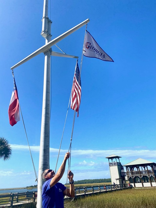
The Georgia Clean Marina Program is a voluntary certification program allowing coastal Georgia marinas the opportunity to demonstrate their environmental stewardship through implementation of Clean Marina Best Management Practices (BMPs). Certified marinas are eligible to fly the Georgia Clean Marina flag and use the logo in their advertising and promotional materials, signaling to the boating community their commitment to protecting coastal waterways.
Marinas are assessed in several areas such as fueling operations, boat washing policies and emergency preparedness to demonstrate the policies they have in place to go above and beyond in ensuring their operations are not negatively impacting their coastal environment. They must meet minimum requirements addressing all areas of marina operation to become certified. Certified marinas can use this designation to attract clientele that value the steps clean marinas have taken to be better stewards of our coast.
These certifications mark the third cohort of facilities to earn designation since the Georgia Clean Marina Program was relaunched in 2023. The program is part of a national initiative and is administered through a collaborative partnership between the Georgia Department of Natural Resources’ Coastal Resources Division (CRD), University of Georgia Marine Extension and Georgia Sea Grant, and the Georgia Marine Business Association (GAMBA).
“The continued growth of the Georgia Clean Marina Program shows how effective this partnership has been,” said Kelly Hill, CRD green growth specialist. “By working together, we’re helping marinas implement practical solutions that protect water quality while supporting a strong coastal economy.”
Marinas play a vital role in Georgia’s coastal communities by supporting recreational boating, marine tourism, and local jobs. Most facilities are located in or near sensitive marshlands and estuarine waters, making environmental stewardship a critical component of marina operations.
“These certifications demonstrate the marine industry’s commitment to balancing business operations with environmental responsibility,” said Lucy Bowie, GAMBA secretary. “Each new cohort strengthens the program and sets a positive example for marinas across the coast.”
Bryan Fluech, associate director of extension for University of Georgia Marine Extension and Georgia Sea Grant, emphasized the long-term impact of the program.
“The Georgia Clean Marina Program is a successful model of collaboration,” he said. “Each newly certified marina represents real progress toward conserving Georgia’s coastal resources for future generations.”
Marinas interested in becoming certified may apply each fall and work closely with program partners throughout the year to meet program benchmarks. For more information, visit GeorgiaCleanMarina.org.
Good morning and welcome to 2026. I hope y’all had a grand New Year’s celebration with your friends and family. I know some of y’all did because driving home from my girlfriend’s house during the first minutes of the year, it sounded like Colonel Sumter’s men were driving the British out of Columbia’s Rosewood neighborhood.
This morning, a storm centered over the southern Plains is moving our way, bringing us some needed rain over the next 36 hours. The rain will reach the northwest later this evening and spread over the state through Saturday morning. While the entire state will see some rain, the southern part will get more than the northern part.
Here’s the National Weather Service’s forecast for rainfall across South Carolina through early Sunday. Most of the state will see a half-inch to an inch of rain. Locally heavier rain will fall over the southern part of the state, where amounts can exceed one inch in spots.
Image Source: WeatherBELL
Meanwhile, a cold front to our north and west will shift southward and send chilly air into the northern part of the state. That will keep the Upstate, Catawba region, and upper Pee Dee in the upper 40s and low 50s, while the Lowcountry sees highs in the 60s.
The warm air over the southern part of the state will be conducive to thunderstorms rumbling through during the afternoon and early evening. A part of the Lowcountry will be at risk for seeing an isolated severe storm.
The level 1 of 5 (marginal) risk area on the Storm Prediction Center’s outlook for Saturday is the area of concern for severe storms; the concern is for isolated damaging wind and an isolated tornado.
This storm system will move out Saturday evening, with dry and seasonably cool air pushing in behind it. Sunday may start with lingering low clouds and fog, but it’s likely to be sunny across the state by the afternoon with highs in the mid to upper 50s from north to south.
Monday also looks dry, with high pressure centered over New York controlling our weather. Highs will range from the mid-50s north to the lower 60s south.
That area of high pressure will slide eastward on Tuesday, and southerly to southwesterly winds around the departing high will give us a warmup. Temperatures will run well above normal again on Tuesday through at least Thursday. We’ll see highs in the 60s on Tuesday, upper 60s and lower 70s on Wednesday, then most of the state will reach the 70s on Thursday. Tuesday and Wednesday should feature plenty of sun, but clouds will stream in on Thursday ahead of our next cold front.
Computer models show varying ideas about the front coming our way late next week. It could move in on Friday and become stationary through next weekend, or it could stall to our northwest and not move through until Sunday. So, there is a lot of uncertainty about what the weather will be like during that time. Once that front finally pushes through, we’re likely to see a period of colder-than-average weather.
This week’s Drought Monitor indicates an expansion of drought conditions since last week.
Rain coming through Saturday will help, but won’t get rid of the drought entirely. Another dry spell Sunday through at least Thursday will not help matters. The setup for next Friday and next weekend has a chance to bring us substantial rainfall, but don’t get your hopes up because most computer models do not show us seeing a soaking.
Frank Strait Severe Weather Liaison S.C. State Climate Office
South Carolina Department of Natural Resources 260 D. Epting Lane West Columbia, SC, 29172
Our weather is looking mainly tranquil through Christmas and beyond. It could be ten days before we see another good chance for rain, which is unfortunate because much of South Carolina remains in a drought despite the soaking that parts of the state saw last night.
For the rest of today, we remain sunny with winds lessening as high pressure builds in. Aside from the gusty winds, it will be a lovely afternoon with temperatures slightly warmer than average. Tonight looks clear and seasonably chilly with light winds.
High pressure overhead Saturday gives us a pleasant December day with sunshine; a chilly start, but highs will be in the mid to upper 50s north and lower 60s south. A clear and seasonably chilly night will follow.
A moisture-starved cold front will move through the state on Sunday, so moisture-starved that we’ll only see a few clouds. We’ll have a mainly sunny sky with highs in the lower 60s north and middle 60s south, a pretty day. Sunday night looks seasonably chilly again with a mostly clear sky.
Monday will bring us below-average temperatures as Canadian air pays us a brief visit. We’ll see a few clouds as Sunday’s front stalls nearby to the south, but a good deal of sun, too. Highs will range from near 50 in the north to the upper 50s south.
The front will retreat northward on Tuesday; it will pick up some moisture while sitting to our south, but not much. So, clouds will limit the sun, and there might be a stray shower or two around the Upstate. If the stray showers or lack thereof are a problem for you, it will be the perfect time to air your grievances!
That front will again become stationary to our north through Christmas Eve before retreating further northward. Meanwhile, an upper-level ridge will set up shop for a while over the southeastern states. This will put us in a warm and dry regime for Christmas and beyond. We’re likely to see sunshine with highs in the upper 60s to lower 70s on Christmas Eve, then mainly lower 70s for Christmas Day. It’s not likely to be the warmest Christmas on record, as record highs for the date are in the upper 70s and lower 80s, but it should be in the top ten warmest (out of over 100 Christmases for many places in the state, our records go back as far as the 1880s).
These NDFD plots show the National Weather Service’s forecast highs for Christmas Eve and Christmas Day.
Image Source: WeatherBELL
The computer models generally agree that we’ll remain warm and dry, with highs in the 70s, until around the 29th (give or take a day), when another cold front finally arrives.
Sorry, snow lovers, the weather pattern looks hostile to snow for the rest of the month and likely the first part of January.
Over the last week, drought has worsened over the Upstate and Catawba region but has improved somewhat in the south.
The rain we saw over much of the state Thursday and Thursday night helped, but it was not a factor in this week’s Drought Monitor, which is compiled on Tuesdays. However, the mostly dry, warm weather over the next week or so will worsen the drought again.
Frank Strait Severe Weather Liaison S.C. State Climate Office
South Carolina Department of Natural Resources 260 D. Epting Lane West Columbia, SC, 29172
This email was sent to curtis.hoff@cruisersnet.net using GovDelivery Communications Cloud on behalf of: South Carolina DNR ·1000 Assembly Street · Columbia, SC 29201
Fred Pickhardt’s Substack is free today. But if you enjoyed this post, you can tell Fred Pickhardt’s Substack that their writing is valuable by pledging a future subscription. You won’t be charged unless they enable payments.
Antarctica is 98% ice covered and contains 90 percent of Earth’s total ice volume. Melting ice is limited mainly to West Antarctica which is offset by ice mass gains over the remainder of Antarctica.
The mass of the Antarctic ice sheet has changed over the last decades. Research based on observations from the Gravity Recovery and Climate Experiment (GRACE) satellites (2002-2025) and GRACE Follow-On (since 2018) indicates that between 2002 and 2025, Antarctica shed approximately 135 gigatons of ice per year, causing global sea level to rise by 0.4 millimeters per year. Since 2020, however, the Antarctic has seen little or no ice mass loss.
At this rate, an additional 28 mm (1.1 inches) of sea level rise can be anticipated by 2100. If the Antarctic ice melt would triple between now and 2100 we should expect an additional 42 mm (1.7 inches) of sea level rise due to Antarctic melt.
As the title implies, we’re going to be on a roller coaster ride with our temperatures over the next week. We get milder at first, then blasted with the coldest air of the season so far Sunday night through Tuesday morning, then we gradually warm up through the rest of next week as a warmer weather pattern develops over this part of the country.
Today, a weak storm system is passing north of us (with flurries as far south as Charlotte); we’ll remain dry as it and a trailing front cross the Palmetto State. Northern areas seeing clouds this morning will see the sun this afternoon.
An air mass of Pacific origin will move in on Saturday, bringing sunshine and temperatures slightly above average. However, a second cold front now over the upper Midwest and northern Plains will approach.
That next front will arrive in the Upstate around daybreak on Sunday and push through the rest of the state through the morning and early afternoon. This front will also bring limited moisture, only enough to trigger stray showers.
This front will lead an arctic air mass into the Southeast. Often, cold air lags behind cold fronts moving through South Carolina by as much as a full day, but not this time. Highs for the day will occur as the front arrives, with temperatures falling during the midday and afternoon after a mild start in most places. Gusty north-northwesterly winds will make it feel even colder with wind chills dropping to the 20s and 30s over the northern part of the state. So, if it feels nice when you leave Sunday morning, take a jacket with you because it may not be so nice on the way home. The winds will be an annoyance for motorists and especially pickleball players. I’ve warned the members of my group to expect a cold, blustery comedy of errors when we play on Sunday afternoon!
The forecast weather map for Sunday morning from the Weather Prediction Center shows their expected positions of weather features at 7 a.m. Sunday and precipitation areas for Sunday and Sunday night. Arctic air will arrive in the Upstate early in the day but during the midday and afternoon for the rest of South Carolina.
The winds will diminish Sunday night, and we’ll wake up on Monday to the coldest temperatures we’ve experienced since last winter. It’ll be in the 15-20° range except at the coast, within shouting distance of the cold we saw back at Christmas of 2022. It’s potentially pipe-busting cold, so you’ll want to take time this weekend to make sure your home’s pipes are adequately insulated. If your plumbing is vulnerable to the cold, you’ll want to leave faucets dripping before you go to bed Sunday night.
The above map shows the forecast low temperatures on Monday morning across South Carolina from the National Weather Service.
Image Source: WeatherBELL
Temperatures will only recover to the 30s on Monday afternoon, with some low 40s in the Lowcountry. Another clear, frigid night follows for Monday night, though it won’t be quite as harsh with most areas seeing lows of 20-25° on Tuesday morning.
Moderation begins Tuesday afternoon, which will be chilly but much more tolerable than Monday afternoon as most of the state gets to at least 50°.
Temperatures take another step upwards to the upper 50s and lower 60s on Wednesday, then most places will get into the 60s on Thursday.
Another cold front will be due here at the end of next week, but the exact timing is uncertain at this range. We’re also not sure how much moisture the front will have to work with; we probably will get some rain, but not a lot.
I’m sure y’all are looking ahead to Christmas, and I am, too. A brief chilly spell should follow the late-week front for next weekend, before it turns warm again the following week. It’s too early to speculate on whether Christmas Day or a surrounding day will be wet or dry. However, above-average temperatures are likely, and the odds of a White Christmas across South Carolina this year are zero, rather than the usual infinitesimally small odds.
If any part of the previous paragraph doesn’t work out, or you’re unhappy about warmth at Christmas, save it for The Airing of Grievances on the 23rd.
Drought remains a problem in parts of the state, especially for some of the Lowcountry and the Central Savannah River Area.
The drought conditions are likely to expand and worsen over the next couple of weeks, as our prospects for substantial rain are low during this period. We can definitely gripe about that next Tuesday.
Frank Strait Severe Weather Liaison S.C. State Climate Office
South Carolina Department of Natural Resources 260 D. Epting Lane West Columbia, SC, 29172
This email was sent to curtis.hoff@cruisersnet.net using GovDelivery Communications Cloud on behalf of: South Carolina DNR ·1000 Assembly Street · Columbia, SC 29201
The hurricane season for this year has ended. Note that named storms this season have been below average.
Weather Alert – December 5, 2025
Gloomy Through Saturday, A Little More Rain Monday
A stationary front just to our south and east will keep us gray and mostly wet through Saturday. The heaviest rain will fall over the Lowcountry, while the Upstate will see the least.
The good part of this is that parts of the state remain in a drought, so persistent chilly, wet weather is beneficial there.
I’m sure some people are happy to see the rain (for example, I need to burn some wood debris that’s been accumulating in my backyard, and it’s been way too dry for that for months), but for most, it’s a bummer that Saturday looks gloomy.
The rain comes in two waves as weak storms ride along the front to our south. The first is passing through this part of the country today, causing rain across the state. Rain will become confined to coastal areas tonight, then the next wave will affect areas mainly along and south of I-20 on Saturday. The rest of the state will remain dry Saturday, and parts of the Upstate might even see the sun pop out briefly at the end of the day. Temperatures will mainly sit in the 40s and lower 50s today, drop to the upper 30s and 40s tonight, then recover to the lower to middle 50s Saturday.
Traveler’s Advisory: Those heading north into central and northern Virginia, Maryland, and Delaware through this evening will encounter snow; not a lot, but enough to cause slippery spots on the secondary roads and back roads.
A loop of visible satellite imagery shows clouds along and north of a stationary front stretching across the Gulf, Georgia, Florida, and the western Atlantic.
Image Source: University of Wisconsin RealEarth
We’ll see a better day on Sunday. Much of the state will see clouds and fog to start, but it looks partly sunny by the afternoon. Highs will mainly be in the 50s, and parts of the Lowcountry could touch 60.
Another storm system will move in on Sunday night, causing light rain to break out again during the wee hours of Monday. A cold front will move in early on Monday as well, with air cold enough to turn the rain to snow up in the land of vinegar and tomato sauce. It’s conceivable that some wet snowflakes mix with the rain over areas north of I-20 here in South Carolina, but don’t expect anything significant. “Cold air chasing moisture” setups rarely lead to significant snow in this part of the country. Besides, there won’t be much precipitation falling on Monday, no matter what form it takes. Highs on Monday will range from the mid-40s north to the mid-50s south.
Tuesday and Wednesday look tranquil under high pressure. That keeps us mainly sunny both days; Tuesday will be chilly with highs in the 40s and lower 50s, but Wednesday will be milder with highs mostly 55-60° (near average for early December).
A 1-2 punch of cold fronts will likely affect us Thursday into next Friday. However, neither front will be able to tap into substantial moisture, so we’ll see little or no rain during the period. Thursday looks a bit warmer than Wednesday with highs mainly in the upper 50s to middle 60s, but it will turn chilly again Friday with highs mainly in the 50s.
Next weekend looks dry but cold. Highs will likely be in the 40s and 50s, with most of the state dropping below freezing at night. It’ll feel a lot like Christmas, and look that way, too. Brown grass, red and green pine trees, and bare hardwoods are how we normally roll at Christmas down here in South Carolina.
Frank Strait Severe Weather Liaison S.C. State Climate Office
South Carolina Department of Natural Resources 260 D. Epting Lane West Columbia, SC, 29172
The hurricane season for this year ends on Sunday, and named storms this season have been below average.
Weather Alert – November 28, 2025
Tropics Done
The hurricane season for this year ends on Sunday, but it’s quiet across the Atlantic tropics, and there is no reasonable chance for any more storms to form over the next few weeks. So, I’m going to go ahead and call it: we did it … we survived another hurricane season!
The season was below average in terms of the number of named storms (13, the average in recent decades is 14.1) and hurricanes (five, the average is 7.1), but above average in terms of major hurricanes (four, the average is 3.2) and seasonal ACE (accumulated cyclone energy, a measure of how much energy a season’s storms expend, there was a total of 132.6 units of ACE from this year’s storms and the average is 121.5).
The best part of this year’s hurricane season is that we only had one landfalling storm in the United States. It was Tropical Storm Chantal, which made landfall here in South Carolina near Litchfield Beach on July 6. Impacts here in South Carolina were low-end, as the winds were not particularly strong and the storm’s rain was mostly welcome. However, Chantal’s rains caused severe flooding in parts of North Carolina and Virginia.
A map from the National Hurricane Center showing the tracks of 2025’s Atlantic storms.
It will likely be months before we face another tropical threat, but it’s important to remain prepared. If it’s not something coming out of the tropics, it can be tornadoes, winter storms, and even earthquakes. So, check out those SCEMD webpages to be well-informed about disaster preparedness.
A cold front that moved through on Wednesday night put an end to our warm weather, and it will be a while before any of us in the Palmetto State see it well into the 70s again. We started this morning with the coldest readings of the season so far, or nearly so, and we’re going to see temperatures remain mostly below average over the next week.
No, it won’t be cold enough for snow. Not for the next week, anyway. We might see some opportunities for a winter storm later in December, but not right off the bat.
A storm will pass by to our north over the weekend and pull a cold front into South Carolina on Sunday. Ahead of it, we remain cold but tranquil through today and Saturday with highs in the 40s north and 50s south. In between, much of the state will see subfreezing temperatures again tonight, with 20s widespread.
Warmth surges into the Coastal Plain ahead of the next front, sending highs along and south of I-20 into the 60s (maybe 70° in the warmest spots), while the chilly air remains stuck over I-85 and north due to cold air damming; it will hold in the 40s and lower 50s there. Unfortunately, the front won’t have much moisture to work with, and we’ll only see isolated showers as it moves through. However, there could be a steadier drizzly or misty nuisance in the areas stuck in the cold air damming regime.
The front will become stationary to our south, and another storm will ride along it through the Southeast on Monday night into Tuesday. The storm track will be along the Gulf Coast and then along the Carolina coast (you know, the sort that causes winter storms ’round these here parts, but it won’t be cold enough to cause any snow or ice here). It will be a close call for a little freezing rain northwest of I-85, where it will likely be in the middle to upper 30s when the rain moves in, so we’ll have to watch for changes in the coldest spots in our northwest. However, it’s likely to be a rain-only event for all of South Carolina. It will be a cold rain for most with highs only in the 40s north of I-20, with 60s confined to the coast.
The good news is that we are likely to see widespread soaking rain of 1-2 inches across the state. There may even be rumbles of thunder along the Coastal Plain. Much of the state remains in a drought, which worsened compared to last week because it was mostly dry.
The latest U. S. Drought Monitor for South Carolina issued on Wednesday shows about a fourth of the state in a drought.
Wednesday through Friday next week looks dry and chilly. Highs will be mainly in the 50s on Wednesday, then it is likely to warm up somewhat to near-average 50s and low 60s for the end of the week. Another good chance of rain could arrive as early as next Friday night; next Saturday is likely to be wet, followed by a drier, colder Sunday.
Frank Strait Severe Weather Liaison S.C. State Climate Office
South Carolina Department of Natural Resources 260 D. Epting Lane West Columbia, SC, 29172
The hurricane season continues until the end of the month, but it looks like the tropics will stay quiet, with Melissa likely the last storm of the season. Nothing is happening down there right now other than two swirls of clouds well east of the Lesser Antilles.
This loop of visible satellite images show little activity over the Atlantic tropics.
Image Source: University of Wisconsin RealEarth
These two features aren’t generating much thunderstorm activity, and what few thunderstorms do pop up are getting ripped to shreds by strong southwesterly to westerly winds aloft.
The computer models show that these little swirlies will be torn apart before they reach the Caribbean Sea, the only area where they might have a chance to develop.
This time of year, we also have to watch for storms to spin up along a stationary front over warm waters, as we now have stretching from the northwestern Caribbean to the Azores, but right now, no models show this to be a genuine concern. Sometimes non-tropical storms wander from the midlatitudes over warm waters and become tropical in nature this time of year, but there’s no sign of that happening either.
While it may be months before we face another tropical threat, it’s important to remain prepared. If it’s not something coming out of the tropics, it can be tornadoes, winter storms, and even earthquakes. So, check out those SCEMD webpages to be well-informed about disaster preparedness.
Warm And Dry For A While
Our weather is looking monotonous for the next week or so. There is no sign of any more cold snaps like the one we had earlier this week for at least 10 days, and definitely no more snow for a while.
An area of high pressure now centered right over us will remain in control through Saturday. As a result, we will remain mainly sunny through this afternoon. Some high cloudiness will drift overhead on Saturday, but our warming trend will continue. Highs this afternoon will be within shouting distance of 70, then we’ll see lower to middle 70s Saturday.
A cold front will move in on Sunday, but it will lack moisture. We’ll see some patchy clouds as it moves through later in the day, but no rain. A surge of warmth ahead of the front will send our highs to the middle-to-upper 70s and the usual warm spots could touch 80°.
Cooler air will filter in behind the front, but it only sends our temperatures to about 5° above normal instead of 10°. Monday’s highs will be in the upper 60s north and lower 70s south. Then we warm up again on Tuesday, with everyone in the 70s; upper 70s for much of the Midlands, the Central Savannah River Area, and the Lowcountry. Both days look mainly sunny.
Another dry front will move in on Tuesday night and stall over us or nearby on Wednesday. Once again, we’ll see some clouds but no rain. Temperatures trend down a little again but remain above average for late November with highs of 65° north to 75° south. There is a chance the front stalls over our vinegar-loving neighbors to the north, and if so, we’ll be quite toasty with temperatures well into the 70s and maybe reaching 80° in the warmer spots.
Thursday should be warm and dry again with early October warmth, then another cold front will move our way at the end of next week. Friday will probably be very warm and dry again, but with increasing humidity, then that front should get here Friday night or Saturday. It will likely tap moisture from the Gulf, so we should at least see some shower activity as the front moves through, and maybe some thunderstorms. Thunderstorm chances would be better if the front moved through during daylight, when it’s warmer. We likely cool down to more typical late November temperatures (highs in the 60s) behind that front.
Drought conditions continue across much of South Carolina, though the situation has changed little from last week.
With rain likely absent for the next week, we’ll likely see the drought worsen, with more of the state affected. The following week doesn’t look great for the drought situation, either, as we’ll likely only see one good chance for rain.
Frank Strait Severe Weather Liaison S.C. State Climate Office
South Carolina Department of Natural Resources 260 D. Epting Lane West Columbia, SC, 29172
This email was sent to curtis.hoff@cruisersnet.net using GovDelivery Communications Cloud on behalf of: South Carolina DNR ·1000 Assembly Street · Columbia, SC 29201
The tropical Atlantic is quiet again. We have no organized features to track, and it’s unlikely we’ll see any form over the next two weeks. With only three weeks left in the hurricane season, there’s a good chance that we won’t see any more tropical cyclones form in the Atlantic until next season.
The satellite view of the Atlantic shows only one feature of interest: an area of disturbed weather over and east of the Lesser Antilles.
This visible satellite image shows only one feature of interest over the Atlantic tropics: an area of disturbed weather near the Lesser Antilles
Image Source: University of Wisconsin RealEarth
That feature will crawl westward in the coming days. Strong westerly winds aloft will cause too much vertical shear for it to develop through at least this weekend. Conditions for it will be less hostile once it reaches the western Caribbean Sea around the middle of next week. A few computer models think that this feature will become a tropical cyclone before reaching Central America, but not many. I think the chances of that happening are less than 10 percent.
Even if a storm did form, there’s no reason to believe that it would ever affect South Carolina. The few models that show a storm forming are keeping it buried over Central America until it dissipates.
While the tropics are not a concern for us now, and it may be months before we face any tropical threats again, it’s important to remain prepared. If it’s not something coming out of the tropics, it can be tornadoes, winter storms, and even earthquakes. So, check out those SCEMD webpages to be well-informed about disaster preparedness.
This week’s weather has been a case study in why we love living in South Carolina, but the stretch of warm, dry days is about to end. A trio of fronts will make our weather more active and flip us into a January-like setup by Monday. The current weather map from the Weather Prediction Center shows where they are.
The first is a stationary front to our south that will retreat northward this afternoon. It will only generate some clouds because we have dry air in place around the region. However, southwesterly winds ahead of the next front (now stretching from Lake Superior to Texas) will bring an increase in humidity. That front will cross South Carolina on Saturday and trigger a scattering of showers, perhaps as early as pre-dawn in the Upstate. The showers mainly stay confined to the north during the day, and a few spots may see a thunderstorm in the afternoon. Showers are likely to affect more of the state Saturday night. Otherwise, we remain warm with highs in the mid to upper 70s; the warmest spots could touch 80.
A Pacific-origin air mass will move in behind this cold front, so temperatures don’t fall much on Sunday; in fact, much of the state will see highs in the 75-80° range again, with only the Upstate seeing slight cooling. However, our third front, the one now over the upper Midwest and Plains states, will reach us on Sunday. There is some uncertainty about how much moisture from the Gulf and Atlantic this front will be able to tap into. Some models keep us mainly dry as this front moves through, while others show more scattered showers and even some thunderstorms during the afternoon and evening across the Coastal Plain. Any thunderstorms that do pop up could be locally gusty.
A polar air mass will rush in behind this front, causing the bottom to fall out of our temperatures. We go from October-like to January-like in hours. We drop to the 30s and 40s from Upstate to the coast by early Monday, and Monday’s highs will only range from the middle 40s along I-85 to the upper 50s at the coast. Monday’s also going to be blustery with gusts in the 30-35 mph range, making it feel even colder. Most of the state will see subfreezing temperatures Monday night into Tuesday morning, with a hard freeze over much of the Upstate and Catawba region.
Forecast lows for Tuesday morning from the National Weather Service
Image Source: WeatherBELL
The cold blast looks to be transient. Tuesday will also be chilly with highs only in the upper 40s and lower 50s, but we’ll warm up again starting Wednesday as we return to the 60s. By Thursday, most places will see highs of 65-70°, and Friday through next weekend will likely feature highs in the 70s again. Most models show a cold front approaching us next weekend, but stalling to our north. Some say enough moisture will get involved with the front for stray showers for parts of our state, but others think we’ll stay dry.
Speaking of dry, we’ve seen some improvements in this week’s U.S. Drought Monitor, which better captures the rain we saw about 10 days ago. However, a large chunk of the state is abnormally dry or in drought.
While much of the state will see some rain over the weekend, amounts will be light in most places. So, this won’t bring any significant drought relief. Next week looks dry, rain chances for next weekend are low, and prospects for the following week are also not great. So, the drought will likely worsen and expand again over the coming weeks.
Frank Strait Severe Weather Liaison S.C. State Climate Office
South Carolina Department of Natural Resources 260 D. Epting Lane West Columbia, SC, 29172
All is quiet on the Atlantic front today. We don’t have any named storms to track and only a few features of interest. That’s no surprise, as we are exiting the most active part of the hurricane season.
This loop of visible satellite images shows clouds associated with the features of interest across the Atlantic Basin today.
Image Source: University of Wisconsin RealEarth
The view from space shows an intense non-tropical storm off the East Coast, a band of clouds over the northern Caribbean Sea and Central Atlantic, and two tropical waves to the east of the Windward Islands. The National Hurricane Center (NHC) tells us that there are two areas to watch for development over the next week.
The storm off the East Coast has a slight chance to gain tropical characteristics over the weekend while it’s passing over the Gulf Stream. It’s a 10 percent chance of becoming a named storm, they say. For us, it doesn’t matter because it’s moving to the east and won’t impact us directly, whether it’s tropical or not. It’s a big storm that will churn up a lot of the Atlantic, potentially causing beach and boating impacts from the storm’s swells. However, the storm’s swells will primarily be directed toward the east and south, making them more of a problem for places like Bermuda, the Bahamas, and the Atlantic-facing sides of the Greater Antilles than for the East Coast.
Of greater concern is the area to watch in the deep tropics. We have a pair of tropical waves moving in tandem across the tropical Atlantic east of the Windward Islands today, and you can see a gentle turning motion with the trailing one along 43° west. That’s the one that NHC has highlighted for possible development once it reaches the Caribbean Sea.
They’re giving it a 30 percent chance to develop over the next week. However, this feature will evolve slowly, and extending the window to 10 days would likely increase the development odds to even money or higher. Most computer models show a tropical cyclone prowling the central or western Caribbean Sea in a week or so. The Caribbean waters are very warm and contain a vast amount of heat energy to fuel a hurricane, so there would be a high ceiling on the potential intensity of a storm in this area.
However, that’s about all the valuable information that I can give at this point. There are too many variables in the long range to predict where this feature might eventually go. Most models show it turning north, crossing one of the Greater Antilles, and then tracking far to our east. However, a few indicate an eventual track toward the U. S. and possibly even South Carolina. If so, it would be more than 10 days from now, so there’s a lot of time to watch it.
The next name on this year’s list is Melissa, which is likely to be used for a storm in the Caribbean later next week or the following weekend. If the storm off the East Coast becomes tropical enough to earn a name, the next one on the list after Melissa is Nestor.
So, the bottom line is that hurricane season isn’t over yet, and we must remain prepared for potential threats. We all hope that the potential Caribbean development remains a Somebody Else’s Problem, but that’s not assured. If you’re not ready and need help getting prepared, hurricane.sc is your go-to resource for prep advice.
The Palmetto State remains in a stretch of tranquility that will continue through Saturday before a cold front moves in with a chance for rain on Sunday. Saturday looks lovely with a cool start followed by a warm afternoon; highs will mainly in the 75-80° range across the state. Then Sunday looks mainly cloudy, or with sun fading behind clouds along the Coastal Plain. The Upstate likely sees showers or steady rain starting before midday, while the rest of the state will likely have showers around during the afternoon and evening. A thunderstorm can’t be ruled out, but the severe storm risk is near zero. Most of the state sees 75-80° for highs again on Sunday, but the Upstate will be cooler due to the earlier arrival of rain.
The Upstate could see a modest amount of rain on Sunday (a quarter to half-inch), but widespread rain is unlikely elsewhere in South Carolina. That will only put a small dent in the Upstate’s drought, and relief elsewhere will be minimal.
This week’s U. S. Drought Monitor shows an end to the drought near the coast, but dry conditions continue elsewhere in South Carolina; about a fourth of the state is in drought.
The big soaking we ended up getting from last weekend’s coastal storm obliterated the drought across most of the Coastal Plain, but the rest of the state remains dry, and we can use whatever rain Sunday’s cold front brings.
Dry weather returns for Monday, and it looks like we’ll see another long dry spell get underway. Monday will be cooler with highs mainly in the lower 70s across the state. Tuesday looks warmer as southerly winds ahead of another cold front pull in warmer air. However, this next front will likely be moisture-starved and generate no rain here.
Wednesday through Friday all look like pleasant and dry days with highs in the 70s. Early indications are that the dry spell will continue through next weekend and maybe the first part of the following week.
Frank Strait Severe Weather Liaison S.C. State Climate Office
South Carolina Department of Natural Resources 260 D. Epting Lane West Columbia, SC, 29172
Thanks to our friends at Fernandina Harbor Marina for this information regarding Snag-a-Slip’s Bankruptcy:
We have some information about snag a slip that applies to all marinas . They filed for Chapter 7 bankruptcy and are no longer providing assistance through their website.
“Snag a slip is no longer a viable platform to make reservations. All users of this platform should contact the marina of choice directly or via their website.” If there are any further questions please reach out to Nate Parsons, 904-310-3303 or Chris Ferguson 904-310-3302 or via email. Thank you for your time.
If you contact snag a slip this is the message you receive: We regret to inform you that Snag-A-Slip has filed a Chapter 7 bankruptcy petition and has ceased operations effective immediately. Our team can no longer manage reservations, and payments or respond to customer service inquiries.
Further information about the case may be obtained through the Delaware Bankruptcy Court’s website, at https://www.deb.uscourts.gov/. The clerk’s office will provide all known creditors with notice of the case and details about whether and when proofs of claim need to be filed. Snag-A-Slip LLC is Case No. 25-11798.
Our coastal storm is taking shape today over western Cuba, and it will track northward through Saturday, with the center staying offshore of South Carolina. The forecast for the storm remains largely unchanged from yesterday, with only our Coastal Plain expected to see significant impacts.
This loop of forecast weather maps from the Weather Prediction Center shows the path of our coastal storm through Tuesday.
While all of South Carolina will see it breezy to windy through Saturday, the strongest winds will be along our coast with peak gusts mainly in the 35-40 mph range. That’s not strong enough to cause noteworthy damage. It’s no fun to drive in, though.
Coastal flooding is the one serious impact, with moderate to major coastal flooding along our coast ongoing as this reaches your inbox. We’ll have another round of flooding at the midday high tide on Saturday, but the highest water occurs with today’s high tide.
Our coastal areas will also see heavy rain. Seeing rain move into the Charleston area as we approach high tide is concerning because it always amplifies the tidal flooding. Our coastal areas from Charleston County to the Grand Strand are likely to see 2-4 inches of rain through Sunday, with some locally higher amounts possible. Rainfall will trail off as you look further inland.
However, there is some uncertainty in the rainfall forecast, which mainly involves differences in how our computer models handle the storm’s track and forward speed. Some have the storm tracking further west and moving more slowly. Those bring heavier rain to the coast (up to six inches through Sunday, locally higher amounts) and show more of the state receiving heavy rainfall (with 1-2 inches as far inland as the I-20 Corridor).
It would be nice to see a soaking rain over more of the state since it’s been so dry over the last 6-8 weeks. However, there will be a risk for isolated flash flooding near our coast through at least Saturday night, and this risk may cover more of the Coastal Plain if the storm is slower and further west than currently forecast.
The storm is helping to pull cool air in from the north, so look for our highs to remain in the 70s this weekend, with parts of the Coastal Plain remaining in the 60s Saturday due to the rain. The Upstate will be the warmest, with the thinnest clouds, and temperatures will reach the mid-70s on Saturday and the upper 70s on Sunday.
The storm moves out to the northeast on Sunday, and we return to a tranquil weather regime again. We’re likely to remain dry and warm on Monday through Friday with highs mainly in the lower 80s across the state each day, though a dry cold front could bring in some slightly cooler air later next week.
Out in the tropics, we have two named systems to track. Tropical Storm Jerry is the first, which continues to struggle against vertical wind shear. It looks very disorganized today with thunderstorms mostly far removed from the circulation center. Jerry is turning north and will remain far away from South Carolina, tracking east of Bermuda early next week. It may still become a hurricane over the weekend, but it has a lot of work to do to get there. Whether it strengthens or continues to struggle, it’s no direct threat to South Carolina. If it does strengthen into a hurricane and get strong enough, we could see swells from it causing marine and beach issues, but that’s looking less likely today.
This loop of visible satellite images shows features of interest across the Atlantic Basin:
Our coastal storm taking shape near western Cuba
Disorganized Tropical Storm Jerry centered north of the Leeward Islands
Subtropical Storm Karen at top right passing north of the Azores
Image Source: University of Wisconsin RealEarth
The other storm to track is newly-formed Subtropical Storm Karen, which formed last night … (checking notes) … northwest of the Azores at … (checking notes again) .. about 44° north latitude. That makes it the farthest-north forming named storm on record over the Atlantic.
With Karen about 2700 miles away and moving toward Iceland to speak with their manager, Karen will not affect South Carolina.
There are no other features across the Atlantic Basin that are a concern for development for at least the next 4-5 days. Most computer models suggest that the Caribbean could be a breeding ground for a storm in about a week, which would make sense from a climatological standpoint because this is the time of year when the Caribbean tends to be active.
Stay ready; we have about seven more weeks of the hurricane season to go. If it’s not a hurricane, a non-tropical storm, or another disaster can affect us. If you need storm prep advice, visit hurricane.sc.
Frank Strait Severe Weather Liaison S.C. State Climate Office
South Carolina Department of Natural Resources 260 D. Epting Lane West Columbia, SC, 29172
Fred Pickhardt’s Substack is free today. But if you enjoyed this post, you can tell Fred Pickhardt’s Substack that their writing is valuable by pledging a future subscription. You won’t be charged unless they enable payments.
Hurricanes are a part of life for coastal communities, but what happens when the storms we thought we understood get a whole lot worse? Recently, a 2024 study in the Proceedings of the National Academy of Sciences proposed something that might seem shocking: a new Category 6 for the most intense tropical cyclones, with wind speeds starting at 193 mph.
At first glance, this might seem like a natural step in the face of increasingly severe weather driven by climate change. But a closer look reveals a deeper conversation with a surprising twist: some experts say a new category might not actually help.
Current Saffir-Simpson Hurricane Wind Scale
The case for Category 6
Researchers behind the 2024 study argue that the Saffir-Simpson Hurricane Wind Scale, which currently maxes out at Category 5 (for any storm with sustained winds of 157 mph or greater), is no longer sufficient. Their motivation is to more accurately communicate the extreme risks associated with today’s most powerful storms.
If a Category 6 were adopted, it would be reserved for the most extreme events. In fact, based on data from 1980 to 2021, the 2024 study identified five storms that would have met the criteria:
Super Typhoon Haiyan (2013): Struck the Philippines with 196 mph winds.
Hurricane Patricia (2015): Reached peak winds of 215 mph at sea in the Eastern Pacific.
Super Typhoon Meranti (2016): Had winds of 196 mph between the Philippines and Taiwan.
Super Typhoon Goni (2020): Made landfall in the Philippines with winds estimated at 196 mph.
Super Typhoon Surigae (2021): Reached wind speeds of 196 mph over the ocean east of the Philippines.
The argument against a new category
Despite the scientific motivation, the National Hurricane Center has not adopted Category 6, citing concerns that it could complicate public messaging.
Catastrophic is still catastrophic: One key argument is that the difference in damage between a high-end Category 5 and a high-end Category 6 is not meaningfully different in terms of public action. Both result in catastrophic destruction that requires immediate evacuation from vulnerable areas.
Damage is already “total”: Robert Simpson, a co-creator of the scale, argued that Category 6 is unnecessary because Category 5 already represents “total destruction”. The scale was designed to measure potential damage, and that potential doesn’t escalate in a way that warrants a new category once winds surpass the Cat 5 threshold.
It’s also important to note that the Saffir-Simpson scale is currently only used for hurricanes in the Atlantic and Eastern Pacific and 4 of the 5 noted storms in the study occurred in the western North Pacific and only one occurred in the eastern Pacific. To date, there have been no storms in the Atlantic that would have reached this level.
Global activity vs. increasing intensity.
So, what about climate change’s role in all of this? While you might assume we are seeing an overall increase in hurricane frequency, the reality is more nuanced. Data from climate scientist Ryan Maue, featured on climatlas.com/tropical, reveals no significant global trend in the number of hurricanes or major hurricanes over the long term. In fact, Maue has highlighted periods of notably low global hurricane activity. A 2022 study also found a decreasing trend in global hurricane numbers from 1990 to 2021.
The real story isn’t about more storms, but stronger ones. Climate change could fuel future more destructive hurricanes with stronger winds, higher storm surges, and heavier rainfall. Warmer ocean temperatures provide more energy for storms. This supercharges the storms, leading to increased intensity. Time will tell.
What does this mean for us?
The debate over Category 6 highlights a critical challenge: how do we best communicate the evolving risks of climate change? While adding a new category might sound alarming, it could also provide a more accurate picture of the intensity of a small minority of intense storms. For the Atlantic and East Pacific basins where the Saffir-Simpson Hurricane Wind Scale is used, there has only been one storm that reached this category in the eastern Pacific, and none have yet reached this level in the Atlantic.
Fred Pickhardt’s Substack is free today. But if you enjoyed this post, you can tell Fred Pickhardt’s Substack that their writing is valuable by pledging a future subscription. You won’t be charged unless they enable payments.
I found this article to be fascinating since I have entered many of these inlets while cruising up and down the East Coast. It is interesting to read about the rich history of many of them.
Cruisers Net publishes Loose Cannon articles with Captain Swanson’s permission in hopes that mariners with salt water in their veins will subscribe. $7 a month or $56 for the year, and you may cancel at any time.
Ocracoke Island villagers salvage lumber from the shattered hull of the schooner Nomis in the summer of 1935. Nomis was carrying 338,000 feet of lumber from Georgetown, South Carolina, to New York City.
Okay, its Fourth of July weekend, so the theme of this Loose Cannon installment is light and playful: Trivia related to various inlets along the Atlantic Coast from Virginia to the Florida border. I was digging for something in my archives, and I found historical summaries written over a decade ago but never published.
Not all inlets are mentioned, and Charleston is omitted altogether because of its historic significance defies pithy summarization. And please do not assume that just because an inlet is included it is recommended for navigation.
Enjoy.
Virginia
Rudee
What is now Rudee Inlet began as a manmade drainage culvert. In 1968, the state created the current inlet, part of a $1 million plan to attract boaters. Now regular dredging is part of a cycle of a system to replenishment sand on the beaches of Virginia Beach. You can often see East Coast Navy SEAL teams launching boats for training exercises here.
Navy SEAL stealth boat goes for a spin at Rudee Inlet, Virginia Beach.
North Carolina
Oregon
In 1873 Congress approved and appropriated funds for the building of 29 lifesaving stations, one of which was the Bodie Island Station, located on the south side of Oregon Inlet. In 1883, the station on the north side of Oregon Inlet (also known as Tommy’s Hummock) was officially named the Bodie Island Station and the “old” Bodie Island Station (south of the inlet) was renamed as the Oregon Inlet Station. These are the antecedents to the current Coast Guard Station on Bodie.
Hatteras
The first Hatteras Inlet was formed south of the current inlet, but closed around 1764. The modern Hatteras Inlet was formed on September 7, 1846 by a violent gale. This was the same storm that opened present-day Oregon Inlet to the north. This became a profitable inlet, because it gave the Inner Banks, a quicker and easier way to travel to and from the Gulf Stream. It was easier to come into this inlet from the north.
Because of the increase of commerce, Hatteras Village Post Office was established in 1858. The initial invasion of the North Carolina coast, on Hatteras Island, during the Civil War called Battle of Hatteras Inlet Batteries came from Hatteras Inlet. The two Confederate forts guarding the inlet quickly fell. The Graveyard of the Atlantic Museum is also located here. Need we say more?
Ocracoke
The residents of this area have stoutly resisted modernization and change and a visit here is very much a trip back to the way it used to be. Ocracoke is part of the area known as the Graveyard of the Atlantic, due to the many shipwrecks over the centuries—more than 600, according to some sources.
Home to whalers and Spanish privateers in the 18th century, Cape Lookout Bight is the location of the distinctively diamond patterned Cape Lookout Lighthouse. The wreck of the schooner Chrissie Wright occurred here on Lookout Shoals, where the entire crew but the cook perished in view of shore, rescuers unable to reach them until the next day due to the large breakers.
Beaufort
Pirate Edward Teach, popularly known as Blackbeard, lost his ship Queen Ann’s Revenge in 1718 after running aground at Beaufort Inlet. There is a fascinating multimedia display at the Beaufort Maritime Museum on his story, and the continuing excavation of his vessel. Blackbeard was later killed by naval forces off Ocracoke, but his head came home through Beaufort inlet, hanging on the bowsprit of the ship which captured him.
Mason
In March 2002, Mason inlet was cut through at a location about 3,500 feet northeast of what was then Mason Inlet. A week after the successful opening of the new inlet, the old Mason Inlet was closed. This engineering work, sponsored by local interests, was in response to the southward migration of Mason Inlet over the years to the point were it was threatening to undermine the Shell Island Resort and community to the south.
Masonboro
In November 1862, Union warships forced blockade running British schooner F.W. Pindar aground at the inlet, and sent a boat crew to destroy the vessel. The boat swamped and the crew was captured after successfully firing the schooner. In the same month, the Union Navy ran the British bark Sophia aground and destroyed her near the inlet as well.
Carolina Beach
Shoaling closed the original inlet in the early 1900s. It was blasted open again with explosives in 1952. In 2007, $1.2 million in federal funds were allocated for dredging Carolina Beach Inlet.
Cape Fear River
Cape Fear’s moniker comes from the fearsome Frying Pan Shoals offshore. This area marks the southern border of the Graveyard of the Atlantic. Bald Head Lighthouse, long known as “Old Baldy,” was North Carolina’s first lighthouse, dating back to 1796. Legendary 19th century singlehander Joshua Slocum came ashore in this region while returning from South America in a small vessel he built and wrote about in his book “Voyage of the Liberdade.”
Lockwood’s Folly
Lockwoods Folly Inlet was the scene of several Civil War confrontations. In an area noted as the Cape Fear Civil War Shipwreck District (shown here from a U.S. Army Corps survey chart), which crosses the inlet itself, are found the wrecks of Lisa Marie, Elizabeth, Iron Age and Bendigo. The name ‘Lockwood’s Folly’ came about when a certain Mr. Lockwood built himself a boat, which happened to have draft too great to transit the inlet. Some things haven’t changed.
Shallotte
The entire coastal area was a hotspot of activity during the Civil War. The Union gunship Penobscot, at 158 feet and 10-foot 6-inch draft, destroyed her first Confederate vessel, the schooner Sereta, which went aground and was abandoned off Shallotte Inlet in June 1862. In November, the Penobscot forced the British ship Pathfinder aground at Shallotte Inlet, then destroyed her. Penobscot was known as the “90-day gunship” for the length of time it took to build her.
A “90-day-gunship,” sister ship to the USS Penobscot.
South Carolina
Little River Inlet
Because of the marshes surrounding Little River, the area received little land traffic until roads were built in the 1920s. Along with the safety afforded by the harbor, it thus became somewhat of a haven for pirates and smugglers. Following the arrival of some ‘northerners’ after the War of 1812, the town was known as “Yankee Town,” certainly not a name fondly accepted by those born there.
Murrells Inlet
Close by Murrells Inlet lies Drunken Jack Island—and Drunken Jack. Legend has it that a pirate was accidentally marooned with nothing but a supply of rum. When the ship finally returned, all they found were empty bottles of rum, and the bones of poor Jack. The island is also another of those reputed to contain Blackbeard’s treasure.
Winyah Bay
The first Europeans to settle the banks of Winyah Bay were actually the Spanish, but after failing as farmers, they built a ship from the towering cypress and oak trees lining the swamps, and sailed off to the Spice Islands of the Caribbean, where there was a ready market for their slaves.
Stono River
Union naval forces controlled the Stono River during the Civil War, but got their comeuppance when a Confedate artillery unit set up on the banks by cover of darkness, bombarded a Union warship and forced her officers to row ashore to surrender.
North Edisto River
The North Edisto River inlet was often used as a back door for Union vessels to attack Charleston, as any vessel proceeding through the Charleston inlet was a sitting duck, unable to return fire with while inbound with Fort Moultrie forward of the alignment of her guns.
St. Helena Sound
St. Helena Island is considered the center of African American Gullah culture and is also the site of several forts which have been extensively excavated. During the Civil War, Fort Walker fell early, leading to the capture of Port Royal. The slaves were freed and measures, including land grants, were undertaken to assist them. Black history is such a powerful force in this area that those supporting the Gullah culture have been able to prevent the building of condos and gated communities on St. Helena Island.
Portrait of a Gullah community after the Civil War.
New River Entrance
Camp Lejeune is located nearby and one will often see Marines on exercises. Kids will be thrilled as they roar by in their inflatable vessels, complete with weaponry, or operating tanks on the east side of the ICW or artillery towed behind trucks. Skippers knowing that this gear constitutes targets for shooting exercises may be a little less sanguine about them.
Port Royal Sound
Most mariners are aware that the Parris Island Marine Corps base is here. What most won’t know is that Cat Island, at the anchorage at Mile 544, was at one time a nudist colony. Hilton Head Island was at one time a prominent outpost of the Gullah community. (The nudist colony closed prior to World War II in case you were wondering!)
Calibogue Sound
This entire area was fought over by the Spanish, French and British for years, and the coast was a favorite hunting ground for pirates, including Blackbeard. The area is noted for its Gullah heritage. Today, most of the coast is a major resort region, with golf on Hilton Head Island. being one of the biggest draws. The red-striped replica lighthouse at Harbortown Yacht Basin is one of the most photographed sights on the Waterway.
Georgia
Savannah River
This entire area was fought over by the Spanish, French and British for years, and the coast was a favorite hunting ground for pirates, including Blackbeard. The area is noted for its Gullah heritage. Colonial Savannah, an early “planned city” (by Gen. James Oglethorpe), is regarded as one of the most beautiful in the United States.
Wassaw Sound
Thunderbolt was supposedly named after a lighting bolt struck there, creating a spring and giving native Americans a reason to settle there.
Ossaba Sound
Archeological evidence indicates Ossabaw Island has been inhabited for 4,000 years. During the last century it was a hunting retreat and then, a privately held scholarly and artistic retreat. When the owners could no longer subsidize the cost, they sold the island to the state of Georgia, thus preserving its natural beauty for the enjoyment of future generations.
St. Catherines Sound
A Spanish fort dating from 1566 was built on St. Catherines Island, which General Sherman awarded to freed slaves after the Civil war along with Ossabaw and Sapelo islands. This state of affairs lasted for two years, after which the island was returned to its former owner, and the new residents relocated to the Georgia mainland. An 1893 hurricane covered the entire island in water. Only one person survived.
Sapelo Sound
Sapelo Island’s ownership makes for a fascinating story. Fleeing revolution at home, a syndicate of French nobles purchased it in 1790, followed by a Danish sea captain, then a planter who was the only one who ever managed to make a profit from the island’s soil. In the 20th century, an excutive of the Hudson Motorcar Company, took possession, but the Crash of ’29 forced him to sell to R.J. Reynolds of tobacco fame. In 1969, Reynold’s widow donated part of it to the state of Georgia for a wildlife refuge. Now the entire island has protected status under government ownership.
An old Coast Guard photo of the Sapelo Island lighthouse.
Doboy Sound
Cruisers using this inlet may well notice mounds of large rocks not native to the area, particularly on Commodore Island. These are ballast stones from tallships which used these waters in past centuries, tossed overboard to lighten them so they could navigate the shallower waters upstream with their cargoes.
St. Simons Sound
Originally built in 1808, St. Simons lighthouse was torn down by Confederate forces in 1862 and replaced in 1872. In 1953, the oil lamps were replaced by a Fresnel lens and the 106 foot structure can be climbed. The view is worth the effort.
St. Andrews Sound
The lighthouse on Little Cumberland Island operated from 1838 until its deactivation in 1915. The keeper’s house was destroyed by fire in 1968.
St. Mary’s Inlet
Fernandina Beach on the Florida side was founded by Union soldiers, who returned there after having occupied Amelia Island during the war; they were drawn to the area’s climate and natural beauty. That may explain why the city’s downtown resembles a 19th Century New England town.
LOOSE CANNON is a reader-supported publication. To receive new posts and support the work, consider becoming a free or paid subscriber.
Gray’s Reef National Marine Sanctuary protects Georgia’s special live-bottom wildlife habitat in the Atlantic Ocean and along the southeastern U.S. coast, an area teeming with diversity and an abundance of marine life.
Gray’s Reef National Marine Sanctuary May Recap
Gray’s Reef Hosts the 2025 MATE ROV Southeast Regional Competition
On May 10th, Gray’s Reef hosted the Southeast Regional MATE ROV Competition at the Chatham County Aquatics Center in Savannah, Georgia! The MATE ROV Southeast Regional Competition uses underwater robotics (aka remotely operated vehicles or ROVs) to inspire and challenge students to learn and creatively apply scientific, engineering, and technical skills to solving real-world problems. This year’s competition challenged students from all over the Southeast U.S. to tackle missions based on scenarios from the workplace, encouraging students to work together, network, and learn from technical professionals and each other.
The first place RANGER level team, WhaleTech from North Paulding High School, will move on to compete at the Worlds Competition in June. Competing in the 2025 regional competition, we had fourteen teams with over one hundred individuals registered as team members, coaches, or volunteers. This number was increased with family members and guests as this event is entirely open to the public. The Gray’s Reef team is looking forward to planning next year’s event! For more information about the MATE ROV Southeast Regional Competition, please contact Danielle Oxman at danielle.oxman@noaa.gov.
RANGER level competitors weighing their ROV before their pool product demonstrations. Photo by Hunter Coughlin/NOAA
2025 MATE ROV pool product demonstration in action! Photo by Hunter Coughlin/NOAA
Building Bridges Academy Join as a New Ocean Guardian School
On May 14th, Building Bridges Academy attended their first formal class as an Ocean Guardian School. Ocean Guardian Schools make commitments to protect and conserve their local watersheds, the world’s ocean, and special ocean areas, like national marine sanctuaries. The school makes this commitment by proposing and then implementing a school- or community-based conservation project.
Building Bridges Academy will be taking on composting to limit food waste in their school for their Ocean Guardian project. During their lesson, students learned about the Ocean Guardian program, Gray’s Reef, the importance of wetland habitats to a healthy ocean, and their connection to watershed areas. Students then got to put their new found knowledge to the test and build their own wetlands that would prevent pollution from draining to the ocean and protect the city from incoming storm surges! For more information about Ocean Guardian Schools, please contact Mary Quinn at mary.quinn@noaa.gov.
Education and Outreach Specialist, Mary, educating students on Ocean Guardian Schools. Photo by Danielle Oxman/NOAA
Ocean Guardian student making their wetland in a pan. Photo by Danielle Oxman/NOAA
Crew Training and Operational Readiness
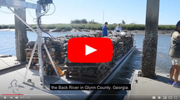
On May 29, R/V Gannet transited offshore to Gray’s Reef National Marine Sanctuary for a crew training and systems review day. The team participated in docking and undocking procedures, reviewed onboard emergency systems and navigation protocols, and assisted with drills and equipment handling. They conducted two man-overboard drills while opportunistically retrieving marine debris—two helium balloons found floating offshore. They also practiced deploying and retrieving a drop marker, which helped to better calibrate GPS accuracy and improve R/V Gannet’s systems. Additionally, they evaluated an alternate return transit route through Ossabaw Sound. Although this route took longer due to the no-wake zones, it was a smoother ride and more protected—valuable information for future planning in the event of unexpected weather deterioration. For more information, please contact the Gray’s Reef Vessel Operations Coordinator voc.grnms@noaa.gov.
Lieutenant Ring preparing to drop a diving drop marker on Captain Jason’s command. Photo by Alison Soss/NOAA
Alison Soss being very excited to go offshore and showing off our crew uniform. Photo by Alison Soss/NOAA
Captain Ward at the helm transitioning back from Gray’s Reef National Marine Sanctuary. Photo by Alison Soss/NOAA
Upcoming Events with Gray’s Reef
2025 Super Sanctuary Summer: June 10th – August 15th
In honor of World Oceans Week, we’re kicking off our Super Sanctuary Summer and extending our Discovery Center hours! Starting on June 10th, we’ll be opening our doors Tuesdays – Fridays from 10:00 a.m. – 4:00 p.m. to host FREE daily activities and events. Each week will feature a new theme with talks, workshops, craft sessions, and more! The Gray’s Reef Ocean Discovery Center is located at 340 MLK Jr Blvd. Savannah, GA. For a detailed schedule of these events, check out our website below.
Ocean Depths Artistic Heights: Deep Dive Exhibit: Now – August 4th
The Gray’s Reef Ocean Discovery Center welcomes local artists to be a part of our new rotating art exhibit, Ocean Depths Artistic Heights. Check out local artist Cat Ward’s exhibit, Deep Dive, which highlights her ocean inspired acrylic and sculpture series.
Sanctuary Advisory Council Meeting: July 10th
National marine sanctuary advisory councils are community-based advisory groups that provide advice and recommendations to the superintendents of the sanctuary sites on issues like management, science, community engagement, and stewardship. Members of the advisory council represent a broad cross-section of communities, industries, and stakeholders interested in and affected by the marine sanctuary. The Gray’s Reef Sanctuary Advisory Council will be meeting on July 10th at the Ocean Discovery Center. More information about hours and agenda will be posted on our website soon!
Southeast Regional Ecosystem Assessment: July 21st – August 3rd
The Gray’s Reef team will be embarking on the NOAA Ship Nancy Foster mission in July! This multidisciplinary mission will include underwater mapping, scientific dive surveys, and public outreach. The Nancy Foster will be docked on River Street, Savannah, GA on August 3rd, and opening its doors to the public! Join us to see this incredible vessel and learn about the important research that was conducted for this mission.
Morningstar Marina at Golden Isles, A CRUISERS NET SPONSOR, lies along the southern reaches of the Frederica River, between Lanier and St. Simons Islands, south of the charted 9 foot bridge.
St. Simons Island Overnight & Transient Dockage
Located on St. Simons Island, GA Morningstar Marina Golden Isles is right off the ICW Marker 675 with easy access to the ocean. The Frederica River provides no vertical obstructions, and we are a deep craft marina, making us a welcome stop for yachts and sailboats for overnight & transient dockage. Our Golden Isles location is home to highly trained dock masters who pair their extensive training and knowledge with superior service, delivering exceptional experiences that go beyond the norm. The overnight & transient dockage facilities for boats at Golden Isles have been designed to serve the specialized needs of today’s boaters offering 1,100 linear feet of transient dock with high-speed fuel pumps, in-slip pump out, free On Spot Wi-Fi, and 30/50/100-amp shore power service. Additional amenities include secure bathroom and shower facilities, laundry facilities, a fully stocked marina ship store, courtesy bicycles and vehicle, a swimming pool, with an onsite restaurant and coffee shop. Beyond the marina facilities, we are two miles away from St. Simons Island and the Golden Isles where you can enjoy the beaches, historic sites, golf, tennis, shopping, and amazing dining. Please submit a request by filling out the form below.


Be the first to comment!