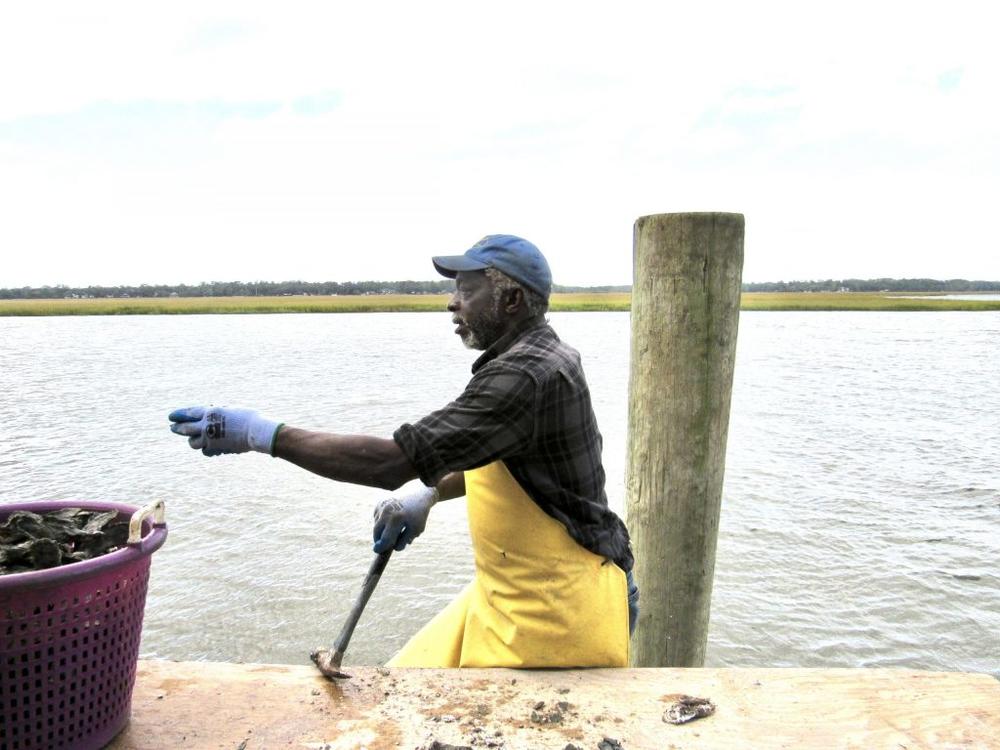
Join us for Virtual CoastFest 2020! 9/30-10/2, Georgia DNR
|
|
St Marys Inlet is the US military’s channel into Kings Bay Atomic Sub Station and is extremely well maintained.
![]() Coast Guard removes fishing vessel from St. Mary’s inlet, GA JACKSONVILLE-Fla.— The Coast Guard completed pollution mitigation and removal efforts for the fishing vessel Phuong Mai in St. Mary’s Inlet Georgia, Friday. The vessel posed a hazard to the marine environment and was an imminent threat to obstruct passage of the navigation channel. As the Federal On-Scene Coordinator, Coast Guard Sector Jacksonville federalized the response using the Oil Spill Liability Trust Fund. Over 500 gallons of oily water was pumped from the vessel, and contractors successfully removed the vessel and debris from the water. The Coast Guard rescued two adults after their fishing vessel ran aground on Thursday, August 20th on the north jetty in St Mary’s Inlet, Georgia. A Coast Guard Air Station Savannah MH-65 Dolphin helicopter crew arrived on scene and hoisted the two adults to safety with no reported injuries. The 40-foot fishing vessel encountered damage to their fiberglass hull and sank in approximately 20-feet of water. “The Coast Guard is responsible for safeguarding the American people, ensuring security in a complex maritime environment, and ensuring the economic prosperity of the region,” said Petty Officer First Class Justin Chartier, the Federal On-Scene Coordinator representative on the response “This was a unique response that included 6 out of 11 Coast Guard missions: Ports, Waterways, & Coastal Security, Search & Rescue, Living Marine Resources, Marine Safety, Defense Readiness, and Marine Environmental Protection. We are thankful to the multiple federal and state agencies that assisted on the response. With their help, we were able to quickly remove the vessel from the water, prevent the threat of pollution to the local area and eliminate a hazard to navigation in a port of national significance.” For more breaking news follow us on Twitter and Facebook. -USCG- |
AREA SPONSORING MARINA
Click Here To Open A Chart View Window, Zoomed To the Location of Fernandina Harbor Marina
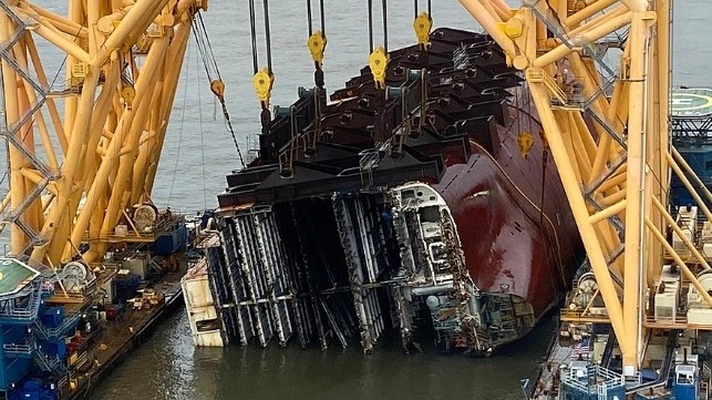
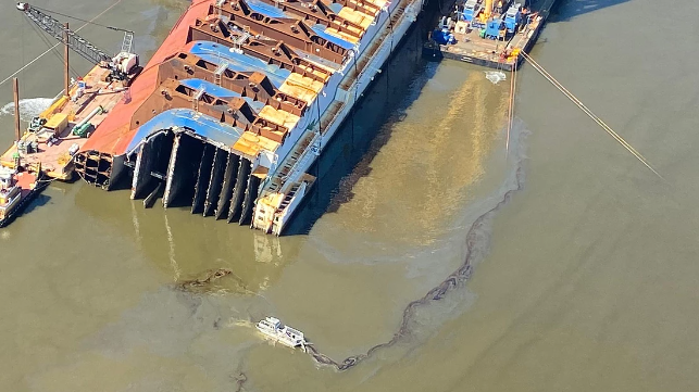
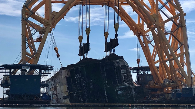
The wreck of the capsized PCTC Golden Ray may take more than a year to remove from St. Simons Sound, Georgia, the U.S. Coast Guard told local leaders recently.
Maritime Executive
7/27/20 Golden Ray Salvage Delayed Due to COVID-19 Outbreak, Weather Risk
Maritime Executive
7/9/20 Barge Crew at Golden Ray Site Tests Positive for COVID-19
Maritime Executive
3/4/20 Contractors Install Protective Barrier for Golden Ray Salvage
Maritime Executive
2/28/20 Overturned Cargo Ship Soon To Be Sliced Up And Removed From Georgia Sound
KPBS
2/27/20 Competing Golden Ray Salvors Face Court
Maritime Executive
2/3/20 Environmental Protection Barrier to be Built Around Golden Ray
Maritime Executive
12/13 Lightering of Fuel from Golden Ray Complete
11/23 Removal of Grounded PCTC Golden Ray Could Take One Year
Maritime Executive
|
This artificial reef is on the northwest shore of Jekyll Island, just east of the Waterway and north of the Waterway’s turn into Jekyll Creek. Advise staying well west of ICW lighted buoys 21 and 1.
GEORGIA – ST. SIMONS SOUND: Inshore Artificial Reef deployment
Georgia Department of Natural Resources (GADNR) intends to deploy 120 concrete oyster balls and 10 fish aggregating devices (FADs) at Henry Vassa Cate Reef. Oyster balls are prefabricated concrete structures that weigh 50 lbs each and FADs consist of a concrete base and PVC tines.The Henry Vassa Cate Inshore Artificial Reef site footprint (3.67 acres) is located along the northwest area of Jekyll Island, St. Simons Sound, Glynn County in the vicinity of 31-06-13.680N/81-25-30.660W (31°6.2280N / 081°25.5110W, 31.103800 / -81.425183) . Deployment dates are weather dependent and subject to change, but is anticipated to
occur between July 9 -16, 2020. (0°16.0000N / 2020°0.0000W, 0.266667 / -2020.000000) For further information, contact GADNR Habitat Unit, Cameron Brinton at (912) 280-6926 or cameron.brinton@dnr.ga.gov. Chart 11506 LNM 27/20
The passage of HB833 makes the GADNR Commissioner’s Anchorage Administration Order unnecessary and the Order has been rescinded effective July 1. More thanks to Save Georgia’s Anchorages.
The Commissioner has rescinded his AO from December.
Due to the importance of public safety, the annual BeachWeek events, typically scheduled for the week leading up to Independence Day, has been canceled.
|
This is good news for Waterway cruisers in Georgia. Our thanks to Kim Russo for this announcement posted on AGLCA’s Forum.
Minutes ago the Georgia State Senate passed legislation that will undo the disastrous anchoring regulations that took effect in that state on January 1st of this year. HB 833, sponsored by Georgia Representative (and Gold Looper!), Ron Stephens, passed the Georgia House on March 12th, but didn’t make it to the Senate floor for a vote before the General Assembly adjourned for COVID-19 quarantine. The lawmakers have returned, and the bill passed the Senate today by a vote of 48-1.
HB 833 takes back some of the widespread power the previous law afforded DNR to regulate anchoring. In short, HB 833 removes the ability to require permits for all overnight anchoring, removes the requirement to keep records of pump outs, and perhaps most importantly, removes the requirement that boats not anchor within 1,000 feet of water front structures and within 300 feet of marinas. Instead, the new law changes those set-back distances to 150-feet from waterfront structures, 300-feet from marinas, and 500-feet from commercial shellfish beds for short-term anchoring, which is defined as anchoring in the same place for up to 14 cumulative nights per calendar year. Long term anchoring (over 14 days in the same place) will require a permit.
The bill now requires a signature from the Governor, which is expected soon. Once signed, the new law takes effect immediately.
This is a big win for the boating community and a great example of what our membership can do with our collective advocacy efforts.
Kim Russo
Director
America’s Great Loop Cruisers’ Association
A big thanks to you two Wally and James.. huge thanks.
Thanks CN for all your support publicizing this issue.
Our thanks to Ted Arisaka of Save Georgia’s Anchorages for passing along this Facebook 5/28 post from Jayne Salvo Gorham. Turner Creek which intersects the Waterway south of Thunderbolt is a small low-traffic area with two small marinas allowing access to Wilmington Island and Savannah.
Well, today we ran afoul of Georgia’s new anchoring law. We went to anchor in Turner Creek near Thunderbolt and anchored in one of the spots recommended in the cruising guides near the town and marinas. We anchored well clear of any of the marinas but apparently one of the marina operators immediately made a call to the Georgia DNR to complain and an officer came out in her car and raised us on her bull horn. We talked to her on the telephone and she told us we were definitely not allowed to Anchor within 1000 feet of any dock of any kind which pretty much eliminates all of the creek. There was one spot way up the creek under the bridge where we could be a thousand feet away from anything and it turns out it was a relatively nice place after all.
Although the officer was very professional and polite, it is quite clear that Georgia is very hostile towards Cruisers who dare to Anchor in sight of their dock
We were planning to go ashore and spend some money in the town, but not anymore.
Jayne Salvo Gorham
One idea, would be to establish anchoring reciprocity agreements from state to state, like with so many other things. That way, if you lived in a state that prohibited anchoring, you could expect the same treatment, when you went somewhere else. Because, you know a lot of the people in Georgia who support these anchoring regulations, probably like anchoring in other states. They just don't want you to do it in their state.
If the poster's push pin locator is correctly placed, she was indeed in violation of the regulations. We just had our boat hauled at that marina / yard…Sail Harbor…with excellent results I might add…and her locator pin is right off the end of the Sail Harbor's docks. And the Creek is very narrow. The Aqua Map icon should be removed from that location. There is another anchoring icon a bit further up the creek toward the bridge where there is bigger water. Sorry she got flagged, but she should have been more courteous to Sail Harbor's facilities.
Hi Kent:
The marker shown on this cruisersnet post is not where they were anchored. I contacted the OP and she messaged me her GPS coordinates both before and after she was asked to move by the GA DNR. It appears they were in compliance with the 300ft setback required in "Marina Zones". My colleague, James Newsome, in our grassroots group "Save Georgia's Anchorages" contacted GA DNR and posted this positive outcome over on our facebook page.
[James H. Newsome] "As a follow up on this incident, I forwarded 2 charts to DNR along with a brief summary opinion of why we thought the DNR officer and marina owner were wrong.
"Assuming the boater's accounting of the incident is correct, and it certainly appears credible, we believe she was inaccurately advised by the DNR officer to abandon her anchored position. Additionally, the officer stated that the boater could not anchor within 1000' of any dock. This is not correct. The marina zone allows boaters to dock closer than 1000' but not within 300' of a marina."
Pictures of the chart by Ted Arisaka will be included in replies to this comment.
I discussed this situation with the Deputy Commissioner for GA DNR yesterday and he agrees with our assessment of the incident. He also commented that the officer has been contacted and the Commissoiner's AO, which established the setbacks, has been reviewed with her in an effort to prevent a future occurrence. He also said that the marina owner was contacted and informed that the boater was legally anchored and should not have been made to move.
Deputy Commission Rabon and I agreed that while a mistake was made it was encouraging that all parties involved were cordial and acted in a responsible manner. I acknowledged that our boating organizations are working to educate cruisers and advise them of the current situation with the anchoring laws in GA.
As a further update, we are hopeful that GA's HB833, legislation to replace HB201, will pass the Senate in the final phase of the General Assembly which will reconvene mid-June. DNR and our coalition of boating groups strongly support this legislation."
AICW Statute Mile 858.5 is not in Georgia:
Georgia’s New Anchoring Regulations Claim a Victim in Turner Creek, GA AICW Statute Mile 858.5
Editor: Jim is correct, it should read 585.5. My bad!
We took the opportunity in April 2020 to just skip the entire state of GA when coming south by going outside to Jacksonville from the last passable inlet in SC.
What is unfortunate is that the DNR Officer apparently only cited the 1000ft setback from structures requirement and seemingly not aware of the 300ft-1000ft "marina zones" that allow anchoring and take precedence. Our group Save Georgia's Anchorages intends to provide some feedback to the DNR on this matter. Thanks Cruisers'Net for broadcasting this story.
Our thanks to Bill King for confirming the success of last year’s dredging of this Problem Stretch, which, for the time being at least, seems not such a Problem Stretch.
BTW…on the north-bound transit, came through Hell Gate (GA) last week at dead low tide. I know it was dredged but I did not expect to see 9’-plus all the way through following the USACE survey route.
Bill King
Stuart, Florida
Click Here To View the Cruisers’ Net’s AICW Problem Stretches Listing For Hell Gate
Click Here To Open A Chart View Window, Zoomed To This AICW Problem Stretch
Went thru the Gate on 1/9/21 at low tide. Lowest observed depth was 7.6 ft.
Our thanks to Fred Braman for this excellent report and chart from Cumberland Island. Cumberland Island National Seashore is a National Park on the east shore of the Waterway’s passage through Cumberland Sound south of Jekyll Island. There are only dinghy docks on the island, which extends over 16 NM from St. Andrew Sound to the Georgia State Line. The Park’s website is https://www.nps.gov/cuis/index.htm. Anchorages may be restricted by Georgia legislation.
Just a note that may be of interest. I visited Cumberland Island last week. The island is as delightful as ever. Only open to private boaters who can get there. Dinghy docks are open at Sea Camp anchorage as are rest rooms and showers in the camping area. No ferries are operating and tour boats are prohibited. The Ranger Station is closed as are attractions like the Ice House Museum and Plum Orchard tours. But the beaches and trails are open, mostly why we go to this delightful place anyway. Happy to answer emailed questions at fredbraman@hotmail.com.
Here is a chart for the Cumberland Sea Camp anchorage. Note that on older chart packs and chart plotters (like mine), Red 34 is Red 40. This series of markers were renumbered years ago. As soon as you turn inside Red 34, look for a shoal marker to port heading in. It marks a sandbar that comes off the tip of the island to the north. Once you spot it, give it plenty of room to port and pick up the first dock complex on shore near a little white building. That’s Dungeness Dock. Head right for it and once near it, follow the shore up to Sea Camp. Don’t wander too far from Cumberland’s shore. There is a sandbar to the west of the main anchorage area. If it starts to get too shallow for comfort, turn towards the island where the deep water is. It sounds more complicated than it is. It’s really straight forward. Plenty of room for dozens of boats. I try to anchor a little to the north of Sea Camp Dock where it gets a little shallower. Depths in most places around 18 ft. Hope this helps.
Fred Braman
Photo by Sonny Reeves
Our thanks to Ted Arisaka of Save Georgia’s Anchorages for calling our attention to this article on anchoring restrictions in Georgia, a topic that dominated cruisers’ news in the fall. Enter “anchoring” in our Search Window for related discussions.
Anchorage Problems in Georgia
Charles J Doane, April 20, 2020
Sail Magazine
The Report Card is an important tool for planning restoration activities and conservation.
|
Cruisers Net joins Ted Arisaka of Save Georgia’s Anchorages in thanking you for your support of their efforts to correct the restrictions on anchorages in recent legislation. Keep your fingers crossed!
Your emails imploring Georgia legislators to support Rep Stephens HB833 have been successful. Today March 10, 2020, HB833 was voted on favorably in The Rules Committee and will proceed forward to the full House floor for vote Thursday.
Following an anticipated favorable disposition in The House, it will go to The Senate on legislative day 28, aka “Crossover Day”.
Ted Arisaka, Save Georgia’s Anchorages
Trade Only Today of Soundings joins the fray to highlight the very restrictive legislation recently enacted in Georgia. See Georgia Anchoring Advocacy Fund.
Don’t Drop Anchor in Georgia
Fighting the good fight for boating and boaters never ends.
BoatUS is leading a push against a new Georgia regulation restricting overnight anchoring within 1,000 feet of any structure, such as public and private docks, wharves, bridges, piers and pilings, except in areas near a marina.
How did boaters get hammered this way? There was little notice or engagement with recreational boating groups by the Georgia legislature in approving House Bill 201. It was then quietly signed by Gov. Brian Kemp.
The legislation directed the Georgia Department of Natural Resources to develop rules regarding the anchoring of vessels in estuarine areas of the state. DNR proposed a rule that has rightfully raised serious concerns in the boating community.
“This 1,000-foot offset needlessly eliminates anchorages all over the state,” says Chris Edmonston, vice president of government affairs for BoatUS. “It will affect numerous boaters, many of whom transit Georgia waters as part of the annual migration along the Intracoastal Waterway. There is no reasonable safety or waterway-management reason for taking such a significant swath of state waters away from the boating public.
“Boating and fishing,” Edmonston adds, “are the second largest outdoor recreational activity in Georgia, bringing in more than $500 million a year in economic activity. Eliminating scores of anchorages will put a severe damper on this very important economic driver to many coastal areas that gain from boater spending.”
He went on to acknowledge the so-called “Marina Zones” that will allow boaters to anchor as close as 300 feet to marinas or facilities that provide fuel, dinghy access, provisions, vessel maintenance or other services. But that won’t reduce the negative economic impact of this poorly crafted legislation and resulting rules.
Perhaps the most persuasive argument is the BoatUS position that the final rule runs counter to the Public Trust Doctrine as codified in Georgia law. It states:
“The State of Georgia, as sovereign, is trustee of the rights of the people of the state to use and enjoy all tidewaters which are capable of use for fishing, passage, navigation, commerce and transportation, pursuant to the common law public trust doctrine.”
BoatUS submits that anchoring is an integral part of navigation.
Georgia dealers, employees and boaters should join the efforts of the grassroots group Save Georgia’s Anchorages, which was created in response to the law.
BY NORM SCHULTZ
As poorly as Georgia maintains the ICW, this is just one more reason to bypass the state when traveling north/south. It's a shame as I have always loved anchoring in the marshes of Glynn, visiting Savannah, etc.
Instead, I will take my tourist dollars elsewhere. That will also impact marinas such as Thunderbolt, Isle of Hope, etc.
Too bad they are so short-sighted, all to coddle some wealthy interests.
"As poorly as GA maintains the ICW." Could you be a little more specific?
James Newsome…Areas like “Hells Gate” mm 600 , or “ The Little Mud River” to name a couple.
BoatUS is always supportive but certainly did not "lead" this effort.
To contribute to securing lobbying efforts on behalf of boaters, please open the link below. Cruisers Net joins America’s Great Loop Cruisers’ Association in urging you to get involved to repeal Georgia’s restrictive anchoring legislation.
Georgia Anchoring Advocacy Fund
To make a contribution, please visit www.greatloop.org/georgia.
Thanks!
-Kim
Kim Russo
Director
America’s Great Loop Cruisers’ Association
Our thanks to James H. Newsome for sharing this report on the work that Save Georgia’s Anchorages is doing on boaters’ behalf. See New Boating Laws. Cruisers Net urges you to contribute to the lobbying efforts of SAGA at the AGLCA link below.
IMPORTANT UPDATE ON GA ANCHORING ISSUE
February 25, 2020
Thanks to all who have supported our effort to establish the Georgia Anchoring Advocacy fund to retain Scott Draper, a professional lobbyist. We have reached 63% of our funding goal in a matter of days with your help. In less than a week Scott has come up to speed with the issues we have identified in HB201, Georgia’s anchoring law that took effect January 1st, 2020. He was able to broker a conference call with GA DNR Commissioner Mark Williams, his team and our anchoring coalition which we just conducted today, Feb 25, 2020.
Over the course of almost two hours, we had open dialogue on the problems DNR was trying to address with HB201 as well as some of the issues the cruising community had with its incarnation as law. All parties felt the call was productive and there is agreement in principle to refine Rep. Ron Stephens’ HB833 to best achieve our mutual objectives and to push the legislation through the current session in the next few weeks. HB833, if it passes, is expected to replace most parts of HB201.
We are not out of the woods yet, but Georgia policymakers appear to now be responsive to changing some of the most questionable facets of the laws passed last year, including restrictions for where vessels may anchor, the identity of cruising and transient vessels. Commissioner Williams is not willing to rescind the Administrative Order signed on December 30, 2019 that prevents boats from anchoring within 1,000 feet of structures throughout the coastal region of the state, until a legislative fix, HB833, is passed by the General Assembly.
We are optimistic about today’s progress and look forward to working with Commissioner Williams, with his support, on HB833. Your support is needed now more than ever to assist in the funding of lobbying efforts that have helped us achieve some degree of success in having Georgia DNR and lawmakers hear our collective voice. Our fight continues in the legislature in the days ahead.
Please join nearly 100 other boaters from across the country and around the world who have supported this effort. Contribute at www.greatloop.org/Georgia
James H Newsome
This staff report is on the FWC February agenda and includes details outlining restrictions on anchoring in Florida waters. These setback distances are pertinent in light of Georgia’s recent extreme setbacks.
MEMORANDUM
To: Florida Fish and Wildlife Conservation Commissioners
From: Colonel Curtis Brown, Director, Division of Law Enforcement
Date: February 20, 2020
Subject: Staff Report – Anchoring and Mooring Pilot Program/Derelict Vessel Report
Purpose:
Provide a report on the results of the 2009 Anchoring and Mooring Pilot Program and the status of the
Derelict Vessel removal efforts.
Why:
How vessels are stowed, parked, and moored in Florida waters is a topic of great public interest across
Florida and staff want to ensure Commissioners are kept apprised of current activities in this area and the
most recent information on Derelict Vessel removal efforts.
Top Points:
1. The 2009 Anchoring and Mooring Pilot program resulted in the capture of best practices in order to
recommend statewide changes to address issues legislatively.
2. Legislation was passed in 2017 as a direct result of a 242-page report sent to the Florida Legislature
and the Governor in January of 2017.
3. The status of FWC Derelict Vessel removal efforts is good, with the Grant Program receiving a
marked increase in participation after FWC grant rule changes went into effect on November 29, 2019.
Affected Parties:
The general boating public, local residents and waterfront property owners and many county and municipal
government partners responsible for derelict vessel removals within their jurisdiction
Summary:
The Anchoring and Mooring Pilot Program began as an effort to address growing conflicts between the
enjoyment of Florida’s waterways and the activities of anchoring and mooring upon state waters. This effort
began in 2006 when stakeholder concerns were brought to the Commission. Staff sought the advice of the
Florida Boating Advisory Council (BAC) in April 2007. The BAC suggested that the Commission seek
clarification from the Florida Legislature on the appropriate roles of local and state authority to regulate
vessels.
At the June 2007 Commission meeting, staff was directed move forward with requesting clarification from
the Florida Legislature as recommended by the BAC. Public input on anchoring and mooring issues was
collected through 6 public meetings throughout the state attended by 273 stakeholders and a number of
common concerns were identified. Further stakeholder engagement with over 700 additional stakeholders,
resulted in a final recommendation which was approved by the Commission at their December 2008
meeting. This recommendation was submitted to the Legislature during the 2009 Legislative session and as
a result s.327.4105, Florida Statutes (F.S.) was enacted establishing authority to conduct an Anchoring and
Mooring Pilot Program.
FWC was required to submit a report on the pilot program findings and recommendations to the Governor,
the President of the Senate, and the Speaker of the House of Representatives by January 1, 2014. The pilot
program and all ordinances adopted under the program would have expired on July 1, 2014; however, it was
reenacted and extended by the Legislature with a new expiration date of July 1, 2017, and a requirement for
an updated report to be submitted by January 1, 2017. The 2017 legislative session produced s. 327.4109
F.S., which regulated anchoring or mooring by:
• Establishing a 150-foot setback for anchoring around marinas, boat ramps, boat yards and other
vessel launching or loading facilities;
• Establishing a 300-foot setback from anchoring around any superyacht repair facility;
• Establishing a 100-foot setback from anchoring around the outward boundary of a marked public
mooring field. Anchoring within a public mooring field was prohibited outside of the established
exemptions within the statute.
• Prohibited tying to an unpermitted object attached to the water bottom (to prevent the proliferation
of unpermitted moorings statewide).
• Making all of these new violations noncriminal infractions punishable for a first offense, up to a
maximum of $50, for a second offense, up to a maximum of $100, and for a third or subsequent
offense, up to a maximum of $250, and included them in the list of mailable citations.
In addition, other legislative changes included the addition of the effective means of propulsion for safe
navigation test as a way to reduce the change of a vessel becoming derelict and increasing the penalty
section for expiration of vessel registration to require a mandatory court appearance and a $500 fine for
second and subsequent violations after 6 months. Local governments were also given authority to
implement a proof of pumpout ordinance for vessels at anchor in a public mooring field for a period of 10
consecutive days of more. This provision was contingent upon the availability of pumpout facilities within
the jurisdiction establishing the program. Finally, changes were made to the derelict vessel statute to allow
for actual notification of a derelict vessel in person as opposed to notification by certified mail and the
ability to freeze the title of a derelict vessel to prevent the sale of the vessel while in a derelict condition.
The update on Derelict Vessels will include an overview of the Grant program including the number of
Grant applications received, executed contracts, vessels scheduled to be removed and the amount of funding
obligated for removal.
Staff Recommendation:
No action is requested at this time, but input from Commissioners is welcomed.
Staff Contact and/or Presenter:
Major Robert Rowe, Section Leader, Division of Law Enforcement, Boating and Waterways Section
Our thanks to James Newsome and Ted Arisaka for sharing their mathematical musings on prohibited anchoring acreage contained in Georgia HB 201.
So my friend James Newsome (co founder of Facebook Group “Save Georgia’s Anchorages” https://www.facebook.com/groups/SaveGeorgiasAnchorages/ ) and I were ruminating about the impact of a single structure of a waterfront property owner now taking exclusive control of a huge swath of waterway and prohibiting anchoring.
We believe the structure now causes unreasonable obstruction to navigation and have started discussions with US Army Corps of Engineers as they have a role in administering the permitting process for these waterfront structures under PGP0083 – but that’s a topic for another day.
A semi circle defined by a radius of 1000ft off a waterfront property owner’s structure is 36 acres.
So how can we picture one acre? A football field is approximately 1.32 acres.
(Ref: https://www.stack.com/a/how-many-acres-is-a-football-field)
So 36 Acres / 1.32 Acres per football field = 27.3 football fields!
I’ve heard about unsportsman like conduct when one kid takes the bat and ball and goes home and ends the game for everyone. Looks like this time the one kid is taking the bat the ball and 27 football fields away to end the game for everyone.
For those of you interested in the math:
A semi circle with a 1000ft radius from a structure is equivalent to 36 acres.
Area of a circle = p r2 so 3.14 * (1000ft)2 = 3,140,000 square feet
1 acre = 43560 square feet
So the area of that semi circle = 3,140,000 sq ft / 43560 sq ft per acre / 2 = 36.0 Acres
A football field is approximately 1.32 acres.
(Ref: https://www.stack.com/a/how-many-acres-is-a-football-field)
36 Acres / 1.32 Acres per football field = 27.3 football fields
Be the first to comment!