ICW Caution Areas July 2019 by Tom Hale
Our thanks to Tom Hale of SAIL magazine for allowing Cruisers Net to reprint this report from his blog.
Click here for ICW Caution Areas July 2019
Our thanks to Tom Hale of SAIL magazine for allowing Cruisers Net to reprint this report from his blog.
Click here for ICW Caution Areas July 2019
The Coast Guard doing what they do so well. Kudos Coast Guard!

Coast Guard Station Pensacola responds to vessel on fire
Coast Guard Station Pensacola assisted Orange Beach Fire Department
 |  |
 |  |
  | |
Editors’ Note: Click on images to download high resolution version of photos, as well as to view video
NEW ORLEANS — The Coast Guard responded to a vessel that caught fire approximately 4 nautical miles south of Perdido Pass, Alabama, Saturday.
Watchstanders at Coast Guard Sector Mobile received a report at approximately 2 p.m. that the charter vessel Hoss Fly III was on fire off the coast of Perdido Pass.
All eight passengers aboard were transferred to a good Samaritan vessel. There were no injuries reported.
Sector watchstanders directed the launch of a 45-foot Response Boat-Medium crew from Coast Guard Station Pensacola to assist Orange County Fire Department in the response.
The crew arrived on scene at 2:30 p.m., and the fire was declared extinguished at 2:49 p.m.
The cause of the fire is under investigation.
-USCG-
Barefoot Marina, A CRUISERS NET SPONSOR!, is located on the western side of the AICW in North Myrtle Beach. AGLCA Forum members were asked for marina recommendations in Myrtle Beach and our thanks to Dan Merrill for his response. See also Praise for Myrtle Beach Yacht Club and Osprey Marina.
Another possibility is Barefoot Marina. Great staff, pool access, walking distance to barefoot landing ( currently being redeveloped). We really enjoyed our stay and plan to stay there again when we head back south for the winter months.
Dan Merrill
Click Here To View the Cruisers’ Net’s South Carolina Marina Directory Listing For Barefoot Marina
Click Here To Open A Chart View Window, Zoomed To the Location of Barefoot Marina

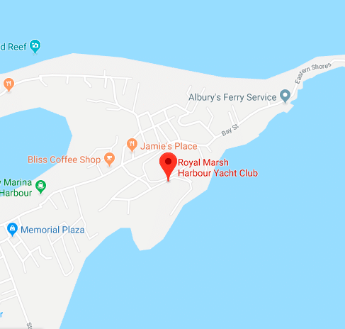
If you are headed for the Bahamas, don’t miss this invitation to link with the Royal Marsh Harbour Yacht Club, A CRUISERS NET SPONSOR!

The Club carries due to fantastic fresh blood. We’ll always remember 12 years of great companionship that continues stateside in the Stuart area
Great suggestions for boaters to help curb the enormous amount of plastics in our waterways.
3 Simple Ways to Reduce Plastic Waste and Pollution When Boating
From the BoatUS Foundation for Boating Safety and Clean Water
ANNAPOLIS, Md., July 24, 2019 — Each year, an estimated 18 billion pounds of plastic is dumped into our oceans from coastal regions. According to a study by the World Economic Forum, at the current rate of pollution, there will be more plastics than fish, by weight, in the ocean by 2050. To help reverse this trend, here are three tips from the nonprofit BoatUS Foundation for Boating Safety and Clean Water to help boaters reduce plastic waste and pollution while on the water.
Pack for the boat trip: Microplastics are very small pieces of plastic, less than 5mm in size, that are the result of larger plastic products partially decomposing from sunlight, heat and wave action. While we haven’t seen the full effects on humans consuming fish and other marine species contaminated with microplastics, studies show that ingested microplastics can seriously damage marine organisms. One of the simplest ways to reduce plastics aboard your boat is to fill up and carry aboard (or stash in a cooler) an insulated container that can hold enough cold water for the day instead of buying individual bottles. Invest in a set of non-breakable plates, cutlery, and food and drink containers to limit single-use plastics aboard. These efforts won’t break the bank, don’t take a lot of extra effort, and can pay big dividends for boaters and the environment in the long-term.
Get your crew involved: Before heading out, provide your crew with a pre-departure briefing and remind them not to put anything overboard. Boats are notoriously windy places, and popular, crowded summer anchorages are particularly prone to wind-driven pollution. When underway, secure possessions as well as any trash below deck or in a storage container. If anything is lost overboard, or if you come across plastic pollution such as a deflated birthday balloon, and conditions permit, it may be a good opportunity — and good practice — for the captain and crew to safely conduct a man-overboard drill to retrieve the item.
Recycle: If your family gets you a fishfinder, a pair of shiny, new boat fenders, or a new boat doodad for your birthday or other event, thank them profusely but unwrap the gift at home and recycle the gift’s packaging if possible. If your marina or boat club doesn’t have a recycling program for plastics and other recyclables, ask about starting one. Ensure all your boating guests know where recyclables go. When fishing, do your best to retrieve fishing line snags, and when respooling, recycle the old line instead of throwing it in the trash.
###
A CRUISERS NET SPONSOR, Myrtle Beach Yacht Club occupies the northerly banks of Coquina Harbor which cuts into the northern banks of the Waterway opposite marker #13. Our thanks to Lenny and Louise Anderson for permitting Cruisers Net to post their comments from AGLCA’s Forum. See Praise for more good words for Myrtle Beach Yacht Club from Forum.
MBYC gets our vote. Clean and well maintained through out. Great restaurant next door. Great dock staff. The entire staff was very kind and attentive when Lenny threw his back out of whack.
Lenny and Louise Anderson
Ranger 31 Tug
Click Here To Open A Chart View Window Zoomed To the Location of Myrtle Beach Yacht Club

The Gulfport Historical Society continues its educational activities for the City of Gulfport, which always has a full calendar of events for all ages and is home to Gulfport Municipal Marina, A CRUISERS NET SPONSOR, located on the northern shores of Boca Ciega Bay, easily accessible from the Western Florida ICW, just north of Tampa Bay.

Click here for We need you! Call for volunteers for GeckoBall and museum projects
Click Here To Open A Chart View Window, Zoomed To the Location of Gulfport Municipal Marina

Our thanks to Hubert Hopkins for permitting us to post his kind words from AGLCA’s Forum for two CRUISERS NET SPONSORS, Myrtle Beach Yacht Club on the northerly banks of Coquina Harbor and Osprey Marina at mile marker 373 on the ICW south of Myrtle Beach, SC.
There are so many nice, convenient marinas in the Myrtle Beach area. My three favorite are The Myrtle Beach Yacht Club which is in North Myrtle Beach. It’s a great marina, right on Hwy 17 and convenient to many things. To me it feels like a marina, not really a “Yacht Club”, very welcoming to transients and affordable. Next is Wacca Wacce, which you had a recommendation on. A third which is just a little North of Wacca Wacce is Osprey Marina. They are the nicest people and a quiet little marina. Not as convenient as the other two, but if you have a rental car would be just as good. No restaurant close by is the biggest drawback. There are also some high-end resort marinas around like Grand Dunes and Barefoot Yacht Club if you want. Have fun!
Hubert Hopkins
Click Here To Open A Chart View Window Zoomed To the Location of Myrtle Beach Yacht Club
Click Here To View the Cruisers Net South Carolina Marina Directory Listing For Osprey Marina
Click Here To Open A Chart View Window, Zoomed To the Location of Osprey Marina

Key Lime Sailing Club, A CRUISERS NET SPONSOR, always has very special offers for their visitors! Key Lime Sailing Club is on the Inside Route side of Key Largo. Key Lime Sailing Club is a unique slice of KEYS ENJOYMENT…give it a try and let us hear about your experience.
| |||||||||||||||||||||||||||||||||
Click Here To Open A Chart View Window, Zoomed To the Location of Key Lime Sailing Club
The proposed ordinance would require owners of boats anchored for more than seven days in a row in Jupiter to register with the town’s police.
Talking is over: Jupiter has a plan to address unsightly boats on its waters
Palm Beach Post
So how are they going to determine/know if I have anchored for 7 days.? Are they going to have a marine meter maid going around and placing a mark on my hull? Are they going to rely on word of mouth?
As so many of you have, Robert Waldrop and his wife are about to step off land and live on the water. If you have marinas that you can recommend as good liveaboard locations, let us hear from you.
My wife and I are in the process of downsizing to acquire a liveaboard boat and become part-time cruisers, living full-time on our boat. Part of this process entails searching for liveaboard marinas, as we don’t necessarily want to be on the hook all the time especially as my wife will still be working full or part-time (she’s an OR scrub tech). We’re currently in North Carolina and planning to relocate to the west coast of Florida, depending on her new job location. Any information for marinas allowing liveaboards in North Carolina, South Carolina, or the west coast of Florida up thru Alabama (NOT GEORGIA – after this anchoring regulation issue they won’t see ANY money of mine!) would be welcome.
Robert L Waldrop
Lots of places in Tampa Bay, Clearwater, Sarasota area. Here is a great place on the Manatee River
http://www.regattapointemarina.com/
We can only hope the FWC patrols can reduce the increase in manatee deaths caused by speeding vessels. The majority of manatee and human deaths on the water are caused by excessive speed.
| ||
|
The City of Clearwater, Florida, is in the beginning of a $15 million project that will see a complete makeover of its marina.
Click here for Clearwater Plans Marina Improvement Project by Mary Lou Jay of Marina Dock Age
Click Here To View the West Florida Cruisers Net Marina Directory Listing For Clearwater Municipal Marina
Click Here To Open A Chart View Window Zoomed To the Location of Clearwater Municipal
The issue of excessive speed and wake in this narrow, crowded portion of the Waterway has been an issue for several years, see 2017 AICW Speed Zone on public meetings held in Jupiter.
Click here for Calls to create no-wake zone in popular Jupiter waterway
WPEC
Our thanks to Waterway Editor, Ed Tillett, for permitting Cruisers Net to publish this article from Waterway Guide’s weekly newsletter.
Editor’s Note: This is part of an ongoing series of timely updates and insights on an issue critical to both cruisers and Georgia residents that is being researched and covered by Waterway Guide Editor-In-Chief, Ed Tillett. We will continue to keep readers informed via our news website, newsletter and on Facebook.
The public comment period has ended for some provisions of Georgia’s new laws related to anchoring and securing a permit to stay overnight on boats in its coastal waters. The state’s Department of Natural Resources (DNR) is tallying the results. What impact the comments, emails and phone calls to DNR will have on the state’s handling of this issue remains to be seen.
When House Bill 201 (HB201) was signed into law on May 7, 2020, resident and visiting boaters, and boating interest groups, realized that they had been left out of the conversation about problems the state was attempting to correct. By the time the legislature passed HB201 it was too late to adjust. Now there is focused interest on revising some of the provisions of the new law. Conversations are ongoing and meetings are being held to refine everyone’s understanding of the regulations. Regardless, the law is in effect and becomes enforceable on January 1, 2020.
This is a complicated issue to unravel due to the language and intent of HB201, what the law requires of DNR, and the history of how Georgia has defined and dealt with “live-aboard” vessels. From the analysis conducted by boating interests since the new law’s passage, there appears to be a misunderstanding on the state’s part of how extended and weekend cruising vessels should be classified, and what the state stands to lose if those boaters are reluctant to visit.
Georgia has one of the most scenic stretches of coastline in America. The Atlantic Intracoastal Waterway (AICW) that runs along the coast of Georgia is a marine highway used by thousands of vessels each year. An overarching concern by many marinas and coastal communities is that the new laws will discourage boating activity due to unreasonable oversight, additional costs and heightened enforcement aimed at residents and visitors.
Short of a dedicated and expensive survey, there are no substantive numbers available to define the economic impact of boaters who transit the state or visit their vessels for weekend pleasure or extended vacations. There are published estimates and overall figures associated with boating in the state from industry groups that may put into perspective the value of vessels on the water.
Whether boats will bypass Georgia on their way north or south due to concern or outrage over the new regulations remains to be seen. Weekend trips by residents and locals will be affected only by their reluctance to deal with new laws. Either way, the recent passage of the regulations has disappointed residents, visitors and business owners alike who were surprised by the state’s handling of what it says are too many derelict and abandoned vessels, and irresponsible full-time residents living on boats.
Extended cruisers and local residents who spend weeks throughout the year on their boats exploring America’s waterways value their lifestyle and independence. Georgia’s new laws will add another layer of requirements and oversight on to responsible boaters who will now be required to show no harm with several of the provisions. The cost of this action by the state may not be readily measured in economic terms, but the price of negative public relations appears to be mounting for Georgia.
View location on the Waterway Guide Explorer
I also contacted state official re: this law and how truly ridiculous it is. My new boat will be docked in SC and I am planning on numerous trips both north and south along the ICW. I anchor out but also use marinas so my expenses for slip fees, fuel, maintenance, entertainment/restaurants, etc. will now be spent in other locations.
I did take the time to comment, even receiving a reply from the "committee."
Upon reading the results of the vote and signing by the Governor ; I replied to the committee that I would avoid GA this year and just go outside, it's easier anyway.
I also will not be storing my boat for 6 months in New Brunswick Marina this coming year.
So, they will conservatively cost themselves at least $10,000 in storage fees and all the little items like maintenance work ..always multiple $K.
Counting our numerous stops along the way,marinas, fuel etc. Let's add another 3-5K and that's one boater.
Perfect example of government not understanding the problem and plowing ahead anyway.
Coquina Harbor is home to Myrtle Beach Yacht Club, A CRUISERS NET SPONSOR, occupying the northerly banks of Coquina Harbor; Coquina Harbor itself cuts into the northern banks of the Waterway, opposite marker #13. Our thanks to Bud Lloyd for this update.
The dredging has been completed in Coquina Harbor, South Carolina. Myrtle Beach Yacht Club is once again accepting transient boats and long term rentals. Our fuel dock is open with the best prices in the area. Top notch facilities; including air conditioned and spotless restrooms and showers, swimming pool, cookout area and a very friendly staff. Reservations are recommended.
Bud Lloyd
Click Here To Open A Chart View Window Zoomed To the Location of Myrtle Beach Yacht Club

This timely discussion and advice re hurricane holes comes from “Bahamas Chatter” on Explorer Chartbooks’ webpage, www.explorercharts.com. Hurricane season is here, so if you have hurricane hole locations/advice to add, please do so. Explorer Chartbooks is A CRUISERS NET SPONSOR!
Nassau/New Providence Hurrican Holes
Published August 26, 2015 | By Strider
Hello, first time cruising the Bahamas and I have Tropical Storm Erika threatening to upgrade to a Cat 1 hurricane and move towards New Providence. The Explorer Charts are great but don’t really point out or suggest any hurricane holes to set up in to wait the storm out. I am currently anchored off of Potter’s Cay, but don’t think that is the best bet. Thank you in advance for any help!
Posted in Cruising Information, Latest, Nassau/New Providence, Questions for Fellow Cruisers
2 Responses to Nassau/New Providence Hurrican Holes
monty says:
August 26, 2015 at 7:08 am
You might consider Palm Cay Marina, Hurricane Hole Marina, or Lyford Cay Marina.
denogail says:
August 26, 2015 at 7:31 am
Don’t forget Atlantis’¦yes, expensive, but you will have good peace of mind, and you can go on the giant slide, while you wait for the storm. Do not go into any marina that is exposed to the main harbor, such as Yacht Haven or Nassau Harbor Club, as the surge and wave action will destroy your boat on the dock. Get inside somewhere, and be ready to lengthen your dock likes if there is a surge in front of the storm. And, use all your dock lines, but save 2 in standby.
Those inside marinas will fill up in a hurry with local boats, so don’t wait to long, and make sure if it is a local boat, and they are next to you, that they don’t use the black polypro lobster line to tie up there boat with which they all use. That is what the two extra lines of yours are for’¦..good luck
DenO
Our thanks to Cruisers Net friend, Tom Hale, for his thoughts on surviving a hurricane on the southeast Waterway.
If you are in the Chesapeake Bay during hurricane season here are some places to hide from a storm. The later you can stay on the Chesapeake, the lower the chance you will be caught in a named storm in the low lying coastal areas of NC, SC and GA.
Osprey Marina in Myrtle beach is a good place, but it fills up very quickly. If you are planning to stay aboard there are many oxbow anchorages in the Waccamaw which may protect you. Brunswick GA has a good reputation, but fills up fast. If you are in GA and can get into the St. Johns River of FL you may find some protection, particularly in the oxbows above Palatka.
Tom Hale
Tadhana
Helmsman 38
There is a fixed bridge at Green Cove Springs 45 vertical, well before you get to Palatka and the oxbows on the St Johns. Good hurricane hole for those in Jax, but if you are in GA, your best bet is the marshes around St Marys, Savannah & Brunswick.
Questions and comments regarding anchoring legislation and evaluation of means of propulsion are certain to come up during the public comment periods. See Anchoring Restrictions and Draft Rule 5-B on the Agenda.

FWC to meet July 17-18 in Stuart
The Florida Fish and Wildlife Conservation Commission (FWC) will meet July 17-18 at the Hutchinson Island Marriott Beach Resort & Marina, 555 NE Ocean Blvd., Stuart, FL 34996. The meeting begins at 8:30 a.m. each day and is open to the public.
The FWC is committed to providing opportunity for public input. Time is allotted for public speakers at Commission meetings after each agenda item. Also, there is opportunity outside of Commission meetings to provide comment for many topics.
At the end of the meeting on the first day, July 17, the Commission will also provide time for public comment on subjects not on the agenda. Those who wish to offer comments during this period will be asked to make sure their comments are not related to any agenda item. The deadline for registration to speak on items not on the agenda is 2 p.m. on July 17.
As standard practice, public speaking is organized using the established speaker registration process and time limits. To accommodate as much input as possible from those attending, the Chairman reserves the right to designate the amount of time given to each topic and speaker, including time donation to other speakers.
For the full July 17-18 agenda and links to background reports, go to MyFWC.com/Commission and select “Commission Meetings.” Those who cannot attend can follow coverage at Twitter.com/MyFWC (@MyFWC) and sign up for news updates at MyFWC.com. Check the Florida Channel for possible live video coverage at TheFloridaChannel.org.
With the 2019 hurricane season underway, this is additional information for boaters navigating the waters of South Florida. This notice comes to us from our good friend, Specialist Erica Skolte, US Army Corp of Engineers.
![]()
For Immediate Release, August 26, 2018
Corps prepares for tropical activity; issues guidance to boaters & campers
With the possibility of tropical activity in south Florida in the coming days, the U.S. Army Corps of Engineers, Jacksonville District is preparing to respond as needed and providing information to boaters and campers on operational adjustments that will take place at navigation locks and recreation facilities.
The Jacksonville District activated its emergency operations center (EOC) at noon today (Aug. 26). This
action allows district staff to devote added attention to the response actions that might be necessary should a tropical cyclone or heavy rain develop.
“Our staff is coordinating with state and local officials,” said Candida Bronson, Acting Operations Division
Chief for Jacksonville District. “We will staff our EOC over the weekend, and dispatch liaison officers to the state EOC and other locations as appropriate.”
Jacksonville District is issuing the following guidance on its operations in south Florida:
• For boaters, the Corps plans to extend operating hours for its navigation locks when a storm is 72 hours out. The extended hours will remain in place until a storm is eight hours from landfall. To ensure safety of lock operators, the Corps will suspend operations when lightning is in the area, or when winds exceed 35 mph.
• For campers and visitors to recreation sites, Jacksonville District park rangers will monitor conditions at Corps’ campgrounds and recreation areas. If a county government issues an evacuation order for mobile homes or RV parks in an area where there is a Corps’ campground or recreational facility, rangers will order an evacuation of the facility and advise on shelter locations. Visitors should move all campers, motor homes, tents, vessels, and trailers from facilities under evacuation orders.
• Field staff will conduct pre-storm evaluation of the Herbert Hoover Dike surrounding Lake Okeechobee. Significant rain on the lake or in the Kissimmee basin to the north could cause a rapid rise in the lake over the coming weeks. The current lake stage is 14.67 feet. While no imminent threat of failure exists, the lake stage is in the upper end of the Corps’ preferred range of 12.5-15.5 feet.
More information on Jacksonville District response actions can be found at www.saj.usace.army.mil.


Be the first to comment!