Shared Photo – Sunrise at Great Bridge Bridge, Great Bridge , VA

Great Bridge Bridge – Now Open
Great Bridge Bridge – Now Open
Katrina Greenwood
Drifting sands/shoaling will change inlets and on the ICW, creating maps to be inaccurate.
Docks won’t have power. No pump out. Marinas may be closed completely. Stores may not open again and be stocked with supplies you need
Sally Grant Grave
I came down after Hugo and we had to go outside quite a bit. Difficult passage, but the places that had managed to open back up were so very grateful to see us!
Kathy Kelly Kennedy
Bridges on the ICW are already closed in SC. we are stuck in Myrtle Beach.
Clarkson Rollins
I always go outside at Beaufort NC. Plan it right seas decent and wind good for a broad reach. Then come in at Jacksonville St Augustine or Coco.
Roger Long
I just heard the head of the Katrina recovery task force say to expect everything east of interstate 95 in NC and SC to remain largely uninhabitable for at least weeks and possibly months. I’m trying to imagine ICW conditions 6 – 8 weeks from now and wondering where we will be. Wilmington at Thanksgiving was the plan but that looks subject to change. Bridges and inlets will be big problems. The swing bridge at Isle of Palms was blown off its mounts in Hugo and I can imagine places like Lockwood’s Folly and Shallotte being filled right in.
We moved our boat from Jarrett Bay to Spooners Creek Marina yesterday with no problems. We went slow but saw only a little debris in the water in the port turning basin in Morehead. All Nav aids seemed to be in the right place.
Power is quickly being restored in most places and people are helping their neighbors clean up. We aren’t New Orleans. Eastern NC is resilient and will be back in business soon.
Laura, you are not alone in your sentiments. I doubt if there is a single boater among our readers who has not felt exactly the same frustration at one or more of the old bascule and swing bridges along the Waterway, not just in North Carolina. In our navigation of the Ditch, we always tried to make bridge and lock schedules a game testing our on-water planning against tides and boat speed. We also became very adept at dropping the hook to wait for an opening when arriving early. We do not want to lose Laura as a Waterway cruiser, so, if you have suggestions for her that might make bridge schedules less stressful, let us hear from you!
And don’t forget that all bridge schedules are listed by state on our Homepage.
We have absolutely nothing against the State of NC, we love some of their cities and very dear friends abide in that state, but we do abhor their ridiculous ICW bridge restrictions. They open only on the hour and then we have to call to awaken the bridge tender to remind him it’s time to open. A few of these bridges are 4 miles apart so only the slowest sailboat would find that beneficial. Opening takes less than 5′ for traffic to stop, yet we wasted almost 2 hours of our day as well as fuel, just treading water awaiting the ‘appointed time’. There are lots of places we can spend our money, but it won’t be traversing NC’s ICW again.
Laura Lane Bender
Kindred Spirit III
Grand Banks 42 Cl
We always review the bridge schedules and set our speed to arrive close to scheduled openings. It’s not a big deal and simply good seamanship. We always call every bridge to let them know we wish to pass. They do not always assume every boat wants to go through and some keep track by name of all boats. Therefore, it’s not because they are sleeping. It’s because they don’t open at the appointed time if no one requests an opening. We’ve found nearly all bridge tenders to be professional, helpful and courteous. Mutual respect works both ways.
We feel very fortunate in our lives that we can boat at our leisure and thus we lack the sense of entitlement that causes some to think bridges should open at their sole convenience. There are thousands upon thousands of vehicles crossing those same bridges every day with people commuting, working, on emergencies, making deliveries and myriad other important and necessary things. That somehow recreational boaters should be the center of the bridge universe inciting a tantrum is self-centered.
Waiting a few minutes because I erred in my TSD calculation is a small price to pay for not occupying one of those thousands of vehicles on the bridge who need to be there.
I agree with Laura, the bridges in NC cause the most trouble on the trip from VA to FL. As noted, a few open on the hour only. Do not be late, even a minute in one place will have you waiting for the next opening. I have never had to remind one that it is time to open but sometimes you can tell that they are having a real bad day.
Our thanks to WPTV of West Palm Beach for this information
CLICK HERE FOR THE COMPLETE LIST OF ESSENTIAL SUPPLIES
Our thanks to Bill Parlatore for permitting Cruisers’ Net to post articles from his excellent blog, Following Seas.

Monday Minute – Where Do Old Boats Go?
I attended the annual boat auction in St Michaels, and wonder about the fate of old boats that no longer have a meaningful purpose.

After this tragedy, the Gulfport Historical Society can certainly use our help to keep their important educational and environmental work going, see https://cruisersnet.net/173192. See below for how to help. Gulfport Municipal Marina, A CRUISERS’ NET SPONSOR, and the City of Gulfport always have a full calendar of events for all ages. The marina and harbor, found on the northern shores of Boca Ciega Bay, are easily accessible from the Western Florida ICW, just north of Tampa Bay.

Click Image to Enlarge
What a day this has been.
This morning, we had a fire at the Gulfport History Museum.
Most importantly, no one was hurt. This is the thing we must bear in mind as we move forward. No. One. Was. Hurt.
It could have been far, far worse. The quick actions of the Gulfport — and St. Petersburg — fire department spared most of the building as well as paper records and photographs. They risked their lives to save our town’s history this morning — if they hadn’t been so quick to act, everything would be lost. As it stands now, it looks like our main historic losses are the historic Shuffleboard Club sign and the Gulfport Historic Register sign (we’ll know more after the investigation is complete and we can conduct a full assessment). These things are not replaceable, and their loss is real and tragic.
Thanks, too, to the Gulfport PD for being on hand, assisting and apprehending a suspect.
We also want to thank everyone who stopped by to tell investigators what they saw, extend their sympathy and join with us in our communal heartbreak. We also want to thank representatives from Gulfport Beach Bazaar and Stella’s, and councilfolk Paul Ray and Christine Anne Brown, who wanted to see how they could help — along with countless others we’re probably too addled to properly thank.
We were touched by all of your support, and also by the number of people asking how they could help. Thank you for the special trip you made to tell us you wanted to help; your kindness to us and reverence for our history touches us.
Finally, we want to thank the city staff who came in before 8 a.m. on their day off to help us with debris clearing and securing the museum. Your dedication to this community means more to us all than you will ever know.
We don’t know what lies ahead, but we’re still here. We’re just a little… charred… right now (here are some photos of what the inside of the museum looks like, and for those of you not in town, what damage the outside suffered).
We’re seeing a lot of talk on social media right now, about arson and who it might have been. Please remember the important things: no one was injured, the losses could have been far greater, and mental illness is a disease. It is our most sincere hope that if it was arson, whoever set the fire — for whatever reason — is able to get the help they need in a safe place. Our hearts break for them and what must be happening in their head.
While we can’t replace the historical items that were lost, we can take steps to further protect our records. Since Hurricane Irma swept through town almost one year ago exactly, we’ve had some big discussions on how to safeguard our town’s history.
What we know we need to do: We need to digitize all our photographs and records — which include historic maps, charts, property information, historic records of construction, property tax records, the Seabreeze and Gulfport Tribune… the list goes on and on. Quite frankly, it’s overwhelming to think about what needs to be done, in part because it’s beyond our immediate ability to do so.
There are, of course, services that can do this — Olive Software has met with us (along with the head of the library, David Mather) about digitizing the collection. They’ve done this for other local groups — take a look at how they’ve archived Dunedin’s records and made them searchable.
This is the most prudent course of action for the Gulfport Historical Society. It will keep our history preserved in perpetuity, safe from any act of nature (or person), and it makes it accessible to people not within striking distance of the physical museum. That means those of you who don’t live in Pinellas County would be able to look at all our records and pictures — and search them to find exactly what you wanted to find — anytime you wanted.
So what’s stopping us?
Excellent question.
Money. It’s all about money. To take the whole of our paper records and images, digitize them, give us a digital copy and maintain an online searchable database of Gulfport’s history is the best possible thing we, as a society entrusted with safeguarding the town’s history, could possibly do. However, the price tag is somewhere between $25,000 and $30,000.
Right.
We’d discussed hiring someone to do development to raise the money, but that’s not something to be taken lightly and the board hadn’t yet voted on this. So many people have asked us today, “What can I do?” it seems the best response we can give you is this:
Donate so we can afford to digitize our history. Insurance money will replace the porch. We can find great porch furniture somewhere (the last set was donated), and there’s nothing we can do to replace the two artifacts we lost today (and, again, how blessed were we to only lose two? Thank you so much, Gulfport and St. Pete firefighters), but we’ve now dodged two potentially devastating bullets: Hurricane Irma and the Labor Day Fire.
The third time, as they say, is the charm. That’s why we’re asking you to donate in case we aren’t lucky one more time. We don’t care if it’s $20,000 or 20¢; every penny helps.
Every. Penny. Helps.
You have trusted us with your history but we need your help to keep it truly safe. Please help preserve Gulfport’s history. Donate here.
We cannot do this without you.
I’m certain, in a week or two, our brilliant board will come up with donor gifts and rewards, but right now, tonight, it’s important we get your donation. It’s important we start to move forward on what we need to do — save Gulfport’s history for the future. This is why I’m asking you — without artifice, and without any glossy sales pitch — to please, please help us avoid losing everything.
Thank you for your support. As we say so often — and we mean it — we cannot do this without you.
Thank you, Gulfport.
Cathy
Cathy Salustri Loper, President, Gulfport Historical Society.
Copyright © 2018 Gulfport Historical Society, All rights reserved.
is is a new mailing list independent of the city. You may unsubscribe from this list at any time.
Our mailing address is:
Gulfport Historical Society
5301 28th Avenue South
Gulfport, FL 33707
Click Here To Open A Chart View Window, Zoomed To the Location of Gulfport Municipal Marina
Click Here To Open A Chart View Window, Zoomed To the Location of Gulfport Anchorage/Mooring Field
The deadline for comments has passed, but you may still register your thoughts and read your fellow boaters’ comments on this page.
![]()
August 9, 2018
Dear BoatUS Member:
The battle to protect your boat’s engine is not over. Right now, the Environmental Protection Agency (EPA) is asking for comments on the amount of ethanol that must be blended into the nation’s fuel supply for 2019. We urge you to Take Action now and tell the EPA to lower the amounts required to avoid harm to your boat’s engine.
Under the current proposal, boaters can expect to face higher-level ethanol fuel blends, such as E15 (15% ethanol), at more gas stations next year. The use of gas blends greater than E10 (10% ethanol) can cause significant damage to boat engines, and as a result can void boat engine warranties.
About the RFS:
The Renewable Fuel Standard (RFS) is the 2005 law that requires the blending of biofuels such as corn-ethanol into our gasoline. To meet this government mandate, in 2010 the EPA permitted E15 (fuel containing up to 15% ethanol) into the marketplace, but only for automobiles made in 2001 or after. The use of E15 in marine engines as well as snowmobiles, motorcycles, and small engines such as lawnmowers, chainsaws, and leaf blowers is prohibited. It has been proven that E15 will damage boat engines, making it vital that E10 and ethanol free gasoline is readily available.
The EPA recently published a report noting the significant potential for negative environmental impacts as a result of increased ethanol blends.
E15 and higher ethanol blended fuels can now be found in at least 29 states and sold at over 1,400 stations, often at the very same pumps as E10 gasoline. A single sticker on the pump mixed in with all the other labels is the only warning for E15 gasoline. This creates a dangerous potential for misfueling and puts boaters at risk of using fuel that will damage their engines and void their warranties.
Please take a few moments to urge the EPA to lower the ethanol mandates and ensure an adequate supply of fuel suitable for your boat is readily available. Take Action Now!
If you have any additional questions, contact BoatUS Government Affairs at GovtAffairs@BoatUS.com
Thank you for being a BoatUS Member!
David Kennedy
GovtAffairs@BoatUS.com
703-461-2878 x8363
Advocacy.BoatUS.com
Speak Up Now to Reduce the Chance of Putting Harmful E15 Fuel in Your Boat
Boaters need a safe supply of approved E10 and ethanol-free gasoline
WHAT: The battle to protect your boat’s engine is not over. Right now, the Environmental Protection Agency (EPA) is seeking public comments on the amount of ethanol that must be blended into the nation’s fuel supply for 2019 under the Renewable Fuel Standard (RFS). Boat Owners Association of The United States (BoatUS) is asking all boat owners to Take Action Now to have their voices heard.
WHY: E15 (15% ethanol) and higher-level ethanol fuel blends can now be found in at least 29 states and sold at over 1,400 stations, often at the very same pumps as E10 (10% ethanol) gasoline. Under the current EPA proposal, boaters can expect to see a greater volume of higher-level ethanol fuel blends dispensed at more gas stations, significantly increasing the chances for misfueling. Gasoline fuel blends greater than 10% ethanol are prohibited by federal law for use in recreational boat engines, will void many boat engine warranties, and can cause significant motor or fuel system damage.
Today, there is just a single, small warning sticker required on a fuel pump (among all the other pump labels) to prevent misfueling with E15. Combined with the EPA’s 2019 RFS proposal for more ethanol in the nation’s fuel supply, BoatUS believes these actions put boaters at greater risk of using fuel that could damage their boat’s engine and void the warrantee, and burden boat owners with expensive repair bills.
HOW: BoatUS asks recreational boaters to urge the EPA to lower the ethanol mandates. Take action now by clicking on: https://bit.ly/2vNZYB9
BACKGROUND: The RFS requires the blending of biofuels such as corn-ethanol into our gasoline. When it was passed in 2005, it assumed that America’s use of gasoline would continue to grow. Since then, however, gasoline usage has not increased as forecast, which today forces more ethanol into each gallon of gas. To meet this government mandate, in 2010 the EPA permitted E15 (fuel containing up to 15% ethanol) into the marketplace, but only for some vehicle engines. For more information, go to https://Advocacy.BoatUS.com.
I was under the impression that members of Congress were there to represent the people off the United States?
When is this going to commence?
Not only should we eliminate Ethanol in all gasoline, we should reduce the number of fuel blends that the energy companies have to create.
Get rid of all the political/EPA BS.
Eliminate ethanol completely. It’s something we don’t need. One of the other posts said feed folks with the corn. I’d add one thing to that, don’t try to feed the public on the BS that ethanol is helping the environment. Do away with it in all fuel now!!
Corn is for consumption not to be burned in combustion engines. Stop this foolish charade about protecting the environment. How about feeding the hungry in our country and around the world.
ethanol is and has been a boondoggle from the start . I have run tests in my car and found that the gas mileage goes up considerably when running non ethanol gas. You should try it yourself, you would be amazed at the difference. I agree, that the price difference between non ethanol gas and the ethanol junk makes it hard to justify, but if you are driving in certain areas of the country it makes sense.
I’ve had to have my Honda outboard as well as my chains saws and weed eaters reworked from ethanol fuel probleso many times it’s unreal. This crap is creating. Boat engine problems with all our Boat inboard engines that can’t be easily replaced. Please repeal this money grabbing waste of a fuel additive as few if any other country in the world is doing so.
You’d think there would be at least a few boaters in the EPA. If there are, they must be on the big diesel-powered yachts (without dinghies powered by gasoline outboards). Like many other problems we endure (i.e.health care, social security, etc), if members of congress were subject to the same rules and restrictions as ordinary citizens, none of these issues would exit.
The use of ethanol is dangerous to boaters, destroys marine engines, and actually consumes more energy in its production than it provides as a fuel. Thus its use is environmentally unsound. There has even been talk of adding it to diesel fuels which would render them as ecplosive as gasoline. Ethanol – a total sham in the name of environmentalism. Shame!
None
Zero is the correct amount.
Zero ethanol in marine and small engine fuel. Ethanol is costing boaters and anyone who uses seasonal small engines millions of dollars in needless repairs every year.
I agree!
Ethanol is destroying marine and small enough engines. Enough is enough.
Got one in…..
This junk in my fuel has cost me over $1,100 in carb repairs last year alone. Inefficient fuel and completely unnecessary with all the oil we have.
Using corn in this fashion has driven up the feed costs of livestock and made food prices higher than necessary.
Terrible program needs to go away!
I agree. I can’t even use my dinghy outboard. i have to row!
Editor’s note: Skipper, your email inbox is not responding. My emails to you have been returned. Larry
Hey Danny, I think that “form” was a re-post from a BoatUS submission. In any event, we appreciate your taking time to try to comment and for letting us know of the difficulty doing so.
Dumb form. Lost my whole comment when I didn’t fill it out just right.
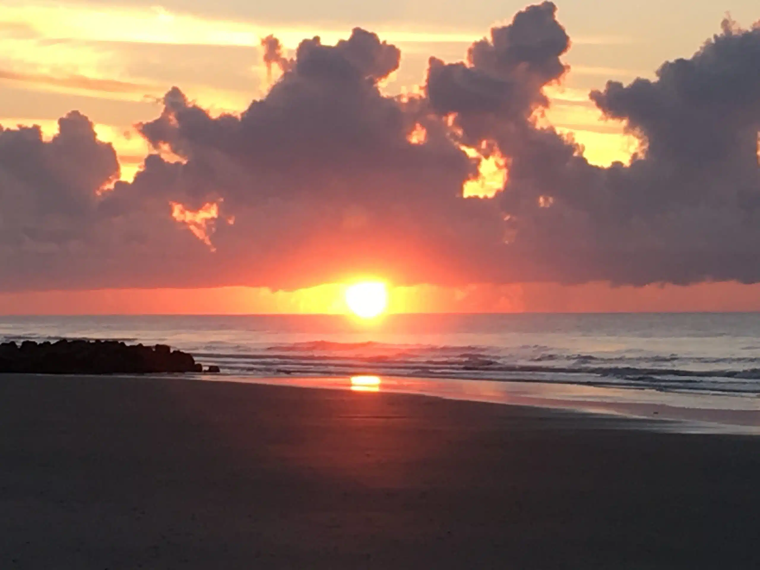
I don’t know about you, but at my age, I’ve enjoyed many sunsets and now I want to see more sunrises. So, fellow early risers, I’ll start us off with one taken recently at Folly Beach, SC.
Now it’s your turn, please send me your favorite sunrise photos!
Our thanks to BoatUS for this notice.
U.S. Coast Guard issues Marine Safety Alert on potential interference problem
ALEXANDRIA, Va., Aug. 30, 2018 – With their low battery draw, cooler operation and sturdy construction, LED lights have been popular with recreational boaters. The lights may also be causing poor VHF radio and Automatic Identification System (AIS) reception, according to a Marine Safety Alert issued by the U.S. Coast Guard on August 15. The BoatUS Foundation for Boating Safety and Clean Water is urging boat owners to follow the Coast Guard’s simple test procedures for LED interference and report any instances to the Coast Guard Navigation Center.
The alert, issued for informational purposes, outlines reports received from mariners concerning radio frequency interference caused by LED lamps that “were found to create potential safety hazards.” In some cases, the Coast Guard says, the interference may cause problems if mariners need to call for help. The interference can affect VHF voice communications as well as Digital Selective Calling (DSC) messages, and it may also affect AIS because they also use VHF radio. In particular, masthead LED navigation lights on sailboats may cause problems due to their close proximity to antennas.
The Coast Guard advises that it is possible to test for the presence of LED interference by using the following procedures:
Turn off LED light(s).
Tune the VHF radio to a quiet channel (for example, channel 13).
Adjust the VHF radio’s squelch control until the radio outputs audio noise.
Re-adjust the VHF radio’s squelch control until the audio noise is quiet, only slightly above the noise threshold.
Turn on the LED light(s).
If the radio now outputs audio noise, then the LED lights are causing interference and it is likely that both shipboard VHF marine radio and AIS reception are being degraded by LED lighting. Potential solutions include contacting an electronics repair facility to address the problem, changing the LED bulb to incandescent bulb or fixture, or increasing the separation between the LED light and antenna.
The Coast Guard also requests those experiencing this problem to report their experiences to the Coast Guard Navigation Center by selecting “Maritime Telecommunications” on the subject drop-down list, then briefly describing the make and model of LED lighting and radios affected, the distance from lighting to any antennas and radios affected, and any other information that may help them understand the scope of the problem.
If you’d like to learn more about VHF DSC radio or AIS operation, BoatUS Foundation has online courses and a free DSC VHF tutorial at BoatUS.org.
###
It’s a fascinating cruise of some 140 nautical miles from the St. Johns River’s inlet at Mayport, to the city of Sanford on Lake Monroe. And here, cruisers will discover Monroe Harbour Marina, a long-time, cruiser friendly spot!
The safest place I can think of is almost anywhere on the St. Johns river. Monroe Harbour marina is one that I like. It is located in Sanford, which is about 20 miles from Orlando.
Dick
M/V “Ladyhawke”
Click Here To Open A Chart View Window, Zoomed To the Location of Monroe Harbour Marina
Our thanks to Bill Parlatore for permitting Cruisers’ Net to post articles from his excellent blog, Following Seas.
A New Adventure – Round 2
Turning a fast chase boat into a cruiser is the next goal of world cruisers, Scott and Mary Flanders. They have found the right boat, trucked her to North Carolina, and in a few months begin the modifications necessary to create a highly competent pocket cruiser.
Longtime Cruisers Net contributor and lifetime cruiser, Sonny Reeves shares his observations on the many derelict and abandoned vessels along our waterways. Enter Reeves’ Report in our Homepage search window for more from Sonny.

Sunken vessel re-floated.
The Atlantic and Gulf Inter-coastal Waterway is a wonderful highway for the boater. The ICW means many things to many people. Freedom to explore and enjoy the wonders of our great country is a gift shared by many. Anchoring out, gunkholing, or mooring gives us a freedom to explore and maybe save a little cash at the end of the month. All this is being challenged by the powers that be, or land dwellers that have bought the few acres near your anchorage. Free docks are disappearing. Sometimes because of the abuses of a few.

Abandoned boat, Cocoa Beach FL
Many years ago I sailed into Boot Key Harbor. The water was dark, muddy looking. Boats were anchored and moored in no order. Elegant yachts near floating piles of junkyard gleanings. Structures built on pontoons, reclaimed hulks that at one time may have been boats now resembled dumpster diving art work. Reminded me of the movies “Waterworld and Mad Max” Some boats were moored tied together with tarps draped at every angle surrounded by dinks of many styles. Several sunken hulks were near shore. As we slowly motored through the obstacle course of boats and derelicts people came out and glared,

Shrimp boat on Jekyll beach before removal by CG
no one waved or greeted us, mangy dogs growled and barked. We left finding no comfortable place to anchor. Trash and sunken boats littered the shore and shallows. We anchored off Boot Key at the South end and dinked into Burdine’s. 30 years later the harbor is clean and organized, a few hold overs here and there to a life style some still embrace, that of the free spirit, beholden to no one, answering only to the wind. Only now the trash and trashy boats are not as profuse or evident on the water, the water while not clear is not as foreboding. Regular pumpouts and a decent place for docking to haul trash in and essentials out is available. Order of sorts prevails and you don’t quite feel like you are trespassing. Sure you have to pay, but other than being homeless and a burden to society where are you going to hang out. A visit to Tarpon Basin which has a small liv a board community shows that some can police themselves. A look around the mangroves shows a few boats that have found their way in the groves with derelicts tied off to the trees and others that don’t move. These are the problem. How are they pumped out? Where does their trash go? Do they have a way to motivate? Who owns the land they are on? If I can see them so can LEOs. No one will agree that laws will be relaxed and governments will give in to the few that insist on being a problem.
The point here is you as a liv aboard are either part of the solution or part of the problem. I observed many boats in derelict condition in our most recent trip down and back on the ICW. I have attached many references to derelict boats. There are thousands of pictures of these on a google search. I slowed to take a picture of a water craft I was sure was a derelict in Mosquito Lagoon . This boat was comprised of a homemade from scrap wood, a box sitting upon a hull from some kind of fishing boat. I discovered a family living aboard.
The bottom line here is that if we as boaters on the same water do not take action and hold our selves responsible then governments and people we do not know/or like will regulate and legislate our life. Sure! You can go down to the Keys or the Islands and drift away in some hidey hole anchorage. Pump out or throw overboard when no one is looking, dink in and throw your trash around, burn your trash on a beautiful beach, don’t pick up after your dog and generally tick off the people that have to come behind you and either clean up or put up with your crap. Then the next sailor has to deal with the new laws or rules you caused because you are too immature to take care of yourself. Just because you can does not make it right to pollute.
To solve the problem of abandoned and derelict boats the law will have to change and $$$ will have to be involved for salvage operators, independent boat seekers or bounty hunters for boats to have the incentive to track down near do wells that leave a hulk for others to dispose of. Almost every boat yard and marina has some nice shape to trashed boats left for storage or repairs that the owner can’t or won’t redeem. These can some times be had for a song or small amount but may require way more than they are worth to restore. As you can see from the pictures most of the hulks abandoned would not be worth the effort at this time under present Florida laws. If we as boaters don’t come up with an answer then some one in power will and we won’t like it.
I trust you will be a good steward of our shared resources, be a friend of all you meet on the water. I hope you are already doing the right things in your environmental responsibility. I know there some that choose to fly the flag of irresponsible, with no regard for any other person. We are watching, waiting for karma to find you.


Albemarle Loop
Our thanks to AGLCA friends, Karen and Lee McClellan and Artie Ortmann, for these good words for three of our North Carolina SPONSORS: Albemarle Plantation, Edenton and Elizabeth City. See Albemarle Loop.
Hi all,
I so agree with Janice! We did the Albemarle Loop in May and it was incredible. Our first stop was Albemarle Plantation, everyone was so so gracious and hospitable. You have access to all the amenities club restaurants, pool, laundry, tennis etc. Next we went to Edenton, a great historical town with good restaurants and shops. We visited the local coffee shop both mornings and met some of the movers/shakers of the town (retired guys); they were fun to talk to. The next stop was Elizabeth City: the Albemarle Bay Museum, great restaurants and, of course, the memorial to the famous “Rose Buddies”. It is so worth doing the Albemarle Loop, one of the highlights of our (AGLCA) loop. I do believe that 5’ drafts can be accommodated in all the Marinas we stayed in and certainly 15.5’ beams. It is so worth the time spent and only dockage cost is electricity. We highly recommend the trip to all loopers.
Karen and Lee McClellan
AGLCA Forum
2 boats one 50 and one 47 just completed the Albemarle loop and found no problems with 15+ beams and 4+ drafts great stops in Washington, edenton ( don’t miss vinyl night), Albemarle plantation and last year in Elizabeth city, ocracoce and manteo some of the best stops on the loop can’t wait to repeat some and Columbia don’t miss this side trip it is great and no problems.
Artie Ortmann
AGLCA Forum
Click Here To Open A Chart View Window, Zoomed To the Location of Albemarle Plantation Marina
Click Here To Open A Chart View Window Zoomed To the Location of Edenton Harbor (City Docks)
If you have navigated New Topsail Inlet recently, let Doug and us hear from you!
Have never used top sail inlet south of surf city. Do you have any information on the inlet?
Thanks
Love all the information on your site
Doug
Was exploring the channel this past week. Difficult Inlet to navigate thru. Several bouys are missing. Shoaling is rampant and the channel thru to the ICW is VERY hard to find and follow. I would not try this route with a fixed keel boat. Even at high tide, it’s risky.

Explorer Chartbooks, A CRUISERS’ NET PARTNER, has long been the standard navigational supplement for enjoyable, informative, and safe cruising through the beautiful Bahamian waters and island visits.
Bahamas Chatter: New dock at Lorraine’s Cafe, Black Point, Exuma
New dock at Lorraine’s Cafe, Black Point, Exuma
Posted: 21 Aug 2018 03:23 PM PDT
Our thanks to Bill Parlatore for permitting Cruisers’ Net to post articles from his excellent blog, Following Seas.
What is Life Beyond Boating?
At some point, we must think of the future. We are the luckiest generation as we enjoy a longer life span than our parents, generally have better health, and hopefully many active years ahead of us. How do we get there, by plan or by chance?
Our thanks to professional photographer, Colin Ruggiero, for sharing his work in the Bahamas.
The Blue Sanctuary One of the most magical places on the planet!
A short film about the trials and successes of the first marine protected area in the Americas. The Exuma Cays Land and Sea Park in the Bahamas is one of the most beautiful places on earth and is a model for marine conservation efforts everywhere.
Colin Ruggiero
Our thanks to Bill Parlatore for permitting Cruisers’ Net to post articles from his excellent blog, Following Seas.
![]()
Monday Minute – Get That Seating Right
Inspired from comments made from last week’s post, let’s discuss helm seat options. There is no one solution for comfortable and safe seating at the helm on all boats. It is something designers and builders used to ignore. Today it gets the attention it deserves. Notice the helm seating when you go to the upcoming boat shows. And can you get around it once it is in position?
Especially with the current red tide threat to manatees in the Gulf, reported sightings are even more important. How to report sightings is listed below.
See a manatee? Report it.
WEARTV.com
Sighting reports help monitor manatee health in the northern Gulf of Mexico
AL.com (blog)
Manatee sightings can be reported to the DISL/MSN team 24 hours a day, 7 days a week by phone 1-866-493-5803, email manatee@disl.org, or through an online sighting form found at manatee.disl.org.
Manatees migrating from Florida to Gulf Coast
KPRC Click2Houston
Give welcome to a new addition to the cruiser’s library, The ICW – Waterway to Adventure, a Practical Guide for Preparation and Traveling the Intracoastal Waterway, By James and Joyce Ebmeyer.
First of all this is an actual book, not a blog, so you can grab it off the shelf any time and take it anywhere you choose. James and Joyce deliver exactly what the title promises: a practical, well-written manual in an unassuming style with no “old salt” jargon or opinion. The advice is especially valid for vessel owners planning to close their homes and live aboard for a length of time. Although there are loads of photos and very good advice about being underway, the guide is not a chart book or navigation guide to the Intracoastal, so don’t expect charts. You will get attention to the many details required to lock your house door, move aboard your vessel and cast off for the adventure of a lifetime. It is a bargain at $16.00.
Larry Dorminy, Cruisers’ Net Senior Editor
(Cruisers’ Net is not commercially associated with the authors in anyway.)
CLICK HERE FOR THE AUTHORS’ SYNOPSIS, TABLE OF CONTENTS AND ORDERING INFORMATION.


Be the first to comment!