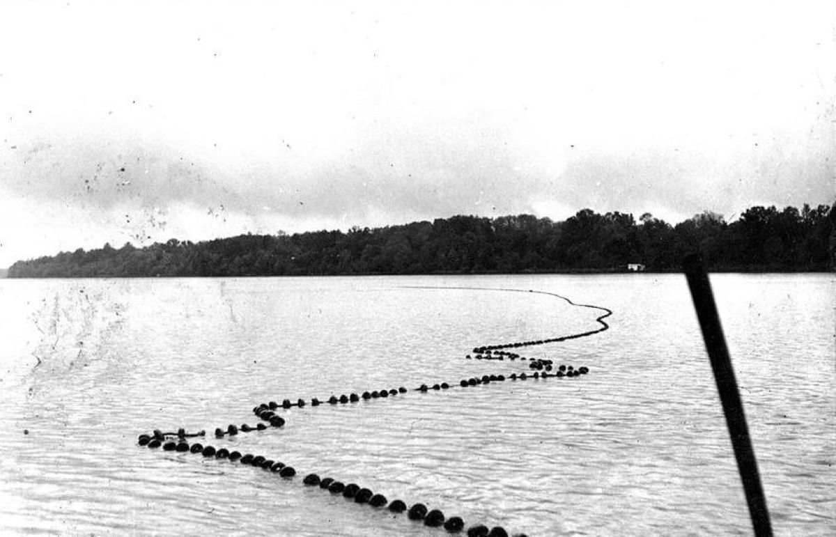
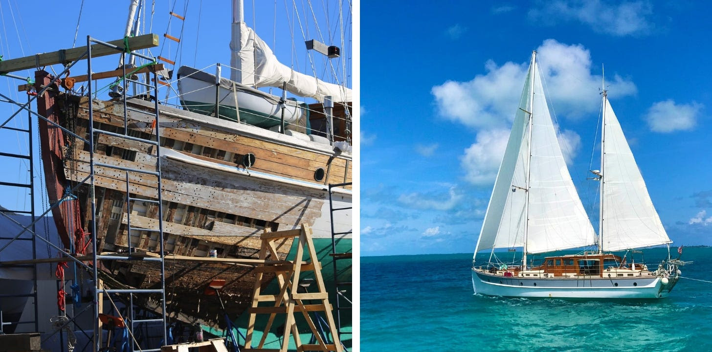
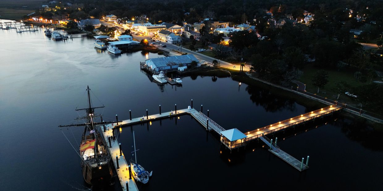
Behind NC coast’s range lights, buoy depots, gas works – David Cecelski
Click here for Behind NC coast’s range lights, buoy depots, gas works
CoastalReview.org
Click here for Behind NC coast’s range lights, buoy depots, gas works
CoastalReview.org
Cruisers Net publishes Loose Cannon articles with Captain Swanson’s permission in hopes mariners with salt water in their veins will subscribe.. $7 a month or $56 for the year and you may cancel at anytime.
![]() |
When all else fails, try journalism.
Reprinted with permission from The Conversation.
When people think about the risks of climate change, the idea of abrupt changes is pretty scary. Movies like “The Day After Tomorrow” feed that fear, with visions of unimaginable storms and populations fleeing to escape rapidly changing temperatures.
While Hollywood clearly takes liberties with the speed and magnitude of disasters, several recent studies have raised real-world alarms that a crucial ocean current that circulates heat to northern countries might shut down this century, with potentially disastrous consequences.
That scenario has happened in the past, most recently more than 16,000 years ago. However, it relies on Greenland shedding a lot of ice into the ocean.
Our new research, published in the journal Science, suggests that while Greenland is indeed losing huge and worrisome volumes of ice right now, that might not continue for long enough to shut down the current on its own. A closer look at evidence from the past shows why.
The Atlantic current system distributes heat and nutrients on a global scale, much like the human circulatory system distributes heat and nutrients around the body.
Warm water from the tropics circulates northward along the U.S. Atlantic coast before crossing the Atlantic. As some of the warm water evaporates and the surface water cools, it becomes saltier and denser. Denser water sinks, and this colder, denser water circulates back south at depth. The variations in heat and salinity fuel the pumping heart of the system.
If the Atlantic circulation system weakened, it could lead to a world of climate chaos.
![]() |
Ice sheets are made of fresh water, so the rapid release of icebergs into the Atlantic Ocean can lower the ocean’s salinity and slow the pumping heart. If the surface water is no longer able to sink deep and the circulation collapses, dramatic cooling would likely occur across Europe and North America. Both the Amazon rain forest and Africa’s Sahel region would become dryer, and Antarctica’s warming and melting would accelerate, all in a matter of years to decades.
Today, the Greenland ice sheet is melting rapidly, and some scientists worry that the Atlantic current system may be headed for a climate tipping point this century. But is that worry warranted?
To answer that, we need to look back in time.
In the 1980s, a junior scientist named Hartmut Heinrich and his colleagues extracted a series of deep-sea sediment cores from the ocean floor to study whether nuclear waste could be safely buried in the deep North Atlantic.
Sediment cores contain a history of everything that accumulated on that part of the ocean floor over hundreds of thousands of years. Heinrich found several layers with lots of mineral grains and rock fragments from land.
The sediment grains were too large to have been carried to the middle of the ocean by the wind or ocean currents alone. Heinrich realized they must have been brought there by icebergs, which had picked up the rock and mineral when the icebergs were still part of glaciers on land.
The layers with the most rock and mineral debris, from a time when the icebergs must have come out in force, coincided with severe weakening of the Atlantic current system. Those periods are now known as Heinrich events.
As paleoclimate scientists, we use natural records such as sediment cores to understand the past. By measuring uranium isotopes in the sediments, we were able to determine the deposition rate of sediments dropped by icebergs. The amount of debris allowed us to estimate how much fresh water those icebergs added to the ocean and compare it with today to assess whether history might repeat itself in the near future.
So, is the Atlantic current system headed for a climate tipping point because of Greenland melting? We think it’s unlikely in the coming decades.
While Greenland is losing huge volumes of ice right now – worryingly comparable to a midrange Heinrich event – the ice loss will likely not continue for long enough to shut down the current on its own.
Icebergs are much more effective at disrupting the current than meltwater from land, in part because icebergs can carry fresh water directly out to the locations where the current sinks. Future warming, however, will force the Greenland ice sheet to recede away from the coast too soon to deliver enough fresh water by iceberg.
![]() |
The strength of the Atlantic Meridional Overturning Circulation, or AMOC, is projected to decline 24% to 39% by 2100. By then, Greenland’s iceberg formation will be closer to the weakest Heinrich events of the past. Heinrich events, in contrast, lasted 200 years or so.
Instead of icebergs, meltwater pouring into the Atlantic at the island’s edge is projected to become the leading cause of Greenland’s thinning. Meltwater still sends fresh water into the ocean, but it mixes with seawater and tends to move along the coast rather than directly freshening the open ocean as drifting icebergs do.
The future trajectory of the Atlantic current system will likely be determined by a combination of the decelerating but more effective icebergs and the accelerating but less influential surface runoff. That will be compounded by rising ocean surface temperatures that could further slow the current.
So, the Earth’s pumping heart could still be at risk, but history suggests that the risk is not as imminent as some people fear.
In “The Day After Tomorrow,” a slowdown of the Atlantic current system froze New York City. Based on our research, we may take some comfort in knowing that such a scenario is unlikely in our lifetimes. Nevertheless, robust efforts to stop climate change remain necessary to ensure the protection of future generations.
LOOSE CANNON is a reader-supported publication. To receive new posts and support the work, become a free subscriber. If you’ve been reading our stories for a while, consider uprgrading to paid.
Our sincerest thanks to Greg and Barbara Allard for once again sharing their thoughts and beautiful photography from their Bahamas cruises. These photos and descriptions will have you aching to follow in Meander‘s wake! For more of this excellent photography, type Allard in our Homepage search window for letters from previous cruises.
Ephasia, a Haitian girl, who lives in the ghetto on Russell Island. We picked her up in our golf cart as she was walking four miles to work on a brutally hot day. She works at Wreckers restaurant, at our marina. Spoke almost no English.
![]() |
Thank you very much for your interest and your loyalty. Enjoy the latest from Steadfast!
Share SPARRING WITH MOTHER NATURE
|
|
Long ago, on the North Rim of the Grand Canyon in Arizona (far from my current environment) I watched the mid-day, late November sky darken and was unabashed until I glanced at my companion. Every strand of his straight blonde hair was completely on end, forming a perfect, unearthly orb as he gazed over the abyss, oblivious. That was the first time I felt that kind of power, and while I remember it with awe, we simply sprinted to the Jeep and observed, safely nestled amongst trees and crags on our rubber tires, snapping photos, listening to the thunder, laughing at the lashing, knowing that, however untimely, rain brings precious life to the desert.
Last night on the Chesapeake Bay, out of the corner of my eye I saw the lightning strike, stark white against the blackness of a cloud-covered sky and a moon not yet risen. I turned in that direction and saw a second strike, just north of the first, and felt a sudden temperature drop. The wind shifted and rapidly built. We were docked; no running from this one.
We had hosted a dinner guest and consciously checked the radar to see if we were within Mother Nature’s path of powerful storms that rocked the Midwest last Holiday Weekend. “Fireworks?’ he asked as he climbed down the boarding ladder. He must have sensed the energy, too, or gotten just a glimpse. “No,” I had replied, peering thoughtfully at the sky, but, as I considered those unexpected flashes it dawned on me that lightning is the original, true fire work of our planet, having made a significant contribution to creating life in most scientific theories, if not in the theological ones.
Exponentially more powerful than the Fourth of July celebrations which sometimes reverberate into your very bones, lightning strikes are a surreal release of pent-up energy. Weather.gov tells us that a typical lightning flash contains 300 million volts and 30,000 AMPS. For comparison, household current is 120 Volts and 15 AMPS, and that small amount is strong enough to be fatal if it flows through the (very) conductive human body. A sailing vessel is generally the tallest thing on the water and as a rule lightning is attracted to the closest available point of contact. There you have it. Lightning makes us nervous.
Is it the vulnerability? The outright danger of it? Perhaps it is both. Feeling vulnerable certainly ties closely into our inherent lack of control in regard to Mother Nature and the weather. People often ask if we have encountered big storms, and we have. Here is a recent story about waves and wind: (OVER AND OVER AND OVER ) It’s the lightning, though, that is frightening in its unpredictability. And stunningly beautiful. I become mesmerized as I watch where the last strike was and to see what the next one might bring, only to spot one in a direction I wouldn’t have anticipated.
The majority of the time we won’t be able to outrun, won’t be able to avoid these squalls. They change direction and like tiny little hurricanes the wind on one side blows in the opposite direction of the wind on the other side, so as it passes you have to once again adjust, joust, spar, maneuver, second guess and hope.
Last year, on a northerly course off the coast of Florida, destination Fernandina Beach, we sparred one night, slicing through the narrow space between two rapidly-building, fast-moving cells that joined just behind our transom as we sailed to victory on that run, adrenaline pumping long after we dropped anchor and crept into the shelter of our bed. We’ve seen storms come across the water at astonishing speeds, leaving no chance to even joust before the first whirling gust is upon us. At night you watch the strikes, far off, and hope they don’t change direction but they can, and they do. We receive forecasts from Marine Weather Center (MWXC.com) as a subscription service. While they always warn of the big weather systems, it is the squalls that come with the highest risk, the least consistency, and the most power. I think it is safe to say that weather is an inexact science; no matter how good the forecaster, they can certainly be wrong, just like the rest of us.
When we first moved aboard this ketch-rigged sailing yacht a friend inquired, “Do you have lightning rods?” I replied, “Yes, we do have lightning rods.” After hanging up the phone on that call, I looked at my grew-up-on-the-water husband and chuckled a bit awkwardly. “Yes,” he said to me. “We definitely have two giant lighting rods. One is 65 feet and one is 50 feet.”
![]() |
A ketch rig is when the main mast is taller than the aft, or mizzen mast. While it may look like lightning rods up there, those are actually VHF antennae.
So, you might ask, is there anything available to deter this particular aspect of Mother Nature’s tendencies? To put yourself at an advantage as you spar out on the open ocean? There are methods and theories going back to the King of Lightning Benjamin Franklin in the 1800’s. These days, Lightning Dissipators are designed to create a negative ion field around the mast, depending on installation. A negative ion controversially creates a ground and more damage can occur with these systems than with nothing at all, according to a veteran Marine Surveyor and investigator of innumerable lightning strike incidents (full disclosure also my husband Steve Uhthoff). For a much more in-depth examination of this topic, please see this LOOSE CANNON. We take the risks with the rewards.
The first winter we explored the Outislands of the Bahamas (Rum Cay, Conception and beyond) we ran low on fresh water. STEADFAST is designed (thank you Dmitri!) with a fresh water collection system on the roof of her pilot house. During a heavy rain shower it’s impressive how much water can fall from the sky, and without a desalination machine, life on the sea is just like life on the high desert. On a calm passage we encountered a slow-moving thunderhead with what looked like lots of life-saving rain. Full of bright ideas and always up for a challenge, we wiped the salt off the surfaces, unburied and hooked up the extensive network of hoses for the collection system, fired up the Detroit Diesel and headed into what was hopefully a rain shower and not a passing storm cell.
The first spar was so close!! We felt some sprinkles but were outmaneuvered in the end, bone dry and miles off our original course. We had no real destination in mind, no schedule, and were not yet defeated. Soon enough we spotted our next target, seemingly not far away, and in a better direction; we utilized both sails and engine only to watch the dark mass pull away from us once again as we heard the rumble of thunder, saw the fireworks within. Mother Nature was simply sending us a reminder that it’s us that moves slowly. Very slowly. We can’t catch and we can’t run.
We found an anchorage that sheltered us from the wind but not the deluge. Unseen, unpredicted and unheard, the downpour hit us late that very night, the rain collection equipment was stored away, the hatches open, the laundry hung out to dry. The Heavens opened once again, this time right onto the bed. The irony struck me full-on as we bolted on deck stark-naked to shut what needed to be shut and then towel off, laughing, knowing I should have just grabbed the soap…
We learned our lesson and never chased another storm. SPARRING WITH MOTHER NATURE on her terms and winning is elusive enough.
![]() |
I call these “Holes to Heaven” when the sun’s rays find their way through the clouds, this time in Abaco, Bahamas. It does not make the impending storms less threatening, just more photogenic!
I truly appreciate that you read this story; I have many more to tell you!
Please click the little heart wherever you find it and that send this tale to others like you who may enjoy vivid non-fiction with the ability to make you feel like you were there.
THANK YOU AGAIN FOR JOINING US ABOARD Steadfast !
© 2024 Janice Anne Wheeler
548 Market Street PMB 72296, San Francisco, CA 94104
Cape Lookout Bight is a wonderful, natural harbor formed by Cape Lookout’s curve of land. This superb anchorage, one of the most popular in North Carolina, The channel between Harkers Island and Cape Lookout Lighthouse has been widened to 100 feet with depths ranging from 7 to 9 feet. This is good news for cruisers wishing to anchor in Cape Lookout Bight southeast of Beaufort.
Click here for Cape Lookout dredging, beach nourishment work complete
Read more at Coastal Review, coastalreview.org.
Click Here To Open A Chart View Window Zoomed To the Location of Cape Lookout Bight
Lat/Lon: 34 37.395 North/076 32.931 West
Click here for As temperatures rise, stay away from algal blooms
CoastalReview.org
Recent fires are making some boat owners wonder if replacing their batteries with lithiums is worth the risk.
Click here for Lithium Batteries: Are They Safe?
Mike Smith
|
Our sincerest thanks to Greg and Barbara Allard for once again sharing their thoughts and beautiful photography from their Bahamas cruises. These photos and descriptions will have you aching to follow in Meander‘s wake! For more of this excellent photography, type Allard in our Homepage search window for letters from previous cruises.
Hello everyone – After our 2022 cruise to the
Bahamas, we decided to downsize a bit; a smaller
boat would make it easier to find transient space in
marinas as we cruise, and a newer, smaller boat
would also lessen some of the maintenance. Our
existing boat was a 34 year old 65’ Tollycraft, one of
the best boats we have ever owned. She sold very
quickly, and then our search began. We did not find a
replacement until early summer of 2023, so we
missed the opportunity to visit the Bahamas last year.
We have a number of new readers who have just
joined us in receiving this letter, so we hope that those
of you who have been regulars will understand that
we will cover some of the basics.
This is the new Meander: she is a 47’ Grand Banks.
For those familiar with boats who recognize the
Grand Banks name, the company has built thousands
of boats over the years; for a long time their boats
were displacement boats, meaning that they cruised
at about 7-9 knots, or approximately 10 mph. Grand
Banks then hired the noted naval architectural firm of
Sparkman and Stephens to redesign the hull, allowing
it to achieve higher speeds – and to plane – which
means instead of pushing through waster, the boat
would rise up and ride on top of the the water.
The Grand Banks we found is a 2009 model, with twin
500HP Cummins diesel engines. She has bow and
stern thrusters, a fly-bridge, stabilizers, a generator,
and a watermaker – for making drinkable fresh water
from salt water – important in the Bahamas. During sea
trials, she topped out at 24 knots, or a bit over 27
mph. She will also cruise comfortably at 9 knots, at
significant savings in fuel costs. We’ll mostly cruise at
a slower speed, especially with diesel fuel in the
Bahamas over $6.00 a gallon.
The new Meander – a 47’ Grand Banks Heritage EU.
We departed for Bahama this year from the east coast
of Florida, around the N.Palm Beach area. The
crossing to our first stop in the Bahamas (Port
Lucaya) is around 78 nautical miles. It takes the
better part of a day to make this open ocean passage,
and if you don’t watch the weather carefully, it can be
a nasty, rough passage. This year there were weather
fronts continually, bringing high winds, so we had to
wait about 2 weeks for a decent weather-window. We
made the first two thirds of the crossing at a leisurely
8-9 knots, but for the last portion we “opened her up”
and ran at 16-17 knots, as shown above. Quite an
exhilarating run, especially since at this speed the
engines drank 40 gallons per hour. Since we had a
second day of calm weather, we departed Port
Lucaya the next morning to make a second long
crossing to the Berry Islands.
A view off the stern of our boat, on the trip from
Lucaya. During such an open water ocean crossing,
you have to continually contend with huge ships;
avoiding them is important. This one was headed
right towards us, but then changed course to pass to
our stern, He was correctly following the international
rule for such situations, since we were crossing in
front of him from his starboard (right) side.
Regardless of the “rules” we always keep out of their
way. Some of the largest such ships can take several
miles to even stop.
The beauty of the Bahamas is unmatched – waters
which we have often described as “gin clear”, and
spectacular beaches with magical colors. Our regular
readers know that what we most love about the
Bahamas is the people; they are warm, friendly, of
great humor and just delightful. They operate at a
different pace and newcomers take a while to adjust.
Very little is urgent in the Bahamas.
Our first layover is in the Berry islands, one of favorite
places in all the Bahamas. This is the Beach Club, on
the north shore of Great Harbour Cay, overlooking
one of the best beaches anywhere. We’ve spent
many an afternoon at this place, having a wonderful
lunch of cracked conch and some cold Bahamian
brewed Kalik beer.
This is Clinique, with her magnificent smile, who has
been our waitress at the Beach Club over many
years. She proudly showed us a picture of her lovely
daughter Chastinique. Such beautiful names.
Even Paradise has its flaws. Unfortunately for the
several hundred people who live on this small, remote
island, they have been enduring “road torture” for over
a year. Based on numerous trips to this island, we
have seen that the roads are always filled with
potholes which can break car axles and throw bikers
to the ground. Over a year ago, the government
undertook a major program to repave all of the roads
on Great Harbour Cay. A contractor arrived, and
stripped the asphalt from almost all of the roads,
leaving an ever worse condition than they started
with. In the above photo part of the road has been
stripped (the light color at the top of the photo), and
you can see the huge pothole in the foreground, in the
yet unstripped road. While you can’t see it in this
photo, there are even more potholes in the stripped
roads, and they are much more difficult to see as you
approach them. The local people are incredibly
frustrated. Several reasons have been given for the
incredible delay, but it is accepted as a normal
expectation for the workings of the Bahamian
government, with its lack of concern for the well-being
of the Bahamian small “out islands”. There are just not
enough votes on this island.
This is Freddy, one of the dockhands at the Great
Harbour Cay marina. He’s excellent at assisting
boats to dock, in tying up the lines and deploying
fenders. He is a genuinely good person, warm and
friendly, but he does have the odd habit of talking to
himself most of the time. That doesn’t interfere,
however, with his excellent work. In defense of
Freddy, with increasing frequency I find that I talk to
myself too. And none of it makes much sense.
Thanks for joining us on this first leg of our cruise.
Warmest regards to you all.
Greg and Barbara
Copyright Greg Allard, 2024
Cruisers Net publishes Loose Cannon articles with Captain Swanson’s permission in hopes mariners with salt water in their veins will subscribe.. $7 a month or $56 for the year and you may cancel at anytime.
De Gallant was built of steel at a Dutch shipyard in 1916. She had been carrying freight for the Blue Schooner Company since 2017.
Click here for Engineless Cargo Schooner Goes Down in Lonely Bahamas Waters, Two Still Missing
Click here for Coast Guard Suspends Search for Two French Sailors
Our sincerest thanks to Greg and Barbara Allard for once again sharing their thoughts and beautiful photography from their Bahamas cruises. These photos and descriptions will have you aching to follow in Meander‘s wake! For more of this excellent photography, type Allard in our Homepage search window for letters from previous cruises.
BAHAMAS 2024-#2
MAY 8, 2024
Live passionately, even if it kills you, because something is going to kill you anyway.
-Webb Chiles
———————————————————————————
Hello everyone.
We left Great Harbour Cay in the Berry islands about a week ago, and after another bumpy, windy, salty
78 mile open-ocean crossing, we arrived at Spanish Wells off the northern end of Eleuthera, in the Far
Bahamas.
Before we visit Spanish Wells with you, there are still several people from Great Harbour whom we would like you to meet.
This six-year-old Bahamian boy, Jamal, was fascinated with our electric bikes, as Barbara explained the
various controls. It was clear that he was sharp: he understood them all right away.
Jamal, and his beautiful proud mother Joelle. All kids, everywhere, love to mug for the camera.
One of our favorite adventures – a dingy expedition to a remote beach. This one is on Cistern Cay, and this place has
some history. In the 1970s & 80s, the Bahamas was a major location for the importation of drugs into the U.S. One of the most notorious traffickers was Carlos Lehder, co-founder of the Medellín Cartel. With the assistance of corrupt Bahamian officials, the Bahamas was positioned perfectly to serve as a drug transfer point; it was close to the U.S., and its huge, often remote, coasts.
Cistern Cay was one of the islands where Lehder’s operation was based; he built a paved runway on the island. There are the remnants of several small planes which crashed into the shallow waters around the cay. Bad pilots, bad planes…. or overloaded? Even today you can explore his once beautiful but now gutted home, just a short distance from our dinghies. Why gutted? All of the sheet rock walls in the house have been torn open by frustrated treasure seekers who thought that those inner walls would hold large quantities of cash and drugs. Were they really “frustrated”? Which of them will ever admit that they found anything?
Today, the U.S. government works closely with the Bahamian officials to continually address the trafficking issues. These days it is not unusual to see a US Coast Guard helicopter pass overhead.
Our long time readers may recognized this gentleman. He is Tramico “Mico” Evans, who lives on Great Harbour and
works at the marina. We have known him for years. His personality is as bright as his smile. But on this trip, we realized that we did not know much about him. So we asked him.
Mico is 37 years old, the youngest of ten children. Born in Nassau, he was raised on the remote island of Andros. His
father cheated on his mother, so to get away from him she took her children, for the summers, to Great Harbor where she had been raised. He has multiple relatives on Great Harbour because of his mother’s connection with the cay. His oldest brother was a police officer in Nassau; when he died, he left his pension to his mother. One of his brothers had a somewhat yellow complexion, which Mico said was “like a ripe mango”; his brother was forever called the “Yellow Man.” Only five of his mother’s ten children (by two different men she never married) are still living.
This is Sand Dollar beach at Shark Creek. At low tide you can walk out far from shore, and with a sharp eye, you can
collect dozens of sand dollars – which are a species of flat, burrowing sea urchin. We don’t collect the live ones,
which are a darkish color, but we do prize the skeleton of the dead ones, which are mostly about three inches
across, have turned white, and have a fascinating pattern in their shell.
Some sand dollars collected a week ago. The five large holes are used to ingest food, and they also allow the urchin to
propel itself across the bottom. When they no longer living and look like these, they are quite fragile.
In the next Newsletter we will show you Spanish Wells, north of Eleuthera, where we are right now. We will also be
doing one more profile from an individual from Great Harbour, a famous, legendary Bahamian, with an international reputation.
Warmest regards to you all.
Barbara and Greg
Copyright Greg Allard, 2024
Our sincerest thanks to Greg and Barbara Allard for once again sharing their thoughts and beautiful photography from their Bahamas cruises. These photos and descriptions will have you aching to follow in Meander‘s wake! For more of this excellent photography, type Allard in our Homepage search window for letters from previous cruises.
Bahamas –
2024 – #3 May 21, 2024
“I returned, and saw under the sun, that the
race is not to the swift, nor the battle to the
strong, neither yet bread to the wise, nor yet
riches to men of understanding, nor yet favour to
men of skill; but time and chance happeneth to them all.” –
Ecclesiastes 9:11
This is Percy Darville, the legendary bone fishing guide who lives on
Great Harbour Cay. We have known him for over a decade. He has an
international reputation as one of the most respected and successful
bonefishing guides anywhere.
A bonefish is a relatively small fish, and adults reach maturity usually
around 17” and generally grow to no more than 30” in length. It is a fierce
fighter, inhabits very shallow coastal waters and is considered one of the
most sought-after game fish which are caught with fly or light fishing
tackle. It is a catch-and-release fish, which means they are generally not
eaten…likely because the flesh is…. boney.
Percy has said: “I’ve fish Presidents, Movie stars, Writers, Golfers
and many many others.”
Jack Nicklaus used to be a regular visitor to Great Harbour, arriving
on his large Westport yacht, named Bear, which carried four small
shoal (shallow) draft bonefishing boats – named Cub 1, Cub 2, Cub
3 and Cub 4 on its upper deck. Percy was Jack’s regular trusted
guide.
Percy on the bonefishing flats, with what is likely a trophy sized fish. This
photo is from Percy’s website
Ten years ago at Great Harbour, while I was talking with Percy, he asked
if we would like some fresh conch (already removed from the shell – a
tedious process.) I said yes, and the next day he showed up at our boat
with a bagful. I intended to pay for them, and asked him what he wanted.
He said “nothing.” I said: “Percy – this is your business and I want to pay
for them.” He said “No, I won’t take any money” and walked away.
Spanish Wells’ north shore. To give you an idea of the scale of this beach, look for the three people farther down on the beach.
Spanish Wells is a separate cay on the north of
Eleuthera, a number of miles from Harbour Island. It
is one-half mile wide and two miles long, with about
1,800 people living there year-round.
Spanish Wells and Man-O-War cay in the Abacos
are the two main cays where the population is largely
of white Bahamians. The locals speak with a curious
lilting British accent overlaid with Bahamian
elements. The majority of people on Spanish Wells
earn their living from fishing for crawfish, the spiney Caribbean lobsters – the ones without the
big claws of the New England lobster.
The photo below is of sunset at Spanish Wells.
You can see two of the big lobster boats in the distance.
Those boats are currently in port, being refitted and
made-ready for when the lobster season opens on
August 1 st . Cruising recreational boats in this
harbour (such as ours) represent a clear minority.
That’s why we like Spanish Wells – it’s an authentic
Bahamian place.
The other target of the fishing industry on
Spanish Wells is the conch. These conch
(above) are being held temporarily in a
sunken boat and a makeshift pen. The tide is
now out, so they are uncovered, but they will
be covered with seawater again as the tide
returns. This way they are kept fresh for
market. They have a beautiful shell with
prized meat inside. After the meat is removed, it is tenderized by pounding with a
mallet, then breaded and deep fried. Similar
to fried calamari, but the flavor is far
superior. Yummy.
We took a small ferry over to Eleuthera, rented a car with our friends Jim
and Ellen, and toured the island as far south as Governor’s Harbour.
We stopped in Gregory Town at our favorite shop, which specializes in
baskets made on the remote island of Andros –whose residents are famous
for creating the highest quality and most beautiful examples of Bahamian
basketmaking.
While at the little shop, we met these two delightful local women (above).
The one on the right is Amanda, who works in the shop. The woman on
the left is Shurlunda, who proudly described herself as the “Postmistress”
of the tiny post office next door.
Some of you surely will remember Kathy; years ago her husband became
fatally ill, and wanted her to have a way to earn a living after he passed.
He set her up in a small home with a bakery. We hadn’t been to her shop
in five years (since we were last in Spanish Wells), so we were thrilled to
see her again. One of her specialties is “Johnny cakes”, which Americans
would recognize as similar to an English muffin, however it is a bit denser
and more flavorful. Bahamians put jam on it, or a slice of cheese.
Warmest regards – Greg and Barbara
![]() |
When all else fails, try journalism.
Click here for New Bahamas Guide Scores on a Triple – Peter Swanson
Click here for Whistle Signals, Oil Concerns & November Seminar
|
…
[Message clipped] View entire message
ReplyForward |
Click here for Three Types of Weather to Watch When You’re Cruising
theboatgalley.com
Three and a half hours to accommodate “rush hour” vehicle traffic twice daily seems extreme, especially during summer months. Please see Comment Portal link below to submit your opinions. With a closed vertical clearance of 30ft, the Ladys Island Bridge crosses the Waterway at statute mile 536 on the eastern edge of Beaufort. Vessels capable of transiting without an opening may pass under the bridge.
SOUTH CAROLINA – AICW (BEAUFORT RIVER) –LADY’S ISLAND (WOODS MEMORIAL) BRIDGE: Rulemaking / Temporary Deviation:
The Coast Guard is proposing to change the operating schedule that governs the Lady’s Island (Woods Memorial) Bridge across the Atlantic Intracoastal Waterway (Beaufort River), mile 536.0, at Beaufort, SC. SCDOT has requested a permanent change to the drawbridge operation regulation for the Lady’s Island (Woods Memorial) Bridge. This temporary deviation will test an operating schedule to determine if a permanent change is necessary.
Under this temporary deviation, the Lady’s Island (Woods Memorial) Bridge shall open on signal; except that the draw need not open from 6 a.m. to 9:29
a.m. and 3:31 p.m. to 7 p.m., Monday through Friday, except Federal holidays. Between 9:30 a.m. and 3:30 p.m., Monday through Friday, except Federal holidays, the draw need open only once an hour on the half hour. Public vessels of the United States and tugs with tows, will be passed through anytime.
This temporary deviation is effective from 12:01 a.m. on March 25, 2024, through 11:59 p.m. on September 29, 2024. A request for comments will be published in the Federal Register. Comments may be submitted under docket number USCG-2024-0198 using Federal Decision Making Portal at https://www.regulations.gov. If you have questions on this rulemaking, call or e-mail Ms. Jennifer Zercher, Bridge Management Specialist, Seventh
Coast Guard District, telephone 305-415-6740, email Jennifer.N.Zercher@uscg.mil. LNM: 10/24
Click Here To View the Cruisers Nets South Carolina Bridge Directory Listing For Ladys Island Bridge
Click Here To Open A Chart View Window, Zoomed To the Location of Ladys Island Bridge
BoatUS is the leading advocate for boating safety in the US and A CRUISERS NET SPONSOR!
Click here for BoatUS Spring Commissioning Checklist
Be the first to comment!