The author writes a Substack newsletter that profiles all sorts of interesting boats. This one was published on May 29, 2026 and is reprinted here with permission. (More about the author at the end of the story.)
Captain Jack Molan and his wife Joanne had been living out of a Sprinter van, crossing the deserts of the American Southwest, when they pulled up alongside a 58-foot wooden trawler in Puget Sound and Jack recognised immediately what he was looking at. Not a weekend cruiser. Not a marina ornament. An escape pod.
He filled her with 3,200 gallons of diesel and 800 gallons of fresh water.
“Her robust, simple systems were perfect to sustain us,” he told me. “The ability to voyage to Japan without reprovisioning was key. I had my eye on her going to the Aleutian Islands if the world crashed. I spent 34 years fishing the Bering Sea. As remote and wild as anywhere on the planet.”
Jack Molan is not a casual boater making a romantic claim. He commanded the F/V Columbia, a 123-foot commercial fishing vessel, for 28 years in the Bering Sea. He helmed vessels that appeared on Discovery Channel’s Deadliest Catch. He has been at sea in conditions most boaters would not choose to think about, across four decades and some of the most demanding waters on earth.
And after all of that, here is what he told me about JoAhna K: “After 40 years as a mariner, she is the quietest, smoothest boat I have ever driven. Almost zero wake at 8 knots.”
That is a statement worth sitting with. And it is where this story begins.
Father of the Character Boat
Before we get to JoAhna K herself, we need to talk about the man who drew her lines.
William Garden was born in Calgary in 1918 and raised in Seattle. He was designing working boats, tugs, trollers and fishing vessels before he was out of his twenties, and by the time he was formally licensed as a naval architect in 1947, he had already built more than 50 vessels with his own hands.
He spent decades working from a succession of offices overlooking Seattle’s ship canal, eventually retreating to his own private island, Toad’s Landing, where he continued drawing boats until the end of his life. He passed away in 2011, aged 92. In 2006, Canada made him a Member of the Order of Canada for a lifetime’s achievement in naval architecture and marine engineering.
His archive lives at Mystic Seaport Museum in Connecticut. Researchers and owners still travel there to obtain his original drawings.
Bob Perry, one of the most respected naval architects working today, described Garden as “the father of the character boat”, meaning the idea that a vessel could transcend its engineering specification and become something with genuine personality and purpose. Perry told Captain Jack, in person, that JoAhna K was his dream retirement boat. His exact words: “Absolutely the pinnacle of Bill Garden genius.”
Yard With a War Record
Garden’s genius needed a yard worthy of it. He found one in Fellows & Stewart, based at Terminal Island, San Pedro, California.
The yard had been building wooden vessels since 1896, incorporated formally in 1917, and by the time JoAhna K’s keel was laid in 1951, it had just completed a wartime contract building wooden PT attack boats for the United States Navy. It was one of the last yards on the West Coast still working exclusively in wood, and it was regarded as the finest of its kind: meticulous craftsmanship, traditional construction, vessels built to endure rather than to sell.
Fellows & Stewart closed in 1967, sold to Harbor Boatbuilding as wooden construction gave way to fibreglass and aluminium across the industry. In 73 years of operation, they built relatively few yachts. The ones they did build have lasted.
Named After Darwin’s Ship
JoAhna K was not built on speculation. She was commissioned by George Mitchell, an Academy Award-winning camera designer from Pasadena, California, for a specific purpose: a non-stop ocean passage from Southern California to the Galapagos Islands, carrying his family and two additional people.
To achieve this, he engaged William Garden. Garden based her hull on the 58-foot Alaska fishing vessels he had designed by the hundred, vessels proven in all seasons and in all weathers across the roughest commercial fishing grounds in the world. The design specification reflects the ambition precisely: 3,200 gallons of fuel across two tanks, 800 gallons of fresh water, a full-displacement hull capable of covering the best part of 5,000 nautical miles without reprovisioning.
Mitchell named her Beagle, after HMS Beagle, the Royal Navy brig-sloop that carried Charles Darwin on his 1831 to 1836 voyage of discovery. There was intention in that name.
Share
While Beagle was under construction at the Fellows & Stewart yard, Mitchell was at the height of his career as a camera designer. He was a Pasadena-based designer of cinematographic equipment, and in 1952, the same year JoAhna K was completed, he received an Academy Award Honorary recognition for his contributions to camera development.
The African Queen, the Humphrey Bogart and Katharine Hepburn picture, was filmed in Africa that same year, and Mitchell’s standing in Hollywood’s technical circles was considerable. There is a story, passed down through the vessel’s ownership history, that Bogart and Hepburn were present at her christening party. I cannot verify that with certainty. It may well be the kind of story that attaches itself to remarkable vessels over time. But as vessel provenance goes, it is quite some start.
Mitchell never made the Galapagos voyage. He sold Beagle, and she passed into what would become one of the most remarkable chains of ownership I have come across in years of writing about and filming boats.
Beagle’s next owner was Bob White, a Seattle dentist. For 20 consecutive summers, he sailed her north to the remote communities of coastal Alaska.
He had converted the master cabin into a dental clinic. Village by village, up the Alaskan coast, JoAhna K became a familiar and welcome presence, a floating surgery offering free care. In return, over those two decades, he received gifts of indigenous artwork, building what became one of the most significant private collections of native Alaskan art in the region.
She was warmly welcomed wherever she went in the Pacific Northwest.
Rebuild Changes Everything
After White’s ownership, she went through a transformation. Rechristened Katherine Jane, she received a refit that lasted nearly a year and cost over $750,000, equivalent to approximately $1.3 million in today’s money.
The project manager was brought in from the large factory trawler fleet in Seattle. JoAhna K was the only private yacht he ever agreed to work on. Every system was removed, assessed and replaced or upgraded to a commercial-grade standard. New Lugger diesel engines. New electrical systems top to bottom. A new fir deck. New masts. Rebuilt anchor gear, rated for commercial use.
Aluminium bulwarks with teak cap rails and custom-cast bronze handrails. Hydraulic steering. Full hydronic heating throughout every compartment.
When she emerged from that year, she was essentially a new vessel wearing a 50-year-old wooden hull.
She entered charter service through Anacortes Charters in Washington State. One of her regular charterers was a man named Loten Hooley. Hooley chartered her repeatedly, fell completely in love, and made offer after offer to buy her. When he finally succeeded, he took a step that tells you everything you need to know about the hold she had on people: he obtained the original William Garden drawings from the Mystic Seaport archive and commissioned a replica, at an estimated cost of $1.5 million.
A fire broke out on board, extinguished improbably by water from a melting hot tub. Hooley and his father spent 18 months on the restoration. She left, by their account, in better condition than she had arrived.
Then, in 2020, Captain Jack Molan found her.
The Captain Who Came Home
Jack and Joanne renamed her JoAhna K, combining their names. They moved aboard. They have been there ever since.
Jack stocked her for a long deployment. The plan was Alaska, eventually. He knew those waters better than most people alive, and he knew exactly what a vessel like this could do in them. “We initially planned to charter her in Alaska,” he told me. “I have world-class bald eagle and nature photographer friends as guides, and the vessel is perfect. She sleeps 10 in four private staterooms with three full heads. With massive anchor gear, we are snug in the hidden bays and inlets that are endless in Alaska.”
The Alaska plan has not yet happened. Life goes its own way. And now she is listed for sale with Dave Carlson, Waterline Boats, at $169,000 (contact details below), because the right life sometimes turns in a direction you did not quite expect. Personally, I think this is an incredible price for such a capable boat that has such a rich heritage.
“I have enjoyed so many moments on the water where she just seems to sit so perfectly balanced, with strength, beauty, and utility,” Jack told me. “Look how they did that. I’m so often amazed when I see the tricks of her construction from another era.”
A vessel that inspires that kind of language in a man who has spent 40 years at sea is not a vessel you ignore.
What $169,000 Buys
Before I take you into premium section of this article, let me be clear about what the asking price represents. This is a full-displacement ocean-capable trawler, designed by one of the most important naval architects of the 20th century, built at one of the finest wooden boat yards in American history, and rebuilt to commercial trawler standards at a cost that now equates to $1.3 million. She is asking $169,000 and is currently listed for sale with Boatshed Seattle.
The questions a serious buyer needs answered are not about her pedigree. Her pedigree is beyond dispute. The questions are about her hull, her machinery, her survey, her running costs, and what realistic ownership looks like in 2026 for a 73-year-old wooden vessel.
Those are the questions I cover below…. Along with the Lugger diesel hours and what they mean, the 2020 survey and what needs updating, and a realistic annual cost model for a vessel of this type. After all, it is my paying members who make this kind of research possible. A subscription to the premium section of my blog costs less than one hour of marina fees.
John Johnson joined the Royal Navy (EW) at 16, travelling the world on three frigates and an aircraft carrier. After six years, he served in London’s 999 services and the Royal National Lifeboat Institution. Later, he built two successful insurance brokering businesses. Now Johnson writes about boats. As is typical for his Substack newsletter, the story above is available for free, but only paid subscribers can access the his detailed cost analysis for the vessel:
The asking price is the “easy” number. The harder question is what she could cost to own, and that is what we will work through here, based on my own estimations and research for someone like me, who has no deep understanding of marine engineering.
LOOSE CANNON covers hard news, technical issues and nautical history. Every so often he tries to be funny. Subscribe for free to support the work. If you’ve been reading for a while—and you like it—consider upgrading to paid.


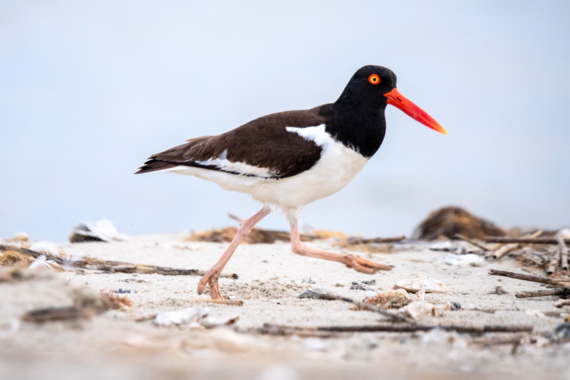 American Oystercatcher, Photo by Kaitlyn Hackathorn
 Looking for a fun activity geared toward kids or a school group? Learn how to

 SCDNR events often require pre-registration to attend. Please click on the respective links and ensure you are signed up before attending.


Be the first to comment!