CRUISERS NET
Cruisers Helping Cruisers
Comprehensive cruising resource for the Intracoastal Waterways
from Norfolk to the Northern Gulf and Bahamas.
from Norfolk to the Northern Gulf and Bahamas.
FREE to use due to the generosity of our sponsors - please patronize them
Praise for Dockmaster Luke Knuttel, Riviera Dunes Marina Resort, on the Manatee River, off Tampa Bay
A CRUISERS NET SPONSOR, Riviera Dunes Marina Resort occupies the Manatee River’s northern banks, just east of the easternmost of three bridges crossing the river at Bradenton and Palmetto near charted Craig Point. See FOCUS ON for more on Riviera Dunes Marina Resort.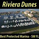

Click Here To View the Cruisers Net Western Florida Marina Directory Listing For Riviera Dunes Marina Resort
Click Here To Open A Chart View Window, Zoomed To the Location of Riviera Dunes Marina Resort
Be the first to comment!
Gulfport Hurricane Update – Gulfport, FL

 City of Gulfport2401 53rd Street SouthGulfport, FL 33707(727) 893-1000#8 For Immediate Release: Thursday, September 29, 2022 – 6:00PMCITY OF GULFPORT HURRICANE IANMayor Henderson Public Service Announcement
- City Facilities including Gulfport City Hall, the Library, Casino, Recreation Center, Senior Center, Municipal Marina, and Community Development will reopen and resume normal City operations on Friday.
- City of Gulfport Public Works regular sanitation and recycling pickup services will resume on Friday. Customers scheduled for regular pick up on Thursday will be picked up on Friday. Residents are advised to place all storm debris in the right of way in the front of your house. The Public Works Department will pickup all sanitation and recycling on the first pass and all storm debris on the second pass.
- The City of Gulfport Citizens Information Call Center will close Thursday evening.
- The City of Gulfport sandbag distribution location distributed 17,000 sandbags to the community.
- Please contact Duke Energy to report a power outage. Visit, https://outagereport.
duke-energy.com/#/report- outage/home/find-account or text OUT to 57801 to report a power outage. - If you see a fallen power line or safety hazard involving Duke Energy, please call 800.POWERON (800.769.3766), or call 911 immediately. Do not touch a power line or anything in contact with it, and keep others away until help arrives.
- The Florida Department of Health in Pinellas County reminds everyone to USE GENERATORS SAFELY and avoid carbon monoxide (CO) exposure when using gas-powered appliances such as generators and charcoal or gas grills.
- Mandatory evacuation orders for Pinellas County lifted for all evacuation zones, mobile home communities, and residential health care facilities effective 9:00AM Thursday (09/29). Residents who evacuated due to the hurricane threat may return home using caution.
- All Pinellas County Schools and offices will be CLOSED through Friday. All meetings, sport will reopen on Monday, October 3.
###
City of Gulfport Hurricane Center
The first action that everyone should take is to prepare and have a hurricane or disaster kit on hand. To find out what hurricane or disaster kit is and what goes into a kit besides food and water, check out FEMA at fema.gov, the National…
Click Here To Open A Chart View Window Zoomed To the Location of Gulfport Municipal Marina
Click Here To Open A Chart View Window Zoomed To the Location of Gulfport Anchorage/Mooring Field
Be the first to comment!
Advice on Hurricanes from an Experienced Mariner, Sean Welsh
Our thanks to Sean Welsh for sharing his experience and knowledge of storm conditions in the southern regions. Current LNMs are also posted and updated daily on Cruisers Net.
For those headed south toward the FL Gulf Coast, some unsolicited advice
from a long-time disaster responder, licensed mariner, and full-time
cruiser:I know it’s late in the season and winter is soon upon us. But I suggest
lingering as far north as practical until well past October. Hurricane
season does not end until November 30, but, more importantly, you are
now unavoidably traveling into a major disaster area. Things will not be
the way you remember them if you’ve been there before, or the way
they’ve been portrayed to you if this is your first time. Some things to
keep in mind:No one will have time or resources to deal with you. Locals will be
focused on recovery and self-care. Businesses will be closed (or
destroyed), have limited hours, or limited stocks. Outsiders traveling
for pleasure can be perceived (whatever the reality) as consuming
resources needed to help residents. Or worse, as “disaster tourists.”Waterways in the area will have changed from what is shown on the
charts. Shoals will have moved or developed. Aids to Navigation will be
missing, off-station, or extinguished. The bottom can be littered with
debris including sunken vessels or entire structures. Even well after
these storms you will need to proceed with extreme caution; consider
traveling offshore if weather permits and avoiding the GIWW and OWW
altogether if possible.Expect waterway closures and security zones, due to damage or recovery.
Some drawbridges or locks may be inoperative or on reduced schedules.
Download the Local Notices to Mariners (LNMs) each week, and listen to
the Broadcast LNMs that the Coast Guard annouces every morning on VHF
16. LNMs can be downloaded here:
https://www.navcen.uscg.gov/local-notices-to-mariners-by... — the
Seventh District will be the relevant one.Obtain your fuel, water, and provisions well before reaching south Florida.
Expect communications to be spotty in many places. Cellular Internet
will be overloaded, and inoperative in some places. Even voice will have
issues. SMS typically works better than anything else cellular in a
disaster area. Make sure you have a good, working VHF in case of emergency.Marine supplies and services are likely to be unavailable. If you’ve
been meaning to pick up a spare impeller, or some extra motor oil, or
whatever, do it now. The simplest of problems can waylay you for a very
long time in a place you probably don’t want to be.It should go without saying, but do not expect to dock. Anywhere for any
reason. You might get lucky, but the chances are slim. If you do find a
place to tie up, it may not have power, water, or pumpout.
Expect to be self-sufficient once west of Stuart or south of Miami.
My thoughts are with you and with all the people affected by, and
responding to the pummeling the gulf coast is receiving. I’m pinned down
today by offshore weather, with a lot of time on my hands to watch the
news roll in; it is heartbreaking.Sean Welsh
Comments from Cruisers (2)
-
Good advice. After a major storm like Ian even traveling offshore can be hazardous for quite awhile afterward. Think of all the junk that has washed into the ocean and could be floating out at sea. If your boat successfully weathered the storm, but was within the strong wind area, be sure to give everything a careful check before going anywhere. Make sure your sailboat rigging is all good. I went up the mast after Hurricane Bob and found most of the strands in the forestay were broken, probably due to the intense vibration endured. Similarly, give any cleats and lines a close inspection and consider replacing rope that was under tremendous stress. Make sure water didn't get into your fuel. Be prepared with extra filters when you do go out.
-
Excellent advice, Sean, which of course will equally apply to cruisers traveling west through the Okeechobee or north from Marathon. Well done article.
-
SPECIAL BULLETIN: Hurricane Science and Safety

SPECIAL BULLETIN (3 New Ocean Today Videos) Hurricane Science and Safety
National Ocean ServiceBe the first to comment!
Hurricane News and Updates – South Flordia Sun Sentinel
Evacuation orders expanded across Florida’s Gulf coast Tuesday morning as Hurricane Ian ground its way across western Cuba and headed toward a U.S. landfall that could generate devastating flooding. As a public service, Sun Sentinel’s storm coverage is free and available to all readers
HURRICANE NEWS
Florida ‘running out of time.’ Hurricane Ian crosses Cuba; tropical storm watches issued in Broward, Palm Beach
Sun SentinelSouth Florida Sun-SentinelBe the first to comment!
Use AIS To Track Whales, Not Boaters, Commenters Say – Peter Swanson
Cruisers Net publishes Loose Cannon articles with Captain Swanson’s permission in hopes mariners with salt water in their veins will subscribe.. $5 a month or $42 for the year and you may cancel at anytime.

Click here for Use AIS To Track Whales, Not Boaters, Commenters Say
Be the first to comment!
Sneads Ferry, Newport Shaped by Marine Corps neighbors
The military has been a boon to North Carolina’s economy. It has brought in millions in government spending, thousands of jobs, and generations of families eager to live and retire where they used to serve.
Sneads Ferry, Newport shaped by Marine Corps neighbors
CoastalReview.orgBe the first to comment!
Blessings of the Fleets, Morehead City, Sep 27 and Swansboro, Oct 7
The 25th Blessing of the Fleet in Morehead City is set for Sunday morning and the Swansboro Blessing of the Fleet is Oct. 7.

Two events set to pay tribute to fishing industry, families
CoastalReview.orgBe the first to comment!
Sun Powered Yachts’ Dufour 382 is For Sale

Sun Powered Yachts is A CRUISERS NET SPONSOR!

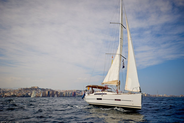
Click here for details: Our Dufour 382 is For Sale
Be the first to comment!
OBX September Park News: Celebrating Our Public Lands!


This is Saturday, September 24, is National Public Lands Day, a day to show our love for the amazing natural, cultural and historic places that are protected for future generations to marvel at and enjoy. Here in the Outer Banks, we are lucky to have several public lands that are unique enough – both environmentally and historically – to be protected. While our mission is to protect and enhance our Outer Banks national parks – Cape Hatteras National Seashore, Fort Raleigh National Historic Site and Wright Brothers National Memorial – we also greatly appreciate our friends and partners who work to protect other areas of our islands like Friends of Jockey’s Ridge State Park, Pea Island Preservation Society, Inc., The Nature Conservancy, Pea Island National Wildlife Refuge and more. This Public Lands Day, we are thrilled to celebrate all of these protected spaces and the natural beauty and impactful stories they preserve.
We encourage you to get out and visit your public lands – here in the Outer Banks or wherever you are – to celebrate with us! Check out our online and in-person opportunities this week to learn more about our Outer Banks national parks in particular (details below).
See you in our parks,
Jessica Barnes
Director, Outer Banks ForeverDonate Today Ask A BioTech:
Why Excavate Sea Turtle Nests?
Did you know that biological science technicians at Cape Hatteras National Seashore carefully track, learn from and protect hundreds of sea turtle nests each summer? One of the ways our BioTechs learn from these nests is by excavating them – digging them up to examine what’s inside – once they have hatched. In our last “Ask A BioTech” article of the season, Ben Ranelli, Seasonal Biological Science Technician on Ocracoke Island, explains the nest excavation process.
Learn More Want to see a sea turtle nest excavation in action? Tune in to our Facebook page TONIGHT at 6 p.m. (ET) when we’ll premiere a recent nest excavation on Ocracoke Island with park rangers from Cape Hatteras National Seashore. Meet Your Volunteer: Paul Hinds
Our Outer Banks VIPs (Volunteers In Parks) are essential to the thriving of our parks. As we celebrate Public Lands Day this month, we want to introduce you to Paul Hinds, a former volunteer at Fort Raleigh National Historic Site! If you visited Fort Raleigh this summer, you likely met Paul, whose volunteer efforts not only created a fun and engaging experience for visitors, but helped improve our park for years to come.
Meet Paul Calling All Educators:
Plan Your OBX National Park Field Trip!
If you’re an educator at a school in Currituck, Dare, Hyde or Tyrrell Counties, we want to help you get your students to Cape Hatteras National Seashore, Fort Raleigh National Historic Site and Wright Brothers National Memorial! Thanks to an Open OutDoors For Kids grant from the National Park Foundation, we are able to cover transportation costs for field trips for your students in kindergarten through 12th grade. To learn more about this opportunity, please email Jessica Barnes, director of Outer Banks Forever, at JessicaBarnes@OBXForever.org.
P.S.: You can also schedule remote learning field trips for your students! To learn more, email our parks at obx_interpretation@nps.gov.
Upcoming Events:
Save the Dates!
Pints for Parks on Public Lands Day: Saturday, September 24 Come out and celebrate our Outer Banks national parks with our friends at Swells’a Brewing Beer Company in Kill Devil Hills on Saturday, September 24, from 5 p.m. to 9 p.m.! We hope to see you there!
Click here to learn how our friends at Swells’a are supporting our national parks through 1% For The Planet!
Join us on Saturday! 
Bodie Island Lighthouse 150th Anniversary Celebration: Saturday, October 1 The Bodie Island Lighthouse will celebrate 150 years of illumination on October 1! You’re invited to join us, our park staff, our friends at the Outer Banks Lighthouse Society, and special guests for morning and evening events.
Learn More 


Copyright © 2022 Outer Banks Forever, All rights reserved.
You are receiving this email because you opted in via our website.Our mailing address is:
Outer Banks Forever802 Colington RdKill Devil Hills, NC 27948-8086
Be the first to comment!
The Current Models of Highfield Marine Tenders
 HIGHFIELD, A CRUISERS NET SPONSOR, is the leading builder of aluminum-hulled RIBs. Performance and strength are the key features of every HIGHFIELD RIB. Their advanced hull designs and Italian-influenced interior styling, keep alive the reputation of a dry-riding, seaworthy and stable craft that can handle rough conditions, as well as please the discerning eye.
The Current Models of Highfield Marine Tenders
Highfield MarineComments from Cruisers (1)
-
We recently purchased a Highfield 340 GT and love it. Lots of great features (storage, etc) plus it feels very secure with the deeper hull than our previous fiberglass rib. Its lightweight works great with our hydraulic swim platform on our Sabre 48 SE.
-
Happy Autumnal Equinox – September 22, 2022
Our long, hot summer is finally coming to an end today with the autumnal equinox, which marks the beginning of fall in the Northern Hemisphere.
It is also one of two days in the year that you can stand an egg on end. Try it works!

Be the first to comment!
International Culture Fest, October 15, Fishermen’s Village, Punta Gorda, FL

There is always plenty to do around Charlotte Harbor, like an International Culture Fest! While berthed at Fishermen’s Village Marina, A CRUISERS NET SPONSOR, you are certain to enjoy visiting Western Florida’s beautiful Charlotte Harbor/Peace River.


Kathy Burnam
Special Events & Community Relations941.639.8721
Click Here To View the Western Florida Cruisers Net Marina Directory Listing For Fishermen’s Village
Click Here To Open A Chart View Window, Zoomed To the Location of Fishermen’s Village
Be the first to comment!
Albemarle Sound boatbuilding exhibit to open Oct. 11
Whether building boats for business or recreation, or used as a means to freedom, boatbuilders, along with their vessels and shipyards, have impacted the maritime history of the Albemarle Sound.
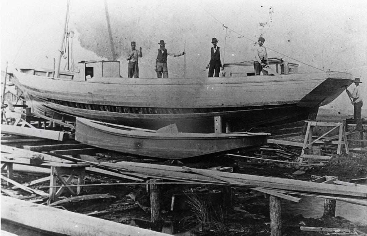
Employees of Creef Boatworks in Wanchese are shown on a schooner under construction. Photo courtesy Outer Banks History Center, Manteo.
Albemarle Sound boatbuilding exhibit to open Oct. 11
CoastalReview.orgBe the first to comment!
Why is Boat Speed Measured in Knots?
See also Why a Ship’s Speed is Measured in Knots
Click for Why is Speed Measured in Knots
SailingScuttleButt.com
Be the first to comment!
Your Guide to NC’s Brunswick Islands by Chris Chamberlain

Holden Beach is home to a sizeable commercial fishing fleet, and it’s fun to watch them unload at the docks. Image: North Carolina’s Brunswick Island
Your Guide to NC’s Brunswick Islands
StyleBluePrintBe the first to comment!
Here Come the Wind Farms; Don’t Discard That Old Radar Reflector by Peter Swanson
Cruisers Net publishes Loose Cannon articles with Captain Swanson’s permission in hopes mariners with salt water in their veins will subscribe.. $5 a month or $42 for the year and you may cancel at anytime.
Click here for Here Come the Wind Farms; Don’t Discard That Old Radar Reflector
Be the first to comment!
To Point or Not to Point, the Starlink Question by Peter Swanson
Cruisers Net publishes Loose Cannon articles with Captain Swanson’s permission in hopes mariners with salt water in their veins will subscribe.. $5 a month or $42 for the year and you may cancel at anytime.
Click here for To Point or Not to Point, the Starlink Question
Be the first to comment!


Social Media Auto Publish Powered By : XYZScripts.com
Be the first to comment!