Lowest Gas Prices Anywhere
All Regions (Price Range $3.00 to $5.50)
Lowest By Region
Virginia to North Carolina (Price Range $3.20 to $4.00)
North Carolina (Price Range $3.33 to $4.59)
South Carolina (Price Range $3.50 to $4.69)
Georgia (Price Range $3.00 to $4.20)
Eastern Florida (Price Range $3.36 to $4.90)
St Johns River (Price Range $3.11 to $4.50)
Florida Keys (Price Range $3.79 to $5.50)
Western Florida (Price Range $3.29 to $4.75)
Okeechobee (Price Range $3.69 to $3.69)
Northern Gulf (Price Range $3.70 to $4.25)
[{“ID”:”4595″,”post_title”:”Delegal Creek Marina”,”rptdate”:”June 1, 2021″,”price”:”3. 93″,”latitude”:”31.89065″,”longitude”:”-81.06155″,”sponsor”:null,”cleanprice”:”3.00″,”formattedDate”:”06\/01″,”region”:”Georgia”,”lowest”:true},{“ID”:”182595″,”post_title”:”Trout Creek Marina – Trout Creek Fish Camp”,”rptdate”:”June 1, 2021″,”price”:”3.11\/ 89 octane, 3.46\/premium\/3.59 ethanol free”,”latitude”:”29.98626667″,”longitude”:”-81.56568333″,”sponsor”:null,”cleanprice”:”3.11″,”formattedDate”:”06\/01″,”region”:”St Johns River”,”lowest”:false},{“ID”:”138489″,”post_title”:”Atlantic Yacht Basin”,”rptdate”:”June 1, 2021″,”price”:”3.20″,”latitude”:”36.720062″,”longitude”:”-76.239299″,”sponsor”:”http:\/\/cruisersnet.net\/wp-content\/plugins\/adrotate\/adrotate-out.php?trackerid=363″,”cleanprice”:”3.20″,”formattedDate”:”06\/01″,”region”:”Virginia to North Carolina”,”lowest”:false},{“ID”:”182001″,”post_title”:”Bradenton Exxon Marina”,”rptdate”:”May 31, 2021″,”price”:”3.29\/ 87 octane, 3.59\/89 octane, 3.89\/93 octane, 3.95\/premium non ethanol”,”latitude”:”27.41591667″,”longitude”:”-82.5755″,”sponsor”:null,”cleanprice”:”3.29″,”formattedDate”:”05\/31″,”region”:”Western Florida”,”lowest”:false},{“ID”:”122071″,”post_title”:”New River Marina”,”rptdate”:”May 31, 2021″,”price”:”3.33″,”latitude”:”34.54351667″,”longitude”:”-77.3606″,”sponsor”:null,”cleanprice”:”3.33″,”formattedDate”:”05\/31″,”region”:”North Carolina”,”lowest”:false},{“ID”:”31507″,”post_title”:”Ocean Club at Port Canaveral”,”rptdate”:”May 31, 2021″,”price”:”3.36″,”latitude”:”28.40773333″,”longitude”:”-80.6289″,”sponsor”:null,”cleanprice”:”3.36″,”formattedDate”:”05\/31″,”region”:”Eastern Florida”,”lowest”:false},{“ID”:”5000″,”post_title”:”Harborwalk Marina”,”rptdate”:”May 31, 2021″,”price”:”3.50″,”latitude”:”33.36393333″,”longitude”:”-79.28231667″,”sponsor”:null,”cleanprice”:”3.50″,”formattedDate”:”05\/31″,”region”:”South Carolina”,”lowest”:false},{“ID”:”19149″,”post_title”:”Sunset Bay Marina”,”rptdate”:”May 31, 2021″,”price”:”3.69″,”latitude”:”27.20086667″,”longitude”:”-80.2602″,”sponsor”:null,”cleanprice”:”3.69″,”formattedDate”:”05\/31″,”region”:”Okeechobee”,”lowest”:false},{“ID”:”154029″,”post_title”:”C-Quarters Marina, Carrabelle, FL”,”rptdate”:”June 1, 2021″,”price”:”3.70″,”latitude”:”29.85196667″,”longitude”:”-84.66886667″,”sponsor”:null,”cleanprice”:”3.70″,”formattedDate”:”06\/01″,”region”:”Northern Gulf”,”lowest”:false},{“ID”:”5182″,”post_title”:”Oceans Edge Key West Resort Hotel and Marina”,”rptdate”:”June 1, 2021″,”price”:”3.79″,”latitude”:”24.56391667″,”longitude”:”-81.73055″,”sponsor”:null,”cleanprice”:”3.79″,”formattedDate”:”06\/01″,”region”:”Florida Keys”,”lowest”:false}]

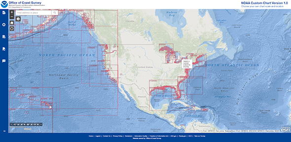 On April 1, 2021, NOAA’s Office of Coast Survey released
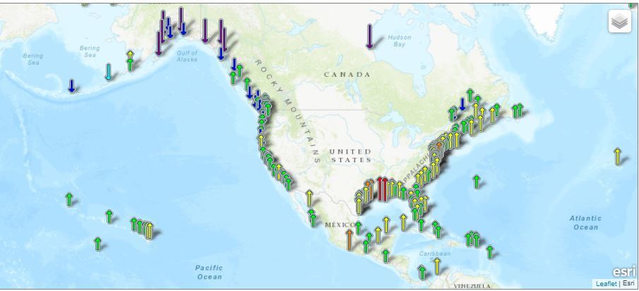
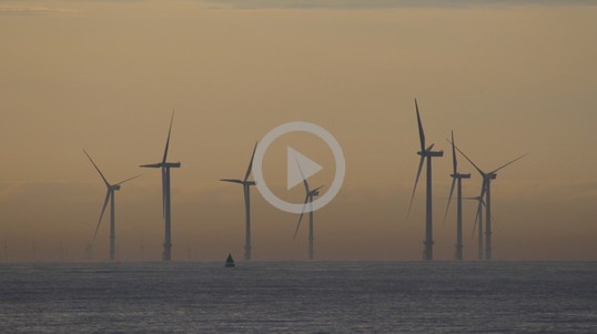
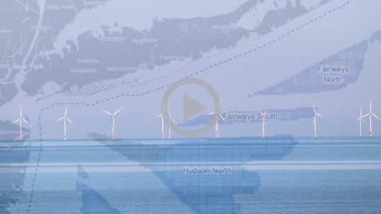
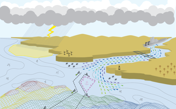 The Precision Marine Navigation (PMN) program has completed the first update of its prototype navigation data service – the
 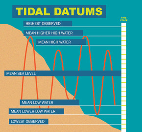 NOAA and its partner agencies in Canada are updating three vertical datums: the International Great Lakes Datum (IGLD) used to reference water levels in the Great Lakes and connecting channels; the National Tidal Datum Epoch (NTDE) used to reference water levels along the U.S. ocean coastline; and the North American Vertical Datum of 1988 (NAVD 88), the geodetic vertical datum that will be replaced by the North American-Pacific Geopotential Datum of 2022 (NAPGD2022). The datum updates are expected to impact a range of communities, including: navigation and shipping, permitting and planning, surveying and mapping, and water management. To learn more, join us on July 15 from 2:00 – 3:00 p.m. (EDT) for a joint webinar, Vertical Datums: An Overview and Planned Updates.
 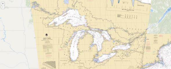 NOAA will shut down its
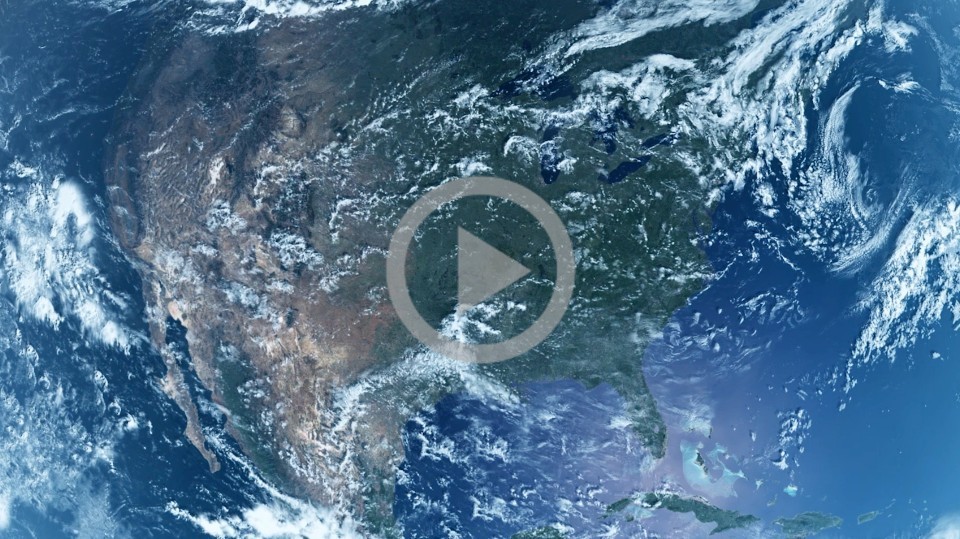
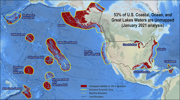 The Interagency Working Group on Ocean and Coastal Mapping (IWG-OCM) released the second annual report on the progress made in mapping U.S. ocean, coastal, and Great Lakes waters. The depth, shape, and composition of the seafloor are foundational data elements that we need to understand in order to explore, sustainably develop, conserve, and manage our coastal and offshore ocean resources. The 2020
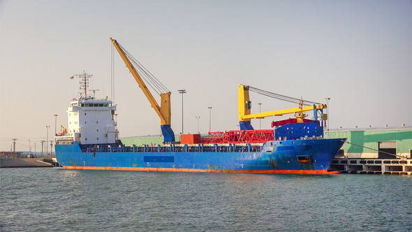


Be the first to comment!