BoatUS News: NMMA Survey Shows E15 Gasoline Warning Labels at the Pump Do a Poor Job
Gas Station Pump Labels Are Supposed to Warn Boaters
Against Putting the Wrong Fuel in the Tank;
Survey Reveals They Fail Miserably
Respondents favor prototype E15 warning label 4-to-1 over existing label
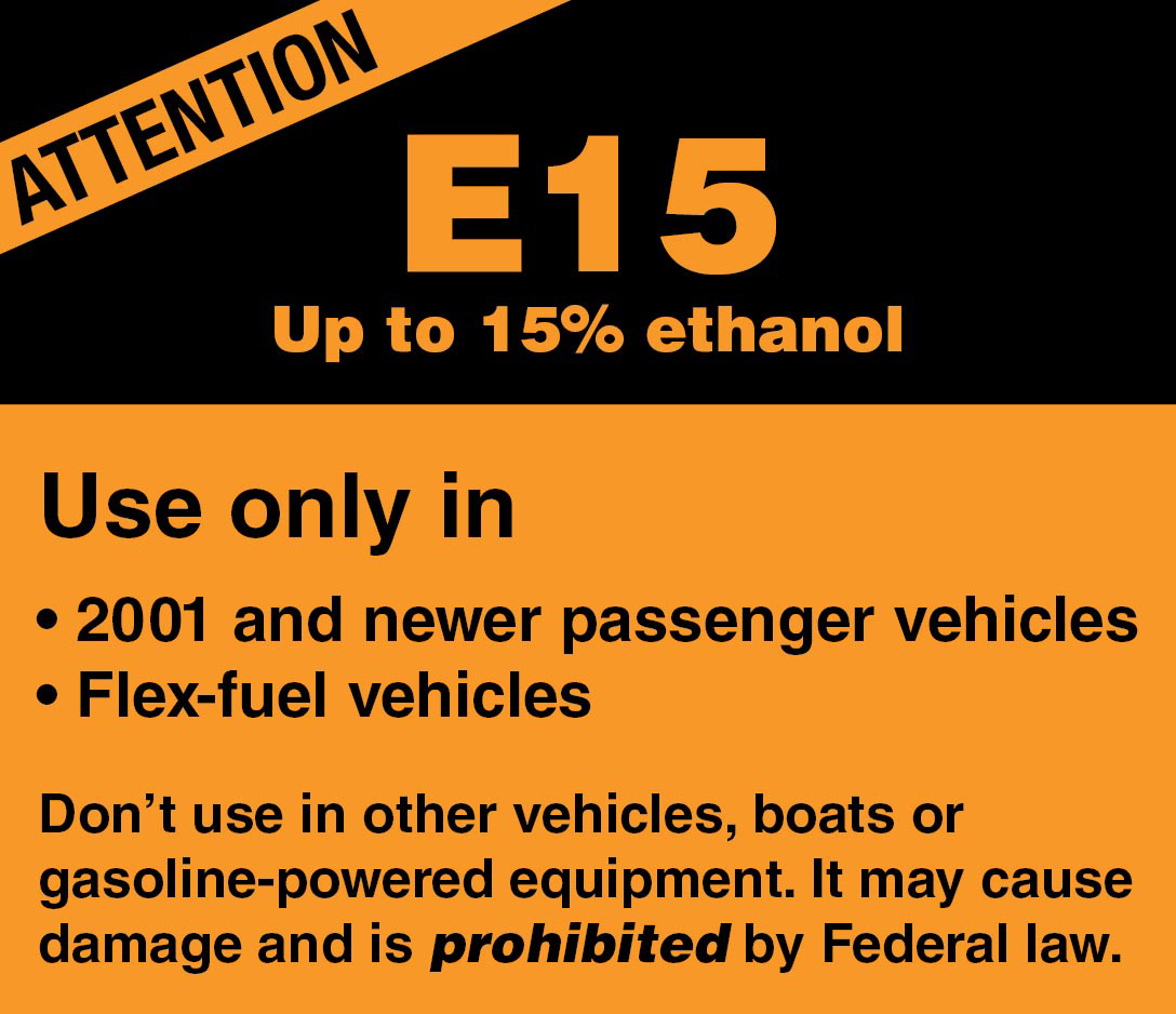
SPRINGFIELD, Va., Dec. 2, 2020 – With the boat in tow, you head to the gas station to fill her up. At the pump you find a fuel prohibited for use in boats, E15 gas, being sold alongside approved E10 fuel. What’s to prevent you from misfueling? A little warning label about the size of a pack of gum that’s often hard to notice, difficult to understand, and too often fails to protect consumers, said boat owners and other non-road-engine users in a recent National Marine Manufacturers Association survey on the effectiveness of current E15 warning labels.
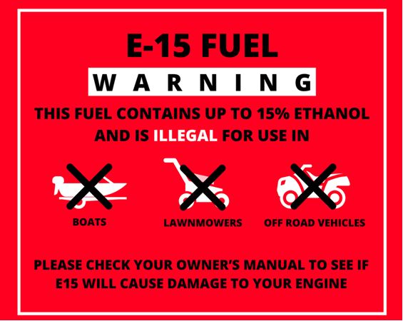
The ethanol warning label survey is being used to help persuade EPA regulators, currently reviewing E15 labels, to offer a more effective warning. Survey takers were shown the existing orange E15 warning label and a red prototype label with pictographs. Respondents were more than four times as likely to say that the prototype label more clearly conveys the idea of a “warning” for consumers than the current label.
What made the difference? The prototype’s red color and visual reinforcement was cited as more effective than the real label. Where the label is located on the pump can also be improved: 70% of respondents noted that inconsistent placement of the E15 label on fuel dispensing pumps made it harder to locate and less effective.
“EPA has some work to do in regard to educating consumers at the pump with more effective ethanol fuel labeling that better communicates the hazards of E15 for boat engines and other small motors,” said BoatUS Manager of Government Affairs David Kennedy. E15 is prohibited by federal law for use in recreational boat engines, off-road vehicles and small engines.
In addition to supporting improvements to the ethanol content warning label type, size and location on the pump, Boat Owners Association of The United States (BoatUS) supports public education efforts, evaluating the adoption of different fuel pump nozzle sizes, ceasing misleading marketing of ethanol fuels such as “Regular 88” fuel (containing 15% ethanol), evaluating the use of physical barriers and keypad systems, and offering a dedicated pump for E0 (0% ethanol) fuel.
###
Suggested social media post: .@thenmma survey responses show that E15 fuel warning labels at the pump do a poor job of helping protect boats and other small engines from misfueling https://bit.ly/39tgYlS #BoatUSonWatch
About Boat Owners Association of The United States (BoatUS):
Celebrating more than 50 years, BoatUS is the nation’s largest organization of recreational boaters with more than 700,000 members. We are the boat owners’ voice on Capitol Hill and fight for their rights. We are The Boat Owners Auto Club and help ensure a roadside trailer breakdown doesn’t end a boating or fishing trip before it begins. When boats break down on the water, TowBoatUS brings them safely back to the launch ramp or dock, 24/7. BoatUS offers GEICO Marine Insurance policies that give boat owners affordable, specialized coverage and superior service they need. We help keep boaters safe and our waters clean with assistance from the nonprofit BoatUS Foundation for Boating Safety and Clean Water. Visit BoatUS.com.

 From Windmill Harbour Marina, A CRUISERS NET SPONSOR, Hilton Head, SC


Be the first to comment!