The Dismal Swamp Canal’s locks are open and accessed southbound at MM 7.2 south of Norfolk or northbound from Albemarle Sound and the Pasquatank River.
The Dismal Swamp Canal is OPEN and locks are operating on their normal schedule.
Thanks,
Sarah
Sarah Hill, TMP Director, Dismal Swamp Canal Welcome CenterChairperson, Camden County Tourism Development Authority2356 US Hwy 17 North, South Mills, NC 27976
We transited the Dismal Swamp Canal northbound May 16 and 17. Saw one boat and hecwas tied up at Rest Center headed south. Canal is great place for photography. My wife was a happy camper taking lots of photos. Lockmasters at both ends were helpful and friendly. Locks easy to transition. Hardly any turbulence atvall. Rest Center on VA NC border convenient stop overnight if you need one. Well maintained. Space for three or four boats. Bathrooms and water available. I never heard road traffic at night. We have a 5’ draft. We clunked 4 or 5 times in the 22 mile canal. Probably sunken logs/branches bseveral felled trees along the way. No issue. Lots of high trees with overhanging branches. We tried to avoid them but one broke off wind vane at top of the mast. All in all, I liked no traffic, beautiful photography, easy overnight. Overhanging trees are a problem for sailboats.
The Great Dismal Swamp, whose alternate ICW route departs the southbound Waterway at MM 7.2, is currently being considered for designation as a National Heritage Area. Dismal Swamp Welcome Center is A CRUISERS NET SPONSOR!
Paddlers take to the water in the Great Dismal Swamp National Wildlife Refuge. Photo: USFWS
2023 is off to an exciting start, and we have our incredible Outer Banks Forever community to thank for that!
Your support is making it possible to protect and enhance our Outer Banks national parks in exciting ways – like creating a new experience at Fort Raleigh National Historic Site’s Freedom Trail that will show you what life was like for freedom seekers on Roanoke Island.
In the coming months we’ll be sharing updates with you all on several projects in our parks including the aforementioned Freedom Trail at Fort Raleigh National Historic Site, the Pathways to Your National Parks project at the Cape Hatteras Lighthouse, and a new community-driven project at the historic Hatteras Weather Bureau Station in partnership with the Outer Banks Visitors Bureau.
We’ve also had several exciting partnership conversations that we look forward to sharing with you – from celebrating art in our parks with Dare Arts to virtual experiences celebrating innovation and the legacy of the Wright Brothers with partners in Dayton, Ohio, and the Smithsonian National Air and Space Museum in Washington, D.C.
I also want to say thank you to everyone who responded to our recent Communications Survey! We truly appreciate your feedback and are incorporating your ideas and stories into our plans for this year to help you stay connected to our parks.
Rangers in Community: The Freedmen’s Colony on Roanoke Island
While Fort Raleigh National Historic Site is best known for its ties to the “Lost Colony” that disappeared from Roanoke Island in the late 1500s, did you know that the island was also home to another colony that had a major impact on American history?
The Freedmen’s Colony on Roanoke Island was established during the Civil War by freedom seekers who risked everything to find safe haven across the Croatan Sound.
Recently, Ranger Josh took this story outside of park boundaries to share it with our community through a free series hosted by the Dare County Library. He shared the struggles and successes of the Freedmen’s Colony, and the incredible resilience of its members, with a group at the Kill Devil Hills Library last week and we were on hand to record it just for you!
In 2022, they partnered with through us through their 1% For The Planet membership. 1% For the Planet was founded by Yvon Chouinard and Craig Mathews in 2002 to encourage companies to give back by donating 1% of their profits to organizations that work to protect the environment.
We’re thrilled to share that Swells’a Brewing Beer Company presented us with a donation of $11,550 on Thursday, February 23! Their generous support allows us to continue in our mission to protect and enhance Cape Hatteras National Seashore, Fort Raleigh National Historic Site, and Wright Brothers National Memorial now and forever.
If you’re interested in learning how your business can support us through 1% For The Planet, please contact Jessica Barnes at JessicaBarnes@OBXForever.org or (252) 423-4545.
Our Meet Your Ranger series introduces you to the many amazing people who support our Outer Banks national parks every day! We’re pleased to introduce you to Adair Raybon, Lead Interpretive Ranger at Wright Brothers National Memorial.
Her days are full as she works on projects, gives programs, connects with park visitors, and plans events. In her free time, she enjoys exploring the Outer Banks, reading, and roller derby!
Looking for a new way to show your support for our Outer Banks national parks? Purchase a handmade bracelet from our friends at Amabile Co.! They designed special Outer Banks Forever bracelets just for us! With every Outer Banks Forever bracelet sold, they are giving 5% directly back to us and 10% back to the water conservation partner of your choice. (Since we are a water conservation partner, that means an additional 10% of your purchase supports our mission!)
Morehead City is in the center of coastal Cataret County, NC.
In our county history series: Colonial beginnings, Civil War battles, maritime industry, fishing, tourism and coastal living among Carteret’s numerous draws.
The Corps of Engineers now says it has authority to follow the deepest natural water, or best water, in the Rollinson Channel Navigation Project linking Hatteras and Ocracoke islands.
The proposed corridor with high-shoaling areas to be dredged any time of year indicated in circles. Image: Corps/FONSI
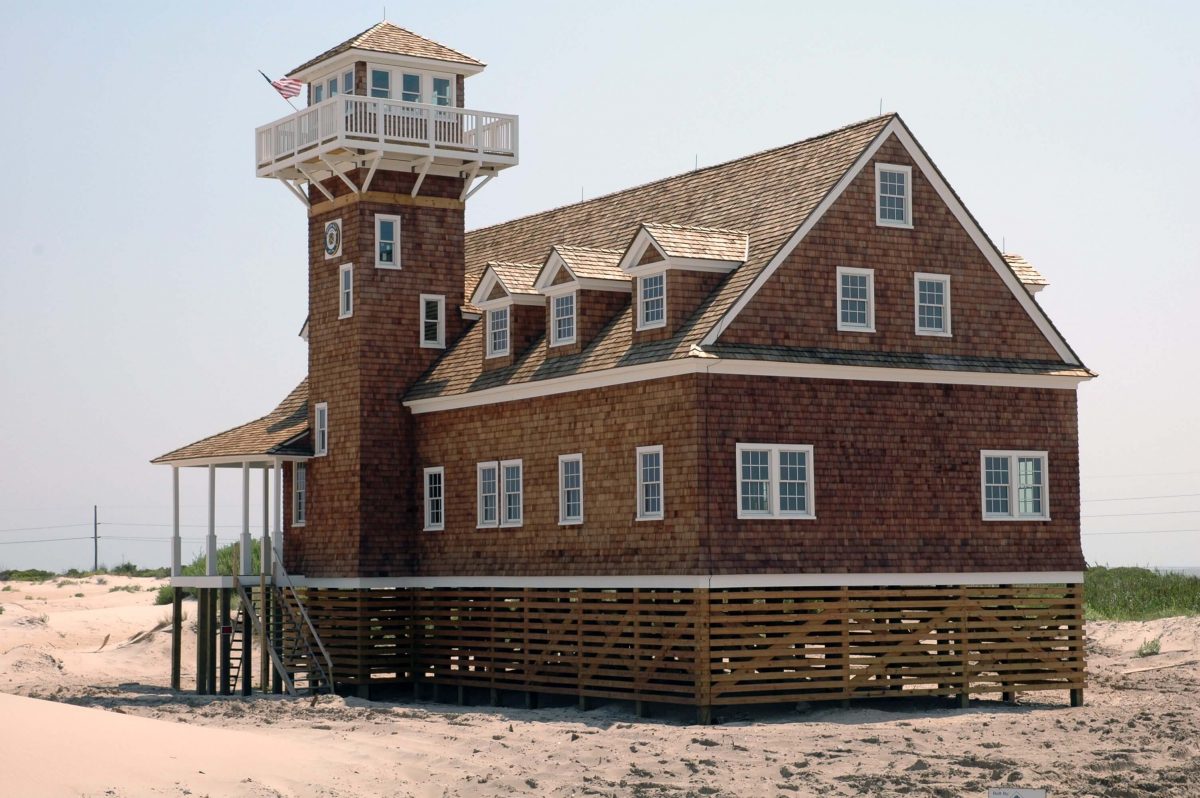
The Old Oregon Inlet Life-Saving Station is one of the most beautiful historic buildings on the Outer Banks, situated at a dramatic coastal location that would befit a movie setting.
The Oregon Inlet Life-Saving Station on the southeast side of Oregon Inlet, part of the Pea island National Wildlife Refuge. Photo: Courtesy U.S. Life-Saving Service Heritage Association
The Waterway’s path through Wrightsville Beach is a narrow congested channel, so caution must be exercised during these dark hours, especially in vicinity of spectator boats.
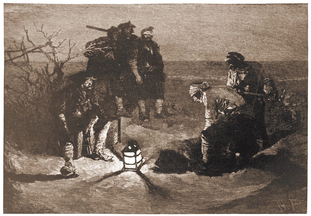
Popular literature and the public’s imagination have long perpetuated the notion that the notorious pirate buried his ill-gotten wealth, perhaps on Ocracoke Island.
“Blackbeard Buries His Treasure” illustrated by Howard Pyle for Harper’s Magazine, 1887.
Cruisers Net reminds you that high water events, like Hurricane Nicole, typically lift lots of debris, visible and submerged, into the navigation channels, especially in the narrow portions of the ICW. A sharp watch is required. Our thanks to Winston Fowler for these photos from the Cape Fear River.
South Harbor Village Marina guards the Waterway’s northern shoreline, a short hop west of unlighted daybeacon #8, and not far from the mouth of the Cape Fear River. Our thanks to Dave Rowe aboard m/v Stinkpot for this review.
Safe Harbor South Harbor Village is really a wonderful marina. Our experience began with dock master, Ian, expertly telling us exactly what conditions we could expect at the dock, wind, state of the current–everything. He correctly even predicted a best approach for the conditions and was spot on! We rarely accept this kind of information from “off the boat,” but he shared it with such knowing authority, that we knew we were dealing with a very experienced hand, and the trust we placed in him proved not to be unfounded!
We have never been met by a larger or more competent contingent of dock hands. No one expected prematurely tossed lines, and it was clear that they understood they were dealing with an experienced crew and treated us that way. There is no doubt in my mind that, if called to do so, they could also deal with an inexperienced crew and get them on and off the dock with ease.
As soon as we were alongside, they immediately asked for another spring line, and we were again impressed that they recognized the current there, and wanted us tied without us having to readjust hastily-tied breast lines you might get anywhere else. In fact, we rarely hand out lines at all these days. The Boatswain and Captain take care of the job after some less than stellar experiences in the past, but no need for such reticence here.
The facilities are gorgeous with new looking floating docks, slip side pump-outs, and the most advanced fire suppression system we have ever seen. Two stellar restaurants onsite in this park-like setting.
The real stars are the staff. Ian and company go way above and beyond, and this well-trained, crackerjack team are endlessly impressive with their ability to anticipate a transient boater’s every need.
The entrance channel to Carolina Beach State Park marina cuts off southward from the AICW, at the western end of Snows Cut, between markers #163 and #165. Our thanks to Dave Rowe, AboardStinkpot.com, for this review and recommendation.
For the budget conscious boater, or one who loves a natural park setting, Carolina Beach State Park Marina is for you! Miles of wooded trails and one of the only spots on earth to spot a Venus Fly Trap in the wild. $30 flat fee for dockage includes power and water. This is the perfect place to hole up and relax while waiting for a favorable current on the Cape Fear River or Snow’s Cut. Choice of grocery stores and a pharmacy under a mile and a half away.
I second everything in the article. We live nearby. A great resource for local and visiting boaters. Usually has good fuel prices compared to others in the area but check first.
A longtime CRUISERS NET SPONSOR, historic Edenton always has an exciting calendar of events and places to visit! Edenton is at the mouth of the Chowan River on the northwest shore of Albemarle Sound.
Hello!
Have you heard about the newest exciting thing to come to Edenton?
The Herringbone is an exciting new restaurant that is breathing new life into an 1898 herring ice house, turning it into a remarkable destination restaurant.
Already, it is turning heads both in Edenton and beyond.
Today, I want to tell you a bit about it, including the background and why so many can’t wait for it to finally open.
The Herringbone is a tribute and celebration of all things Edenton, combining incredible history with breathtaking execution into a magnificent experience.
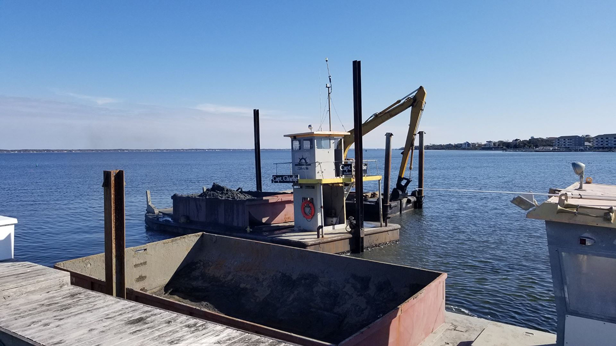
The Army Corps of Engineers says its five-year-old rule blocking local governments, marinas and private entities from using its dredged material disposal sites will remain.


Comments from Cruisers (1)
We transited the Dismal Swamp Canal northbound May 16 and 17. Saw one boat and hecwas tied up at Rest Center headed south. Canal is great place for photography. My wife was a happy camper taking lots of photos. Lockmasters at both ends were helpful and friendly. Locks easy to transition. Hardly any turbulence atvall. Rest Center on VA NC border convenient stop overnight if you need one. Well maintained. Space for three or four boats. Bathrooms and water available. I never heard road traffic at night. We have a 5’ draft. We clunked 4 or 5 times in the 22 mile canal. Probably sunken logs/branches bseveral felled trees along the way. No issue. Lots of high trees with overhanging branches. We tried to avoid them but one broke off wind vane at top of the mast. All in all, I liked no traffic, beautiful photography, easy overnight. Overhanging trees are a problem for sailboats.