Visit Logged
  • Select Region
    • All Regions
    • VA to NC Line
    • North Carolina
    • South Carolina
    • Georgia
    • Eastern Florida
    • Western Florida
    • Florida Keys
    • Okeechobee Waterway
    • Northern Gulf
    • Bahamas
    • New York
    • Ohio
    • Pennsylvania
    • Washington
    • Puerto Rico
    • Minnesota
    • Maryland
    • Tennessee
    Order by:
    • Healy Report: Dismal Swamp Canal to Belhaven, NC

      Belhaven

      Experienced cruisers, Jim and Peg Healy, continue to generously share their observations and advice as they make their way south for the winter. Thank you Jim and Peg! Belhaven, A CRUISERS NET SPONSOR, sits on the northern shore of Pantego Creek which meets the western shoulder of the Waterway at Mile 135 south of the Alligator River – Pungo River Canal.

      Today is Thursday 19/18, 05h15 hrs…

      Sanctuary and crew transited the Dismal Swamp Canal from Chesapeake, VA to Elizabeth City, NC on Tuesday, 10/16. There is about a mile of duckweed in the canal south of the Deep Creek lock. South of the South Mills lock, there are several miles of duckweed across the canal. Our engine cooling water intake is about 30″ below the waterline, and we had no issues with the sea strainer.. AT THE FEEDER DITCH AND AGAIN IMMEDIATELY SOUTH OF THE SOUTH MILLS LOCK, THERE ARE POSTS PAINTED RED AND GREEN THAT MARK A NARROWED CHANNEL. HONOR THOSE POSTS. The canal carried at least 7′ of water, and we had zero bangs and bumps. We traveled with four other boats, and they made me the lead dog. The trick to avoid bangs and bump is to SPREAD OUT. Follow the boat in front of you by 1/2 to 3/2 mile, so if prop wash does bring something off the bottom, it has tome to settle back down before you get to it.

      We traveled from Elizabeth City to Belhaven on Wednesday, 10/17. BE ADVISED that in the Alligator-Pungo Canal at approximately MM116-117, there is a LARGE DEADHEAD in almost the visual center of the canal. It is easy to spot, as it sticks up at least a foot above the water line. It appears to be the remains of a piling.

      We’re staying on the Belhaven City Docks. They take reservations, but many treat this as first come first served. It is full tonight, but we did get our reserved space.
      There is ample 30A power available all along the dock, and self-serve pumpout. This is an excellent option at $1.00/ft and $5.00 for electric.

      Goal for today is Morehead City.

      Jim

      Peg and Jim Healy aboard Sanctuary, currently at Charlotte Harbor, Punta Gorda, FL
      Monk 36 Hull #132
      MMSI #367042570
      AGLCA #3767
      MTOA #3436

      Be the first to comment!

    • Post Florence Report from McCotters Marina and Repair Yard, Pamlico River, Washington, NC


      McCotters Marina, Washington, NC

      McCotters Marina and Repair Yard, A CRUISERS’ NET SPONSOR, is located on Broad Creek, off the Pamlico River, a few miles downstream of the Washington, NC waterfront. McCotters is one of the largest marinas in North Carolina and its repair capabilities are impressive.

      McCotter’s Marina is fully operational.
      Mark said, Our store in Oriental, NC, “the Intracoastal Waterway Provision Company,” is also now fully open
      …. he said other restaurants in Oriental are open also as is the marina.
      Mark said he looks forward to serving the boaters and those headed south. He invites all to spend a little time in NC and enjoy the many Fall festivals and various events as well as local dining delights. Spend some time in Washington, NC and Oriental, NC as well as so many other excellent venues for the cruising community.
      Mark Henley

      Click Here To View the North Carolina Cruisers’ Net Marina Directory Listing For McCotters Marina

      Click Here To Open A Chart View Window, Zoomed To the Location of McCotters Marina

      Be the first to comment!

    • More Reason to Stop in Southport, NC! By Bill Parlatore

      Our thanks to Bill Parlatore for permitting Cruisers Net to post articles from his excellent blog, Following Seas.

      Monday Minute – More Reason to Stop in Southport, NC!
      Announcing the start of the highly anticipated Daily Navigation and Weather Briefs at the Dock, conducted each day at Southport Marina in Southport, North Carolina.

      Click Here To View the Cruisers’ Net’s North Carolina Marina Directory Listing For Southport Marina

      Click Here To Open A Chart View Window, Zoomed To the Location of Southport Marina

      Be the first to comment!

    • Dismal Swamp Canal and Locks are Open, 10/12

      Set in beautiful Camden Count, NC, the Dismal Swamp Canal Welcome Center provides free dockage for cruisers' on the Dismal Swamp AICW Alternate Route

      Despite the passage of Hurricane Michael through the area, the canal and locks are open, according to our good friend, Matt the Bridge Tender in Chesapeake City. The Dismal Swamp Canal Welcome Center Docks and information are provided at the Dismal Swamp Canal Welcome Center, A CRUISERS’ NET SPONSOR and a NC DOT Rest Area facility, located adjacent to the Dismal Swamp State Park, offering trails, exhibits and ongoing programs in Camden County, NC.

      I just checked with Deep Creek Locks (Friday 10/12 at 8:55 AM) and they said the Dismal Swamp Canal route is open. They recommend a draft of no more than 6 feet.
      Matt the Bridge Tender

      Click Here To View the North Carolina Cruisers’ Net Marina Directory Listing For the Camden TDA/Dismal Swamp Canal Welcome Center

      Click Here To Open A Chart View Window, Zoomed To the Location of the Dismal Swamp Canal Welcome Center

      Be the first to comment!

    • New Survey of Problem Stretch AICW/Shallotte Inlet Intersection, NC Statute Mile 332


      Our thanks to Robert Sherer, ICW Cruising Guide by Bob423, for this report and survey of Shallotte Inlet/AICW Intersection.

      The ICW at Shallotte Inlet has a new survey as of 10/1/2018. Just follow the old channel but note the placement of G81, it’s on the red side of the channel. That could be confusing. You can still honor the buoys but you have to hug G81. I’ll have a GPX route Wednesday.

      Click Here To View the Cruisers’ Net’s “AICW Problem Stretches” Listing For the AICW/Shallotte Inlet Intersection

      Click Here To Open A Chart View Window, Zoomed To This AICW Problem Stretch

      Be the first to comment!

    • Report on Shoaling in Snows Cut, Carolina Beach, NC, AICW Statute Mile 296


      Our thanks to Hank Pomeranz of Carolina Yacht Care for this report of shoaling at Marker #162A in Snow’s Cut. See Shoaling Surveyed from March 2017. Snows Cut is a 1.5 mile cut connecting Cape Fear River with the east coast Waterway at Carolina Beach.

      The second image shows the south side of the cut. Note that waypoints 3 and 4 take you a bit south around some 6′ humps between R162 and G161A. I can personally attest to their existence. Those waypoints are not meant to take you outside the channel between the 2 marks but rather to keep you a bit to port [southbound]. Finally, it is definitely shoal at 162A. No reason to take this one close aboard.

      Click Here To Open A Chart View Window, Zoomed To the Location of Marker 162A


      Click Here To View the North Carolina Cruisers’ Net Marina Directory Listing For Southport Marina

      Click Here To Open A Chart View Window, Zoomed To the Location of Southport Marina

      Click Here To View the North Carolina Cruisers’ Net Marina Directory Listing For Bald Head Island Marina

      Click Here To Open A Chart View Window, Zoomed To the Location of Bald Head Island Marina

      Click Here To View the North Carolina Cruisers’ Net Marina Directory Listing For Deep Point Marina

      Click Here To Open A Chart View Window, Zoomed To the Location of Deep Point Marina

      Be the first to comment!

    • Post Florence Onsite Report from Lockwoods Folly/AICW Intersection, NC Statute Mile 321


      Our thanks to Hank Pomeranz of Carolina Yacht Care for this onsite report from Lockwoods Folly Inlet/AICW intersection, a Cruisers’ Net Problem Stretch. The intersection of the Waterway and Lockwoods Folly has been a Problem Stretch for years and requires almost annual dredging. As Hank agrees, Cruisers Net recommends mid-high rising tide for passgae.

      Good morning gentlemen,
      Finally got the Whaler up and running and had a chance to go down to Lockwoods Folly Inlet yesterday. As I imagine you’re aware, USACE completed a post-Florence survey. A few points – see attached image:

      1. Buoys shown are on station.

      2. My own sounding corroborate the depths shown on the survey chart.

      3. The USACE suggested Waypoints work BUT you will note that the route brings you “under” G47. That is – you take G47 to your starboard Southbound – along with the Reds. The difficulty I found is lack of a reference point to port and, with the shoal so close to port, there is very little room for error. I would be particularly concerned about following that route on a strong ebb when you are being sucked towards the inlet. The black solid line is an alternative. That is not to say there’s deeper water there but, in my pea-brain, it was easier to follow the channel around – keeping the G47 to port.

      4. It is shoal around R48 as the survey suggests. USACE AIWW Waypoint 5 is a good target to clear the shoal at R48 before turning.

      5. For all but the shallowest draft vessels, I suggest a mid and rising tidal passage.

      Finally, there are two fixed bridges between Southport and Lockwoods Folly – MM 312 and MM 317. I went through at High tide and neither was less than 65’

      Feel free to use any of this to help get the word out.
      Best regards
      Hank
      P.S. I plan on taking the sailboat up to Wrightsville this weekend. If I do, I will report on Snow’s Cut, Carolina Beach crossing, etc.

      Click Here To View the Cruisers’ Net’s “AICW Problem Stretches” Listing For the AICW/Lockwoods Folly Inlet Intersection

      Click Here To Open A Chart View Window, Zoomed To This AICW Problem Stretch

      Be the first to comment!

    • Beaufort Town Council Plans to Tackle Derelict Vessels, Beaufort, NC, AICW Statute Mile 205


      Morehead City Yacht Basin

      Beaufort is a major port of call for Waterway cruisers and the harbor is home to Morehead City Yacht Basin, A CRUISERS NET SPONSOR! Happily, the marina is up and fully functional following Florence. Our thanks to S.A. Scudder for this story link.

      Beaufort staff to crack down on derelict boats
      Posted: Saturday, September 29, 2018 11:30 pm
      BEAUFORT — Town officials are taking the initial steps to rid Beaufort of illegal moors and anchored boats.

      CLICK HERE FOR THE FULL REPORT from Carteret County News-Times

      Click Here To View the Cruisers’ Net’s North Carolina Marina Directory Listing For Morehead City Yacht Basin

      Click Here To Open A Chart View Window, Zoomed To the Location of Morehead City Yacht Basin

      Be the first to comment!

    • USACE Post- Florence Surveys of NC Coast by Tom Hale


      Our thanks to Tom Hale for sharing this good news!

      For a little bit of good news and sunshine: The USACE survey crews from the Wilmington NC district have been very active since hurricane Florence crossed the waters of North Carolina. The survey crews have surveyed many of the trouble spots. So far, the effects of Florence would appear to be far less than we feared. At this time they have surveyed and updated Browns Inlet Crossing (almost no change!), New River inlet crossing (almost no change from last survey), Masonboro Inlet crossing, Mason Inlet crossing, and Topsail Inlet crossing. As a general observation these inlets have not changed very much as a result of the storm. We’re now looking forward to their surveys between Carolina Beach and New River, and in particular Lockwoods Folly and Shallotte Inlet crossing.
      The Corps of Engineers in NC have a lot of missions to conduct post hurricane Florence. This is only one of them and we are very grateful that they have been able to apply assets to this project. If you should see any of these survey crews on the water, be sure to hail them on VHF 13/16 and thank them for their prompt attention to these waterways!
      For more charts: https://www.sailfeed.com/2018/09/usace-icw-surveys-post-florence/
      For GPX files: PM me
      Cheers,
      Tom

      Click Here To Open A Chart View Window Zoomed To the Location of Browns Inlet

      Click Here To Open A Chart View Window, Zoomed To the Location of New River Inlet

      Click Here To Open A Chart View Window, Zoomed To the Location of Masonboro Inlet and Banks Channel

      Click Here To Open A Chart View Window, Zoomed To the Location of New Topsail/AICW Intersection

      Be the first to comment!

    • An Update from New Bern Grand Marina, New Bern, NC, off the Neuse River


      New Bern Grand Marina Yacht Club

      The New Bern Grand Marina, A CRUISERS’ NET SPONSOR, lies in the heart of downtown New Bern, North Carolina, along Trent River’s northern banks between Trent River highway and railroad bridges. New Bern took a direct hit from Florence and the community has experienced extensive flooding.


      All,
      Millissa here,
      I wanted to take a moment to thank everyone for their rock-solid and uplifting feedback regarding how the entire team (staff and or marina community) pooled together to secure the marina for Florence. I’m nothing less than amazed by the support of the local and extended boating community and their genuine concern. Jeremy and team have been tasked with an extensive list of tasks that would frazzle the minds of most, but are relentlessly pushing the marina forward to the next phase of updates an repairs and will assume an aggressive round of replacements and updates in the upcoming months. They are exhausted so please be patient. Not a single one of us would enjoy most of the things they are doing.

      Since my client acquired the property, a progressive list of updates and repairs have been made to the marina on a planned schedule, however this next round of updates and repairs may prove to be a bit more extensive as we must seek the counsel of marine contractors. As most would agree, this next phase will ensure our beloved marina continues to be one of the best and most affordable destination marinas in eastern North Carolina, so again, please be patient as we move forward. 

      Also, all ramps to the docks have now been repaired. All docks are accessible and now also have water.

       
      Remember, through the miry mud of weary tired souls, the best efforts of many will make us grand. 
       
      Thank you again for being who you are! 
       
      (Please see an important message from Jeremy below)
       
      Millissa
       
      —————————————————————————————————————————————-
      Important Message – Hurricane Florence Aftermath Preparation & Instructions
       
         As you come back to the marina please take into account all the work vehicles and trucks in the area.  Note-be aware of tripping hazards on the docks as repairs are being made.
       
      Entrance: to the marina and docks: the entry point to the marina will be at the Craven Street walkway. The hotel will be blocked off and there will be a walkway to the marina. This will be the main and only entrance. 
       
      ID’s: everyone needs to have IDs to walk around town. The NB police and National Guard will be checking IDs and your reason to be downtown. It’s also recommended to have a document from your boat. I am providing the Police and Hotel staff a list of those in the marina to verify their entry. I will have it to them by tomorrow.
       
      Ramps: I am working on the ramps for F and D dock. I hope to have them up in the next couple days. 
       
      Power: expect power to be off for the next month. I have spoke to the city and we are on the list. All transformers for each dock have been damaged.
       
      Water: I was working on finding the water main today and will continue tomorrow. The main has been covered up by sand, dirt and debris. Unfortunately it’s been a bear to find. I hope to find it soon to assess any damage and effect repair quickly.
       
      Mail/ Packages: all mail and packages will come to the sales office for now. I have advised the postal service and will advised UPS and FEDEX. 
       
      We will be here everyday to try and assist with limited hours at the Administrative Office, but will be on the docks and about the marina so please call the cell number posted on the door for assistance. Contractors and adjusters will be around. Please give them room to evaluate, repair, and do their jobs.
       
      Thank you all for your effort, patience, and resiliency. We will do our best to answer any calls, texts, and emails as they come. A current time, we do not have phone or internet service at either office, so please give us time to respond by cell.
      Thank you,

      Jeremy McConnell


      Click Here To View the Cruisers’ Net’s North Carolina Marina Directory Listing For New Bern Grand Marina

      Click Here To Open A Chart View Window, Zoomed To the Location of New Bern Grand Marina

      Be the first to comment!

    • Special Report on NC/SC AICW Conditions by Tom Hale

      Our sincerest thanks to Tom Hale for sharing this detailed look at Waterway conditions following Hurricane Florence in North and South Carolina.

      Sept. 17, 2018

      As previously suggested and as hoped, the Northern part of the ICW between Norfolk and Beaufort NC is partially operational. Some facilities are fully up and running. Some facilities are damaged but running.  Some facilities are closed. However the ICW seems passable with dockage, fuel and water available in places between Norfolk and Beaufort, NC.  Those facilities which are open for business are anxious to have cruisers come through.  But be aware that many homes and businesses are flooded and already damaged.  Be even more careful about your wake, as in flooding conditions your wake is hitting homes and yards. The ICW south of Georgetown SC is operating normally.

      But that 125 miles between Beaufort, NC and New River (Myrtle Beach)  is still flooding, is lacking electrical power and phone lines,  and is several days away from being able to fully report, and weeks or months from being back to normal water levels.

      • Great Bridge bridge and lock are fully operational.
      • According to USACE Norfolk District Dismal Swamp Canal is open and the locks and bridges are operating on a normal schedule.
      • All is OK at Coinjock. Over 20 boats have left and headed to Hatteras, Wanchese,  Beaufort and points south! They have not heard of any reported problems in any of the canals and creeks to Beaufort NC.
      • Alligator River Swing Bridge is operational.
      • Dowry Creek has power to the office and heads, still working on the dock power. The water is below the docks but is still up 2.5 feet.  USCG has been through Alligator Pungo Canal to check ATONs. There are damaged ATONs.
      • Wilkerson Bridge now at about 60.5 feet
      • River Forrest Marina has no fuel but is taking reservations.  Transient space is limited to smaller vessels. Grocery store is open, downtown restaurants are “drying out” after 4’ of flood water.  Main streets are dry this morning, but only just barely.  Many parts of town are still flooded. .
      • 9/17 A tug and barge headed north in AP canal this morning, so commercial traffic is resuming.
      • Hobucken USCG has covered about 20% of their territory.   So far AP canal to G7 in Adams creek has been checked.  ICW has damaged ATONs.
      • Jarrett Bay is closed. No Power. Area is devastated.  2 USCG boats went north bound in Adams Creek this morning 9/17.
      • Homer Smith Docks had no damage.  Still has no power but is taking transients.  They report that boats are moving up and down the Beaufort waterways with no trouble.
      • Morehead City Marina is not answering their phone.
      • Beaufort City Docks are operational. No Power as of noon 9/17. A generator is wired to the fuel pumps, so fuel is available.  2 x  100’ yachts are inbound from Coinjock today.
      • Onslow Beach Bridge phone not working 9/17
      • Surf City Bridge phone not working 9/17
      • Figure 8 Bridge phone not working 9/17
      • Wrightsville beach bridge 910.256.2886 not answering 9/17/18
      • Southport NC: All the marinas were spared major damage.  There is still no electrical power in the area.  The city potable water system has had several major breaks and  it is unclear how long it will take to get the water flowing again.  All of the roads leading into Southport are washed out and flooded.  At this time there is no vehicular access to Southport.  The Cape Fear river is expected to crest later this week.  There will be significant debris washing though.
      • Myrtle Beach YC is fully operational with power and water. Center console boats are running in the ICW
      • Wrightsville Beach Bridge not answering 9/17/18
      • All bridges in Horry County SC (Myrtle Beach area) are operational! Socastee Swing Bridge, Barefoot Landing and Little River Swing Bridge. Flood waters are still rising inland and it is entirely possible that the bridges will be  non-operational at some point  as the rivers crest. The 65’ bridges aren’t! Water still high and rising.   After Matthew it took weeks for the water to get back to normal levels.
      • Myrtle Beach YC is fully operational. Center console boats are running in the ICW
      • Osprey Marina reports that they survived with no damage. The Waccamaw crest is expected Thursday . It could be worse than Mathew.  Expect floods and a slow speed zone through Socastee.  The 65 foot bridges in Socastee are far less than 65′ right now.
      • Port of Georgetown is open. Marinas are open and selling fuel.
      • McClellanville, Leland Oil open reports USCG has checked channel. They have not heard of any problems.
      • Isle of Palms Marina is fully operational and taking transients. No word yet on the condition of ICW to Georgetown. No boat traffic in ICW except center consoles and work boats.
      • Ben Sawyer Bridge is now operational and back on normal schedule.
      • Port of Charleston Open. Charleston Marina is taking transients.

      Comments from Cruisers (2)

      1. Larry Shick -  September 18, 2018 - 1:45 pm

        Never mind my earlier post. Let’s try again:

        Do we have a closer timestamp on the observation of the Wilkerson Bridge?

        Reply to Larry
      2. Larry Shick -  September 18, 2018 - 1:06 pm

        Thank you for this report. Was the clearance reported for the Wilkerson Bridge adjusted to MHHW?

        Reply to Larry
    • Disaster Information from US Senator for North Carolina

      Friends and Neighbors,

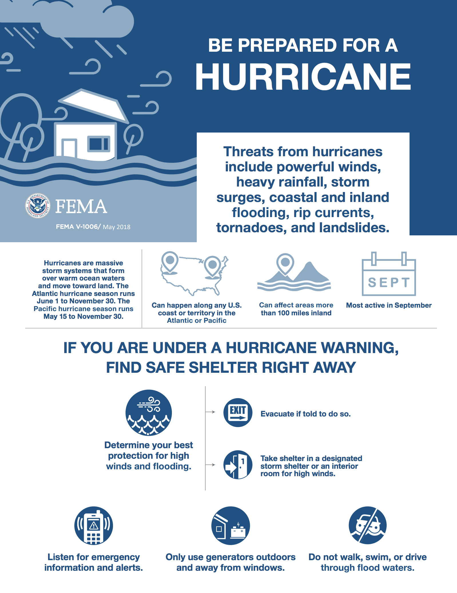
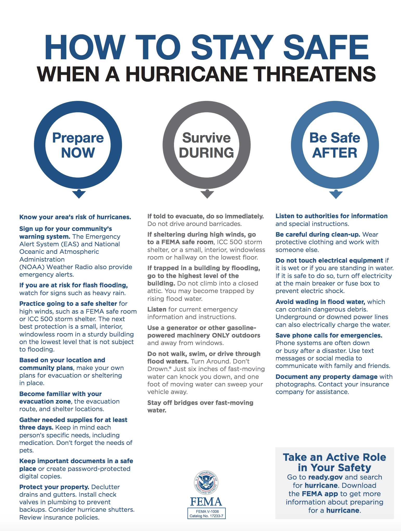
      This week, North Carolina will be experiencing severe weather, including strong winds and a large amount of rainfall as Hurricane Florence makes landfall. There is potential for power outages and major flooding in low-lying areas, and the most important thing you can be doing is to start preparing for a direct hit. This includes:

      • Having emergency supplies in place at home, at work and in the car, including bottled water, nonperishable food items for three to seven days for each family member, prescription medications, first aid kits, flashlights, and extra batteries. 
      • Creating an emergency communication plan with your family before the hurricane. Know where family members will be during the storm and how to get in touch with them.
      • Checking your insurance coverage and gather important documents. 
      • Knowing your local evacuation plan and how to receive alerts.

      Instructions on how to plan and prepare for severe weather as well as access to real-time weather, flooding, traffic and shelter information can be found at ReadyNC.orgI also want to make sure you have important contact information available if you need to deal with power outages or any emergencies. 

      • For life-threatening emergencies, call 911.
      • For a toll-free hotline to speak with a trained specialist, call 211. They can provide you information on shelters, evacuation routes, storm clean-up, volunteer needs, and locating food and water. The service is available 24/7.
      • For road closures, call 511.
      • For Coast Guard search and rescue, call 1-757-398-6700.
      • For help finding fuel/gas, visit gasbuddy.com or download the app.
      • For shelter locations, visit redcross.org or call 888-892-1162.
      • For volunteer opportunities, visit nvoad.org.

      If you have trouble contacting emergency officials, my staff can be reached at (704) 589-7493.

      Below is additional information I hope you find helpful, please pass it along to family and friends.

      Stay safe,


      Power Outages


      Customers may also report an outage or view current outages using the online outage map. Duke Energy also will provide updates on Twitterand Facebook to keep customers informed if significant outages occur. 

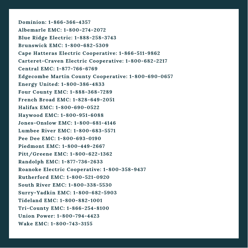
      Crews will work as fast as possible to restore power. Please call your local power company for more information (See below).


      1 Facebook Likes, 1 Facebook Reactions

      Be the first to comment!

    • Praise for the Albemarle Loop including Albemarle Plantation, Edenton and Elizabeth City

      Our marina is your boating access to Albemarle Sound, the largest freshwater sound in the country—55 miles long and 15 miles at its widest point. Placed strategically at the mouth of Yeopim Creek, the marina is just beyond the high insurance line saving boaters significantly on their insurance rates.
      Edenton, NC - the prettiest town in the South!

      Albemarle Loop

      Our thanks to AGLCA friends, Karen and Lee McClellan and Artie Ortmann, for these good words for three of our North Carolina SPONSORS: Albemarle Plantation, Edenton and Elizabeth City. See Albemarle Loop.


      Hi all,
      I so agree with Janice! We did the Albemarle Loop in May and it was incredible. Our first stop was Albemarle Plantation, everyone was so so gracious and hospitable. You have access to all the amenities club restaurants, pool, laundry, tennis etc. Next we went to Edenton, a great historical town with good restaurants and shops. We visited the local coffee shop both mornings and met some of the movers/shakers of the town (retired guys); they were fun to talk to. The next stop was Elizabeth City: the Albemarle Bay Museum, great restaurants and, of course, the memorial to the famous “Rose Buddies”. It is so worth doing the Albemarle Loop, one of the highlights of our (AGLCA) loop. I do believe that 5’ drafts can be accommodated in all the Marinas we stayed in and certainly 15.5’ beams. It is so worth the time spent and only dockage cost is electricity. We highly recommend the trip to all loopers.
      Karen and Lee McClellan
      AGLCA Forum

      2 boats one 50 and one 47 just completed the Albemarle loop and found no problems with 15+ beams and 4+ drafts great stops in Washington, edenton ( don’t miss vinyl night), Albemarle plantation and last year in Elizabeth city, ocracoce and manteo some of the best stops on the loop can’t wait to repeat some and Columbia don’t miss this side trip it is great and no problems.
      Artie Ortmann
      AGLCA Forum

      Click Here To View the Cruisers’ Net North Carolina Marina Directory Listing For Albemarle Plantation Marina

      Click Here To Open A Chart View Window, Zoomed To the Location of Albemarle Plantation Marina

      Click Here To View the North Carolina Cruisers’ Net Marina Directory Listing For Edenton Harbor (City Docks)

      Click Here To Open A Chart View Window Zoomed To the Location of Edenton Harbor (City Docks)

      Click Here To View the North Carolina Cruisers’ Net Marina Directory Listing For the Mariner’s Wharf Elizabeth City Docks

      Click Here To Open A Chart View Window, Zoomed To the Location of the Mariner’s Wharf Elizabeth City Docks

      Be the first to comment!

    • Information Requested on New Topsail Inlet, near AICW Statute Mile 270


      If you have navigated New Topsail Inlet recently, let Doug and us hear from you!

      Have never used top sail inlet south of surf city. Do you have any information on the inlet?
      Thanks
      Love all the information on your site
      Doug

      Comments from Cruisers (1)

      1. Al -  August 31, 2018 - 3:56 pm

        Was exploring the channel this past week. Difficult Inlet to navigate thru. Several bouys are missing. Shoaling is rampant and the channel thru to the ICW is VERY hard to find and follow. I would not try this route with a fixed keel boat. Even at high tide, it’s risky.

        Reply to Al
    • Good Words for Historic Edenton, NC, Albemarle Sound


      Edenton, NC - the prettiest town in the South!

      Our thanks to Jim Ward for this praise for Historic Edenton, a longtime Cruisers’ Net Sponsor. During their 350th Anniversary Celebration, Edenton has an exciting calendar of Celebration events for all ages. Edenton is at the mouth of the Chowan River on the northwest shore of Albemarle Sound.

      Wonderful city dockage. Overnight free and electricity reasonable ($3 for 30a, $5 for 50a). Neat Southern town with good places to eat and even a courtesy car to go to a grocery store. Dockmaster A Richie welcoming and helpful. Well worth a visit.
      Jim

      Click Here To View the North Carolina Cruisers’ Net Marina Directory Listing For Edenton Harbor (City Docks)

      Click Here To Open A Chart View Window Zoomed To the Location of Edenton Harbor (City Docks)

      Be the first to comment!

    • Dare County, NC, Moving Ahead on Inlet Dredge Vessel Plan

      The two-year project to build a dedicated dredge for NC waterways should insure a much more consistent dredging of the NC inlets and intersecting ICW.

      Dare Moving Ahead on Inlet Dredge Plan
      Coastal Review Online
      DARE COUNTY — As the need for dredging in North Carolina waterways has long ago surpassed the availability of funds and equipment to dredge, Dare County, with the help of $15 million provided in the recent state budget, is about to try something different: Build a dedicated dredge to maintain its waterways.

      Be the first to comment!

    • Feeling Hungry? Check Out New Downtown Eateries, Elizabeth City, NC, AICW Alternate Route

      Elizabeth City, A CRUISERS’ NET SPONSOR and the friendliest-to-boaters community on the Waterway, is located on the Pasquotank River off the northeast corner of Albemarle Sound and at the southern end of the Dismal Swamp Canal Route. With the canal fully open to navigation, this wonderful community continues its calendar of exciting events, making a stop at Mariners Wharf in the heart of Elizabeth City a must!

      Discover These Delightful Ways to Savor Locally Prepared International Cuisine


      Click Here To View the North Carolina Cruisers’ Net Marina Directory Listing For the Mariner’s Wharf Elizabeth City Docks

      Click Here To Open A Chart View Window, Zoomed To the Location of the Mariner’s Wharf Elizabeth City Docks

      Be the first to comment!

    • LNM: Destroyed ICW Light 128, AICW Statute Mile 285, Wrightsville Beach, NC


      This destroyed ICW light is on the west shoulder of the Waterway immediately north of its intersection with Masonboro Inlet channel.

      2. SEC NC BNM 348-18
      3. NORTH CAROLINA – NEUSE RIVER TO MYRTLE GROVE SOUND (CHART 11541)
      4. NEW RIVER – CAPE FEAR RIVER LIGHT 128 (LLNR 39625 [34°11.8130N / 077°49.4033W, 34.196884 / -77.823389]) RPTD DESTROYED. PORTIONS MAY REMAIN.

      Be the first to comment!

    • Deep Creek Cove Now Posted as NO TRESPASSING, Northern Entrance to Dismal Swamp Canal


      Our thanks to William Spaur for bringing this to our attention. Deep Creek Basin is on the south shore of the Dismal Swamp Route east of Deep Creek Lock.

      The COVE on Deep Creek, the Deep Creek Basin, is now being developed by RYAN HOMES and has been named BRYAN’S COVE. The land and the water are now NO TRESPASSING.

      Deep Creek Cove is near the junction of the Southern Branch of the Elizabeth River and Deep Creek waterway, Chesapeake VA. It has always been a favorite anchorage for boats transiting the Dismal Swamp Canal. It is a borrow pit vintage 1962 to develop Interstate 64. It is the size of a city block and connected to Deep Creek by a narrow channel.
      William Spaur

      Comments from Cruisers (3)

      1. Wally Moran -  September 8, 2018 - 2:53 pm

        I thought I truly hated lawyers until it became a photo… Then I realized I hate a developers far more.
        I would be very surprised to find out that this is a legal restriction.

        Reply to Wally
      2. Chuck Stires -  July 27, 2018 - 8:02 am

        I believe all navigable water in NC is public…not restrictions. Is Deep Creek Basin in VA or NC?
        Chuck

        Editor’s note: Deep Creek Basin is in Virginia

        Reply to Chuck
      3. Wallace Gouk -  July 13, 2018 - 12:47 pm

        Is this legitimate or just another case of a landowner overstepping his bounds ?

        Reply to Wallace
    • Summer on Edenton Bay, Historic Edenton, NC, Albemarle Sound


      Edenton, NC - the prettiest town in the South!

      During their 350th Anniversary Celebration, Historic Edenton, A CRUISERS’ NET SPONSOR, has an exciting calendar of year-long Celebration events for all ages. Edenton is at the mouth of the Chowan River on the northwest shore of Albemarle Sound.

      CLICK HERE FOR Summer on Edenton Bay


      Click Here To View the North Carolina Cruisers’ Net Marina Directory Listing For Edenton Harbor (City Docks)

      Click Here To Open A Chart View Window Zoomed To the Location of Edenton Harbor (City Docks)

      Be the first to comment!


    Social Media Auto Publish Powered By : XYZScripts.com