CRUISERS NET
Cruisers Helping Cruisers
Comprehensive cruising resource for the Intracoastal Waterways
from Norfolk to the Northern Gulf and Bahamas.
from Norfolk to the Northern Gulf and Bahamas.
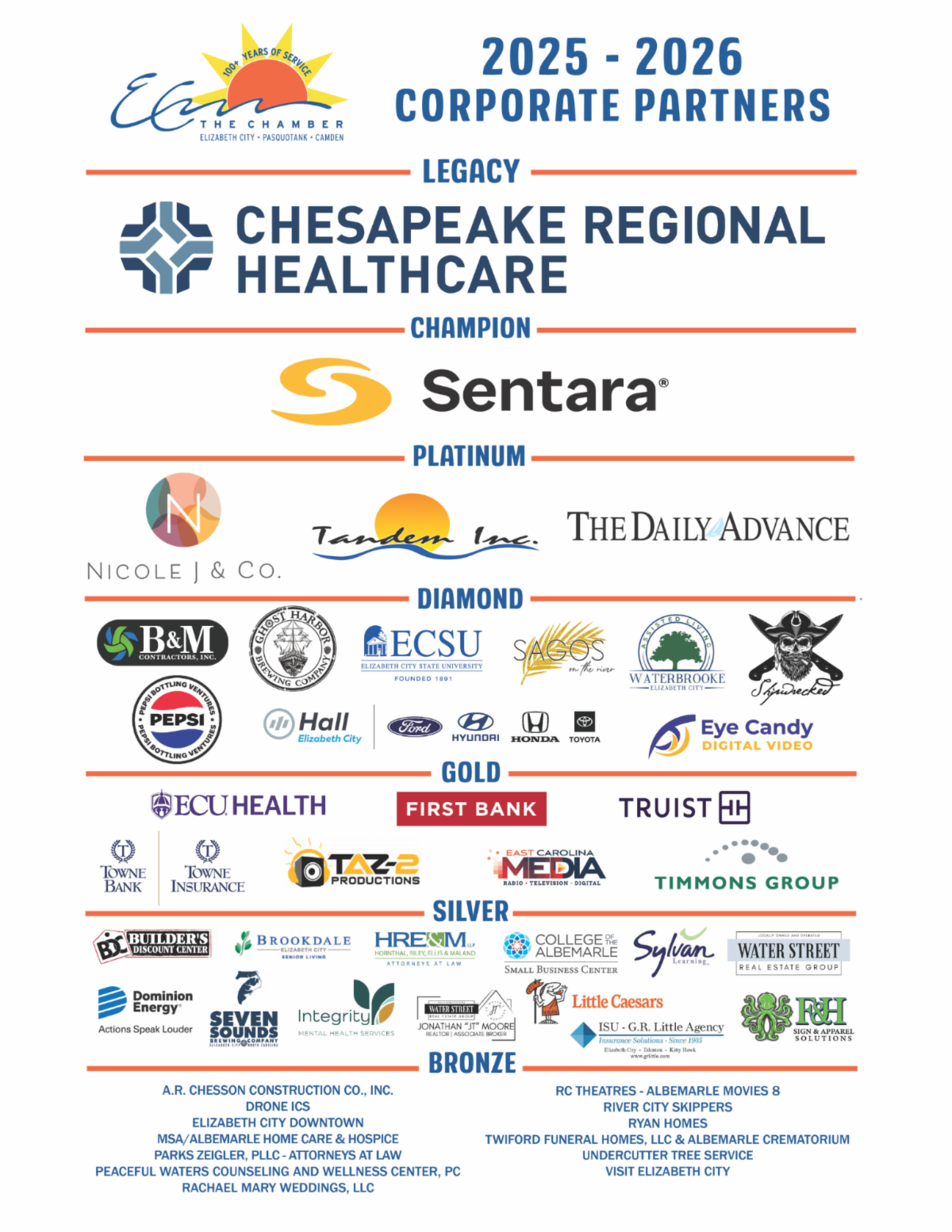
FREE to use due to the generosity of our sponsors - please patronize them
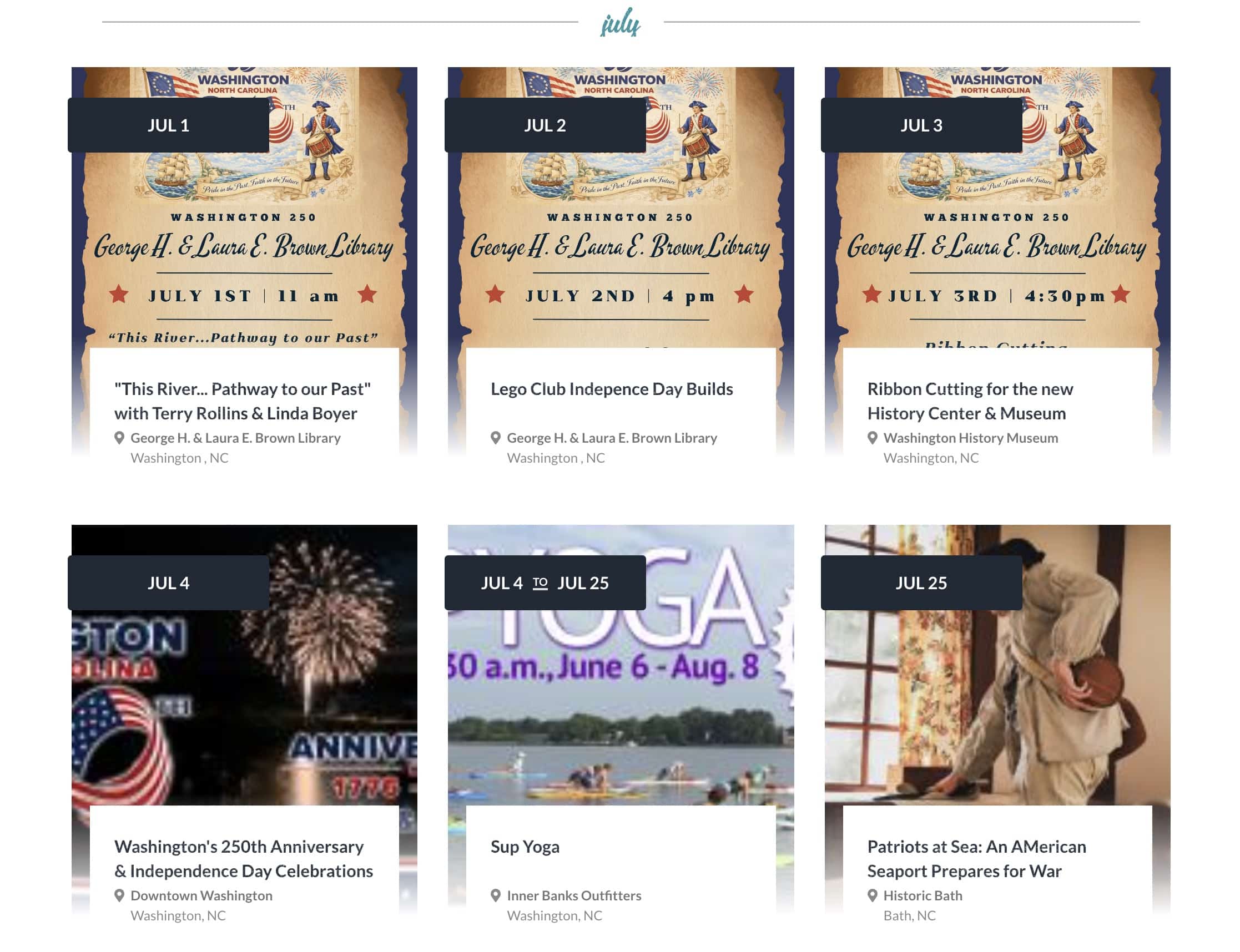
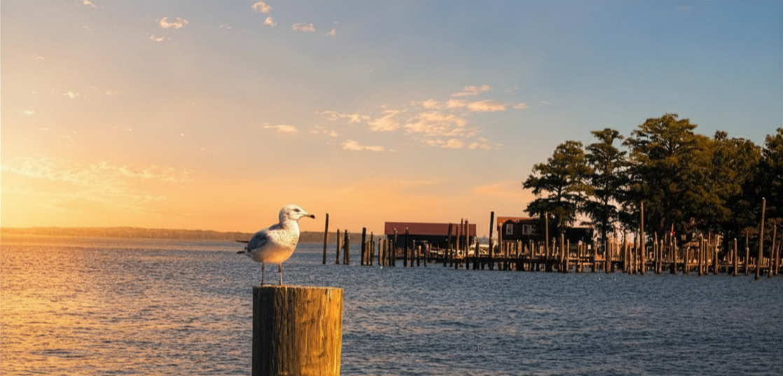
Washington NC JULY Events, Pamlico River

Keep your calendar clear: Every season in Washington, NC brings something new and exciting. Enjoy local festivals, area concerts, or waterfront adventure.
Click here for the complete calendar: https://visitwashingtonnc.com/events/#/
Be the first to comment!
Don’t Miss Our Exciting Juneteenth Weekend! – Elizabeth City
Elizabeth City sits at the southern terminus of the Dismal Swamp Canal and has the well-earned reputation of being a transient-friendly town with free dockage for 72 hours.
Experience a Weekend of Culture, Connection & Celebration June 19-21
 FRIDAY
June 19th, 2026
5:00 -7:30 pm
516 E Main St, Elizabeth City, NC 27909
The Juneteenth celebration kicks off Friday night at Arts of the Albemarle with an exciting evening of culture, connection, and community! Hosted in partnership with The Elizabeth City Area Chamber of Commerce, the event features an inspiring presentation from the Pasquotank County NAACP, great networking opportunities, lively conversations, delicious free soul food, and entertainment. Join uf for this special Business After Hours Reception! Bring your friends and family and join us as we launch a weekend filled with celebration, history, and fun!
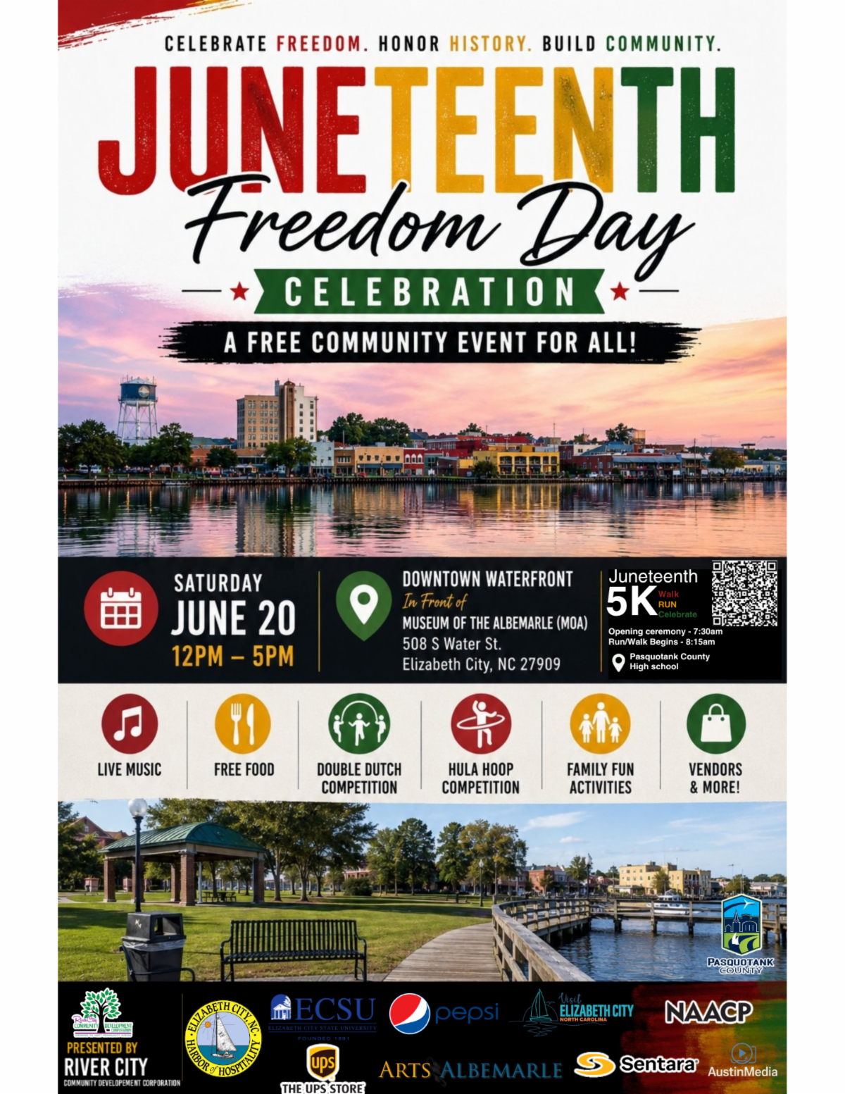
 SATURDAY
June 20th, 2026
12:00-5:00pm
508 S Water St, Elizabeth City, NC 27909
Saturday is all about fun, family, and community at the Main Festival, presented by River City CDC and Community Partners! The day kicks off with an opening ceremony, followed by shopping with local vendors, delicious free food stations, live music and entertainment, games, and activities for all ages. Celebrating its 21st year, this beloved festival brings family reunion vibes to Waterfront Park with a special kids’ zone and plenty of opportunities to connect, celebrate, and make memories..
RSVP for Juneteenth Business After Hours 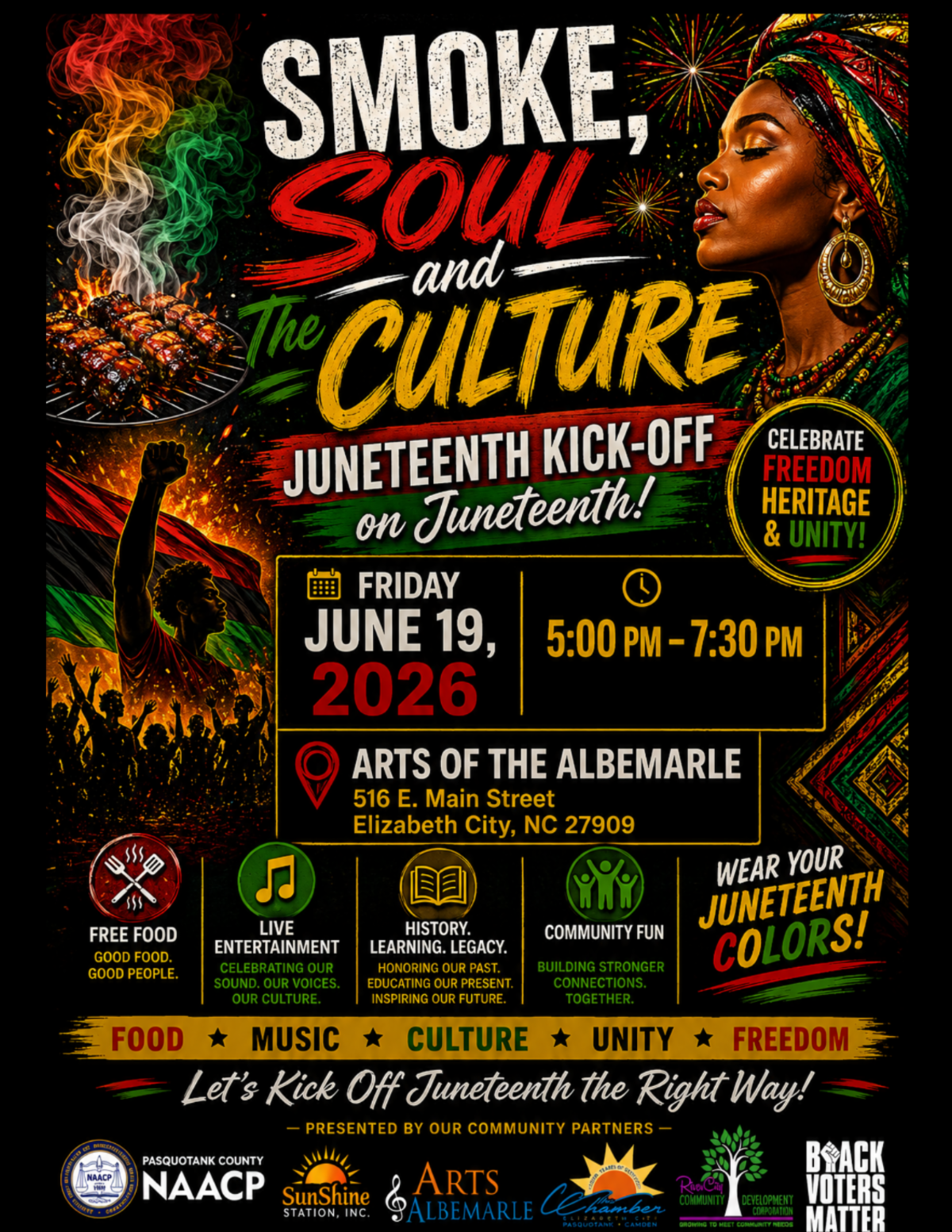
Elizabeth City Area Chamber of Commerce | 502 E. Ehringhaus St. | Elizabeth City, NC 27909 US Be the first to comment!
What’s in your ditch bag? – Southern Boating & Yachting
Be the first to comment!
T Electronic Flares vs Pyrotechnic Flares: What Boaters Need to Know – Southern Boating & Yachting
Be the first to comment!
Extend the Life, Value & Beauty of Your Boat With Our Summer Refinishing Special – Atlantic Yacht Basin

Atlantic Yacht Basin, A LONG-TIME CRUISERS NET SPONSOR, is located just south of the Great Bridge lock and bridge at Mile Marker 12 in Great Bridge, VA. If you have wood damage or need a few modifications with the interior or exterior of your boat, Atlantic Yacht Basin has the team to fix it right.
I have used them many times for both repairs and short-term storage during my ICW trips. AYB has a great location and is capable of performing any repairs you may require.
2 Facebook Likes, 2 Facebook Reactions
Be the first to comment!
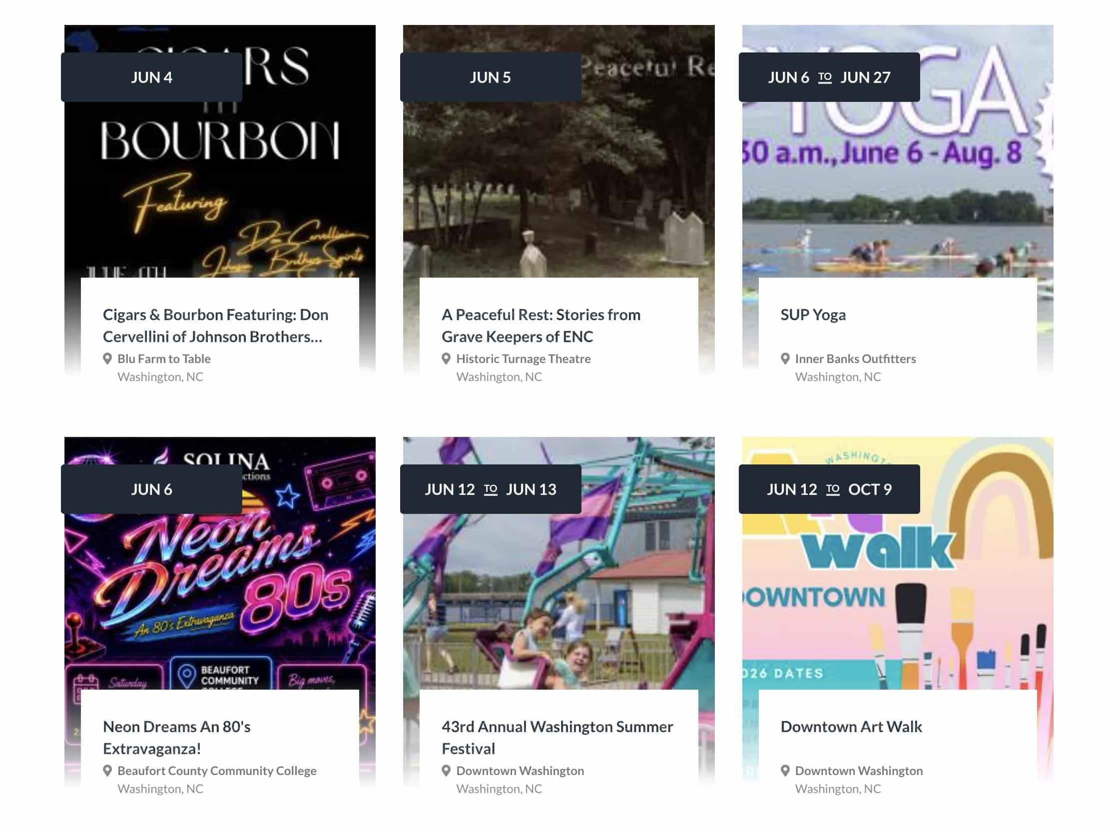
Washington NC JUNE Events, Pamlico River
Keep your calendar clear: Every season in Washington, NC brings something new and exciting. Enjoy local festivals, area concerts, or waterfront adventure.
Click here for the complete calendar: https://visitwashingtonnc.com/events/#/
Screenshot

Screenshot
Be the first to comment!
You Won’t Want to Miss What’s Coming to Elizabeth City – Elizabeth City
Elizabeth City sits at the southern terminus of the Dismal Swamp Canal and has the well-earned reputation of being a transient-friendly town with free dockage for 72 hours.

Summer Starts at the Harbor

The Bassmaster Countdown Is On

Elizabeth City is gearing up for one of the biggest weekends of the year as the Bassmaster Elite Series returns to the waterfront June 11–14! Professional anglers from across the country will compete on our local waters while downtown comes alive with daily weigh-ins, vendors, food trucks, live entertainment, and family-friendly fun during Harbor Festival weekend. Planning to visit? Now is the perfect time to book your hotel, bed and breakfast or Airbnb and experience the excitement right here in the Harbor of Hospitality.
Harbor Happenings
Head to Seven Sounds Brewing Company on June 2 at 6 PM for the Mariners’ Wharf Film Festival featuring Bewitched under the stars.
Catch the River City Skippers this week with:
June 2 @ 7 PM — Kids Run the Bases Night
June 4 @ 7 PM — Thirsty Thursday
June 5 @ 7 PM — Military Night
Enjoy live music downtown with Kaye Baron at Seven Sounds Brewing Company on June 4 starting at 5:30 PM.
Don’t miss First Friday ArtWalk on June 5 beginning at 4 PM featuring local artists, shopping, dining, and waterfront fun throughout downtown Elizabeth City.


RiverCity Skippers Schedule Here!


These are just a few of the upcoming events click here to see more!

Events Community Spotlight

Currently located at 111 N. McMorrine Street, All The Things has become a favorite downtown stop for vintage lovers, treasure hunters, and anyone who enjoys discovering something unique. Filled with antiques, collectibles, handmade goods, and nostalgic finds, the shop offers a fun and ever-changing shopping experience right in the heart of Elizabeth City.
This summer, All The Things will be moving into the former Rochelle Cleaners building at 100 S. Water Street, giving new life to one of downtown’s classic historic spaces. Whether you’re browsing for vintage décor, gifts, or simply exploring downtown, All The Things is a must-visit local gem.


Follow us on social for the latest updates and what’s happening around the county.


Copyright (C) 2026 Elizabeth City – Pasquotank County TDA. All rights reserved.
Our mailing address is:
400 S Water Street Elizabeth City NC 27909
Be the first to comment!
Your Weekend Plans Just Got Better – Elizabeth City
Elizabeth City sits at the southern terminus of the Dismal Swamp Canal and has the well-earned reputation of being a transient-friendly town with free dockage for 72 hours.
Your Weekend Plans Just Got Better

School’s Out, Boats Are In, & Summer Begins


Kick Off Summer in Elizabeth City
School’s out, the days are getting longer, and summer fun is officially arriving in Elizabeth City. From waterfront walks and local shopping to delicious dining and relaxing harbor views, June is the perfect time to plan a getaway to the Harbor of Hospitality.
Harbor Happenings
Betsy is coming! – Step back in time and experience the legendary story of Betsy Dowdy during the upcoming Betsy Dowdy Ride Event on May 30. This unique regional reenactment honors the brave 16-year-old who rode nearly 50 miles through the night in 1775 to warn local militia troops of advancing British forces.
- Live Music: Downtown is bringing the music this week with several live performances to enjoy along the waterfront. Catch PBNJ at River City Biergarten on Thursday May 28, Derek Smith & Jasper Smith at Seven Sounds Brewing Company on Friday May 29, and Jazz Night with James & Connected at 2 Souls Wine Bar on Saturday May 30. It’s the perfect excuse to grab dinner, relax with friends, and enjoy a fun weekend downtown.
- BassMaster Elite Hooked on the Harbor fishing tournament: Excitement is building in Elizabeth City as this nationally known fishing tournament is quickly approaching on June 11–14 at Waterfront Park. Visitors can look forward to daily weigh-ins, professional anglers, local vendors, family-friendly activities, and a lively Harbor Festival atmosphere throughout downtown. We are currently confirming volunteers, if you’d like to be part of the excitement, sign up today! Bassmaster Volunteer Sign Up
- River City Skippers baseball: Summer fun is officially underway in Elizabeth City as the River City Skippers kick off their 4th season in the Old North State League at Knobbs Creek Park. The Skippers bring exciting summer collegiate baseball to the waterfront community all season long.
- First Friday Art Walk: Be sure to mark your calendar for the June First Friday ArtWalk , where downtown comes alive with local artists, shopping, music, and community fun. Whether you’re planning a weekend getaway or just looking for a reason to explore the harbor, June is packed with reasons to visit Elizabeth City.


RiverCity Skippers Schedule Here!
These are just a few of the upcoming events click here to see more!

Events Community Spotlight

Albemarle Queen
Cruise into waterfront fun aboard the Albemarle Queen, one of Elizabeth City’s most unique experiences on the water. Offering scenic cruises along the Pasquotank River and Albemarle Sound, the paddlewheel boat provides a relaxing way to enjoy the Harbor of Hospitality from a different perspective.
Whether you’re planning a weekend getaway, date night, or family outing, the Albemarle Queen offers memorable cruises and specialty events throughout the season. With beautiful waterfront views and a welcoming atmosphere, it continues to be a favorite for both visitors and locals alike.


Follow us on social for the latest updates and what’s happening around the county.


Copyright (C) 2026 Elizabeth City – Pasquotank County TDA. All rights reserved.
Our mailing address is:
400 S Water Street Elizabeth City NC 27909
Be the first to comment!
Interactive tool lets users find nearby public water accesses – CoastalReview
Be the first to comment!
Don’t get complacent with tropical outlook; ‘it only takes one’ – CoastalReview
Be the first to comment!
I grew up on this coast; I won’t watch right whales disappear – CoastalReview
Be the first to comment!
What’s Happening in Elizabeth City this weekend? – Elizabeth City
Elizabeth City sits at the southern terminus of the Dismal Swamp Canal and has the well-earned reputation of being a transient-friendly town with free dockage for 72 hours.

North Carolina Potato Festival
THIS WEEKEND!!

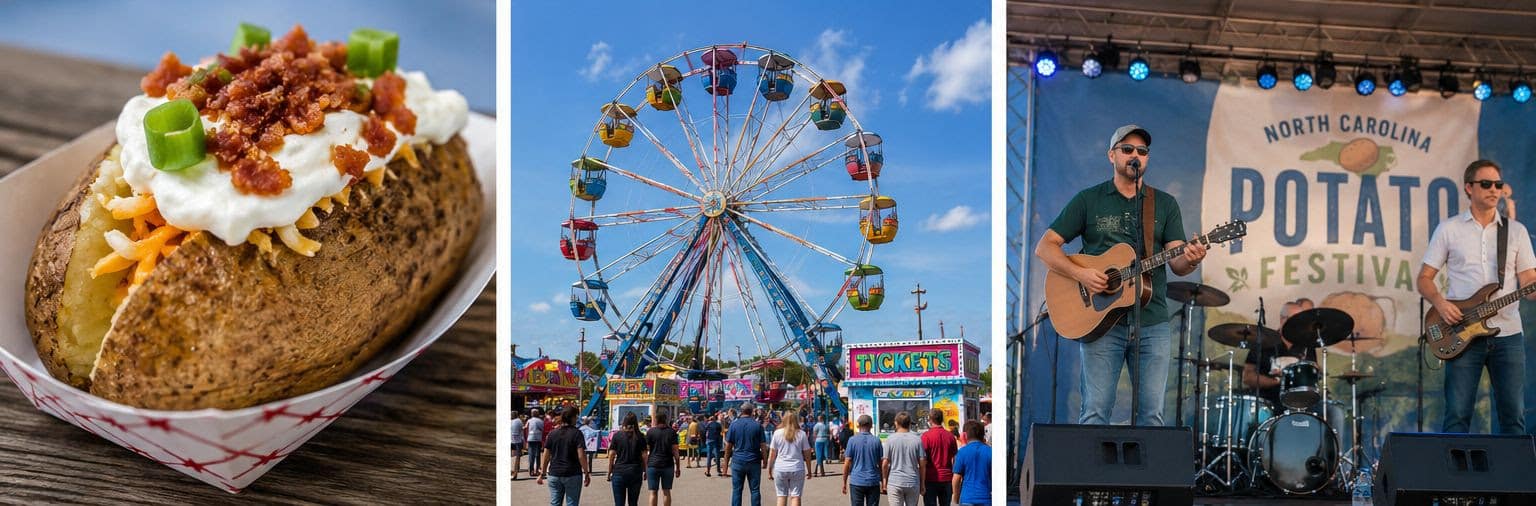
May 15th – 17th
The annual North Carolina Potato Festival is almost here, and downtown Elizabeth City is getting ready for one of the most exciting weekends of the year! From May 15th-17th, visitors and locals alike will gather along the waterfront for three days packed with live entertainment, delicious food, family fun, unique vendors, and community spirit.
Celebrating northeastern North Carolina’s rich agricultural heritage, the festival has become a beloved tradition that brings thousands of people to the Harbor of Hospitality each year. Guests can enjoy everything from rides and artisan booths to live music, classic festival foods, and of course plenty of potatoes along the way. The weekend also features the popular midway, local shopping, waterfront views, and activities for all ages.
Whether you’re planning a weekend getaway or just looking for something fun to do close to home, the NC Potato Festival is the perfect opportunity to experience the energy and charm of Elizabeth City. Be sure to stroll downtown, support local businesses, and soak in the lively atmosphere all weekend long.
We can’t wait to welcome everyone to the waterfront for another unforgettable festival weekend!
Harbor Happenings

Watercolor Wednesday
📅May 13th
📍Poindexter Paint & Pottery
⏱️6:30pm-8:30pm
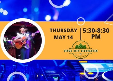
Live Music
📅May 14th
📍River City Biergarten
⏱️5:30pm-8:30pm

Wine & Paint
📅May 14th
📍2 Souls Wine Bar
⏱️6pm-8pm

Inclusive Nature Walk
📅May 15th
📍COA Wetlands Trail
⏱️10:30am-12:00pm

Hope on Wheels
📅May 16th
📍Kin’Folk Axe Throwing
⏱️11:00am-7:00pm

Town Market
📅May 17th
📍Venue 601
⏱️11:00am-4:00pm
These are just a few of the upcoming events click here to see more! ➡️
Events Take a Walk With Us 😊
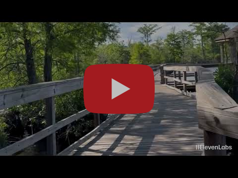


Take a walk down the Fenwick-Hollowell Wetlands Trail and experience one of Elizabeth City’s hidden gems! From peaceful boardwalk views to native wildlife and beautiful wetlands scenery, it’s the perfect spot to slow down, explore nature, and enjoy the quiet side of the Albemarle region. Whether you’re looking for a quick stroll or a relaxing outdoor escape, this trail is worth the walk.
Community Spotlight
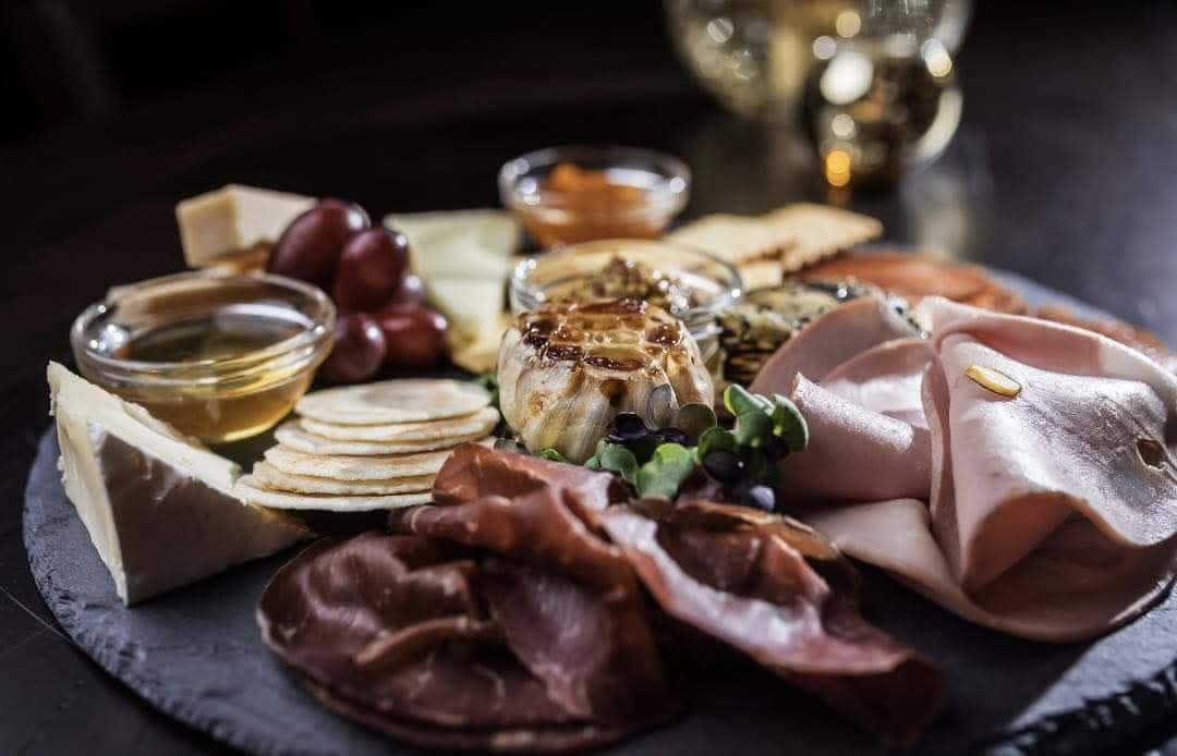
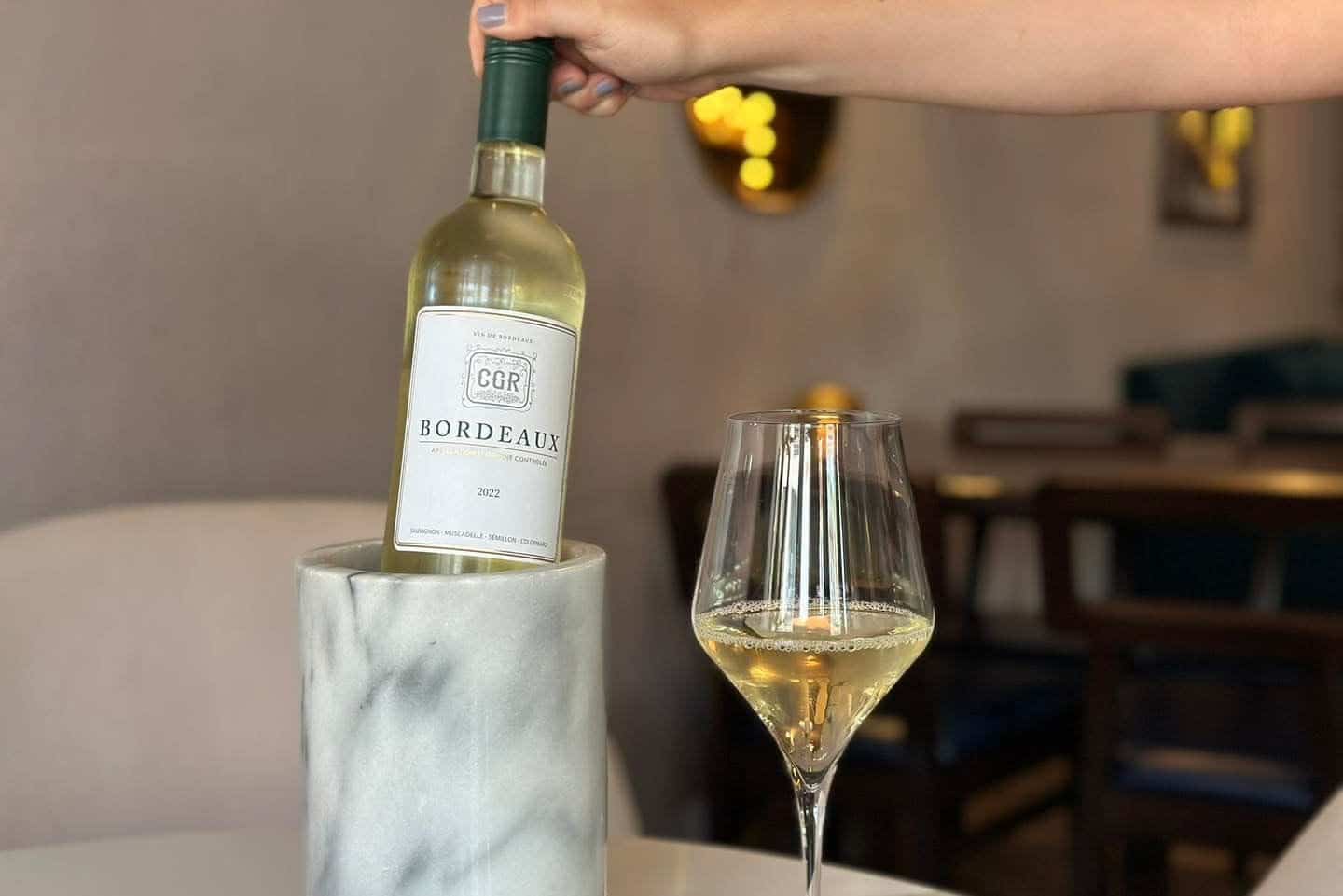
Did you know 2 Souls Wine Bar was created by two friends with a shared love for wine, charcuterie, conversation, and community? Located in the heart of downtown Elizabeth City, this cozy local favorite has quickly become a go-to gathering spot for both locals and visitors looking to relax, connect, and “linger a little longer.” Known for their curated charcuterie boards, specialty wines, bourbons, and craft cocktails, 2 Souls offers more than just drinks — they’ve created an experience centered around hospitality and community. They regularly host fun events like live entertainment, themed nights, workshops, and community gatherings that bring people together in a warm and welcoming atmosphere. Fun fact: they’re also dog-friendly, making them a perfect stop during a downtown stroll! Whether you’re planning a date night, girls’ night, celebration, or simply looking for a relaxing evening downtown, 2 Souls Wine & Bourbon Bar continues to add charm, creativity, and connection to Elizabeth City’s growing downtown scene.
Click to visit the website! 


Follow us on social for the latest updates and what’s happening around the county.


Copyright (C) 2026 Elizabeth City – Pasquotank County TDA. All rights reserved.
Our mailing address is:
400 S Water Street Elizabeth City NC 27909
View in browser Unsubscribe Update your preferences Be the first to comment!


 June 2nd


 May 28th


Social Media Auto Publish Powered By : XYZScripts.com
Be the first to comment!